Grand tour des Ecrins

4-day Tour du Combeynot
The Tour du Combeynot is an easily accessible trail through the mountain valleys of the Romanche and the Guisane, and takes you from one to the other via the Col d'Arsine and the Col du Lautaret to admire the finest peaks of the Ecrins.
The Tour du Combeynot leaves from Col du Lautaret and then heads into the mountain valleys of Les Ecrins. In a decor of rock and glaciers, below the impressive Agneaux mountain, the Pic Gaspard or La Meije (3,983 m), the route makes its way through mountain pastures, larch forests and mountain hamlets. Along the Romanche or on the banks of the Guisane, the fauna and flora appear at each step, as well as the rich local heritage. Between the points of interest and breathtaking views, you make your way between tradition and high mountains.
Description
From Col du Lautaret there are two ways to go to the Alpe de Villar d’Arêne refuge. First, along the Crevasses path, which runs around the mountainside above the Romanche valley, or second, by continuing along the GR 50 as far as the village of Le Pied du Col (accommodation available) and going up alongside the water via Le Pas d'Anna Falque.
From the Alpe de Villar d'Arêne refuge, the path enters the heart of the park and rises gradually to the Arsine glacier lakes, the highest point of the trip. The decor also matches the altitude and there is a high-mountain atmosphere. The trail is transformed in the Guisane valley, with a good path as far as the village of Le Casset, passing in front of the small lake of La Douche at the entrance to the larch forest.
The third stage begins deep in the valley and is a chance to explore the architecture of the valley villages, then follows the slope opposite (on the Cerces side), along the Chemin du Roy, to arrive below L'Aiguillette du Lauzet, where you may spot some Alpine ibex, and the hamlet of Le Lauzet.
The last, short stage heads back up towards the north-west of the Col du Lautaret, along the Guisane torrent, rich in the villages and chapels that are typical of mountain valleys.
- Departure : Col du Lautaret
- Arrival : Col du Lautaret
- Towns crossed : Le Monêtier-les-Bains and Villar-d'Arêne
Altimetric profile
Recommandations.

Information desks
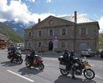
Information center "Col du Lautaret" (summer only)
Col du Lautaret, 05220 Le Monêtier-les-bains
Under the gaze of the Meije (3983 m) and surrounded by beautiful meadows celebrated in the great names of botany, the former hospice of the Lautaret called "refuge Napoleon" houses the reception and information Park center - Projections, documentation, books of the Park. Accessible to people with reduced mobility. Free admission.
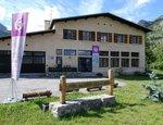
Information center "le Casset" (summer only)
Le Casset, 05220 Le Monêtier-les-bains
At the entrance of the hamlet of "le Casset" and near the core zone of the Park, a stop before or after your walk... Projections, documentation, books of the Park. Free admission. All animations of the Park are free unless otherwise stated.
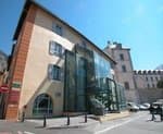
Maison du Parc du Briançonnais
Place Médecin-Général Blanchard, 05100 Briançon
Located at the foot of the medieval town fortified by Vauban, declared World Heritage by UNESCO in 2008, the Maison du Parc Briançon is a welcoming place of information exchange. Three floors of exhibition to discover : the natural and cultural heritage, the museum of the history of skiing in Briançon. Documentation, maps, guidebooks, books and products of the Park. Guided tours for groups by reservation. Free admission.
Access and parking
From Briançon, follow the D1091 towards Grenoble, passing Le Monêtier-les-Bains and continuing on to Col du Lautaret.
From Grenoble, take the D1091 towards Bourg d'Oisans, then continue towards La Grave and up to the Col du Lautaret. The Chambon tunnel is closed - you need to take the relief road.
More information
Report a problem or an error
If you have found an error on this page or if you have noticed any problems during your hike, please report them to us here:
Parc national des Ecrins
Formulaire de recherche, vous êtes ici, tour du combeynot.

- Documents techniques et thématiques
Le Tour du Combeynot, peut se parcourir sur plusieurs durées de séjours de 3 à 6 jours. Pour faire le Tour du Combeynot il faut partir du col du Lautaret pour s’enfoncer dans les hautes vallées des Écrins. Dans ce décor de roche et de glaciers, sous l’impressionnante montagne desc Agneaux, le Pic Gaspard ou la Meije (3983 m), l’itinéraire file entre alpages, forêts de mélèzes et hameaux montagnards. Le long de la Romanche ou en bord de Guisane, la faune et la flore se dévoileront à chaque pas, tout comme le riche patrimoine local.
December 9, 2019
Top 3 walks.

The Hautes Alpes is a mountain walkers paradise, with the Écrins national park, the Queyras regional park and the Cerces massif all easily accessible and offering a wide range of options from easy day walks to challenging multi-day trek’s.
Here are three of my favourite day walk's, tour de combeynot.

20 km with a height gain of 571 m
A circular route, over a pastoral col with impressive views of glaciers and high peaks, which may be shortened by using two vehicles., start from the mythical col du lautaret at over 2000m and follow the well marked path called the ‘sentier des crevasses’ towards the refuge de l‘ alpe de villar d’arêne. there are no crevasses, but there is a short airy section of about 20m where a cable is placed to hold onto for those who might be intimidated by a narrowing of the path above a steep slope., after spectacular views across the hanging glaciers, expect to be greeted by inquisitive, surprisingly confident marmottes and the clanging of cow bells, before arriving at the refuge which offers food and drink at your mid way point., carry on over the col d’arsine on the gr54, where you have the option of extending the walk, upwards, to take in the milky waters of the otherwise hidden moraine lake. descend alongside a stream and small lakes to arrive at the lac de la douche and a shady, but thigh sapping, final path through the woods, alongside the petit tabuc torrent to arrive at the village of le casset, where you might have decided to have earlier parked a vehicle. otherwise, a café awaits to further replenish your energy reserves for the stroll up the upper reaches of the guisane valley back to the lautaret., glacier blanc refuge.

7.2 km with a height gain of 646 m
A return trip into the heart of the ecrins park, alongside gear laden alpinists and picnicking families, to the refuge that sits with spectacular views of mont pelvoux., an early departure from the fee paying car park at pré de madame carle, beyond ailefroide, may be rewarded by sights of the chamois that frequently spend the night lower down. then follow the path that first crosses the torrents that issue from the glacier noir, before zig zagging up the mountainside to a well earned rest stop at a plateau, where you can consider how far the snout of the glacier blanc has retreated in recent times. a bridge that spans the run off waters marks the start of another steep section of path where care is needed to proceed upwards to the tiny old tuckett refuge and at last, a sight of the objective of your trip, the refuge to glacier blanc above, that you will soon reach after first passing a small shallow lake. the final ascent through the rocks bends back right to arrive on the front terrace of the refuge where you can eat, photograph the imposing pelvoux and perhaps choose to spend the night before returning to the valley by the same route., crête de vars.

10 km with a height gain of 720 m
An exhilarating ridge walk with breathtaking views, but be careful at some places as there are serious drops below the path ., the route follows a ridge above the val d’escreins nature reserve, which is surrounded by 3000m peaks., park above the small village of ste. catherine on a forestry road, before setting off on foot until a smaller track leads to the northern end of the ridge, then follow this, enjoying magnificent panoramas on either side above the void below. when you eventually arrive at the southern end, take a steep path down to the col de la ceulette and from here descend another path through the woods to return to the forest road and the car, passing by the cabane de la pine on the way., the collective, our sponsors.
This guide would not be possible with out the generous support of our sponsors.

Guided Day walks
Family walks, walk the écrins, our featured, guided activities.
We've been helping outdoor enthusiasts experience the Ecrins since 2001. Take a look at some of our guided experiences.
meet our expert
Meet the man behind the Collective.
Enquire Now
Ogso schwarztor review part two long term.
Long term review of the OGSO Schwarztor ski
Eddie Bauer Guide Pro Pant review
Hybrid crampon review petzl & blue ice, 10 best family activities hautes alpes.

Feel like nature in your mailbox ?
3 to 4 times a year, receive offers inspired by nature!
- Diminuer le texte
- Augmenter le texte
- Niveau de gris
- Haut contraste
- Contraste négatif
- Arrière-plan clair
- Liens soulignés
- Police lisible
- Mode dyslexie
- Réinitialiser
- Prepare my stay
- Tours & excursions
- All tours & excursions
Tour de Combeynot trail
Lieu-dit Ventelon L'Adrech 05320 La Grave France

A discovery for all those who want to run in the mountains. A fun and friendly learning of the basics of trail running. Punctuated by breaks, a unique way to discover the mountain and its riches: fauna, flora, glaciology, human environment, the PNE...
A magnificent and immersive course in the heart of the Écrins.
Duration : 3h/3h30
Difference in altitude: 450m + / 850m -
Target audience : from 16 years old to 65 years old
Important additional information: This outing is aimed at people in good physical condition and having a punctual practice (2 to 3 sessions per week of 1 hour minimum) of running in plain on flat and/or hilly terrain. Experience in hiking in the mountains is preferable. Be able to walk 4 to 5 hours and up to 800m of elevation gain per day.
Rates : 2022
Max commitment 08 participants: 200€
I also offer you

- Read more about Tour of Combeynot

- Read more about Balme de Françoic White Glacier Noir

- Read more about Discovery trail of Lautaret

- Read more about Emparis Lake Lerie and Black Lake

- Read more about Balcons de la Meije Aiguillon Pontet

- Read more about Grand Galibier 3228m

- Read more about The Kingdom of the ibex on snowshoes

- Read more about Lake of the shower

- Read more about Col du Lautaret, Roche Noire valley

- Read more about Lake Combeynot

- Read more about The signal of La Grave

- Read more about On the trail of the chamois at Laurichard

- Read more about Fontenil Valley

- Read more about Les Marmottes de l'Alpe (Villar d'Arène)

- Read more about Glaciers are alive

05480 Villar-d’Arêne France
- Read more about Exit "Refuge and Lake of Pavé 2841m" - Alexandre Puech

- Read more about Trail Guisane initiation

- Read more about Sources of the Romanche

- Read more about Initiation Trail de la Meije

- Read more about Tour of the Aiguillette du Lauzet

- Read more about Ibex

Do you like this photo?
In the Cévennes National Park, the Lac des Pises du Vigan offers a magnificent landscape. The site is a subtle mix of nordic and steppe landscapes.
Subscribe to Esprit parc national & you to receive offers inspired by nature 3 to 4 times a year!
- Join the brand
- Professionals
- Recherches avancées de Carnets Outdoor
- Les derniers carnets
- Moyen-Orient
- Comparateur de billets d’avion
- Canoë, Kayak, paddle & Rafting
- Raquettes à neige
- Ski de Randonnée & Splitboard
- Ski de randonnée nordique
- Vélo & VTT
- Test chaussures de randonnée
- Test sacs à dos
- Test sacs de couchage
- Test sous-vêtements techniques
- Test tentes
- Test vestes imperméables
- Autres types de produits
- Par Marques
- Actualités sur la Randonnée, le Matériel et l’Outdoor
- Conseils sur la Randonnée, le Matériel et l’Outdoor
- Livres et topoguides
- Déconnexion
- Mot de passe Perdu
- Edition de mon profil
- Devenir membre
- Devenir auteur
- Classement des membres
Tour du Combeynot
Télécharger la "trace gps du tour du combeynot" (téléchargement :380 fois).
J’ai réalisé le tour du Combeynot dans les Ecrins en 2 jours en bivouac au départ du col du Lautaret . L’itinéraire est aussi réalisable en gîtes d’étape et refuges en 3 ou 4 jours (voir les informations pratiques pour plus d’infos à ce sujet).
On dit tour du Combeynot mais on devrait dire tour des pics de Combeynot car plusieurs sommets forment le massif du Combeynot : Le Pic Est de Combeynot (3145 m), le Pic Ouest de Combeynot (3155 m), le Roc Noir de Combeynot (3112 m) et le Pic du Lac de Combeynot (3088 m).
La boucle se réalise en partie dans le parc national des Ecrins.
J1 : Col du Lautaret – Réou d’Arsine
11h30. Je pars du parking du col du Lautaret en direction des refuges de l’Alpe de Villar-d’Arène et de Chamoissière par le sentier des crevasses. Il traverse des alpages entrecoupés par des tranchées d’aulnes verts.
Face à moi le massif de la Meije étale sa dentelle de glaciers . Avec majesté, il aimante le regard des randonneurs.
Je suis parti en montagne sur un coup de tête. Après la disparition de Crapule, cette petite boule de poils gris avec qui j’ai partagé presque 14 ans de ma vie, j’ai ressenti le besoin de me retrouver seul en montagne. J’ai l’espoir que cela aura un impact positif sur le profond vide et l’extrême tristesse qui m’envahi depuis le départ de mon chat au pays des étoiles il y a une semaine.
Le chemin monte progressivement. Après le passage d’une barrière, il rétrécie. Certains passages peuvent être difficiles pour les personnes sujettes au vertige.
Je passe le ruisseau du Colombier qui peut constituer un point de ravitaillement en eau. Mieux vaut filtrer son eau ou disposer de pastilles car les alpages peuvent être occupés par vaches et moutons.
Dans la descente vers le Plan de l’Alpe et le refuge de l’Alpe de Villar-d’Arène, je croise quelques marmottes assez farouches car les chiens non tenus en laisse sont nombreux sur le sentier.
Un banc de choucas , semblable aux poissons, fait des allers-retours au dessus de ma tête. Ils lancent des cris répétés stridents.
J’atteins le refuge de l’Alpe de Villar-d’Arène (2079 m) après 1h40 de marche. Je me pose pour prendre un déjeuner. Ça sera salade Romanche, un coca et une tarte aux myrtilles. Il y a du monde. Il faut dire que c’est la première semaine de beau temps depuis bien longtemps.

Des niverolles alpines , le moineau d’altitude, voltigent au dessus des quelques rochers et de la prairie alpine qui entourent le refuge.
Le ventre plein, trop plein sûrement, je me remets en marche en direction du col d’Arsine (2348 m), 269 m plus haut. Il est 14h30 quand je quitte le refuge et commence ma remontée de la vallée de la Planche. Les marmottes sont nombreuses le long du sentier . Elles profitent des rochers pour construire leur terrier et assurer un peu plus leur sécurité. J’observe aussi des chamois qui se déplacent dans les éboulis à droite à gauche du chemin.
Il est 16h00 quand j’arrive au col. D’ici, je peux rejoindre le glacier d’Arsine en 45 mn où descendre directement au Réou d’Arsine pour poser mon bivouac. Je me pose quelques instants au col. Puis décide de ne pas monter au lac, la partie du versant ouest du cirque étant déjà complètement à l’ombre. Je préfère prendre mon temps au bivouac. Je vous conseille de démarrer votre randonnée tôt le matin (et pas à 11h30 comme moi) pour monter au lac du glacier d’Arsine avant de basculer vers le vallon du Petit Tabuc.
Comment soutenir I-Trekkings ? En partageant cet article par exemple ou en effectuant vos achats chez nos partenaires (Merci de ne pas cliquer pour cliquer. N’achetez que si vous avez un besoin et pensez à accepter les cookies de nos partenaires dès l’arrivée sur leur site). Il y a bien d’autres façons de soutenir I-Trekkings. Pour en savoir plus, c’est par ici .
Le top de nos partenaires pour vous équiper :
- Alltricks : Déstrockage sur plus de 4 300 produits.
- Cimalp : Jusqu’à-50% jusqu’au 25 mars sur une sélection d’articles de Trail.
- Ekosport : -20% supplémentaire sur les nouveautés Trail & Running avec le code NEW20.
- I-Run : Race’s Days – Réduction jusqu’à -50% sur la Randonnée, le Trail, le Running.
- Les petits Baroudeurs : La Boutique Outdoor pour équiper vos enfants et petits enfants.
- Lyophilise & Co : La boutique spécialiste des plats lyophilisés & du bivouac (-10% sur les lyophilisés avec le code LYO10).
- Snowleader , The Reblochon Company : -10% sur tout l’univers Ski de Rando avec le code TOURING10.
- Trekkinn : 10 000 bons plans
Le top de nos partenaires pour partir en rando et en trekking :
- Allibert Trekking (Agence de voyage basée dans les Alpes, spécialiste rando, trekking et voyages d’aventure)
- Atalante (Spécialiste du voyage d’aventure, de la randonnée et du trek)
- Chilowé (le spécialiste de la micro-aventure en France)
- La Balaguère (randonnées dans les Pyrénées et à travers le monde)
- Randonades (Randonnées dans les Pyrénées et rien que les Pyrénées)
- Travelbase (Agence de voyage pour des aventures à vivre en groupe ou en solo, et avec l’esprit Travelbase)

Je rejoins mon lieu de bivouac en moins de 20 mn et en traînant. Mon Dieu que c’est beau. Les eaux de la fonte des glaciers d’Arsine se déversent dans le ruisseau du Petit Tabuc et donnent à l’eau une couleur turquoise légèrement laiteuse des plus étonnantes. Savez-vous pourquoi l’eau prend des teintes bleutées ? C’est la « farine de roche », un sédiment provenant de roches concassées sous le glacier qui donne cette couleur turquoise après avoir été transporté par les rivières vers les lacs ou laquets.
Je fais quelques photos des environs et pose ma tente au pied du ruisseau à environ 2200 m d’altitude. Je décide de manger assez tôt pour refaire des photos au coucher de soleil. Comme souvent en bivouac, c’est plat lyophilisé. Chose très rare, je n’ai pas réussi à finir le repas. Les œufs brouillés aux pommes de terre et aux poivrons d’Expedition Foods étaient juste immangeables. Je me suis contenté d’un peu de fromage et d’une très bonne crème croustillante à la pomme de Fuel your preparation en dessert. Après ce dîner frugal, je vais photographier le réou d’Arsine et le cirque d’Arsine dominé par la montagne des Agneaux (3664 m) et le Pic Neige Cordier (3614 m). A la nuit tombée, le berger passe me voir lorsque je réalise mes dernières photos. Il est en estive avec son troupeau de 850 têtes jusqu’à la fin août.
Lorsque je pars me coucher sur les coups de 22h00, la nuit noire n’est pas encore là. Je m’endors et me réveille vers minuit. J’entrouvre la porte de l’abside de la tente et regarde les étoiles. Les larmes me montent aux yeux. L’une d’entre-elles doit être Crapule. Mais laquelle ? Je me sens perdu.

Le bivouac dans le parc national des Ecrins est règlementé par la loi .
Le bivouac est autorisé dans les conditions cumulatives suivantes
- la tente devra être de petite taille, de dimension ne permettant pas la station debout,
- la tente devra être montée après 19h et démontée avant 9h,
- le bivouac est autorisé sous tente pour une nuit ou, au plus, pendant la durée des intempéries susceptibles de compromettre la sécurité du randonneur.
L’emplacement du bivouac devra être situé
- soit à plus d’une heure de marche d’un point d’accès routier ou des limites du cœur,
- soit à moins d’une heure de marche d’un point d’accès routier ou des limites du cœur, mais à proximité de refuges particulièrement fréquentés des itinéraires de grande randonnée : au Pré de la Chaumette à Champoléon, aux abords du Iac de la Muzelle à Venosc et au Pré des Selles aux abords du lac Lauvitel au Bourg d’Oisans (non concerné par cette itinéraire).
L’utilisation du réchaud portatif est autorisée. Les feux sont interdits.
Mon matos de bivouac :
- Tente MSR Freelite 1 : une tente 1 place légère et facile à monter (900 g).
- Matelas Therm-A-Rest NeoAir® UberLite™ : C’est le plus léger du marché !
- Sac de couchage Therm-A-Rest Hyperion™ -6C/2F : Un 0° confort pour seulement 580 g en version regular.
- Réchaud Jetboil Zip : un réchaud à gaz simple à utiliser et efficace.
J2 : Réou d’Arsine – Col du Lautaret
Je me réveille à 6h00. J’ai les yeux bouffis. Je sors de la tente et me prépare un thé et fait chauffer de l’eau pour mon muesli aux raisins de Forclaz . Il est plutôt bon comme muesli. Je le recommande.
J’attends patiemment les premiers rayons du soleil pour faire de nouvelles photos autour de mon bivouac. Le cirque d’Arsine s’embrase quelques instants . Je profite de ce spectacle un maximum et retourne à ma tente pour la démonter. C’est à ce moment là que le troupeau de moutons accompagné de son Patou protecteur vient boire dans le laquet près de ma tente. Les moutons ne s’arrêtent que quelques instants, la bergère accompagnée de son border collie rejoint le troupeau pour le guider vers les pâturages d’altitude. Dans le ciel un aigle royal survolent le cirque d’Arsine . C’est un jeune. Ses parents ont déjà quitté le nid.

Quant à moi, je quitte le Réou d’Arsine en direction du hameau de Le Casset . Il est 8h15. Ce bivouac était juste incroyable. Je passe la cabane du couple de bergers. Un couple de linottes mélodieuses passe près de moi. C’est la première fois que je vois l’espèce dans les Alpes.
Je poursuis ma descente le long du ruisseau du Petit Tabuc jusqu’au lac de la Douche (1900 m). Dominé par le glacier du Casset, il étale ses teintes turquoise laiteuses. Voilà aussi un bon spot de bivouac. D’ailleurs, une famille plie leur tente à mon passage.

A partir d’ici jusqu’à le Casset (1520 m), le sentier serpente à travers les mélèzes . Je suis au hameau sur le coup des 10h00. Je fais un léger détour pour aller voir l’Église Saint-Claude, fondée au XVIIIe siècle et inscrite aux Monuments historiques depuis 1945.
Du Casset au col du Lautaret, le chemin remonte en pente douce la vallée de la Guisane . Sur ma droite les montagnes des Cerces dominent le paysage tandis que sur ma gauche, le Pic Est de Combeynot domine la forêt de mélèzes.
Au village du Lauzet, je fais une pause au gîte d’étape et reprend mon chemin. Cette portion n’est vraiment pas celle que je préfère. La route fréquentée de la vallée de la Guisane qui relie le col du Lautaret à Briançon est bruyante, surtout lorsque les motos accélèrent. Pour cette raison, je vous conseille d’éviter la période du 14 juillet au 15 août.
A la chapelle de la Madeleine (1820 m), je fais une pause pour manger un excellent taboulé aux petits légumes de chez Voyager. D’un point de vue énergétique, il sera suffisant pour que je termine ce tour du Combeynot. Il est 13h30 quand j’arrive au col du Lautaret.

- Tour des Cerces
- Tour de la pointe des Cerces
- Tour du Thabor
- Tour des Ecrins
- Tour du Vieux Chaillol
Informations pratiques – Tour du Combeynot
Comment s’y rendre .
Plusieurs grands parkings permettent de garer son véhicule au col du Lautaret, point de départ et d’arrivée de ce tour du Combeynot.
Le col du Lautaret est aussi accessible en bus par la Ligne Express Régionale n°35 qui relie Briançon et Grenoble.
Le Tour du Combeynot en gîtes d’étape et refuges
Le tour du Combeynot peut aussi être réalisé en gîtes d’étape et en refuges en 3 jours.
- J1 : Col du Lautaret – Refuge de l’Alpe de Villar-d’Arène ou refuge de Chamoissière
- (2h – 6.3 km – +120 m)
- J2 : Refuge de l’Alpe de Villar-d’Arène ou refuge de Chamoissière – Le Casset (4h30 – 13 km – +420 m). Nuit au Gîte Hôtel le Rebanchon
- J3 : Le Casset – Col du Lautaret (4h00 – 10,8 km – +560 m)
Quand s’y rendre ?
Selon le niveau d’enneigement, le tour du Combeynot est réalisable de mi-juin à mi-septembre.
Cartographie
IGN TOP 25 Meije Pelvoux 3436ET

L'ARTICLE VOUS A PLUS ? PARTAGEZ LE !

Grégory Rohart

Encore une rando de fou ! et de vrai talent de photographe ^^
Ouais une superbe rando, plutôt facile. Merci.

Une superbe boucle dans un magnifique paysage avec des photos qui me donnent envie d’y retourner encore une fois de plus
C’est le genre de coin dont on ne peux se lasser.
Enregistrer mon nom, mon e-mail et mon site dans le navigateur pour mon prochain commentaire.
J’accepte les conditions et la politique de confidentialité
Me prévenir lorsque de nouveaux commentaires sont ajoutés.
Ce site utilise Akismet pour réduire les indésirables. En savoir plus sur comment les données de vos commentaires sont utilisées .
I-Trekkings vous conseille aussi

Suivez I-Trekkings sur les réseaux sociaux
Recevoir la newsletter.

- Tour du Combeynot in Écrins National Park
- Things to do
- The Most Beautiful Routes
We’re off for a hiking adventure among the rocky landscapes and gigantic glaciers of Écrins National Park. A genuine feast for the eyes, our 4-day trek in the Southern Alps, starting out from Col du Lautaret, promises a magical plunge into high mountain scenery, traditions and history.
Tour Duration 4 days Locations Col du Lautaret Alpe du Villar d’Arène pastures Glacier d’Arsine lakes Hameau du Casset Le-Monêtier-les-Bains Chemin du Roy
The must-do departure point for hiking tours in the Hautes-Alpes, Col du Lautaret opens the way to a 6 km trail set under high peaks, dominated by the gigantic silhouette of La Meije . The signposted trail crosses a few streams before reaching the first view point – Belvédère de L’Homme – boasting magnificent vistas over the Écrins mountain range. In the distance, the old farming terraces and flocks grazing above the villages of La Grave and Villar d’Arène still stand witness to the area’s ancient pastoral traditions. When you’ve had your fill of the view, it’s time to tackle Les Crevasses: a steep and stunning shale path. After a 2-hour walk you’ll reach your refuge for the night set in mountain pastures with views over the summit of Les Agneaux .

A new day begins as you leave the refuge and head up into Vallon du Rif de la Planche , stepping over bubbling brooks on the way. From Col d’Arsine, at an altitude of 2,348 metres, you can tackle the return trip to the lake featuring a surprising geological curiosity: the vast moraine of Glacier d’Arsine , formed by rock debris dragged along by the glacier. Two large lakes at the foot of a rocky amphitheatre mark the end of the outward journey – the homeward trail crosses pastures and wood cabins with the valley down below, and winds its way through alpine meadows and forests where majestic larches reign. Your second day ends in the little hamlet of Le Casset , lined with pastures and vegetable plots that welcome visitors with a deliciously colourful and sweet-scented embrace.

If the weather’s hot, it’s best to get an early start on the stunning 18 km overhanging trail set facing the Écrins mountain range. The climb begins in a pine wood and heads along La Guisane river tumbling down from Col du Lautaret . Cross the verdant forest and relish the peace and quiet of Vallon de la Moulette , before reaching Chemin du Roy and the « balcony trail »… At the summit, at over 3,000 metres, the peaks of Montagne des Agneaux and Dômes du Monêtier soon give way to the breathtaking backdrop of the Barre des Écrins , perched at a head-spinning 4,102 metres! Wind your way along the path lined with the chalky slopes of Massif des Cerces – a favourite climbing spot for the people of Briançon – before tackling the descent to the Buvette de l’Alpe du Lauzet, where you can raise a welcome glass to your gravity-defying adventure…

Your 4-day hiking adventure in Écrins National Park winds up gently as you leave Le Lauzet . The last 7 km are an opportunity to really take your time and immerse yourself in the spirit of the old chapels and hamlets tucked away in the four corners of the pastures. Pause for a moment to imagine the life of the men and women who sought refuge here during their travels, cradled by the bubbling waters of the Guisane river . Last but not least, the ancient hospice of La Madeleine and its chapel herald the end of your tour and return to Col du Lautaret , where your fabulous odyssey began.

- TO & Travel Agents

- Route planner
Réserve naturelle du versant Nord des pics de Combeynot
Hiking around Réserve naturelle du versant Nord des pics de Combeynot
Looking for the best hikes and walks around Réserve naturelle du versant Nord des pics de Combeynot? Then browse our collection of routes around this beautiful natural park in Briançon below. We present you with hiking trails around Réserve naturelle du versant Nord des pics de Combeynot — all you’ve got to do is pick your favorite and get going.
The best walks and hikes around Réserve naturelle du versant Nord des pics de Combeynot
Lac du glacier d’arsine – boucle au cœur du parc national des écrins, source de la romanche – torrent loop from villar-d'arêne.

Let us show you the way with the komoot mobile app
Col du lautaret – lis martagons loop from villar-d'arêne, pas d'anna falque – torrent loop from villar-d'arêne, ancienne route du galibier loop from villar-d'arêne, explore these walks and hikes on the map.
Our Tour recommendations are based on thousands of activities completed by other people on komoot.
Popular around Réserve naturelle du versant Nord des pics de Combeynot
Bike Touring Collection by komoot
Road Cycling Collection by komoot
Running Collection by komoot
Mountain Biking Collection by komoot
Mountain Climbing Collection by komoot
Find the perfect Tour
Explore the most popular tours around réserve naturelle du versant nord des pics de combeynot.
Explore more of Briançon : Browse the best Hikes in other regions.
- Puy-Saint-Vincent
- Réserve naturelle de Ristolas - Mont-Viso
- Lac De L'Eychauda
- Freissinières
- Le Monêtier-Les-Bains
- Montgenèvre
- Molines-En-Queyras
- Villar-D'Arêne
- La Roche-De-Rame
- Saint-Véran
- Saint-Chaffrey
- Val-Des-Prés
- Saint-Clément-Sur-Durance
- Villar-Saint-Pancrace
- Réserve Naturelle Des Partias
- Puy-Saint-Pierre
- Bois De La Pinée
- La Salle-Les-Alpes
- Saint-Crépin
- Saint-Martin-De-Queyrières
- Château-Ville-Vieille
- L'Argentière-La-Bessée
- Les Vigneaux
- Réserve Biologique Dirigée Du Bois Des Ayes
- Mont-Dauphin
- Puy-Saint-André

White Marmotte
Alpine Adventures
Combeynot, Col du Lautaret
Posted on May 1, 2016 by ianhuyton
Leave a Comment
Just to the south of the Col du Lautaret, the Combeynot range offers a range of interesting ski tours of differing lengths and difficulties. The high starting point (2057m) at the Lautaret means that it is possible to ski back to the road on north facing slopes, even late in the season.

On Wednesday (27th April) we headed towards the Pic Ouest de Combeynot (3155m) which stands guard at the head of the Vallon bearing its name. The route heads south from the Col du Lautaret, initially up steep but wide open slopes to a flat area around 2600m just above the top of the Gros Ane – a large rock outcrop with a pleasant little couloir in its north face. Above the flat the route follows the left bank of the Combeynot glacier which funnels into a steep gully where it was time to take the skis off and bootpack. This leads onto a shoulder at 3000m which for us was the end of the climb. Beyond that a steep slope leads 100m higher to the summit ridge and a final 50m of ascent on foot. Sadly snow conditions were not amenable with heavy windslab accumulations close to the summit ridge.
Despite not ticking a summit the ski down was very enjoyable with a detour to the east of the Gros Ane giving softer snow conditions for the descent.

Category: Ecrins Ski Tours , Ski Touring Tags: Col du Lautaret , Pic Ouest de Combeynot , Ski tour
Leave a Reply Cancel reply
This site uses Akismet to reduce spam. Learn how your comment data is processed .
Recent Posts
- Col de la Cicle and Col de la Fenêtre ski touring
- Col des Rachasses
- Lac Blanc – Chamonix Hiking
- Aiguillette des Houches – Chamonix Hikes
- The History of the TMB
- Alpine Flora (4)
- Alpine Wildlife (9)
- Tales of the Alps (6)
- Courses (6)
- Ecrins Hikes (4)
- Mont-Blanc Hikes (6)
- Mountain skills (2)
- Off-piste routes (6)
- Resort Profile (3)
- Ecrins Ski Tours (9)
- Mont-Blanc Ski Tours (4)
- Other Ski Tours (1)
- Weather & WebCam
- Search Type to search & press enter
- +44 (0) 7973 322014
- [email protected]
TOUR GUIDE: COL DU LAUTARET TO ROC NOIR DE COMBEYNOT
- February, 2014
- Gavin Baylis

Grab the skins, touring skis or split board and head for the quieter hills. Going slackcountry off the lifts or backcountry where the only lift is the one on your tech binding, our crew embark on classic and new routes, report on conditions, capture the views and make first tracks.
Ski tour with a good friend Matts. After yesterday's questionable snow it was time, while it's still there, to find some cold powder.....
And mission achieved.
Track log shows the route and number of kick turns on the final climb.
Click on an image to start the gallery up:

Latest Blog Posts

Second Skin: Our Randonee Recruit's Latest Ski Blog
- Thu, 21 Mar 2024

The Backcountry Experience First Timer Ski Blog

What's So Great About Walking Up Hill Ski Touring?
- Sun, 17 Mar 2024

Planic Attack. Deciding What's Best for Ski Touring?
- Fri, 08 Mar 2024
Recent Features

Conquering Serre Chevalier's Epic Ski Tours In 2 Days
- Wed, 10 Apr 2024

How To Work the Ski Season? Become a Ski Instructor

Guide to the Different Types of Snow & How to Ski Them
- Sun, 03 Mar 2024

Learning to Ski or Snowboard. Which is Best for Beginners?
- Mon, 06 Nov 2023
Latest Gear Reviews

SCOTT Blend Plus Integrated Helmet and Visor Review
- Fri, 16 Feb 2024

The Cardo Packtalk Outdoor Mountain Ski Comms Review
- Tue, 06 Feb 2024

Best Carving Skis Review for Winter 2024 - 2025
- Tue, 05 Mar 2024

Best Women's Backcountry Touring Skis 2024 - 2025
- Sat, 06 Apr 2024
COMMENTS
This roaming path is varied, with a beautiful crossing of a larch at the start, and allows the tour of the Pic du Combeynot (2555m) at the foot of the peaks in the Guisane Valley. Road access: Join the Pont de l'Alpe between the Col du Lautaret and Monêtier-les-Bains. From there, reach the hamlet of Lauzet and finally park in the Boussardes car park. Boussardes (1626m) - Lac de Combeynot ...
The Tour du Combeynot is an easily accessible trail through the mountain valleys of the Romanche and the Guisane, and takes you from one to the other via the Col d'Arsine and the Col du Lautaret to admire the finest peaks of the Ecrins. ... From the Alpe de Villar d'Arêne refuge, the path enters the heart of the park and rises gradually to the ...
Informations pratiques. Le Tour du Combeynot en 4 étapes avec 3 nuits en gite ou refuge : Refuge de l'Alpe de Villar-d'Arêne. Adresse : 05480 Villar-d'Arène - Téléphone : 04 76 79 94 66. Gîte Le Flourou. Adresse: 31 Rue Bonbourget, 05220 Le Monêtier-les-Bains. Téléphone : 04 92 24 41 13.
Le Tour du Combeynot, peut se parcourir sur plusieurs durées de séjours de 3 à 6 jours. Pour faire le Tour du Combeynot il faut partir du col du Lautaret pour s'enfoncer dans les hautes vallées des Écrins. Dans ce décor de roche et de glaciers, sous l'impressionnante montagne desc Agneaux, le Pic Gaspard ou la Meije (3983 m), l'itinéraire file entre alpages, forêts de mélèzes
This Tour du Combeynot is a 3-day itinerary, ideal for families who wish to combine the natural diversity of the environment with the cultural aspect of the territory during their stay. From the Col du Lautaret, take the Crevasses path, passing the impressive Belvédère de l'Homme, to climb up to the Alpe du Villar d'Arène.
From the Col du Lautaret, take the Crevasses path, passing the magnificent belvedere de l'Homme, to climb up to the Alpe de Villar d'Arène. From the Alpe de Villar d'Arêne refuge, the path enters the heart of the park and gradually rises to the lakes of the Arsine glaciers, the highest point of the loop.
Randonneurs au lac de la Douche (© Parc national des Ecrins - Carlos Ayesta) 04/22/2024 • 4-day Tour du Combeynot 1/23. Trek Departure: Col du Lautaret Arrival: Col du Lautaret Markings: PR GR ... 04/22/2024 • 4-day Tour du Combeynot 6/23. Access From Briançon, follow the D1091 towards Grenoble, passing Le Monêtier-les-Bains ...
Tour du Combeynot. Explorez cet itinéraire en boucle de 28,0-km près de Le Monêtier-les-Bains, Hautes-Alpes. Ce parcours est généralement considéré comme difficile. Cet itinéraire est idéal pour l'itinérance, le camping et la randonnée, et vous ne croiserez sûrement pas grand monde sur les sentiers. La meilleure période de visite ...
Tour de Combeynot. 20 km with a height gain of 571 m A circular route, over a pastoral col with impressive views of glaciers and high peaks, which may be shortened by using two vehicles. ... Crête de Vars. 10 km with a height gain of 720 m An exhilarating ridge walk with breathtaking views, but be careful at some places as there are serious ...
Tour de Combeynot trail. Lieu-dit Ventelon L'Adrech 05320 La Grave France. En savoir plus sur Tour de Combeynot trail; Parc national des Ecrins. Ajouter aux favoris. Randonnées pédestres. Les Marmottes de l'Alpe (Villar d'Arène) Lieu-dit Ventelon L'Adrech 05320 La Grave France.
Tour de Combeynot trail. A discovery for all those who want to run in the mountains. A fun and friendly learning of the basics of trail running. Punctuated by breaks, a unique way to discover the mountain and its riches: fauna, flora, glaciology, human environment, the PNE... A magnificent and immersive course in the heart of the Écrins.
[Translate to fr:] Idées de randonnées à la Grave - La Meije, du parc des Ecrins jusqu'au plateau d'Emparis entre Oisans et Hautes-Alpes.
On dit tour du Combeynot mais on devrait dire tour des pics de Combeynot car plusieurs sommets forment le massif du Combeynot : Le Pic Est de Combeynot (3145 m), le Pic Ouest de Combeynot (3155 m), le Roc Noir de Combeynot (3112 m) et le Pic du Lac de Combeynot (3088 m). La boucle se réalise en partie dans le parc national des Ecrins.
Tour De Combeynot Walking route mapped by rob benton 3 years ago Starts near Vallouise-Pelvoux, FR MORE ROUTES NEAR HERE. 21 views. 0 comments. Rate this route (0) A hilly A to B walking route, approximately 12.5 miles long. ROUTE METRICS. 12.474 miles. DISTANCE 1919 ft | 3645 ft. ASCENT ...
This itinerant trail is varied, with a beautiful larch tree crossing at the start, and takes you around the Combeynot peak (2555m) at the foot of the peaks in the Guisane Valley. Access by road: Join the Pont de l'Alpe between the Col du Lautaret and Monêtier-les-Bains. From there, head for the hamlet of Le Lauzet and park in the Boussardes car park. Boussardes (1626m) - Lac de Combeynot ...
Tour du Combeynot in Écrins National Park We're off for a hiking adventure among the rocky landscapes and gigantic glaciers of Écrins National Park. A genuine feast for the eyes, our 4-day trek in the Southern Alps, starting out from Col du Lautaret, promises a magical plunge into high mountain scenery, traditions and history.
Looking for the best hikes and walks around Réserve naturelle du versant Nord des pics de Combeynot? Then browse our collection of routes around this beautiful natural park in Briançon below. We present you with a total of 14 hiking trails around Réserve naturelle du versant Nord des pics de Combeynot — all you've got to do is pick your favorite and get going.
This hiking route leads to Lac de Combeynot, a mountain lake located in the Guisane Valley, in the Hautes-Alpes. It is located at an altitude of approximately 2,360 meters in the Écrins massif. The lake is surrounded by towering mountains, including the Pic de Combeynot and the Grand Pinier. It is fed by meltwater from the surrounding glaciers, which gives it a crystal blue color.
Just to the south of the Col du Lautaret, the Combeynot range offers a range of interesting ski tours of differing lengths and difficulties. The high starting point (2057m) at the Lautaret means that it is possible to ski back to the road on north facing slopes, even late in the season. On Wednesday (27th April) we headed towards the Pic Ouest ...
TOUR GUIDE: COL DU LAUTARET TO ROC NOIR DE COMBEYNOT. Grab the skins, touring skis or split board and head for the quieter hills. Going slackcountry off the lifts or backcountry where the only lift is the one on your tech binding, our crew embark on classic and new routes, report on conditions, capture the views and make first tracks. A mission ...
Route map for 'Tour De Combeynot (Clayton) D4' - a 12.0km walking route near Le Monêtier-les-Bains, FR. Plotted with the plotaroute.com route planner.
Tour De Combeynot (Clayton) D1 Walking route mapped by Ben Clayton 3 years ago Starts near Villar-d'Arêne, FR SEARCH NEARBY. 20 views. 0 comments. Rate this route (0) ROUTE METRICS. 8.004 miles. DISTANCE 3211 ft | 1646 ft. ASCENT / DESCENT Off-Road . TERRAIN CALORIES CONFIGURE. X ...
Tour De Combeynot (Clayton) D2 Walking route mapped by Ben Clayton 4 years ago Starts near Névache, FR MORE ROUTES NEAR HERE. 11 views. 0 comments. Rate this route (0) A hilly A to B walking route, approximately 8.3 miles long. ROUTE METRICS. 8.325 miles. DISTANCE 1473 ft | 4924 ft ...