
Australia Recommends 2024

Come and Say G'day

G'day, the short film

Discover your Australia

Travel videos

Deals and offers

Australian Capital Territory

New South Wales

Northern Territory

South Australia

Western Australia
")
External Territories

The Whitsundays

Mornington Peninsula

Port Douglas

Ningaloo Reef

Airlie Beach

Kangaroo Island

Rottnest Island
, QLD © Tourism & Events Queensland")
Hamilton Island

Lord Howe Island

Tiwi Islands

Phillip Island

Bruny Island

Margaret River

Barossa Valley

The Grampians

Hunter Valley

McLaren Vale

Glass House Mountains

Alice Springs

Uluru and Kata Tjuta

The Kimberley

Flinders Ranges

Kakadu National Park

Eyre Peninsula

Karijini National Park

Great Barrier Reef

Blue Mountains

Daintree Rainforest

Great Ocean Road

Purnululu National Park

Cradle Mountain-Lake St Clair National Park

Litchfield National Park

Aboriginal experiences

Arts and culture

Festivals and events

Food and drink

Adventure and sports

Walks and hikes

Road trips and drives

Beaches and islands

Nature and national parks

Eco-friendly travel

Health and wellness

Family travel

Family destinations

Family road trips

Backpacking

Work and holiday

Beginner's guide

Accessible travel

Planning tips

Trip planner

Australian budget guide

Itinerary planner

Find a travel agent

Find accommodation

Find transport

Visitor information centres
Deals and travel packages

Visa and entry requirements FAQ

Customs and biosecurity

Working Holiday Maker visas

Facts about Australia

Experiences that will make you feel like an Aussie

People and culture

Health and safety FAQ

Cities, states & territories

Iconic places and attractions

When is the best time to visit Australia?

Seasonal travel

Events and festivals

School holidays

Public holidays

How to get to Australia's most iconic cities

How long do I need for my trip to Australia?

How to travel around Australia

Guide to driving in Australia

How to hire a car or campervan

How to plan a family road trip

How to plan an outback road trip

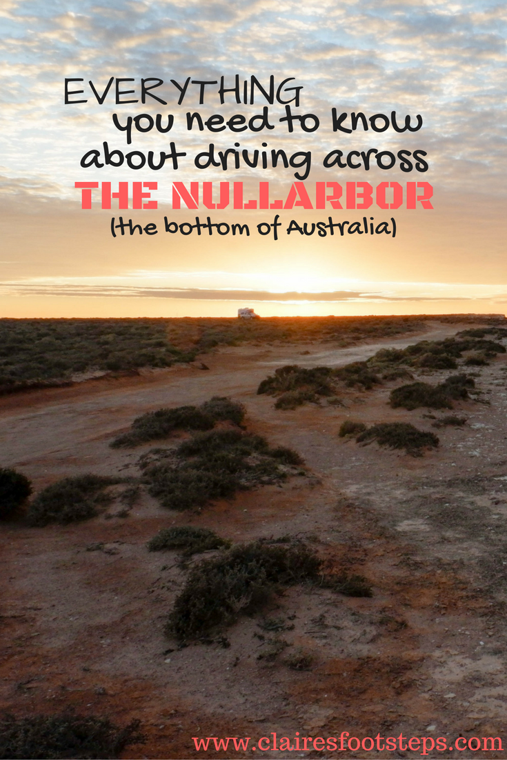
Crossing the Nullarbor
Widen your horizons driving the Eyre Highway across the vast Nullarbor Plain, four times the size of Belgium.
By Sue Gough Henly
Feel the wide open space of Australia's vast outback beneath your wheels on one of the world's greatest adventure drives as you cross the vast, semi-arid Nullarbor Plain. The Nullarbor stretches across the southern edge of Australia between the goldfields of Western Australia and the Eyre Peninsula in South Australia . You can connect to this journey from Adelaide or Perth and drive west to east or east to west along the Eyre Highway. While this is a sealed road, it goes through remote areas and the trip requires thorough preparation. You should carry extra petrol and plenty of water and food. You'll need a 4WD vehicle to venture off the highway. If you'd rather make the trek with a tour, check out the epic adventures offered by Untamed Escapes .
What to expect
- Watch whales beneath the world's longest line of sea cliffs
- Drive the longest, straightest, flattest road in Australia
- Play a round on the longest golf course in the world
- Time: 6 days
- Distance: 1,256 kilometres (781 miles)
- Transport: car
- Nearest major city: Perth and Adelaide
Nullarbor means "no trees" in Latin, but in reality, the Nullarbor is covered with bluebush and mulga scrub, and even wildflowers after rain. You'll see plenty of wildlife, including wild camels, kangaroos and emus (be careful at dusk), meet eccentric outback characters and even discover space junk that fell to earth. Go whale watching on a clifftop lookout, visit vast cattle stations, and play the world's longest golf course – an unbelievable 1,365 kilometres (848 miles) long, with a hole at each town or roadhouse along the way.
,url-https%3A%2F%2Fwww.australia.com%2Fcontent%2Fdam%2Fassets%2Fimage%2Fmapbox%2Fmarkers%2F1x%2F6.png(133.6742,-32.126399),url-https%3A%2F%2Fwww.australia.com%2Fcontent%2Fdam%2Fassets%2Fimage%2Fmapbox%2Fmarkers%2F1x%2F5.png(130.896227,-31.450424),url-https%3A%2F%2Fwww.australia.com%2Fcontent%2Fdam%2Fassets%2Fimage%2Fmapbox%2Fmarkers%2F1x%2F4.png(129.002183,-31.63816),url-https%3A%2F%2Fwww.australia.com%2Fcontent%2Fdam%2Fassets%2Fimage%2Fmapbox%2Fmarkers%2F1x%2F3.png(127.0208,-31.9007),url-https%3A%2F%2Fwww.australia.com%2Fcontent%2Fdam%2Fassets%2Fimage%2Fmapbox%2Fmarkers%2F1x%2F2.png(125.4874,-32.2705),url-https%3A%2F%2Fwww.australia.com%2Fcontent%2Fdam%2Fassets%2Fimage%2Fmapbox%2Fmarkers%2F1x%2F1.png(123.866,-32.4581)/auto/600x400@2x?access_token=pk.eyJ1IjoidG91cmlzbWF1c3RyYWxpYSIsImEiOiJja2ExdXdsNzYwNTZsM2dsd24zNnFqMTN2In0.An2c1t_cPfn8R7-LR5glLg "Crossing the Nullarbor")

Day 1: Norseman to Balladonia

Kalgoorlie Golf Course, Kalgoorlie, Western Australia © Tourism Western Australia
An eight-hour drive from Perth brings you to Norseman, where your Nullarbor journey begins. If you would like to play the 18-hole, par 72 Nullarbor Links , which is spread across two states and two time zones, be sure to make a detour to the gold rush town of Kalgoorlie-Boulder, where you can buy your scorecards from the Visitor Centre . Play the first two holes at the Kalgoorlie Golf Course, one hole at the Kambalda Golf Club and two holes at the Norseman Golf Club (clubs can be hired at each course). It is 190 kilometres (118 miles) between Kalgoorlie and Norseman. Check out life-sized tin monuments of the early camel trains before heading east along the Eyre Highway. Drive past the woodlands of Dundas Nature Reserve and climb the granite hills of Fraser Range, circled by the world's largest eucalypt hardwood forest. Walk through the towering blackbutts, salmon gums and green gimlets, and see Mount Pleasant rising over the forest. Visit the Fraser Range sheep station (105 kilometres or 65 miles east of Norseman), spot birds, camels and wildflowers on a bushwalk, and play the Sheep's Back par three hole. Drive 40 kilometres (25 miles) east to Newman Rock for views of forest, range and plains. It is just another 50 kilometres (31 miles) east to the Balladonia Roadhouse , which is the first stop on the Nullarbor journey from Western Australia to South Australia . In 1979, Balladonia hit the world news when parts of the US Skylab space station fell to earth around here. You can see some bits at the free Balladonia Cultural Heritage Museum , which also has exhibits of Aboriginal heritage, European exploration and settlement and local flora and fauna. It is located at the Roadhouse, where you can cool off in the pool, have dinner and spend the night in a motel room or the caravan park.
Day 2: Balladonia to Caiguna

Eyre Highway, Western Australia © Tourism Western Australia
Start your day with an excellent coffee at the roadhouse and stock up on water, food and petrol before playing the par three Skylab hole through the scrub (beware of snakes). This is where the golf course starts to get peculiar. The holes in the Nullarbor comprise greens and tees and rugged fairways through the scrub. Playing the course becomes a quirky Aussie outback experience. Ask at the roadhouse for directions to the nearby Balladonia Rocks (loosely translated, Balladonia comes from an Aboriginal word meaning "big red rock") for superb views of the flat plains. The Afghan Rocks are 14 kilometres (nine miles) east of Balladonia, where fresh water dams provided water for the early Afghan camel drivers. From here drive the 90 Mile Straight, which at 147 kilometres (91 miles) is one of the world's longest stretches of straight road (don't forget to take a photo at the iconic wildlife road sign). It ends in Caiguna, where you can drive south to the coast to check out the Caiguna Blowhole. Play the par four 90 Mile Straight hole through the trees before dinner and a night spent at the John Eyre Motel and Caravan Park.
Day 3: Caiguna to Madura

Nullarbor Cliffs, Western Australia © Tourism Western Australia
Drive from Caiguna Roadhouse 65 kilometres (40 miles) to Cocklebiddy, once an Aboriginal mission, where you can play the par four Eagles Nest hole. If you have a 4WD and are experienced in rough conditions, explore the Nuytsland Nature Reserve to see some of the world's longest unbroken cliffs, along with stunning coastal scenery and beaches. Book ahead to visit (you can also stay overnight) the Eyre Bird Observatory , Australia's first bird observatory. It was established in 1977 in the 1897 stone telegraph station nestled between woodlands and white dunes within walking distance of the beach. It is a 34-kilometre (21-mile) detour (via 4WD only) south-east of the Eyre Highway. You'll be rewarded by seeing the likes of silvereyes, singing honeyeaters, brown falcons and the pretty pink and white Major Mitchell's cockatoos. Back on the Eyre Highway continue for 92 kilometres (57 miles) to Madura, the midway point between Adelaide and Perth , where robust horses known as Walers were bred for the Australian Light Horse Brigade in World War I. Today, sheep graze alongside the roadhouse, where you can rest and refuel for the night after playing the par three Brumby's Run hole (a brumby is a wild horse).
Day 4: Madura to Border Village

Eucla sand dunes, Eucla, Western Australia © Tourism Western Australia
From Madura, the hill-flanked highway stretches into the horizon without interruption for 117 kilometres (73 miles) to Mundrabilla Roadhouse, where Australia's largest meteorite was discovered. Play the par four Watering Hole and stock up on food, water and fuel at the roadhouse before driving 66 kilometres (41 miles) to the top of the Hampton Tableland at Eucla , home to the fascinating, shifting sand dunes of Eucla National Park. See the old telegraph station, once Australia's busiest regional telegraph station, which is being slowly claimed by the dunes. Walk to the derelict jetty that once was used to ship supplies to pioneers, and enjoy the white sandy beach. Visit the small museum and take in sweeping views from the top of the escarpment. Back in Eucla, play the par four Nullarbor Nymph hole on the Eucla Golf Course before driving 12 kilometres (7.5 miles) to cross the South Australian border at Border Village. Enjoy a refreshing swim in the pool, a bite to eat and a comfortable bed at the Border Village Roadhouse.
Day 5: Border Village to Nullarbor Roadhouse

Bunda Cliffs, Eyre Peninsula, South Australia © Peter Eve, Monsoon Studio, South Australian Tourism Commission
Head over to the Giant Kangaroo to play the par three Border Kangaroo hole before you stock up on water, food and petrol. Follow the Eyre Highway through Nullarbor National Park , alongside the sheer 90-metre (300-foot) high, 200-kilometre (124-mile) long Bunda Cliffs , the longest line of sea cliffs in the world. See Australia's southern edge drop dramatically to the sea from any of the five signposted lookouts over the cliffs. Be careful when treading around the limestone clifftops as they crumble easily. From here, the highway traverses classic Nullarbor country – treeless and seemingly limitless plains where you will see lots of semitrailers and road trains hurrying goods across the continent. It is 184 kilometres (114 miles) between Border Village and the Nullarbor Roadhouse . Play the par five Dingo's Den hole at the recently upgraded roadhouse before checking out the Aussie music icon murals in the bar, where you can play a round of pool with passing truck drivers (truckies) and grey nomads (retirees driving around the country pulling caravans) after dinner. Don't forget to look at the night sky to see the Southern Cross and other Southern Hemisphere constellations – there's no light pollution out here.
Day 6: Nullarbor Roadhouse to Ceduna

Head of Bight, Eyre Peninsula, South Australia © Adam Bruzzone, South Australian Tourism Commission
From here to Nundroo you'll be travelling through Yalata Aboriginal Land and will need a permit to venture off the highway. Pick one up from the White Well Ranger Station on the short 20-kilometre (12.5-mile) journey south to the Head of Bight . The whale watching platform here is one of the world's best land-based vantage points to see a whale nursery. Southern right whales, which can grow to 18 metres (59 feet) long, mate and calve in these protected waters between May and October. Back on the highway, drive about 130 kilometres (81 miles) to the next roadhouse, at Nundroo, and play the par five Wombat Hole. You can take a 55-kilometre (34-mile) detour to the picturesque fishing haven of Fowlers Bay . Watch whales from the rugged sea cliffs (you can also do a whale watching boat tour , on which you can spot fur seals and sea lions), hike along the sand dunes and spot wildlife in Fowlers Bay Conservation Park. From here it is 71 kilometres (44 miles) to Penong, where you'll see dozens of old-fashioned windmills at the windmill museum and play the par four Windmills Hole at the Penong Golf Course. Just 22 kilometres (13.5 miles) south of Penong, surf the world-class breaks of Cactus Beach or swim in the netted enclosure. From Penong, it is 72 kilometres (45 miles) to Ceduna , on the sandy curves of Murat Bay, where you can buy Aboriginal art and craftwork from the Ceduna Aboriginal Arts and Culture Centre and play the last two holes of the Nullarbor Links (the par five Oyster Beds Hole and par four Denial Bay Hole at the Ceduna Golf Club). From here fly to Adelaide, or begin the drive, which is almost 800 kilometres (497 miles).
Spend a few days in Adelaide , or continue your journey through South Australia . Kangaroo Island is brimming with wildlife, while the Great Ocean Road is one of Australia's most magical coastal road trips.
Explore more nearby

We use cookies on this site to enhance your user experience. Find out more . By clicking any link on this page you are giving your consent for us to set cookies.
Acknowledgement of Country

We acknowledge the Traditional Aboriginal and Torres Strait Islander Owners of the land, sea and waters of the Australian continent, and recognise their custodianship of culture and Country for over 60,000 years.
- New Zealand (English)
- United States (English)
- Canada (English)
- United Kingdom (English)
- India (English)
- Malaysia (English)
- Singapore (English)
- Indonesia (Bahasa Indonesia)
- Deutschland (Deutsch)
- France (Français)
- Italia (Italiano)
- 中国大陆 (简体中文)
*Product Disclaimer: Tourism Australia is not the owner, operator, advertiser or promoter of the listed products and services. Information on listed products and services, including Covid-safe accreditations, are provided by the third-party operator on their website or as published on Australian Tourism Data Warehouse where applicable. Rates are indicative based on the minimum and maximum available prices of products and services. Please visit the operator’s website for further information. All prices quoted are in Australian dollars (AUD). Tourism Australia makes no representations whatsoever about any other websites which you may access through its websites such as australia.com. Some websites which are linked to the Tourism Australia website are independent from Tourism Australia and are not under the control of Tourism Australia. Tourism Australia does not endorse or accept any responsibility for the use of websites which are owned or operated by third parties and makes no representation or warranty in relation to the standard, class or fitness for purpose of any services, nor does it endorse or in any respect warrant any products or services by virtue of any information, material or content linked from or to this site.
The Ultimate Guide to Crossing the Nullarbor
- Driving tips
- Destinations
Crossing the mighty Nullabor plain is more than just ticking an experience off the Australia bucket list. Vast and wild, the place of ‘no trees’ is home to ancient limestone cave systems, towering sea cliffs, shifting sand dunes and abandoned buildings that are all a testament to its prehistoric and human past. Like any road trip worth its salt, it’s not about the destination. On the Nullarbor, it’s all about how you get there.
Once you and your crew are road-ready, you’ll set off and meet a veritable host of characters. From the feral camels, kangaroos and wombats who call this desert home, to the sunburnt holidaymakers, intrepid backpackers and regular truckies there’s plenty of others travelling here. Stop for a coffee and chinwag at one of the many roadhouses, take a dip at the remote Cactus Beach, watch the rare whales play off the coast of the Bunda Cliffs and dream of it all in a swag by night, sleeping under the undiminished stars.
Driving the Nullarbor Plain
Tales of road trains and wind tunnels can make the idea of crossing this flat, desert landscape daunting. But trust us – with the right preparation, a spectacular and otherworldly adventure awaits. This vast and remote stretch of land can be navigated by taking a straightforwardly rather flat and famously straight, bitumen highway. But there’s more to it than that.
Nullarbor novices would do best to cross the plain in the winter. Not only are the days significantly cooler, but it is also when you can watch the southern right whales that breed and birth here from the top of the Great Australian Bight. But while you might shudder at the idea of crossing in the heat, there are perks. Swims at secluded beaches to cool off for one, and undertaking one of Australia’s most iconic road trips with a banging summer playlist coming out the stereo for another.
Towns & fuel
The drive between the South Australian town of Ceduna on the Eyre Peninsula and Norseman in Western Australia is around 13 hours and 1,200 kilometres, so you can bet you’ll need to factor in a few fuel stops on the way. There are around 12 roadhouses where you can fill up including Penong, Nurdoo, Nullarbor (which has a famous Roadhouse rest stop), Mundrabilla, Cocklebiddy and Balladonia. There are also other roadhouses where you can pick up fuel.
Tips & rules
The first step to tackling the Nullabor, you’ll want to get your car checked out before you leave. To cross, you’ll also want to make sure you’re prepped with supplies, including at least 10 litres of water per person, coolant, engine oil, a spare tyre … and that’s just the start. Once you hit the road, travellers recommend that despite the temptation to make up hours, don’t drive at night. The limit is 110 kilometres an hour, and coming across a big kangaroo or even a camel at those speeds is a disaster waiting to happen. Give way to road trains and oversize trucks.
If you really don’t like the idea of driving, there’s a pretty stunning alternative. A ride on the Indian Pacific will take you straight across by train.

On board the epic Indian Pacific train
The Indian Pacific sounds like one of the world's most epic train journey, but what's it really like to spend 4 days crossing the ...

Crossing the Nullarbor: all your top questions answered
Australian Traveller drives the Nullarbor Crossing on one of Australia’s greatest outback journeys. Crossing the Nullarbor Plai...
Nullarbor accommodation
Hotels & motels.
You can find motels at most of the roadhouses, as well as caravan parks and spots to pitch your tent. Options include the iconic Nullarbor Roadhouse , which has motel rooms, a restaurant and caravan spots. Although these roadhouses can be considered on the pricier side, a night of sleep in a bed can be priceless for a tired out driver.
Camping & campgrounds
Many drivers instead opt to sleep in nature’s hospitality, pitching a tent at an unpowered site or in the bush for a spot of free Nullarbor camping . For something a bit different (and if you have a car that can handle unsealed roads) Koonalda Homestead campsite in Nullarbor National Park is off the Eyre Highway. This old homestead with a train station and outbuildings, which you can stay in. For beach camping, Cactus Beach has the Point Sinclair Camping Ground for $15pp a night.
Highlights along the Nullarbor

featured post
The top places you should stop along the Nullarbor
The Nullarbor crossing is infamous among road trippers, with legends of how monotonous the 1256-kilometre route across s...
Attractions
The first European to cross the Nullarbor, Edward John Eyre, was seriously short-sighted when he called it a place of “bad dreams”. Instead, it’s a place of wonders . As a karst region, its caves include the Koonalda Cave , where ancient Indigenous prehistoric art has been found that dates back over 20,000 years. While you can’t visit, you can go to the Murrawijinie Cave to see the Indigenous ochre hand stencils at its entrance.
Step up to the ‘edge of Australia’ when you visit the Bunda Cliffs. Towering over the Great Southern Ocean, these limestone monuments are the world’s longest uninterrupted line of sea cliffs. There are five main lookouts from which you can see whales in winter. Take the experience to a higher level, and charter a scenic flight with Chinta Air over here.
Tee-up time on the Nullarbor Links , the world’s longest golf course. Starting at Kalgoorlie in WA, it stretches 1,365km to Ceduna in SA.
Tours & packages
If you want to sleep under the stars with a whole bunch of new mates, there’s no better way to make the Nullarbor crossing than on the tour. The family-owned Xplore Eyre hosts small group and private tours, while Nullarbor Traveller runs multi-day camping tours. Both run between the Eyre Peninsula and the southwestern Australia region .

Play the world’s longest Golf Course on the Nullarbor Plain
Not satisfied with cricket matches that take five days to complete? There is now a golf course that takes four days and 1365km ...
Restaurants & food along the Nullarbor
Start off your journey right at Ceduna Oyster Barn in South Australia, where you can gorge yourself on sashimi and freshly shucked oysters before you make the crossing. From then on out, food options can be limited as the roadhouse shops are known for being pricey. You’re best to bring plenty of dried and canned food with you, which you can snack on to keep the costs of your road trip down. Unfortunately, any fresh food will be confiscated from you at the WA/SA border.
There are some dining options at the roadhouse restaurants, although they tend to be of the reheated variety. That being said, the Nullabor Roadhouse has a reputation for stellar feeds that include road trip classics such as burgers, hot chips and chicken schnitzel.
Explore more of South Australia
- South Australia
- Outback South Australia
- Coober Pedy
- Flinders Ranges
- Eyre Peninsula
- Port Lincoln
- Adelaide Hills
- Barossa Valley
- Clare Valley
- Fleurieu Peninsula
- McLaren Vale
- Kangaroo Island
- Limestone Coast
- Mount Gambier

© Australian Traveller Media 2024. All rights reserved.
The Ultimate Guide to Driving Across the Nullarbor

A unique and unforgettable experience and one of the world’s most iconic road trips. Besides being frequented by truck drivers, the Nullarbor has become a sought-after destination for adventurers and travellers who want to experience the rugged beauty of Australia’s outback and cross the border between Western Australia and South Australia. The vast, open plains, rugged coastlines and stunning sunsets are unlike anything else in the world.
With careful planning and preparation you can make the most of the drive, appreciating the natural beauty of this remote and fascinating region and creating memories that will last a lifetime. To help you, we’ve put together this guide on everything you need to know about driving across the Nullarbor to really make the most of the journey.
Where Does the Nullarbor Start and Finish?
The Nullarbor starts in the town of Norseman in Western Australia and finishes in the town of Ceduna in South Australia or vice versa depending on which state you’re travelling from.
How Long is the Nullarbor?
The journey across the Nullarbor from Norseman to Ceduna is approximately 1200km long.
How Long Does it Take to Drive Across the Nullarbor?
The drive across the Nullarbor takes approximately 12.5 hours. The actual time it will take you to drive across the Nullarbor depends on a variety of factors such as the road conditions, the speed you are driving and how often you stop along the way. For most travellers it takes around 2-3 days to drive across the Nullarbor.
It’s important to keep in mind that the drive across the Nullarbor is long and tiring so it’s a good idea to break the journey up into sections and have frequent breaks so you can take your time and enjoy it.

How Many Days do you Need for the Nullarbor?
You need at least 2 days to drive across the Nullarbor. This would involve spending one night on the Nullarbor and just over 6 hours of driving each day.
Extending the drive out over additional days could make the drive less tiring and more enjoyable. With additional days you can reduce the amount of driving needed each day, you can take more rests and you can spend more time exploring and enjoying the rugged scenery.
Just make sure to know your own limits and listen to your body. If you’re tired pull over and take a rest, your safety is the most important consideration. We completed the drive across the Nullarbor in two days and were totally fine doing so, we kept checking in with each other, had frequent rest stops and stayed fully hydrated.
What is the Best Time to Cross the Nullarbor?
The best time to cross the Nullarbor depends on your personal preference and what you want to experience during the drive. As a whole, the best time to cross the Nullarbor is usually during the colder months (March-November). Summer (December-February) can bring intense heat that can make the drive significantly less enjoyable, it’s also when fire danger risk is typically at it’s highest.
If you’re interested in seeing wildlife the best time to cross the Nullarbor is July to September which is when the number of Southern Right Whales visiting the area peaks. There’s nothing more incredible than seeing these magnificent creatures in the wild. These cooler months are also when many species are more active and are easier to spot.
Can you Cross the Nullarbor in Summer?
Yes, you can cross the Nullarbor in Summer but the drive can be less enjoyable if you’re travelling during very hot days. Just make sure to keep an eye on the weather forecast to avoid days of extreme heat. With a good air con and plenty of water you should be fine.
We crossed the Nullarbor during summer in February and we were fine. The weather was cooler and the heat was less intense during our drive.
Where is Australia’s Longest Straight Road?
Australia’s longest straight road, the 90 Mile Straight, runs from the town of Balladonia in Western Australia to the town of Caiguna in Western Australia. Covering a distance of 146.6km.

Can you Camp Along the Nullarbor?
Yes, there are loads of free campsites along the Nullarbor that you are welcome to camp at. Majority of these campsites are suitable for motorhomes, caravans, campervans and tent setups. The campsites are typically rest stops just off the main highway so majority of these don’t have any facilities but there are some that do. For example, on our drive we took a rest and stretched our legs at the ‘Woorlba 24 Hour Free Camping and Rest Area’, this site had a dump point, toilets, picnic benches and it’s own little gnome display called ‘BallaGnomeia’.
Free campsites on the Western Australian side of the Nullarbor are mostly just a large, open sections of dirt track surrounded by shrubs. Half of the South Australian side of the Nullarbor is similar with dirt track rest stops that are surrounded by bush, the other half however (closest to the border) is where the famous Bunda Cliff camping spots are. If you search for the Nullarbor you’ll likely see hundreds of images of the Bunda Cliff camping spots, these are dirt track campsites that sit close to the Nullarbor cliffs, giving you incredible views of the Southern Ocean. If you’re driving across the Nullarbor we’d definitely recommend spending at least one night camping on one of the Bunda Cliff campsites as this was a highlight during our trip. If you’d like to know more about the Bunda Cliffs check out our post: Bunda Cliffs (Nullarbor Cliffs): Everything You Need to Know .
For those who require power hookup or would prefer to stay at a caravan park or roadhouse there are lots along the way.

If you are planning on camping along the Nullarbor make sure to prepare accordingly ensuring you have appropriate gear to camp and be off grid. Also just a reminder that the Nullarbor can get very cold at night so make sure you have warm gear no matter what season you’re driving. We drove across the Nullarbor during summer and still found the night extremely cold.
We’d recommend downloading the WikiCamps app to find campsites and facilities (such as toilets) that are suitable for you during your trip. WikiCamps is what we’re using for our entire lap of Australia and we’ve found it incredibly useful and couldn’t manage without it. It was key to our entire trip, let alone finding great spots along the Nullarbor. The app has offline mode so you can still access the app without internet connection or phone signal. For example, below is an example of the app, showing us the free campsites available on that section of the Nullarbor.

Is Sleeping in my Car on the Nullarbor Ok?
Yes, sleeping in your car while crossing the Nullarbor is ok. Pull into one of the rest stops when you need to rest and make sure you have the right supplies to keep you comfortable and warm throughout the night.
Is There Accommodation Along the Nullarbor?
Yes, there is accommodation available along the Nullarbor if you don’t want to camp but need somewhere to stay the night. These accommodation spots are primarily roadhouses and motels. Below is a list of some of the accommodation spots available along the Nullarbor:
- Fraser Range Station
- Balladonia Hotel Motel
- Cocklebiddy Hotel Motel Service Station
- Madura Pass Oasis Motel
- Mundrabilla Roadhouse
- Eucla Motel
- Border Village Roadhouse
- Nullarbor Roadhouse
- Coorabie Farm
- Fowlers Bay Beach House
Is the Nullarbor Dog Friendly?
Yes, you can drive across the Nullarbor with your dog. You can have your dog at majority of the free campsites along the Nullarbor and there are some dog friendly accommodation spots. Just make sure to keep your dog controlled (and/or on a leash) at all times and make sure to pack enough water and supplies for your dog to be comfortable on the trip.
Keep in mind that 1080 baits may be in use as you’re driving across the Nullarbor, hence the importance of keeping your dog controlled and/or on a leash. We saw on WikiCamps that 1080 baits were in use at a lot of the campsites along the Nullarbor.
How Many Roadhouses are on the Nullarbor?
There are around 10 roadhouses situated at different spots along the Nullarbor between Norseman in Western Australia and Ceduna in South Australia. Each roadhouse has different facilities and products available to travellers but majority offer fuel, toilets, basic supplies and food and drinks.

Are There any Shops Along the Nullarbor?
Yes, there are a few shops located along the Nullarbor at roadhouses and petrol stations. These aren’t full blown department stores or grocery shops but are small shops that offer basic supplies such as snacks, drinks, souvenirs and car supplies. Some of these also sell hot food such as the Nullarbor Roadhouse which sells full dinners such as burgers and schnitzels.
Some items at the roadhouses and petrol stations are pretty expensive so we’d recommend packing enough food, water and supplies to cross the Nullarbor without needing to rely on them. Then you can still support those businesses and spoil yourself with fun stuff like souvenirs or delicious hot meals.
Are There Petrol Stations Along the Nullarbor?
Yes, there are multiple petrol stations along the Nullarbor (around 10+). These petrol stations are spaced a fair distance apart so we’d recommend familiarising yourself with their locations before starting the drive across the Nullarbor. The longest stretch between petrol stations however is 191km between Balladonia and Norseman.
Prior to driving across the Nullarbor we heard the advice of making sure you start the drive across the Nullarbor on a full tank and fill up at every petrol station you pass to ensure you don’t run out. Then if for some reason one of the petrol stations is closed or doesn’t have fuel (which is unlikely) you’ll still be fine. This is the advice we took (besides skipping a few petrol stations near the end) and we definitely recommend it as we made it across the Nullarbor just fine without having to worry or carry any extra.
Is Fuel Expensive on the Nullarbor?
Yes, fuel can get expensive on the Nullarbor due to the remote location and high running costs of the petrol stations. Fuel prices do vary between the petrol stations/roadhouses depending on their location and the time of year.
To give you an idea on fuel prices we have listed our fuel spend while driving across the Nullarbor below. Keep in mind that we started with a full tank and we drive a LWB Mercedes Sprinter van which uses diesel.
- First Top-Up (Balladonia BP): $61.92 ($2.44/L)
- Second Top-Up (Cocklebiddy BP): $95.09 ($2.70/L)
- Third Top-Up (Mundrabilla Roadhouse): $65.56 ($2.68/L)
- Fourth Top-Up (Nullarbor Roadhouse): $34.55 ($2.94/L)
- Last Top-Up (Ceduna BP): $138.01 ($2.10/L)

What Happens if You Break Down on the Nullarbor?
Don’t freak out if you break down on the Nullarbor. In contrast to people’s expectations of the Nullarbor it can actually be quite a busy road, with lots of travellers and truck drivers driving it every day. Petrol stations are also relatively close together with the longest stretch between petrol stations being 191km.
If you have signal you can contact the nearest roadhouse or your roadside assistance provider. If you don’t have signal, get out of your vehicle and safely grab the attention of passing vehicles.
Are There Toilets Along the Nullarbor?
Yes, there are lots of toilets along the Nullarbor. Toilet facilities are often available at majority of the petrol stations and roadhouses along the Nullarbor and a few campsites have toilet facilities also. Keep in mind that the state of the campsite toilets can be pretty hit and miss, they’re often drop toilets that may be dirty and sometimes don’t have toilet paper.
We’d recommend packing toilet paper just in case. For the ladies we’d also recommend getting a female urination device in case you need to go ‘in the bush’ or don’t want to get too close to a gross toilet! If you’re interested, check out Lydia’s recommendation on the best female urination device .
If you can’t wait to make it to a proper toilet and go ‘in the bush’ make sure to clean up after yourself and leave no trace.
Is There a Speed Limit on the Nullarbor?
Yes there is a speed limit on the Nullarbor. The speed limit on Eyre Highway (the main road on the Nullarbor) is primarily 110km/h. It drops down to 90km/h for some sections of the road that pass through small towns.
Is the Nullarbor Road Sealed?
Yes, Eyre Highway, the road that crosses the Nullarbor and connects South Australia and Western Australia is a sealed road, making it suitable for all vehicles to drive on.
Previously an unsealed road, sealing the highway began in Norseman in 1960. Sealing the Western Australian section of the Eyre Highway was completed in 1969 and sealing of the South Australian section of the highway was finished in 1976.

Do You Need a 4WD for the Nullarbor?
No you don’t need a 4WD for the Nullarbor. The Eyre Highway, the road that crosses the Nullarbor, is a sealed road, making it suitable for all vehicles to drive on.
Is it Safe to Drive Across the Nullarbor?
Yes, driving across the Nullarbor is safe. However, the drive is long and the Nullarbor is a remote and sparsely populated region so you need to make sure you’re prepared and do/have the following:
- A reliable vehicle – Make sure your vehicle is in good condition so you can rely on it during the long drive. Check your tyres and all other critical components to ensure they are in good working order. Also check your oil and coolant levels.
- Supplies – Pack essential supplies such as lots of food, water and a first aid kit.
- Check conditions – Check the road conditions and weather conditions prior to driving so you’re aware of any potential hazards.
- Take frequent breaks – Driving across the Nullarbor can be exhausting, so it’s important to take regular breaks to rest and recharge. If you’re tired make sure to pull over and rest.
- Drive carefully – Besides following road rules and driving at a safe speed, make sure to stay alert for wildlife. Crossing wildlife such as kangaroos, emus and wombats are a hazard for drivers, especially during dusk, dawn and during the night when these animals are more active. We would recommend not driving at dusk, dawn and during the night all together.
- Inform someone – let someone else know your plans to cross the Nullarbor and how long you expect to be.
Is there Phone Signal Along the Nullarbor?
There is limited phone signal along the Nullarbor. Large areas of the Nullarbor don’t have signal and those areas that do have signal have very patchy coverage.
Rather than being frustrated by this, embrace it and enjoy this period of being disconnected. Just let family and friends know that you’re going to be without signal and you’ll be in touch when you have signal again. If you need, some of the roadhouses/motels along the Nullarbor offer internet access for a fee.
Below I’ve included an image of Telsta’s coverage over the Nullarbor. Areas highlighted green have 4G coverage and areas highlighted turquoise have 3G coverage.

What Should I Pack When Driving Across the Nullarbor?
The Nullarbor has long stretches of road with no petrol stations, restaurants, or shops, so it’s important to stock up on supplies before you leave. Make sure to pack the following when driving across the Nullarbor:
- Food – Pack meals and snacks for while you’re on the road. Some of the roadhouses on the Nullarbor do sell snacks and food, including full meals like burgers, schnitzels and more. Some specific items can be unavailable or expensive however so if you need particular items during the drive make sure to pack these prior and don’t rely on the roadhouses to stock them.
- Water – Bring plenty of water to stay hydrated during the long stretches of driving.
- First aid kit – Always have a first aid kit on hand just in case, it’s better to be safe than sorry.
- Sun protection – Pack sun protection such as sunscreen, a hat and sunglasses. The sun can be intense in the outback, so it’s important to protect yourself.
- Comfortable clothes – Wear (and pack) loose-fitting clothes that you are comfortable in and that are suitable for the weather.
- Warm clothes and blankets – The temperature can drop significantly at night so make sure to pack warm clothes and blankets in case you get cold.
- Toilet paper – Pack toilet paper just in case as some toilet spots may have run out.
- Car supplies – As mentioned before, it’s important to check your car before starting the drive. Bring any other car supplies that you think your car might need such as a spare tyre, extra oil, a jump starter and distilled water. What you should bring will depend on your car and what condition it is in.
- Camping gear – If you’re going to camp along the Nullarbor make sure to bring appropriate camping gear.
Are There Drinking Water Top Ups Along the Nullarbor?
No, there are no designated drinking water top up areas for your caravan, campervan or motorhome so we’d recommend topping up before you start the drive. You can buy bottled water and other beverages at the roadhouses however.
At the time of writing this (April 2023) both Ceduna and Norseman have drinking water top ups for a small fee. Ceduna has a potable water station in town that charges a $1 coin for up to 150L of water. Norseman has a potable water station in town that takes tokens purchased from the Visitor Information Centre, these cost $2 for 60L of water.
What Should I Do When Driving Across the Nullarbor?
There are many things to see and do when driving across the Nullarbor, besides blasting your favourite music or listening to a podcast. We’ve listed some of these things below:
- Take on the world’s longest golf course, the Nullarbor Links.
- Go whale watching anywhere along the Bunda Cliffs or at the Head of Bight Lookout – if you’re visiting during the right season.
- Drive by Lake Macdonnell to see what colour it is.
- Check out the Penong Windmill Museum which is home to the biggest windmill in Australia.
- Revisit history with the Replica Old Garage at Nullarbor Roadhouse then enjoy the artwork and grab a bite to eat at the new roadhouse.
- Explore the ruins of the Old Telegraph Station in Eucla.
- Enjoy the beach and beautiful scenery at the old Eucla Jetty.
- Feel the cool breeze from the Caiguna Blowhole.
- Spend the night stargazing and experience the undisrupted and magical beauty of the outback night sky.
- Step back in time at the Balladonia Heritage Museum with Skylab, Aboriginal heritage and European settlement displays.
- Snap a picture at the ’90 Mile Straight’ sign so you can brag about crossing Australia’s longest straight road.
- Appreciate the beauty and history of the Murrawijinie Caves.

What is the Weather Like on the Nullarbor?
The Nullarbor is an arid region with little rain and dry weather. Typically summer months are very dry, hot and sunny with little rainfall. Temperatures in summer months are usually between 15-40°C. Winter months are much milder with daytime temperatures between 5-20°C.
Is it Cold at Night on the Nullarbor?
Yes, temperatures can drop significantly and get pretty cold at night on the Nullarbor. Make sure to pack warm blankets and clothes so you can stay warm if temperatures do drop.
What Border Checks are on the Nullarbor?
There are two border checks along the Nullarbor; one for visitors heading into Western Australia and one for visitors heading into South Australia. These border checks are at two completely different locations. Australia has strict biosecurity laws to protect against the spread of pests and diseases which is what these border checks cover. You will have your vehicle inspected and will need to declare and/or dispose of any restricted produce, plants, animal products and more.
The border check for visitors travelling from Western Australia into South Australia is on the Eyre Highway just before the town of Ceduna. The border check process was very smooth for us and took a maximum of 5 minutes. Upon driving to the quarantine station we let the worker know what produce we had and they let us know what we could keep and what they had to confiscate. The worker didn’t do a full inspection of our vehicle and just popped his head in to look at our fridge.
The border check for visitors travelling from South Australia into Western Australia is on the Eyre Highway at the border crossing between the two states. We don’t have experience at this border check but have heard the process is similar to that of the South Australian quarantine station, the inspection is just a little more thorough.

Where Did the Name Nullarbor Come From?
The name Nullarbor comes from the Latin words ‘nullus’ and ‘arbor’ meaning ‘no trees’. Surveyor Edmund Alexander Delisser was credited for this name, as his journal is believed to contain the first written use of the name Nullarbor when he was surveying the Nullarbor in 1865. Edmund was a private surveyor who had a contract with the South Australian government to survey the Great Australian Bight area.
What is the Aboriginal Name for the Nullarbor?
The Aboriginal name for the Nullarbor Plain came from the local Mirning people who referred to the Nullarbor as ‘Oondiri’ which means ‘the waterless’. Perhaps due to the lack of a permanent water source on the Nullarbor. The Mirning people would only venture inland following heavy rain.
Why are There No Trees on the Nullarbor?
The Nullarbor mostly consists of shrubs instead of trees due to a few different conditions that make it extremely difficult for trees to survive. We’ve listed each of these below.
Firstly, the harsh arid weather conditions on the Nullarbor mean there is little rainfall making it difficult for trees to grow and survive.
Additionally, the soil on the Nullarbor is shallow with a limestone bedrock close to the surface for majority of the plain which limits the ability for trees to establish roots. The soil is also quite poor in nutrients and is rich in calcium, raising the pH to a level that most trees can’t stand.
The Nullarbor consists mostly of low and hardy shrubs such as Saltbush and Bluebush. They both do well on the Nullarbor as they are tough plants that are resistant to drought and can grow in hot and dry conditions.
What Animals Live in the Nullarbor?
There’s a huge variety of animals who call the Nullarbor home, including;
- Birds of prey such as osprey, eagles and falcons.
- Reptiles such as lizards and snakes.
- A huge variety of birds such as emus, owls, kookaburras and more. There are some bird species that are unique to South Australia such as the Plains-Wanderer and Nullarbor Quail-Thrush.
- Marsupials such as wombats and kangaroos.
- Mammals such as camels, dingoes and whales.
- Insects such as beetles, flies, spiders and scorpions.

When Can you See Whales on the Nullarbor?
The best time to see whales on the Nullarbor is during the cooler months from May to October, peaking in July-August. These months are when the Southern Right Whales visit the region for their annual breeding migration, they migrate to the area for socialising, mating and calving.
There’s no better place to see these magnificent creatures in the wild. The high cliffs of the Nullarbor are not only a spectacular sight themselves, they’re also the perfect vantage point for having fantastic views of the visiting whales.

Where Can I See Whales on the Nullarbor?
You can see whales on the Nullarbor anywhere along the Bunda Cliffs in South Australia or at the Head of the Bight Lookout.
The Head of Bight Visitor Centre does charge an entry fee for it’s lookout. At the time of writing this (April 2023) fees during whale season (1 June to 30 October) are $16 per adult, $7 per child (5-15 years old) and family entry (for 2 adults and 2 children) is $40.
What is the Nullarbor Nymph?
The Nullarbor Nymph is a ‘legendary creature’, a beautiful, blonde, naked woman who supposedly lived amongst kangaroos on the Nullarbor. Between 1971 and 1972 there were multiple supposed sightings of the Nullarbor Nymph that were picked up by the media. Within days of the first sighting magazine and camera crews arrived from across the world to try and capture their own footage of the Nullarbor Nymph.
The Nullarbor Nymph was eventually revealed as a publicity stunt that was setup to help increase traffic to Eucla. ‘Geoff Pearce’ a PR man who couldn’t pay for his motel bill when passing through town promised the motel owner a publicity stunt that would help drive traffic to Eucla. He then teamed up with local kangaroos shooters to set it up. Geneice Brooker (the partner of one of the kangaroo shooters) was photographed as the nymph, she also ran across the road during the night near a passing bus of tourists so they would all report the sighting.
Enjoy Your Journey Driving Across the Nullarbor
That’s the end of our full guide on driving across the Nullarbor. We hope you found it useful! Enjoy the journey, drive safe and have an amazing time.
Watch Our Experience Driving Across the Nullarbor
If you’d like to you can watch our experience driving across the Nullarbor in our YouTube video below.

Hey! I’m Lydia and I have been travelling full time with Wehan since 2022. Alongside documenting our travels on YouTube, we put together comprehensive travel guides on the locations we visit here on our website. We also put together guides on other aspects of our travels, such as detailed information on the gear we use, specifics on our van build and tips for van life. Our goal with this website and the guides we write is to help others travel.
At the moment we are currently doing the big lap of Australia in our self converted Sprinter van. Our goal is to continue to push ourselves outside our comfort zone; seeking new adventures, learning about new cultures and seeing as much of the world as possible.
You may also enjoy:
The 8 best swimming holes in collie, where to see platypus in tasmania: the …, free camping near devonport tasmania: 8 best campsites, pildappa rock, minnipa: everything you need to …, lydia and wehan.
Hey, welcome to our site! We are Lydia and Wehan. We’re from Perth (Australia) and are currently doing the big lap of Australia in our self converted Sprinter van.

All Destinations , Australasia , Australia
Driving across the nullarbor plain : everything you’ll ever need to know.

The name ‘Nullarbor Plain’ exudes a certain air of mystery and compel. The plain spans two Australian states, broken only by the Eyre Highway that is the main part of an Adelaide to Perth road trip. If you’re planning on driving across the Nullarbor, you’ll most likely have been told that you’re crackers, had a few dozen people wondering why you don’t just hop on a plane and have lost count of how many times you’ve heard ‘you know it’s a load of nothing, don’t you’…
Don’t listen to ‘em. If you’re craving space, freedom and an authentic Australian experience, take the Nullarbor. I mean, it is a load of nothing. Apart from a few roadhouses, all placed 200kms or so apart, the Nullarbor is one empty place. But at the same time, driving across the Nullarbor is an experience like no other. It makes you realise how big Australia – and the world – is. It’s actually home to some amazing sights – like the beautiful head of Bight – and some of the most spectacular sunsets and sunrises in Australia, if not the world. And most of all, driving across the Nullarbor is a huge adventure.

If you’re planning on taking the 1200km drive, you’ll most likely be searching for some tips for driving across the Nullarbor highway. The road is safe and a lot busier than you might think, but there’s definitely some things you should keep in mind when driving across the Nullarbor. Tips like these will help you get out of any sticky situation and have a safe and enjoyable experience while crossing the Nullarbor!

As with any outback adventure, driving from Melbourne or Adelaide to Perth requires basic car kit and camping gear (unless you’re staying at the somewhat pricey roadhouse hotel motels). Remember to pack the following:
- Spare tyre and screws
- LOTS of water – I’d say try to keep 10l for each person at all times and top up when possible
- Canned and dried foods – enough to last a couple of extra days than you need. You could buy stuff at the roadhouses on the Nullarbor, but they’re super expensive – a bag of doritos for $7 expensive…
- Tent – such as this one from Wild Earth
- A self-inflating mat; this type of camp mat is compact but still comfy – check out this great value one .
- A good quality sleeping bag – the Nullarbor nights can get cold! Here’s a cosy sleeping bag suggestion .
- Camping stove – like this great two burner stove – and gas cylinders
The jury’s out on a petrol tank. If you’re just sticking to the highway, you probably won’t need it. But you will save money if you take one – fuel at some of the road houses can be in excess of $1.80 per litre! We didn’t take one but could have saved some money if we had.
Shop for camping supplies here!
Check your car’s oil, coolant and tyres routinely

Confession: before we left Adelaide, I thought my car didn’t have a dipstick. Following a concerned conversation with a car mechanic, I drove all over the city to see if anyone had a dipstick for my car. Eventually one of the scrappers I spoke to looked in the bonnet, where he found the dipstick… exactly where it was meant to be. I was the dipstick that day.
Following this incident, I learnt the importance of checking the oil, coolant and tyres. I checked them pretty much every day and avoided any incidents. I still don’t know how to change a tyre, but I have the wikihow instructions print screened on my phone for when the day comes…
It’s well worth keeping an eye on these things when you’re driving several hundred kilometres a day to avoid the car breaking on you somewhere around Cocklebiddy.
Don’t drive at night

That’s where the wild things are! Crossing the Nullarbor at night is just tempting fate – we saw a couple of bad accidents that looked like they’d happened at night. There’s loads of roaming animals around the Nullarbor after the sun goes down, who will jump out suddenly at night. Plus it’s so much easier to become drowsy when it’s not light. It’s really really not worth it.
Be vigilant about trucks and road trains

We were lucky when we crossed the Nullarbor; the wind was pretty low, so we didn’t have any problems crossing trucks. But in high wind, they can create a ‘wind tunnel’ which will feel like your car is being pulled into them. It won’t actually hit it, and there’s not much you can do other than hold your nerve, but it’s important to be vigilant.
Road trains are interesting. They can be over 50 meters long and go at speeds of up to 130 kmph. If you see one coming towards you, (and you will see it in good time thanks to the good old flatness and straightness of the plain) it’s best to pull onto the side and wait for it to pass. We didn’t actually see any super long road trains when we were driving across the Nullarbor, but I’ve heard lots of accounts of them.
Know your fuel stops!

If you know your petrol tank’s capabilities at certain speeds, you might be able to deign whether certain fuel stops can be avoided. Here’s a list of all of the fuel stops across the Nullarbor and the distances between them:
Ceduna 71km – this is the start of the Nullarbor – click here for accomodation options and book today!
Penong 79km
Nurdoo 143km
Nullarbor 181km – the roadhouse here is highly rated for travellers and makes a good rest stop. Click here to read more about it and to book today!
Border Village 13km
Mundrabilla 69km
Mandura 90km
Cocklebiddy 65km
Caiguna 175km
Balladonia 176km
Norseman is the end of the Nullarbor, where there are way more amenities than you’re now used to and lots of petrol stations. If you want to book some accomodation for your victorious night after crossing the Nullarbor (or to prep for it, if you’re driving west to east!), click here to see rates and book today .
My top tip for getting cheap fuel is to bypass Border Village and top up at Eucla, just 13km away. It’s much cheaper!
For a great crossing the Nullarbor map, check out this handy PDF .
Use Wikicamps to find free campsites

Look no further than Wikicamps for accommodation across the Nullarbor; it’s a fantastic app that helps users find free campsites on the Nullarbor and all around Australia. On the Nullarbor, these are just pit stops off the road, but are ideal for a night. I saw the best sunset and sunrise of my life at one of these!
Wikicamps cost around $5 to download (the price does go up and down) but is well worth it – you’ll make your money back in one day. There’s heaps of free campsites on the Nullarbor, so you can negate the pricey fuel with some accommodation for gratis !
If camping’s not your thing, there’s alternative Nullarbor accommodation at most roadhouses. These should really be booked ahead of time, especially in the tourist seasons – if you get to one and find it’s full it’s a long way to the next one!
Today’s Nullarbor Roadhouse Deals – Click through for more details and to book today!
Stop whenever possible.
Did I mention that driving across the Nullarbor is a long way? Stop whenever you can to avoid driver fatigue. There’s not a huge amount of attractions on this long straight road, but there’s a few unique things to do on the Nullarbor Plain that are well worth stopping for, including…
Snapping pictures with some of the iconic ‘I’m in the desert in Australia’ signs

These include the typical ‘a million miles from everywhere’ signs and ‘exotic animals on the road’ warnings. The pictures will be a great memento of your time!
Admiring some of the Nullarbor specific signs!

Where else will you have the chance to get a picture taken with an ‘Australia’s longest straight road’ sign (answer: nowhere, because it is here) or ‘Nullarbor: eastern end of treeless plain’ (same answer applies)? Enjoy these signs, there’s little else to do!
The Great Australian Bight

Don’t miss the bight, but don’t go to the head of bight, which costs $12 and closes at 3:53pm sharp. (advertised as 4, but the owner wouldn’t let us in for five minutes at 3:53. Hmphh). Just down the road (heading west), there’s a turn for the cliffs of the bight, where the spectacular view is freeeeee. Bear in mind that this area isn’t signposted with a name, just with a parking and photo symbol. So if you know you’re close to the bight and you see a little camera picture on a sign infront of you, turn down the next side road!

We had a great view of the bight from our wikicamps spot too. Seeing the sun come up over the colossal edge of the Australian continent is an experience that I don’t think I’ll EVER forget.
Get out of the car and stare off at the flatness, and the long road before you…

It is an experience like no other; I come from London and I’ve never felt so much SPACE. It’s quite surreal really, so be sure to get out of the car and take it all in.

Roadhouses are interesting places, and I loved marvelling at the random attractions they have there (such as a giant kangaroo holding a tub of vegemite at border village, SO stereotypical) and people watching, wondering why each of these people were driving across the Nullarbor. Roadhouses provide hideously expensive snacks, drinks and coffee and some ‘I’ve crossed the Nullarbor’ memorabilia. I did spend six dollars on a bumper sticker that is now proudly sitting on the back of my car, and I’m not sorry.
I also named my car ‘Nulla’ after crossing the Nullarbor. I’m still not sorry.
Roadhouses also normally have some interesting/ weird museums about the history of the area. They’re worth a stroll around while on a driving break!
Remember to download a LOT of music
You’re going to be driving 1,200 kilometres across the Nullarbor with very limited reception, so you’ll really need some pre-downloaded music. By some I mean A LOT. I had 250 songs on my ipod and to this day, whenever I hear ANY of them I just think about that long straight road…
I’d recommend at least a thousand songs. And one of them has to be ‘Nullarbor Song’ by Kasey Chambers. If you’re not sure what else to download, here’s some road trip playlist inspiration .
Get a Telstra plan

If you want any phone reception on the Nullarbor, go with Telstra – other providers just don’t have signal. You can get a pay as you go plan starting at $30. It’s well worth it!
Telstra doesn’t cover absolutely everywhere on the Nullarbor, but it does span across a majority of the plain.
Don’t panic if you break down (but make sure that you have the right cover)
If you do break down on the Nullarbor, you won’t be left to perish, especially if you’re on the main road. There’s plenty of cars still using this road – we saw about one every five minutes. People in the outback are typically very friendly and helpful, and lots will stop for you; helping if they know the problem, or passing a message on if you’re out of a phone signal area.
To avoid hefty tow away fees, make sure that you have RAC insurance and, if you’re savvy enough, some spare parts. I’m not going to pretend to be an expert on this; I know nothing about car repairs and I only had what I detailed above on me. There’s a lot more you can have/ know and if you want to hear advice from someone who knows a bit more about cars than me check out Amanda from Travel Outback Australia ’s advice for if you break down in the outback .
Be prepared to lose all sense of time

Time doesn’t really matter on your Nullarbor roadtrip, but it’s worth mentioning that the time zones will baffle you. South Australia is half an hour behind East Australia and Western Australia two hours behind (8 and a half hours and 7 hours ahead of GMT respectively). BUT various places on the border have their own time zone, 45 minutes ahead of WA time and behind SA time. It makes sense in terms of daylight, but it’s a tad baffling. To make things more confusing, your phone might automatically change to WA time when you’re still in SA or vice versa, like mine did…. I ended up going to bed at 5:50pm in darkness because I was so damn confused.
Don’t underestimate the distance

It takes time to drive 1,100 kms. Don’t think you can do it in a day. That’ll just give you our old foe, driver fatigue. With two drivers, we made it from 50kms from the WA border to past Norseman in a day – a huge amount really – but we swapped every two hours and only drove that way because we felt we could.
Don’t put a time on it and force yourself to be in one place at a certain time. This is where the flexibility of wikicamps can’t be criticized. You just rock up to whichever is nearest when you’ve had enough of driving (and there’s honestly tons ).
Don’t forget everyone’s warnings… but work out how to avoid the dangers and have a safe time driving across the Nullarbor

Driving across the Nullarbor is no way as scary as most of the people I spoke to before I went thought it was going to be. The main danger is driver fatigue, and if you’re old enough to be driving across the bottom of Australia you’re old enough to know how to keep yourself awake when you’re in control of a vehicle zooming at 110kmph.
The next biggest danger is animals being in the road – which can happen at any time, but is rare during the day. If an animal jumps out the main advice is sadly to go with it and not try to dodge it, as you’ve still got a very high chance of hitting the animal and an equally high chance of flipping the car. I cringe every time I see roadkill, so I was extremely glad this didn’t happen to me. But you can avoid this by not driving at night and remaining vigilant. It’s worth mentioning that when we drove across the Nullarbor the only animals we saw were two emus at the side of the road – which I was kind of disappointed about – but this nods to the fact that it’s not absolutely teeming with wildlife.

Other dangers? Not stopping for road trains, overtaking too closely etc. We didn’t see any road trains but as long as you remember to pull over when you see one coming, you’ll be fine. It’s probably safer to overtake here than another road, as there’s a lot less cars and at times you can see incredibly far, but obviously don’t overtake anywhere unsafe.
We’ve covered breaking down, and as long as you take Amanda’s advice (not the girl who thought a dipstick went somewhere completely different to where it actually does), you’ll be fine there. It’s a pain in the ass if it happens and it might cost you a few bob, but you’ll make it through.

The long and short of it? You’re going to be fine crossing the Nullarbor by car. It’s long, it’s flat, it’s straight… but it’s also fun, unique and safe.
The Nullarbor road trip is one of the best things I’ve done in Australia so far. It’s an experience like nothing I’ve ever had and it’s one of those travel memories that I will take with me forever. If you’re thinking about it – DO IT. You’ll have a blast.
P.S. When I was researching this road trip, I struggled to find helpful real-life accounts of road tripping across the Nullarbor. So I want this to be a helpful real-life account to help future Nullarbor goers. SO, please do comment and leave me some feedback. Do you have any more Nullarbor related questions? Could I add anything else to the article? How would you rate my Nullarbor information knowledge on a scale of 1-10? 😉
Also, let me know if you’ve crossed the Nullarbor, I love speaking to people about it! Comment below or drop me a message on Facebook, Twitter or Instagram!
Disclaimer: some of the links in these posts are affiliate links . If you make a purchase using these links, I may get a small commission at no extra cost to you . This is just one of the ways I keep Claire’s Footsteps running!
Hey! I’m on YouTube too!
I’m currently travelling from Bali to London without taking a single flight! I’m documenting my journey on YouTube and would love it if you could follow me there!
And finally, please add this on pinterest and help more people discover the magic of the Nullarbor Plain!
93 thoughts on “ Driving Across The Nullarbor Plain : Everything You’ll Ever Need To Know ”

Great post. I have driven across the Nullabour twice now once from Perth to Adelaide with a friend. Then I did the drive on the way back on my own with my 2 dogs a couple of years later and I was perfectly safe as a solo female. Just keep your wits about you and you will be perfectly safe driving on your own and I felt safe the whole time only time I was a little nervous was actually in Port Augusta in SA at a caravan park but the Nullabour itself and along there no probs felt 100% safe. Also do what other say drive during the day and rest up at night. It is not worth driving at night with the amount of wildlife that is out and about. Plenty of places to stop and I stayed at a mixture of campsites and hotels and never had a problem getting in anywhere.

Thanks for your additional tips Mell! I absolutely loved my trip over the Nullarbor! 🙂

Thanks for the info; lived in this country for 40 yrs and thought only mad people do this trip! But my daughter and hubby did this and loved it. So I’m up for it!

I’m just wondering if you found pitching your tent OK? I have read that it’s very challenging to pitch a tent on the Nullabor and am wondering whether this is the best option.
Hell, why did you read that it was challenging? Because of the wind? We found it ok generally, it was windy a couple of nights but never too bad. I actually slept in the car and my friends slept in the tent but they seemed to find it ok!
Because the ground is very hard, apparently? I have no idea. I’ve just read it in a few places, and it gave me pause 🙂
Glad to hear you don’t recall your friends battling for hours to get the pegs in, I guess! This is… apparently a thing? Other people have experienced? I have no idea.
Thanks for your reply!
Comments are closed.
- New Zealand
- The Philippines
- The Netherlands
- United Kingdom
- Inspiration
- Overland Itineraries
- Packing Lists
- Travel Tips
- Working Abroad
- Accomodation Guides
- Overland Travel
- Preserving Cultures
- Protecting Animals
- Living Abroad
Crossing the Nullarbor – An epic outback Australian Road Trip
Crossing the Nullarbor – some people look forward to this road trip with awe and excitement, others with dread. “The Nullarbor” is a 1,200km (745 mile) stretch of road between Norseman in Western Australia and Ceduna in South Australia . While some people see this as a boring trip with nothing to see or do, we absolutely loved driving across the Nullarbor.
It’s true there are no real towns along the route and its very flat and straight. You will, however, see so much history in the many roadhouses that dot the road. You might even be surprised at some of the things you’ll find on this epic Nullarbor road trip.
The word “Nullarbor” comes from Latin and means “no trees”. The actual Treeless Plain is in the South Australian section of the road, but the entire section of the Eyre Highway is generally referred to as “the Nullarbor”.
We spent almost a week driving across the Nullarbor from Norseman to Ceduna, and in this post you’ll learn about all the best things to see and do, and the best places for camping on the Nullarbor.
We’ve organised this Nullarbor Road Trip itinerary from west to east, as that’s the way we crossed. Of course, if you’re crossing the Nullarbor east to west, simply start at the bottom of this post and read up!
Disclaimer : This post may contain affiliate links. If you purchase through these links, we may earn a small commission, at no extra cost to you. As an Amazon Associate we earn from qualifying purchases. Purchasing through these links supports our work and allows us to continue bringing you travel guides, like this, for free. Thank you for your support.

Crossing the Nullarbor – before you go
Firstly, this is a remote road. While you will see other traffic, if you break down, you may be 100km away from the nearest roadhouse, with no phone reception. Make sure your vehicle is mechanically sound before you go, and don’t forget to check your spare tyre.
There are roadhouses every couple of hundred kilometres along the Nullarbor where you can fill your fuel tank and get a café meal or takeaway food. However, there isn’t really anywhere to get fresh food.
If you’re driving the Nullarbor west to east, you can stock up at the supermarket in Esperance or Kalgoorlie. We filled our water tank in Esperance at the Visitor Centre. If you’re heading west, the last opportunity to stock up is at Ceduna.
Crossing the Nullarbor east to west is a bit trickier, as the Western Australia quarantine is located at the border, and you can’t bring any fresh fruit or vegetables across. You will need to plan your trip so that you’ve eaten or cooked all your fruit and veg before crossing into WA. Here is an up-to-date list of the WA Quarantine restrictions .
If you’re driving from WA into SA, the quarantine isn’t until right before Ceduna. We found this ideal, as we spent almost a week driving across the Nullarbor. We didn’t have to spend days with no fresh fruit and vegetables.

Getting to the Nullarbor
Most people cross the Nullarbor as part of their Lap of Australia, or a Perth to Adelaide Road Trip. If that’s you, you have probably been to the beaches around Esperance right before. From Esperance head north to Norseman and then turn east. If, like us, you’ve been in Kalgoorlie, head south to Norseman and then turn east.

Nullarbor Golf
The Nullarbor Golf Links is the longest golf course in the world. The 18 hole course starts in Kalgoorlie (or Ceduna) and while the first and last holes are at actual golf courses, most of the holes are outback bush holes. Playing a round on the Nullarbor Golf Course was so much fun. It was a great way to break up the drive, not to mention lots of laughs.
For $70 you get your score-card and can play the course as you’re crossing the Nullarbor plain. You can register and pay at the Visitor Centre in Kalgoorlie or Ceduna. The visitor centres also hire clubs, I think they were $30 for 5 clubs and 3 balls.
You may want to buy a few extra balls as you’re bound to lose a couple on the rough course. There’s even a crow who steals balls at one of the holes. We’d heard about this crow, and true to form he took one of our balls (Nigel’s). He waited until we’d almost walked right up to the ball before flying off with it!
You can check out our full Nullarbor Golf adventure on YouTube .

Where to stay on the Nullarbor
Unless you are camping, accommodation options on the Nullarbor are limited to roadhouses. Most have a motel attached, and while the accommodation can be basic, you’ll find a bed, shower and be able to get a meal every couple of hundred kilometres.
The roadhouses are the best overnight stops on the Nullarbor if you need to plug in to electricity or if you don’t have toilet/shower in your camping set up. Most roadhouses also offer showers to travellers for a small fee (usually around $4). Water is scarce here and most shower water comes from bores.
Free Camping on the Nullarbor
If you’re crossing the Nullarbor by Caravan or Campervan, you’ll be pleased to know there are loads of opportunities for free camping. This area is so remote, that it seems to be OK to just pull over and spend the night just about anywhere.
We stayed at 5 different free camps as we were driving across the Nullarbor. Some were just places to pull over, and some were full of rubbish. By far our favourite place to camp on the Nullarbor was the Bunda Cliffs.

Crossing the Nullarbor – Things to see
The last town before the Nullarbor is Norseman. There’s a couple of fuel stations, small IGA and a free camp in the town. You can fill your water tanks (and dump your toilet) at the paid water station. You’ll need to get tokens from the Visitor Centre or IGA for the water station, which is $2 for 60 litres.
We chose not to stay at the free camp in town, but headed about 6km out of town to Jimberlana Hill Rest Area . As with almost every free camp we found on the Nullarbor, this one had no facilities and lots of rubbish strewn around. But it was free.
Skylab Museum at Balladonia Roadhouse
One of the first roadhouses you will come to is Balladonia. This was a highlight of our Nullarbor road trip for me because there is a Skylab Museum here.
In 1979 the US space station Skylab broke apart and fell to earth. I was in my first year of high school, and I remember the media frenzy about where the pieces of Skylab would end up. It seemed like every night on the news there were new predictions.
Most of the space station fell into the ocean just south of Esperance, but there was a trail of debris up through the desert and to Balladonia. 17yo Stan Thornton found several pieces of Skylab in his back yard and flew to San Francisco to claim a $10,000 prize that had been offered by the newspaper.
Apparently, US President Jimmy Carter phoned the proprietor of the Balladonia Roadhouse to apologise for Skylab falling nearby, and a parks official in Esperance issued NASA with a $400 fine for littering (which they didn’t pay!).
In the Skylab Museum at the Balladonia Roadhouse, you can see several pieces of sheet metal from the space station, a cluster of wiring, and lots of media memorabilia like newspaper clippings and photographs.

90 Mile Straight Sign
There are some great photo opportunities at the signs along the Nullarbor. You’ll see well worn places to pull over to take your photo with your vehicle in front of these signs. #doitforthegram
The 90 Mile Straight, is, as the name suggests, a section of road that has no bends for 90 miles (146 km). This is the longest straight road in Australia, and one of the longest in the world. Tourism Western Australia’s website states this is the longest straight road in the world, but the Guiness Book of Records gives that honour to Highway 10 in Saudi Arabia .

Central Western Time Zone
The “secret” time zone! I always thought there were three time zones in Australia, but there is actually a fourth albeit unofficial time zone known as Central Western Time. Australian Central Western time is observed east of Caiguna to the SA border.
This time zone is a compromise between Australian Central time (observed in SA) and Australian Western Time (observed in the rest of WA). These time zones are 1.5 hours apart (2.5 during daylight saving that is observed in SA but not WA). ACWT is UTC + 8:45.
There are signs along the road advising you to put your clocks forward 45 minutes. We looked at each other and said “huh?” and then our phones jumped ahead by 45 minutes. We then did some research and found out the about this time zone that we’d never heard of before.
Royal Flying Doctor Service Runways
Certain parts of the Eyre Highway double as runways for the RFDS. You will see these signposted and the road and verge widened to allow for planes to land in the event of an emergency.

West Australia/South Australia Border
Heading east, just after the small town of Eucla (really just a roadhouse) you will cross the border into South Australia. You are not required to stop here if you are heading east as the SA Quarantine post is just before Ceduna.
If you are heading west into Western Australia, you will have to stop here for a Quarantine Inspection. You may not bring any fresh fruit or vegetables, honey, plants or soil into WA. For an up to date list on the quarantine regulations, visit the WA Government website .
You’ll see one of Australia’s “Big Things” at the Border Village, the Big Kangaroo, with her jar of Vegemite. Another great Nullarbor Photo Opportunity.

Bunda Cliffs
Probably the most highly anticipated place on everyone’s Nullarbor Crossing is the Bunda Cliffs. These limestone sea cliffs rise up to 120m from the Great Australian Bight from the Head of the Bight to Eucla, a distance of around 200km.
If you’re crossing the Nullarbor in winter, keep your eyes peeled for whales. This area is a breeding ground for Southern Right Whales, and on a good day you might see 100 whales here! The whale season is from June to October. Sadly we were just a couple of weeks too early.
Being able to park our van and camp right on the very edge of Australia was one of our greatest experiences of our three-year lap of Australia. This is free camping on the Nullarbor crossing at its finest.
There is an abundance places for free camping on the Bunda Cliffs, just look for the tracks heading off from the main road. There are no facilities along here, so you’ll need to be self-contained and remember to leave no trace.
NOTE: In September 2023 several of the unofficial campsites on the Bunda Cliffs were closed, with No Access signs and chains blocking off the access tracks. The cliffs are very unstable, and we saw several cracks and places where the edges were tumbling into the ocean.

Head of the Bight Whale Watching Centre
If you’re not comfortable standing on the edge of a crumbling cliff to look for whales, head to the Head of the Bight Whale Watching Centre. Here you will find boardwalks and lookouts, along with educational information boards about the whales’ migratory patterns and behaviours.
In the early part of the season (June and July) you’ll see mainly adult whales, and later in the season, you’ll see calves alongside their mothers. In October the whales begin their migration back towards Antarctica.
The Head of the Bight Whale Centre is just a few kilometres off the Eyre Highway. The road in is sealed. Adult entry costs $18 during whale season and $9 in the off season (seniors and children prices are also available). There is a café and toilets here also.
You’ll see a signboard at the turn-off to the Head of the Bight Whale Watching Centre, notifying you how many whales were seen the previous day.
Nullarbor Roadhouse
The Nullarbor Roadhouse was established in 1956 to sell fuel to travellers. The original roadhouse building has been kept as a museum. This is now one of the most iconic stops along the Nullarbor. This roadhouse marks the beginning or end of the journey, depending on which way you are travelling.

Treeless Plain
When people talk of “Crossing the Nullarbor”, they are usually referring to the entire 1200km drive from Ceduna to Norseman. However the actual Treeless Plain stretches for around 200km around the Nullarbor Roadhouse.
You’ll see signs marking the Eastern and Western End of the Treeless Plain. Another photo opportunity!

Lake MacDonnell
A popular detour from the Eyre Highway is down to Lake MacDonnell, which at times is brilliantly pink. There is a gravel road with the lake on one side and the ocean on the other. In perfect conditions if you fly your drone you’ll get bright blue on one side and pink on the other. That’s not quite what we saw.
Penong is the first actual town you reach heading east. You will have seen evidence of civilisation with farmhouses, ruins, crops, livestock and windmills. Penong’s claim to fame is the windmill museum. This is an outdoor museum with the largest collection of windmills you’ll find anywhere.

SA Quarantine
If you’re heading east you will pass through the SA Quarantine station just before Ceduna. We had a quarantine officer come on board the van and check our fridge for any fruit and veg. We saw a vehicle that was being subjected to the full inspection. A couple of Asian backpackers were there pulling everything out of the boot!
For a full up-to-date list of what you can’t bring into SA, check this website .
The unofficial end (or start) of the Nullarbor Crossing is Ceduna, a seaside town most known for it’s incredible seafood. Nigel was super excited for the Oysters. The waters here and around the Eyre Peninsula are very clear and provide great farming grounds for oysters. He wasn’t disappointed!
Ceduna is also the end (or beginning) of the Nullarbor Golf Link. If you’re finishing your round here, be sure to go into the Visitor Centre to drop off your clubs. You’ll get your deposit back and also receive your certificate.

Essential Information for Crossing the Nullarbor
Fuel is available at various roadhouses along the Nullarbor. The longest stretch between roadhouses is only 191km, so you shouldn’t need to bring additional fuel. Fuel can be a lot more expensive in this remote area, but that is to be expected.
Food and water
While you certainly won’t starve driving across the Nullarbor, the availability of fresh, healthy food is limited. Especially fruit and vegetables. The roadhouses serve typical “roadhouse” food, burgers, hot chips, pies etc.
If you’re travelling in a self-contained caravan or campervan and can do your own cooking, ensure that you are following quarantine regulations when crossing the WA/SA border.
Water is scarce along the Nullarbor. Cocklebiddy Roadhouse has a coin-operated tap that dispenses 10 litres for $2. The are dump points along the Nullarbor at the Baxter Rest area between Balladonia and Caiguna, and also at the SA Border Village.
Phone and Internet
Phone and Internet service along the Nullarbor is very patchy. We have Telstra phones and found we only got service when parked up at the Roadhouses.
Watch our “Crossing the Nullarbor” travel film
We produced two travel films as we were crossing the Nullarbor, one about the crossing, where we stayed and what we saw , and the other about playing the Nullarbor Golf Links . We really enjoyed the crossing and didn’t find it boring at all.
How long does it take to drive across the Nullarbor?
The distance from Ceduna to Norseman is 1200km, so you could cross the Nullarbor in two days if you were pushed for time. If you want to enjoy the experience, stay on the Bunda cliffs and visit some of the historical spots, allow 3-5 days.
How many fuel stops are along the Nullarbor?
There are 10 roadhouses along the Nullarbor. They are spaced out every couple of hundred kilometres. In fact, the longest distance between fuel stops on the Nullarbor is only 191km. It’s a misconception that you need to carry extra fuel when crossing the Nullarbor.
When you arrive at each roadhouse, just make sure you have enough fuel to get to the next one.
When is the best time of year to cross the Nullarbor?
Summers in the outback can get very hot, and there is almost no shade along the Nullarbor. Daytime temperatures in summer will regularly be over 30 degrees Celsius. During winter, the day time temperatures are much more pleasant, although the nights can get very cold.
We ran our diesel heater in the van every night during our crossing, but the days were really nice. We were also lucky to cross when it wasn’t too windy (that really helped with our golf game).
Can you drive the Nullarbor at night?
You’re not recommended to drive along the Eyre Highway at night. Like any outback road, there may be animals close to the road, posing a danger to drivers. Time your drive to arrive at a roadhouse or campsite before the sun sets.
Is there a speed limit on the Nullarbor?
The maximum speed limit on the Nullarbor is 110km per hour. The road is only one lane in each direction. If you have a UHF radio, consider using it to communicate with slower drivers you wish to pass (and for faster drivers coming up behind you).
Where to next?
If you’re heading further east, check out our post on the Eyre Peninsula , or if you want more of the outback experience, why not head for Coober Pedy and the Oodnadatta Track ?
If you have questions about crossing the Nullarbor, drop us a comment down below, or send us an email .
Leave a Comment Cancel reply
Save my name, email, and website in this browser for the next time I comment.
- Work With Me

The Ultimate Guide to Crossing the Nullarbor Plain
by Lisa Bull | Last updated Oct 16, 2023 | Nullarbor

This post may contain affiliate links. Please see my disclosure policy for more details.
If you’re planning a road trip from Perth to Adelaide along the south coast of Australia, crossing the Nullarbor Plain is going to be an inevitable part of your journey.
Driving the Nullarbor takes two to three days, and there is little to see on the Eyre Highway apart from Nullarbor roadhouses. However, a Nullarbor road trip is a unique experience that allows you to appreciate just how vast and uninhibited much of Australia really is.
I experienced driving across the Nullarbor on my five-week Perth to Adelaide road trip . After enjoying the ancient forests and bright white beaches of Western Australia, including a few rainy days exploring Esperance , we headed inland to begin our journey from Norseman to Ceduna.
I’ve used my experience to write this comprehensive guide to driving the Nullarbor Plain. It includes Nullarbor accommodation and the best overnight stops on the Nullarbor, including free camping, caravan parks and roadhouses.
You can also use this post to plan visits to Nullarbor petrol stations and which things to see on your road trip. Read on to learn more!
Crossing the Nullarbor Plain: Table of Contents
Nullarbor car hire.
- Roadhouses on the Nullarbor
Comparison of Nullarbor Accommodation
1. great western motel norseman.
- 2. Balladonia Caravan Park & Motel
- 3. Caiguna: John Eyre Motel & Caravan Park
4. Cocklebiddy Caravan Park & Wedgetail Hotel
5. madura pass oasis motel.
- 6. Mundrabilla Caravan Park & Motel
7. Eucla Caravan Park & Motel
- 8. Border Village Caravan Park & Motel
9. Nullarbor Roadhouse Motel & Caravan Park
- 10. Nundroo Hotel-Motel & Caravan Park
- 11 . Penong Caravan Park
- 12. Ceduna Highway One Motel
- Crossing the Nullarbor Facts & FAQ
- Travelling the Nullarbor: Attractions
Make sure you find the best price for car hire by using Kayak as a starting point. They compare hundreds of car hire sites to save you hours of research.
>> Click here to compare car hire prices and book your rental car <<
Roadhouses on the Nullarbor: Petrol Stations
Roadhouses on the Nullarbor are where you’ll find petrol stations, as well as overnight accommodation and cafes or restaurants. Use the list of roadhouses below to plan your fuel stops on the Nullarbor .
Since there are very long distances between Nullarbor roadhouses, with nothing in between, it’s crucial to know where to find petrol stations on the Nullarbor.
Make sure you carry a full jerry can of petrol when you’re crossing the Nullarbor, just in case you run out of fuel.
Most Nullarbor roadhouses have motel accommodation and a caravan park, as well as a restaurant, shop and sometimes coin-operated showers.
- Read about the best overnight stops on the Nullarbor in my accommodation section .
- Find out about things to do on the Nullarbor in my Nullarbor attractions section .
Here is a list of roadhouses across the Nullarbor where you can fill up on petrol, along with the distances between them.
- Norseman Roadhouse : 205km from Esperance (2 hours, 10 mins)
- Balladonia Roadhouse : 218km from Norseman (2 hours 15 mins)
- Caiguna Roadhouse : 153km from Balladonia (1 hour 30 mins)
- Cocklebiddy Roadhouse : 66km from Caiguna (40 mins)
- Madura Roadhouse : 91km from Cocklebiddy (55 mins)
- Mundrabilla Roadhouse : 116km from Madura (1 hour 10 mins)
- Eucla Roadhouse : 65km from Mundrabilla (40 mins)
- Border Village Roadhouse : 41km from Eucla (30 mins)
- Nullarbor Roadhouse : 184km from Border Village (1 hour 55 mins)
- Nundroo Roadhouse : 144km from Nullarbor (1 hour 30 mins)
- Penong Roadhouse : 79km from Nundroo (50 mins)
- Ceduna Roadhouse : 72km from Penong (50 mins)
The price of fuel on the Nullarbor is more expensive than in the surrounding towns, unfortunately. We paid around 50% more for fuel on the Nullabor than in Esperance and southwest Australia.
We did meet a couple in Albany who’d recently crossed the Nullarbor and told us the cheapest places to get petrol. The prices had totally changed when we did the journey just a few weeks later though. So, I don’t think particular roadhouses will be consistently cheaper than others.
There is plenty of accommodation on the Nullarbor, including motels, caravan parks, camping grounds and free camping areas.
If you want to stay at caravan parks or motels on the Nullarbor, I recommend booking in advance. There are long distances between each accommodation and limited rooms, so you may be spending a night in your car if they are fully booked!
If you’re travelling with dogs or other pets, some motels offer pet-friendly accommodation on the Nullarbor Plain.
Check the accommodation across the Nullarbor table below, where I’ve marked yes or no in the pet-friendly column. Alternatively, read through the details in the best overnight stops on the Nullarbor section .
Make sure you check with the accommodation provider beforehand whether they are pet friendly or not, as some only have limited rooms that you need to book in advance.
Here is a list of Nullarbor hotels, motels and caravan parks, with links or phone numbers to book. Scroll across to see all the columns and booking links.
Best Overnight Stops on Nullarbor (Motels & Caravan Parks)
Read more details about the location and facilities available at each motel and caravan park accommodation on the Nullarbor Plain below.
If you’re brave enough to try Nullarbor camping like we did, head to the free camping on the Nullarbor section ! I’ve listed all of the free camps that we stayed at with details of facilities.
Great Western Motel Norseman has ensuite rooms and apartments and a rating of 3.8 out of 5 on Google reviews.
Address: Corner Prinsep and McIvor St, Norseman, WA 6443
Click here to check prices at Great Western Motel Norseman
Accommodation Type:
- Ensuite motel rooms (double, twin, queen and family (some pet friendly) with a/c, TV, desk, free Wi-Fi, fridge and kettle)
- Apartments (sleep up to 4 people with motel room facilities plus kitchenette and seating area)
Site Facilities:
- Swimming pool
2. Balladonia Caravan Park & Hotel Motel
Balladonia Hotel Motel and Caravan Park has a rating of 3.6 out of 5 on Google reviews.
Address: Balladonia Hotel Motel, Eyre Highway, Balladonia, WA 6443
Click here to check availability at Balladonia Hotel Motel
- Ensuite motel rooms (double, suite and family with a/c, heating, TV, fridge and kettle)
- Backpacker dorms and kitchen
- Caravan park (powered and unpowered sites)
- Underground swimming pool
- BBQs and outdoor entertainment area
- Children’s playground
3. Caiguna Accommodation: John Eyre Motel & Caravan Park
Caiguna accommodation is the John Eyre Motel and Caravan Park, which has a rating of 3.0 out of 5 on Google reviews.
Address: Mile Peg, 232 Eyre Highway, Caiguna, WA 6443
Call John Eyre Motel to check availability: (08) 9039 3459 .
- Motel rooms (single, twin and double)
- Camping ground
Cocklebiddy Caravan Park and Wedgetail Hotel has a rating of 4.1 out of 5 on Google reviews.
Address: Eyre Highway, Cocklebiddy, WA 6443
Call Cocklebiddy’s Wedgetail Hotel to check availability: (08) 9039 3462 .
- Motel rooms (single, double, triple or family up to 6 people)
- Caravan park
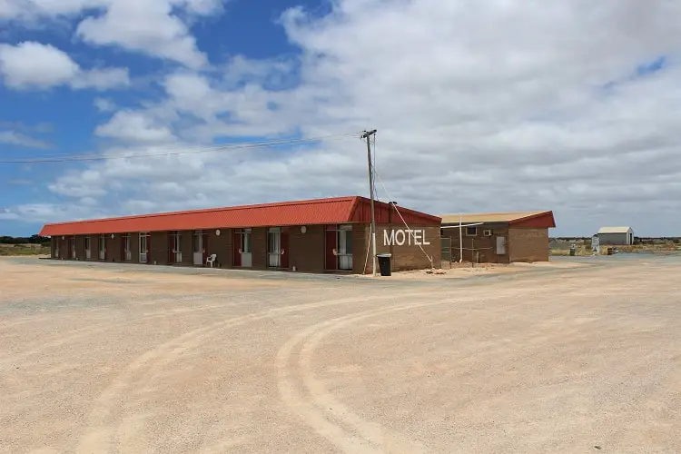
Madura Pass Oasis Motel has a rating of 3.9 out of 5 on Google reviews.
Call Madura Pass Oasis to check availability: (08) 9039 346 4.
- Motel rooms (with a/c and free Wi-Fi)
6. Mundrabilla Roadhouse Motel & Caravan Park
Mundrabilla Roadhouse Motel and Caravan Park has a rating of 4.0 out of 5 on Google reviews.
Address: Mundrabilla Roadhouse, Eyre Highway, Mundrabilla, WA 6443
Click here to check prices at Mundrabilla Roadhouse .
- Ensuite motel rooms (single, double, group and family (some pet friendly) with a/c, fridge, kettle, TV and free Wi-Fi)
The Eucla Motel and Caravan Park has a rating of 3.8 out of 5 on Google reviews. There are a few things to see in Eucla, such as the sand dunes, as well as great views.
Address: The Eucla Motel, Eyre Highway, Eucla, Western Australia, 6443.
Click here to check availability at The Eucla Motel .
- Ensuite motel rooms (double and family (some pet friendly) with a/c, heating, TV, fridge and kettle)
- Executive motel rooms (sleep two, includes motel room facilities plus sofa, kitchenette and indoor and outdoor seating area)
- Outdoor deck with views to the Australian Bight

8. Border Village Roadhouse (Motel & Caravan Park)
Border Village Roadhouse is a motel, camping and caravan park located at the border of WA and SA. It has a rating of 3.9 out of 5 on Google reviews.
Address: Border Village Roadhouse, Eyre Highway, Border Village, South Australia, 5690.
Click to check availability at Border Village Roadhouse .
- Ensuite motel rooms (single, double, queen and family (some pet friendly) with TV, a/c, fridge, kettle and free Wi-Fi)
- Cabins (two bedrooms sleeping up to 6 people & kitchenette)
Nullarbor Roadhouse has a motel, camping and caravan park with a rating of 4.1 out of 5 on Google reviews.
Address: Nullarbor Roadhouse, Eyre Highway, South Australia, 5690.
Click here to check motel room availability at Nullarbor Roadhouse.
- Ensuite motel rooms (sleeping up to 6 people, pet friendly with a/c, heating, TV, desk, kettle and free Wi-Fi)
- Free parking

10. Nundroo Hotel-Motel
Nundroo Hotel-Motel has motel rooms, dorms and a caravan park with a rating of 3.2 out of 5 on Google reviews.
Address: Nundroo Hotel-Motel, Eyre Highway, South Australia, 5690.
Click here to check availability at Nundroo Hotel Motel .
- Motel rooms (ensuite double and twin with a/c, TV, kettle, fridge and Wi-Fi)
- Backpacker dorms
Site facilities:
11. Penong Caravan Park
Penong Caravan Park has cabins and caravan sites and a rating of 4.6 out of 5 on Google reviews.
Address: 4 Stiggants Road, Penong, SA 5690
Click h ere to check availability at Penong Caravan Park.
- Caravan park (pet friendly powered and unpowered sites)
- Cabins (ensuite with 1 or 2 bedrooms and full kitchen)
- Entertaining area
12. Highway One Motel (Ceduna)
Highway One Motel in Ceduna has a rating of 4.8 out of 5 on Google reviews.
Address: 35 Eyre Highway, Ceduna, SA 5690
Clic k here to check availability at Highway One Motel.
- Ensuite motel rooms (double, twin and family with a/c, heating, TV, kettle, microwave, fridge, toaster and free Wi-Fi.
- Beachfront location
Browse more Ceduna accommodation using the search box below:
Free Camping on the Nullarbor
Here are the free camping Nullarbor spots that we stayed at on our road trip. Most free camps don’t have bathrooms, but lots of the roadhouses have coin-operated showers.
Note that the ground was very hard on the Nullarbor, and it was difficult to get pegs into the ground. We didn’t see many other people in tents!
1. Free Camping Nullarbor: Baxter Rest Area
We had our first overnight stop 114km east of Balladonia , at a free camping spot called Baxter Rest Area.
The free camp was very basic, with just a few picnic tables and a toilet. If you’re self-sufficient though, and have your own water and food, it’ll save you a few dollars.
We stayed at Baxter Rest free camp in summertime, and only one other group of people arrived! It was extremely quiet!
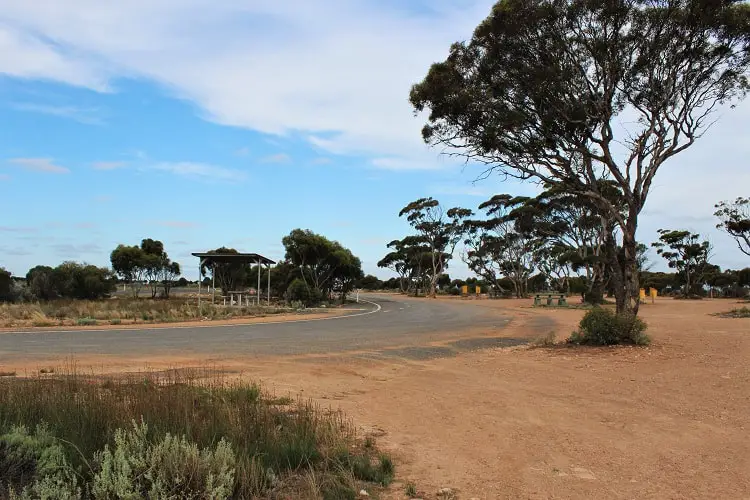
Baxter rest Area was by far the most remote place we’d camped at on our Perth to Adelaide adventure. It was very weird to see absolutely nothing in all directions!
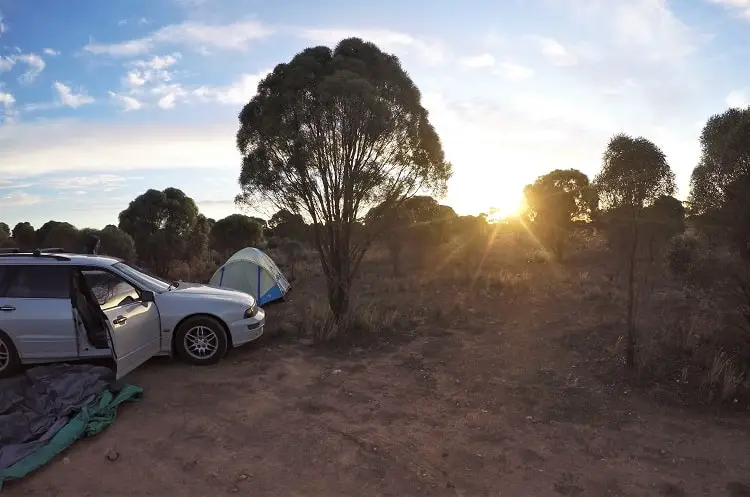
We even recovered from our long day in the car with a bit of a workout in the outback! Definitely not something I’d done before!
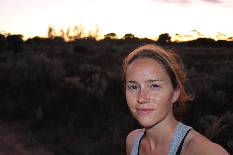
2. Free Camping Nullarbor: Bunda Cliffs, Great Australian Bight
There are quite a few marked camping areas along Bunda Cliffs, just east of Border Village, on the southern side of the highway.
There’s a series of fantastic lookouts here, over the 80-metre high Nullarbor Cliffs at the Great Australian Bight. Looking out over Bunda Cliffs was one of my favourite things to do on the Nullarbor. Sunset was amazing!
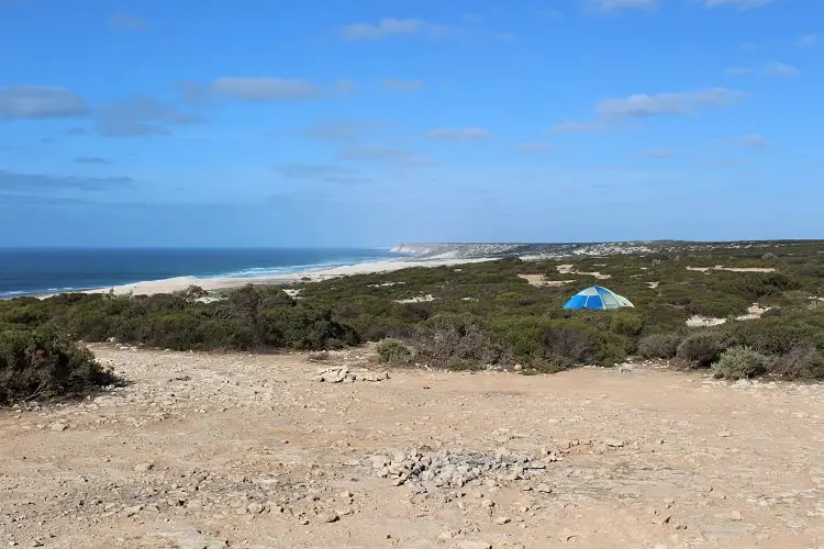
While free camping across the Nullarbor saved us money, we weren’t expecting there to be no toilets at the Bunda Cliffs campsite! Most of the greenery only came up to our knees, which wasn’t too bad in the dark, but come the morning I had to walk right over to the cliffs to find a bit of privacy!
The ground was extremely rocky, which wasn’t ideal for tent camping. Perfect if you’re in a campervan or caravan though, like everyone else was!
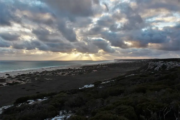
3. Free Camping Across Nullarbor : Wittelbee Conservation Park
We decided to save money again and bush camp in Ceduna, at Wittelbee Conservation Park. Although the view was beautiful, I’ll admit Wittelbee was the final straw for me in terms of bush camping!

The first annoyance was getting stung by a mystery insect whilst rummaging round in the tent in the dark. There was nobody else staying at the camping ground at all, and it was a very isolated spot.
The sting was unbelievably painful, much worse than a wasp sting, and I had to run to the car, which Michi was inside, and sit and wait until it subsided, hoping it was nothing serious!
We then had to attempt to search for the mystery insect inside the dark tent, and shake out our sleeping bags etc.
Michi thought he saw a bull ant (the most likely culprit, as their stings are mega painful and we saw loads across the Nullarbor), but we just had to hope there wasn’t one still in there.

It was also the second night in a row that we had no toilet . (We weren’t aware this would be the case when choosing the site.) Skulking off in opposite directions in the morning, surrounded by flies in searing heat was an experience neither of us wish to remember.

The final straw was finding a huge hairy huntsman spider on the car as we were about to leave. They’re not dangerous, but not what you want to see after three long days in the car!
We only stayed in caravan parks on our way to Adelaide after crossing the Nullarbor!

Travelling the Nullarbor: Attractions & Things to Do
Now we’ve covered accommodation and fuel stops, here is what you can see on each section as you drive across the Nullarbor. I’ve listed the facilities at each roadhouse as well as other Nullarbor attractions.
1. Esperance to Norseman
The first stop at the western end of the Nullarbor is Norseman. Since Norseman to Perth is an 8-hour drive (722km), you’ll likely have at least one overnight stop in between if you’re not in a rush.
We spent a few days exploring beautiful Esperance before heading inland towards Norseman to start crossing the Nullarbor.
Norsema n is a proper town, not just a roadhouse, so it’s here you’ll wave goodbye to “normal” life! If you need a lunch break, stop at Phoenix Park on the main road like we did. There are toilets and a few interesting things to look at in the park.
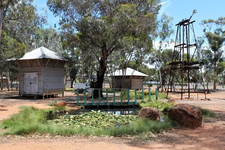
Facilities in Norseman
- Petrol stations, IGA supermarket, visitor centre, public swimming pool, motels.
- Perth to Norseman: 722km – 8 hours
- Esperance to Norseman: 205km – 3 hours
2. Norseman to Balladonia
You’ve now got a two-hour drive from Norseman to Balladonia, the tiny Western Australian settlement where pieces of a rogue NASA space station called Skylab came crashing down in 1979!
You can learn more about the Skylab incident, as well as information about the area, at the B alladonia Museum , which is located at Balladonia Roadhouse.
On the way to Balladonia, you can also stop at Fraser Range Sta tion , about 100km east of Norseman. You can go on walks or take a tour of the station.
Facilities at Balladonia Roadhouse
- Balladonia BP Roadhouse: fuel, shop and cafeteria.
- Balladonia Museum: free to enter.
- Norseman to Balladonia: 191km – 2 hours
3. Balladonia to Caiguna
After stopping for fuel at Balladonia caravan park and motel, you can stop at Afghan Rocks. This is 14km east of Balladonia, before the “90 Mile Straight”, Australia’s longest straight road!
One of the classic Nullarbor attractions is the sign for the 90 Mile Straight. Make sure you pull over here and take your “We’ve crossed the Nullarbor!” picture like we did!
A two-hour drive east of Balladonia is Caiguna Roadhouse. Here, you should visit the Caiguna Blowhole, just 5 kilometres to the west.
Facilities at Caiguna Roadhouse
- Caiguna BP Roadhouse: 24-hour fuel & fast food, playground.
- Balladonia to Caiguna: 181km – 1 hour 50 minutes
4. Caiguna to Cocklebiddy
It’s only another 40 minutes east of Caiguna to Cocklebiddy Roadhouse, which is where we stopped to refuel and have a break. You can stay overnight here at the Wedgetail Inn or the caravan park.
A Nullarbor attraction in this area is the Eyre Bird Observatory , 50km south-east of Cocklebiddy Roadhouse, which is the most remote research station in Australia.
You can visit for the day or stay overnight in the Old Telegraph Building. Read the website carefully, as there are restrictions on types of vehicles because of the roads.
The sign below shows just how isolated the roadhouse owners are, living out on the Nullarbor! Let’s hope they like kangaroos!
Facilities at Cocklebiddy Roadhouse
- Cocklebiddy Roadhouse: fuel, takeaway food, restaurant, licensed bar, playground.
- Caiguna to Cocklebiddy: 66km – 40 minutes
5. Cocklebiddy to Madura
At the base of the Hampton Tablelands, an hour east of Cocklebiddy and just over an hour west of Mundrabilla is Madura Roadhouse , where you can refuel, refresh and stay overnight at Madura Pass Oasis motel or the camping and caravan park.
About 2km west of Madura Roadhouse you can pull over at Madura Pass lookout (on the north side of the highway) to admire the sweeping view across the Roe Plains and Madura Pass.
Facilities at Madura Roadhouse
- Madura Roadhouse: takeaway food, bar, fuel.
- Cocklebiddy to Madura: 91km – 1 hour
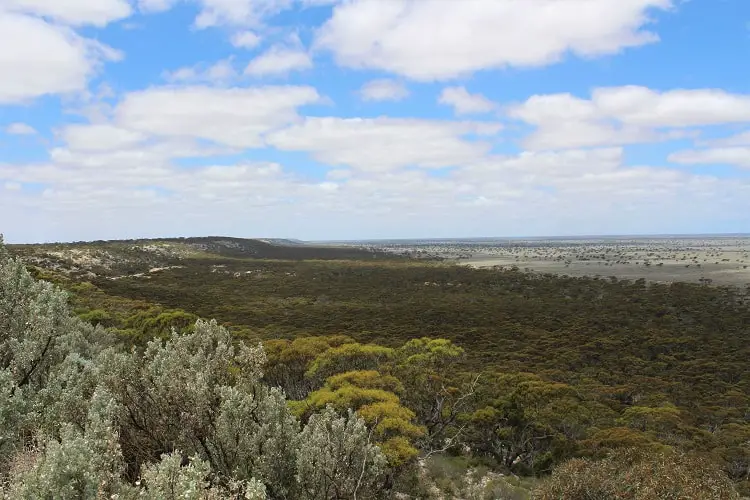
6. Madura to Mundrabilla
Just over an hour east of Madura Roadhouse is Mundrabilla Roadhouse , which has a motel, caravan park, and according to its website, a reputation for being one of the cheaper places to buy fuel across the Nullarbor.
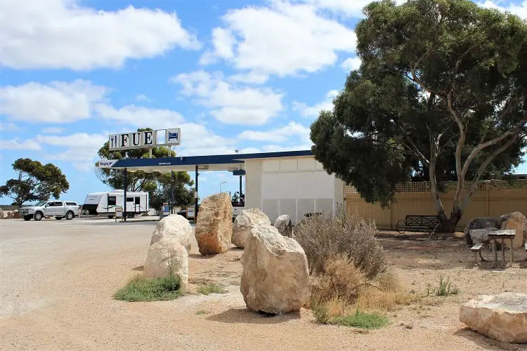
Facilities at Mundrabilla Roadhouse
- Mundrabilla Roadhouse: home-cooked meals, fast food, bar, shop, ATM
- Madura to Mundrabilla: 116km – 1 hour 10 mins
7. Mundrabilla to Eucla
As you can see, Eucla Roadhouse, 40 minutes east of Mundrabilla, is one of the more modern roadhouses across the Nullarbor.
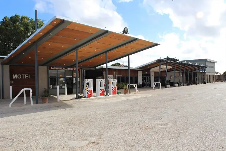
There’s a bit more to see around Eucla than at most of the other roadhouses across the Nullarbor. You can take a look at the buried telegraph station and sand dunes now that you’re by the sea!
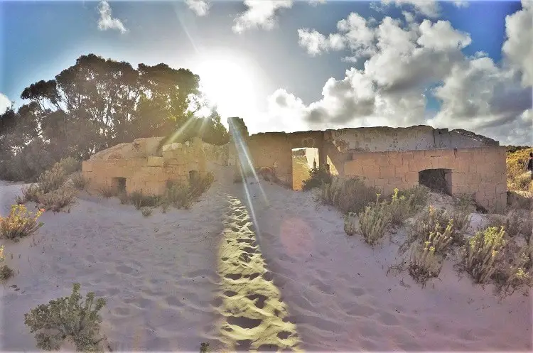
Facilities at Eucla Roadhouse
- Eucla Roadhouse: takeaway food, fuel, museum, playground
- Mundrabillato Eucla: 65km – 40 mins
8. Eucla to Border Village
Half an hour east of Eucla, at the checkpoint between Western Australia and South Australia, is Border Village Roadhouse . There’s a variety of accommodation types on offer here.

Facilities at Border Village Roadhouse
- Fuel, store (groceries & souvenirs), restaurant.
- Eucla to Border Village: 41km – 30 mins
Note that there are quarantine restrictions between WA and SA, so we stopped at a rest area on the way and cooked all our vegetables (to eat later on) as we’d been told we couldn’t take raw fruit and veg across the border.
Visit the Australian Interstate Quarantine website for details on what you can take in and out of each state.

Note that if you’re travelling east like we were, your quarantine checkpoint is actually at Ceduna , not Border Village (see the picture below). So we didn’t need to cook everything before crossing the border after all!
If you’re travelling west , you will be stopped for a quarantine check about 50 metres west of Border Village Roadhouse .
Note that the quarantine check in Ceduna just consisted of an officer poking around in our car boot. It wasn’t massively thorough, but obviously you should stick to the rules as there are reasons for them!
9. Border Village to Nullarbor Roadhouse
To the east of Border Village, on the southern side of the highway, are a series of lookouts to view the magnificent 80-metre high Bunda Cliffs at the Great Australian Bight.
We chose to camp in this area, but if you’re passing on through, you should definitely stop for a look.
You can also pay to go to the visitor centre at the Head of Bight , where you can whale watch from a viewing platform between May and October. There’s also a café, picnic area and toilets.
Nullarbor Roadhouse, two hours east of Border Village, is one of the nicer roadhouses. Although we didn’t plan it, we ended up spending ages here, as we stopped for a coffee and a shower.
The accommodation at Nullarbor Roadhouse has lots of options too.
Facilities at Nullarbor Roadhouse
- Nullarbor Roadhouse: fuel, shop, café, bar.
- Border Village to Nullarbor Roadhouse: 184km – 1 hour 55 mins
10. Nullarbor Roadhouse to Nundroo
An hour and a half east of Nullarbor Roadhouse is Nundroo Roadhouse , which offers overnight accommodation.
Facilities at Nundroo Roadhouse
- Nundroo Roadhouse: fuel, kiosk, shop, ATM.
- Nullarbor Roadhouse to Nundroo: 144km – 1 hour 30 mins
11. Nundroo to Penong
Penong is a dusty, blink-and-you’ll-miss-it settlement about an hour west of Nundroo, where you’ll find the Penong Hotel as well as fuel and a few shops.
Facilities in Penong
- Town: general store, post office, laundromat.
- Penong Roadhouse: fuel, fast food.
- Nundroo to Penong: 82km – 50 mins
12. Penong to Ceduna
If you’re crossing the Nullarbor from west to east, it’s here you will finish your 1,202km journey from Norseman to Ceduna! Travelling from Penong to Ceduna takes just under an hour.
After three days of staring out at endless plains of nothingness, it felt extremely weird to reach Ceduna and see an actual town, and kind of a relief!
Ceduna is still quite isolated, lying on the eastern edge of the Great Australian Bight at scenic Murat Bay, but it does have houses and schools and shops and people – around 3,500 of them!
Ceduna also has a thriving oyster industry, dry salt lakes, wildflowers, secluded beaches and the chance to snorkel or scuba dive along the coastline.
- Penong to Ceduna: 72km – 50 mins
Nullarbor Plain Facts & Tips
Here are some important facts to learn before crossing the Nullarbor!
What is the Nullarbor Plain?
The Nullarbor Plain is a semi-arid area of limestone bedrock between Perth and Adelaide on the southern coast of Australia, covering 200,000 square kilometres . The name Nullarbor comes from the latin words “nullus”, meaning no, and “arbor”, meaning tree.
Beneath the limestone lies a vast system of unexplored caves and underwater labryrinths , which together with the rough, bumpy surface is known as a “karst” landscape.
I must say, I saw a lot more trees than I expected on my journey! However, the Nullarbor is still a whole lot of nothing compared to the more populated parts of Australia. It is also home to the world’s longest golf course, the Nullarbor Links !

How long is the Nullarbor?
The distance from Norseman to Ceduna across the Nullarbor Plain is 1,202km , which takes about 12 hours 20 minutes to drive.
Since you’ll likely be starting or ending in Esperance (the nearest large coastal town to Norseman), you’ll need to add on another couple of hours. The distance from Esperance to Ceduna is 1,406km , which takes around 14 hours and 30 minutes to drive.
We split the journey over three days , with two overnight stops bush camping on the Nullarbor Plain, at Baxter Rest Area and Bunda Cliffs, and one night at Wittelbee Conservation Park in Ceduna at the end.
How do you travel across the Nullarbor?
You could cross the Nullarbor Plain by bus tour or by train on the Indian Pacific railway journey that runs all the way from Perth to Sydney. This blog post will help you plan a self-drive itinerary if you’re travelling by car, campervan or motorbike.
Where to stay when crossing the Nullarbor Plain – free camping and caravan stops
If you want to go camping on the Nullarbor, there are lots of free camping sites, but note that they are really basic! Some don’t even have toilets!
You can use an app called Wikicamps to find campsites all around Australia (I didn’t use this, but have read great reviews), or just use Google.
I would plan your Nullarbor camping grounds in advance, as you won’t always have a phone signal and internet access!
We chose to camp in our tent at free campsites and rest areas along the Nullarbor.
I must say, we were the only people I saw tent camping – everyone else was in caravans or campervans.
Due to the hard limestone ground, it was extremely difficult to get tent pegs in. It took my travel mate about an hour to hammer them all in each time. There’s no way I’d have been strong enough to do it by myself.
You might have an easier time camping at the roadhouses if you’re staying in a tent.
What do you need to know crossing the Nullarbor by car?
The Nullarbor is the kind of place you pass through if you need to get from Perth to Adelaide; it’s not somewhere people go on holiday. You certainly won’t get stuck in any traffic jams!
For somewhere with so much space though, it’s unfortunate that there’s only a single lane in each direction . Although with the low amount of traffic I can understand it wouldn’t be cost effective to expand the highway.
What you will come across is a lot of trucks and road trains (huge lorries). They tend to drive a bit below the Nullarbor speed limit, so you may want to overtake them (though not extremely long ones, as remember it’s a single lane). I don’t think I’d have had the guts to, but Michi did the driving on this stretch, and he’s a bit speedier than me!
Just be warned, the road train drivers would often try to “help” us overtake them by putting on their right-hand indicator to let us know it was safe for us to go round them.
It took us a while to understand this was why they were signalling, as back in the UK it would mean that they themselves were about to pull out and overtake something!
Before you set off, you should also make sure your vehicle has been serviced and is in a safe condition to drive, which you should have done already if you’re doing the whole Perth to Adelaide trip.
Make sure you keep an eye on your oil and coolant levels and tyre pressure every so often too.
Note that you won’t pick up a radio signal across the Nullarbor, so make sure you have an alternative source of music!
Driving the Nullarbor at night
Don’t do it. Just don’t. It might be tempting to power on through the night just to save some time, but it can be very dangerous.
First of all, the road trains drive all through the night (you’ll hear them if you’re camping), and you don’t want to be overtaking them in the dark. There aren’t any streetlights on the Nullarbor, and nobody’s going to realise until the morning if you’ve hurtled off the road into the outback!
Also, the Nullarbor is home to wild kangaroos , wombats and, apparently, camels ! Kangaroos like to come out for the night just before sunset until dawn, so you need to be very careful of running them over, not just here but anywhere rural in Australia.
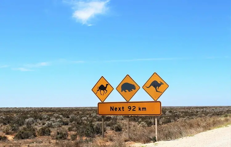
It’s not just nasty for the roos (often the mothers are carrying babies in their pouches, which will be left to die in there), but if a kangaroo comes flying through your windscreen, you’re probably going to come off just as badly as they are!
So, plan where you’re going to sleep, arrive well before nightfall and live the rest of your life without a kangaroo’s leg lodged through your skull.
Mobile phone coverage across the Nullarbor
You won’t have a phone signal at a lot of places across the Nullarbor, but you’ll have a much better chance if you’re with Telstra .
I chose Optus when I arrived in Australia, and Michi chose Telstra. We quickly discovered that Telstra has better coverage in virtually every rural area we visited (including the majority of Tasmania). I’ve read the same thing countless times on other blogs. You’ve been warned!
Weather across the Nullarbor
The Nullarbor weather tends to be hot and dry, with cooler nights . The daytime temperatures average 31-33 degrees Celsius in the summer, with nights falling to 15-17 . In the winter, daytime temperatures are usually between 19-21 degrees, but as low as 5-6 degrees at night.
The Nullarbor climate felt vastly different to what we’d experienced so far on our journey across the coastline from Perth to Esperance, which had been mostly windy and cool, despite it being summer! Norseman was the first place we felt properly hot since Perth!
Where to buy food and drink on the Nullarbor
You can pick up fast food at the Nullarbor roadhouses, and most have restaurants if you’re staying overnight.
Due to the Nullarbor’s isolated location, food prices are higher than in other parts of Australia. I paid about 50% more for a coffee at a roadhouse that I usually pay in Australian cities, although it was an enormous mug!
I’d advise stocking up on food and drink (certainly drinking water) before you set off. Just remember there are quarantine restrictions on food between WA and SA, so don’t bring too much fresh fruit and veg. See my Border Village section further down for more details.
Nullarbor time zones
This is one we weren’t expecting. While it’s well known that there’s a 1.5 hour time difference between Western Australia and South Australia (and 2.5 hours in the summer since WA has no daylight saving), some areas across the Nullarbor also have their own time zones!
There are clocks up in the roadhouses, and one had a sign confirming that yes, this is the real time!
While we were tired, stiff and in desperate need of showers by the end, we can proudly say that we crossed the Nullarbor! We also finally made some headway on our Perth to Adelaide road trip.
We had a terrific treat lined up the next day too: swimming with wild dolphins and sea lions on the Baird Bay Ocean Eco Experienc e !
Best of luck on your Australian travel adventures. Let me know in the comments if you’re thinking of driving across the Nullarbor or if you’ve already done it!
You can read about our next overnight stop in my blog post on things to do in Port Lincoln .

Lisa Bull, founder of Dreaming of Down Under, has been living in Australia as a British expat since 2015. After travelling to every state and territory in Australia and living in Perth, Brisbane and Sydney, Lisa knows from first-hand experience the best destinations to visit in Australia and the best budget travel tips. Her guides on this blog have been read by over 700k readers and helped thousands of people achieve their dream of living in or travelling Australia.
32 Comments

Wow what a great wrap. We are doing Oerth Adelaide in Januaryvand this tells me all I need to know. Well done!??

Thank you! Really glad it was useful.Enjoy your trip!

Great Article Lisa. very informative.
I am planning to do this drive and only wanted to do one direction. ( catch a flight the other way) – as I live in sydney. any recommondations on hire car? may be cheaper to hire from perth and drop it off at sydney?
Hi, glad you enjoyed the article. Sorry, I’ve actually never hired a car here, so I’m not sure which way would be cheaper. There are a few comparison sites though so maybe just do some research. Hope you have a great trip!

Having read this I thought it was extremely enlightening. Thanks for sharing this article.
Glad you enjoyed it!

Hi Thankyou so much for al, this great information, we are travelling from the uk to Perth March 23 to our sons then all 3 are doing the trip from perth to Melbourne, also , taking in the wineries and Melbourne F1, so it has been so helpful to have telephone numbers of accomadation as we will need it for there and back
Glad it was helpful Janice! Have a great trip.

I’ve crossed the Nullarbor numerous times by car and found that night travel to be the better time for me. There are just to many inexperienced, dozy old boomers towing 30 odd foot caravans and what during the daylight hours and my heart starts beating fast everytime I see one approaching. The Nullarbor has changed dramatically in the past 40 yrs since my first crossing and is pretty much like any other country highway today.
Got to keep out the way of those boomers!

Thanks Lisa. Just starting to plan a trip across the Nullabor in 2023 after all these years and your post looks very helpful.
Am planning to buy your book.
Thank you Barbara! Hope you have a great trip.

Amazing write-up, thank you. As someone looking to cross from Adelaide to Perth this is super helpful, especially having reasonably current intel. One question on the fuel situation. Did you notice what kind of fuel was available? Was their Premium 95 or 98 octane at any of the stops or just regular unleaded petrol?
Glad you found it useful! Sorry, I can’t remember the fuel in that much detail now. It’s been a good few years. I just remember that it was much more expensive than either side of the Nullarbor! You can get pretty close to the road houses on Google street view, so you may be able to tell if you have a look at some of them.

Thanks for this, we are driving from Perth to Adelaide in Sept 2022 and this info has been invaluable. Cheers Claire from NZ
No problem, Claire! Glad it was useful. Have a great trip.
I had a huntsman crawl into my pants overnight. I felt something prickly in there so I pulled them down a little and a big huntsman came out!.
Gahh, that is awful!!!

I just read this and enjoyed it very much, nice travel Blog Glad you enjoyed our wonderful country, Cheers Titch
Thanks so much Titch!

Thanks for sharing your experience- you have given us some great ideas
No problem, Kristina.

Interesting, about to do SA to WA, in the Comfort of my Sprinter, which is also my f/T home, I will have my two Whippets with me, although Whippets do not make great guard dogs! I am 68.
Hope you have a great time on your journey Annabel!

Howdy Anna, I have just done the trip accoss the nullabor sa to wa, take your time lots to see the old eucla jetty and the bunda cliffs were good as was the bird obseritory but no dogs allowed. You can camp anywhere. I am 75.

Thanks Does one need to book accommodation in advance? Between esperance and nullarbor plains?
Hi, yes I would book in advance. It’s not a busy route, but as accommodation is so far apart, you will have no alternative options if a place is fully booked!

Thanks for the useful info. I’ve taken note of a number of things you’ve mentioned. Fingers crossed we’ll make our trip from Howlong in NSW, into SA and up the centre to Katherine NT and then around the western coast of WA and back across the Nullabor. We’re hoping to do this from May to September 2022 (covid and state lockdowns permitting 🙂
Hope you have a great trip, Helen!

Thanks for sharing

Glad you enjoyed the trip I have done it 4 times-twice by road and twice by train. I travelled after the road had been sealed and moved slightly to the south .Incidentally the explorer after whom the Highway was named -Edward John Eyre- was the great uncle of a friend of my parents. Incidentally did you mean Coolgardie or Kalgoorlie ? best wishes

Hi Wayne, wow four times! I’ll check which place name I meant. It’s been a while since I wrote it. Thanks for reading, Lisa
Submit a Comment Cancel reply
Your email address will not be published. Required fields are marked *
This site uses Akismet to reduce spam. Learn how your comment data is processed .

Hi, I'm Lisa, a British expat living in Sydney. I've travelled almost the whole Australian coastline and love sharing detailed travel and migration guides to inspire other adventurous souls to travel or move to Australia. Read more about me!
Driving The Nullarbor Plain – Getting To The Start
Driving the Nullarbor is a road trip rite of passage in Australia. It’s one of those iconic stretches of road that you really have to experience for yourself. It’s miles of flat, straight road through one of the most isolated places on earth. But before you can drive across the Nullarbor Plain, you have to get to where it starts, and that’s where this road trip comes in. Here is everything you need to know to plan your trip to Nullarbor, Australia.

GUEST POST – Josie Wanders
Table of Contents
Disclosure: Some of the links below are affiliate links, meaning at no additional cost to you, we will earn commission if you click through and make a purchase.

Getting To Driving Nullarbor Plain
The Nullarbor Plain is huge, it stretches for about 1100km across the top of the Great Australia Bight. Its expanse crosses the border between South Australia and Western Australia. The eastern edge of the Nullarbor Plain is generally said to start a few kilometres west of the Nullarbor Roadhouse, which will be our final destination for this road trip.
The drive from Adelaide to the Nullarbor Roadhouse is just under 1100km. You could do this in one very long driving day, but I recommend breaking it up into three days to allow plenty of time to see some of the sites along the way.
Adelaide to Nullarbor Plain Map
DAY 1 - Adelaide to Port Augusta
Today you will drive just over 300km north from Adelaide to Port Augusta. I suggest you drive fairly steadily to Port Augusta so that you will have some time to look around the town. Here are some of the highlights to look out for along the way.
Needing Transport For Your Road Trip?
Check out the Best Motorhome & Campervan Hire for South Australia. Simply click below!
Already Know What You Need?
Dublin sculptures.
Around 60km north of Adelaide you will see some large steel sculptures along the side of the road. Erected in the 1990’s by a local resident as a protest against a proposed rubbish dump, they have become a treasured reminder of the politics and culture of the time.
Lake Bumbunga (Pink Lake)

Stop in the tiny town of Lochiel and take a short walk to check out Lake Bumbunga. At certain times of the year the lake will take on a distinctive pink hue. Perfect for those instagram photos. Also, be sure to go and find “Nessie” Lake Bumbunga’s very own Loch Ness monster.
"The Big Blade" at Snowtown
Detour slightly off the main highway into the town of Snowtown. Check out “The Big Blade” and learn about the local wind farm industry and see the painted water tower dedicated to some local heroes. While it’s not marked, you can also try to find the infamous bank that the town is most well known for unfortunately thanks to some gruesome events.
Port Germein Jetty
When it was built, the Port Germein Jetty was the longest in the Southern Hemisphere. It’s a little shorter now, but at over 1.5km, it’s a good length walk to stretch the legs after the driving you have been doing.
Wadlata Outback Centre - Port Augusta
Once you arrive it’s time to explore this city at the crossroads of Australia. Visit the Wadlata Outback Centre to learn about the history of both the Aboriginals and the European settlers of the area. Port Augusta is the last stop with substantial shopping options. Now is the time to stock up on supplies for the rest of your trip.
Port Augusta Accommodation
In Port Augusta I would recommend staying at the Crossroads Ecomotel or Majestic Oasis , or if you have a caravan or RV, try the Discovery Parks – Port Augusta
DAY 2 - Port Augusta To Ceduna
The drive today is around 470km from Port Augusta to Ceduna. I would plan on taking all day to arrive at Ceduna, stopping frequently along the way to explore some of these attractions
Australian Arid Lands Botanic Gardens - Port Augusta
Before starting your drive, call in to the Australian Arid Lands Botanic Gardens. Take an early morning walk among the local flora, looking out for the wildlife too. Walk (or drive) out to the Red Cliffs to see them glowing red with the morning sun on them. Grab a late breakfast or a snack at the cafe before hitting the road.
"Halfway Across Australia" - Kimba

There are plenty of reasons to stop in this town that claims to be “Halfway Across Australia”. You can’t miss the beautiful silo art, but also look out for the big galah too. Drive up to White’s Knob Scenic Lookout to see the Edward John Eyre sculpture and learn about his pioneering explorations in this area. If it’s time from a early lunch or late morning tea, I recommend Eileen’s Cafe
Mount Wudinna
It’s time to stretch your legs by climbing Mount Wudinna, the second largest monolith in Australia (Uluru is the first). Don’t worry too much though, this granite outcrop only reaches 260m above sea level, and the climb to the top is much less than that and only takes a few minutes. You will be rewarded with expansive views over the almost perfectly flat surrounds. While in Wudinna itself, check out the two sides of the Farmer statue. If you need a snack, the locals love the Golden Wattle Roadhouse.
Pildappa Rock - Minnipa

Just outside of town is Pildappa Rock, another huge granite structure. This one though has incredible wave formations along the side and it well worth checking out.
Once you arrive in Ceduna you will likely need a rest. Grab some takeaway and relax on the foreshore while watching the sun sink into the sea.
Ceduna Accommodation
In Ceduna stay at the Ceduna Foreshore Hotel Motel , or if you are after a caravan park, try the Ceduna Foreshore Caravan Park.
Interested in other Eyre Peninsula Caravan Park?
Day 3 - ceduna to nullarbor roadhouse.
Today is the final leg of driving before reaching the Nullarbor Roadhouse. In total you will cover around 300km, but I recommend taking a detour or two off the highway to explore along the way.
Play The Worlds Longest Golf Course
Begin the morning with a hole of golf! Ceduna is home to the first hole of the world’s longest golf course, Nullarbor Links. Hole 18 is in Kalgoorlie, almost 1400km away. As you drive between the two, stop and play each hole.
"Town of Windmills" - Penong

The “town of windmills” took its name seriously and has created the Windmill Museum. Stop to take a look at this free open air museum which is home to the biggest windmill in Australia, and dozens of others. Call into the last shop for 1000km and stock up on road trip snacks. The coffee is pretty good too.
Cactus Beach & Lake MacDonnell
Just outside of Penong take a detour towards Cactus Beach to explore one of Australia’s iconic surfing beaches. On the way there you will pass by Lake MacDonnell, another of the incredible pink lakes, and some of the whitest Sandhills anywhere.
Fowler's Bay
Another detour off the highway into the last town for many kilometres, Fowler’s Bay. From here on it’s just Nullarbor Roadhouses until Eucla, across the Western Australian border. Fowler’s Bay is great for a walk along the beach, or if you have time and the season is right you can take a whale watching tour by boat.
Head Of The Bight

Speaking of whales , if you are passing between May and October, a detour here is a must. Spend some time standing on the cliffs watching these majestic creatures with views like nowhere else. You will also see the start of the Bunda cliffs which continue along the edge of Australia for another 100km.
Nullarbor Roadhouse
You have finally arrived at the last stop before crossing and driving the Nullarbor Plain. You will likely be very underwhelmed by this isolated spot out on the treeless plain, it’s simply one low, sprawling building. Spend some time appreciating exactly how isolated this area is and enjoy sunset over the Nullarbor.
Nullarbor Accommodation
There is only one choice of accommodation here and that’s at the Nullarbor Roadhouse itself, unless you are planning to continue on. There are motel rooms and space for camping, caravans and RVs.
Final Thoughts
Whether you are now continuing on with your Nullarbor travel into Western Australia or returning back to Adelaide, this road trip through South Australia will leave you with experiences and memories to last a lifetime.
Authors Bio
Josie Kelsh is a born and bred South Australian, growing up in the country with road trips a part of life. While now living in Adelaide, she loves to get out on the road to continue to explore both here at home and further afield.

Interested in More Road Trips?

Other Areas of SA - Check Them Out!
Our Nullarbor Roadtrip Itinerary: Best Way to See South and West Australia

These two regions of Australia are a goldmine of photogenic scenery. Plus, the pace of life is a lot more relaxed than in the cities of the East Coast. What a great way to immerse yourself in nature, see unique wildlife every day, and watch more sunrise and sunsets than you’ve ever seen before!

Eating camp-cooked food around a campfire and camping out under a blanket of stars is just one of the ways a Nullarbor road trip will amaze you.

If you’re looking for an incredible camping adventure, this 10-day adventure with Nullarbor Traveller is exactly what you need. From hikes through gorgeous national parks to finding yourself in the middle of the outback and ancient forests, this trip has it all. We loved it and so will you!

Table of Contents
The Ultimate Road Trip to Explore South and West Australia
Here is where our itinerary took us on our Nullarbor road trip exploring this fantastic part of the Land Down Under:
Day 1: Flinders Ranges National Park
The Nullarbor Road trip began extra early from the City of Churches but it was every bit worth it. With a quick stop in Clare, we set off on a 400 km drive towards the Flinders ranges. We were able to see the spectacular Alligator Gorge and Warren Gorges of the Flinders Ranges. We had a short trek in the afternoon to watch the sunset, then we set up camp while our guide Jodie cooked up a dinner of kangaroo stew!
But undoubtedly, the best part of the day was sleeping under the stars and bush camping in Warren Gorge. Under the beautiful lights of the Southern Cross, we camped in swags, canvas bedrolls like heavy duty sleeping bags.
Day 2: Coodlie Park and Eyre Peninsula
This morning took us on a long hike along the Flinders Ranges, where we hiked up the mountain in time for sunrise and saw our first wild kangaroos! In the afternoon we headed for Talia Caves, where the limestone caves have been carved out by the weather and the power of the seas. The view from inside the caves was like looking out of a window onto the ocean.
And after a long day’s drive, we arrived at Coodlie Park, an off-grid eco-lodge where the showers are made from a system of buckets, ropes, and pulleys and we slept in open huts.
Day 3: Baird Bay and Fowlers Bay

After two days inland, what a lovely treat to be by the coast! Lunch was a picnic by a beautiful beach and as an added bonus, this area of Baird Bay is known for its vibrant aquatic wildlife. This was also the day we got to swim with wild sea lions with Baird Bay Eco Experience ! On this several hour boat ride, we climbed into wetsuits and jumped into the water with a local group of sea lions. They are even cuter in real life as they are in pictures and movies. They’re actually just like underwater puppies and they love to play. The best way to get them excited and playing are by being fun and playful with them, so dive down, swim around underwater and you’ll be amazed at how they follow you around. If you’re lucky, one of them might even swim up and give you a little kiss! We also went to see if there were any dolphins nearby, but they were not as playful as the sea lions at the time!
After having lunch on the beach, we drove to our stopping point for the night, Fowler’s Bay, with some of the largest sand dunes in Australia – time for some sand boarding! Jodie had several purpose-made sand boards in the trailer, so we took turns riding them at high speed down the sand, seeing who could get the farthest!
Day 4: The Great Australian Bight
On this day, our postcard-perfect expectation of Australia just kept coming. It began with crossing the dingo fence, a 5,320 km long stretch of fence-line, designed to keep Australia’s wild dogs at bay!
But the highlight of the day was visiting the Bunda Cliffs. This is the area where Australia literally drops into the ocean, along with the longest uninterrupted line of sea cliffs in the world – about 100 kilometers long. It is probably the most scenic lookout point in South Australia. Today was also the day that we ventured into the Nullarbor, the natural desert barrier between South and West Australia. It’s on this iconic stretch of road that we first saw one of Australia’s best road signs!
Finally, to cap the day off, it was time for more starlight camping, but thanks to some heavy rain, we decided to sleep in the tents that were kept in reserve for occasions just like this one!
Day 5: Esperance and Cape Le Grand National Park
We had fallen in love with the great Australian outdoors over those first few days, but nothing could have prepared us for what we would find when we arrived in Western Australia – Cape Le Grande National Park in Esperance. The water was such a deep shade of turquoise, contrasted against the bright white sand, fringed by the low-lying vegetation all around it. A relaxed 2-hour trek took us up over the hillside to watch the sunset, just in time to walk along the 2-kilometer beach and be back in time for dinner.
Day 6: Cape Le Grand National Park
An immaculate sea, white-sand beach, mega granite bluffs, all make Cape Le Grand National Park one of the most spectacular places in Australia, so it is best to just say all of it. There is definitely no growing bored in this part of the trip. We hiked the Le Grande Coastal Trail in the morning, which was a 10-kilometer water across several headlands and beautiful beaches. In the middle of the day, we spent time hanging out on the beach, where there were wild kangaroos drinking the fresh water which ran down the beach.
The hike to Frenchman’s Peak in the afternoon was a challenging climb up steep granite rock face, but we were rewarded with beautiful views of Cape Le Grand and the Recherche Archipelago – Western Australia is simply stunning!
Day 7: Cape Le Grand National Park and Stirling Ranges

Day 8: Stirling Ranges to Quinninup
Just as we thought we have seen so many wonderful things, this day just elevated our experience of Australia. This place is the Western Australian equivalent to Victoria’s Great Ocean Road. There is simply so many wonders to see.
The red-rock cliffs are nothing short of monumental. Imagine eons going by, with the diligent waves and tides crafting this natural beauty – astounding! And all around, there is no shortage of treats for the senses: turquoise seas, sun-bleached boulders, the beautiful coast, and the ancient empire walk in the Valley of Giants. It is amazing how so much beauty can be found here!

This was also the day of one of our favourite hikes and most spectacular views of the entire trip, hiking up Mount Trio, where there are huge boulders and an incredible viewing platform offering the most ridiculous views you have ever seen, anywhere!
Day 9: Quinninup to Margaret River
A trip to Western Australia is incomplete without enjoying fine food. This day, we indulged in the best local fare found in the Margaret River. The boutique breweries proved a lot of fun to explore but even more pleasurable were the chocolate, fudge, and cheese factories! How can you say no to that?
What really made this day incredible though, was the Diamond Tree, a 52 meter high Karri tree which has been used as a fire lookout tree ever since the 1930’s, with precarious metal stakes forming a spiral staircase all the way up to a wooden platform at the top. From here there are the most spectacular views over the top of the forest canopy. Just another once-in-a-lifetime view that this part of Australia has to offer!

Day 10: Margaret River to Perth
The perfect end to the perfect road trip is a visit to the Ngilgi Cave. Discovered in 1899, this amazing structure is home to a stunning collection of stalactite, stalagmite, helictites, and shawl formations. Indeed, we emerged from this underground world totally pleased and captivated!
Admittedly, words fail to capture how awesome this Nullarbor road trip is. At every turn, it was filled with wonder that transforms how you see nature and the world around you. This is definitely a remarkable experience of a remarkable place.

Are you on Pinterest? Pin these!

Leave a Reply Cancel reply
Your email address will not be published. Required fields are marked *
This site uses Akismet to reduce spam. Learn how your comment data is processed .
One thought on “ Our Nullarbor Roadtrip Itinerary: Best Way to See South and West Australia ”
Unstoppable fun and great pics!
COPYRIGHT DISCLAIMER: Many of the articles on Two Monkeys Travel Group are guest posts by a number of Approved Contributors and are hosted by Two Monkeys Travel Group. Approved Contributors control their own work and post freely to our site. This includes all text and images that they use within their own work. All contributors are instructed to follow internationally recognised copyright and intellectual property guidelines. Two Monkeys Travel Group takes its own responsibilities very seriously, so if you feel that any part of this work is abusive in any way, please send us an email so that we can investigate - [email protected]
DISCLOSURE: Please note that some of the links above are affiliate links. So when you make a purchase we sometimes make a small commission, at no extra cost to you. The cost to you remains the same, sometimes even cheaper if we have negotiated a special deal for our readers.We use all of the companies we have listed here and that’s why they are in this list, but of course we need to keep Two Monkeys Travel Group running as well as it can, which is exactly what you’re helping with if you do decide to buy or book something through an affiliate link! If you have any more questions about the companies we use or any other companies you’re looking at, just email us and we’ll be happy to help. Please see our full disclaimer page for more information.
Written by Kach Umandap
Founder of Two Monkeys Travel Group. Since 2013, Kach has visited all the 7 continents (including Antarctica) and 151 countries using her Philippines Passport. In 2016, she bought a sailboat and went on sailing adventures with her two cats - Captain Ahab & Little Zissou in the Caribbean for 2 years. She now lives in Herceg Novi, Montenegro where she's enjoying her expat life and living on a gorgeous Stonehouse. She writes about her experiences traveling as a Filipina traveler with a PHL Passport. Also tips on backpacking trips, luxury hotel experiences, product reviews, sailing & adventure travel.
5 Reasons Why You Should Visit TeamLab Planets in Toyosu, Tokyo
Al hamra residence – my best stay in the uae, anavrin ras al khaimah – the perfect retreat for corporate junkies, where to stay in the gambia [best hotels and resorts in the gambia], 8 best things to do in the gambia, west africa, related posts, 5 best things to do in geelong, australia [with suggested tours], 10+ things to do in pilbara, western australia, melbourne australia: what to do in victoria, 10 awesome things i love about sydney, australia, previous post, luxury weekend at cheeca lodge and spa – tropical paradise in the florida keys, unbridled class and luxury at oceans edge key west hotel & marina, subscribe to our newsletter.
Receive tips on how you can live a sustainable long-term travel lifestyle!
- First Name *
- Email This field is for validation purposes and should be left unchanged.
No products in the cart.

A Guide to Exploring the Nullarbor Plain
Crossing the Nullarbor is an iconic Australian trip, and completing it is much more than ticking an experience off your bucket list. Embarking on a road trip across Australia’s Nullarbor Plain is an experience like no other.
The Nullarbor Plain stretches over 1,200 kilometres of open desert and starkly beautiful coastal scenery. This vast stretch of land has been dubbed “the longest straight line in the world” due to its long stretches of seemingly endless highways. You are guaranteed to see lots of road trains and semitrailers taking goods across the continent.
But while there may not be much in the way of places to stop along the Eyre Highway, there are still plenty of incredible sights to enjoy and experiences to be had.
We had to cross the Nullarbor when going from South Australia to Western Australia in December 2022, and we took four days to complete it, taking our time to see everything we wanted in this journey.
In this blog post, we will share our itinerary with you, take a look at all the top stops you should make on your journey, and also some interesting facts about this iconic Australian landscape.
The Nullarbor Links
Nullarbor plain information.
Before we get into the itinerary, we thought it would be interesting to share some valuable and interesting facts about the Nullarbor Plain!
Need a rental car to explore the Nullarbor? Book here
What is the Nullarbor Plain?
The Nullarbor Plain is a vast desert landscape stretching from Western Australia to South Australia. It is the most extensive limestone plain in the world, spanning an area of over 200,000 square kilometres (77,220 square miles).
The name “Nullarbor” comes from the Latin words nullus (no trees) and arbor (trees), aptly describing this treeless region.
Where does Nullarbor start and finish?
The Nullarbor begins in Ceduna, a coastal town located just west of Adelaide in South Australia . From there, it runs eastwards until it reaches Norseman in Western Australia.

How long does it take to do the Nullarbor?
The distance between the two towns is 1,201 km, which would take 12 hours and 20 minutes without any stops.
However, the length of your trip will depend on your preferences and what you want to do while you’re there. Depending on your timeframe, you can make it a quick trip or an extended journey.
We crossed the Nullarbor in four days and will share our complete itinerary with you below.
What is the best time of year to cross the Nullarbor?
The best time of year to cross the Nullarbor depends on what you want from your trip.
During spring and summer, you’ll experience warmer temperatures with more daylight hours, which means more opportunities for sightseeing and exploring.
If you prefer cooler weather, then autumn or winter might be better suited for your needs. During winter, the Great Australian Bight is a popular place to witness southern right whales as they breed and give birth. Viewing these majestic creatures from atop the bight’s towering cliffs creates an unforgettable experience.
The Nullarbor crossing is also home to the world’s longest golf course, the Nullarbor Links.
The Nullarbor Links golf course is an 18-hole, par 72 that stretches across 1,400 kilometres (860 miles) of some of Australia’s most remote countryside. It has one hole in each town or roadhouse along the Eyre Highway from Ceduna to Kalgoorlie.
It is officially recognised as being the longest golf course in the world. It takes players through 12 towns on both Western Australia and the South Australian border.
Nullarbor Plain Itinerary
See below our route in Google Maps :
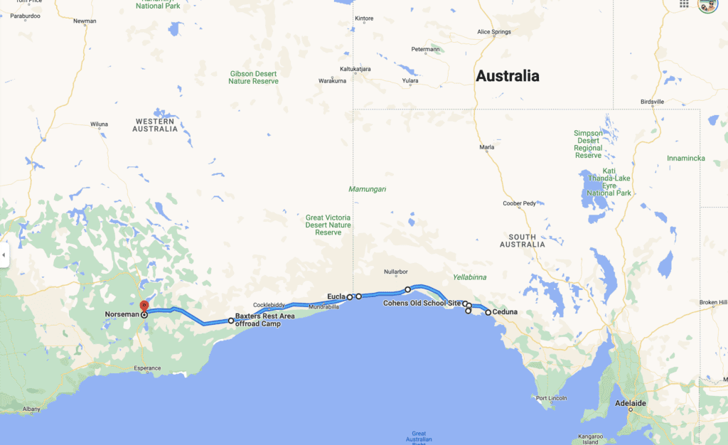
Day 1 – Ceduna to Cohen’s Old School Site (86.5 km)
Ceduna is a small town in South Australia and is the last big-ish town you’ll see until you finish crossing the Nullarbor. While it may not have much to offer, it has a stunning foreshore and jetty with essential services.
Here is where you should fill up on fuel (check prices on Petrol Spy app or Fuel Map Australia) and stock up on essential items such as groceries and water ($1 for up to 150L) for your trip.
Leave Ceduna and drive 72 kilometres (45 miles) until you arrive at the awe-inspiring windmill museum in Penong. Here, be prepared to take a trip down memory lane as you marvel at dozens of vintage windmills!
Just 15 kilometres south of Penong, make your way towards Lake Macdonnell, and, if you are lucky, you will see a beautiful pink salt lake. This salt lake is insta famous as one side of the road is pink and the other is blue, making it the perfect picture if you have a drone.

Take some pictures and make your way to the world-class surf breaks of Cactus Beach . For any ocean lover, surfer, or road-tripper, this is the perfect accommodation option after Ceduna.
If you decide to stay at Cactus Beach, it will cost you $17.50 per adult, and $5 per child, per night. When we visited, the weather wasn’t good, so it didn’t make sense to pay to park by the beach if we were not going to make the most of it.
We left Cactus Beach and made our way to a free camp only 13 km from Penong called Cohen’s Old School Site, where we spent our night after day 1, crossing the Nullarbor Plain.
Day 2 – Cohen’s Old School Site to Bunda Cliffs (374 km)
The first stop of day 2 is at the Nullarbor Roadhouse, 209km from Cohen’s Old School Site.
You can stop at Nullarbor Roadhouse to grab a coffee and something to eat, fuel, and you can also stop for the night if you would like to. They have caravan park and motel options.
Make sure you walk over to the still-standing original Nullarbor roadhouse from the 1950s before moving on. This is the perfect spot for some Instagram pictures!!
We stopped at the Nullarbor Roadhouse for pictures and a hot shower. Their bathrooms have hot showers available to anyone for $1 for 5 minutes.

We then drove another 165 km to Bunda Cliffs, a series of incredible cliffs that are more than 65m high and stretch for well over 100km, making them the longest line of sea cliffs in the world.
After that, we embarked on a journey of 165km to the Bunda Cliffs – an awe-inspiring chain of cliffs that are more than 65m high. They extend for over a hundred kilometres, making them the world’s longest line of sea cliffs in the world!
Don’t miss the opportunity to see a breathtaking Southern Ocean view from atop these magnificent cliffs! You can camp here for free; that was precisely what we did! Highly recommend it, but make sure you don’t park too close to the edge.
Our Youtube Video on the Nullarbor – Part 1
We recorded our road trip crossing the Nullarbor Plain in 2 Youtube videos. Watch part 1 from Ceduna to Bunda Cliffs here.
Day 3 – Bunda Cliffs to Baxter Rest Area (435 km)
Day 3 of the Nullarbor crossing started by leaving Bunda Cliffs and heading towards the WA Border Crossing at Border Village.
Be aware that at this point, you will have to stop, and a quarantine officer will come to your car/van and inspect your vehicle for fresh fruits and vegetables, honey, soil and other items that are not allowed into Western Australia. This check aims to control the spread of pests, diseases and weeds.
After crossing the border, our next stop was at Eucla, the first city in WA if you come from the South Australian border.
The Nullarbor has a few fuel stops, including Eucla . We decided to get enough diesel there to get us to the end of the Nullarbor. Diesel at the Eucla petrol station was $0.20 cheaper than at Border Village but $0.50 more expensive than at Norseman, so we filled up just enough to get us there.
While in Eucla, step back in time and explore what was once Australia’s busiest regional telegraph station, now slowly engulfed by the sand dunes.
Eucla has great paid accommodation options but we decided to leave the town and drive to the free camp where we stayed for the night: Baxter Rest Area. There are toilets and a dump station there.

Day 4 – Baxter Rest Area to Norseman (305 km)
The next day we woke up at 4:30 am due to jetlag. The Nullarbor has two time zones. As soon as you cross the border from South Australia to Western Australia, you are 2:30 hours behind in time. For us, 4:30 am felt like 7 am. We made some coffee and jumped back on the Eyre Highway to continue our Nullarbor Crossing.
We drove 305km straight and arrived in Norseman, officially the end of the Nullarbor Plain.
However, that didn’t mean the end of driving for us. Norseman is a tiny town, and we still had a few hours of driving before reaching our next destination.
Norseman is the perfect place to fill your tank, stock up on necessary items, and celebrate having crossed the Nullarbor.
Our Youtube Video on the Nullarbor – part 2
We recorded our road trip crossing the Nullarbor Plain in 2 Youtube videos. Watch part 2 from Bunda Cliffs to Norseman here .

Wade & Dani
Hi! We’re Wade and Dani, We’re currently travelling around Australia in our 2017 Mercedes Sprinter Camper van and sharing our best experiences, stories, reviews and adventures as we go along. Make sure to check out our socials

Nullarbor Plain: How to Cross the Nullarbor Safely
The Nullarbor Plain is home to one of the most iconic road trips of Australia. Better known as a ‘Nullarbor Crossing’ or ‘Crossing the Nullarbor, this road trip is like an Australian rite of passage.
Although, this road trip is not to be taken carelessly as there are extreme and harsh weather conditions in the outback, and there are well over a thousand kilometres to trek. Furthermore, this guide will give you an insight on how to do the Nullarbor correctly and safely.
Come upon information such as driving etiquette, mobile phone service, Nullarbor facts, towns along the Nullarbor and more.
Finally, the Nullarbor is a significant road as it connects the western regions of Australia to the central and southern parts of Australia.
How Long Is the Nullarbor and How Long Does It Take to Cross?
The Nullarbor is set along the A1 Eyre Highway , also known as the National Highway. It typically takes around two full days of driving to cross the Nullarbor. However, you can complete this road trip at a much more leisurely pace and spend around 5-7 days.
The Nullarbor is a total of 1675km and is not a road trip to be taken lightly! Not to mention, there is a straight path called the 90-mile straight, which is about 147km long; This is one of the longest straight roads in the world.
Additionally, there’s about 200km between towns, which means stocking up on necessities such as water and food is crucial. Finally, the highway begins in Port Augusta, South Australia and ends in Norseman, Western Australia.

The Towns along the Nullarbor
If you’re travelling in a westerly direction, coming from Adelaide, these are the towns in which you will pass on your journey. Moreover, this list will only include towns from Port August SA to Norseman WA.
- Port Augusta: This is the starting (or finishing) destination, be sure to stock up on plenty of supplies before beginning your journey.
- Kimba: Home to the Big Galah and Halfway across Australia signage. And this is a nice spot to stopover for the night and have a rest. Also, there are plenty of cafes in the area and an IGA for essentials.
- Ceduna: A slightly larger coastal town worth a single-night stopover. Moreover, there is a lovely swimming beach to cool off after many hours of driving. Additionally, this is also an excellent location to stock up on more supplies and spend the night at a holiday park.
- Yalata: A small town just off the Eyre Highway; Also a great rest stop for the night.
- Eucla: Once crossing the border from South Australia into Western Australia, the next town you’ll come upon is Eucla. I’d recommend stopping here for at least a night to explore this lovely little town. Moreover, there is a motel and caravan park in the area, therefore choose according to your travel needs.
- Norseman: Upon reaching Norseman, you will have completed the length of the Nullarbor.
Finally, there are a few other small towns that you will pass through. However, they aren’t as populated, and they tend to be much quieter.
Read more: Travel Advice in Australia: 10 Things You Should Know
What Is the Average Fuel Expense?
While this number will vary widely due to different vehicles and tow limits, a rough estimate of the cost is anywhere from $220 up to $450.
Keep in mind, towns are roughly 200km from each other, so if you see a fuel stop, it’s best to fill up when you can.
Also, in the outback and throughout your journey, expect to pay upwards of $2 a litre for Unleaded petrol. Moreover, it seems that these regions are typically 50c more expensive than metro cities.

5 Facts about the Nullarbor Plain
- There are over 100,000 wild camels that roam the Nullarboar plain. These animals were abandoned here after their service in building the rail roads. Therefore, you’re bound to see a camel at some point of your trip.
- The word ‘Nullarbor’ is latin which translates to ‘No trees’.
- The average rainfall along the Nullarbor Plain is typically around 200mm, although many animals still call this region home. Some of which include camels, kangaroos, birds and dingoes.
- The Nullarbor is home to the worlds longest straight road, largest piece of limestome and longest underwater cave.
- John Eyre was the first European settler to successfully cross the Nullarbor in 1841. The crossing took almost a year.
For more information on the Nullarbor Plain, check out the official Australia website
Where to Stay along the Nullarbor
Surprisingly enough, there is a range of places to stay along the Nullarbor, many of which have great reviews. Therefore, enjoy a stay in a unique and desolate location to rest up for the following days of driving.
- Caravan and Camping Area, Iron Knob, SA
- Penong Caravan Park, Penong SA
- Nuttbush Retreat, Pandura, SA
- Nullarbor Roadhouse, Nullarbor SA
- Eucla Motel, Eucla WA
- Mundrabilla Roadhouse, Mundrabilla WA
- Wedgetail Inn Hotel, Cocklebiddy WA
- Norseman Free RV Site, Norseman WA
Things to See along the Nullarbor
Great Australian Bight Marine Park Awesome views of the bight, an absolute must-stop location. Address: Great Australian Bight Marine Park, Nullarbor SA 5690
Eastern End of the Nullarbor Plain Stop by the sign and take a photo. Address: Eastern End of the Nullarbor Plain, Eyre Hwy, Yalata SA 5690
Nullarbor Cliffs Lookout Pull over for 5 minutes to check out the awesome views. Address: Nullarbor Cliffs Lookout, National Highway, Nullarbor SA 5690
SA/WA Border Crossing Sign Awesome spot to pull over before crossing the opposite state. And, take a photo in front of the sign. Address: SA/WA Border Crossing Sign, Eyre Highway, Eucla SA 6443
Eucla Jetty This jetty is situated in a pretty spectacular location in Western Australia, and it’s also a historical landmark. Moreover, it was built in 1887 and was originally 151m long. Not to mention, it’s an awesome spot for snorkelling and ideal for a refreshing dip! Finally, this was a significant transport location for international ships, including the trade of camels, horses, sandalwood and wool. Address: Eucla Jetty, Eucla Airport, Eucla WA 6443
Bilbunya Dunes Whitesand dunes. some of the dunes are up to 100m tall. awesome to explore mid road trip. Address: Bilbunya Dunes, Eucla WA 6443
Mundrabilla Home to nothing but a roadhouse, nice for a quick stopover. Address: Mundrabilla Roadhouse, Eyre Hwy, Mundrabilla WA 6443
Madura Pass Lookout Simple lookout over the Nullarbor plain. Also, a great spot to stretch your legs. Address: Madura Pass Lookout, National Highway 1, Madura WA 6443
Beacon Hill Lookout A raised lookout location with plenty of signage on the history of the area. Address: Beacon Hill Lookout, Norseman WA 6443
Norseman Visitor Centre This centre is great for some local information, there is also some beautiful art on display outside. Address: Norseman Visitor Centre, 78 Prinsep St, Norseman WA 6443

A Few Tips on Driving Etiquette
When driving along the Nullarbor Plain, it’s crucial to have a good understanding of driving etiquette. Therefore, as long as everyone follows the rules and drives safely, crashes will be much less likely to happen.
For the most part, you’re likely to see around 5-15 vehicles per hour . And, the majority of them will be either trucks or road trains while a smaller number of them will be travellers or recreational vehicles.
Firstly, keep your distance from other vehicles . Never travel closely to another car as braking distance is crucial ; Especially since most vehicles are travelling at 110km/h.
Secondly, never overtake a road train when they’re performing a turn . Since these trucks are exceptionally long, they usually need all the space possible to complete a turn.
Finally, pull over when you see a road train approaching . Therefore, this ensures that minimal rocks will fly up at your windscreen, and the wind force won’t be as strong. (The drivers will be thankful!)

Mobile Phone Service
It’s doubtful that you’ll receive phone service throughout the majority of the trip. However, your best chance for receiving service is near accommodation, roadhouses, caravan parks and small towns .
So, take the chance while stopping in these towns to check anything you may need online, call a family member, send a text message or even an email.

How to Cross the Nullarbor Plain Safely
First things first, it’s great to see you’re researching how to cross the Nullarbor safely, as it’s not a road trip to be taken thoughtlessly! So, continue reading the travel tips to ensure your Nullarbor crossing is performed cautiously.
- Do a Complete Vehicle Check
Before embarking on your journey, be sure to have your vehicle serviced and fix any issues that arise. It’s likely best to do this at least a month before leaving so that everything is up to scratch for your road trip. Secondly, a few days or a week before heading off, check the engine oil, coolant, windscreen wipes, tyres (and spare tyre), car jack and other mechanical fluids. Get all of these sorted to ensure your vehicle drives as safe as possible.
- Carry Spare Fuel
While there are many fuel stops along the way, being caught out with no fuel isn’t exactly ideal. Therefore, pick up a fuel-safe jerry can from any automotive store or Bunnings warehouse to ensure you don’t end up stranded. As a general rule of thumb, if the fuel tank goes under halfway and you’re not far from the next fuel station… Fill up! It’s better to have more fuel than less.
- Do Not Drive before Dusk and after Dawn
Strangely enough, there are lots of animals along the Nullarbor Plain. Therefore, you wouldn’t want to run into one along the trip. With that being said, begin your driving at the earliest after dawn and finish driving in the afternoon. The reason being that these animals are most active at dawn and dusk as it’s their feeding time.
- Pull Over When You See a Road Train Approaching
Thankfully, since the Nullarbor is mainly a long and straight road, you’re likely to see any approaching trucks and road trains. Therefore, if you see a road train approaching, take some time to pull over and allow it to pass. Road trains tend to create a strong wind force which may be dangerous for your sake.
- Pack Enough Food and Water for 7 Days
You may be surprised that when you begin driving along these long and straight roads, exhaustion will quickly set in. So, take your time planning and allow plenty of time for rest stops to keep yourself and other drivers on the road safe.
- Turn Those Headlights On
Even in broad daylight, headlights are an absolute essential. You are much more likely to see a vehicle many kilometres away when they have their lights on compared to when off. Thus, it gives you plenty of time to prepare to pass the opposite vehicle safely.
- Allow Vehicles to Safely Overtake You
While driving along this long stretch of road, you’re bound to be overtaken several times. And, it’s totally fine to go a little slower than the speed limit, nonetheless allowing vehicles to overtake you safely is crucial. As they prepare to overtake you, do not turn off the road or slow down, be sure to maintain your current speed. Then as they cross the other side of the highway, slow down a little to allow them to get ahead. Finally, they will pull back into your lane, and this is where you provide them space to get further ahead, creating a safer braking distance.
Wrapping Up
In conclusion, the journey across the Nullarbor is an absolutely fantastic experience for all travellers. But, it requires some sensibility before completing.
Luckily, we have access to plenty of helpful resources that encourage us to make the best decisions regarding safety. Therefore, write up a few key points from this post that resonate best with you.
Finally, the main advice from myself and previous Nullarbor travellers is to plan ahead and ensure you are completely prepared for what this desolate landscape throws at you.
When are you planning your Nullarbor crossing? Who are you crossing the Nullarbor with?
Read more: 10 Best Travel Apps Australia Read more: Road Trip around Australia

Comments are closed.
Australia Thailand Vietnam Laos Indonesia
About Blog Contact
© 2024 Ashlee Morgan. All Rights Reserved
- Travel Blogging
- New South Wales
- Western Australia
- South Australia
- Northern Territory
- New Zealand
Crossing the Nullarbor
One of the world's great road trips.

Crossing the Nullarbor – one of the Great Road Trips
Crossing the nullarbor | one of the great road trips.
Crossing the Nullarbor is truly one of Australia’s, and probably the world’s great road trips.
We feel more qualified than most to write about this incredible journey because to date I have clocked up a total of 45 separate crossings. Four times on a motorbike (with a dog on the tank), four times on the Indian Pacific train, once in a car (an old Holden), once in a 4wd, twice on a passenger coach bus, once in ‘Fork the Bus’ and 32 times as a tour guide with Nullarbor Traveller. I’m not going to count the 12 times I flew across because that just isn’t the same experience. Most of these crossings have been camping or swagging in the bush, just the way I like it.
Miss Linda has also clocked up a few km’s doing the iconic trip, crossing a total of 32 times. Twice in an old Holden, once in a four wheel drive which included a direct route from Norseman to Byford on unknown dirt tracks at night. Once on passenger coach bus, three times on the Indian Pacific train as a passenger, and 24 times as a conductor/waitress on the Indian Pacific and once in ‘Fork the Bus’ with me and Bella Dog. In all we have done a combined total of Crossing the Nullarbor seventy seven times on and in varied types of transport.

The most recent of these crossings was driving ‘Fork the Bus’ with Miss Linda and Bella Dog travelling from South Australia to Western Australia. To give you an idea of the relationship I have with this great road trip, when we reached Norseman in Western Australia I said, “Farewell old friend, I look forward to when we meet again”. After 45 separate Nullarbor Adventures I am honestly still looking forward to the next time.
” Welcome to one of the great road trips. This will be a journey of extremes, extreme distances, extreme weather, sometimes extreme flies but it is always extremely beautiful and extremely unique”.
When I was working as a tour guide for a fantastic company, Nullarbor Traveller, I began each tour with the same heart felt line. I would greet the eager and sometimes apprehensive passengers from all over the world with “ Welcome to one of the great road trips. This will be a journey of extremes, extreme distances, extreme weather, sometimes extreme flies but it is always extremely beautiful and extremely unique”. This welcome was always genuine and I still feel the same to this day.
The jury is out on what constitutes the actual Nullarbor, but in my mind it begins or ends at Ceduna in South Australia and Norseman in Western Australia. The whole journey is generally considered to be Adelaide to Perth or vice versa but people travelling from Melbourne, Sydney or other destinations would not agree.

The trip to Ceduna or Norseman is epic in itself. On the South Australian side you have the wonders of the Eyre and Yorke Peninsula’s that are a fabulous destination in themselves and on the Western Australian side you have the choice of the Kalgoorlie Goldfields route or the Esperance, Albany and South West route. All of which are must do experiences and uniquely beautiful parts of Australia.
Distances vary – we used to average around 4,500 km’s on the Adelaide to Perth tour
Of course the distances vary a great deal depending on the route you take. To give you an idea of the type of distance we are talking about if you take the most direct route from Adelaide to Perth, it is just under 3000km’s. This is the Kalgoorlie Goldfields option and it doesn’t include Yorke or Eyre Peninsulas in South Australia. The Nullarbor Traveller tours I used to do took in areas like Esperance, Albany and some parts of the South West and we used to average around 4,500 km’s on the Adelaide to Perth tour. So you can see that we are talking about a serious road trip and you do need to be prepared.
For this article I will follow the East to West crossing focussing on the 1200.32km or 745.85mile section of Ceduna to Norseman. This is the essence of the Nullarbor. The world around you begins to change as the sheer vastness of Australia becomes apparent and indeed a little daunting. As I leave Ceduna I get this feeling of excitement with a hint of anxiousness of the impending journey. I go through the preparation checklist; is the vehicle sound, good tyres and spares, good belts, oil good and cooling system ready.
Not long into the journey evidence of vehicles that didn’t make it becomes apparent
It doesn’t take long into the journey before evidence of vehicles that didn’t make it becomes apparent. Disregarded casualties in the form of stripped car bodies are not uncommon and a reminder that if the mechanical gods are not on your side then often walking away is a cheaper option than retrieval. Unless you have good insurance and roadside assist if something goes wrong out there it will cost and cost big.

I remember a French passenger on the Nullarbor Traveller bus commenting about the unbelievable amount of stolen cars out there. I informed her that it wasn’t a case of grand theft auto but remote auto breakdown. A little preparation can take you a long way. In some ways the car shells are a haunting reminder that this is more than a trip to the local, but you are in fact crossing Australia, one of the largest most ancient countries on the planet. The evidence of this becomes increasingly apparent as you continue your journey.
There is one secret to driving across Australia and crossing the Nullarbor
And I will share this with you. DON’T BE IN A HURRY. I have spoken to a number of people who seem to think that it is just a long straight road and the quicker you do it and ‘kill the meters’ the better, sometimes so they can just say, “I have crossed the Nullarbor”. This is nearly sad because by travelling with the blinkers on they miss the experience and beauty. There is so much to see and the remote wilderness is all part of the experience. Even when you are fronted with nothing as far as the eye can see, this just adds to the overwhelming awe of the country and the journey.

One of the first things you notice is that everything seems to get bigger. Not only the country but the road trains and their loads seem to grow. I am always intrigued by the amount of big stuff on the back of the road trains. I have seen an array of everything from mining equipment to multi-million dollar yachts strapped to the back of incredibly large trailers being towed by equally incredibly large prime movers. There is something surreal about a huge boat sailing towards you down the road, sometimes you rub your eyes and say, “What the f#*@ is that coming towards us?”
Talking about the road it is generally very good. Wide enough to safely share with the mammoth trucks piloted by experienced driving professionals. Old stories of cowboy operators seem to be exactly that, old stories. I have experienced the cowboys many years ago but for now they are pretty much skilled operators behind the road train wheels. The road is in good repair and is well maintained and that combined with a degree of driving common sense means that you can relax and enjoy the drive.
“On the East to West trip it isn’t long before you start to encounter absolute Nullarbor icons”
The first is exactly the area that gives the Nullarbor its name, the Treeless Plains. Many people are mistaken thinking the name Nullarbor is of Aboriginal origins but in fact it is of Latin origins which is Nullus or “No” and Arbor “Tree”. The actual tree less plain is quite a small section of the overall journey but in this area you will not see anything much higher than a few feet off the ground in any direction.
It is in this area you come across ‘The Head of the Bight’. Wilderness, wildlife and ancient landforms collide in an unforgettable experience. On our last expedition to this wonderful location wild dingoes crossed the road as we drove to the ‘Head of the Bight Interpretive and Whale Watching Centre’. This is without doubt a whale watchers paradise.

The huge magnificent Southern Right Whales migrate to the warmer waters of the Bight from Antarctica to give birth to their young. All this can be viewed from the outstanding walkways and platforms that hug the cliffs. I have spent hours here watching these incredible creatures frolicking sometimes only meters from the cliffs edge.
The natural limestone behemoth rise up to 90 meters from the Southern Ocean
Even if you aren’t here during the June to October whale migration period the Head of the Bight is still a must see. Looking east you have stunning sloping hills and dunes that fall from the desert and sink into the vast Southern Ocean. Look west the truly magnificent Bunda Cliffs begin their sheer rise from the sometimes severe ocean swells. The natural limestone behemoth rise up to 90 meters from the Southern Ocean and stretch for nearly 200km’s west and forms the world’s longest stretch of sea cliffs. There are several excellent viewing areas easily accessible for any type of vehicle or RV between Nullarbor Roadhouse and Eucla. Experiencing these cliffs is alone worth travelling to this remote outback location but there is much more on offer as you continue.

When you drag yourself away from the Head of The Bight you soon come across the iconic Nullarbor Roadhouse. The roadhouse looks mirage like as it pops out of the treeless plains and a real sense of how harsh and remote this environment is really sweeps across you. Expect to see more of this as you make your crossing. Towns are a simple roadhouse that generally consist of the basic caravan park, a bar and fuel. You can get a decent feed at most of the roadhouses along the way but be prepared to pay top dollar.
Same goes for fuel, this essential item comes at a premium price but considering the remote roadhouse locations and their high running costs fuel is fairly reasonable priced. The most we paid for fuel (diesel) on the last crossing was $2.05c/litre at Nullarbor Roadhouse and the cheapest was Ceduna at $1.39c/litre. The average price for the overall trip worked out at $1.77 c/litre and we stopped and topped up at every roadhouse along the journey.
There was more than one reason we stopped at every roadhouse and that it is because on this last crossing I also played ‘The World’s Longest Golf Course – The Nullarbor Links’. Each roadhouse has one hole, along with two holes at Ceduna, Norseman and Kalgoorlie and then also one at Fraser Range Station which is situated between Balladonia and Norseman. I have written a more detailed review about The Nullarbor Links but it is safe to say that from a golfing view it is generally pretty rough but from an enjoyment view, it is a novelty well worth conquering as a part of the Nullarbor experience.
The Quarantine WA Border check point
As you near the South Australian/ West Australian border you will be confronted by what, for all intensive purposes, looks like a military check point that would be at home on the DMZ somewhere in Korea. This is the border quarantine checkpoint. It is illegal to take fresh fruit and vegetables and other stuff like honey across the border. Don’t even try to smuggle goods across because these uniformed quarantine officers are thorough and they do take their job seriously. Every vehicle is searched and although they are generally pleasant about their searches they will fine you if you don’t abide.
It is much easier and better for the biosecurity of the country to just conform. Me, I just cook up a big curry of all the leftovers the night before the border crossing because cooked is ok. A more detailed account of what you can or can’t take across the border is available online and if you’re heading east the quarantine inspection is not until you approach Ceduna.

The quarantine station is one of two distinct hurdles when crossing the SA/WA border. The other is what the f#*! is the time. Due to the sheer size of Australia there are several time zones. Not only this, but some states have daylight savings time and some don’t. SA does WA doesn’t, and just to confuse matters more there is a Central West time zone which not only doesn’t have daylight savings, it is different to WA time. Confused yet? In this part of the world no-one seems to know exactly what the time is and what’s more besides the fact that the whole daylight, night-time thing changes substantially it really doesn’t matter.
Time zones crossing the Nullarbor
I recall a funny conversation with Miss Linda immediately after crossing the border when we decided to change ‘Fork’s’ clock. The question was, “What time is it?” the answer, “Not entirely sure” short pause, “What day is it?” answer, “Don’t know”. Conclusion, I suppose if you don’t know what day it is then the time isn’t that important.
The most annoying thing about the whole time change was that Bella dog tends to be a creature of habit and is used to her breaky roughly between 6:27am and 6:30am. For several mornings after the border crossing a time confused pooch would stand next to our bed and stare at me from around 4:00am. If I showed any sign of being awake, any movement or flicker of the eyes, her tail would then start to wag and in the narrow ‘Fork’ hallway this resembled the sound of hitting the fridge then the cupboard repeatedly with a newspaper. Inevitably this lead to the wet nose inches from mine with the occasional wet nose nudge. After a period of retraining and puppy time change adjustment (PTCA) things eventually returned to same routine just a little later in the morning.

Sorry I digress, back to crossing the Nullarbor. At the border crossing there is a quirky photo opportunity with a line marking SA and WA. Myself along with many others have had the straddling the border photo taken. The shortest distance between towns is Border Village and Eucla. Eucla is the closest thing to an actual town during the crossing and there are sensational views from on top the Eucla Pass. At Eucla the road descends quickly to lower plains that stretch as far as the eye can see, with a higher ridge following the road most of the way to Madura where the Madura pass takes you back up to higher plains.
As you descend onto these lower plains vast sand dunes form a natural barrier between native scrub and the Southern Ocean. It is worth taking a left turn (heading west) to the old Eucla Telegraph Station. The telegraph station is interesting and has amazing historical significance. However, I would walk in a straight line toward the ocean over the dunes andcame across magnificent unspoilt beaches of which I have yet to see anyone else on. The walk was only around 20mins or so and I used to promise the passengers on the Nullarbor Traveller bus that I would show them beaches without footprints and this was always one of my options.
Eucla – Home of the Nullarbor Nymph
When in Eucla you are also in the home of the Nullarbor Nymph. This is a story worth investigating and an absolute tribute to the great Aussie sense of humour. I used to love retelling the story around the campfire to international tourists who would generally have tears in their eyes from laughter when the truth of the legend of the nymph was revealed.
The ingredients for a classic road trip is not only the places but it is also the people. Whether or not they are historical, residents, workers or travellers the Nullarbor is a magnet for unique characters. I feel unique places naturally attract unique characters and the Nullarbor seems to be a very powerful magnet. I have never done a crossing without sharing yarns with interesting people, or tracing back stories to the historical characters that opened up this amazing part of the world.
“I have never done a crossing without sharing yarns with interesting people, or tracing back stories to historical characters”
I am not going to reveal the exact whereabouts, partly because it is near impossible anyway. But, there is a tiny, what you would call a settlement not a town, that is situated on what would have to be just about Australia’s most remote beach. This tiny settlement has a couple of permanent residents and a couple of holiday shacks. It sits on the most amazing beach and is nestled in absolute pristine native scrub. I ventured there many crossings ago because I was told about it by a local.
There is no clear road and we followed a dirt track through miles of scrub and, after hiding the large trailer in the scrub, I was amazed I actually found it and got through with no real problems. The look of surprise from one of the two resident’s faces was priceless when we rolled out of the scrub. Oh! Did I mention I was in a small tour bus with passengers? The guy we met was one of these unique characters and his hand-built home made from driftwood and a variety of random items found on the beach reflected his eccentric demeanour. He was more than happy to proudly share his home and the enthralling story of its ongoing construction with us.

I returned on another occasion with a smaller crew of passengers and we packed light, stashed the trailer again and spent the night on the beach. It was a special night for all of us and that same local greeted us with open arms and entertained us with fascinating stories of his home.
As you near Madura the road takes a sharp rise and you are back on the higher plains. The view from the top of the Madura pass should not be missed and once again you are reminded of the absolute enormity of your surrounds. The curvature of the Earth is obvious when there is nothing to obscure the view. This is one of those locations.
“Is it a scene from a Mad Max movie”?
Just when you feel that you couldn’t get much more remote and you will surely pass through a real town soon your surrounds seem to get larger and even further removed from population. Turning into the Cocklebiddy Roadhouse feels like a scene from a Mad Max movie and nearly post-apocalyptic. The first thing you will notice is the rescued pet Wedge Tail Eagles in their giant aviary and then there is the mammoth vehicle graveyard lurking in the distance behind the constant drone of the roadhouses diesel generators.
I have memories of howling winds, dust storms and sudden torrential downpours all at this location. When you have 200,000km2 of exposed arid land to your right (travelling west) and even more of the vast Southern Ocean to your left you will experience dramatic shifts and extremes in weather. This is true for the entire crossing but I just seem to experience most of it around Cocklebiddy, coincidence, maybe?

Even though the landscape is desolate it’s not so much what is above ground it is what lies beneath the harsh weather beaten surface. One of the world’s largest network of underground caves and waterways are located in this area. The Cocklebiddy Caves have held world records for cave diving and was considered to be one of, if not the premier destination for cave divers worldwide.
I am not and never will be amongst the ranks of cave divers but I have on many different occasions as a tour guide, swam in the underground lakes up to 150 meters below the surface. The cathedral like underground chasm I used to climb down to and swim by candle light in has actually partially caved in and are now closed to the public. This same cave was the location of a world record underwater cave dive by a crack Australian team.
At this point of the journey you are still in the middle somewhere
Once again the Nullarbor never ceases to amaze and at this point of the journey you are still in the middle somewhere. There is no point turning back because that is further than the destination and why would you anyway. But, crossing the Nullarbor does have a habit of throwing up these uncertainties. Near Caiguna you drive the world’s longest straight stretch of road, the 90 mile straight, which converts to 144.8km and you’re on your way to Balladonia.
When you arrive at Balladonia it seems like a hive of activity. It is still not much more than a roadhouse but there is thicker scrub and definite changes appearing in the landscape. Not far from Balladonia is one of the debris sights of the ill-fated Skylab when it made its unceremonious return to Earth July 12 th 1979. I love the interesting and unique historical facts that pop up during the Nullarbor’s history, for example, the US government was given a fine for littering after the Skylab crash and they paid it. Then US President Jimmy Carter personally rang the Balladonia Roadhouse after the incident and apologised for any inconvenience. I would love to have been the person who answered that call.
When you think the journey can’t offer more it does. Now you enter full thick virgin native forest and a pleasant change from the arid and semi-arid landscapes. On the edge of the Dundas Nature Reserve is yet another one of those Nullarbor must experience locations. Newman Rocks is tucked around 10km off the main road, not that far from Balladonia on your left as you travel to Norseman. It is signposted but easy to miss and well worth a diversion. The track is a little rough but manageable in most vehicles although be careful where you drive if it has been raining. You can, and I have been bogged there, another experience for the Nullarbor Traveller passengers.
The rock pools attract an array of wildlife including wild camels
Newman Rocks is a granite plateau that looks out to the east and is simply stunning. The rocks form pools that attract an array of wildlife including regular visits by wild camels. An interesting fact about the region is that it has the largest population of wild camels anywhere in the world. The only man made interference to the view is the distant lights on the highway.

The numerous times I have slept under the stars here I have experienced a show of stars equal or better than any other. I have failed to mention during this article one of the greatest draw cards for the entire Nullarbor crossing, the star shows at night. Tucked in a swag and gazing up is one of those simple yet unforgettable experiences that only remote locations like the Nullarbor can deliver and deliver it does. Newman’s Rocks delivers on several fronts and the secret is out with more people camping there. When you watch the sunrise from the plateau over the vast plains you understand that this is truly a special place.
Tucked in a swag and gazing up is one of those simple yet unforgettable experiences
As we continue west a visit to the historical sheep grazing property Fraser Range Station is a must. Not only because it has a Nullarbor Links hole there but it’s a top spot worth a visit. They offer a selection of accommodation including powered and non-powered sites and you can get a good feed if you don’t feel like cooking. Sunset walks to the top of the surrounding hills gives you unforgettable views of the station and adjoining Dundas Nature Reserve.
When we leave Fraser Range Station it is with the realisation that our Nullarbor crossing is nearly at its end. It’s kind of nice when you do reach Norseman because you have flash services like pubs and a supermarket but this is short lived when you have just experienced all a Nullarbor crossing has to offer. Of course this isn’t the journey’s end (unless you live in Norseman) and no matter which route you take to Perth it is full of interest and great locations.
However, the Nullarbor has an awe about it, a stunning unique ancient landscape coupled with its pioneering, character filled modern history that gives it a personality all of its own. I am sure if the traveller takes their time, dares to wander a little off the main track and open their eyes to all the journey has to offer, they will discover the experience that is ‘The Nullarbor’ and why it’s crossing is an “old friend” of Finchys Australia.
You also might be interested in

- Southern Rock Lobsters & how to pick them
Southern Rock Lobsters, aka Crayfish can be difficult to remove the meat from the shell. See our expert How To Video & cray picking backstory

Travelling Solo For the First Time, Day One
Armed with a broken heart, an old Holden station wagon and thinking I was wise beyond my years I made the decision to leave

Port Lincoln
Finchys Australia Photo Essay of Port Lincoln in South Australia
WHERE DO YOU START ?
Where do you start? Australian Travel, Places, People, Stories. Follow us: YouTube, Instagram, Facebook, Tik Tok & Pinterest. Finchy & Miss Linda

Search Our Stories
- Photo Essays
- Golf Courses
Recent Posts
- Floating through River Life S1 E7 – Mypolonga
- Floating through River Life S1 E6 – The Lightbulb Moment
- Floating through River Life S1 E5 – Blankets
Follow & Subscribe

© 2024 · FINCHYS AUSTRALIA. | Privacy Policy
- Privacy Policy
Type and press Enter to search
Driving across the Nullarbor

Fern & Alex
Driving across the Nullarbor Plain has to be one of the most amazing drives we've ever been on.
When we set out on this trip, we always saw this part as being a risky - if not scary - stretch of road, but we're pleased to report (to our parent's relief) that we had the best time on this drive and arrived safely to our destination.
There are numerous blogs and sites out there that give you a very detailed explanation on HOW to do the drive: things to look out for, stops along the way, tips with petrol and water and everything, so I won't go through that here. Rather, I thought I'd share our experience - as a married couple with a dog - driving across this long, flat, endless stretch of land.

With more than 2,100km to cover between Adelaide from Esperance, we decided we would do this drive over 3 days, so that our drives wouldn't be too long and the 3 of us wouldn't go crazy or get too tired on the road.
Day 1: Adelaide to Ceduna
Our first day saw us say goodbye to Adelaide and the lovely Henley Beach, and heading northwest towards Ceduna , which is essentially the eastern end of the Nullarbor Plain.

About 130km out of Adelaide, we reached our very first pink lake, Lake Bumbunga , situated in this little town called Lochiel (population 113, according to their 2016 census ). Having a Scottish name and a lake (or loch?) in town, someone found pertinent to put in a monster in the lake and name it Lochie:

All in all, an interesting stop to stretch the legs, give Summer a little run, and a chance to get the drone out for some shots:
And that, my friends, was pretty much the only noteworthy stop for that day. The remaining 780km of the drive was rather dull, cruising along open fields, farm lands and nothing really worthwhile until you we got to Port Augusta, an old port town that seemed to have seen better days. From there, onwards to yet more of the same landscape and open fields with not much to look out for.
Thanks to Bill Bryson though, and his book Down Under we were kept entertained throughout the entire drive. Bill's tales of crossing the Nullarbor were getting us particularly excited for Day 2.
We stayed the night at the Ceduna Motor Inn by the side of the road, one of the few motels that were pet friendly. We had an easy night in with pizza and beers in the room, and got some good rest for the remainder of the drive.

Day 2: Ceduna to Mundrabilla
Day 2 was our first day in the Nullarbor as well as our shortest drive day. With only 580km to cover, we decided to take our time and enjoy the day as much as we could.
We started off with a little wander around Ceduna waterfront (very windy but lovely) and breakfast at the local bakery. We were starting to get a feel for small-town Australia, with not much open around town on a Saturday morning, and a very neighbourly gesture: the butcher next to the bakery saw Summer with us and walked out with massive offcuts from beef and asked us if Summer could have them. As much as his offer warmed our hearts, we've had a few too many stomach incidents with Summer and weren't ready to risk it on a 580km drive, so we politely declined, to Summer's dismay.
With our bellies full (some more than others... sorry again, Summer) we were ready to hit the road and see what this Nullarbor was all about. With time on our side for the day, we decided to take a small detour and check out Point Sinclair Pink Lake , just outside of Penong (SA), which turned out to be a huge highlight:

Yet again, the drone came out and provided some fantastic shots of the pink lake and the contrast of colours around us:
From that point on, the landscape started shifting. Bush started getting thinner and thinner until we were well and truly in the middle of the Nullarbor.

I'm sure I was not the first one to be surprised to learn that "Nullarbor" is not an Aboriginal name for the area - it is in fact Latin for "no trees" (checks out). The Aboriginal name for the are is Oondiri which means "the waterless" (also checks out). We were both mesmerised by the open, vast landscape, and the feeling that we're all tiny specs of dust flying across this universe.

And the most fascinating of all of this is that this wide vast plain that looks landlocked in the middle of nowhere actually runs along the coast, which creates these otherworldly views of a dry, arid desert right next to this magnificent cliff looking out to the open ocean:

The Nullarbor Timezone

One of the most interesting (and confusing) experiences during this drive was learning that we crossed three different timezones during our drive. If this wasn't enough to do your head in, the time difference between them was just 45 minutes. Let's recap this...
In Adelaide we were in Australian Central Standard Time (UTC+9:30). This was already confusing as we were just 30 minutes behind Sydney (Australian Eastern Standard Time, UTC +10).
For 340km in the Nullarbor, and in Mundrabilla where we stayed the night, the "local time" is the officially unrecognised Central Western Time Zone (UTC+08:45) which is 45 minutes behind Adelaide.
Still with us?
Once we left the Nullarbor (and the weird 340km stretch) we entered Australian Western Standard Time (UTC+8).

We stayed the night at the Mundrabilla Roadhouse , a very pleasant surprise for us, where we secured a pet-friendly room (Summer even had her own bed), and managed to have a drink and a very good meal at their restaurant. We couldn't be happier!

Day 3: Mundrabilla to Esperance
The third and last day of our drive was also the longest: with more than 820km to cover, we woke up early and were on the road by the first sunlight.
I'm not gonna lie, it was a hell lot of driving, and while we were devouring offline Spotify playlists, podcasts of different genres (politics, news, pop culture, music) and long Audiobooks, we were going a bit crazy. The roads are always so flat that it required an additional level of attention. Here's Alex behind the wheel in one of those moments, letting some steam off:

The rest of the drive across the Nullarbor was beautiful and, thankfully, uneventful. Probably the only highlight of the day (if we can call that) was the 90 Mile Straight : as the name suggest, a stretch of land without the slightest turn, that goes for 90 miles.

After hours and countless km's on the road, the vegetation started to change slightly and trees start to pop up, indicating that the "tree-less" Nullarbor was definitely coming to an end:

The Nullarbor Plain ends at the rather uneventful town of Norseman, where we simply stopped for a quick break, before venturing the last 200km stretch to Esperance.
We've spoken to quite a few people now who have also done the Nullarbur drive and most of them hated it. I am not entirely sure how such a long (and arguably boring) drive became a highlight for us, but we thoroughly enjoyed it, and were very glad that our car stayed strong with us and we safely made it to Esperance.
We are now officialy in Western Australia for the first time in our lives and ready for the adventure ahead of us!

Odometer check:
For the data nerds out there like me, here's the odometer of our car after these 3 days of driving from Adelaide (SA) to Esperance (WA):

Sign up for more like this.

A Guide To Driving Across The Nullarbor
The idea of driving across the Nullarbor sparks excitement in some people, while others couldn’t think of anything worse.
It’s one of the longest drives in Australia. Stretching across 1,256 kilometres with virtually nothing around. It’s made up of the longest flat road in Australia, the longest treeless plain, and is generally one of our longest drives. One very long road that connects South Australia and Western Australia together, across the Nullarbor Plain.
There’s probably more to see and do across the Nullarbor than you might think, with roadhouses, iconic road signs and all kinds of strange sculptures and even stranger towns to keep you amused as you drive along. We’ve put together a collection of our best tips for driving across the Nullarbor, as well as all the places there is to stop along the way.
In this post:
Planning to drive the Nullarbor
A few things you should keep in mind before and during your drive across the Nullarbor:
Know where the fuel stations are: there are plenty of fuel stops along the Nullarbor, but they can still be hundreds of kilometres apart. Make sure you know where the fuel stops are and fill up regularly to avoid running out of fuel or not making it to the next stop.
Don’t drive at night: the Nullarbor is home to lots of different wildlife, most of which come out of hiding at night and roam around. Avoid driving at night, when it’s more likely that wildlife could be on or near the road and you have limited visibility. We actually saw a dead camel on the side of the road that had been hit by a car or truck. I would hate to see the damage on the vehicle that hit a camel!
Bring some warm clothes with you: even if you’re travelling during the summer time, temperatures drop at night and can be very cool, especially along the Bunda Cliffs. Bring a warm change of clothes to be prepared for any conditions.
Be careful of road trains: the trucks out here are just MASSIVE. Some with three or even four huge trailers, and can sometimes have upwards of 90 tyres. Be careful when you’re driving past them, especially if it’s windy, and drive as far to the left of your lane as you can.
There is no water: there is nowhere to get clean water along the Nullarbor, unless of course you’re buying it in a plastic bottle. Make sure you have enough water and all your tanks are full before you leave Ceduna.
There are quite a few interesting places to stop along the Nullarbor, some with iconic things to see. Others that are just a necessary fuel and toilet stop. Here are all the places you can stop along the way, and what you can expect to find there:
Fowlers Bay
Ceduna to Fowlers Bay: 143 kilometres, approximately 1 hour and 40 minutes
While many consider Ceduna to be the last town in South Australia, our last stop in SA before we embarked on the Nullarbor was Fowlers Bay . A very small, very remote town at the fringe end of the Eyre Peninsula where sand dunes mark the end of the street and the caravan park convenience store is the only store in town. It’s so remote in fact, that there is no mains power or water here, with the residents of the town creating their own solutions.
Fowlers Bay is made up of a caravan park, a public laundromat and that’s about it. But it is a charming, cute little town, where vintage caravans can be seen everywhere, and you can walk around the whole town like walking around the block. It provided us a great overnight spot to do our laundry and have a good sleep before we started our long drive across the Nullarbor.
We woke up bright and early, ready to go. We were excited for the Nullarbor.
Important note: There is no fuel station in Fowlers Bay, so we had stopped and filled up in Ceduna before we stayed the night. When you’re in Ceduna make sure you use one of those fuel price apps to find the lowest price – we were able to find diesel for $1.29 at a petrol station we probably wouldn’t have seen otherwise!
Head of the Bite
Fowlers Bay to Head of the Bight: 164 kilometres, approximately 1 hour and 53 minutes
The first stop we made along the way was at the Head of the Bight Visitors Centre. It is the beginning of the iconic Bunda Cliffs that extend all the way to the Western Australia border. It’s also a great place for whale watching during the winter months, with whales and dolphins regularly spotted swimming close to the cliff face.
The Visitors Centre has boardwalks that extend all the way down to the ocean, with beautiful lookouts over the cliffs and the Great Australian Bite. Even though we weren’t visiting during the whale season, it was still a lovely spot to visit and break up the drive a little bit. There was also phone reception in the Visitors Centre and a small cafe, in case you need a snack or to connect.
The Head of the Bite is open from 8:30am until 4pm, with extended hours from 8am to 5pm during the whale watching season. It cost $8 per adult for entry when we visited, which was considered the off-season.
Nullarbor Roadhouse
Head of the Bite to the Nullarbor Roadhouse: 25 kilometres, approximately 21 minutes
Only a short way down the road was our next stop, the iconic Nullarbor Roadhouse.
This might be one of the most famous sites along this stretch of road, where the original roadhouse from the 1950s still stands, despite a new petrol station, motel, pub and store being built all around it. It’s a favourite spot to stop of anyone crossing the Nullarbor, and a great place to stop for a photo.
You can still go inside the old roadhouse, where you can see kind of a shop set up on one side, while the other side resembles more of an abandoned shed. There’s even an original petrol pump still standing outside.
Bunda Cliffs
Nullarbor Roadhouse to Bunda Cliffs: 165 kilometres, approximately 1 hour and 40 minutes
The Bunda Cliffs are, quite simply, AMAZING. Spanning for hundreds of kilometres, they really give you the feeling that you are standing on the edge of Australia. Even though (the thought came to me as we stood there), you’re kind of standing at the edge of Australia every time you go to the beach!
There are four designated lookouts along the Nullarbor that provide some of the best views of the Bunda Cliffs, but there are also plenty of other spots where you can simply follow a dirt track and see the views from wherever it takes you. There is also plenty of free camping spots all along the Bunda Cliffs and this area before you get to Western Australia. Can you see us on the cliff edge in the photo above?
If you’re going to free camp along here, just make sure you pull into a spot that is off the tracks and the main roads, as others might need to get past you. Also make sure that you leave the site as you found it, take any rubbish and toilet paper with you to keep the environment as pristine as possible.
We spent the night camping on Bunda Cliffs, just about an hour or so east of the state border. It was super windy overnight here, which I expect is always the case at the cliffs.
Border Village & the SA/WA Border
Bunda Cliffs to Border Village: 20 kilometres, approximately 12 minutes
The next morning we crossed the border into Western Australia! I actually thought there was going to be a lot more driving on the South Australian side of the Nullarbor, but as we found out, WA had snuck up on us quickly.
The small town at the border is literally called Border Village. On the SA side you can find a petrol station and small takeaway store, as well as the strange giant kangaroo holding a jar of Vegemite.
It’s important to know that WA has a very strict quarantine inspection for anyone crossing the border. You are not allowed to take any plant matter with you to WA, which means any fruit or vegetables you have needs to be eaten or thrown out before you cross the boarder. It’s annoying, but it’s an attempt to stop fruit-flies and other insects from crossing over into WA.
We already knew about these rules, so we had already eaten most of our fruit and veggies and didn’t have to throw away very much. Once you’re ready to be inspected, and leave SA, you need to line up at the quarantine station to be inspected.
The quarantine official looked through our car fridge and the fridge and freezer in the caravan to check that we didn’t have anything that wasn’t allowed to be taken in to WA. She was lovely and very polite to us, however I have heard about ruthless inspectors that want to look through everything you have, making people throw out honey and all sorts of things.
She waved us on and just like that we were in Western Australia!
Just after the quarantine inspection point, pull over to the left hand side to take a photo with the iconic SA/WA border sign. There’s a line on the floor that clearly marks the separation of the states, and we couldn’t resist taking one of those silly photos with Thom standing in SA and me standing in WA.
Border Village to Eucla: 12 kilometres, approximately 11 minutes
The first stop you will come across in WA is Eucla, literally just on the other side of the border. Again, another rest stop with a petrol station, a small takeaway store and a place to stay. We stopped here to fill up the car and noticed that we were in a weird timezone, that wasn’t inline with either Perth or Adelaide.
Yep, welcome to border time . A fictitious time zone in my opinion apparently officially called ACWST Australian Central Western Standard Time , that just covers this small area of the Nullarbor from Border Village to Balladonia. The time here makes absolutely no sense, it’s 45 minutes ahead of Perth (UTC +8:45) and just throws out all logic. If you can, just ignore the time until you get through this weird zone. It will make your head hurt.
Cocklebiddy
Eucla to Cocklebiddy: 273 kilometres, approximately 2 hours and 46 minutes
After a few hours of driving Cocklebiddy was the next stop. A very strange place where the number of residents (8) are wildly outnumbered by the number of budgies (25). We stopped for a break to stretch the legs, use the bathroom and check out this infamous weird cage of budgies before we kept driving.
There’s a small motel here if you need accommodation for the night, as well as a petrol station and bar where you can have a drink or a quick fast food meal. This place also runs on “border time”, although they call it Cocklebiddy time . Honestly, these little rest stops along the Nullarbor are some of the weirdest places we have visited around Australia so far.
Cocklebiddy to Balladonia: 220 kilometres, approximately 2 hours and 15 minutes
After a full day of driving we pulled in to Balladonia as it was getting dark. At Balladonia you can find a petrol station and convenience store, a pub and a caravan park.
We were running very low on food, having had to get rid of all out fruit and vegetables before we crossed the border into Western Australia, so we stopped at the pub for dinner. There were no other options, let’s be honest. The food was quite good at the pub, I had a Thai Beef Salad (the only option that resembled a salad on the menu) and Thom had a parma that was very large.
We didn’t want to pay to spend the night at the caravan park – it was very expensive for what you got (about $35 a night), and we wouldn’t even be leaving our van to use amenities. Instead we drove about 5 kilometres back down the road where there was a great free camp to stay in for the night. There was no more road noise than there would have been at the caravan park and it was a big rest stop, perfect place to spend the night.
Balladonia to Norseman: 219 kilometres, approximately 2 hours and 17 minutes
On the morning of our third driving day we reached Norseman, the end of the Nullarbor! A real town with just about everything you might need including a huge petrol station, grocery store, visitors centre, accommodation and dining options. After crossing the border, Norseman will be the first place where you can finally stock up on fruit and veggies again.
There is a dump point behind the Visitors Centre if you need it, and the BP will let you fill up your water tanks with clean drinking water for a gold coin donation which goes to the Royal Flying Doctors Service.
From Norseman you can either continue south to Esperance and the south-east coast of WA, or north to Kalgoorlie and the Goldfields region. Both are about a two hour drive from Norseman, and will take you onward to Perth if that’s your final destination.
Norseman Visitors Centre || LOT 1781 Roberts Street, Norseman || Ph: (08) 9039 1071
Check out the best places to stay in Norseman for your dates.
If you haven’t driven it before, the Nullarbor is definitely not as scary as you might think. It took us about two and a half days, reaching Kalgoorlie by about lunch time on the third day. We were taking our time and not rushing at all, so you could definitely do it a lot quicker if you needed to. In fact, both days we took our time and didn’t get moving until about 10am.
Surprisingly, the Nullarbor definitely wasn’t as boring as you might think either! While some parts were definitely longer and more boring than others, there are lots of different things to stop and see to break the trip up, as well as lots of colourful characters working at the rest stops along the way that are sure to keep you entertained.
What was your favourite stop along the Nullarbor?
Explore more of our adventures around South Australia
Pin for later >>
Happy travels, if you enjoyed this post, we'd love you to share it for us follow us on instagram @exploreshaw to see our latest adventures around australia. check out our travel favourites: click here to subscribe to our newsletter, for blog posts and updates emailed straight to your inbox use this link for $25 aud off your next hotel stay with booking.com, or this link for $55 aud off your first booking with airbnb..

Emma is a travel writer, photographer and blogger, chasing the sun around Australia. Travelling in her recently renovated vintage Viscount caravan, along with her husband Thom and daughter Macey, she's sharing the very best experiences from around her beloved sunburnt country.
Related posts

Where To Hug A Koala In Australia

30 Things You Need To Know About Australia Before You Go

Our Best Day Ever: A Look Inside Our Wedding Day
No comments, leave a reply cancel reply.
We're travelling around Australia, exploring all the best destinations and experiences our beautiful country has to offer. We'd love to have you along for the ride!

for all the best bits on the site

destinations

follow on insta
@exploreshaw.
- Work With Us
- Privacy Policy
- Travel Resources
for updates to your inbox
current location melbourne
© 2023 EXPLORE SHAW

Crossing the Nullarbor Plain, Australia
A guide to crossing the nullarbor plain in australia.
Imagine an authentic Australia adventure, driving through the outback at your own pace, along solitary coastal roads, standing alone on a clifftop to watch the sun setting over the ocean, and camping under silent starlit dark skies. Come with us on a journey through Australia’s vast south western territory, crossing the Nullarbor Plain along the Eyre highway, all the way from Adelaide to Perth.
You’ll see the Great Australian Bight Coast, skirt the Great Victoria Desert, encounter dragon lizards and wild kangaroo, stop at remote bush settlements, and intrepidly travel some 1675 kilometres of little-known landscapes.
Although the Nullabor can be crossed on the South Pacific Train, or by car (typically sleeping in roadhouses or free camping), driving a campervan is the epic way to do this legendary road trip.

Why Crossing the Nullarbor’s Amazing
Enjoy the roadhouses, don’t rely on cell phone service, a backpacker’s guide to crossing the nullarbor plain.
Authored by Danny Newman
“Some people say you haven’t really seen Australia until you’ve crossed the Nullarbor”, said the wrinkly old man with leathery skin and a twinkle in his eye.
We were at a rest stop at the side of the road on the east coast of Australia, both of us taking our campervans around the country. Having stopped for the night and found ourselves as temporary neighbours, we’d struck up a conversation about our respective journeys and the different routes we were planning to take.

He was heading to Western Australia, via the south, along a stretch of road I hadn’t heard of before: The Nullarbor. Otherwise known as the Eyre Highway, it sounded almost mythical in nature. Long and impossibly straight, it was the only way to get between Adelaide and Perth on wheels. The caveat?
Crossing the Nullarbor meant driving along 1600+ kilometres of wild, desolate, semi-arid Aussie outback. You’d pass through 3 time zones, dodge packs of wild camels, and spend entire days under a blistering sun with nothing but red dirt and the occasional road train for company.
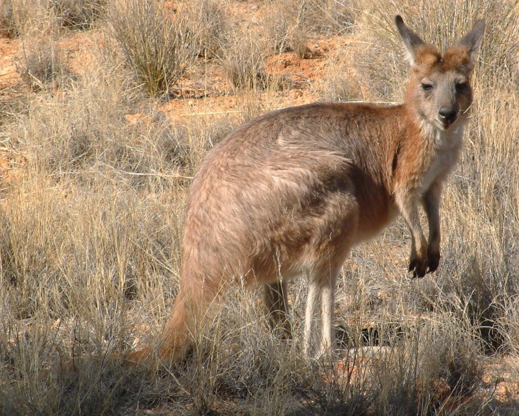
…I decided to do it.
And the experience was everything that wizened old traveller said it’d be! An otherworldly place, I’ll never forget my time crossing the Nullarbor Plain and recommend it to anyone who’s on an Aussie adventure of their own looking for crazy things to do . However, to do it safely, comfortably, and successfully, it’s important to a) know what you’re getting into and b) prepare properly for the trip!
With that in mind, I thought I’d put together a comprehensive guide to crossing the Nullarbor. Sound good? Read on to learn more about this remarkable part of Australia and how to travel across it!
Where Is the Nullarbor Plain?
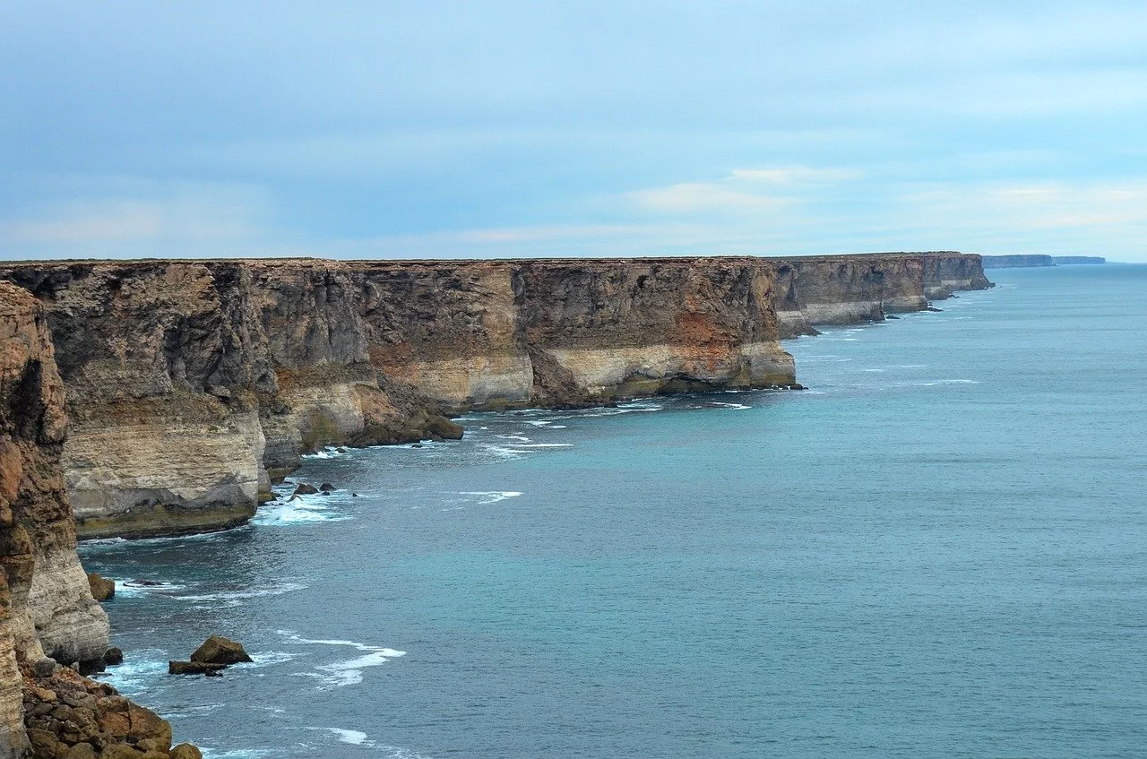
The Nullarbor (sometimes referred to simply as “the ‘Bor”) Plain straddles two Australian states: Western and South Australia. If you plan to drive between Adelaide and Perth, you literally can’t miss it. Looking at a map of the country, you’ll see the road itself right down at the bottom, running along the southern coast between Ceduna (on the eastern end) and Norseman (to the west).

Driving across the ‘Bor isn’t everybody’s idea of fun. You’re spending days on the road. It’s dead straight, hot as hell outside, and for big chunks of time there really isn’t much to look at! Just red dirt, scrubland, and a road that narrows and shimmers all the way to the horizon. The name itself derives from the Latin words “nullus” and “arbor”, which literally translates to “no trees”.
That’s one (and dare I say it, pessimistic ) way to look at things, anyway. Another is to see crossing the Nullarbor as one giant adventure! You’re out in the sticks, alone, with nobody else around for hundreds of miles. You have to entertain and fend for yourself, knowing full well that you’re in trouble if anything goes seriously wrong. This turns it into a cool, unique, and intrepid experience that’s unlike any other you can expect to have in Australia (or most other places you travel, for that matter).

The Nullarbor’s also a strikingly beautiful part of the world. Cave systems run beneath your feet, giant limestone cliffs descend hundreds of metres into the ocean below (where you can sometimes Southern right whales doing their thing), rolling sand dunes create a pristine play area in places, and there’s all sorts of Australian wildlife to see, including camels, emus, dingoes, kangaroos, and snakes.
How to Cross the Nullarbor

You can travel over this vast expanse of land by train (on the Indian Pacific railway), tour bus (various tour companies operate services across the Nullarbor), or by car/truck/campervan. Some crazy folks even cycle it!
Want my advice? Get a vehicle so you can drive across it yourself and plan a road trip . In my opinion, the ideal set of wheels would be a 4×4 campervan, which would allow you to a) sleep wherever you like along the way and b) get off the main drag to see the various Nullarbor attractions that exist down long, rough, unsealed tracks.
Places of Interest/Things to Do Along the Nullarbor
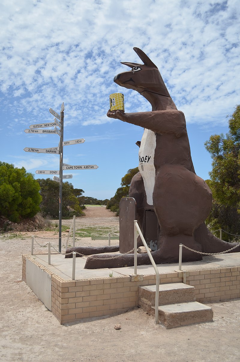
For a 1600+km stretch of straight road that runs through what’s essentially a desert, there’s a surprising amount to see and do along the Nullarbor Plain! Here are a few of the best ways to break up the drive:
Play a Round of Golf
Yes, you read that correctly! The Nullarbor Plain’s home to the “world’s longest golf course”, an 18-hole, par 72 course called the Nullarbor Links . With a new hole at each roadhouse/town that you pass, it’s a unique way to have some fun, engage with the locals, and stretch your legs as you drive between Norseman and Ceduna.
Visit the Murrawijinie Caves
These ancient limestone caves are located around 10km north of the Nullarbor Roadhouse, in South Australia, accessible via a signposted dirt track (be sure to ask in the roadhouse for specific directions). When you arrive at the caves, you’ll be greeted by age-old ochre hand stencils made by indigenous people way back in the day.

See the Bunda Cliffs
Stopping to see the Bunda Cliffs is an absolute must as you cross the Bor! With sheer cliffs falling hundreds of feet into crashing waters below, it feels as if you’re standing on the very edge of the world. You’ll enjoy breath-taking views, awesome Instagram opportunities, and some top camping spots too. Oh, and if you’re there at the right time of year (between May and October), you might even see some whales frolicking out to sea as well.
As you might expect in such a remote place, light pollution’s all-but non-existent along the Nullarbor. The result? It’s perfect for stargazing! Whenever you stop somewhere to set camp, then, take the opportunity to look in awe at the crystal clear night sky and the Southern Cross hanging above your head.

Roadhouses are your go-to establishments on the Bor to buy fuel and supplies, grab a coffee (or a beer), and/or rest your head for the night (if you’re not free-camping).
Convenient crosses between motels, cafes, and fuel stops, you’ll find them along the entire route, usually around 2 to 3 hours apart. Quirky, old-school, and a little bit rundown, they’re funny old places that nonetheless serve a vital purpose along the road.
Top Tips for Crossing the Nullarbor
There are significant risks to crossing the Nullarbor- especially if you’re self-driving with nobody else around! Here are a few top tips to help you stay out of trouble and get from one side to the other as safely and comfortably as possible.
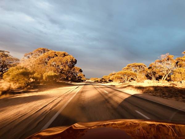
Don’t drive at night
With a long journey ahead, it can be tempting to save some time and keep driving after sundown. But don’t do it! Night driving on the Nullarbor’s best avoided. Why?

First, because this is when various Australian animals come out to play. Kangaroos, for instance, will appear from nowhere and jump right across the road in front of your car. Hitting one at night in the middle of nowhere would be bad news for both you and the ‘roo.
Second, because road trains (more on these next) often do choose to continue their cross-country journeys throughout the night. Trying to keep clear of these enormous vehicles wouldn’t be fun when you’re tired from a long day behind the wheel and visibility’s limited due to the darkness.
Be wary of road trains

Imagine trucks so big they resemble trains! These “long combination vehicles” haul freight all over Australia (often through some of its remotest and most inhospitable areas) and are without a doubt the biggest vehicles I’ve ever seen on the road. They’re also renowned for being somewhat brutish, hurtling at high speeds down highways and expecting whoever’s in their path to move out of the way!
It can be a bit like this on the Nullarbor. Notice a road train speeding up behind you? Move over to let them pass. This may mean coming to a complete standstill in the dirt beside the bitumen sometimes, but it’s better than having them speed up on you and risking a collision! Play it safe, give them a wide berth, and you’ll be fine.
Expect higher prices
The remoteness of the Nullarbor Plain means that the roadhouses have a monopoly on fuel and supplies. The result?
It’s gut-wrenchingly expensive! Expect things to cost 2 to 3 times more than they would elsewhere in the country. Save yourself some money by stocking up on drinks, snacks, and fuel beforehand (taking a jerry-can or two extra just in case of emergencies).
Download WikiCamps

Planning to free camp in your van, car, or tent along the way? Download an app called WikiCamps to your smartphone or tablet. I used this awesome app throughout my travels in Australia. It may cost a few dollars to install, but it’s worth the investment! WikiCamps will show you all of the most viable places to stop for the night, complete with reviews, photos, useful insights from past campers, and more.
Mobile service is unreliable at best (and non-existent at worst) on the Nullarbor! You’re likely to have more luck with Telstra than other providers, but you should still expect to struggle for signal at times. This could be problematic when you’re searching for camping spots! Try downloading offline versions of Google maps and/or carrying an actual physical map (remember those?!), just in case you have no signal when you need it.
Time to Cross the Nullarbor Plain

Crossing the Nullarbor was a highlight of my time in Australia. Sure, it was scorching hot, mind-numbingly featureless, and I had a close encounter with a deadly brown snake.
But that section of my trip was so different, unique, otherworldly and adventurous that it’ll hold a special place in my memory forevermore!

About the Author Danny Newman is a travel writer and blogger from the UK.
Follow his adventurous journeys around the world as a digital nomad and discover what he’s doing next on What’s Danny Doing .
I hope the insights in this article have been useful if you’re planning a similar journey across the Bor in the future. Keep them in mind and, with any luck, you’ll enjoy a smooth, happy, and uneventful time as you travel across this remarkable part of the world.
Related Posts on Adventurous Destinations
The Best 2 Week East Coast Australia Itinerary

For this East Coast Australia itinerary we begin our journey in Sydney and travel right up to Cairns.
You can do it in 2 weeks visiting the major tourist spots or add more destinations along the way.
Read more… / Leer más…
5 Things To See And Do In Kenya (a week of beach & bush)

Where should you go if you’re on holiday in Kenya for a week or two?
Kenya is synonymous with safari but there are lots of other things to do. This is our selection of the best sights, 5 must-see places to visit in Kenya, a contrast of bush & beach adventure.
Best Places to Visit in Kolkata for 2 Days, India

Planning a future trip to India and want to see Kolkata?
Then follow our insider guide, a 2 day itinerary which explains the best heritage sites and how to get to the main places of interest in this fascinating city.
Poon Hill – Amazing 6 Day Annapurna trek, Nepal

Our Himalaya trek through the Annapurna foothills
The trail was flatter for a while, winding through forests which are bright with Rhododendron blooms in spring. After an uphill stretch we reached Ghorepani, the village that lies under Poon Hill.
7 day adventure from Cuzco to Machu Picchu, Peru

A 7 day adventure from Cuzco through the Sacred Valley to Machu Picchu (Peru).
Machu Picchu is one of the new 7 Wonders of the World! Peru’s most treasured site, one of the most spectacular places on the planet and a must-see on our world trip!
Leave a Reply Cancel reply
Your email address will not be published. Required fields are marked *
Save my name, e-mail, and site URL in my browser for next time I post a comment.
Recent Posts
- 1-Day Rome Itinerary: How to See Rome and The Vatican
- Travelling On The Greenland Coastal Ferry, Sarfaq Ittuk
- Why Visit Greenland: A Once In A Lifetime Travel Experience
- A Day In Siena (Walking Itinerary + Map 2024)
- Why Visit Pisa (Easy Itinerary To See Pisa, Italy)
The Nullarbor
An endless expanse of desert scrubland stretching towards the horizon, the Nullarbor is one of Australia’s most eerie and otherworldly landscapes. Look more closely though, and you’ll find dramatic cliffs and secluded beaches, colourful wildflower carpets and quirky attractions. Whether you explore at your own pace on an epic road trip, or travel in style on the Indian Pacific train, the Nullarbor will live long in your memories.
With a name that means ‘no trees’, the vast, arid Nullarbor spans 1,200 kilometres across the southern edge of Australia, connecting the West Australian goldfields town of Norseman – an eight-hour drive from Perth – with Ceduna on South Australia’s Eyre Peninsula.
As you gaze along Australia’s longest, straightest, flattest road, the air seems to shimmer. Pause to visit granite outcrops and Eucla National Park’s sweeping sand dunes, and spot spring wildflowers after the rains. Peer over the edge of towering sea cliffs into the crashing waves of the Great Australian Bight, and feel the Earth ‘breathe’ at the Caiguna Blowhole.
The limitless plain is far from deserted, however. Wildlife abounds, and you’ll spy wild camels, graceful kangaroos and curious emus as you traverse the scrubland. Visit Eyre Bird Observatory, Australia’s first bird observatory, to spot silvereyes, Major Mitchell’s cockatoos and honeyeaters.
Home to larger-than-life personalities and traditional outback roadhouses, the wide open spaces of the Nullarbor also host some one-of-a-kind attractions. See the remains of the fallen US Skylab at Balladonia , or play a round on the unforgettable 1,385-kilometre Nullarbor Links , the world’s longest golf course.
Then, as night falls, stare into the velvety night sky and spot endless twinkling constellations of jewel-like stars.
Tourism Western Australia acknowledges Aboriginal peoples as the traditional custodians of Western Australia and pay our respects to Elders past and present. We celebrate the diversity of Aboriginal West Australians and honour their continuing connection to Country, culture and community. We recognise and appreciate the invaluable contributions made by First Nations peoples across many generations in shaping Western Australia as a premier destination.
- Skip to main content
- Skip to footer
Cut Lunch Adventures
TREK | LEARN | ENJOY

Australia: Nullarbor Road Trip – Flat as a pancake, as far as the eye can see
Published February 2017 by Trevor . Updated December 2019 .
Introduction
Local flora and fauna, heading from east to west, heading back home – west to east, broken hill and mad max, anzac centre, karri trees and pinnacles.
I first did the Nullarbor road trip back in 1978 travelling from the West coast of Australia to the East coast and back again. Some 40 years later, nothing has changed. However, it’s never boring.

It had it all. Long straight roads (the straightest section is around 146km/91mi). Lots of native Australian wildlife consisting of kangaroos, wombats, emus, rabbits, wedge tail eagles and camels. The camels came courtesy of the Afghans who brought them out during the gold rush days of the 1800’s. Plus pesky flies which appeared out of nowhere when you stop alongside the road, obviously looking for a ‘good feed’. Oh well, at least this allowed us again to practice the great Aussie salute.

My partner had just become an Australian citizen. So I thought it was timely to formally introduce her to the ‘great Aussie road trip’. With a few months of planning, we set off from Sydney on a crisp but nice sunny morning. Heading in a westerly direction, we plotted a course: Sydney-Mildura-Streaky Bay-Eucla-Esperance-Albany-Margaret River-Perth.

After a few days break, we headed East back home to Sydney: Perth-Kalgoorlie-Eucla-Port Augusta-Broken Hill-Dubbo-Sydney. In total, we covered around 10,000km (6,214 mi). Surprisingly, time went quick and it was loads of fun – at least I didn’t have to listen to Barry Gibb and that Bee Gees tape all over again like I did on my first trip.

The people encountered along the way, conversations you have at the local bar of a hotel coupled with the food were simply amazing (read Aussie Rules football, chicken schnitzel’s and beer). There is definitely something to be said about genuine country folk and the local grub.

The added bonus of such a road trip wouldn’t of course be without viewing first hand where the Mad Max films were made. Plus visiting the famous artist Pro Hart’s gallery in Broken Hill; hanging out at the largest open cut gold mine in the world in Kalgoorlie; viewing the remnants of Skylab that fell over Balladonia (US Space station that broke up on re-entry over the outback of Western Australia); playing the longest golf course in the world and walking along the majestic coastline of Esperance with it’s icing sugar white sand that squeaks between your feet and lots off granite islands as far as your eye can see.
We also enjoyed many natural sites and some unnatural. Such as viewing whales and their calves frolicking 50m from the huge limestone cliffs just off the road along the Eyre Peninsula and witnessing wedged-tail eagles with the road kill from the passing road trains.

We also visited the National ANZAC centre in Albany where soldiers from Australia and New Zealand (some 41,000) gathered in the port city in 1914 to set sail in a convoy of ships to the Mediterranean during the First World War. Sadly, for a majority of them, this was the last time they ever got to see the shores of Australia.

We marvelled at the towering Karri trees of the Western Australia State Forrest, sampled the famous red wines from Margaret River, saw the famous Pinnacles north of Perth where the weathered rock spires rise out of yellow sand dunes. Of course no road trip would be complete without having your fruit seized at a local fruit quarantine check point in South Australia (fruit fly zone).
The trip was finally topped off by bumping into a bunch of road bikers heading up through central Australia on their way to Cairns, Queensland via the infamous Birdsville Track. Only to discover that during a conversation you went to school with them some 40 years earlier (we had only changed slightly). It really is a small world after all.
Onwards and upwards!
- Head off before dawn if you can. It’s the nicest time of the day with the sun rising in the East, plus it’s cooler that way in the hotter months (December to March).

- Watch out for Kangaroos, especially the hour before dawn and after the sun sets at night. They can be easily startled in your headlights and you don’t want to hit one at high speed. Least of all it could mean the end of your trip – for you and the kangaroo.
- Road trains are encountered regularly along the Eyre Highway (towing sometimes up to three trailers) as well as the numerous ‘grey nomads’ towing a caravan or trailer. Be careful to allow space and distance in passing and don’t forget to wave to oncoming traffic – an outback Aussie tradition.

- Fuel and bottled water is readily available, but be careful of the section between Balladonia and Caiguna. This section includes the longest straight stretch of road in Australia and one of the longest in the world. The road stretches for some 145.6 km (90.5 mi), signposted and commonly known as the ’90 Mile Straight’. Obviously, the further you are away from a major city or town centre, the cost of fuel will increase but on our trip the most we paid was around $1.80 AUD per litre (unleaded petrol), but have seen it as high as $2.30 AUD per litre – diesel is much more expensive.
- Autumn and winter months (April-August) are the best times to travel across the Nullarbor as the Summer months (December-February) can be very hot (40 plus degrees Celsius/104 degrees Fahrenheit). If you do choose to drive across during summer, take extra water with you.

- Accommodation is basic and can be expensive by local standards. Unfortunately that’s what you get for staying in a remote area.
- Located near the Nullarbor Plain in Western Australia’s far east coast, the Head of the Bight is one of the best whale-watching sites in the world – 20km (12.4mi) to the east of Nullarbor Roadhouse. It’s known for its impressive land-based viewing of whales migrating up from Antarctica. During whale season, pods of 70-tonne Southern Right Whales and their calves can clearly be seen frolicking along the cliffs.
- Also, during the whale migration season, it’s not uncommon to see other Southern Right Whales (watch out for their water-spout) coming along the Eucla Highway, heading towards/away from Norseman as the road runs parallel and close to the coast for around 50km (31mi).

- The Nullarbor Plain is part of the area of flat, almost treeless, arid or semi-arid country of southern Australia. Located on the Great Australian Bight coast with the Great Victoria Desert to its north.
- Now, about those Camels. Another unknown fact is that Australia is the largest exporter of camels to the Middle East for racing purposes. Now there’s a juxtaposition if ever I’ve heard one.
- If you want to read more on the outback of Australia, see our post on Uluru.
Share this:
If you liked this post you may also like ….
- How to Prepare for a Trek
- 12 Tips to Build Mental Toughness for Your Next Trek
- High Altitude Trekking Tips
- Life Changing Adventure
- Self Discovery
- Trekking Gear Lists
- Trekking Tools & Calculators
- Trekking and Mountaineering Insurance
- Guide to Successful Adventures
- Ideas for Your Next Adventure
- Trek Finder Wizard
- Trekking for Beginners
Other Posts by Destination …
Other posts by topic ….
Join our mailing list for latest tips, ideas and inspiration.
Want to get the most out of your next adventure?
Download the Adventure Project Guide to help you achieve adventure success!
This subscribes you to our mailing list for more tips and ideas.
Want to be well prepared for your trek?
Download the Trek Ready Cheat Sheet to set you up for success!
Need to know what to take on your summer hike?
Download the Summer Hiking Gear List to help you get ready!
Need to know what to take on your winter hike?
Download the Winter Hiking Gear List to help you get ready!
Want to be well-prepared for your next trek?
Download the Yak Pack to help you prepare your gear, fitness and mental toughness!
Need to know what to take on your trek?
Download the Trekking Gear List to help you get ready!
Perth to Adelaide Road Trip: Across the Nullarbor Plain in 10 Days
A Perth to Adelaide road trip is a once-in-a-lifetime experience. Crossing the Nullarbor isn’t something you will soon forget.
Table of Contents
Especially not when you did it with mono like I did.
From the Latin nullus arbor meaning “no tree,” this arid limestone desert runs parallel to the Great Australian Bight for close to 1,700 kilometers.
To those who haven’t crossed it, traveling along Nullarbor and Australia’s Great Southern Ocean is often thought of as “the Nullar-boring.”
In fact, when I told people I planned to take on this stretch of highway devoid of anything and everything interesting (their words, not mine), I almost started feeling like I was convincing people about my vacation choices.

Like I had to justify my holiday to them.
But really, where else can you get an idea of just how vast the Australian continent is?
Crossing the Nulla from Norseman (Western Australia) to Port Augusta (South Australia) along the sizzling Eyre Highway takes two days minimum. Prepare for haunting, beautiful monotony – abandoned sheep farms, Outback pubs, plains stubbled with saltbush – broken up by strange anomalies.
You’ll get to stand at the bottom of the world and look straight out towards Antarctica (no, you can’t see it on a good day), test your limits by bush camping and digging your own toilet, and encounter snakes , dingos, and friendly wombats in their natural habitat.
If you’re brave enough, you might even find yourself in a cage face-to-face with a great white shark (or two!).

This post is a part of my Outback Road Trip series.
I’ll walk you through each day of this adventure tour from Perth to Adelaide across the Nullarbor Plain.
There will be tips and personal stories throughout, but each day will have a summary at the top of each day for all my skimmers out there.
Also, before you book, read up on how to get this tour for up to 20% off the total price.

Even if you are more interested in doing a self-drive tour of the Nullarbor, this itinerary is pretty solid and easy to follow for couples and families. You can also easily do the trip in reverse from Adelaide to Perth both on your own, or with the same tour company.
Book your Perth to Adelaide Road Trip here .
Perth to adelaide road trip day 1: rabbit-proof fence, wave rock.

Accommodation
Swag camping with facilities
Nullarbor Plain Road Trip Included Activities
Rabbit-proof fence, Wave Rock
The total driving time today is around 10 hours and approximately 600km. The total walking distance is approximately 1km.
Meals Included
Lunch/Dinner

This tour starts in much the same way as any other bus tour. It was early morning outside the Perth YHA.
As the pickup time approaches, more and more people appear outside the hostel, nervously making eye contact and shyly asking “Are you on the tour?” before the next most-asked travel question, “Where are you from?” Seriously, people often know I’m from Texas before they even know my name when I’m traveling.
My new friends and I, mostly young women traveling alone, although there was one older gentleman and one retired couple, sat in the bus in near silence as our friendly tour guide, Chris, tried to get us excited despite the early wake-up call.

He was honest with us. This tour was a lot of driving. Untamed Escapes had gone out of their way to make sure we got to see as much “cool stuff” in between as we possibly could, but there was no way around it. We were in it for the long haul.
As we left Perth behind, I was surprised by just how quickly things went from urban to bush. But this tracks, as Perth is the most isolated city in the world. Perth is just under a 4,000-kilometer drive from Sydney (clear across the continent!) and the nearest city is Adelaide…which is still a three-hour plane ride (not drive!) away.

And we were driving it.
We continued to head east from the city over the Darling Ranges and stopped for morning coffee and a bathroom break at Western Australia’s oldest inland town, York.
Then, the first real stop was near Wamenusking to check out the rabbit-proof fence.
What is the Rabbit-Proof Fence?
In the early 1900s, the government built a fence that stretched over 1,800 miles through Western Australia to keep rabbits out of farming areas, as they were an invasive species that were reproducing rapidly and harming crops. The fence also happened to run through areas where many Aboriginal communities lived.
Around the same time, the Australian government began a policy of forcibly removing Aboriginal children from their families and placing them in institutions or with white families. The idea was to assimilate them into white society and eliminate Aboriginal culture. This policy became known as the Stolen Generations and it had a devastating impact on Indigenous communities.

In 1931, three Aboriginal girls, Molly Craig, Gracie Fields, and Daisy Kadibil, were taken from their families and sent to the Moore River Native Settlement, a government-run institution. The girls were determined to escape and make their way back to their families, who lived hundreds of miles away. They followed the rabbit-proof fence, which led them north, back to their home in Jigalong.
Their journey took them 9 weeks and covered over 1,000 miles. They faced hunger, thirst, and the danger of being caught by authorities, but they persevered. The story of their journey was made into a book by Doris Pilkington, Molly’s daughter, called “Follow the Rabbit-Proof Fence,” and was later turned into a movie .

The Rabbit-Proof Fence is now seen as a symbol of the resilience and determination of the Aboriginal people in the face of government policies that sought to erase their culture and identity.
It was really powerful to see it in person.
What is Wave Rock?

The next stop is Wave Rock for a picnic lunch. At the time of year I went, the outback flies were out in full force. I had a fly net, and it was a fun challenge trying to get my sandwich into my mouth under the net without picking up some extra protein along the way.
After lunch, we had about an hour to enjoy Wave Rock from all angles, including a short walk that goes along its top.

The rock is about 14 meters high and over 110 meters long, and its shape resembles a large ocean wave that has been frozen in time. The wave-like shape was created over millions of years by the slow erosion of the softer rock beneath the surface, which left the harder granite rock exposed.
Wave Rock is also significant because of its cultural and spiritual importance to the local Indigenous people. The rock is located in an area that is traditionally owned by the Ballardong Nyoongar people, who have lived in the region for thousands of years. They believe that the rock was created by a spirit known as the Rainbow Serpent, who is a significant figure in Aboriginal mythology. The rock is also considered a sacred site and is used for traditional ceremonies and gatherings.

In addition to its natural and cultural significance, Wave Rock is also significant for scientific research. The rock has been studied by geologists and other scientists who are interested in understanding the geological processes that have shaped the landscape of Australia.
Fitzgerald River
We stopped at a candy shop in Ravensthorpe and I picked up a few treats. I would always recommend buying some treats wherever you can. If you’re not much of a camper (like me!) it helps to take the edge off.

That evening, we pulled into camp and set down our swags and backpacks.
Each night, Chris laid a tarp down on the ground, so our bags wouldn’t get wet. We took them out of the trailer behind the bus and placed them on the tarp, so we could get what we needed out of them easily. While we brought our own sleeping bags and travel pillows, the company provided swags, or Aussie sleeping rolls, for us.

Chris placed a piece of duct tape on each one and we wrote our names on it. This way, we got the same one every night because we left our sleeping bags rolled up inside of them.
Chris took some of the group on a hike up East Mt. Baron, but I didn’t feel well and wasn’t up for the walk. Instead, some of my new friends who preferred a more low-key evening watched the sunset on the beach. I kept my fly net on. Just in case.
Perth to Adelaide Road Trip Day 2: Esperance, Cape Le Grand

Esperance, Cape Le Grand, Lucky Bay
The total driving time today is around 2.5 hours and approximately 250km. The total walking distance depends on if you join the hike or not.
Breakfast/Lunch/Dinner
After packing up camp, Chris really kicked our next day on the Perth to Adelaide road trip off with a bang by bringing a slithery friend aboard the bus. This was, of course, after he rescued him from being squashed on the highway.

After returning our new friend to the bush, we took the coastal route into Esperance for a grocery shop, an iconic oceanic wonderland. From there, we set up camp for two nights at Cape Le Grand. This is home to the famous Lucky Bay. You’ve likely seen the photos on social media of people sitting on a white beach, backed by bright blue water, with kangaroos.
But for real.
Crystal blue water, rugged walking trails, and the whitest sand in the land – Cape La Grand National Park has it all.

Unfortunately, the roos weren’t really on the beach much during our visit. Instead, they were just a short walk away up in the campground. However, the landscapes were stunning even without the social media shot.
We all did some swimming in the early afternoon, then did a few short hikes at other nearby bays, like Hellfire.

Overall, this day was very laid back. We cooked dinner back at camp (there were a few picnic tables to eat at from what I can remember) and had a good time swapping stories as a group.
I was glad I booked a tour instead of doing this on my own (even with a friend or two) because we had already covered so much ground this early on the trip.

I feel like with all the driving, I would have been too tired to enjoy anything else. At least this way I could rest in the car.
Everyone else had the same idea, too.
Perth to Adelaide Road Trip Day 3: Cape Le Grand

Cape Le Grand National Park
The total driving time today is around 10 minutes (you stay in the park). The total walking distance depends on how many hikes you do, anywhere from two to four hours.
I was pretty tired when I woke up on day three, as were some of the other girls. While Chris took the more adventurous in our group off to hike nearby Frenchman’s Peak, the rest of us stayed around camp. We played card games, took showers, and some of us even went back down to the beach to see the kangaroos.

By this point in my overland camping trip, I felt pretty used to sleeping in a swag. I had my first night in one while traveling from Darwin to Broome and then became a certified pro from Broome down to Perth.
Basically, a swag is like a fancy sleeping bag. As you can see, the outside is a tough canvas material. Inside, there is a thin mattress. You put your sleeping bag inside the canvas and on top of the mattress, then zip yourself in like a bug in a rug. I didn’t have a pillow (too much to carry honestly), so each night I just put my sweater on top of my small daypack and that worked.
In the grand scheme of things, it was pretty comfortable. It also zipped up tightly so I could make sure I didn’t have any visitors in the evening. It was pretty chilly, so snakes and spiders weren’t too mobile anyway…and it also didn’t get too hot. In the morning, you roll it up and secure it with straps, just to make sure nothing else gets cozy in it during the day while you’re gone.

This was the compositing toilet near our campsite. There were flushing toilets near the women’s shower as well, but you just had to walk a little bit further to get to this.
Make sure you take a shower at Cape Le Grand because you won’t be able to for the next few days as you cross the Nullarbor Plain and wild bush camp.

When the rest of the group got back from hiking Frenchman’s Peak, we had lunch ( a standard menu of pits wraps, lunch meat, and veggies) and headed off for a few more hikes around the area. We also finally got to meet some of the famous Lucky Bay kangaroos.
The girls who went on the hike said it was about 262 meters in elevation and they were treated to sweeping views of the Recherche Archipelago.

I don’t have any food in my hand, although this little guy (or gal IDK) thought that I must have.
Remember, never feed a wild animal. No matter how cute they are.
Perth to Adelaide Road Trip Day 4: Across the Nullarbor

Swag camping along the Nullarbor (no facilities … yep…not even a toilet)
Nullarbor Plain, 90-mile straight, Balladonia Museum
The total driving time today is around seven hours and there isn’t much walking.
The day you’ve been waiting for is finally here! It’s time to start crossing the Nullarbor Plain.

Nullarbor means ‘no trees’, which explains the lack of greenery along the 1,200-kilometer road. And for some reason, it was one of my “must-dos” while on my working holiday in Australia. Seriously, the idea of driving across the country’s longest, straightest road really got me revved up.
What is the Nullarbor Plain?

I am SO glad you asked.
This massive, dry-as-a-bone region of Southern Australia is made up of limestone bedrock. It’s like, 200,000 square kilometers huge and runs across the border of two Aussie states: Western Australia and South Australia. This place is notorious for its flat landscape that looks like something out of a post-apocalyptic movie – barely any trees or plants around.
But don’t worry, it’s not all barren – you’ll find some cool and unique species of animals and plants that have adapted to the harsh environment. Like wombats! And even a dingo or two.

And get this – there’s even a golf course that spans the entire region called the Nullarbor Links. It’s the longest golf course in the world, stretching over 1,365 kilometers from Kalgoorlie in Western Australia to Ceduna in South Australia. While I am not much of a golfer myself, it was fun passing each of the 18 holes along the way, as they are themed.
We also stopped off at the Balladonia Museum on our way across the Nullarbor.
The Balladonia Museum is a small museum located in the remote town of Balladonia, which lies on the edge of the Nullarbor Plain in Western Australia. The museum is famous for its association with one of the most significant events in Australia’s history : the re-entry of the American Skylab space station in 1979.

On July 12, 1979, Skylab’s debris fell to Earth, and a large piece of it landed in the town of Balladonia. The local authorities quickly retrieved the wreckage, and it was stored in a shed behind the Balladonia Roadhouse until the American government sent officials to retrieve it.
In 1983, the shed was turned into a museum to commemorate the event, and the Balladonia Museum was born. Today, the museum features a variety of exhibits related to the town’s history , including displays about the Nullarbor Plain, the local wildlife, and the story of Skylab’s re-entry.
While the museum’s association with Skylab’s crash landing is undoubtedly its main draw, the Balladonia Museum has become a significant cultural and historical attraction for visitors to the region.
We didn’t get to go inside, but did stop for a bathroom break here, so it was cool to see. If you are driving yourself across the Nullarbor, I think you could budget at least an hour to poke around here.

Then it was time for one of the tougher nights on the trip. True outback camping. As the sun began dipping farther and farther down towards the horizon, Chris came on over the loudspeaker.
“Hey guys, I know it’s getting dark, but I’ve been doing this for years. I am going to find a great spot. I need you to trust me, ok?”
I did trust him. But the idea of just kind of … pulling over on the side of the road and making camp there was entirely new to me. But that’s what we did.
Chris found this little road, probably a fire trail, he said, and pulled the bus in.

It had all the elements of a good bush camp:
- close enough to the road to get help in an emergency
- far enough away from the road that no one would crash into us or bother us (rob us? I’m not really sure what he meant by that)
- on a bit of cleared bush which made for softer sleeping.
We had to work quickly, as dusk was falling and we needed to set up camp and cook dinner. By this point, we were a well-oiled machine. We all had jobs and knew who set up the table, who helped Chris cook, who unloaded the trailer, etc.

But then it started to rain.
I really wasn’t feeling well at this point in the trip, either. Back in Perth, I had been diagnosed with tonsilitis and given some antibiotics. Unfortunately, I didn’t actually have JUST tonsilitis…I had mononucleosis (called glandular fever in Australia), so my antibiotics were actually making me sicker.
I just didn’t know it at the time. What I did know is that I was crouched about 20 feet from camp, peeing in the rain, crying.
And then someone saw a brown snake.
We had a quick briefing: don’t go too far from camp to use the toilet and bring your toilet paper back with you to throw away. Take the shovel if you plan to go #2. Somehow, I didn’t ever need to do this while crossing the Nullarbor. In an unfathomable turn of events, my body actually did me a real solid by only giving me the urge to take care of business each morning when we stopped at a roadhouse to get gas for the van.
It was seriously a miracle.
But back to bush camping: if you get lost coming back from the toilet, just stop walking. If you don’t come across camp in a minute or two, seriously just stop. Wait until the sun comes up and then you’ll be able to find your way back easily if you haven’t walked too far.

If you walk for a while trying to find camp, when the sun comes up, you might be long gone. You might even have walked over the edge of the Great Australian Blight to your death. Really great to think about, I know.
Luckily, we had tents with rain covers, so I stayed mostly dry. I was able to sleep a little bit, but was still so, so glad when morning came.
Perth to Adelaide Road Trip Day 5: Across the Nullarbor

Bush camp OR swag camping with facilities…I guess it depends on how far you get across the Nullarbor that day. We bush camped again, but the website says you get to go to a campsite. Maybe we just made bad time.
Nullarbor Plain, Great Australian Bight, Eucla
The total driving time today is around 7 hours. Not much walking.
Timezones can be a little bit haywire across the southern coast of Australia. Adelaide works on Central Standard Time, Perth has Western Standard Time (which is an hour and a half behind) and then there’s Nowhere Standard Time, which applies to towns on the SA/WA border. Throw daylight savings times into the mix and you’re got an extra hour of confusion (but is that earlier or later?).

So today, when you cross into South Australia, prepare to feel a little bit confused and a lot bit jetlagged. When we crossed the border, Chris played a fun game with us where he passed out paper cups and filled them with a bit of water.
We all placed them on our heads and the last one to keep theirs balanced, won.

I think the prize might have been to sit up in the front seat, as it was the most comfortable in the house. Unlike other bus tours I’d been on where the first seat you sat in was yours for the duration of the tour, this group liked to play musical chairs a bit.
I’ll admit, this did stress me out.
And I also didn’t win the cup game.

Just before we crossed the border, we did stop for lunch next to a large tank of non-potable water. Chris probably saved about ten lives in the 30 minutes we stopped off because a few different caravans pulled up and were planning to refill their water reserves with it. We were sure to leave our mark on the tank, along with a small warning for those who came after us.
Can you spot what I wrote?

Why visit Eucla, Western Australia?
The town was established in the late 19th century as a telegraph station to connect Western Australia with the rest of the world. It was also an important stopover point for travelers crossing the Nullarbor Plain.

Today, Eucla is a small community with a population of around 50 people. It has a hotel, a roadhouse, a museum, and a golf course. The town is also known for its unique landscape, which is dominated by sand dunes and limestone cliffs. The area is home to a variety of wildlife, including kangaroos, emus, and wedge-tailed eagles. We didn’t see one in Eucla, but we did see one a few hours down the road, so they are definitely around.

One of the most interesting features of Eucla is the Eucla Telegraph Station Ruins. This historic site is a reminder of the town’s early days as a telegraph station, and it provides visitors with a glimpse into the past. The ruins are located on a hill overlooking the town and offer spectacular views of the surrounding landscape. It was hard walking up there, but worth it for the glimpse into history!
Next, it was time to cross the border, play our game, and see the game changer.
The Great Australian Bight

It’s like standing on the edge of the world.
Great Australian Bight is a bay that stretches over 1,160 km along the southern coast of Australia. It’s kind of like the White Cliffs of Dover in the UK. From a distance, you wouldn’t even know there is a cliff and then suddenly you’re there and all you can see is the ocean.
The Bight is home to a variety of incredible natural and cultural sites, including the largest population of Australian sea lions in the world (more on this in a bit). It’s also a breeding ground for southern right whales, humpback whales, and other majestic marine mammals. And let’s not forget about the fascinating Indigenous history, historic lighthouses, and shipwrecks that dot the region.

However, there’s also been some controversy lately. Some people want to drill for oil and gas in the area, but environmental groups are worried about the potential impact on the marine environment and local fishing and tourism industries. It’s a debate that’s still ongoing.
I was glad that I saw something so beautiful with my own two eyes because camping that night was one of the worst nights of my life.
If you’re good at camping, it probably would have been easy for you. But I am not typically a camper, so this was well out of my comfort zone.
As we crossed the final bits of the Nullarbor Plain and started inches back toward civilization, the sun betrayed us. It fell to the horizon a lot faster than any of us really expected. Suddenly it was almost dark and we needed to make camp.

As per usual, Chris drove until he found a spot that he felt was safe for us. This time, it was near an abandoned quarry. Yet tonight, it wasn’t cold and rainy. It was hot and windy! This day was wild because I didn’t know that “windy” could be a forecast, but gosh, I almost got picked up off the ground.
There was so much dust and someone saw a scorpion, so I pitched a tent even though my tentmate from the previous evening just wanted to sleep in her swag.

So I slept in the tent alone, but I wasn’t heavy enough by myself to keep things put, even sleeping diagonally.
The temperature soared (the mono I was cooking up, but still didn’t know I had also decided to really come out in full force this night) and the wind tried to carry me away à la “Wizard of Oz.”
I had never been so glad to see the sunrise.
Perth to Adelaide Road Trip Day 6: Sandboarding and Bucket Showers

Sandboarding, Ceduna Arts and Cultural Centre
The total driving time today is around 9 hours and approximately 600km. Not much walking.

Unfortunately, the wind never really died down. My tent tried to fly away in the wind as I was packing it up and as we inched along the highway, the can rocked back and forth.
The wind wasn’t quite strong enough to blow the absolutely insane amounts of roadkill off the highway. I was baffled! Although our group had kept a tally of the number of flies we killed so far on the trip, this was nothing compared to the dozens of kangaroos we passed, splattered across the pavement.

The Nullarbor is bisected by the Eyre Highway, which is the only major road linking Western and South Australia. This means that there is a high volume of traffic on the road. Normally, private cars stop driving at dusk because a collision with an animal would not only kill the creature, but cause significant damage to the car as well. However, big trucks hauling goods across the continent don’t have to stop at all to maintain their safety.
So the animals pay the price.
We stopped for petrol, but couldn’t really set up our lunch station because the wind would blow it away. Instead, Chris bought us a bunch of french fries and we sat in town along the beach trying to eat them before they blew into the water, or a seagull snatched them out of our hands.

While Chris was shopping, he dropped us off for some shopping at the Ceduna Arts and Cultural Centre to hear about the styles and meanings of Indigenous artwork. The staff and artists there were fantastic, although most of the original work was a bit outside my price range.
After lunch, we were meant to go sandboarding, but this was canceled because of the weather. I wasn’t too keen on sandboarding, so this wasn’t the biggest disappointment. Hopefully, there is better weather on your tour so you can give it a try.

Finally, with the Nullarbor Plain officially behind us, we rolled into Coodlie Park Farm Retreat to enjoy a barbecue feast and roll out our swags in a unique outdoor hut. I remember sleeping so well this night because it was chilly and being raised off the ground like this made me feel really safe from any snakes lurking nearby (not that there were any…but I’m paranoid).

This was a fun night because it’s actually the home base/headquarters of the company! We got to meet the tour coming the opposite way from Adelaide to Perth and have dinner with them. It was a blast to meet new folks. Plus, we bought t-shirts. I still wear mine all the time.
It was also amazing to have a shower after almost three days of being out in the wilderness. Writing that sentence makes me feel like the world’s biggest baby, but it was such a big deal to be at the time.

Even if we did have to fill up a bucket with lukewarm water, walk it to the shower, and turn it off and on in between sudzing up because we were only allowed one bucket each.
In that moment, it felt like heaven.
Perth to Adelaide Road Trip Day 7: Swim with Dolphins

Swag camping with facilities … but I stayed in a hostel this night along with a few of my tourmates.
Swimming with dolphins and sea lions (optional)
The total driving time today is around 4.5 hours and 400km. Not much walking, but some swimming!
This day on the Perth to Adelaide road trip was actually a blast! It started out great with a chance to swim with wild sea lions and dolphins on a 3-hour cruise in the sheltered waters of Baird Bay. It was an extra cost, but I would definitely recommend splashing out on it. It’s operated by Baird Bay Eco Tours. I really enjoyed getting to see the dolphins up close. They were curious enough that I feel like we got some good interaction time.

It was also a great way to swim with sea creatures ethically. The guides didn’t chum the waters or anything and we were not allowed to touch the animals. We also went out into their natural habitat to see them, instead of feeding them at SeaWorld or swimming with them in a roped-off area in the Bahamas. As we become more aware, it’s important to always choose ethical animal encounters in our travels.
If you don’t want to pay to go out on the boat (a few on my tour didn’t), you can stay back at Point Labatt Conservation Park, the only place on the mainland where you can see Australian seal pups playing and resting on the beach.

While I had a magnificent time out on the boat, by the time I pulled myself in and out of the frigid water, swam about, and made it back to shore a few hours later, I was sicker than ever.
My tonsils were now the size of golf balls (a common symptom of mono, I later learned) and I had never felt so tired. At this point, I had been taking my antibiotics faithfully twice a day, so I thought I just must be run down from camping too long (I had been on the go for over a month now, from Darwin to Perth via Broome and now across the Nullarbor).

After a quick lunch and goodbyes to the tour traveling in the opposite direction as us, we went to Elliston, South Australia for a short coastal drive and to pick up some dinner.
I was covered in salt water and sick as a dog. It started raining and was quickly becoming dark.
“I know it’s not looking good out there folks, but I need you to trust me! Tonight is going to be good.”

Except I was at my breaking point. I knew we were meant to head to Mikkira Station to set up camp for two nights. This private property is home to the Eyre Peninsula’s only wild koala population, with around 170 koalas and lots of kangaroos and emus calling Mikkira home.
But the shower was quite a walk from the camping area. Everyone would be sleeping close together under a small metal structure.
So I asked Chris if he could drop me off at the YHA in town for the night so I wouldn’t have a mental breakdown. He agreed, since he was swinging back through town in the morning. He named a few activities I would miss, but I didn’t mind. In the end, five of us opted to stay at the YHA.

I am so thankful for Chris’ flexibility here because if he hasn’t been willing to drop us off and come back in the morning, I would have 100% have had a mental breakdown and had to leave the trip. I was feeling too sick and needed a night in a warm bed. I remember almost crying when the woman at the desk was so kind. She arranged for the couple to stay in a private room, the gentlemen to bunk in a mixed dorm, and three of us ladies who booked in had an eight-bed en-suite to ourselves.
The Port Lincoln YHA was honestly one of the nicest hostels I’d ever been to. I did a load of laundry, took a long, hot shower, and got almost 9 hours of sleep in a fluffy bed. We even went out for beer and pizza at a nearby restaurant.

When we came back to the hostel and watched the sunset, I felt like I was a new person. I was ready to finish my Perth to Adelaide road trip.
My tonsils were still causing me severe breathing problems, but everything was sorted. If your mind is strong, you can get through anything and this is the brain break my mind needed. This was the trip of a lifetime, yet without this interlude, I wouldn’t have been able to enjoy it.

Perth to Adelaide Road Trip Day 8: Shark Diving and Seafood

The total driving time today is about 2.5 hours unless you are doing the sharks experience, in which case it is only 1 hour. Not much walking.
The next morning, I slept in. Chris contacted us via text (god bless free hostel WIFI) to let us know when he would be by. I remember calling my family and watching a little TV in the common room. It was heaven. While we were away, the rest of the group explored the natural highlights of Port Lincoln and its surroundings, including the rugged Whalers Way and white sandy beaches of Coffin Bay National Park.

When Chris came to pick us up, we greeted the rest of our friends and set off to properly explore Port Lincoln, Australia’s Seafood Capital . We went to a fancy restaurant near the beach so anyone who wanted to try fresh oysters could. Chris also explained how the beaches in the area were used as the last point of refuge in bushfires.
Bit of a spooky timing, since the Black Summer bushfires started shortly after that conversation.

This is also the day that if you want to do Great White Shark diving, you’d do it instead. It’s an extra cost, but your tour guide can book it for you. Chris asked around a few days in advance, but none of us were up for it. If you are doing a self-drive Perth to Adelaide road trip, the YHA (or any travel agent) can get you sorted in Port Lincoln.
After a full day of exploring, we went back to Mikkira Station for a camp dinner and a rest.

Here you can see the metal structure that you can sleep under if you want a bit of shelter. It felt a bit crowded in there for me, so I chose to sleep outside under the stars. The ground was still a bit damp from the night before, so Chris gave us a tarp to put down so our swags didn’t get soggy.

I was refreshed and ready to take on camping head-on. That night was amazing because I could see the haze of the Milky Way through bleary eyes.

This is the walk from the bathroom to the structure we camped. It took me about five minutes at a slow pace to walk over. You can see the bus and metal house on the left-hand side.

This is the toilet and shower block that was available to use if you wanted. But, since we were camping in a field, if you needed to pee in the middle of the night, you could just go wherever if you really didn’t want to walk all the way down here.
When I got back to civilization, not just peeing wherever was a hard habit to break.
Perth to Adelaide Road Trip Day 9: Surfing in South Australia

The total driving time today is around 4 hours and approximately 400km. Not much walking, but some swimming and surfing.
Cowabunga dudes! Surf’s Up! When you book the tour, you pay for a two-hour learn-to-surf lesson. The turquoise and calm water of Fisheries Bay is the perfect place for beginners to perfect their skills. It was my first time surfing and I feel like I nailed it.

When we got to the beach after breakfast, I, of course, felt sick. Turns out, taking antibiotics when you have a virus is horrible for you. I went off to throw up in the bushes while the rest of my team was gearing up. By the time I wandered down to the beach, only one wetsuit was left. I struggled to get it on, which was really embarrassing because I’m not the smallest person, but the teacher was so friendly.
Turns out, he knew my name since everyone had mentioned I was missing.
Just out having a good ole’ pre-surf chunder.

However, this really worked in my favor because I thrive on positive encouragement, so him using my name while teaching me and calling out “You can do it, Emily ! Stand up!” really thrilled me and pushed me to do better.
I didn’t “pop up” all the way, but I didn’t actually catch a few waves and ride them into the shallows on my knees.
Suddenly, all the metaphors about “riding the wave” started to make sense. It was a thrilling feeling.

If you don’t want to surf, you don’t have to. Some of my new friends read a book on the beach, or just went swimming. But I recommend you do it on your Perth to Adelaide road trip. I’d never felt so sporty in my life and was really proud of myself for getting out there. I’d like to go surfing again.
Then, onwards to the ancient Southern Flinders Ranges to set up camp in Mt. Remarkable National Park. I had a doctor’s appointment booked for the day after we arrived in Adelaide. It was then I would finally get bloodwork done to learn I had been fighting mononucleosis, while bush camping across the Nullarbor.
That night at Mt. Remarkable, my tonsils were so swollen I could hardly breathe. I had gargled with salt water and didn’t eat dinner because it hurt to chew and swallow. Chris confirmed I had a doctor’s appointment booked and told me to take it easy.

I was sitting on the bus, in tears because I was in so much pain. I was 26 years old at the time, but I just wanted my mom. It’s so wild how the universe works sometimes because as I exited the bus and set up my swag next to the campfire, 1/2 of the couple on the tour came to ask me how I was feeling.
It was divine timing. I tried to choke out an answer, but she took my hand, told me to lay down, and then gave me, I am not exaggerating, a 20-minute foot massage. She said reflexology is good for the soul and she hoped it helped me to heal.
I’ve never had a prayer answered so quickly in my life. Oh, you want your mom? the universe said. Here is the next best thing. I will never forget her kindness and try to pass on her blessing to others as often as I can.
Perth to Adelaide Road Trip Day 10: Pink Lake, Clare Valley, Port Germain

Whatever you decided to book for yourself in Adelaide.
Drive time today is about 5 hours.
Breakfast/Lunch
I can’t believe it’s already the last day of the Perth to Adelaide road trip! This tour was the shortest and longest of my life. First thing after breakfast, the rest of the group took a short hike at Davey’s Gully. I stayed back and read some of the informational signs at the tour head.

After the hike, Chris took us to Port Germein to have a look around.
The town was established in the mid-1800s as a port for the transportation of agricultural and mining products. It was named after the Germein family, who were early settlers in the area.
Today, Port Germein is primarily a tourist destination known for its historic jetty, which is the longest wooden jetty in the southern hemisphere, stretching 1,500 meters out into the gulf. The jetty was built in the late 1800s and was once an important transport hub for the region.

As South Australia is well known for its world-class wine, the last stop of the tour takes full advantage of this. We visited the Clare Valley wine region, world-renowned for its Riesling, for lunch and a wine tasting, and cheers to our adventure.

Then suddenly, we were in Adelaide. It was time to say goodbye to my new friends as we all ended up at different hostels.
I couldn’t believe it was over, but boy was I ready to get to the doctor.
Final thoughts on an Across the Nullarbor road trip
This Perth to Adelaide road trip pushed me to my absolute limits, but I think it’s because I was so sick. I would like to go back and do it again one day without mononucleosis to see how I do.

I loved the opportunity to see what I was capable of. My tenacity is one of the things I love most about myself. So many people get mono and can’t even get out of bed, but I went surfing for the first time! I bushed camped for two nights in the wildest bits of outback Australia. I swam with sea lions.
I am so proud of myself.
It was also amazing to see the sunset of the never-ending Eyre Highway. To see the end of Australia and stare off into the beautiful nothingness of the Great Australian Bight.

I would recommend this trip, with this company, to anyone. The itinerary was fantastic. Chris, our guide, was caring, knowledgeable, and tons of fun.
The value for money was amazing.
And most of all, I lucked out with an amazing group of tour mates.

Emily’s all over the place. She’s an expert on working holidays, studying abroad, and turning your #GapYear into a #GapLife. Learn how here .
You may also enjoy:
Australia gets cold here’s what to wear in sydney during the winter, things to do in darwin city while waiting for your tour, best things to do in fremantle, western australia, what is australian bush camping really like.
Wow! The whole road trip looks so dreamy and refreshing.
It’s definitely an amazing part of the world!
Congrats on surviving mono and your exhausting trip. You should be proud. I’d like to see that Aussie sunset over the never-ending Eyre Highway.
Thank you so much! It definitely showed me how strong I am.
Leave a Reply Cancel reply
Your email address will not be published. Required fields are marked *
Notify me of follow-up comments by email.
This site uses Akismet to reduce spam. Learn how your comment data is processed .
Past Stories
She’s a Trip contains affiliate links throughout the site. This means that if you purchase items through these links, I will earn a small commission at no extra cost to you. You can learn more in my Privacy Policy
Where to next?
Privacy overview.
Crossing the Nullarbor
It’s one of the iconic road trips in Australia, but also one filled with isolation, long distances and the unknown. Here is everything you need to know before crossing the Nullarbor.
Whether you’re embarking on this adventure to witness the sheer vastness of the plain, explore its unique geological formations, or simply experience the thrill of crossing this untamed wilderness, the Nullarbor Plain promises an unforgettable journey that will test your endurance and ignite your sense of adventure.
What and Where is the Nullarbor Plain
The Nullarbor Plain is a huge, arid region located in southern Australia. Stretching across the states of South Australia and Western Australia, it is one of the world’s largest limestone karst landscapes.
The name “Nullarbor” is derived from Latin, meaning “no trees,” which aptly describes the predominantly treeless terrain of the plain.
Covering an area of about 200,000 square kilometres (77,000 square miles), the Nullarbor Plain is known for its vast, flat expanse, interrupted only by low shrubs, grasslands, and occasional rocky outcrops.
The Nullarbor Plain starts at the northwestern point of the Eyre Peninsula and extends eastward past the Great Australian Bight, a large open bay in the Southern Ocean. It is bordered by the Great Victoria Desert to the north and is usually considered to end at Norseman in the west.
The plain is intersected by the Eyre Highway, a major road that connects Western Australia with South Australia, and the Trans-Australian Railway, which runs from Perth to Sydney.
Despite its seemingly desolate appearance, the Nullarbor Plain supports a surprising diversity of wildlife, including kangaroos, emus, dingoes and various bird species, making it an important ecological region in Australia.
Get the FREE travel planning checklist
Say goodbye to travel stress and hello to hassle-free planning with this simple checklist. BONUS packing list included
Please check your emails for more on your download, it should arrive in just a few moments. It could be hiding in your junk mail though, so check there too.
This article may contain affiliate links. This means that if you make a purchase after clicking on a link, I may receive a small commission. Read the full disclaimer here.
Driving Across the Nullarbor
Map of the Nullarbor Plain
While not exactly geographically correct, the drive across the Nullarbor is considered to be the drive between Ceduna in South Australia and Norseman in Western Australia.
Once on this road, unless you are planning to take dirt tracks out in the desert, there really is no other way to go than straight ahead.
Most people planning this drive do not do it in isolation, but rather as part of a longer drive, perhaps when driving from Melbourne to Perth or, like me, Adelaide to Esperance.
While I will be discussing the trip from east to west because that’s the way I come from, there is no best direction for driving across Nullarbor Plain.
The drive between the two towns is 1200km in total and I recommend driving it over a minimum of two days, although three or four days would allow you to stop and look at some of the Nullarbor attractions along the way.
Yes, it’s numerically possible to do it in one very long driving day but there are some safety considerations and you will likely want to be able to spend some time taking a look at some of the attractions along the way.
The road that crosses the Nullarbor is the main highway that loops around Australia, usually referred to as Highway One. In this area, it is also called the Eyre Highway. The highway is paved and has a single lane of traffic in each direction, with almost no overtaking lanes.
Thankfully, there is not a huge amount of traffic on the highway, but you will find a high portion of caravans, trucks, and even road trains, some up to four trailers long.
On my last crossing, we also saw a number of wide loads, two of them large mining trucks that were so wide they took up both lanes and all oncoming traffic had to pull off the road for them to pass.
Parts of the highway are designated runways for the Flying Doctor planes if they need to land in the area in case of an emergency.
Note that there are no medical services between Ceduna and Norseman, so the Flying Doctor is the only option if you have an emergency.

The Nullarbor is home to the largest straight stretch of road in Australia, the “90 Mile Straight” – 146km of dead straight road with not even the slightest bend. It starts just to the west of Caiguna.
The distances mean you should ensure your car is mechanically sound before a trip like this, has a workable spare tyre and you have plenty of food and water.
I also recommend only driving during the daylight hours to cut down on the risks of encountering animals on the road, which can very quickly put an end to your road trip.
If your car does break down or you have an accident, there is a decent amount of traffic flowing so you would be able to flag someone down and arrange help.
Roadhouses on the Nullarbor Plain

As you drive the Nullarbor you will find the only sign of civilisation to be the roadhouses along the way. While they don’t even qualify as a small town, there is generally a good range of services that can be found.
Firstly, each roadhouse is a fuel stop. There are toilets available for public use, and food options too. Usually, there is some sort of basic sit-down restaurant as well as takeaway food available too. In the evenings, there is often a bar that opens too.
Accommodation is available at each roadhouse. You will not be finding anything five-star here, instead think standard motel rooms or perhaps even more budget “dongas”.
The price of fuel on the Nullarbor is some of the most expensive in Australia (it could be as much as $1/litre more expensive than in the cities) and accommodation may not seem like value for money, but remember how isolated these places are.
There will be a caravan park with both powered and unpowered sites. Some of them will take bookings, but many of them are first come, best dressed – another reason why I don’t recommend really long driving days.
Each of the roadhouses is self-sufficient. They have diesel generators for electricity and desalination plants for drinking water. Expect, therefore, prices to be expensive and things to be restricted.
For example, there will be hot showers available in the campgrounds and caravan parks, but you will probably have to pay for them and there will only be 3-5 minutes of hot water.

While you can buy food and drinks along the way, I recommend carrying plenty of water for your trip.
If you have special dietary requirements, I recommend bringing enough food for the trip because most of the food is standard fare.
As a plant-based eater, my options were almost non-existent – even my standard fall-back of hot chips was not readily available due to the current potato shortage.
After leaving Ceduna, there is one small town on the highway, Penong, and after that, it’s all roadhouses. In order as you drive to the west they are:
- Nundroo Roadhouse
- Yalata Roadhouse (was under construction when I passed on May 2023)
- Nullarbor Roadhouse
- Border Village
- Mundrabilla
- Cocklebiddy
Best Overnight Stops on the Nullarbor
I have stopped overnight at three of the roadhouses mentioned above, Nullarbor Roadhouse, Cocklebiddy and Eucla. Each time we were camping in a tent and it was during winter. All three were adequate and I would stay at them again.
If I had to pick just one place to recommend for camping and caravans crossing the Nullarbor, it would be Eucla.
It’s towards the middle of the drive, just on the WA side of the state border and because it houses the quarantine staff and a police officer, it is a little bigger than some of the other stops.

Eucla was the only one of the three that had a campground with trees – the other two were both very open – not a surprise on the treeless plain!
There was plenty of space in the campground, and it was not close to being full during our visit. There were a lot of powered sites as well as unpowered spots too.
The bathrooms are dated, but very clean and well-maintained. Showers were $1 (coin needed) for five minutes and the water was abundant and hot! It even seemed to go on longer than five minutes – I ended up turning it off before it stopped.
There are other facilities such as a laundry, BBQ area and a basic camp kitchen. At the service station, there is a restaurant and bar. There’s a swimming pool during the warmer months (it was empty during our visit) and there are even a few things to do around the area if you have some time.
Bookings are not required at Eucla, just check in at the service station. Pets are also welcome.
If you are not crossing the Nullarbor by caravan, RV or with your own tent, then there is a range of motel accommodation here too.
You can see the details on their website , but the best way to book a night is by phone. Read the Eucla TripAdvisor reviews here .
Another option nearby for motel accommodation is Border Village , literally just across the border on the SA side. Compare both to find the best prices.
If you are completely self-contained and considering free-camping your way across the Nullarbor then there are plenty of options for that along the way.
From bush camps with toilets to cliff-top camps with stunning views, there’s usually a place every few kilometres or so. Nullarbor camping really feels like you are remote.
Things to Do on the Nullarbor
Some people like to drive across the Nullabor with barely a look, but even though it may seem desolate, there are a few interesting things to do as you make your way across.
Play a round of golf

No, I’m not joking. The Nullarbor Links golf course is the world’s longest golf course, stretching for 1365 km from Ceduna to Kalgoorlie.
Along the way, there is one hole in each town or roadhouse. The idea is to play each hole as you drive across the Nullarbor and keep track of your score until the end. It’s a unique golfing experience that lets you explore the vast landscapes of the Nullarbor while enjoying the sport.
Explore Penong attractions

There are a few things to do in and around the town of Penong
- Take a look at the Windmill Museum
- See the stunning, pink, Lake MacDonnell
- Surf at the iconic Cactus Beach
Go whale watching

Between the months of June and October, the Great Australian Bight becomes home to hundreds of whales (mostly Southern Right Whales) and they come to warmer waters to give birth and feed before returning to Antarctica.
While you may be able to see the whales from any vantage point as you are travelling the Nullarbor, there are two particular spots to stop for an amazing experience
- Do a whale-watching cruise at Fowlers Bay with EP Cruises – a small detour off the Nullarbor highway towards the Ceduna end. This has so many great reviews on TripAdvisor !
- Stop in at the Head of the Bight to watch whales playing in the sea below the Bunda Cliffs
See some “Big Things”

You can find two of South Australia’s Big Things when travelling the Nullarbor – the Big Wombat at Scotdesco and Rooey II, the Big Kangaroo at Border Village. (There’s also a third in Ceduna, the Bog Oyster)
Admire the Bunda Cliffs

The Bunda Cliffs are the longest continuous cliffs in the world, stretching for about 100 km. The cliffs are around 60 to 120 metres high and start at the whale-watching boardwalks in Head of the Bight.
If you look left, you’ll see sand hills and beaches, and if you look right, you’ll see towering cliffs.
While the Head of the Bight is a good place to see the Bunda Cliffs, there are many other lookout points that offer views as you make your way towards the Western Australia border.
These lookout points let you see more of the cliffs from different angles and appreciate their natural beauty.
Stop and get photos with ALL the signs

If you are doing this drive, it may be the only time so make sure you record it by stopping at all the unique signs along the way, such as the ones declaring the start of the Nullarbor Plain, the ones warning about the various animals, the longest straight section of road and of course the ones at the state border.
Explore Eucla attractions

If you stay at Eucla, spend a little time looking around the area, where you will find history, nature and shifting sand dunes. Here are some of the things to see and do
- Eucla Telegraph station
- Eucla jetty and beach
- Eucla Roadside Cross
- Delisser Sandhills
Check out a Nullarbor cave or two
Underneath the Nullarbor are hundreds of caves. Some are easy to visit, some have Aboriginal artwork, and some have blowholes. Here are some of the best to explore
- Murrawijinie Caves
- Clay Dam Cave
- Koonalda Cave
- Madura Caves
- Cocklebiddy Cave
- Caiguna Blowhole
Just be aware that you may need a 4WD to access some of these, and be aware of your personal safety when exploring the caves.
Go bird-watching at the Eyre Bird Observatory
Not far from Cocklebiddy you will find the Eyre Bird Conservatory, the oldest of its kind in Australia. If you’re a bird enthusiast, more than 250 species have been spotted here making it a great place for some bird-watching.
There are some walking trails in the area if you need to get out and stretch your legs. There is also accommodation here, but you will need a 4WD to access it as the roads are particularly rough with a steep descent.
Fun fact: the lowest temperature to ever be recorded in WA (-7.2 celsius) was recorded here.
The Legend of the Nullarbor Nymph
The Nullarbor Nymph is a legendary figure said to be a half-naked woman living among kangaroos in the Nullarbor Plain.
The story started in 1971 with a sighting near Eucla, capturing worldwide attention. However, it was later revealed to be a hoax performed for publicity.
Whether true or not, the tale of the Nullarbor Nymph captured public attention and had a significant impact on art and film.
While the story originated in Nullarbor, where it all began, it is worth exploring the area to learn about the interesting history associated with the myth and legend of the Nullarbor Nymph.
Even today, people continue to share stories of her adventures in Nullarbor, keeping the legend alive.

Driving the Nullarbor FAQs
What time of year is best for crossing the Nullarbor?
There are benefits to driving across the Nullabor at any time of the year. Winter is best for avoiding the hot, dry summer temperatures, but summer is better for longer days, which means more time for driving and exploring.
Is there phone coverage on the Nullarbor?
The short answer is mostly, no! But there are exceptions. On my recent trip (May 2023) we had both a Telstra phone and one that runs on the Optus network.
The Telstra phone had reception at all the roadhouses along the way – sometimes it was better than others, but it was good enough for a quick check-in and some social media browsing. Occasionally there would also be coverage between towns.
The Optus phone had absolutely no coverage on our Nullarbor crossing between Ceduna and Norseman – so if that is all you have and you need phone coverage during your Nullarbor road trip, then I would pick up a prepaid Telstra SIM.
While we didn’t have it ourselves, we did notice many travellers were using Starlink along the way for the internet.
This seems to be a great option if you are travelling for quite a while in remote areas and want access to the internet for work or entertainment. The set-up costs are still quite high, so this is not a short-term solution.
What is the speed limit on the Nullarbor?
As with most Australian highways, the speed limit across the Nullarbor is 110km/hr.
How many time zones does the Nullarbor have?
Time becomes tricky near the state border as there is an “unofficial” time zone. At Border Village, if you are travelling west, you will need to move your clock back by 45 minutes.
This time zone doesn’t last very long though, because just 350km further along the highway at Caiguna you will need to move your clock back another 45 minutes so that you are now on Perth time.
It’s different again in summer because South Australia has daylight savings but Western Australia doesn’t. That means that at Border Village you will need to move your clock back/forward 1hr45min, depending on which way you are travelling.
What is the distance between fuel stops on the Nullarbor?
There are plenty of stops along the Nullarbor road for fuel, usually every 100km or so. The longest stretch is at the Western end between Belladonia and Norseman.
Before starting the drive, fill up at either Ceduna or Norseman, because fuel will only get more expensive from then on. We found Belladonia to be the most expensive on our last trip, but that may vary.
Here are more great Australian posts you may like 20+ Great Things to Do in Esperance 17 Places to Stop on the Great Ocean Road Free Things to Do in Sydney
TRAVEL PLANNING ESSENTIALS Find flights – I always use Skyscanner as my starting point when searching for flights. One search will give many options including airlines I may not have thought of. This means I can find the best possible flights to suit my needs Book accommodation – my go to is always Booking.com for the best places to stay. It’s not just hotels anymore, but hostels, apartments, B&Bs and more. I love that the bookings are usually cancellable, and that I can book now and pay later. Hire a rental car – RentalCars.com is my go to here. It allows me to do just one search and it finds cars from many of the different supplies, so no checking multiple websites to compare. Get travel insurance – you would have heard by now that saying “if you can’t afford travel insurance, you can’t afford to travel”. If we’ve learnt anything from the last couple of years it should be how essential travel insurance is. I use CoverMore for my insurance. Pick up an eSIM – I tried an eSIM on my last trip and it was fantastic. I set it up before I went so it was ready as soon as I landed, and I still had access to my home number for emergencies. Get your own eSIM at Airalo . Book activities, tours & attractions – I use a few different websites for this. Viator and Get Your Guide tend to be the first places I look. In Asia, Klook often has more options, and in Australia it’s Experience Oz . Manage your money – the best way to manage your different currencies is with an account from Wise . You can hold money in many different currencies, and use them with the ATM card or from your phone.
Please share this with your friends and pin for later

Melbourne to Perth Drive Itinerary: Crossing the Nullarbor With Kids
If you are planning a road trip involving a Melbourne to Perth drive with kids, you are in for an epic cross-country adventure!
Not only will you visit some of the best small towns and cities in Australia , but you’ll also get to marvel at incredible scenery as you make your way along its coastline and through its bush and outback.
You’ll also have some incredible experiences driving along the coastline of the Great Ocean Road to check out the Twelve Apostles, the gorgeous Eyre Peninsula, and the Great Australian Bight. The stunning Gawler Ranges National Park and Grampians National Park are sure to leave a lasting impression on you too.
And what can be more fair dinkum Aussie than seeing kangaroos or wallabies hopping across the road in front of you? Or overnight stops at roadhouses on the Nullarbor ?
These are just a few of the hundreds of highlights waiting for you on this road trip adventure. So get your travel planner app ready for some serious note taking!
What is the Distance Between Melbourne and Perth?
How long is the drive from melbourne to perth, best time of year to drive from melbourne to perth, grampians national park, murray bridge, port augusta, gawler ranges national park, drive the great ocean road, eyre peninsula, southern western australia, more tips for road tripping melbourne to perth.

The driving distance from Melbourne to Perth via the most direct route, which includes the Nullarbor Plain, is approximately 3,400 kilometres.
If you were to drive it non-stop without taking a break, it would take you roughly 37 hours.
This drive time would increase if you decided to detour into rural Victoria’s heart. You can pass through famous country towns like Bendigo and Ouyen before rejoining the direct route on the A1 just after Crystal Brook, should you want to do this.
Another detour you can take is around the Eyre Peninsula in SA . To get there, you must head off towards Whyalla, which will eventually take you down to the gorgeous scenery around Port Lincoln and Coffin Bay, before heading up to Streaky Bay and rejoining the main route a few km from Ceduna.
Once you get to Norseman in Western Australia, you can also veer off towards Esperance to explore the coastline that will take you through Albany, Denmark, Margaret River, Bunbury, and Rockingham before driving to Perth.
For many people, driving the Nullarbor is a once-in-a-lifetime experience. So you should give yourself as much time as possible to do it justice during your Melbourne to Perth trip.
Two weeks would be a reasonable amount of time to set aside for this journey, as it would give you plenty of opportunity for sightseeing, transiting and resting.
Driving the Great Alpine Road Victoria
Perth to Exmouth Road Itinerary: 2024 Driving Guide
Epic Eyre Peninsula Road Trip Itinerary Exploring South…
But, if you only have a little time at your disposal and have two or more people with a licence, driving from Melbourne to Perth can be done in about 3-5 days.
This timeframe will at least give you a flavour of some of the main highlights of the journey.
- See here how to expand this journey into a Big Lap of Australia
The best time to complete a Melbourne to Perth road trip through the Nullarbor Plain is during the Australian winter months of June to August.
Many people don’t realise that temperatures in the Nullarbor fluctuate wildly in the summer (Dec to Feb). The mercury can touch 50°C during the day, only to fall close to zero at night!
These extreme temperatures, particularly the heat, can also impact your enjoyment of certain outdoor scenic attractions. (Really, you should not stand outside for more than 5 – 15 minutes during the heat of the day in the summer.)
If you visit during winter, you can spend more time sightseeing in much safer temperatures.
That said, spring (Sept to Oct) is a nice time to complete the drive, as the season offers pleasant temperatures, which lead to more comfortable driving conditions. It is also a period when wildflowers bloom across the Nullarbor, thus making it an even more beautiful drive.
Best Stops on a Direct Melbourne to Perth Road Trip
It’s hard to narrow down the best stops on a Melbourne to Perth drive because so many deserve mention.
- Before your long drive! Check out these driving trip ideas from Melbourne

Here are some destinations we consider to be must-visits along the most direct route from Melbourne to Perth:
Just three hours from the Melbourne CBD, Grampians National Park is a fabulous destination for families that love stunning landscapes and outdoor adventures.
The park is located in the state’s western part and is renowned for its rugged mountain ranges, ancient rock formations, diverse wildlife and opportunities to connect with nature.
One of the main highlights of visiting Grampians National Park with kids is the network of walking trails you can explore as a family. They take you to breathtaking viewpoints, such as The Pinnacle or Boroka Lookout , where you can take a group photo against panoramic views of the surrounding valleys and rock formations.
Along the way, kids can spot unique flora and fauna, including kangaroos, emus, and various bird species. They can also learn about the rich Indigenous cultural heritage of the area, as the park is home to significant Aboriginal rock art sites.
Another of the park’s main drawcards is MacKenzie Falls , a magnificent cascade that tips over the edge of majestic cliffs. At the bottom of it are rock pools where you can go for a refreshing dip.
Should your children be older, they might also like to participate in rock climbing. While camping options are available for those, who want to sleep under the stars.
About an hour’s drive from Adelaide resides Murray Bridge. You should consider stopping here for several reasons, especially if you have children.
One of the main reasons is that it is home to some of the darkest skies in Australia. Therefore, it provides outstanding conditions to see the Milky Way in all its glory. Be sure to check out the River Murray Dark Sky Reserve for the best views of it.

Aside from the skies, its location on the banks of the Murray River provides plenty of opportunities for aquatic fun such as swimming, kayaking, canoeing and SUP. You can also take a leisurely cruise along the river on a paddle steamer, learning about the history and ecology of the region while taking in the picturesque scenery.
Close by, the Monarto Safari Park is a terrific open-range 1500-hectare zoo where kids can observe a diverse range of animals up close, including giraffes, lions, rhinos, and kangaroos. The park also offers unique behind-the-scenes experiences and guided tours that provide educational insights into conservation and animal care.
Plenty of parks and playgrounds in the area provide perfect opportunities for family breaks and playtime. Be sure to check out the Murray Bridge Regional Playground, which has a range of play equipment, including climbing structures, slides, swings, and water play areas.
Additionally, The Murray Bridge Regional Gallery is an excellent place to escape the day’s intense heat while checking out impressive contemporary and indigenous artworks.
It is always worth visiting Adelaide with kids, especially when you have a long drive through the Nullarbor to come.
One of its main highlights is a trip to Adelaide Zoo , located right in the heart of the city. The zoo has diverse animals, including pandas, monkeys, and big cats. It also offers interactive experiences like feeding giraffes.
The Adelaide Botanic Garden is another very popular destination for families. This lush and expansive garden is perfect for a picnic or a leisurely stroll, where you can explore themed gardens, including the stunning Bicentennial Conservatory and the magical First Creek Wetland . The garden also offers nature play activities for children and guided tours.
Adelaide is famous for its expansive green spaces, and the Adelaide Park Lands offer plenty of opportunities for outdoor adventures. Victoria Park is a popular spot for families, with its wide open spaces, playgrounds, and BBQ areas. Kids can enjoy bike riding, flying kites, or playing ball games in picturesque surroundings.
Likewise, Bonython Park is another family-friendly green space featuring a nature playground, paddle boats and a lake for kayaking or canoeing.
Glenelg Beach is a great place to go if you would prefer to hit the sand. This bustling seaside suburb has a fabulous swimming beach, a charming promenade and a range of family-friendly activities, including an amusement park with a Ferris wheel.
Nestled at the head of the Spencer Gulf, about 3.5 hours from Adelaide, Port Augusta is a charming coastal town that proffers a lovely blend of natural beauty and cultural experiences.
Despite enjoying a coastal location, one of the main reasons to come here is to learn about The Outback. You can do this at the Wadlata Outback Centre , an award-winning interactive visitor centre that takes you on a journey through the history and culture of the Australian Outback.

Children here can view several exhibits, including a replica underground opal mine and a working sheep station, and learn about the region’s indigenous heritage. The centre also offers a 3D cinema experience that brings The Outback to life.
Port Augusta is situated near the southern end of the Flinders Ranges , making it a gateway to this iconic mountain range. Families can embark on scenic drives through it, enjoying breathtaking views of rugged landscapes and ancient rock formations.
The area also offers numerous hiking trails suitable for children, providing opportunities to spot wildlife, admire colourful wildflowers, and soak in the serenity of nature.
If you don’t fancy detouring there, the Australian Arid Lands Botanic Garden is a nice spot to discover native plant species. The garden also offers guided tours and hosts educational programs for children, allowing them to learn about the importance of conserving Australia’s natural environment.
You’ll find the garden on the Port Augusta Foreshore , a scenic waterfront promenade with views of the Spencer Gulf. Children can play at the playgrounds, ride bikes along the shared pathways, or go for a dip in the water here.
After Port Augusta, you should pencil in a trip to the Gawler Ranges National Park.
It is about a four-hour drive away, so it makes an excellent rest stop during the drive. But it is also worth visiting for its incredible rugged and diverse landscape.
One of the main attractions in Gawler Ranges National Park is the Organ Pipes, a fascinating geological formation that resembles a series of towering organ pipes. Kids will be amazed by the natural beauty and unique shapes of these rock formations, formed millions of years ago. If you explore the area around the base of the Organ Pipes, you will also likely see kangaroos and emus.
Within the park, Lake Gairdner is a massive salt lake with vast expanses of white salt flats that create a surreal and otherworldly landscape. Your kids will love to walk on the salt crust and create patterns on it. They may also be able to swim in it depending on the time of year you visit.
Gawler Ranges National Park is also home to Mount Wudinna , an impressive granite monolith with panoramic views from its summit. You can hike to the top, although it is probably not suitable for younger kids.
Should you wish to camp here, some facilities enable you to do so.
Ceduna in South Australia represents the last town before the start of the Nullarbor Drive. So you should take the opportunity to get a good night’s rest here and fill up on petrol and other essential supplies.

If you stay here, the Ceduna Foreshore Hotel Motel is a good option. It offers a giant water slide that provides hours of fun for kids. The venue also features a playground, perfect for younger children to burn off some energy while enjoying outdoor playtime.
Located on the Eyre Peninsula , the hotel is also close to the beach, whose white sandy shores and clear turquoise waters are great for swimming, fishing and snorkelling. Nearby it, you should also take the opportunity to view the colony of sea lions at the Point Labatt Conservation Park .
For a dose of culture and history, the Ceduna National Trust Museum showcases the local heritage, providing insights into the area’s Indigenous culture, early European settlement, and maritime history. Kids can learn about the region’s fascinating past through interactive exhibits, displays, and artefacts.
You’ll find several roadhouses within the small towns that line the Nullarbor where you can fuel up. However, should you want to stretch your legs for a while, Eucla is a terrific stop in which to do so.
Providing a unique and off-the-beaten-path adventure, this small town on the Nullarbor Plain offers a glimpse into the vastness and beauty of Australia’s outback.
Blessed with incredible scenery that includes endless horizons, stunning coastal cliffs and rolling sand dunes, it is known for the historic Eucla Telegraph Station ruins. This heritage site showcases the town’s past and role in developing early communication systems.
The Eucla National Park is another must-visit destination. Families can embark on nature walks to scenic lookout points where you can enjoy breathtaking views of the Southern Ocean and the rugged coastline. Sandboarding is also popular here, allowing kids to slide down the sandy slopes on specially designed boards in a thrilling experience.
Eucla also offers fantastic stargazing opportunities with its clear night skies. So, set up a blanket or camping chairs and spend an evening identifying constellations, spotting shooting stars, and appreciating the quietness and vastness of the universe.
Be mindful that accommodation options in town are limited, with the Eucla Motel being the primary choice. So make sure you reserve a room well before your visit here to avoid inconvenience or disappointment.
- The drive from Ecula to Norseman is over 700 kilometres, including the longest straight road in Australia, the “90-mile Straight” (well, in fact, 91.1 miles or 146.6 kilometres without a turn). Stay alert and well-rested before tackling this leg.
Norseman is the first town you get to after leaving the Nullarbor Plain. So you should stop here to refuel and rest before completing your drive to Perth.

Norseman is known for its rich mining history, which you can learn about by visiting the Norseman Mining Museum . The museum showcases exhibits that provide insight into the mining practices of the past and the significance of gold in shaping the region’s history. It’s an educational and engaging experience that can spark curiosity and interest in geology and mining with your kids.
Other attractions like the Fraser Range Station and the Dundas Nature Reserve offer opportunities for camping, bushwalking and wildlife spotting, while, like Eucla, Norseman is also a fantastic spot for stargazing.
Kalgoorlie is one of Australia’s most famous tourist destinations. Even though it’s only a 2-hour drive from Norseman, you should stop here for a day or two during your drive from Melbourne to Perth.
Known for its rich gold mining history and vast landscapes, Kalgoorlie offers a range of activities that will engage the whole family.
Arguably its most compelling attraction is the Super Pit . In this open-pit gold mine, you can take a guided tour to learn about the mining process and the Super Pit’s history and get an up-close look at the massive machinery used in mining operations. It’s a unique opportunity for kids to witness firsthand the scale of a working gold mine.
Another highlight of visiting Kalgoorlie is exploring the town’s historical sites. Walk through the streets and admire the beautifully preserved heritage buildings that showcase the town’s gold rush past. They include the Kalgoorlie Town Hall , Post Office, and the Western Australian Museum .
Nearby, Karlkurla Bushland Park is a great place to visit for families who like to get active. This expansive park offers walking trails, picnic areas, and a playground where kids can run, play, and discover the native flora and fauna. There are also designated cycling tracks for those who enjoy exploring on two wheels.
Alternatively, the Goldfields Oasis Recreation Centre is another fantastic destination for families. It features an indoor aquatic centre with waterslides and a heated swimming pool. It also has various other sports facilities, including a gymnasium, basketball courts, and indoor climbing walls.
Detours To Consider Driving Melbourne to Perth
The Melbourne to Perth itinerary we’ve shared here is the most direct route. However, there are several detours you could add to make this a much more in-depth coastal driving itinerary. These are some popular detours to add to your Melbourne to Perth drive:
Setting out from Melbourne, head to Geelong and Torquay instead of heading directly to the Western Highway to take on the world-renowned Great Ocean Road. This 242-kilometre stretch of rugged coastal drive is one of the most beautiful roads in the world .

If this is your only trip Downunder, we highly recommend taking the extra few days to explore this Australian gem, taking in the 12 Apostles, Otways National Park and Loch Ard Gorge before continuing to Adelaide through the Limestone Coast region.
- You can follow our Adelaide-Melbourne itinerary for more details of interesting stopping points taking this route.
If you’re seeking even more dramatic coastal beauty, then a detour to South Australia’s Eyre Peninsula is a must. From Port Augusta, head south to Whyalla, then Port Lincoln, and explore Lincoln National Park. Adrenaline junkies may be interested in cage-diving experiences from Neptune Island Conservation Park.
Enjoy more stunning cliffs and glorious remote beaches around the Eyre Peninsula. Visit Coffin Bay, famous for its oysters, and onward to Baird Bay, renowned for its sea lion colony. You’ll rejoin the above itinerary at Ceduna to fuel up for your long Nullarbor stretch of driving to Ecula.
- Find more side trip ideas in this guide to epic South Australian road trips
Another popular detour to take is continuing on the coastal route beyond Esperance instead of heading north to Norseman and Kalgoorlie. Take in Bremer Bay, famous for its brilliant beaches and orcas, and continue to the port city of Albany and stunningly beautiful Denmark and William Bay on the southern coast.

You’ll pass through Walpole and the tall timber of the southern forests and see Australia’s most south-westerly point in Augusta before completing your journey north through the acclaimed Margaret River Region, Bunbury and finishing your journey in the Western Australian capital of Perth.
We’d suggest a further week at least is needed for this detour (did we mention wineries and craft breweries? You’ll want plenty of rest days built in too!)
- Our Perth-Albany itinerary is coming soon with much more detail on the southwestern corner of WA.
As exciting a prospect as driving across the Nullarbor is, it can also be quite a challenge. Here are some tips to make it as pleasurable an experience as possible.

- The Nullarbor Plain is a vast and remote region, so planning your journey is crucial. Decide whether you’ll be driving the Eyre Highway or taking an alternative route, and make a note of fuel stations, accommodations and food options along the way.
- Petrol stations can sometimes be hundreds of kilometres apart on the drive through the Nullarbor. So make sure you fill up with fuel or recharge your EV whenever you can – even if you still have more than 50% capacity left.
- If you are driving a petrol vehicle, consider taking some fuel with you, not just for yourself but anyone you see who might have run out along the way.
- Before attempting the crossing, ensure you stock up on supplies like food, water, and any necessary medications, as there may be limited options for purchasing these items along the route. It is worth taking at least 3-4 days’ worth of supplies with you – as a minimum.
- The Nullarbor can be a long and monotonous drive, so staying focused and alert is essential. Avoid fatigue by taking regular breaks and switching drivers often to keep yourself fresh.
- To break up the boredom of the long drive, consider creating a music or podcast playlist you can access offline through apps like Spotify Premium. Doing this will keep you entertained along the way. If you have kids, consider downloading movies onto an iPad and bring lots of toys , games, books and crafts for them.
- Try to leave as early in the morning as possible – no later than 6 am ideally – to give you as many hours of daylight as possible to navigate the road.
- Whilst driving, be mindful of wildlife, as kangaroos, emus, and other animals can cross the road unexpectedly. Take extra caution at dawn, dusk, and night when they are more active.
- If you see birds on the road feasting on roadkill, beep your horn (as opposed to swerving into the opposite lane), as this will make them disperse quickly.
- Ensure you have an emergency kit in your vehicle , including a spare tyre, tools, first aid supplies and a flashlight. It’s also advisable to carry a satellite phone or a UHF radio for communication in extreme emergencies.
- When passing through small towns along the Nullarbor, take the opportunity to connect with the locals. They can offer valuable insights, tips, and recommendations for the region.

Where to Next?
Exploring out west, you may also want to read:
- Our favourite Perth Road trips – from weekenders to multi-weekers, here’s how to explore the best of the west.
- A complete family guide to exploring Perth , with our suggested list of things to do and the best areas for families to stay to make the most of their time in Perth
- Drive from Perth to Esperance , exploring southern WA.
- Continue your Big Lap by heading next Perth to Exmouth , or stretch the journey further beyond WA with our Perth to Darwin itinerary .

Don’t miss our complete collection of Aussie city guides for families:
ADELAIDE | BRISBANE | CAIRNS | CANBERRA | DARWIN | GOLD COAST | MELBOURNE | PERTH | SYDNEY
© Family Road Trip
Epic Eyre Peninsula Road Trip Itinerary Exploring South Australia
Sensational South Coast NSW Road Trip Itinerary
Great Central Road remains closed as Laverton shire estimates flood damage could cost up to $100 million
A flooded outback highway connecting Western Australia and the Northern Territory will likely be closed for another month, with the shire responsible estimating repairs to its road network could cost up to $100 million.
The Great Central Road, a dirt highway that runs 1,126 kilometres from Laverton in WA's northern Goldfields to Yulara near Uluru in the Northern Territory, has been closed since March 5 due to widespread flooding.
The closure has affected production at the Gruyere gold mine, 200km north-east of Laverton, forcing truck drivers to make a 9,200km round trip to deliver essential supplies to the remote site.
At the peak of the flooding, water levels on the road reached 1.1 metres high and supplies had to be flown into the Cosmo Newberry Aboriginal community , 90km north of Laverton.
Shire of Laverton chief executive Phil Marshall said the Great Central Road would likely remain closed until late May.
"We have people [from the Ngaanyatjarra Lands in the north] trapped in Laverton and Kalgoorlie who want to get home," he said.
"We're working hard on it and as soon as we can open the road, we'll certainly get that open."
Damage to the Great Central Road is just the tip of the iceberg for the Shire of Laverton, which manages more than 4,300km of unsealed roads.
Mr Marshall said engineers had assessed about 30 per cent of the network so far.
"Overall we think the damage will range anywhere from $20 million to $100 million," he said.
"Until we get the final figures and our assessment has been completed we're not going to be quite sure, but it's going to be somewhere in that ballpark."
Gold miner reroutes supplies
The Gruyere mine recorded about 140 millimetres of rain in the fortnight to March 14 — equivalent to half its average annual rainfall —and had more significant rainfall on March 19 and March 28.
The floods forced the temporary shutdown of the Gruyere gold mine's processing plant due to a lack of consumables, and open pit mining was also briefly suspended due to fuel shortages.
Gold Road Resources, which owns 50 per cent of the Gruyere mine alongside South African mining giant Gold Fields, reported its latest production results to the ASX on Friday.
Gruyere's production fell from 74,659 ounces in the December quarter to 64,323oz in the March quarter, with the cost of production rising from $1,973 an ounce to $2,194/oz.
Gold Road Resources managing director Duncan Gibbs said supply runs out of Perth had been rerouted via South Australia and the Northern Territory.
It is the same route being taken by trucks re-supplying communities in the remote Ngaanyatjarra Lands .
"That might sound easy but it's been quite a herculean task, requiring a round trip from Perth of more than 9,000km," Mr Gibbs said.
"Google Maps tells me that's more than 100 hours of driving.
"Most of our our vendors simply don't have the trucking capacity and the personnel to do that, so we've also reached out to numerous alternative vendors across eastern Australia."
When asked how much production costs were likely to increase while the road remained closed, Mr Gibbs said he was unsure,
"Look at this point in time, I really don't have numbers on that," he said.
"Obviously, there are some higher transport costs but clearly, it's the right thing to do relative to not operating.
"We're also likely to incur some one-off costs, potentially a few million dollars, that we'll be contributing to reinstate access along the Great Central Road."
Disaster relief funding promised
Laverton was one of eight local governments which this week became eligible for disaster assistance through the jointly funded Commonwealth-State Disaster Recovery Funding Arrangements (DRFA).
The Shires of Coolgardie, Dundas, Leonora, Menzies, Ngaanyatjarraku and the City of Kalgoorlie-Boulder are also eligible.
Significant repairs will need to be conducted along the Trans Access Road, which runs east from Kalgoorlie-Boulder alongside the Trans Australian Railway Line and is a lifeline for pastoralists on the Nullarbor who have been hit hard by flooding .
Federal Minister for Emergency Management Murray Watt said the funding would help communities and individuals affected by the extreme weather to get back on their feet.
"Shires will be provided with support to undertake emergency recovery and repair works to bring essential public assets like bridges and roads back to usable condition," Minister Watt said in a statement.
"This funding is an investment in the communities and the local economy, to help residents to recover faster."
- X (formerly Twitter)
Related Stories
Nullarbor floodwaters still waist-deep a month after drought-breaking rain.
Truckies forced to drive more than 2,000km extra to resupply flooded outback WA
Helicopter flies to remote WA community as flood-hit residents call for medical help, food supplies
It's being billed as a once in a lifetime flood. Here's the pathway to recovery for the Nullarbor
- Cosmo Newbery
- Disaster Relief
- Federal Government
- Local Government
- Mining (Rural)
- Mining and Metals Industry
- Australia Tourism
- Australia Hotels
- Australia Bed and Breakfast
- Australia Vacation Rentals
- Flights to Australia
- Australia Restaurants
- Things to Do in Australia
- Australia Travel Forum
- Australia Photos
- All Australia Hotels
- Australia Hotel Deals
- Last Minute Hotels in Australia
- Things to Do
- Restaurants
- Vacation Rentals
- Travel Stories
- Rental Cars
- Add a Place
- Travel Forum
- Travelers' Choice
- Help Center
Brisbane road trip to Dubbo for 4 nights return. - Australia Forum
- South Pacific
- Australia
Brisbane road trip to Dubbo for 4 nights return.
- United States Forums
- Europe Forums
- Canada Forums
- Asia Forums
- Central America Forums
- Africa Forums
- Caribbean Forums
- Mexico Forums
- South Pacific Forums
- South America Forums
- Middle East Forums
- Honeymoons and Romance
- Business Travel
- Train Travel
- Traveling With Disabilities
- Tripadvisor Support
- Solo Travel
- Bargain Travel
- Timeshares / Vacation Rentals
- South Pacific forums
- Australia forum
I am travelling to Dubbo for a Powered parachute flying weekend.
Looking for a travel companion, rather that doing the road trip by myself.
Accommodation booked at the Historic 1865 Homestead, which is just up the road from the flying site.
Leaving 30 May and returning 3 June. Happy to organise your own accommodation in Dubbo centre.
Weather permitting, I will be up early each morning flying, but will be available from mid morning onwards. This is my first attempt at a TA Forum entry, so happy to clarify anything I have missed.

Looks like a fun weekend, but this isn't really the forum to find travelling companions. I'd suggest you contact the organisers and maybe put a note on their FB page.
- Crossing through the Kimberley 9:02 pm
- Help with Itinerary please 8:56 pm
- Perth Itinerary in end Apr 8:54 pm
- Blue Mountains 2 day itinerary 8:04 pm
- Apex car rental 7:36 pm
- Advice on ANZ Tour for 2025 - Land or Sea? 7:34 pm
- 11D10N in Merbourne during winter with 3 kids 5:58 pm
- Sydney New South Wales 4:44 pm
- Grampians holiday 10:55 am
- Mt Kosciuszko with an 18month old? today
- Car hire companies today
- East Coast Travel Reviews today
- Driving Darwin to Broome - Accommodation? today
- 14 day road trip FNQ today
- Travel Insurance 33 replies
- Holding koalas 10 replies
- What does CBD mean? 2 replies
- Best Places to Visit 7 replies
- Okay, don't laugh--I want to see a wild kangaroo 13 replies
- Accor advantage plus bad experience 76 replies
- Best zoo in Australia? 13 replies
- Itinerary help needed...East Coast, from Sydney to Cairns! 25 replies
- What to do in Australia for 2 weeks in February 2012 7 replies
- Best way to see Australia and New Zealand 6 replies
Australia Hotels and Places to Stay
- Big Things of Australia - by 1TraveltheWorld
- Iconic Pubs and Roadhouses of Australia - by 1TraveltheWorld
- Across the Nullarbor - Ceduna to Norseman By 1TraveltheWorld
- How Big is Australia?
- FAQ - Top Ten Must Sees
- FAQ - BUDGET Travel Tips
- FAQ - DRIVING in Australia
- FAQ - Vehicle RENTAL Tips
- FAQ - Booking hotel ACCOMMODATION
- FAQ - TIPPING in Australia
- Trip Reports - NT
- Trip Reports - QLD
IMAGES
VIDEO
COMMENTS
From here, the highway traverses classic Nullarbor country - treeless and seemingly limitless plains where you will see lots of semitrailers and road trains hurrying goods across the continent. It is 184 kilometres (114 miles) between Border Village and the Nullarbor Roadhouse. Play the par five Dingo's Den hole at the recently upgraded ...
Swims at secluded beaches to cool off for one, and undertaking one of Australia's most iconic road trips with a banging summer playlist coming out the stereo for another. Towns & fuel The drive between the South Australian town of Ceduna on the Eyre Peninsula and Norseman in Western Australia is around 13 hours and 1,200 kilometres, so you ...
The drive across the Nullarbor takes approximately 12.5 hours. The actual time it will take you to drive across the Nullarbor depends on a variety of factors such as the road conditions, the speed you are driving and how often you stop along the way. For most travellers it takes around 2-3 days to drive across the Nullarbor.
Caiguna. The distance from Cocklebiddy to Caiguna is 65 km and takes roughly 45 minutes to drive. You can drop in for a sit down meal or stay the night at the John Eyre Motel or caravan park. Caiguna Roadhouse is open 24 hours and nearby is the 90 Mile Straight hole of the Nullarbor Links.
The name 'Nullarbor Plain' exudes a certain air of mystery and compel. The plain spans two Australian states, broken only by the Eyre Highway that is the main part of an Adelaide to Perth road trip. If you're planning on driving across the Nullarbor, you'll most likely have been told that you're crackers, had a few dozen people ...
Crossing the Nullarbor - some people look forward to this road trip with awe and excitement, others with dread. "The Nullarbor" is a 1,200km (745 mile) stretch of road between Norseman in Western Australia and Ceduna in South Australia.While some people see this as a boring trip with nothing to see or do, we absolutely loved driving across the Nullarbor.
Here are the free camping Nullarbor spots that we stayed at on our road trip. Most free camps don't have bathrooms, but lots of the roadhouses have coin-operated showers. Note that the ground was very hard on the Nullarbor, and it was difficult to get pegs into the ground. We didn't see many other people in tents! 1.
Road trip: Nullarbor. 2513km. Adventure. Nature. Benefit. Driving across the Nullarbor Plain is one of the world's great transcontinental journeys. It might be notorious as Australia's longest, flattest, straightest road, but there's a lot more to see and do along the way than most people think. Peer over the edge of the Great Australian ...
Its expanse crosses the border between South Australia and Western Australia. The eastern edge of the Nullarbor Plain is generally said to start a few kilometres west of the Nullarbor Roadhouse, which will be our final destination for this road trip. The drive from Adelaide to the Nullarbor Roadhouse is just under 1100km.
The Nullarbor Road trip began extra early from the City of Churches but it was every bit worth it. With a quick stop in Clare, we set off on a 400 km drive towards the Flinders ranges. We were able to see the spectacular Alligator Gorge and Warren Gorges of the Flinders Ranges. We had a short trek in the afternoon to watch the sunset, then we ...
The Nullarbor Plain road's official name is actually the Eyre Highway. This route hugs the coastline, right down through South Australia's pristine Eyre Peninsula. It then travels along the Southern Bight, and eventually turns inland into WA's bushland. It is also the longest, flattest, and straightest road in Australia.
Nullarbor Iconic Roadsigns. A road that becomes a runway, the 90 MileStraight, giant road trains and wildlife warnings. No trip across the Nullarbor is complete without a selfie or family shot next to these iconic signs. Sunsets & Stars. One of the best things about the Nullarbor is its size.
Embarking on a road trip across Australia's Nullarbor Plain is an experience like no other. The Nullarbor Plain stretches over 1,200 kilometres of open desert and starkly beautiful coastal scenery. This vast stretch of land has been dubbed "the longest straight line in the world" due to its long stretches of seemingly endless highways ...
The Nullarbor is set along the A1 Eyre Highway, also known as the National Highway. It typically takes around two full days of driving to cross the Nullarbor. However, you can complete this road trip at a much more leisurely pace and spend around 5-7 days. The Nullarbor is a total of 1675km and is not a road trip to be taken lightly!
Crossing the Nullarbor is truly one of Australia's, and probably the world's great road trips. We feel more qualified than most to write about this incredible journey because to date I have clocked up a total of 45 separate crossings. Four times on a motorbike (with a dog on the tank), four times on the Indian Pacific train, once in a car ...
Oct 5, 2023 • 7 min read. Nullarbor Plain, near Mundrabilla (WA) Driving across the Nullarbor Plain has to be one of the most amazing drives we've ever been on. When we set out on this trip, we always saw this part as being a risky - if not scary - stretch of road, but we're pleased to report (to our parent's relief) that we had the best time ...
The idea of driving across the Nullarbor sparks excitement in some people, while others couldn't think of anything worse. It's one of the longest drives in Australia. Stretching across 1,256 kilometres with virtually nothing around. It's made up of the longest flat road in Australia, the longest treeless plain, and is generally one of our ...
A Backpacker's Guide to Crossing the Nullarbor Plain. Authored by Danny Newman. "Some people say you haven't really seen Australia until you've crossed the Nullarbor", said the wrinkly old man with leathery skin and a twinkle in his eye. We were at a rest stop at the side of the road on the east coast of Australia, both of us taking ...
Whether you explore at your own pace on an epic road trip, or travel in style on the Indian Pacific train, the Nullarbor will live long in your memories. With a name that means 'no trees', the vast, arid Nullarbor spans 1,200 kilometres across the southern edge of Australia, connecting the West Australian goldfields town of Norseman - an ...
Autumn and winter months (April-August) are the best times to travel across the Nullarbor as the Summer months (December-February) can be very hot (40 plus degrees Celsius/104 degrees Fahrenheit). If you do choose to drive across during summer, take extra water with you. White sands near Esperance. Esperance beach.
Nullarbor Plain Road Trip Included Activities. Swimming with dolphins and sea lions (optional) The total driving time today is around 4.5 hours and 400km. Not much walking, but some swimming! Meals Included. Breakfast/Lunch/Dinner. This day on the Perth to Adelaide road trip was actually a blast! It started out great with a chance to swim with ...
Crossing the Nullarbor. It's one of the iconic road trips in Australia, but also one filled with isolation, long distances and the unknown. Here is everything you need to know before crossing the Nullarbor. Whether you're embarking on this adventure to witness the sheer vastness of the plain, explore its unique geological formations, or ...
The driving distance from Melbourne to Perth via the most direct route, which includes the Nullarbor Plain, is approximately 3,400 kilometres. If you were to drive it non-stop without taking a break, it would take you roughly 37 hours. Estimates only; times will vary based on traffic and road conditions.
Gruyere's production fell from 74,659 ounces in the December quarter to 64,323oz in the March quarter, with the cost of production rising from $1,973 an ounce to $2,194/oz.
Looking for a travel companion, rather that doing the road trip by myself. Accommodation booked at the Historic 1865 Homestead, which is just up the road from the flying site. Leaving 30 May and returning 3 June. Happy to organise your own accommodation in Dubbo centre.