GRAND CANYON TOURS | (866) 218-3427

- Grand Canyon West Rim
- Grand Canyon South Rim
- Grand Canyon North Rim
- Grand Canyon East Area
- Red Rock Canyon
- Valley of Fire
- All Destinations
- Airplane Tours
- Helicopter Tours
- ATV/UTV Tours
- Hummer Tours
- Rafting Tours
- Popular Tours
- Tours on Sale
- Vacation Packages
- The Grand Canyon
- The Southwest
- Adventure Resources
- Group Tours
- Tour Policies
- Tour Reviews

The Ultimate Las Vegas-Grand Canyon Road Trip Itinerary
- April 6, 2023
Las Vegas is a popular point of origin (or final destination) for a Grand Canyon road trip. What exactly makes Sin City such an ideal starting point?
- If you have enough time, its proximity to the Grand Canyon offers easy access to every spot on the Rim.
- It’s also within easy driving distance of a number of other nearby southwest hotspots —not to mention the smorgasbord of activities and attractions available in Sin City to any type of visitor.
- Flights to Las Vegas are usually reasonably priced compared to Phoenix (another popular point of origin for a Grand Canyon road trip).
Whether you’re planning a road trip to the Grand Canyon from Las Vegas or you’re ending your southwest journey in Sin City, we’ve created a Las Vegas-Grand Canyon road trip itinerary to get you rolling.
Before we jump into places to visit on the way, you’ll need to decide what region(s) of the Grand Canyon you want to visit. Each tourist region can be reached fairly easily from Las Vegas by car, depending on how much time you have.
If you have five days or more, and are flexible with your route, you can easily hit all four regions by following our itinerary. If you have less time, don’t worry—we’ve got you covered, too.
Las Vegas-Grand Canyon Road Trip
Explore all four rims of the Grand Canyon—and beyond if you want to keep the fun rolling!
Route Summary
Las Vegas → Springs Preserve → Boulder City → Hoover Dam & Lake Mead → Grand Canyon West → Route 66: Kingman and Seligman, AZ → Williams, AZ → Tusayan → South Rim National Park → Return to Las Vegas or continue east → Grand Canyon East and Page, AZ → Flagstaff, Sedona, and Jerome → Montezuma Castle → Phoenix
Total Miles Travelled: 823 miles (from Las Vegas to Phoenix); 784 miles (Las Vegas Loop) Total Driving Time: 14 hours 40 minutes; 13 hours 35 minutes Recommended Trip Duration: 5-7 days
To make it easier for road trippers who have less time to explore the southwest, we’ve broken up our itinerary into two segments:
From Las Vegas to the South Rim and everything in between, including Grand Canyon West, Route 66, and the Hoover Dam. Ideal for shorter timelines, loop routes, and those beginning their road trip in Las Vegas.
- If you only have one day for your Grand Canyon road trip, opt for the West Rim—you can easily make it there and back to Las Vegas in a single day. Save yourself the work of driving and hop on a guided tour instead—there are many guided tour options available, including airplane tours, helicopter floor landings, and leisurely Colorado River boat tours through the Grand Canyon.
- If you only have the time to visit one Rim, head to the South Rim—it has the greatest number of viewpoints, guided ranger programs, and hiking trails, as well as many of the most iconic sights and vistas. The best way to experience the South Rim as part of a Grand Canyon road trip is to spend the night—that way, you can break up the drive and check out the many other places to visit on the way to the Grand Canyon. More on that below.
- If you have more time, you can add the East Edge segment to your trip.
ROAD TRIP TIP: While it is possible to drive straight to the South Rim from Las Vegas and back in a single day, we don’t recommend it—you won’t have time to stop at the many other places to visit on the way to the Grand Canyon, and you may feel too rushed to truly enjoy the splendor of the South Rim. Instead, plan to spend the night somewhere so you can experience everything the region has to offer without feeling stressed or pressured to get back on the road, or hop on a guided South Rim tour and let someone else do the driving.
Explore the sights and attractions that lie beyond the borders of the South Rim, including Horseshoe Bend, Antelope Canyon, Monument Valley, and Bryce Canyon, as well as cities like Flagstaff, Sedona, and Phoenix. Ideal for those journeying westward towards Las Vegas from Phoenix or other eastern points of origin, or for longer road trips. If you have lots of time to work with, you can also add the East Edge component of the Las Vegas-Grand Canyon Road Trip Itinerary to the West Edge segment of our suggested route, or skip the West Edge altogether by heading straight to the South Rim from Las Vegas and continuing east.
The Ultimate Las Vegas-Grand Canyon Road Trip: West Edge route details
What can you see and do between Las Vegas and the Grand Canyon, and beyond? Let’s find out.
Las Vegas hosts nearly 43 million visitors every year. Its reputation for catering to visitors of every inclination—including kids—and its proximity to numerous Southwest locations make it an ideal spot to start your Grand Canyon road trip. Depending on your preferences, you can start your Grand Canyon road trip in Las Vegas or end your southwest adventure in Sin City.
If you have a few days to explore Las Vegas, check out our Ultimate Guide to Visiting Las Vegas for our tips for finding the right hotel, what to pack, where to eat, and what to see and do in the city limits and beyond.
The Ultimate Las Vegas Visitor Guide: Meet the Contributors
- November 10, 2021
Continue reading
Las Vegas Scams and Tourist Traps to Avoid
Visiting las vegas with kids, your first trip to las vegas: what you need to know [updated in 2023].
- April 11, 2023
15 Unforgettable Things to Do Off the Las Vegas Strip
- November 8, 2021
Nearby Attractions – Things To Do Outside Las Vegas [Updated in 2023]
A guide to tours & sightseeing opportunities in downtown las vegas.
- November 5, 2021
Las Vegas on a Budget
Las vegas packing list.
- August 3, 2022
A Guide to Las Vegas Nightlife, Parties & Clubs – How to Get in, What to Wear & More
- October 20, 2021
Shows & Performances
Las vegas restaurants – a guide to dining out in sin city.
- October 18, 2021
Springs Preserve
Located just 5 miles from the Strip, Springs Preserve is a 180-acre natural preserve featuring interactive exhibits about how to live sustainably in the desert, the history of Las Vegas, and its historic and current inhabitants.
It’s a great place to stop if you’re beginning your southwest adventure in Las Vegas for a quick primer on area history, geology, and wildlife. If you’re ending your Grand Canyon road trip in Las Vegas too, make sure you visit Springs Preserve either before you continue your journey or head home.
Boulder City
About 30 minutes southeast of Las Vegas and just a short hop from Lake Mead and the Hoover Dam, Boulder City is the last place you can stop for major metropolitan conveniences before you hit the desert.
ROAD TRIP TIP: Skip the busy and expensive breakfast in Sin City and stop in Boulder City instead. Pack a picnic to enjoy in Hemenway Park—you may even spot a bighorn sheep. They’re known to frequent the area.
Hoover Dam & Lake Mead
- The Hoover Dam created the nation’s largest reservoir—Lake Mead—covering 248 square miles and containing approximately 29 million acre-feet of water. One acre-foot is equivalent to about 325,000 gallons. As a result of a drought in the Colorado River Basin, Lake Mead has since dropped to its lowest water level since it was first filled in the 1930s.
- It took a total of 21,000 workers to build the Hoover Dam. Each worker was paid an hourly wage ranging from $0.50 to $1.25. There were officially 96 construction-related fatalities, but no workers were buried alive while the Dam was poured.
- The Dam consists of approximately 4.3 million cubic yards of concrete—that’s enough concrete to pave a 16-foot-wide, 8-inch-thick road from San Francisco to New York City.
- The Hoover Dam is not the world’s tallest dam—that title belongs to the 1,001 foot high Jinping-I Dam in Liangshan, Sichuan, China.
- Lake Mead is America’s most diverse recreation area, with 600,000 hectares of mountains, canyons, and wilderness, plus two lakes where you can fish, participate in watersports, and swim.
About 40 miles east of Las Vegas, this is a great place to stop and stretch your legs while you snap a pic of Lake Mead, the Hoover Dam, and the Bypass Bridge. If you have the time, hop on a Hoover Dam tour and journey deep inside the Dam for a look at the hydroelectric generators, a chance to navigate the interior tunnels, and to learn more about the Dam. Guided tours run daily and are about one hour in duration.
The Hoover Dam isn’t directly en route for road trips to the North Rim or Grand Canyon East, so if you’re heading in that direction, you might be better off making a separate trip or taking a guided Hoover Dam tour from Las Vegas so you can take your time to truly enjoy the visit.
After your visit to the Hoover Dam, cross the Bypass Bridge into Arizona.
ROAD TRIP TIP: Arizona does not observe daylight saving. After you cross the border, double check your timezones so you can adjust your clocks accordingly and stay on schedule.
- Grand Canyon West
Continue 100 miles from the Hoover Dam to Grand Canyon West. If you don’t have time to visit Grand Canyon West and the South Rim, stay on Highway 93 till you reach Kingman, AZ .
While you’re there, be sure to check out Eagle Point and Guano Point, as well as attractions like the Skywalk, Hualapai Ranch, and the new zipline.
Learn more about what you can do and see at Grand Canyon West:
These 3 Viewpoints Will Make You Want to Visit the Grand Canyon’s West Rim
- September 24, 2021
The Grand Canyon’s West Rim has no shortage of breathtaking vistas and experiences to offer.
How Did They Build the Skywalk?
- August 24, 2021
Learn how this 1.2 million pound steel and glass structure is able to extend straight out from the edge of Eagle Point, 4,000 feet above the Canyon floor.
8 Reasons Why You Should Visit the West Rim
- August 10, 2021
There are many advantages to visiting the West Rim. Here’s why you should make the short trip to the West Rim next time you’re in Las Vegas.
8 Questions We Know You Have About the Grand Canyon Skywalk
- August 9, 2021
How does the Skywalk stay up? How thick is the glass? Keep reading to get the answer to all your questions about the Grand Canyon Skywalk.
Route 66: Kingman and Seligman, AZ
After visiting Grand Canyon West, it’s time to get your kicks on Route 66. Hop on the Mother Road in Kingman, AZ and continue your journey along one of the original highways in the U.S. Highway System.
ROUTE 66 FACT: Route 66 was established in 1926. Also known as the Main Street of America and the Mother Road, Route 66 originally stretched from Chicago through Missouri, Kansas, Oklahoma, Texas, New Mexico, and Arizona before culminating in California. Because it crossed the majority of the country, it was one of the main routes for people migrating west during the 1930s Dust Bowl.
Kingman, AZ
Kingman, AZ, is a common stop on the road between the Grand Canyon and Las Vegas or Los Angeles, and it’s where you’ll catch Route 66 if you’re planning a road trip to the Grand Canyon. With over 60 restaurants to choose from, including the famous Mr. D’z Route 66 Diner (try their famous homemade root beer), it’s a great place to stop for a bite to eat or to spend the night after exploring Grand Canyon West—you can even hunker down in one of the last remaining pre-WWII tourist motor courts. Kingman, AZ
Be sure to check out:
- The Arizona Route 66 Museum: Located across from Mr. D’z Route 66 Dinner, this museum features photos of Dust Bowl survivors and stories of post-WWII America, as well as an exhibit featuring the famous Burma-Shave signs that used to line the route.
- The old town area —it’s a living tribute to the Mother Road.
- The world’s longest Route 66 map, painted onto the side of the El Trovatore Motel. Also check out El Trovatore’s restored 100-foot neon sign.
ROAD TRIP TIP: Take a short 30-mile detour off Route 66 from Kingman to visit Oatman, AZ. This abandoned ghost town was originally founded in 1908, and is now home to just 135 people. Stop in for some quick souvenir shopping before you continue your journey to the South Rim.
Seligman, AZ
About 87 miles from Kingman along Route 66, Seligman is a great place to stop and stretch your legs on your way to the South Rim. There are only 500 inhabitants and few tourists. Check out the Route 66 General Store and the Return of the 50s Museum, and stop in at the Roadkill Cafe to try one of their famous buffalo burgers.
ROUTE HACK: If you want to save some time, skip the drive down Route 66 and hop on the I-40 instead. You’ll shave 14 miles off your trip.
Williams, AZ
Williams, AZ is your last stop on Route 66 (signposted here as Route 161). Despite its small size, there’s lots to do in Williams before you head to Tusayan and onto the Grand Canyon:
- Bearizona Drive-thru Wildlife Park: See bears, wolves, buffalo, and more, from the comfort and safety of your own car.
- Grand Canyon Brewing Co: If you’re a fan of craft brews, jump on a brewery tour or stop for a bite.
- Kaibab National Forest: Explore the Kaibab National Forest and try some of the many hiking trails that originate in Williams.
- Grand Canyon Railway: Bypass Tusayan and hop on the Grand Canyon Railway for a leisurely ride through the Arizona forest right to the Grand Canyon Village, complete with a (staged) train heist.
Williams is also a convenient place to spend the night—it’s about an hour’s drive to the South Rim, and hotels are more plentiful and affordable than inside the National Park.
Tusayan, AZ
Las Vegas → Springs Preserve → Boulder City → Hoover Dam & Lake Mead → Grand Canyon West → Route 66: Kingman and Seligman, AZ → Williams, AZ → Tusayan → South Rim National Park → Return to Las Vegas or continue east → Grand Canyon East and Page, AZ → Flagstaff, Sedona, and Jerome → Montezuma Castle → Phoenix
A short 1-hour drive from Williams, Tusayan, AZ is your last stop before the Grand Canyon. Like Williams, Tusayan is a prime spot to spend the night, but since it’s only about 15 minutes from the South Rim, hotels book up quick, so book as far in advance as possible. Stop in at the National Geographic Visitor Center and the IMAX theater to learn all about the hidden secrets of the Grand Canyon before you make your way to the South Rim.
Grand Canyon South Rim National Park
Make the most of your Grand Canyon road trip and stay overnight at (or near) the South Rim. Two days gives you the perfect amount of time to snap pics at the most iconic viewpoints, explore the Grand Canyon Village , and even check out some hiking trails.
ROAD TRIP TIP: If you want to stay overnight inside the National Park, book your accommodation as early as possible. Hotels on the Rim can be fully booked up to a year in advance.
If you’re not staying overnight in the National Park or only have one day to explore, park your car in the lots near the main entrances and take advantage of the shuttle bus. It’s the best way to get around and easily access every viewpoint and attraction, including:
- Mojave Point
- The Grand Canyon Village
- Mather Point
Discover 11 more South Rim viewpoints to visit, find out what to do in the Grand Canyon Village, and more with our South Rim resources:
6 Iconic Grand Canyon Buildings Designed by Mary Colter
- August 25, 2021
Exploring the Grand Canyon Village
- August 20, 2021
Located on the South Rim within the Grand Canyon National Park, the Grand Canyon Village contains many of the Grand Canyon’s most iconic buildings and structures.
15 Breathtaking Grand Canyon South Rim Viewpoints [Updated in 2023]
- February 28, 2023
Some of the most recognizable Grand Canyon viewpoints can be found at the South Rim. Discover some of the most popular, from remote Yuma Point to Desert View Watchtower.
Should I Drive to the Grand Canyon from Las Vegas or Take a Guided Tour?
- July 28, 2021
Las Vegas is one of the closest major cities to the Grand Canyon, so the question for Vegas visitors isn’t “should I visit the Grand Canyon?”, it’s “should I drive myself to the Canyon, or take a guided tour?”.
Return to Las Vegas or continue east
From the South Rim, you can return to Las Vegas and check out any spots you might have missed on your way to the Grand Canyon, or you can continue east to explore the east rim and beyond on the East Edge segment of the Ultimate Las Vegas-Grand Canyon road trip.
The Ultimate Las Vegas-Grand Canyon Road Trip: East Edge route details
Continuing eastward? Here’s where to stop on your journey.
Grand Canyon East and Page, AZ
Page, AZ is the perfect home base for exploring the Grand Canyon East region, including Glen Canyon Dam, Horseshoe Bend (one of the most photographed natural places in the world), Marble Canyon, Antelope Canyon, and Lake Powell.
Spend a day exploring viewpoints like Horseshoe Bend and Antelope Canyon, then trade your tent, camper, or hotel room and rent a houseboat on Lake Powell for a relaxing break from the road.
FACT: Lake Powell is the second largest manmade lake in the United States, with nearly 2,000 miles of shoreline, more than 90 major canyons, and numerous sandy beaches.
Learn more about the Grand Canyon East region and find out what else you can do and see in our East Rim Guide.
From Page, you can head back west to Zion National Park and Bryce Canyon National Park, or detour northeast to Monument Valley before continuing on to Flagstaff, Sedona, and Jerome.
Flagstaff, Sedona, and Jerome, AZ
Las Vegas → Springs Preserve → Boulder City → Hoover Dam & Lake Mead → Grand Canyon West → Route 66: Kingman and Seligman, AZ → Williams, AZ → Tusayan → South Rim National Park → Return to Las Vegas or continue east → Grand Canyon East and Page, AZ → Flagstaff, Sedona, and Jerome → Montezuma Castle → Phoenix
Flagstaff, Jerome, and Sedona, AZ are all very close to each other—only about 70 miles separate Flagstaff and Jerome, with Sedona sitting right in the middle. You can easily explore all three towns in 2 or 3 days.
If you’re arriving from the east rim of the Grand Canyon or Monument Valley, your first stop will be Flagstaff. If your Las Vegas-Grand Canyon road trip originated in Phoenix, you’ll reach Jerome first.
Flagstaff is home to Mount Humphreys, Arizona’s tallest mountain, as well as the Arizona Snowbowl ski resort. The resort is open year round, with summertime activities like tubing, bungee trampolining, ropes courses, and more. You can also hop on the scenic chairlift for a ride up the western side of the San Francisco Peaks to catch birds-eye views of Northern Arizona, including the red rocks of Sedona and the Grand Canyon. There are also numerous hiking trails leading up to the resort and in the surrounding area.
The Flagstaff Arboretum is also worth a visit—this 200-acre botanical garden is home to 2,500 plant species, and one of the largest collections of mountain plants and wildflowers in the world.
DETOUR: Fans of the Eagles (the band) might recognize another town near Flagstaff. You too can stand on the corner of Winslow, Arizona—it’s only about an hour’s drive from Flagstaff. After a quick stop in Winslow, continue another 60 miles east to Petrified Forest National Park. From here, you can return to Flagstaff or continue on to Phoenix.
Situated in the middle of Arizona’s red mountains and right between Flagstaff and Jerome, Sedona is an ideal spot to set up camp while you explore the area. There are plenty of upscale hotels, spas, and restaurants to enjoy, as well as dozens of hiking and biking trails, and other activities such as:
- Sedona Trolley: Hop on board this historic trolley for a 55 minute narrated tour of Sedona’s landmarks and scenic overlooks.
- Oak Creek Canyon: About 4 miles outside of Sedona, this 12-mile long river gorge is a lovely place to stop for a picnic lunch.
- Meteor Crater: Created more than 50,000 years ago when a meteor crashed into the earth, this giant crater stretches 1 mile across and is more than 550 feet deep. Bonus for Eagles fans: it’s located just outside Winslow, AZ.
Founded in the late 19th century, Jerome was once a booming mining town with a population of more than 10,000 people. Today, it’s home to less than 500 people, but there’s lots to explore, including numerous ghost and vampire tours, as well as historical and heritage sites.
OFF THE BEATEN PATH: Adventurous travelers might enjoy an overnight stay at the Grand Hotel—formerly an insane asylum, the Grand Hotel is now considered one of the most haunted hotels in the country. If you’re a fan of the band Tool, take a trip to Caduceus Cellars—Maynard James Keenan’s winery—for a tasting.
Montezuma Castle
If you’re heading to Phoenix from Flagstaff, Sedona, or Jerome, stop at Montezuma Castle, just 25 miles outside of Jerome, to see the well-preserved ruins of an early cliff dwelling built around 700 AD by the pre-Columbian Sinagua people.
Whether you start your journey in Phoenix and head westward towards the Grand Canyon and Las Vegas, or end your epic Grand Canyon road trip from Las Vegas in Arizona’s state capital, there’s lots to see and do in Phoenix.
Enjoy the sunshine (Arizona’s capital city sees 310 days of sunshine per year) while you check out these activities and attractions:
- Street art on Roosevelt Row: Get that perfect vacation selfie (besides your #CanyonSelfie, of course).
- Camelback Mountain: Hike to the top of Camelback Mountain for some of the best views of the area. If you’re visiting in the summer, be sure to start early to beat the heat. There are also several less intensive hikes in the area.
- First Friday: On the first Friday of every month, downtown Phoenix turns into a huge street festival, complete with food trucks, live music, street exhibitions, and more.
- Taliesin West: Visit Frank Lloyd Wright’s famous home on the Frank Lloyd Wright Foundation’s Night Lights tour.
- Tubing: Float down the salt river in Tonto National Forest.
- South Mountain Park and Preserve: Explore over 16,000 acres of land, with over 50 miles of biking, hiking, and horseback riding trails.
If you’re planning a road trip to the Grand Canyon, Las Vegas is a great place to kickstart or wrap up your journey. You can reach each of the four rims of the Grand Canyon by car, and there are numerous places to visit on the way. See them all on the Ultimate Las Vegas-Grand Canyon road trip itinerary:
The Ultimate Grand Canyon Road Trip Guide
Get more tips for your Grand Canyon road trip in our comprehensive guide:
Itineraries
- 7 Popular Grand Canyon Road Trip Routes
- Las Vegas to the Grand Canyon
- Grand Canyon to Bryce Canyon and Zion National Park
Tips & Road Trip Hacks
- How To Plan a Road Trip
Related Posts
Which national parks close to las vegas should you visit.
- March 4, 2024
Top 10 Spots to Peep The Best Southwestern Petroglyphs
- May 23, 2023
How Was Bryce Canyon Formed + 6 Other Questions We Know You Have About Bryce Canyon National Park
- July 28, 2022
What Makes the Southwest Region Unique? What to Do & When to Visit the Southwest USA
- June 2, 2022
11 Easy Day Trips from Las Vegas
How to plan a road trip.
- January 12, 2022
Grand Canyon to Bryce Canyon and Zion National Park Road Trip Itinerary
7 grand canyon road trip itineraries.
- August 5, 2022
Driving to the Grand Canyon vs. Taking a Guided Tour
- January 5, 2022
Getting to the Grand Canyon
12 more national & state parks within driving distance of las vegas [updated in 2023].
Las Vegas is within easy driving distance of a number of iconic state and national monuments. Here are 12 of the most popular spots you can reach from Vegas.
- Grand Canyon South
- Grand Canyon North
- Grand Canyon East
- Login / Register

How To Ride The Vegas Loop (Cost, Stations & Future Routes)
(This article may contain affiliate links, which means we might earn a small commission if you click and make a purchase. Thank you!)
Las Vegas has been dealing with severe traffic congestion for years due to the high volume of tourist visitors. Tesla has responded to this challenge by building an underground loop system for passenger vehicles.
You can ride the Vegas Loop for free from one station to another as a conventioner via the Las Vegas Convention Center (LVCC). But the best way to enjoy a good Tesla tunnel ride experience is through the Resort World Station, although this would cost you some money.
This article gives you the low-down on the ambitious Vegas Loop tunnel system run by Tesla’s Boring Company. You’ll learn how much it costs to ride the loop, where it stops, and the future expansion plans for the project. Read to the end to get answers to some frequently asked questions about the Las Vegas Loop!
Inside this article:
What is The Vegas Loop?
 2")
The Vegas Loop is an innovative and futuristic method of transportation that transports people via underground tunnels that have been bored out beneath the city. The system uses Tesla electric vehicles, which are luxurious to ride in, produce no exhaust, and are very quiet.
The ultimate idea is to have each of these vehicles be completely autonomous, meaning that they would be self-driving and no driver would need to be behind the wheel. For now, however, each vehicle is driven by an actual human driver.
As of now, the Vegas Loop route is relatively small and only covers the Las Vegas Convention Center (LVCC) and Resorts World. However, now that the proof of concept system has been proven to work, many casinos and properties around the Las Vegas Strip and downtown are clamoring to have their own routes added. Expansion plans are well underway.
Steps to Riding The Vegas Loop
Riding on the Vegas Loop is quite simple.
 3")
First, you’ll enter one of the Loop stations. Some of the stations are above ground, while others are below ground.
 4")
Wait in a short line, if necessary, and hop into a car when it arrives. (We’ve used the loop tunnels on several occasions now during large conferences at the convention center and never encountered much of a line.)
 5")
Your car will then enter the tunnel. Sit back and relax. You’ll be at your destination in just a few minutes. That’s about all there is to it.
How Much Does It Cost To Ride the Vegas Loop?
Your first Tesla ride experience could come at no cost if you are a conventioner. Navigating through the Las Vegas Convention Center is free. However, riding via the Resort World expansion for a day will cost you $4.50, while one ride will cost $1.50.
So, basically, if you’re riding from one side of the Vegas Convention Center to the other, it is free to ride the Loop. This is because the LVCC sponsored the cost of the system’s construction. It’s only if you want to come and go from Resorts World that you will have to pay a small amount due to the resort property paying for the construction of this particular route.
The Loop even has projected prices for tentatively planned extensions.
Projected Loop Prices For Potential Future Expansion
The Boring Company’s website provides sample price information on the possible Vegas Loop routes:
- The five-minute, 4.9-mile ride from Harry Reid International Airport to and from the Las Vegas Convention Center would cost $10.
- The four-minute, 3.6-mile trip from Allegiant Stadium to the Las Vegas Convention Center will cost $6
- Riding from Downtown Las Vegas to and from the Las Vegas Convention, a three-minute trip, is projected to cost $5.
Note: In July, CNN reported that Boring would join the list of Musk’s companies accepting Dogecoin as payment.
Vegas Loop Stops
 6")
The Las Vegas Loop currently has two routes:
- The Las Vegas Conference Center (LVCC Loop)
- The Resort World Loop
Tesla Boring Tunnels have been open to all from the start of the project at the LVCC and, lately, the Resort World. There are currently four stops at the Vegas Loop: three on the LVCC loop and one at the Resort World Loop.
The Las Vegas Convention Center Loop
The Las Vegas Convention Center Loop is the most used of the Tesla Loop project. These tunnels move people across the convention center faster, reducing a forty-five-minute walk across the giant property to a two or three-minute loop trip.
However, without your LVCC official attendee ticket, you won’t be allowed to stop at any LVCC stations. You must prove you’re a registered conventioner to get full access to the free rides through the stations.
Right now, riding in the LVCC loop is only possible during conventions, but that will change as the project develops.
Convention Center Stations at LVCC
There are three stations in the LVCC Loop, which include:
- The South Station is situated above the ground and is adjacent to the South Hall in the LVCC, which hosts events like the Las Vegas Souvenir and Resort Gift Show.
- The Central Station (Convention Center central station) is underground, and you must get to it through an escalator or elevator.
- The West Station is above the ground and is adjacent to the LVCC West Hall.
Tesla Boring tunnels started by transporting convention attendees around the Las Vegas Convention Center. But the loop system is now expanding beyond commuting conventioneers.
The Resorts World Loop
 7")
In July 2022, Resort World opened its Las Vegas Loop station, marking significant progress for the Tesla Boring project. This is an important project for the Resort World because it is the first casino to have an open tunnel station. You now have more reasons to book a stay at Resort World. The station offers direct access to the exhibition halls in LVCC.
Driving underground from the Resort World loop to the convention center saves you a tremendous amount of time. Driving from Resort World to LVCC on the loop only takes four minutes, compared to the 30 minutes it would take to walk there from the convention center.
Also, it normally takes 25 minutes to walk from West Hall to Central Hall, but you can shorten it by taking a 2-minute trip on the loop!
The Riviera Station
The Resort’s World Loop has only one stop at the Riviera Station, which is above ground. Conventioneers can hop in a Tesla at the Riviera Station (Resorts World) and be at the convention center in just a couple of minutes.
The Loop also has plans to connect the Resort World station directly to the South, Central, and West Stations of the LVCC Loop. You can access some of Tesla’s best vehicles in the Resort World Station at the North end of the Strip, like the X/Y models.
The Resort World station is easily accessible but isn’t free, unlike riding the Convention Center stations. Going to or from the Resort World and Convention Center will cost about $1.50 for a one-way trip and $4.50 for a day pass. You can even now pay with Dogecoin.
Access to the Resort World Station is usually closed when there is no convention at the LVCC. You can purchase the Resort World station tickets on their official site.
The Boring Company’s Vision and the Loop System
 8")
Elon Musk , the founder of the Boring Company, came up with the idea of an underground transport system in response to the terrible traffic problem in Las Vegas.
However, the company had to overcome tunneling challenges that made people and companies weary of using the system.
The company has made tunneling cheaper and more effective through technology. But most importantly, they’ve created very safe tunnels where electric passenger vehicles can pass through safely without any cause for alarm.
The tunnels are safe because Boring Co. builds them from non-flammable material (concrete), and there are ventilation systems and emergency exits in the tunnel as well. They’ve even been built to address issues of flooding due to the occasional Las Vegas monsoon rainstorm .
Long-Term Plans
The Boring tunnel system is relatively new, and many plans are still developing, so many changes and developments will occur within the system.
For instance, while human drivers currently operate tunnel cars, the long-term plan is to run the system with autonomous Tesla EVs or a custom-designed 16-passenger shuttle.
Also, the loop system is not operating at full speed because the constructed tunnels are short. The system has a speed potential of 155 mph (249.45 kph) but currently only uses 35 mph (56.33 kph) at most. But with longer and straighter channels, the speed will increase.
When the expansion project is complete, there will be more stops within the LVCC. The Boring Company plans to expand the four current stations in Las Vegas to 51 stops . The company has already identified the Las Vegas strip, the University of Nevada, the airport, and the Allegiant Stadium as points to build new stops.
Some of the plans have gotten approval from the city of Las Vegas and Clark County and are already underway. The Clark County commissioners have approved Boring Tunnels’ expansion plan and opened direct routes to major resorts, including Westgate and Encore. The encore tunnel will connect to the LVCC too. The network will expand to a downtown loop with several stops spread between The STRAT and the Fremont Street Experience.
Features of the Vegas Loop
 9")
The Loop is a novel transportation system that enhances the movement of people from one point to another. The Loop can significantly improve the traffic situation in Vegas, and with the promise of more stations in the future, tourism in the city has a bright future.
Here are some of the features of the Loop that make it a unique transportation system.
- Innovative Transport System: Most people liken the Loop to a subway system. The Loop is not a subway system that makes many stops on the way. In the Loop, you move directly to your destination without stopping anywhere.
- Passenger Capacity: The LVCC Loop can move an incredible number of people, with a capacity of 4,400 people per hour. The Vegas Loop even promises much more, with a potential capacity of 57,000 people per hour.
- Safety Features: The Loop has numerous safety features that should put your mind at ease. The Loop can safely serve many people with a built-in fire suppression system, flooding controls, and emergency exits.
RELATED: [Does Las Vegas Have Public Transportation?] (Article coming soon)
Vegas Loop FAQs
 10")
The loop transportation system is still relatively new, and people have many questions. Here are the most commonly asked questions about the Las Vegas Loop:
What if Cars Get Stuck in a Tunnel?
I first want to mention that this rarely happens. But, the Tesla loop drivers are trained to respond to such situations appropriately without panic. If a car stalls or blocks a tunnel for some reason, all the drivers behind that car will clear themselves out, help tow the stalled vehicle, and move everyone to safety.
Is There a Provision To Help Disabled People?
The Las Vegas loop has a good plan for everyone. With people who find it difficult to get into cars in mind, Tesla has developed a model (Model X vehicles) designed primarily to help the disabled feel comfortable in a ride.
The model X Tesla was designed to make life easier for the disabled. For example, the forward-opening falcon door makes it easy to enter and exit the car.
What Is the Average Speed of Vegas Loop Vehicles?
The average speed range of a vehicle in the Vegas Loop system is 30 mph (48.28 kph) to 40 mph (64.37 kph). Vegas loop vehicles can get you to your destination a lot faster than typical surface streets. It is not unusual to see the normal time it would take to complete a journey shortened tremendously because of using the Vegas Loop.
How Many Loop Stations Are in Las Vegas?
Currently, there are four stations in the Las Vegas territory, including the West Station, Central Station, South Station, and Riviera Station. However, there are plans to expand the Loop, and they expect to have 51 stations once the expansion is completed.
Why Are There Disco Lights in the Tunnel?
Tunnel and station operators use white lights on a normal day. But on a special day, they design and decorate the whole place with colored lights. The colorful lights enhance the Vegas Loop experience and make it a more unique and enjoyable experience for passengers.
How Do They Load Passengers Into the Tesla Vehicles on Vegas Loop?
Tesla loop vehicles run efficiently. They have a smooth and seamless way of loading passengers into the vehicle. Once a rider has entered a station, they will simply choose a short line and wait for a vehicle to arrive. Departing passengers are asked not to close the door when they exit. They leave the door open for passengers coming on to close it.
Where Should I Stand in the Las Vegas Loop Station?
First, you must understand how drivers pick up their passengers. The vegas loop uses individual slips for each car, and drivers pick the first open slip they reach. To be picked up quicker, you shouldn’t be too far down the slip in the direction you are traveling.
Are the Boring Companies Tunnels Too Tight?
You would think the tunnels are too tight when you see them in pictures, but it’s not. The tunnel is wide enough and is, in fact, wider than some roads. Riding in the tunnel is unlikely to trigger you if you are claustrophobic. It just feels like driving through a tunnel anywhere else on the road.
Keep in mind, however, that, unlike regular tunnels with two lanes or more of traffic heading in opposite directions, the loop tunnels are only wide enough for a single lane of traffic heading in the same direction. So, in a sense, this does make the tunnels seem smaller.
RELATED READING:
- Las Vegas Taxi Fare Guide
- 3 Free Trams Plus a Monorail on The Las Vegas Strip (Routes & Stops)
- Getting to the Strip From the Las Vegas Airport (7 Ways)
- How Much Does Uber and Lyft Cost In Las Vegas?
Conclusions
The Tesla Boring Loop project is relatively new, but it’s the best response so far to Las Vegas’s transit problems. It has effectively reduced the traffic issues at the Las Vegas Conference Center and significantly increased movement speed.
If you are attending a conference at the LVCC, trips on the Vegas Loop are free. However, you’ll have to pay to move through to the Resort World station.
The loop system offers direct access from the Resort World Loop to the LVCC with four stops. However, there are plans to expand the system to include more than 50 stations.

Bryan is a Las Vegas local who has spent years exploring the city's vibrant culture and entertainment scene. With his extensive knowledge of the best attractions and hidden gems, he has become an expert on all things Las Vegas. He regularly shares his insider tips with people looking to visit Las Vegas and make the most of their trip. More about Bryan.
Similar Posts

Driving in Las Vegas: A Local’s Top Tips for a Smooth Ride
Let’s face it, driving in Vegas can be a challenge, and that’s true whether you live here or are just visiting. Tons of cars on the road, mixed with Las Vegas’s 24-hour lifestyle, makes driving here somewhat different than in other cities. So what is it like to drive in Las Vegas? Operating a motor…

Should You Rent a Car in Las Vegas? The Pros & Cons
Deciding whether or not to rent a car in Las Vegas is essential for travelers seeking the best way to explore the city’s famous casinos, luxurious hotels, and vibrant nightlife Key Points In This Article Compare the best deals on car rentals in Las Vegas at Discover Cars Why Rent a Car in Las Vegas…
 23")
Is The Las Vegas Monorail Worth It? (What You Need to Know)
Having opened in 2002, the Las Vegas monorail system has carried more than 90 million riders to date. It’s incredibly popular, but when you look at the rest of the story, is Las Vegas monorail worth it? The Las Vegas monorail was built to replace traditional taxis and personal vehicles on the strip to improve…
 24")
How Much Does Uber & Lyft Cost In Las Vegas? (Rates Compared)
What transportation method do you choose if you’re traveling to Las Vegas and need to get around the city? While taxis and city buses are the first things that come to mind, there are other options, such as Uber and Lyft. How much do these rideshare services cost when you’re in Las Vegas? On average,…
 25")
Las Vegas Airport to The Strip in a Limo (How Much?)
If you’re making the trip from the Las Vegas airport to the Strip, you’re going to want to do it in style, and that means a limousine. In fact, it may be wiser financially to get a limo instead of using multiple Ubers if you’re transporting a group of people. So, how much is a…
 2024 Parking Fees 26")
Harrah’s Las Vegas Parking Rates (Self-Park & Valet) 2024 Parking Fees
Harrah’s Las Vegas has a prime and central location on the Strip, affordable accommodations, a popular casino, and a wide variety of nearby attractions. However, before you can start having fun at Harrah’s, you’ll need to pay to park. So, what are the paid parking rates at Harrah’s Las Vegas? Self-parking at Harrah’s Las Vegas…

- Destinations
An Epic 7-Day Grand Circle Road Trip Itinerary

If you’re looking for otherworldly views and dramatic landscapes, there’s no place like the southwest USA. A road trip itinerary through the “grand circle” (aka a loop between Las Vegas, Utah’s five national parks, and the Grand Canyon) is an epic way to see these landscapes firsthand.
I took this road trip with my best friends and it’s still one of my favorite trips to date. The beauty of this area is unparalleled! I guarantee you’ll love it too.

Views from the road through Capitol Reef National Park. Are you ready for epic landscapes like this?!
Before we dive into the details of this grand circle road trip itinerary, let’s chat logistics.
I’ll be upfront: this itinerary packs a lot into one week (six national parks, to be exact!). Obviously, you could spend a week at almost every one of these stops. There’s so much to see in this part of the country! However, I’ve designed this road trip itinerary to give you a taste of all the grand circle highlights so you can pack as much into your week vacation as possible! You can always come back and explore your favorite areas on a later trip.
As with all national park trips , I recommend getting the Annual Parks Pass to save on your park entrance fees! It’s also fun to get a national parks passport that you can get stamped at all the park visitors centers.
This part of the country gets very hot in the summers (and also packed with tourists), so I recommend visiting in the shoulder season, like early spring or late fall. I visited in October and it was perfect. Mornings were a bit chilly, but the sunny afternoons quickly warmed things up.
Finally, many parts of this itinerary are in remote areas, so cell phone reception may not be the best. Consider a GPS phone, and at the very least make sure to have your itinerary and directions available offline.
Food, gas, and rest stops may be few and far between, so always make sure you have enough gas to get to the next major city. And, as my grandma always said, never skip a bathroom!
Bags packed and ready to go? Here’s my itinerary for an epic week-long grand circle road trip.
Read more: The Ultimate U.S. National Parks Guide
Grand Circle Road Trip Itinerary: Day 1
Arrive in las vegas.

4x4s make driving through the off-road section of Capitol Reef National Park a breeze.
The easiest way to start your grand circle road trip is from Las Vegas. There are plenty of flights to this airport (including many budget airlines like Southwest). Make sure to arrive in the morning so you can take full advantage of day one.
It’ll be easy to rent a car directly at the airport. Opt for something with at least all wheel drive (or even four wheel drive), as some parts of this itinerary involve bumpy back roads.
Finally, I recommend packing snacks or stopping at a grocery store on your way out of town. Parts of this itinerary are fairly remote, so you’ll want to have plenty of food and water with you. I packed a reusable water bottle that I filled up at the airport and bought some non perishable snacks (like granola bars, clif bars, jerky, bagels and peanut butter, and canned sparking water) at a Wal-mart not too far outside of Las Vegas.
Visit Zion National Park

Our first park of the trip! Iconic Zion views.
After grabbing groceries and a quick lunch in Vegas, drive 2.75 hours northeast to your first stop: Zion National Park ! (Keep in mind that you’ll also lose an hour when you cross into Utah’s mountain time zone.)
Make your first stop at the Zion National Park visitors center. Here you can grab a park map, get your park passport stamped, use the restroom, and fill up on water. The parking lot is fairly small, and this park is very popular, so you may need to circle a few times to find a spot. One thing to keep in mind is that many of the roads in the park are closed during the summer and require you to take park shuttles to trailheads, so make sure to check the park’s website before setting out.
Next, stop at the photogenic Canyon Junction Bridge for some pictures. This spot is about ten minutes from the visitors center and will sneak up on you, so be aware! There are a few nearby pull offs that you can park in while you pop out for your pics. This stop will only take a few minutes but it’s worth it for the scenery.
You’ve got time for one hike in Zion, so pick wisely! We skipped the ever-popular Angel’s Landing and the Narrows (we’ll come back another time for those!) and opted for a slightly less intense hike at Canyon Overlook that still packs in amazing views.

The first of many beautiful sunsets on this trip!
The trailhead is about 15 minutes from the bridge. This is another one that sneaks up on you! This parking lot is VERY small. We had to park along the road shoulder and walk back to the trailhead.
The Canyon Overlook Trail is a one mile out-and-back trail with about 160 feet of elevation gain. While short, consider that you are hiking at elevation which may take longer. Parts of the trail were slippery with sandy rock – don’t skip your hiking boots here!
The end of this trail is a spectacular viewpoint looking over Zion Canyon. You can see little cars winding up the road you just drove. Take a few minutes and enjoy the view, maybe while enjoying one of the snacks you packed! If you time it right, you’ll be getting here around sunset and can watch the sky light up beautifully.
End the first day of your grand circle road trip by staying somewhere between Zion and Bryce Canyon. We opted for a rental property in Hatch, which is another hour north of Zion, and grabbed dinner at a local saloon.
Grand Circle Road Trip Itinerary: Day 2
Sunrise at bryce canyon national park.

And the first of many sunrises!
Day two starts with an early wake up call – we left Hatch a little over an hour before sunrise. If you go in October like I did, it will be quite cold. It was even flurrying during our drive! Make sure to make yourself a hot coffee or tea before you leave and pack a warm, lightweight coat.
The drive from Hatch to the Bryce Canyon National Park entrance is about 35 minutes. Once you arrive, park near Sunset Point. There should be plenty of spots. (While there is also a Sunrise Point, I liked Sunset Point as you can see more of the sun on the rocks.)
After parking, take a short walk to the canyon rim and find a quiet spot where you can watch the sunrise peacefully. The views here are all amazing and you don’t need to be packed in at the overlook with the other sunrise photographers. Even before sunset, the views will be breathtaking – the canyon is filled with unique spiraling rocks called hoodoos and is unlike any other place I’ve seen.
As the sun comes up, you’ll be rewarded for the early wake up call with a spectacular show! The sun will peek over the canyon and slowly warm up the hoodoos with golden light. This was one of the best sunrises I’ve ever seen, and I won’t soon forget it.

Bryce Canyon is an absolute dream.
Once the sun is up, time for a hike! I recommend hiking the Navajo Loop Trail paired with the Queens Garden Trail for a 2.9 mile hike with 600 feet of elevation. This trail takes you down into the canyon, past plenty of hoodoos, through a forest, and back up some through some weaving hoodoos. Start at Sunset Point, then connect to Navajo, then Queens Garden, then Sunrise Point, then the Rim trail.
Plan for 2-3 hours for this hike, as there are plenty of beautiful spots along the way to stop and take photos. Plus, this is the highest elevation of the trip, so if you’re like me, you may be a little breathless!
Once you’re done, stop at the visitors center for the usual items. Then, grab lunch near the entrance to the park (there are a few general stores), and head on your way to your next destination!
Off Road at Capitol Reef National Park

Dancing by the Temple of the Sun and Moon. One of the more remote places I’ve been!
Drive the 2.25 hours to the Capitol Reef National Park visitors center. Here, make sure you fill up on gas and water, because this afternoon is going to be remote!
Drive a little past the visitors center until you see a turnoff on your left; this will take you to the Temple of the Sun and Moon, two large rock formations in the remote part of this park. The drive is quite rough and will take almost two hours. Take your time and enjoy the epic views – you’ll likely be the only person for miles!
If you have a four wheel drive car and the river is low, you could also ford the river and drive to the epic Bentonite Hills. You’ve probably seen these on Instagram – these striped hills look like they’re the surface of mars, and at sunset turn amazing shades of blue and red. Unfortunately, the river was too high for us to safely cross (this is something to ask about at the visitors center!), but luckily there were a few similar hills on the way to the Temples of the Sun and Moon.

Bentonite Hills or Mars?
After you’ve seen the Temples, turn around and drive out the way you came. I would try not to do this past sunset, as it will be incredibly dark on the remote road.
Have dinner at one of the restaurants near the park (Pioneer Kitchen, Rim Rock, or Hunt and Gather). Then, rest up at the Capitol Reef Resort for the night.
Grand Circle Road Trip Itinerary: Day 3
Explore more at capitol reef national park.
This morning is all about exploring the “on-road” part of Capitol Reef National Park. There is a main road that winds through this part of the park, so I recommend stopping at the various turnouts and hiking around. Some great spots to stop at include Panorama Point, Sunset Point, and Goosenecks Overlook. These all have their own parking lots and short trails you can wander through.

More epic views of Capitol Reef – don’t sleep on this park!
Then, head to the trailhead for the Fremont River Trail for the main hike of the morning. This hike is 2.0 miles roundtrip and 440 feet of elevation gain. You will start with a quiet walk along the river before steeply ascending during the second half of the hike. However, the views from the top are breathtaking! If you keep going past the official trail “end” (you’ll see an unofficial path from others), you’ll get a great view of the canyon below.
Reward yourself for all the hard work with one of the famous homemade pies at the Gifford Homestead. This historic home from the early 1900s serves up some delicious treats. Consider having a picnic lunch here with some of the snacks you bought on day one. Don’t forget to pet the horses!

Motivation for hiking steep trails.
On your way out of Capitol Reef, stop at Petroglyph Panel to see a series of historic drawings from the Native Americans who lived in this area, the Fremont Culture, between 600-1300 AD. There’s a convenient parking lot at the turnoff and a few boardwalks to explore.
In my opinion, this is one of the most underrated parks in the US. Hopefully now that you’ve explored it for yourself, you’ll understand why!
Pit Stop at Goblin Valley State Park

The ~unique~ rocks in Goblin Valley.
Next, drive east for about 1.25 hours until you reach Goblin Valley State Park. This unique area is worth a pit stop (and the entrance fee). The white rock formations are completely different from the red hoodoos in Bryce Canyon. Many of them may resemble a melting *eggplant emoji*, if you catch my drift.
You can free-roam through this canyon, so spend some time stretching your legs before the next leg of the itinerary, which is to drive another 1.75 hours to Moab.
Moab is by far the biggest town so far in this road trip, so there will be plenty of options for accommodation, including hotels and funky vacation rentals!
Grab dinner and drinks at a local restaurant. There’s plenty of good food in Moab! We ate Vietnamese at 98 Center Moab and loved it.
Grand Circle Road Trip Itinerary: Day 4
Sunrise at canyonlands national park.

Sunrise at Canyonlands – sadly cloudy for us, but still beautiful!
Today’s grand circle itinerary involves another early wake up call (but I promise it’ll be worth it). Wake up at least two hours before sunrise and drive the hour into Canyonlands National Park . Head to the famous Mesa Arch trailhead and hike the easy 0.7 miles to the arch. Consider headlamps so you can see where you’re going in the dark!
There’s plenty of parking at the trailhead, but expect crowds at this famous sunrise spot. Getting there early will ensure you get a good spot to watch (or photograph) the sunrise over the Canyon and reflect off this giant arch.
After sunrise, continue driving along the park’s main road and pull off at some of the turn-offs for more beautiful views. I recommend Buck Canyon Overlook and Green River Overlook.

These landscapes are just unreal.
If you have the time (and energy), hike the White Rim Overlook trail. This 1.8 mile roundtrip hike includes only 159 feet of elevation gain and will get you even closer to some of the canyon overlooks.
Explore Moab
Moab is the largest town we’ve visited so far on this grand circle road trip itinerary, so after a busy morning in nature, spend a little time in the city. There are lots of cute shops selling local artisanal goods. There are also plenty of coffee shops, bars, and restaurants to explore! Don’t miss Love Muffin, our favorite little coffee and breakfast spot.
Sunset at Dead Horse Point State Park

Dead Horse Point State Park – sad name, good views.
There’s so much to do in this area that Dead Horse Point State Park is often overlooked by visitors. Don’t make that mistake! This is an incredible park that is certainly worth a visit. The landscape is similar to the famous Horseshoe Bend, but twice the bends!
There are a few trails you can hike, but we just wandered around the main one along the canyon’s edge. The views are breathtaking, especially at sunset!
This state park is about 45 minutes drive outside of Moab and requires a $10 entrance fee.
Grand Circle Road Trip Itinerary: Day 5
Sunrise at arches national park .

Delicate Arch is even bigger in person than we imagined!
Another day, another sunrise. Arriving early to the popular (and crowded) Arches National Park will give you plenty of time to explore its unique landscape.
You’ll start your day with a hike up to the famous Delicate Arch. Leave about two hours before sunrise to allow for the 45 minute drive into the park and the beginning of the hike. Again, I suggest bringing a headlamp so you can watch your step on the trail.
This 3.4 mile, 480 foot elevation gain hike is very popular, but also rather challenging. There are parts that are quite steep, as well as close to large drop-offs (including the end of the trail near the arch itself). If you’re afraid of heights, keep this in mind. Seeing this huge, mind-blowing arch in person will be worth the effort, though!

Nature is neat.
Once you’re finished with the Delicate Arch hike, there are a few other arches you can see from fairly near the parking lots. These include Windows Arch, Turret Arch, Double Arch, and Balancing Rock.
Before you leave, head out on one more (less strenuous) hike to Landscape Arch. This arch is long and thin and appears to almost defy physics. This hike is 1.8 miles and only 40 feet of elevation gain, so will be fairly easy compared to the first hike of the day!
Once you’ve finished, it’s time to pack up, fill up on gas and water, and head south for the next part of your epic grand circle road trip itinerary!
Detour Through Monument Valley
Run, Forest, run!
Take a slightly longer route to Page, AZ by driving through Monument Valley. You’ve seen this in countless photos and films (including Forrest Gump), and trust me, the extra driving time is worth it to see this beautiful area! The way the rocks rise up so high from the flat ground is amazing.
Make sure to stop at the aptly named Forrest Gump point along Highway 163 for the famous view of the road with the iconic monument valley rock formations in the background. There’s a pull off on the right side of the road where you can park and snap a photo. The drive from Moab to here will take you about 2.25 hours.
From here, drive another 2.25 hours to Page, AZ, where you’ll spend the night. We treated ourselves to Under Canvas Glamping and are so glad we did – it was such a unique stay. We got the stargazer room so we could see the stars from our bed. Just be warned that it gets a little cold at night so be prepared to stock your fire!
Note that if you do this, Under Canvas Lake Powell is in Utah, a separate time zone from Arizona. This part of Arizona is also a separate time zone from the part you just drove through (due to being on Navajo lands). It can all be a bit confusing so I recommend manually setting your phone to Page time so you don’t miss any tours or events!
Grand Circle Road Trip Itinerary: Day 6
Squeeze through a slot canyon.

You could almost feel how mystical these slot canyons are.
Sleep in this morning (you deserve it!) before heading to a slot canyon tour. The most famous slot canyon is Antelope Canyon (specifically lower Antelope Canyon), which is on Navajo land. The canyon is sacred to the Navajo people and they are the only ones who can provide tours of the canyon. You can’t visit on your own, you must book one of these tours.
It can get a bit crowded in Antelope Canyon, but there’s nothing like it so I think it’s worth a visit. The crowds are better in recent years now that they made the canyon one-way walking only. The best time of day to visit is midday so you can see the famous light beams! Sadly in October the sun doesn’t get high enough in the sky for this, but it was beautiful nonetheless.

Abe Lincoln’s chin…can you see it?
Several tour companies offer package tours so you can see other slot canyons. Definitely do this so you get a contrast to Antelope Canyon, both in terms of style and crowds! Being alone in a quiet slot canyon is definitely a majestic moment.
I was worried about the slot canyons being too narrow and getting claustrophobic, but they weren’t too bad. Looking up and seeing the sky really helped!
Relax at Lake Powell
Grab lunch in Page on your way back and spend the afternoon relaxing at Lake Powell. You can rent a boat or kayak and enjoy some time on the water and in the sun!
Sunset at Horseshoe Bend

Famous, but for good reason.
Horseshoe Bend is probably one of the most famous viewpoints in the world, but honestly, it’s for good reason. This spot is just gorgeous!
The viewpoint is a short, 10-minute walk from the parking lot. While there will be large crowds, the bend is quite large and there are plenty of large rocks for you to find a spot that’s a little less busy. Get here early, bring a picnic, and enjoy a beautiful sunset as it reflects off the canyon walls and Colorado river below.
Grand Circle Road Trip Itinerary: Day 7
Explore grand canyon national park.

The grandest canyon of them all.
It’s time for one more national park on your last day of the grand circle road trip itinerary! Drive the 2.5 hours south to the south rim of Grand Canyon National Park for epic views of this incredible landscape. This is one of those places where pictures just can’t do it justice!
There’s no real itinerary for this section – just stop at various pull offs along the southern rim and enjoy the views!
Witness History at the Hoover Dam

Hoover Dam!
After leaving the Grand Canyon, drive 3.75 hours west towards Las Vegas. The Hoover Dam is famous for being a depression-era feat of engineering. Conveniently, it’s also right off the highway on your way back, so it’s well worth it to stop! Depending on how much time you have, you can vary how long you spend here. We just parked and took a quick walk across the bridge, but you can definitely stay longer and learn more about the history and engineering of this massive dam.
Return to Las Vegas and Head Home
Unfortunately, it’s finally time to drive the final hour back to Las Vegas, return the rental car, and head home. It’s been an amazing trip!
LGBTQ Considerations

My wife and I went on this trip with another lesbian couple, and we all had an amazing time! While I’m always a little cautious in small towns, generally national parks attract a diverse crowd, which enabled us to relax, explore, and be ourselves.
Read more: Top Safety Tips for Queer Travelers
I hope you’ve enjoyed this grand circle road trip itinerary as much as I did! This is one of the most beautiful parts of the USA and being able to pack so much into one trip is just incredible.
Tell me, what was your favorite part of the grand circle road trip?
Read more: United States Travel Guide
Share This Story, Choose Your Platform!
Related posts.

The Ultimate 10 Day Costa Rica Itinerary

The Queer Traveler’s Guide to Costa Rica

The Best Things to Do at Indiana Dunes National Park

Hello, I’m planning a Grand Circle road trip and like the itinerary you posted. We will have 7 nights and was wondering where you would spend an extra night?

Great question! I would pick which park sounds most interesting to you and stay there! That being said, this itinerary probably spends the least amount of time in Zion – that park has so much more to offer, so if it were me, I would stay there!
Leave A Comment Cancel reply

5 Best Road Trips From Las Vegas, Nevada
Home | Travel | North America | United States | Nevada | Vegas | 5 Best Road Trips From Las Vegas, Nevada
When traveling abroad, get a policy from one of the best travel insurance companies . Y ou can get a 5% discount on Heymondo , the only insurance that pays medical bills upfront for you, HERE!
If you can find a free weekend or a few extra days, you can take a spectacular road trip from Las Vegas . Sin City has the convenience of being close to several top attractions, cities, and national parks, so don’t miss your chance to explore the great American West!
You can plan a road trip itinerary using our guides on national parks near Las Vegas and things to do outside Las Vegas . However, this article gives you the best Las Vegas road trips to maximize time and mileage. I’ll share 2, 3, 4, 5, and 10-day Las Vegas road trip itineraries so you can find the perfect one for your schedule.
In summary, these are the best road trips from Vegas :
- Grand Canyon , the best 2-day road trip from Las Vegas
- Los Angeles , a fun 3-day car trip from Las Vegas
- San Francisco , one of the most popular 4-day road trips from Las Vegas to California
- Monument Valley , one of the best 5-day road trips from Las Vegas to Arizona
- Arches National Park , the ultimate 10-day road trip from Las Vegas to Utah
Also, before setting off on your weekend getaway from Las Vegas , you’ll want reliable transportation. I suggest reading my guide on renting a car in Las Vegas or, for the ultimate experience, renting an RV in Las Vegas or campervan rentals in Las Vegas .
1. Grand Canyon, the best 2-day road trip from Las Vegas
♦ 576 miles, 9 hrs total driving – 2 days, 1 night – Out & back
Taking a road trip from Vegas to the Grand Canyon is one of the best things to do near Las Vegas .
Right outside Las Vegas, you’ll pass the Hoover Dam , where you can spend a few hours. Take a tour of this significant landmark and check the attractions nearby.

Continue towards Grand Canyon Village , also known as the South Rim. While it’s a slower route, to get there I recommend taking historic Route 66 from Kingman to Seligman. Once in the Grand Canyon National Park you can check its famous viewpoints, restaurants, and beautiful hiking routes.
The park is open 24/7, and the entrance fee is $30 per vehicle. If you have more time, I have some ideas for extending your Las Vegas road trip to the Grand Canyon South Rim .
2-DAY LAS VEGAS ROAD TRIP ITINERARY
Day 1 – 300 miles, 5 hrs.
Get an early start, so you have time to visit Hoover Dam and Boulder City. Then, continue your road trip from Las Vegas to the Grand Canyon South Rim. The scenic route is via Route 66, between Kingman and Seligman. This way, you’ll see Angel & Vilma’s Gift Shop, famous restaurants like Mr. D’z 66 Diner, the Grand Canyon caverns near Peach Springs, and the Mohave Museum.
Once at Grand Canyon Village, you can take one of the shuttles to popular lookouts like Hopi Point (it has the perfect sunset views). The Rim Trail, which circles the South Rim, is a great hike to do as a family.
- Recommended accommodations: Best Western Premier Grand Canyon Squire Inn and The Grand Hotel at the Grand Canyon are great, or consult our guide on where to stay in the Grand Canyon .
Day 2 – 280 miles, 4 hrs 15 mins
The best way to start your second day is with a Grand Canyon helicopter tour . It’s an amazing way to see the canyon, and we have an entire guide on the top 6 flight tours.
After your helicopter ride, take the free shuttle to one of the lookout points around the South Rim. You can also visit interesting places like the Yavapai Geology Museum and the Tusayan Ruins and Museum before heading back to Vegas.
- Recommended accommodations: Any of the best hotels in Las Vegas will be great for an overnight stay.
VEGAS ROAD TRIP ALTERNATIVES
One extra day.
Use your extra day in the Grand Canyon to visit the West Rim . Here, you can see the Skywalk, a glass balcony that hangs over the edge of the canyon. Visiting the West Rim adds 90 miles and 2 hrs 15 mins of driving.
Two extra days
A couple of extra days at the Grand Canyon means you can hike the Bright Angel Trail , one of the top hikes in the canyon. The path starts at Grand Canyon Village and descends over 4,360 feet into the canyon.
The route is 16 miles round-trip, so you’ll need 2 days to do it. It’s best to hike to the bottom. Camp there overnight, then make the ascent back to the South Rim.
Three extra days
If you have three more days in this area, you can make the trek to Havasu Falls. The falls are part of the Havasupai Indian Reservation, so you must make reservations in advance.
To get to the trailhead, take Route 66 toward Peach Spring. Continue for about 130 miles and turn right onto Indian Road 18. This road leads to the Hualapai Hilltop Parking Lot.
From there, you can hike the Havasupai Falls Trail to the waterfalls, which aren’t far from the Havasupai Campground .
2-DAY LAS VEGAS ROAD TRIP MAP
2. Hollywood, a fun 3-day car trip from Las Vegas to Los Angeles
♦ 350 miles, 6 hrs 15 mins total driving – 3 days, 2 nights – One-way
When planning a road trip from Las Vegas , consider California. This state is full of gorgeous landscapes, enjoyable cities, and, of course, beaches. My itinerary is for a 3-day road trip from Las Vegas to Hollywood, but you can add more days and take a Vegas road trip to San Diego too.
On this car trip to Los Angeles from Las Vegas , you’ll take a pitstop to 7 Magic Mountains before visiting Mojave National Preserve . The preserve has some of the best night skies in the country, so I highly recommend camping overnight.

Then, head to Joshua Tree National Park and see the wide range of desert flora there. Check out the Cholla Cactus Garden and stay overnight in the park before waking up early for day 3.
The last stop on this road trip from Las Vegas to California is Los Angeles , where you can find unlimited things to do. If you have more time, extend your stay in LA, or drive down to San Diego.
Keep in mind that the end point of this route is different from the starting point. So, when setting up your rental, consider any extra fees for returning the car in a different location and book two one-way flights.
3-day Las Vegas road trip itinerary
Day 1 – 97 miles, 2 hrs.
This Las Vegas road trip to California begins with a quick stop at 7 Magic Mountains . This colorful art installation by Swiss artist Ugo Rondinone is a nice photo op along the Las Vegas Freeway.
Then, drive the hour or so to Mojave National Preserve , one of the most amazing destinations between Vegas and LA. Rather than drive through it, take time to appreciate the area, especially the Kelso Dunes and the ancient Mojave Lava Tube. The volcanic tunnel is over 1300 feet long and casts impressive light rays in the afternoon.
One of the most popular things to do here is to hike the Rings Loop Trail, which is a little over a mile long. You’ll see that Mojave National Preserve has lots of Joshua Trees; it actually has the highest density of these trees in the world, even more than Joshua Tree National Park!
- Recommended accommodation: Hole-in-the-Wall Campground
Day 2 – 125 miles, 2 hrs 15 mins
The next day, make the short drive to Joshua Tree National Park , which is also in the Mojave Desert. This park is known for its unique landscape of Joshua trees and gravity-defying rock formations.
That said, one of the best sights in Joshua Tree is the Cholla Cactus Garden . You can take the circular walking trail through the garden of brittlebush, desert lavender, and several species of cacti.
- Recommended accommodations: Americas Best Value Inn & Suites Yucca Valley or High Desert Motel Joshua Tree National Park
Day 3 – 130 miles, 2 hrs
The last stop on this 3-day road trip from Las Vegas is Los Angeles . Here, you’ll have your pick of all kinds of tours and activities, so check our guide on to things to do in Los Angeles for some ideas.
Everyone likes popular attractions like the Hollywood Sign and the Walk of Fame . Perhaps you’d prefer one of the beaches, like Santa Monica or Malibu . Film buffs can check out the famous Hollywood studios and theaters , while shopaholics can hit Rodeo Drive .
- Recommended accommodations: InterContinental – Los Angeles Downtown is nice, and we have a guide on where to stay in Los Angeles
Vegas road trip alternatives
One day short.
If you must cut your trip short one day, skip Mojave and go straight to Joshua Tree. It’ll save you 25 miles and 45 minutes of driving.
An extra day means you can spend two days in LA, which is great because there are so many things to do in Los Angeles and Hollywood.
Add two more days to your itinerary, and you can take a Vegas road trip to San Diego . It adds 120 miles and one hour of driving, and you can see fabulous beaches like La Jolla Cove.
3-DAY LAS VEGAS ROAD TRIP MAP
3. San Francisco, one of the most popular 4-day road trips from Las Vegas to California
♦ 630 miles, 12 hrs 30 mins total driving – 4 days, 3 nights – One-way
Note: This route can only be completed when Tioga Road is open; check dates.
This 4-day road trip from Las Vegas is action-packed and starts with a visit to Red Rock Canyon . Then, you’ll head to Death Valley , where you can see the famous Badwater Basin, Zabriskie Point, Artist’s Palette, and other sights.
Then, you can witness the unique landscapes of Alabama Hills , Hot Creek , and Mono Lake before stopping at Yosemite National Park . This is a must-see on any road trip from Las Vegas to California since Yosemite is full of hiking routes, waterfalls, lookouts, and other landmarks.

The last stop is San Francisco , an amazing city by the bay with all kinds of attractions. Not only is the city surrounded by beautiful natural places, but San Fran itself is tons of fun. Check out iconic areas like Nob Hill, the Golden Gate Bridge, and the 16th Avenue Tiled Steps. Besides that, there are museums, historic buildings, neighborhoods, and architectural monuments to behold.
With all of the stops along the way, this is the best road trip from Las Vegas to San Francisco !
4-day road trip itinerary from Las Vegas
Day 1 – 130 miles, 2 hrs 30 mins.
The first stop on this road trip from Las Vegas to California is right outside Sin City. You’ll start by exploring Red Rock Canyon , known for its fiery rock formations and ancient pictographs. You can check out the sights along the Scenic Loop Drive or do one of the most popular hikes in Red Rock .
Then, you’ll make your way to Death Valley , California , one of the largest national parks in the country. Here, you’ll have your pick of all kinds of attractions and points of interest, like the Artist’s Palette and Badwater Basin , the lowest point in the U.S. There are also hiking trails to overlooks like Zabriskie Point and Dante’s View .
- Recommended accommodations: Stay at The Ranch at Death Valley or check out our guide on where to stay in Death Valley
Day 2 – 230 miles, 4 hrs
Outside Death Valley, there is the town of Lone Pine, a great intermediary between Death Valley and Mt. Whitney. Here, you must see the Alabama Hills National Scenic Area at the base of the Sierra Nevada Mountains. If you’ve ever seen a western film, you’ll recognize the landscape of Alabama Hills. Check out scenic Movie Road and the famous Mobius Arch , which perfectly frames the mountain range in the distance.
Later, make the drive to Hot Creek Geological Site , a gorge with bubbling turquoise hot springs. Magma mixes with the cool waters of Hot Creek to heat the thermal pools, which you can hike past for a closer look.
Day 2 of this 4-day road trip from La Vegas ends with a visit to nearby Mono Lake . This saline lake offers lovely views of the Sierra Nevada mountains, as well as hiking and kayaking.
- Recommended accommodations: Spend a restful night at Lake View Lodge near Mono Lake.
Day 3 – 80 miles, 2 hrs
Get an early start in the morning so you can make the long drive to Yosemite National Park . You can stop by Yosemite Village and the Visitor Center for trail maps and info, then decide what to do.
I will say that some of the best things to see here are El Capitan , which is over 7,500 feet tall, and the Half Dome , another granite formation that’s over 8,800 feet tall. The park also has the highest waterfall in the U.S., Yosemite Falls , which is 2,425 feet tall.
There are other waterfalls in the park, as well as lakes and overlooks. You can see some of these while traveling along Glacier Point Road . Also, it’s worth seeing Tuolumne Grove , a giant sequoia forest. Of course, there is lots more to see here, including wildlife and beautiful hiking trails, so check our guide!
- Recommended accommodations: Stay at Yosemite Valley Lodge or one of the places in our guide on where to stay in Yosemite
Day 4 – 190 miles, 4 hrs
Finally, this Las Vegas road trip ends in San Francisco , one of the most enjoyable cities in the country. There is a little bit of everything here, so it’s well worth the drive.
This bay city is known for its relaxed environment and landmarks like the Golden Gate Bridge , Fisherman’s Wharf , and Nob Hill . One of the most iconic things to do here is to take a cable car past notable sights like Chinatown and Russian Hill .
San Francisco is full of museums, unique neighborhoods, shops, restaurants, and natural areas like forests, gardens, and beaches. So, be sure to read our guide so you can plan your perfect day in the city.
- Recommended accommodations: The Handlery Union Square Hotel is a nice downtown accommodation, or you can check our article on where to stay in San Francisco
Vegas car trip alternatives
If you can add more days to your road trip from Las Vegas to California , you can see even more incredible things along the way. Here are some ideas to consider if you have more time.
If you have an extra day, you can spend more time in Yosemite . You could easily spend three days in the park since there is so much to do there. The Upper Yosemite Falls Trail is a gorgeous 7-hour route, and Tunnel View is an iconic lookout point. Mirror Lake and Mariposa Grove are two other lovely spots, and the Taft Point-Sentinel Dome hike is a must-do if you have the time.
Another option if you have one more day is to spend more time in San Francisco . You could even spend a week here and not get bored. So, it’s up to you if you want to see nearby natural attractions or explore the city.
With two extra days, you can spend more time in Yosemite or San Francisco and take a detour to Lake Tahoe . A visit to the largest alpine lake in the U.S. adds 150 miles (2 hrs 45 mins) of driving.
Here, you can do different kinds of water sports or visit one of the ski resorts. Lake Tahoe also offers excellent hiking trails like the Tahoe Rim Trail and Eagle Lake .
4-DAY LAS VEGAS ROAD TRIP MAP
4. Monument Valley, one of the best 5-day road trips from Las Vegas to Arizona
♦ 900 miles, 16 hrs 20 mins total driving – 5 days, 4 nights – Loop
This 5-day road trip from Las Vegas has lots of interesting stops, so be prepared. As you leave Vegas, pay a visit to the Valley of Fire , and walk among the dazzling geological formations.
Then, spend a day exploring Zion National Park and some of the hiking routes and viewpoints there. Next, this road trip from Las Vegas goes to Arizona , where you’ll see Horseshoe Bend and Antelope Canyon . You’ll definitely want your camera for these two incredibly scenic places!

The next stop on this road trip from Las Vegas is Monument Valley , an area full of mesas, buttes, and stunning starry skies. Finally, you’ll head to the Grand Canyon , where you can hike along the canyon’s rim or even take a helicopter tour.
As you make your way back to Vegas, take historic Route 66 . It’s a bit longer, but it’s more scenic. As you get closer to Sin City, you can pass through Boulder City and check out the Hoover Dam , too.
5-DAY ROAD TRIP ITINERARY from Las Vegas
Day 1 – 180, 3 hrs 30 mins.
This road trip from Las Vegas begins with a stop at the Valley of Fire , one of the best hiking spots right outside Sin City. Some of the most popular hikes in Valley of Fire include the Fire Wave Trail and Petroglyph Canyon Trail .
Besides hiking, you can do the Scenic Drive at Valley of Fire, which goes past some famous landmarks. While the park is known for its fiery rock formations, it also has colorful attractions like the Rainbow Vista and Pink Canyon . Plus, this can be a fun road trip from Las Vegas to do with kids. They’ll love the petroglyphs , Elephant Rock , and the Fire Cave .
After spending some time at Valley of Fire, drive a few hours northeast to Zion National Park .
- Recommended accommodations: La Quinta by Wyndham Kanab is comfortable and cheap, but we also have a guide on hotels and campgrounds in Zion
Day 2 – 120 miles, 2 hrs 20 mins
Day 2 of this Las Vegas road trip itinerary is dedicated to exploring Zion National Park . We have an article about all the things to do in Zion, but I’ll tell you some of the most popular activities if you only have one day.
As I said, the hiking trails here are amazing, so check out Angel’s Landing , The Narrows , or The Subway . The family-friendly Lower Emerald Pools trail is also worth doing. Also, Zion has excellent starry skies, and you can get iconic views from the Court of the Patriarchs lookout point.
If you take the Zion Scenic Drive , you’ll see the Visitor Center and Museum , Court of the Patriarchs , The Grotto , Weeping Rock , Big Bend , and Temple of Sinawava.
After Zion, head to Page, Arizona, and get some rest for another action-packed day.
- Recommended accommodations: Country Inn & Suites by Radisson is one of the best, or you can check out our guide on where to stay in Page
Day 3 – 120 miles, 2 hrs
As you continue your 5-day road trip from Las Vegas , make a quick stop at Horseshoe Bend . This horseshoe-shaped meander stands nearly 1,000 feet tall and has an imposing presence you have to see to believe. The view from Horseshoe Bend is incredible at sunrise or sunset, but even if you can’t visit then, it’s still beautiful.
Another great thing about Horseshoe Bend is that it’s a very short drive from Antelope Canyon . We have an article about how to photograph the canyon and which part to visit. I will tell you that if you go to the Upper section in summer in the middle of the day, you can see the famous light beams coming through the canyon walls.
Also, be aware that since Antelope Canyon is within the Navajo Indian Reservation , you must take a tour. A Navajo guide will take you through the canyon and tell you about the geological and cultural history of the area, and you’ll see the canyon’s undulating structure for yourself!
After spending time at Antelope Canyon, drive the two hours to Monument Valley and get some rest for Day 4 of this road trip from Las Vegas .
- Recommended accommodations: Goulding’s Lodge is among the most popular, or you can book one of the places in our where to stay in Monument Valley guide
Day 4 – 180 miles, 3 hrs 15 mins
Get an early start in the morning and check out Monument Valley . One of the best things to do here is to take the Scenic Drive past fascinating formations. You’ll see Elephant Butte , the Three Sisters , John Ford’s Point , The Thumb , and several other landmarks.
You can also hike the Wildcat Trail and capture superb photos at lookout points like The Mittens and Merrick Butte and Artist’s Point .
Be sure to budget enough time to drive to the Grand Canyon from Monument Valley since it takes over 3 hours, and you’ll want to rest up for tomorrow.
- Recommended accommodations: Best Western Premier Grand Canyon Squire Inn or The Grand Hotel at the Grand Canyon
Day 5 – 300 miles, 5 hrs 15 mins
Spend the last day of this road trip from Las Vegas at the Grand Canyon . Start at Grand Canyon Village , which is at the South Rim . From there, you can take one of the shuttles to the South Kaibab Trail or Hermit Road where you can find beautiful viewpoints like Yavapai and Yaki Point on the Kaibab Rim Route or Hopi Point on the Hermit Road Route.
If you want to make your visit extra special, take a helicopter tour over the Grand Canyon and see this natural wonder from a birds-eye view.
When it’s time to head back to Sin City, take the return trip via Route 66 . This way, you’ll pass the most iconic part of this famous highway, then you can stop at Boulder City and visit Hoover Dam .
- Recommended accommodations: Spend the night at one of the best hotels in Las Vegas
VEGAS ROAD TRIP alternatives
If you’re short on time, you can skip Monument Valley and save 150 miles (about 2.5 hours) of driving.
If you have time, you can make this a 6-day road trip from Las Vegas . You could spend a day in Bryce Canyon or check out Sedona and Red Rock Country .
Bryce Canyon National Park is a short drive from Zion and is known for its incredible hoodoos and rock formations. It adds 120 miles (2 hrs 15 mins) of driving.
Meanwhile, Red Rock Country is in the Oak Creek area of Sedona and has a distinct canyon landscape. Some of the most photographed sights here include Oak Creek Canyon , Cathedral Rock, Bell Rock, and Tuzigoot National Monument . It adds 135 miles (3 hrs) of driving.
If you have two extra days, you can maximize your road trip from Las Vegas to Arizona by visiting Sedona and Phoenix . Check out the iconic attractions along the Red Rock Scenic Byway . Phoenix is home to the Desert Botanical Garden , several impressive hiking trails, and South Mountain Park , one of the largest in the U.S. It adds 295 miles (5 hrs 20 mins) of driving.
Alternatively, two extra days can give you the best road trip from Las Vegas to the Grand Canyon . You’ll have enough time to hike the full Bright Angel Trail and camp at the bottom of the canyon.
If you want to extend your trip by 3 extra days, consider adding the Havasu Falls to your itinerary. After visiting the Grand Canyon, make the drive to Supai at the Havasupai Indian Reservation. Along with a lodge, you’ll find the Havasu Falls Trailhead , which takes you past the Fifty Foot Falls and Navajo Falls . Once you get to Havasu Falls , you can see Carbonate Canyon and stay overnight at the Havasupai Campground . It adds 140 miles (4 hrs 30 mins) of driving.
5-DAY LAS VEGAS ROAD TRIP MAP
5. Arches, the best 10-day road trip from Las Vegas to Utah
♦ 1,545 miles, 31 hrs total driving – 10 days, 9 nights – Loop
This ultimate 10-day road trip from Las Vegas begins with a stop at the Valley of Fire , where you can take the scenic drive (Mouse’s Tank) past the Rainbow Vista, Arch Rock, and other impressive formations.
The next day, you can visit Zion and Bryce Canyon National Parks for amazing lookout points, hikes, and geological monuments. Speaking of which, this road trip from Las Vegas to Utah also includes the Grand Staircase-Escalante National Monument . Spanning 1.8 million acres, this natural wonder sits between Bryce Canyon and Capitol Reef , another national park on this itinerary.

Capitol Reef offers excellent hiking and backpacking, and it’s about an hour from Goblin Valley State Park , an awesome place in Utah for wildlife viewing and stargazing.
Two other national parks you’ll see are Arches and Canyonlands , which have thousands of natural arches between them. The tail-end of this Las Vegas road trip includes stops at Monument Valley , Antelope Canyon , Horseshoe Bend , and the Grand Canyon , which I’ve mentioned earlier.
Finally, as you make your way back to Vegas, you can visit Boulder City and Hoover Dam .
10-DAY LAS VEGAS ROAD TRIP ITINERARY
Day 1 – 185 miles, 3 hrs 15 mins.
The distance from Vegas to Valley of Fire is about 45 miles, so this state park is the first stop. It’s a great place to hike outside Sin City, especially since there are trails for all levels. Not only that, but each route takes you past some incredible sights, like the Fire Wave , Pink Canyon , and Balanced Rock .
After exploring this red sandstone playground, get back in the car and make your way to Zion National Park .
- Recommended accommodations: Stay at La Quinta by Wyndham Kanab or check our guide to hotels and campgrounds in Zion
Day 2 – 85 miles, 2 hrs
As one of the top road trip ideas from Las Vegas , you can’t miss Zion National Park . That said, if you only have one day there, you must prioritize.
I recommend doing a hike, such as Angel’s Landing , which takes about 4 hours and leads to an amazing 360° viewpoint. Other photographic spots in Zion include the Three Patriarchs , The Narrows , and the Emerald Pools .
After a day in Zion, continue this road trip from Las Vegas to Utah’s national parks by heading to Bryce Canyon .
- Recommended accommodations: Check out Bryce Park Place or our list of suggested hotels and campsites in Bryce Canyon
Day 3 – 105 miles, 3 hrs 15 mins
Like Zion, Bryce Canyon is an excellent stop on this road trip from Las Vegas to Utah . The defining characteristic of Bryce Canyon is the smattering of hoodoos, which are spire-like rock formations.
One of the best ways to see the hoodoos is by going to Sunrise Point , where you can see them glow in the sunlight. Moreover, there are other intriguing natural sculptures in Bryce, like Thor’s Hammer , Bryce Amphitheater , and Two Bridges .
If you’d like to do a short hike, I recommend the Navajo Loop or Queen’s Garden Trail . You can combine these routes and loop past Queen Victoria and Wall Street , ending at Thor’s Hammer.
The next stop will be the Grand Staircase-Escalante National Monument , so head to your hotel and get some rest.
- Recommended accommodations: Stay at the Cowboy Country Inn or the Canyon Country Lodge
Day 4 – 115 miles, 3 hrs 40 mins
Besides Zion and Bryce Canyon, there are lots of other cool things to do in Utah . The next stop on this road trip from Las Vegas to Utah is the Grand Staircase-Escalante National Monument , a remote region in southern Utah.
GSENM covers an expansive area, so you won’t be able to see everything during your trip. I recommend checking out the Hole-in-the-Rock Scenic Byway , a 55-mile road that winds around several attractions. It’s a good way to see the Zebra and Tunnel Canyons , the Devil’s Garden , Batty Pass Caves , Jacob Hamblin Arch, Coyote Natural Bridge , and more.
The arches in this place are out of this world, as are the Spooky and Brimstone Gulches . After basking in the magnitude of this natural monument, do the short drive to Capitol Reef and rest up.
- Recommended accommodations: Spend the night at the Capitol Reef Resort or Broken Spur Inn & Steakhouse
Day 5 – 160 miles, 2 hrs 45 mins
This Utah national park road trip from Las Vegas continues with a visit to Capitol Reef National Park . The area is known for its white sandstone cliffs and domes, which look like dried-up reefs. That said, it’s also in southern Utah’s red rock country, so the landscape is quite beautiful.
You can see lots of canyons, cliffs, gorges, and petroglyphs while traveling along the park’s Scenic Drive . There are also several trailheads, so consider a short hike like the Capitol Gorge , Goosenecks , or Sunset Point Trail .
About an hour north of Capitol Reef, you’ll find Goblin Valley State Park , another interesting place to visit in Utah . Its desert landscape is characterized by giant hoodoos, which have been nicknamed “goblins.” The park offers excellent wildlife spotting and enjoyable hikes like the Carmel Canyon Loop and the Three Sisters Trail , which leads to a natural monument by the same name.
Another great thing about Goblin Valley is that it’s about 1.5 hours from Arches National Park , the next stop on this Las Vegas road trip itinerary .
- Recommended accommodations: Red Cliffs Lodge or River Canyon Lodge
Day 6 – 30 miles, 45 mins
As you might expect, Arches National Park is full of natural arches, bridges, and rock structures. It’s the perfect place to visit on any Las Vegas road trip to Utah .
Some of the most iconic spots I suggest checking out include Balanced Rock , The Windows , and Turret Arch . Double Arch is one of the most famous landmarks in the park, as is Delicate Arch , which you can reach via a 3.4-mile hike.
If you want, you can hang out in the town of Moab before heading to Canyonlands National Park . Along with shops and restaurants, Moab is home to the popular strong>Corona Arch.
- Recommended accommodations: Consider Moab Springs Ranch in Moab or Fairfield Inn & Suites by Marriott Moab
Day 7 – 200 miles, 3 hrs 40 mins
Day 7 begins at Canyonlands National Park , home to exceptional natural landmarks like the Mesa Arch . I recommend getting there at dawn so you can see the sunrise from the arch.
That said, there are other amazing sights to see here. For example, the Washer Woman stands 500 feet tall, and Monster Tower is even higher. One of the best viewpoints here is the Green River Overlook , where you can gaze at an impressive landscape from 1,000 feet up.
The park offers wildlife spotting, hiking, and kayaking throughout its four regions, so I suggest checking beforehand and planning which section to visit during your day here.
Moreover, together with Arches and Canyonlands, Dead Horse Point State Park is also worth visiting. Known as the setting for the film helma & Louise , the park has some family-friendly hikes to beautiful viewpoints. I recommend the Dead Horse Point Overlook Trail or the Visitor Center Nature Trail . They’re short enough to give you time to drive to Monument Valley and rest for tomorrow.
- Recommended accommodations: Book a room at Goulding’s Lodge or check out our guide on where to stay in Monument Valley
Day 8 – 125 miles, 2 hrs 10 mins
On Day 8, it’s time to bring this Las Vegas road trip to Arizona . The first stop in this state is Monument Valley , one of our personal favorites. With its striking landscape of red stone and green desert shrubs, it’s no wonder this place was a backdrop for movies like Fort Apache and Back to the Future III .
If you can time it right, catch the sunrise at Merrick Butte ; it’ll leave you breathless. Of course, there are other iconic views here, such as the one from John Ford’s Point . A few other cool sights include Camel Butte , the Three Sisters , and Elephant Butte . If you want to do a self-guided hike, do the Wildcat Trail around the West Mitten Butte .
Monument Valley is the best introduction to Arizona, although as you drive to Page, Arizona , you’ll see that there is more to come!
- Recommended accommodations: Sleep at Country Inn & Suites by Radisson or one of the places in our Page hotels guide
Day 9 – 150 miles, 2 hrs 50 mins
Antelope Canyon is an absolute dream to visit, so you must add it to your Las Vegas road trip itinerary . It’s one thing to see photos of this place and another to walk through the slot canyon yourself.
We have a complete visitor’s guide with tips on how to photograph Antelope Canyon and which tour to take. I’ll tell you that both the Upper and Lower canyons are gorgeous, so there’s no wrong choice here!
What’s also great about Antelope Canyon is that it’s close to Horseshoe Bend , another stop on this Arizona road trip from Las Vegas . Be sure to make a quick stop here to see the view from nearly 1,000 feet high. You’ll want your camera with you because Horseshoe Bend offers the best images of the Colorado River .
After an exciting day, drive to the Grand Canyon and get some sleep for a full day of exploring tomorrow.
- Recommended accommodations: Stay at Best Western Premier Grand Canyon Squire Inn or The Grand Hotel at the Grand Canyon , or consult our guide on where to stay in the Grand Canyon
Day 10 – 300 miles, 5 hrs 15 mins
Last but not least, this 10-day road trip from Las Vegas goes to the Grand Canyon . The South Rim is where Grand Canyon Village is, so I recommend exploring this area. There are popular overlooks and trails here, such as the South Kaibab Trail or the Rim Trail .
If your budget allows, I highly recommend taking a helicopter tour over the canyon. Not only is a helicopter ride a good use of your time, but you’ll be able to escape the crowds and see an entirely new view of the Grand Canyon.
Be sure to plan enough time to make the drive to Las Vegas from Arizona . Right before you hit the city limits, you’ll pass through Boulder City and the Hoover Dam . Consider checking out the Visitor Center or Memorial Bridge before heading into Vegas.
- Recommended accommodations: Recover from your road trip at one of the best hotels in Las Vegas
VEGAS car TRIP ALTERNATIVES
If you have an extra day, consider spending more time in Zion since there are so many things to see there.
You could also extend your time at the Grand Canyon and visit the West Rim and Skywalk . It adds 90 miles (2 hrs 15 mins) of driving.
Yet another option is to check out Red Rock Country in Sedona, Arizona . The distinct canyon landscape includes Oak Creek Canyon, Cathedral Rock, Bell Rock, and Tuzigoot National Monument. It adds 135 miles (3 hrs) of driving.
With two extra days, you can maximize your road trip from Las Vegas to Arizona by visiting Salt Lake City . The city is full of impressive temples, parks, natural areas, and, of course, Great Salt Lake. It adds 355 miles (6 hrs 50 mins) of driving.
Another way you can maximize your road trip from Las Vegas to Arizona is by visiting Sedona and Phoenix . Check out the iconic attractions along the Red Rock Scenic Byway in Sedona. Then go to Phoenix, home to the Desert Botanical Garden , several impressive hiking trails, and South Mountain Park , one of the largest in the U.S. It adds 295 miles (5 hrs 20 mins) of driving.
If you loved the Grand Canyon , spend your extra time hiking the full Bright Angel Trail and camping at the bottom of the canyon.
If you want to extend your trip by 3 extra days, consider adding the Havasu Falls to your itinerary. After visiting the Grand Canyon, make the drive to Supai at the Havasupai Indian Reservation . Along with a lodge, you’ll find the Havasu Falls Trailhead, which takes you past the Fifty Foot Falls and Navajo Falls . Once you get to Havasu Falls , you can see Carbonate Canyon and stay overnight at the Havasupai Campground . It adds 140 miles (4 hrs 30 mins) of driving.
Those are the five best road trips from Las Vegas ! I hope you found an itinerary that works for your schedule. Be sure to check out my map of each road trip so you can see the driving distances from Vegas and planned routes.
10-DAY LAS VEGAS ROAD TRIP MAP
If you want more options, check my 10-day West Coast itinerary with Las Vegas as the starting point. It’s true that we didn’t optimize miles and time, but we got to see the main national parks and cities in Nevada, Utah, Arizona, and California.
Finally, feel free to tell me about your Las Vegas road trip below or ask any questions. I’ll be happy to help you out! Safe travels!
Don't miss a 5% discount on your HeyMondo travel insurance
and the only one that pays all your medical bills upfront for you!

Ascen Aynat

2 replies on “ 5 Best Road Trips From Las Vegas, Nevada ”
Good morning from Australia,
I will be visiting USA August & September 2024. I will be going to several cities and town, but would like to end up in Las Vegas.
I have been to Zion National Park & Bryce Canyon twice previously and was wondering if you would be able to tailor a road trip for me of approx 5 days, departing and returning from Vegas, or departing from Salt Lake City and returning to Vegas.
i would like to visit the large rock formations in the area.
Thank you and regards
Hi Peter, That sounds awesome. I would start by looking at our 10-day road trip from Las Vegas (which goes to Utah), and tailoring it to your interests. For example, skip Zion and Bryce Canyon, and instead check out the Grand Staircase-Escalante National Monument, which has some unique formations. There are lots of cool things to see in Utah , but I recommend the national parks at Capitol Reef, Arches, and Canyonlands.
Leave a Reply Cancel reply
Your email address will not be published. Required fields are marked *
This site is protected by reCAPTCHA and the Google Privacy Policy and Terms of Service apply.


The Ultimate USA Southwest Road Trip Itinerary
This page contains affiliate links. Please read our disclosure for more info.
The American Southwest is one of the best places for a road trip with its epic red rock scenery, long empty roads, and numerous national parks.
Our Southwest road trip focused on nature (with a fun night in Las Vegas at the end) and was one of our favourite travel experiences.
We hiked through freezing rivers and vibrant slot canyons, gazed into the depths of the Grand Canyon and out at the otherworldly hoodoos of Bryce Canyon, and were constantly in awe of the magnificent landscapes.
In this post, I share our detailed Southwest road trip itinerary with ideas for trips of 5 to 10+ days. I also include a map, tips on making the most of your trip, and suggestions on where to stay.
Our Southwest USA Road Trip at a Glance
Other southwest road trip ideas, tips for a southwest road trip, map of our usa southwest road trip, best southwest road trip itinerary, more usa posts.
Here’s where we visited on our Southwest road trip, which starts and ends in Las Vegas and includes three states and three national parks.
- Zion National Park, Utah – Stay at Cable Mountain Lodge in Springdale.
- Bryce Canyon National Park, Utah – Day trip from Zion.
- Page, Arizona – Stay at an Airbnb .
- Grand Canyon National Park, Arizona – Stay at Thunderbird Lodge on South Rim.
- Sedona, Arizona – Stay at Wilde Resort .
- Las Vegas, Nevada – Stay at Bellagio Hotel .
Back to Contents
We had 18 days for our Southwest trip and travelled at a leisurely pace with a week each in Zion and Sedona.
As most people don’t have that long, here are my itinerary suggestions for various lengths of time.
All start and end in Las Vegas, which is convenient for the route and often has the cheapest flights and rental cars in the area.
5 Day Southwest Road Trip

- Zion National Park – 2 nights
- Page – 1 night
- Grand Canyon National Park – 1 night
- Las Vegas – 1 night
If you only have a short trip, you can still see many highlights on this Southwest road trip loop from Las Vegas.
This route is 692 miles and involves 12 hours of driving. Most driving days are 2-3 hours long with one longer 4+ hour journey on the last day.

If you don’t want to visit Antelope Canyon or prefer to do a long hike into Grand Canyon, skip the night in Page (you’ll still pass through) and add an extra night in Grand Canyon.
7 Day Southwest Road Trip
- Zion National Park – 3 nights (including a day trip to Bryce Canyon NP)
- Grand Canyon National Park – 2 nights
This 1 week road trip from Las Vegas follows the same route as the 5 day trip but at a more relaxed pace.
With an extra night in Zion, you can spent one day in Bryce Canyon NP on a day trip.

An extra night in Grand Canyon means you’ll have time to do a longer hike into the canyon.
10 Day Southwest Road Trip

- Zion National Park – 4 nights (including a day trip to Bryce Canyon NP)
- Sedona, Arizona – 2 nights
If you have 9 or 10 days for your American Southwest road trip, you can follow our complete itinerary.
This route is 975 miles and involves 18 hours of driving.

As above, most driving days are 2-3 hours long with one longer 4+ hour journey on the last day. The Zion to Bryce Canyon day trip is 1 hour 45 mins each way plus driving in the park.
If you only have 9 nights, reduce your Zion stay to 3 nights or skip Page.
California Add-On
If you are on a longer trip, you could add on more Utah National Parks ( Arches , Capitol Reef , and Canyonlands ), which we’d love to do next time.
Or you could start and/or end your trip in California, which is not far from Las Vegas.
We started our trip in California and ended in Las Vegas. We flew into Los Angeles, travelled around Southern California, and eventually drove from Death Valley National Park to Zion (a 5-hour drive) for the start of the Southwest portion of our road trip.
Some of our favourite places in California that work well with this trip are:
- Death Valley National Park – We used Beatty, Nevada as our base, which is 2 hours from Las Vegas.
- Joshua Tree National Park – 3.5 hours from Las Vegas.
- Palm Springs – 4 hours from Las Vegas, 50 minutes from Joshua Tree.
Read our post on the best things to do in Southern California for more tips.
A good route for this extended Southwest national park road trip would be Los Angeles – Joshua Tree – Death Valley – Zion and continue with the itineraries above.
- Rental Car – We use Rental Cars to find the best deals. Picking up your car from Harry Reid International Airport (LAS) in Las Vegas is the most convenient location for this route. Or in Los Angeles, if you are starting in California.
- Google Maps – We used this app for all our directions. Make sure to save the area you’ll be visiting offline, as there isn’t always mobile signal.
- Time Zones – Keep in mind that you change time zones when crossing between California/Nevada (Pacific Time) and Utah (Mountain Time). So when you drive from Las Vegas to Zion the time will move one hour ahead. Arizona is more complicated. It’s in Mountain Time but does not observe daylight saving time like Utah, so from mid-March to early November it’s the same as Pacific Time. In winter, it’s the same as Utah.
- America the Beautiful Pass – As this route covers at least three national parks, it’s worth buying the America the Beautiful annual pass for $80. You only need one as it’s valid for everyone in your vehicle. Buy it in advance from REI to save time or get one from the first park you visit. Available for domestic and international visitors.
- AllTrails+ Subscription – The AllTrails app is a fantastic resource that we use to find hiking trails around the world. We used it a lot on this trip and upgraded to the AllTrails+ annual plan so that we could save trail maps offline. This prevented us from getting lost on many occasions, so I highly recommend it.
- Best Time of Year – If you can, avoid doing this trip in the summer when it’ll be busy and very hot. Spring and autumn are better for mild weather and lower crowds. Our trip was in February and we loved this quieter and cheaper time of year. Yes, we had some snow, but with the right clothes, hiking was comfortable. Some places like Zion and Las Vegas were sunny and mild.
Zion National Park, Utah

Las Vegas to Springdale Drive: 2.5 hours / 160 miles (257 km) Note: Utah is one hour ahead of Nevada.
The Journey to Zion
This Southwest road trip loop starts and ends in Las Vegas. The most convenient place to pick up your rental car is Harry Reid International Airport/LAS (previously called McCarran Airport) if you fly in.
The journey to Zion National Park takes under three hours, so if you arrive early and have the energy, you could stop on the way at Valley of Fire State Park .
The park looks gorgeous with massive red sandstone formations. On a quick stop, you could drive scenic White Domes Road and hike the unique but easy Fire Wave Trail (allow 40 minutes).

Sadly, we didn’t have the energy for the park as we had driven from Death Valley , but we will return.
Once you enter Utah, the scenery transforms with bright orange dirt and red mountains. The closer you get to Zion, the more spectacular it is.
Zion National Park

Zion National Park is one of the most visited national parks in the US and for good reason—it is absolutely spectacular!
It’s like a cross between the desert scenery of Death Valley or Joshua Tree (red rocks and cacti) and the epic scale of Yosemite with soaring rugged mountains.
Zion is greener than the desert parks, though, and we loved the combination of red cliffs and evergreen forest, all against the big blue skies.
The highlight of the park is Zion Canyon, which was carved by the Virgin River leaving sheer walls of colourful Navajo sandstone towering up to 3000 feet above the river.
Here are a few things to know about Zion:
- Zion Canyon is the main area – The scenic drive through it only takes about 20 minutes (longer on the shuttle), but there are many hikes along the way.
- It’s crowded – The park has become very popular so expect trails to be crowded (an early start is a good idea). Avoid the summer if possible. In February, it was fairly quiet.
- You may need to use the shuttle – For most of the year, you can’t drive into Zion Canyon and must take the free shuttle bus . From December to February (except for holidays), the shuttle doesn’t run, so we were able to drive in, which made our visit easier.
- You need a permit to hike Angels Landing – Zion’s most notorious trail now requires a permit. You can enter a lottery a few months in advance or the day before. See the Zion NP website for details.

These are our favourite things to do in Zion:
- The Narrows – Hiking in the river through a stunning red rock canyon is one of our favourite ever experiences. With the right gear, you can even hike it in winter and avoid the crowds. See my guide to hiking the Zion Narrows in winter for everything you need to know.
- Canyon Overlook Trail – Don’t miss this fairly easy, one-mile return trail with spectacular views 1000 feet above Zion Canyon. It’s in the east side of the park not on the shuttle route. Go early to get parking.
- West Rim Trail – Angels Landing requires a permit and looks absolutely terrifying. We skipped it, but it’s still worth hiking up the West Rim Trail to Scout Lookout (4.2 miles return), where the scary part starts. You don’t need a permit for this section and you’ll still have gorgeous views. Even better, continue along the West Rim Trail as far as you like for more views and solitude.
- Riverside Dining at Zion Canyon Brew Pub – A burger and beer in the sun by the river is just what you need after a strenuous hike.
See our guide to Zion National Park in winter for details on our favourite hikes and more tips.

Where to Stay for Zion National Park

Zion National Park is very accessible as it’s next to the small outdoorsy town of Springdale.
There’s one hotel in the park—Zion Lodge—but it’s expensive. When the shuttle is running, it might be worth staying here to be able to walk to some trails, but we felt Springdale was close enough.
We stayed at Cable Mountain Lodge , which has a superb location next to the park’s entrance. We often walked or ran into the park along the Pa’rus and Watchman trails.
The mountain views are stunning, there’s a pool and hot tub, and it’s right on the river (with chairs to enjoy on the beach).
All rooms have kitchenettes, so they are ideal for families and those who want to self-cater.
We booked the Luxury Suite, which I wouldn’t describe as luxurious, but it was comfortable and we appreciated having a separate bedroom. Ask for a second-floor suite for the best mountain views.
Check prices for Cable Mountain Lodge here.
Or search for more accommodation in Springdale here.
Bryce Canyon National Park, Utah

Springdale to Bryce Canyon Drive (Each Way): 1 hour 45 mins / 85 miles (137 km)
While you could add a night near Bryce Canyon National Park to this road trip, we did a day trip from Zion to avoid changing hotels.
I highly recommend visiting Bryce—it feels different from Zion with the unique Bryce Amphitheater filled with eroded spires of rock called hoodoos.
See our one day in Bryce Canyon itinerary for everything we did.
Bear in mind that Bryce Canyon is at a much higher elevation than Zion (8000 feet vs 4000 feet), so it will be colder, especially in winter. On our visit in February, it was 14ºF (-10ºC)!
We loved seeing the park sprinkled with snow, and with plenty of layers, we were warm enough to hike. Kahtoola Microspikes for our shoes were useful on some icy sections of trails.
On a Bryce day trip, we enjoyed the scenery at various drive-up viewpoints including Sunset Point, Inspiration Point, and Bryce Point.
Our highlight was hiking into the canyon for a closer look at the hoodoos on a variation of the Queen’s Garden/ Navajo Loop Trail .

We parked at Sunset Point, walked along the rim to Sunrise Point, and then headed down the Queen’s Garden Trail (the easiest trail down).
We added on a short section of the Peekaboo Trail (you could do the full loop), then climbed back out on the Two Bridges Trail.
This 4.5-mile loop took us 2.5 hours, but you can make it shorter or longer. It’s a special trail that’s worth the moderate effort.

Page, Arizona

Springdale to Page Drive: 2 hours 15 mins / 117 miles (188 km) Note: During daylight saving time (summer), Arizona is one hour behind Utah. In winter, it’s the same time.
We reluctantly left Utah behind (we will return!) for the fairly short drive to Page in Arizona. On the way you pass through the beautiful east side of Zion NP.
We didn’t make many stops on the way except for the Wahweap Overlook on the edge of Page for a look at Lake Powell , a huge manmade reservoir on the Colorado River.
Page is a small town surrounded by desert. Honestly, after Zion, we didn’t find it that exciting. I think it’d be better in the warmer months when you can swim and kayak in the lake.
There are a few beautiful sights that make Page a popular stop on a Southwest road trip.
If you don’t want to visit Antelope Canyon and have limited time, you could just make a quick stop in Page on your way to the Grand Canyon .
Horseshoe Bend

Page’s easiest attraction to visit is Horseshoe Bend , a viewpoint of a meander in the Colorado River that was made famous by Instagram.
There’s a $10 fee to park at the Horseshoe Bend Overlook Parking Lot. From here it’s a 1.5-mile return walk, which took us about 10 minutes each way to the viewpoint. Be prepared for heat in the warmer months.
It is a beautiful view, but the crowds were overwhelming.
It’s also tricky to choose the right time for photography. Sunrise and sunset can be stunning, but to see the sandstone cliffs lit up, you’ll need to visit at midday (not advised in summer).
We went at 9am (two hours after sunrise in February) and it was still mostly in shadow.
Antelope Canyon

Antelope Canyon is Page’s biggest draw. These series of slot canyons are on Navajo land just outside town and feature incredible colours and swirling rock formations.
You can only visit on a guided tour and advance bookings are essential.
The most popular and expensive tour is to Upper Antelope Canyon , which features light beams at midday from April to September. Tours at peak times sell out months in advance.
Lower Antelope Canyon is a little quieter but more challenging to experience (you have to climb down ladders).
As both slot canyons have become incredibly busy and must be booked far in advance, we decided on the newest canyon, Antelope Canyon X .
This is much easier to get a booking for and is cheaper than the others, but on a holiday weekend, it still felt very busy to us. Lower and Upper Canyons look much worse, though.
Whichever canyon you choose, don’t expect a peaceful experience, but it is worth it.

Antelope Canyon X is the most beautiful slot canyon we’ve seen. The narrow canyon walls tower above you in vibrant shades of red and orange, the ripples and swirls created by millions of years of flood erosion.
On the 1.5-hour tour, you visit two short canyons, both with different shapes. The walk down is easy, but there’s a slight incline on the way out. We didn’t find it at all difficult.
Where to Stay in Page
We stayed in this two-bedroom Airbnb house in a residential area of Page. It was comfortable, well-equipped, and a short drive to all the local attractions.
Search here for hotels and motels in Page .
Grand Canyon National Park, Arizona

Page to Grand Canyon Village Drive: 2 hours 25 mins / 133 miles (214 km)
The Grand Canyon is, of course, a Southwest must see. The immense canyon was formed by the Colorado River and is 277 miles long and up to a mile deep.
The South Rim is the most visited part of Grand Canyon National Park, and this is where we went as the quieter North Rim is closed in winter.
We had 24 hours in the park and found that a good amount of time. With an extra night, you could do a longer hike, though.
Desert View Drive
From Page, it’s an easy two-hour drive to the park’s east entrance at Desert View , where you can start the scenic Desert View Drive .
There are many easy viewpoints you can stop at on the way to peer into the canyon. Our highlights were Navajo Point and Lipan Point .
Our absolute favourite viewpoint was at Shoshone Point , but it requires a 20-minute walk each way (2.3 miles return). This is not marked on the park map (find it on Google Maps), so it’s much quieter—we had it to ourselves.

At the end of the road, you reach Grand Canyon Village , where the visitor centre and accommodation are located.
Hermit Road
From the village, you can continue to more viewpoints on Hermit Road. Note that from March to November you can only access this road by shuttle bus .
We were able to drive and stopped at Hopi Point and Mohave Point (our favourite). On a weekday winter morning, we found it quieter here than on Desert View Drive.
You can also walk a section of the rim at any point (the shuttle makes it easier to do a one-way hike).
South Kaibab Trail
The Grand Canyon is set up for cars, and you can easily visit many vistas without walking more than a few feet.
But our favourite experience was walking into the canyon. If you are very adventurous, you can walk all the way to the river, but this requires an overnight stay at the bottom (camping or Phantom Ranch ) and is not recommended in summer.
There’s no need to go all the way down to enjoy stunning views, though.
We hiked the South Kaibab Trail from Pipe Creek Vista to Ooh Aah Point , a 3.4-mile round trip (1.8 miles in the canyon), which took 1.5 hours with 689 feet of elevation gain.

The South Kaibab Trailhead is located on Yaki Point Rd, which is closed to private vehicles. You can take the shuttle, or as we did, park at Pipe Creek Vista and walk 15 minutes on an easy trail on the edge of the rim.
We started at 7.30am and it was so lovely to enjoy the canyon in peace on our way down. It was busier on the way up, so I recommend an even earlier start.
For an extra 3 miles return, you could continue down to Cedar Ridge (I wish we’d done this). Just make sure to remember it’s a lot harder to hike back up!
Where to Stay for Grand Canyon National Park
We chose to stay in Grand Canyon Village within the park so we could get an early start. The park lodges book up early, and the only one with availability was Thunderbird Lodge .
It has a fantastic location on the edge of the South Rim close to Bright Angel Trailhead, but it’s basic motel accommodation at high prices. We didn’t have a view on our ground floor canyon side room (request a higher floor), and we had to wait 90 minutes to check in.
If you manage your expectations, it’s fine for a night, but if you want higher quality accommodation, book far ahead (up to a year) for El Tovar or Bright Angel lodges instead.
Alternatively, you could stay 15 minutes outside the park in Tusayan. Search for Tusayan hotels here .
Sedona, Arizona

Grand Canyon to Sedona Drive: 2 hours / 113 miles (182 km)
We drove from Grand Canyon to Sedona via Flagstaff and the winding, very scenic Oak Creek Canyon .
Sedona feels different from anywhere else on this road trip. It has a small town feel and is surrounded by vivid red sandstone towers and buttes that look especially gorgeous in the golden light of early morning or late afternoon.
While there are definite desert vibes, it’s by no means barren with plenty of greenery from cypress, juniper, and pine trees.
Many people come here for the spa resorts or spiritual energy (it’s home to sacred vortexes), but for us, Sedona was all about hiking.

There are over 200 trails within a 20-minute drive of town, and we enjoyed every one we did, although we did find the trails fairly busy (and parking is often an issue).
The America the Beautiful NPS annual pass comes in useful for many of the trails in Sedona as they are in the Coconino National Forest. Other areas may have separate fees.

Our top three hikes in Sedona were:
- Soldier Pass and Brins Mesa Loop – If you start this 5-mile loop at Jordan Road Trailhead early, you’ll reach Seven Sacred Pools before the crowds. The rest of the hike is just as awe-inspiring.
- Courthouse Butte and Bell Rock Loop – An easy but rewarding 3.7-mile loop around impressive rock formations including Bell Rock (which you can climb).
- Fay Canyon – A gentle 2.3-mile out-and-back walk into a lush green canyon beneath towering red cliffs. It’s worth scrambling up the rocks at the end for a panoramic view.
See our detailed guide to the best easy hikes in Sedona for more ideas and tips.

Where to Stay in Sedona, Arizona
We stayed in West Sedona, which is quieter and cheaper than Uptown Sedona but close to many trails.
Wilde Resort and Spa is near a busy road, but the grounds are beautiful. There’s a heated pool (warm enough for me to swim in the snow!), two hot tubs, and plenty of comfortable seating around firepits.
Rooms are stylish and comfortable. Try to get one with a mountain view.
Check prices for Wilde Resort here or search for more hotels in Sedona here .
Las Vegas, Nevada

Sedona to Las Vegas Drive: 4.5 hours / 280 miles (450 km) Note: Nevada is one hour behind Arizona in winter. During daylight saving time, the time is the same in both states.
It’s a fairly long drive to Las Vegas. We didn’t make any major stops, but you do pass the Hoover Dam , where you could stop to walk over it or sign up for a tour at the visitor centre.
After a month in national parks, Las Vegas came as a shock with the neon lights, noise, and crowds of the Strip. Simon loved the pure tackiness of it all, while I suffered sensory overload.
We spent the last night of our road trip drinking cocktails in the hotel pool (it was so much hotter in Las Vegas) and wandering through casinos (the Venetian’s canal is worth seeing).
We won money on the slot machines then promptly lost it at the blackjack table, but Simon proudly made it all back (and more) in the Bellagio’s poker room.
Where to Stay in Las Vegas
With just one night in Las Vegas, we wanted to make the most of it, so we stayed at the iconic Bellagio Hotel and had no regrets.
The heated pool was great for relaxing (if busy), and the view from our Fountain View King Room was incredible.
We loved being able to watch the extravagant Bellagio Water Show from the comfort of our room—more than 1000 fountains sway and soar to music and lights.
Explore more beautiful US national parks in our other guides:
- Zion National Park in Winter: Best Hikes and Tips
- Hiking the Zion Narrows in Winter: A Beginner’s Guide
- One Day in Bryce Canyon: A Perfect Day Trip from Zion
- 15 Incredible Things to Do in Death Valley National Park
- 14 Best Hikes in Joshua Tree National Park
- The Best 3 Day Yosemite National Park Itinerary
- 23 Best Things to Do in Southern California
- 23 Unmissable Things to Do in Big Island, Hawaii (including Hawaii Volcanoes National Park)
- 25 Best Things to Do in Maui, Hawaii (including Haleakalā National Park)
If you enjoyed this post, pin for later!

Leave a Reply Cancel reply
Required fields are marked *. Your email address will not be published. By clicking the Submit button, you give consent for us to store your information for the purposes of displaying your comment and you accept the terms of our Privacy Policy .
This site uses Akismet to reduce spam. Learn how your comment data is processed .

The Best 7-day Road Trip from Las Vegas
This 7-day round trip takes you through stunning red rock desert landscapes, sandstone formations that will take your breath way, national parks that will impress you with their beautiful plant and wildlife, and iconic cities and monuments like the Grand Canyon, Santa Fe, Albuquerque, and Moab.
The best 7-day road trip from Las Vegas spans about 1900 miles and takes a total of 32 hours from start to finish. You'll make your way from Vegas to Flagstaff and Albuquerque, visiting the Grand Canyon and passing through several National Parks before looping back towards Sin City.
If you feel at home in the desert or surrounded by tall trees, and if you love long stretches of barren roads where you can blast your favourite tunes, this 7-day road trip is absolutely for you! Keep scrolling to find out more.
Your 7-day road trip from Las Vegas: the best day-by-day itinerary
What is the best 7-day road trip from las vegas and where will it take you to.
With an average daily drive time of about 3 hours, this 7-day road trip is an ideal combination of short driving stretches mixed with wonderful stopping points.
Apart from the Grand Canyon (a highlight of this journey) you'll also be stopping in several other parks and forests including the Apache National Forest, Cibola National Forest, Dixie National Forest and Zion National Park.
While this itinerary is definitely nature-focused, there'll be plenty of time to get some city fun in Santa Fe, Albuquerque, and Sedona.
Day 1: Driving from Las Vegas to Flagstaff
We're starting off this trip with a bang by including the Grand Canyon National Park on the first day. The first day's drive will take you 4 hours to drive, covering 250 miles.
Keep reading to discover what awaits you in your first few moments of travelling.

Road trip route from Las Vegas to Flagstaff
You'll start in Vegas where you'll take the US-93 and make your way to the Grand Canyon National Park. Once you've had your fill of this arid natural wonder, you can continue towards Flagstaff, where you'll be spending your first night.
Things to explore on the way to Flagstaff
One of the most impressive natural landscapes in the entirety of the United States, Grand Canyon National Park is a must-see and bucket-list location for anyone venturing through this part of the US. Boasting stunning canyons and red deserts, this unique national park is definitely worth exploring.
If you're looking for something else to discover on this stretch, we recommend stopping in the suburb of Henderson where you can check out the Clark County Museum, or taking a hike through Prescott National Forest, where you're sure to enjoy the stunning nature that surrounds you.
Where to stay in Flagstaff: small-town luxury
Flagstaff is known for its small-town charm and storied history, and it's a great spot to stay as it's right by the Grand Canyon. This means that you can spend the day exploring, spend the night in Flagstaff and then head out early without worrying about crowds.
One thing to keep in mind is that Flagstaff can get quite snowy due to its elevation, so be prepared for cold weather if travelling in the winter.
And if you're looking for a place to stay, we highly recommend the High Country Motor Lodge , which boasts some truly amazing amenities. You'll have access to their on-site restaurant, where you can catch an evening show, as well as their shared lounge, bar and garden.
The High Country Motor Lodge also boasts a fitness center, outdoor swimming pool and a hot tub, perfect for some well-deserved relaxation after a long drive. And to top it off, they've got free parking, so you won't have to worry about where to drop off your car when you arrive.
READ MORE - Click here for more great hotel options
Click here to skip back to the top.
Day 2: Driving from Flagstaff to Winslow
After a great night's rest, you'll be primed for the second day of travelling and exploring some neat sites. It is a rather short drive from Flagstaff to Winslow, covering 120 miles in 2 hours and 20 minutes, so you can spend most of your day exploring Sedona and Coconino National Forest.

Road trip route from Flagstaff to Winslow
The driving stretch for day 2 is pretty short, about an hour in total and travelling just under 60 miles. You'll leave Flagstaff and head towards Sedona via the 89A.
Then, when you've finished exploring the many unique attractions within and surrounding Sedona, head back up towards Flagstaff, this time diverting right onto the I-40 and continuing until you've reached Winslow.
Things to explore on the way to Winslow
There are tons of things to explore along this relatively short stretch. Sedona (and the nearby Montezuma Castle National Monument) are absolutely worth a visit.
A town surrounded by the Arizona Desert, Sedona boasts tons of New Age shops, spas and art galleries; nearby Montezuma Castle is a historic palace carved directly into limestone cliffs.
You can also check out Coconino National Forest. Touted as one of the most diverse national forests in America, Coconino National Forest offers a variety of natural landscapes ranging from red rocks to alpine tundras.
Once you've finished exploring Sedona, we recommend you spend a little time exploring the over 1.8 million-acre forest of this celebrated park.
Where to stay in Winslow: explore the historic roots of Route 66
Winslow is a small city along your route, known mostly as being an important stop along the famous Route 66. It's also celebrated for its mention in the Eagle's “Take it Easy”, which features a verse about standing on a corner in Winslow (which is now a dedicated park).
Winslow is also a great base to explore some of the fascinating surrounding landmarks and attractions. You can easily reach Sedona and Coconino National Forest from the city. Make sure to visit the Meteor Crater as well!
While visiting this city, Homolovi State Park is a must-visit for all archaeology and history buffs. However, if you are a more outdoorsy person, you can visit McHood Park to enjoy kayaking and canoeing.
We've got a great hotel option for this small town: the La Posada Hotel and Gardens . This historic and frankly iconic hotel is known for having hosted some of history's greatest American personalities, including Amelia Earhart, James Cagney, Franklin D. Roosevelt and John Wayne. If the walls could talk!
Apart from its famous guests, La Posada boasts a garden and martini bar where you can enjoy a refreshing drink, as well as an old-school trading post and book store. The hotel also offers some delicious food at i's on-site restaurant, as well as room service.
Day 3: Driving from Winslow to Albuquerque
This third day of traveling takes you from Winslow to Albuquerque, with about 350 miles of travel covered in a 6-hour period. It's the longest travel day, but also packs in tons of cool natural attractions.

Road trip route from Winslow to Albuquerque
You'll leave Winslow via I-40 and continue along this interstate until you reach Holbrook, where you'll take Exit 285 and continue along US-180. Merge onto the US-191 and continue to Springerville, where you can make a stop to explore the nearby Apache National Forest.
Once you've had your fill of this celebrated forest, hop into your car and direct yourself towards US-60. From there, slowly make your way back towards I-40, which will take you all the way to Albuquerque as well as the nearby Cibola National Forest.
Things to explore on the way to Albuquerque
This third day combines exploration of natural spaces with the urban bustle of Albuquerque. Along the way, one spot we definitely suggest you explore is The Apache-Sitgreaves National Forests.
The Apache-Sitgreaves National Forests are most known for their many bodies of water; over thirty lakes and reservoirs, and more than 690 miles of river and streams. The park itself spans over two million acres of forest and encompasses some really diverse landscapes, including stunning mountainous country.
If you've got some time to spare, check out the nearby Cibola National Forest. Spanning across the width of New Mexico and including the grassy plains of Oklahoma and Texas, the Cibola National Forest spans over 1.9 million acres, offering tons of vistas and unique walking trails.
Where to stay in Albuquerque: unwind and re-energize
Known for being a technology and media company hub, Albuquerque also boasts tons of historic landmarks and celebrated festivals like the International Balloon Fiesta and the New Mexico State Fair.
This city is a great spot to stop on this road trip, offering great dining opportunities and a unique set of attractions. And if you're looking for a spot to stay while visiting, then Casas de Suenos Old Town Historic Inn offers a charming stay, packed with authenticity and great amenities.
This interesting accommodation, built in 1938, blends Southwestern décor style with contemporary design. The spacious casitas, have hidden courtyards and there are some hot tub suites, providing a peaceful retreat after a day exploring.
You can also make sure to start the day off right at the on-site restaurant, serving up hot breakfast options cooked to order. Make sure to try the green Chile burritos!
Day 4: Driving from Albuquerque to Taos
This day takes you from Albuquerque to the small city of Taos, which marks the turnaround point of this journey. The drive itself is about 2 hours 30 minutes and spans about 130 miles. Keep reading to discover what awaits you on Day 4.

Road trip route from Albuquerque to Taos
After a night in the stunning Crowne Plaza accommodations, we're sure you'll feel relaxed and ready to head back on the road. Exit Albuquerque via I-25, which takes you to the historic city of Santa Fe.
Nearby, you'll find the wonderful Santa Fe National Forest, which you can visit before getting onto the US-68 from Santa Fe and continuing to Taos.
Things to explore on the way to Taos
Due to the relatively short driving time on day 4, you'll have plenty of time to explore the surrounding sites.
We highly recommend spending some time exploring the beautiful and historic city of Santa Fe. Known as the artistic counterpart to the industrial center that is Albuquerque, Santa Fe boasts a really rich and booming classical music and arts scene.
The city also happens to be the oldest capital in the United States and is nationally celebrated for its wonderful Spanish colonial architecture and rich Native American culture.
If you've got some time left over after exploring Santa Fe, we suggest checking out the Bandelier National Monument, which boasts over 33,000 acres of canyon and mesa country housing evidence of human settlements, dating back over 11,000 years.
Where to stay in Taos: an immersive desert resort
We recommend staying at the El Monte Sagrado Resort & Spa while visiting the unique city of Taos. Boasting stunning outdoor landscapes and gardens, the El Monte Sagrado will have you feeling like you've been immersed in the desert jungle.
You'll also have plenty of opportunities to relax at this resort's full-service spa, which offers massages, facials, and tons of other therapeutic services. If that's not enough, you can always enjoy a workout or a dip at this hotel's indoor pool and fitness center.
If you're looking for a place to dine in the evening, check out El Monte Sagrado's two restaurants, De La Tierra and The Gardens. And for a drink afterwards, we recommend you check out the resort's Anaconda Bar.
Want to explore Taos? We highly recommend you check out The Taos Pueblo, a collection of adobe dwellings that have been inhabited for 1000 years and located just 10 minutes by car from the resort.
This happens to also be the only living Native American community with both the UNESCO World Heritage Site and National Historic Landmark designation. Overall, a great place to explore overnight.
Day 5: Driving from Taos to Canyonlands National Park
On day 5, you'll be driving from Taos to the iconic Canyonlands National Park. This stretch spans about 300 miles, which should take you about 5 hours 30 minutes to cross in total.

Road trip route from Taos to Canyonlands National Park
From Taos, take US-64; you'll have the option of stopping at Carson National Forest, which is located right along the route. This road should be pretty scenic, so make sure to have your passenger ready with a camera to snap some great shots.
Continue along the US-64, which will turn into the US-84; follow this road to Pagosa Springs. Here you can hop out and explore the Rio Grande National Forest, or continue along the US-160 passed Durango and until you've reached Monticello.
Things to explore on the way to Canyonlands National Park
There are a couple of unique forests to explore along this stretch, including the San Juan National Forest and the Rio Grande National Forest.
The Rio Grande National Forest spans 1.8 million acres and offers year-round opportunities for sightseeing throughout its many natural landscapes. This park also offers ample opportunities for recreational activities, so it's a great way to get a little active on this road trip.
If you've got some additional time on your hands, we recommend checking out the Hovenweep National Monument, a preserve that's home to over 2,500 people and which is comprised of six prehistoric villages, all built between 1200 and 1300 A.D.
You'll have to add about 30 minutes to your route to explore this monument, and we highly recommend you do as it's definitely worth it.
Where to stay in Monticello: get cozy in a charming town
Monticello, Utah is most known for being an early settlement area, settled by pioneers from the Mormon church in 1887. The city itself is quite small, offering a relaxed vibe that'll be much appreciated in the last few days of your road trip.
This is also the perfect place to base yourself in as you explore Canyonlands National Park. This stunning and unique national park is split into four districts and you will want to put aside a day or two to explore The Needles, Island in the Sky, The Maze, and the rivers.
While visiting Canyonlands National Park, make sure to marvel at Mesa Arch. This geological formation is possibly the most famous area in the park and stills majestically on a cliff.
You can take in some of the amazing scenery of the surroundings at Grand Viewpoint, Green River Overlook, Shafer Trail Viewpoint and Buck Canyon Overlook.
Looking for a spot to stay? We recommend the Inn at the Canyons, a small hotel that offers quaint décor and a relaxing atmosphere. The hotel boasts an expansive pool and hot tub, so you can relax and enjoy a dip after a day of trekking and hiking.
The Inn at the Canyons also boasts a daily continental breakfast, so you don't have to worry about where to grab the most important meal of the day.
Day 6: Driving from Canyonlands National Park to Richfield
This penultimate day of driving takes you from Canyonlands National Park to Richfield, crossing about 230 miles which should take you about 3 hours 30 minutes in total.

Road trip route from Canyonlands National Park to Richfield
On your way out of Monticello, we recommend making a stop in Canyonlands National Park to explore this arid desert paradise. Once you've had your fill, get onto the US-191 and follow this until you can turn left onto the I-70.
From there, continue on this road past Salina until you've reached the small town of Richfield, where you'll be spending the night.
Things to explore on the way to Richfield
Apart from the Canyonlands National Park, there are tons of other open and natural spaces that are ripe for exploration on your way to Richfield. One spot you should definitely check out is Arches National Park.
Arches National Park is a truly unique protected space, most celebrated for being home to over 2000 natural stone arches, hundreds of soaring pinnacles, massive rock fins and giant balanced rocks. It's the spot to check-out for those that are fans of red desert landscapes—you can even take a guided tour, or simply enjoy hiking this park solo.
If you've got some more time on your hands, try exploring Moab, UT. Moab is probably most celebrated for being located close to the Moab Desert, a stunning barren desert landscape.
That being said, the city itself also boasts lots of attractions, including some unique restaurants and cute shops that'll be a welcome urban experience after a few days of driving through the desert.
Where to stay in Richfield: a comfortable stop
More a stopover city than a destination, Richfield still manages to some really unique attractions, including the Richfield tabernacle (often visited by the Utah Symphony and Opera Company) as well as lots of shopping opportunities.
Our favourite accommodation out of the somewhat limited selection in this area is the Holiday Inn Express Richfield, a classic road trip hotel . Unfussy and highly reviewed, the Holiday Inn Express boasts an indoor pool and hot tub, as well as a fitness centre, where you can burn off some steam after a day of driving.
Best of all, this hotel offers a deluxe continental breakfast, serving cinnamon buns, eggs and baked goods – eat breakfast there, then pack yourself some food for the journey.
Day 7: Driving from Richfield to Las Vegas
On this last day, you'll be driving about 330 miles from Richfield all the way back home to Las Vegas. This drive should take you just over 5 hours and will get you back home in time for dinner.

Road trip route from Richfield to Las Vegas
The drive from Richfield to Las Vegas includes several stops at stunning protected spaces along the way, including Dixie National Forest and Zion National Park.
The route itself is pretty simple: follow the US-89 to Bryce Canyon and Dixie National Forest, where we definitely recommend you take some time to explore. Once you've had your fill of this arid paradise, hop back into the car and onto the I-15 which will take you to Zion National Park.
Explore this stunning green space before heading back on the road, once again hopping onto the I-15 which will take you straight back home to Las Vegas.
Things to explore on the way back to Las Vegas
One of Utah's most celebrated national parks, Zion National Park is probably best known for Zion Canyon, an expansive canyon that averages at 2000 feet deep and offers some unique hiking opportunities. There's also the nearby Virgin River, where you can go for a swim.
Though we could definitely spend a whole day exploring Zion National Park, nearby Dixie National Forest is also worth checking out. Known for sandstone formations, this park is also viewable view a scenic drive called Hell's Backbone.
Things to see on a 7-day road trip from Las Vegas
We've detailed some of the many attractions along your route above, but here are some additional museums, monuments and other attractions that will enrich your already wonderful trip.

- Lava River Cave – Discover this mile-long underground tunnel, created by a river of lava over 700,000 years ago and located about an hour from the Grand Canyon.
- Museum of Northern Arizona – This museum boasts tons of exhibits dating back to 15,000 BC and which explore the rich history of the state of Arizona.
- Petrified Forest National Park – The name says it all: this unique forest boasts the world's largest collection of petrified wood, some of which date back millions of years.
- National Museum of Nuclear Science & History – If you're curious about the history of nuclear power and the development of nuclear science, we recommend checking out this unique museum.
- National Scouting Museum – Check out this unique museum, featuring some artworks by American painter Norman Rockwell as well as hands-on exhibits and artifacts relating to the Boy Scouts of America.
- Pioneer Town – Located in Cedaredge Colorado, Pioneer Town spans five acres and is comprised of twenty buildings that are dedicated to recreating life in the late 1800s and early 1900s. Adds about two hours driving to your route, but well worth it!
- Giant Soda Cans – This one's a quickie, but a must-see: the Giant Soda Cans are a favourite roadie attraction and are comprised of massive tanks painted to resemble some familiar soda drinks.
- Parowan Gap Petroglyphs – Discover these Native American Petroglyphs, which scientists believe are over 1000 years old!
- Temple of Sinawava – Located within Zion National Park, the Temple of Sinawava is a natural amphitheater complete with waterfalls and flower gardens.
- Moqui Cave – Check out Moqui Cave, once a speakeasy but now offering exhibits on natural history and boasting a great rock collection and gift shop.

Best time to go on a 7-day road trip from Las Vegas
While this area is certainly worth exploring any time of year, we recommend taking this road trip during the fall and spring months, when you'll be able to avoid the scorching hot desert temperatures or the significant snowfall in higher-altitude locations.
Traveling in winter
Winter is a great time to take this road trip if you're comfortable dealing with some snow, particularly in towns like Flagstaff which are known to see over 100 inches of snow a year. That being said, you might find that prices for lodging are slightly lower as a result.
You will be traveling through Arizona, New Mexico, Colorado and Utah. While the southern states tend to be warmer during the winter, with temperatures in Arizona reaching high 60 degrees Fahrenheit even in winter.
However, it is a good idea to bring some chain and winter tires with you, which will be especially helpful as you cross Colorado.
Traveling in summer
This collection of states—Arizona, New Mexico, Colorado, Utah and Nevada—are known to get quite hot during the summer, with temperatures in certain areas exceeding 100 degrees Fahrenheit. If you're particularly sensitive to the heat we recommend avoiding traveling during the summer.
While it does get quite hot, you can still expect some traffic in the National Parks, and as a result, some of the accommodation prices may be higher.

Traveling in spring and fall
Spring and fall are both great times to take on this trip--you'll find that there are fewer tourists and more affordable accommodations, but the weather is still relatively warm, meaning you'll be able to enjoy the natural landscapes and deserts.
And if you're looking to experience some memorable events, try taking this road trip during one of the following events: The Grand Canyon Music Festival, Fiestas Santa Fe, the New Mexico State Fair, Moab Folk Festival and the Red Rocks Arts Festival.
Join our email list!
By joining our email list, you give LazyTrips permission to use your email for sending you newsletters, emails and updates including for marketing purposes. Your email will not be provided to third parties.
Related posts

6 of our favorite road trips from Las Vegas

A popular Las Vegas marketing slogan has successfully become a part of Sin City's identifying lexicon and culture: "What happens in Vegas, stays in Vegas."
The image the phrase conjures up is part illusion and part reality. But if what was going to happen in Vegas has already happened, what can you do now? Or, as Vegas' new marketing video implies, what if you need to find something new?
Fortunately, there's so much more to Vegas than just casinos , expensive concerts and fancy meals. For travelers who've already seen the main attractions, or locals who are ready to spread their wings, here are six of our favorite road trips from Las Vegas.
For the latest travel news, deals and points and miles tips please subscribe to The Points Guy daily email newsletter .
Mount Charleston
Driving time from Las Vegas: One hour
For a dramatic and totally unexpected escape from the bright city lights, get in your rental car and head up to Mount Charleston. It's visible from some Las Vegas hotels and is part of the Spring Mountains, behind which the sun sets each day. It doesn't look overly inviting or welcoming from Las Vegas Boulevard because the eastern front of the range appears mostly barren and dry. But that distant and somewhat hostile impression plays a big part in the surprise that awaits the first-time visitor.
What to do: Mount Charleston is a relaxed, outdoor playground perfect for a variety of outdoor experiences such as hiking, camping, skiing, horseback riding or even just a scenic drive. It's a clear contrast between Nevada's two worlds: man-made and natural. The man-made sits on the valley floor, the natural tops out at 11,900 feet. One has imported palm trees, the other has tall Ponderosa pines and aspens that glow gold in the fall.
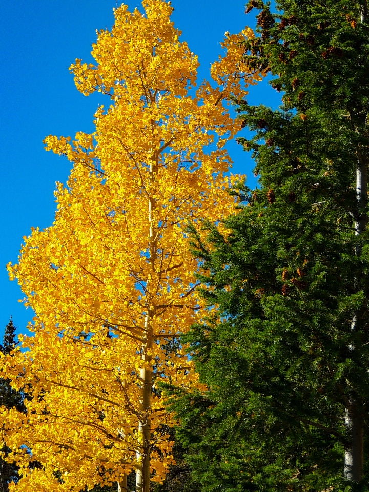
If you find Las Vegas overwhelming, you'll love the fresh, crisp air here. The towering glass-and-steel hotels are replaced by cabins made of rough-hewn logs and in an instant, your blood pressure drops. You're only 50 miles from Vegas, but it feels like a thousand.
During the drive to Mount Charleston, be sure to stop at the Desert View Overlook. There you'll find a short and well-maintained path that leads to an expansive and panoramic vista of the Mojave Desert below. A series of informative panels provide information about what you're viewing and its history.
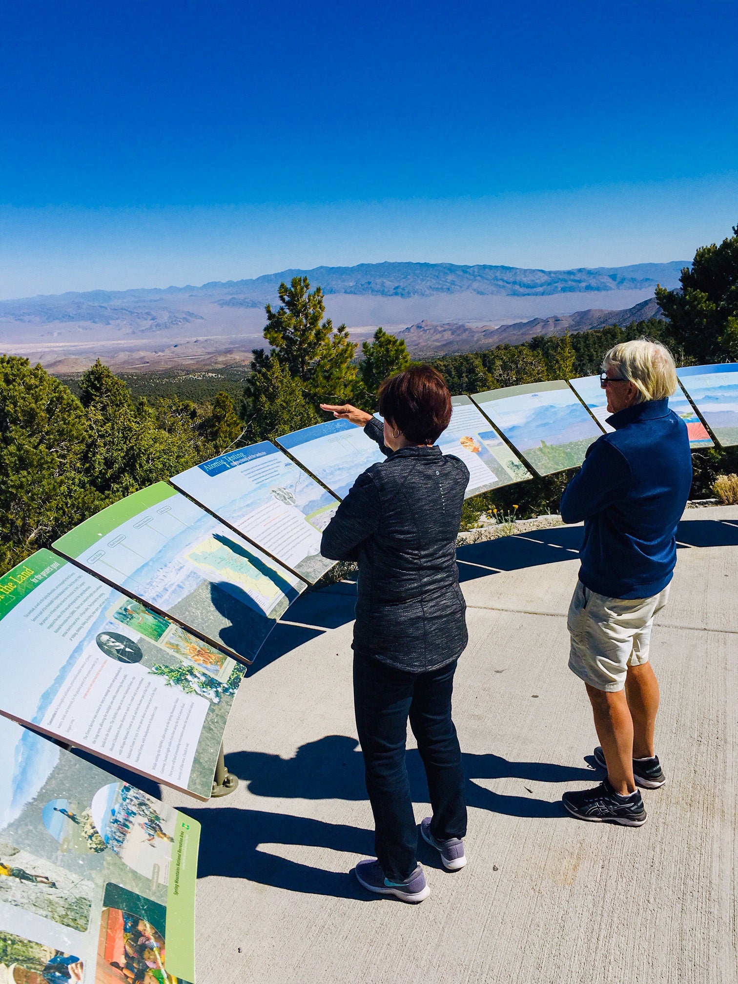
Part of what you'll see includes the Nevada Test Site, the scene of almost 1,000 nuclear detonations from the 1950s to the 1990s. About 100 of these were atmospheric tests that resulted in mushroom clouds that could be seen from Las Vegas.
Farther up the road, at the end of Lee Canyon, is the Las Vegas Ski and Snowboard Resort.
Yes, there's a real outdoor ski area within an easy drive from Las Vegas. Sure, it's small, but there's enough terrain and snow to provide for a great winter getaway. The area historically receives about 200 inches of snow each season, with temperatures about 30 to 40 degrees lower than those in the valley. At other times of the year, it's a still a beautiful backdrop for a picnic.
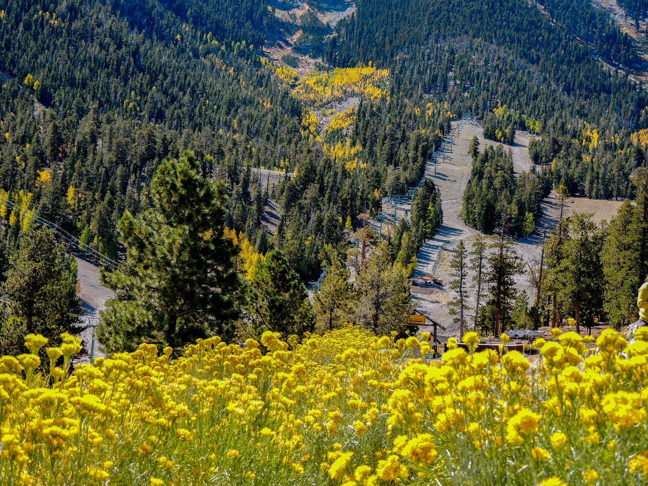
A few years ago, we skied at the Las Vegas Ski and Snowboard Resort, and I wouldn't hesitate to include it into another Vegas winter stay.
Where to eat: Be sure to fit the Mount Charleston Lodge and Restaurant into your day trip; it's a quintessential mountain experience.
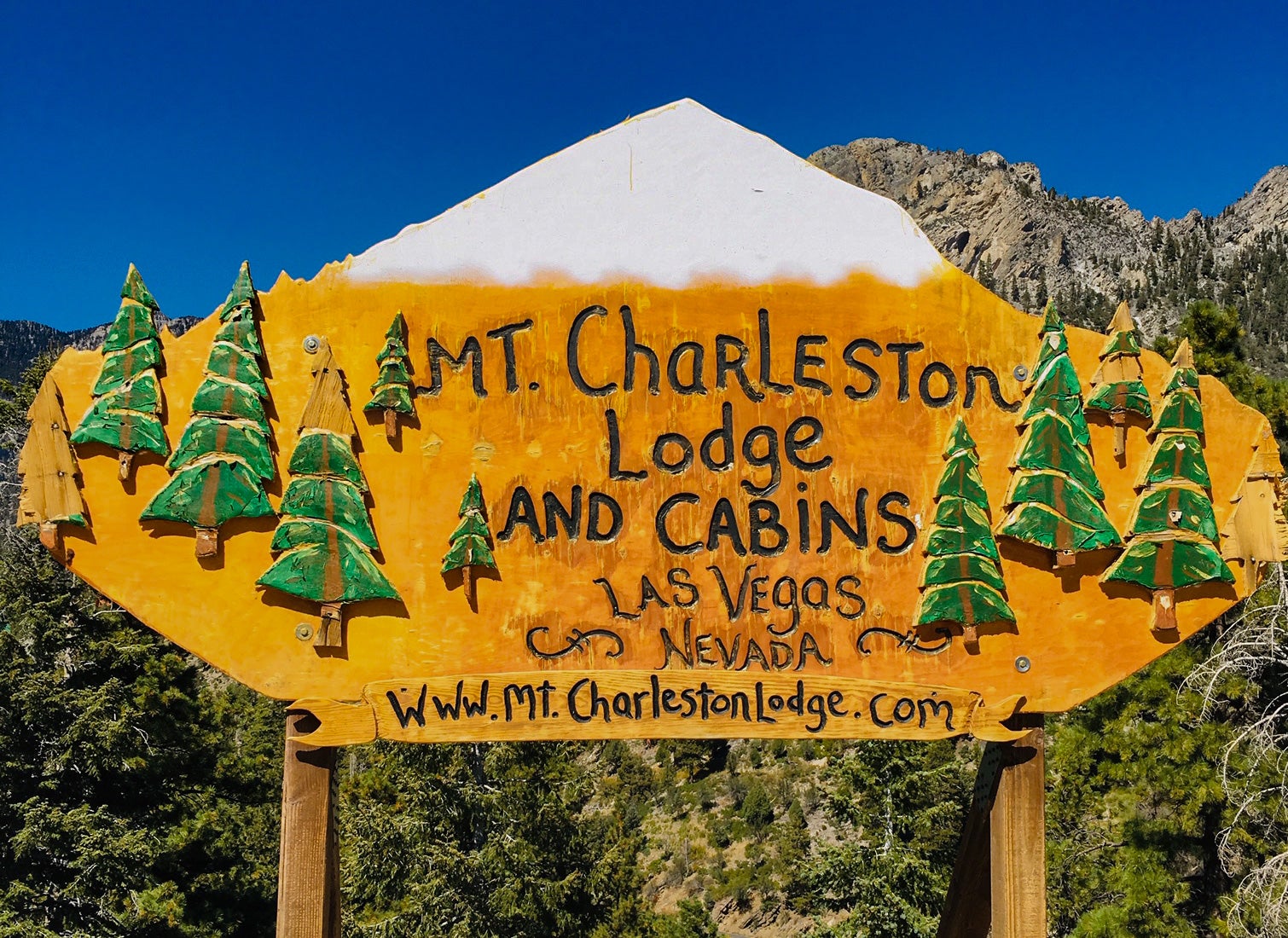
The very popular restaurant has a rustic A-frame design with full windows on three sides that allow guests to enjoy the view while perusing the large menu. An expansive porch wraps around the exterior to allow for outdoor dining, and a central fireplace adds to the coziness. You will also likely find authentic Native American jewelry and goods crafted by local artisans for sale.
Where to stay: The Mount Charleston log cabins start at around $125 per night. Of course, since Mount Charleson is only an hour from Las Vegas, you could also head back to Las Vegas in time for your dinner reservation on the Strip.
Valley of Fire State Park
A second easily reachable destination outside Las Vegas is the Valley of Fire State Park . It's about an hour away from the city via I-15 N to Exit 75. The Valley of Fire is named for the color of the 150-million-year-old Aztec Red sandstone that comprises a lot of the park. We've also been there with the temperatures approaching 120 degrees, so maybe the heat also has something to do with the name.
What to do: A $10-per-car entrance fee is required and a stop at the visitor center is suggested. There you'll find a comprehensive study of the park and learn about how it was created. Also, there are restrooms and a small store selling snacks and souvenirs . Make sure you leave the visitor center with a map, a plan and water. Lots of water. It's very dry and has a very high ultraviolet and heat index.
Related: 10 things no one tells you about Las Vegas
Valley of Fire State Park can be thoroughly enjoyed from the car using the excellent Scenic Loop Road that curves its way through the rock formations. But you'll be best served by at least an occasional stop at the many parking areas that provide access to some of the most distinctive features.
For instance, there's the Petroglyph Canyon that leads to Mouse's Tank. Here, rock etchings created by inhabitants from 2,500 years ago are visible on the sides of this short canyon. The canyon floor is covered with a loose, fine, deep sand that will easily make its way into your shoes and boots.
Another easy stop is Rainbow Vista, a colorful, panoramic landscape that seems to change hue with the movement of the sun. One of our favorites is the one-mile, round-trip hike to the Fire Wave. A relatively flat and easy trek leads you to undulating sandstone formations enhanced by swirling ribbons of contrasting color.
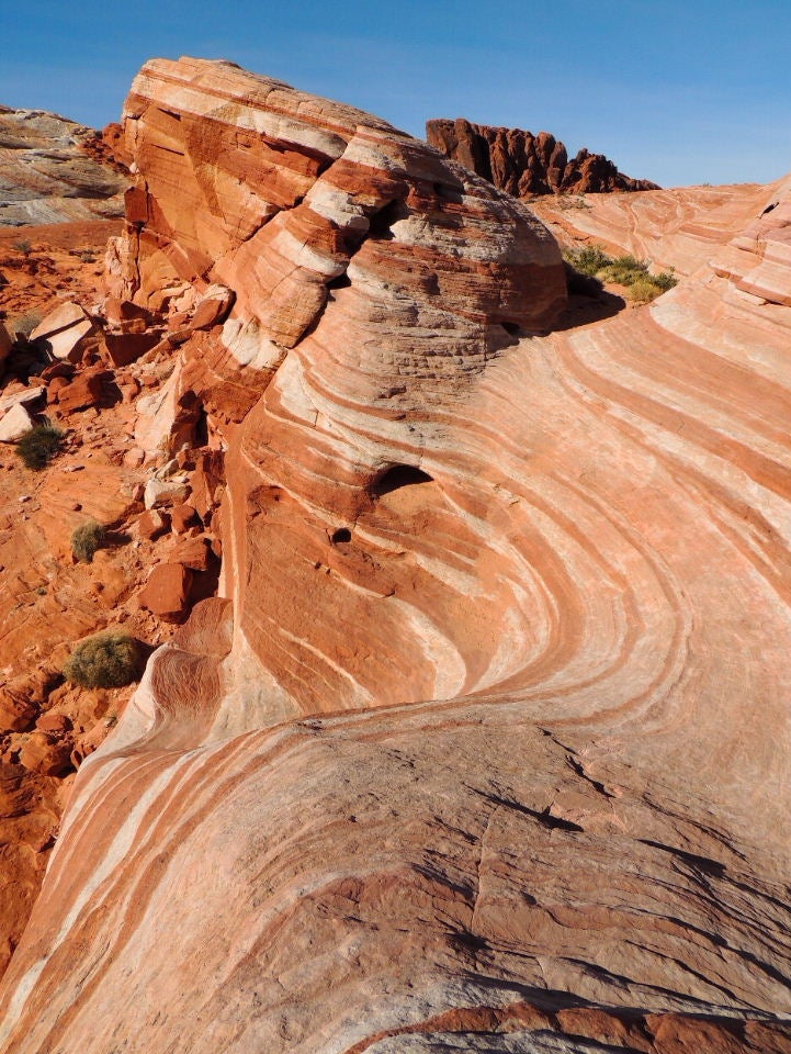
It is a small but very dramatic area you'll be glad to see — especially if you need a break from all the neon in Las Vegas. Just remember, there's little to no shade on this walk, and the heat can certainly be a risk.
White Domes is a crowd favorite. The mile-and-a-half-long trail leads you down past remnants of an old movie set and through a short but impressive slot canyon before looping back toward the parking area. The landscape is peppered with towering rock formations that look especially resplendent against the darker colors of the nearby desert rocks.
Related: The best national and state parks to visit with kids in the Southwest
Don't miss the petroglyph panel known as Atlatl Rock. You climb about four stories of metal stairs to get a close-up look of the carvings that are highlighted by images of the Atlatl — an ancient hunting weapon.
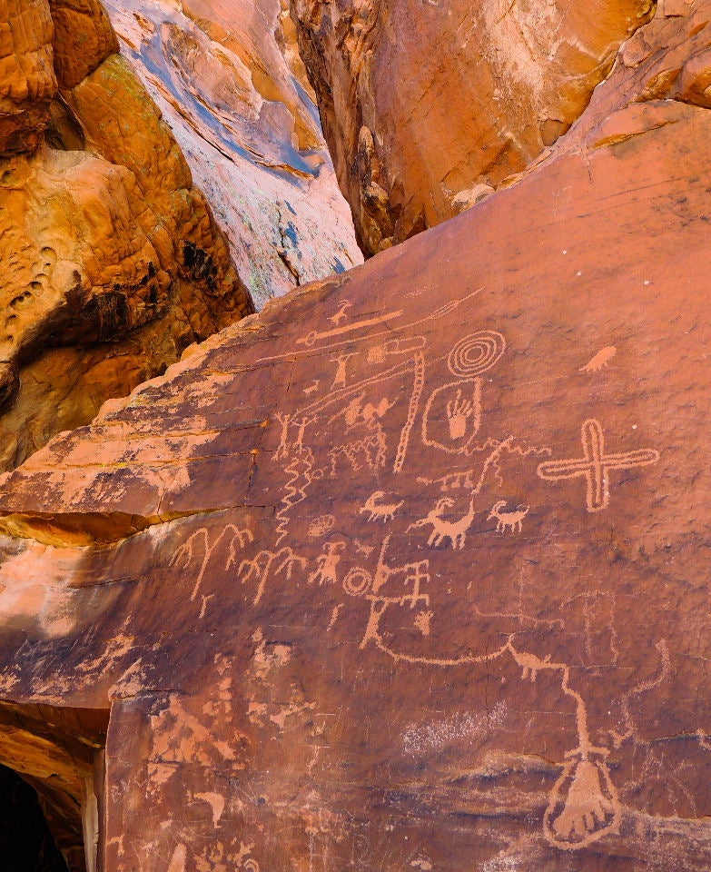
The Valley of Fire offers history and hills ablaze. There are petroglyphs and petrified logs; arches and ancient art; balanced rocks and bighorn sheep. Among the waves of red rock and snaking roads, you'll find the Valley of Fire is a destination on its own, but also a nice road trip from Las Vegas.
Where to stay: As with Mount Charleston, you could easily make a day trip from Las Vegas to the Valley of Fire State Park, but there are options if you want to spend the night. There is camping available within the state park. You can also choose among some budget hotels, such as the North Shore Inn at Lake Mead, about 12 miles away. But, if you want some luxury at the end of your day of hiking, you'll probably want to head back to Vegas.
Related: Review of the Bellagio Las Vegas
Death Valley
Driving time from Las Vegas: 2.5 hours
What to do: The things to do in Death Valley are to absorb the unusual, value the uniqueness, respect the environment and simply survive. Death Valley is different, beautiful in its own way and extreme.
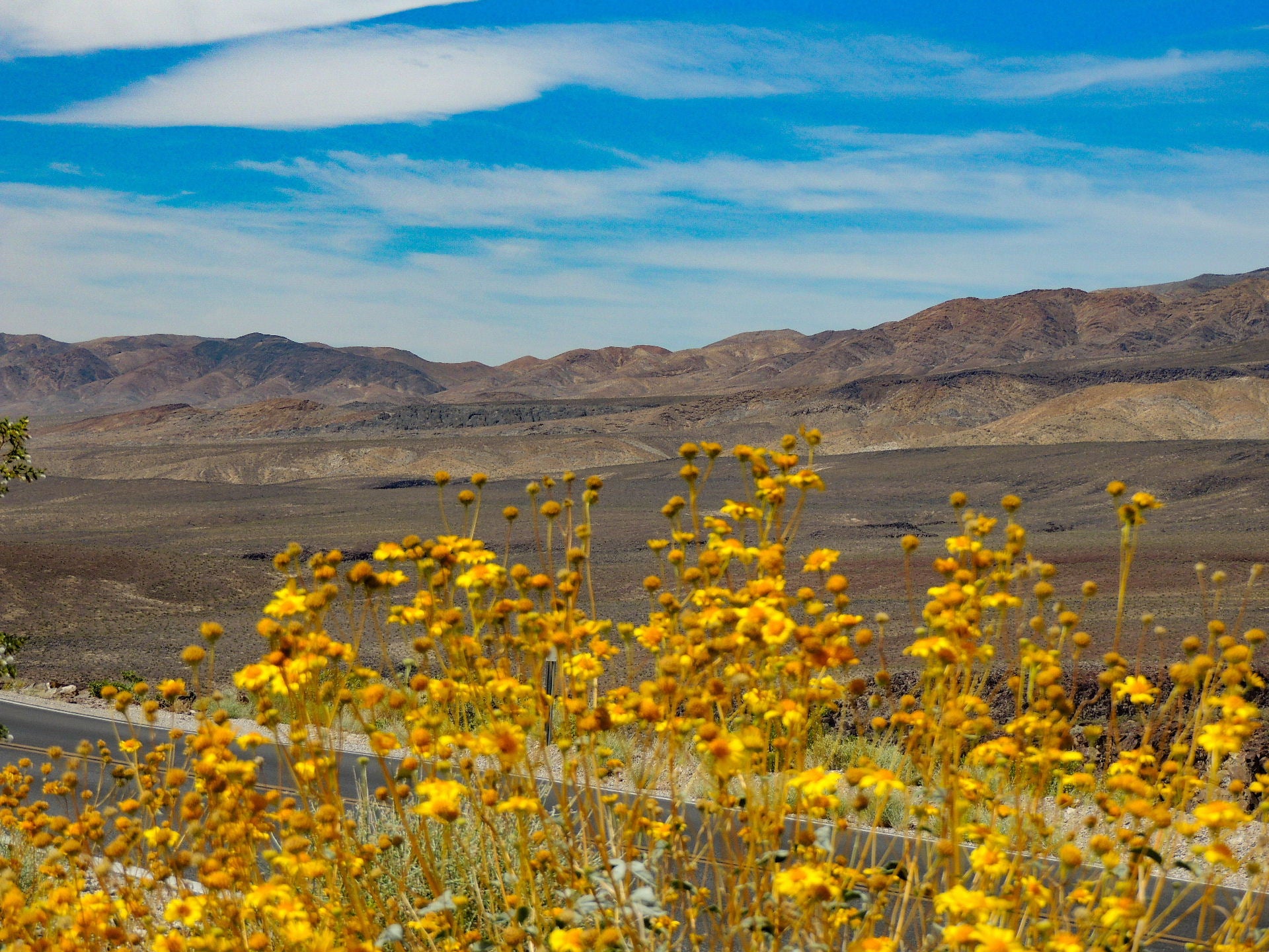
One of the high points, if the lowest elevation in the U.S. can ever be defined using the word high, is Badwater Basiin, 282 feet below with sea-level starkness. Heatwaves dance and mirages come to life here during the heat of the day. The distance itself becomes an optical illusion.
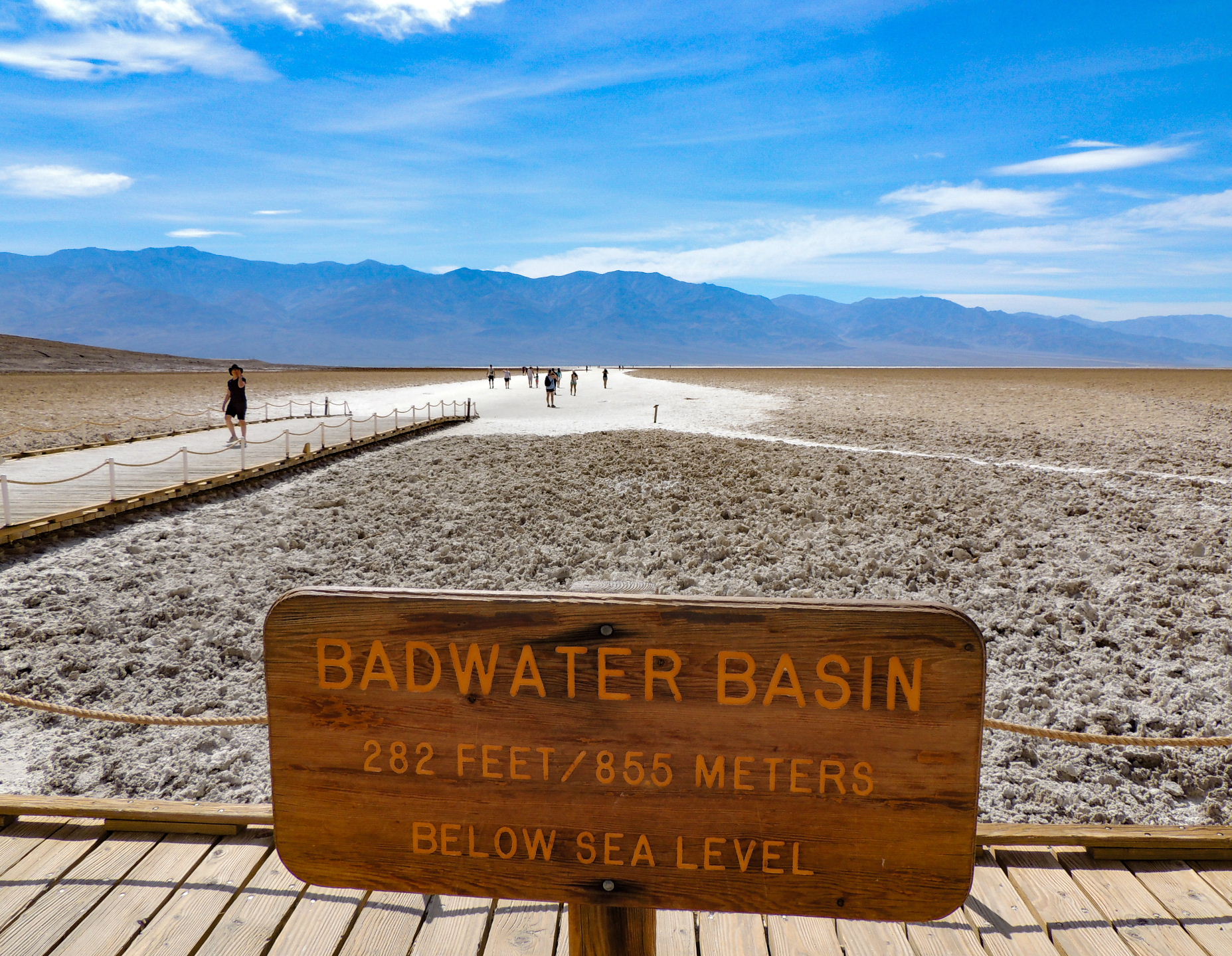
Artists Palette on Artists Drive is also worth investigating as the rolling hills are splotched with multi-colored hues much like an artist's palette. The colors are usually best defined in the late afternoon light.
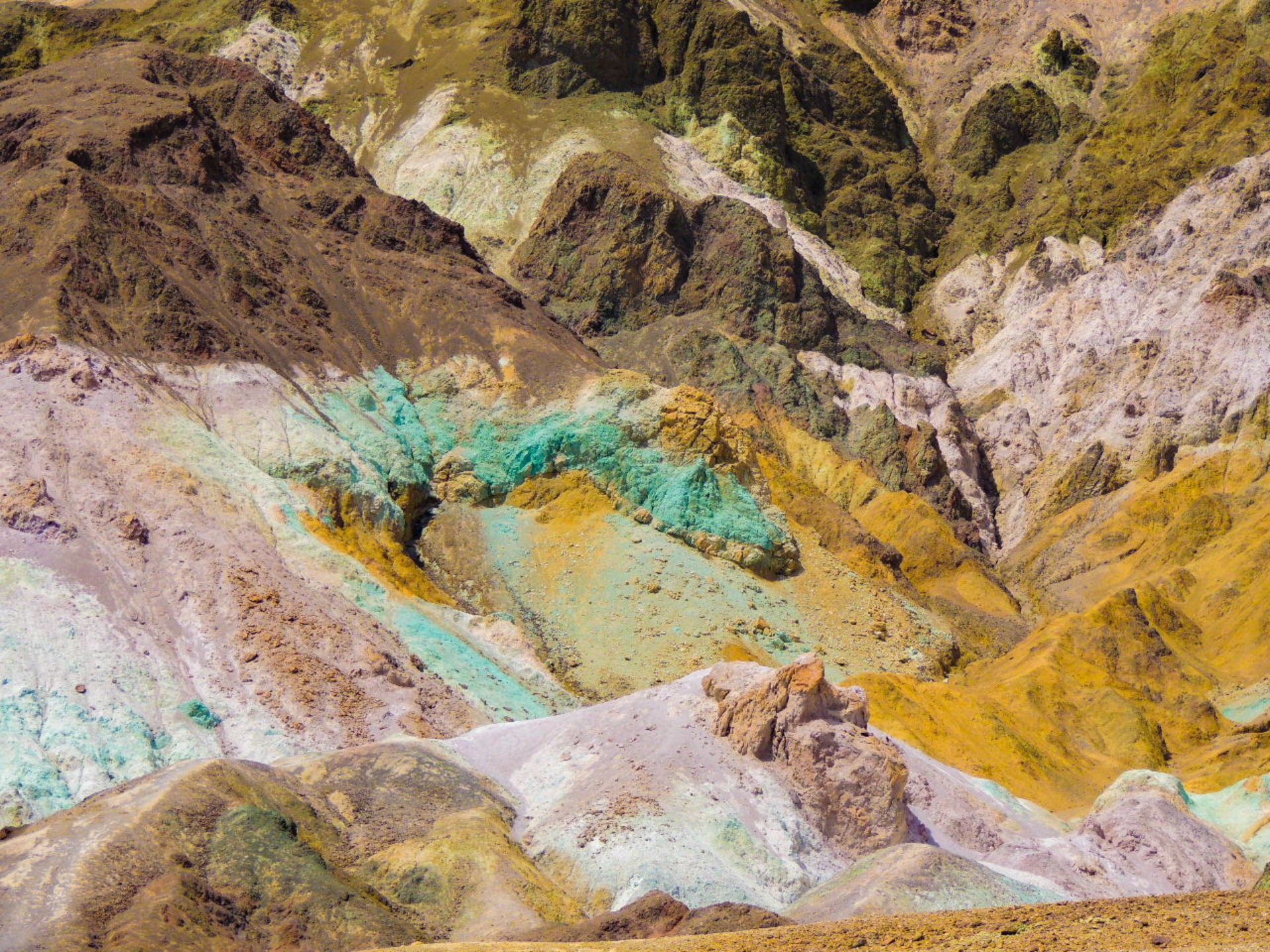
The road is one-way, well paved and narrow. And fun. It is a miniature roller coaster ride that you may want to take twice. It is at its best when you have the road to yourself.
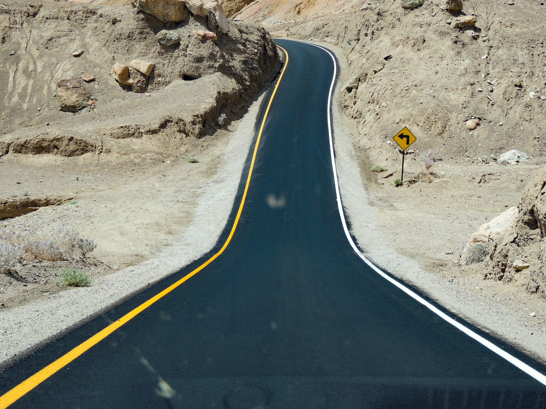
Other popular and automobile-accessible locations for Vegas day-trippers are Zabriskie Point and Dante's Peak. Dante's sits about one mile above the valley floor and offers an expansive overlook of Badwater Basin and its surroundings. Zabriskie is likely the park's most popular viewing spot and offers a nice vantage for sunrise and sunsets.
Golden Canyon is just off Badwater Road and allows visitors to get an intimate feel for Death Valley without going too far from your car's air conditioning.
If time allows, the Mesquite Flat Sand Dunes near Stovepipe Wells is a good visit. The sand hills rise and flow, poetically delineated by the rippled ridges of the sand that are forever at the mercy of a thermal wind. This is another good locale for the photographer in you.
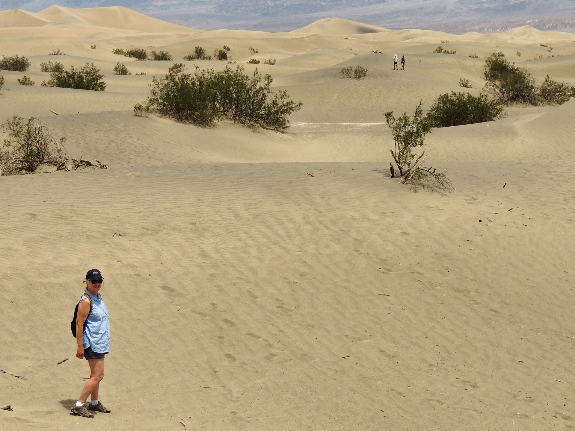
Stops at the Harmony Borax Worksite, the Park Information Center and at the Death Valley National Park sign are certain to be on most visitors' agendas. If you spend the night in the park, the skies in Death Valley can get dynamically dark, providing a brilliant celestial show. During the day, Navy fighter jets race across those same skies.
Related: What to expect as national parks reopen
Death Valley is best enjoyed when the temperature is an ally and not an enemy. Think October through April. Also, like most of the great and grand outdoors, optimum viewing is when the sun is lower in the sky and not directly overhead. We have been to Death Valley when the temperatures were 115+. It is doable ... but the land's ancestral natives did not call the area Tomesha ("Ground Afire") without cause.
Where to stay: You can stay within Death Valley at Stovepipe Wells Village Hotel in one of 83 rooms that start around $150 per night. There are also campsites and RV hookups available -- along with a general store, the Toll Road Restaurant and Badwater Saloon.
Other options can be found at the Oasis at Death Valley, the Ranch at Death Valley and the Inn at Death Valley, set along Highway 190 next to the National Park Service Visitor Center. Here you'll find lush date palms, spring-fed pools and even golf.
Related: The US welcomes 3 new dark sky parks
Grand Canyon
Driving time from Las Vegas: 2.5 hours to the closest point, the Grand Canyon West Rim
What to do: The Grand Canyon lives up to its name. It is quite ... grand. The more popular North and South Rims are also reachable by car from Vegas, but you'll need to budget several additional hours in the car each direction, with the South Rim being the closer of those two. The West Rim is closer still, though each offers its own unique possibilities.
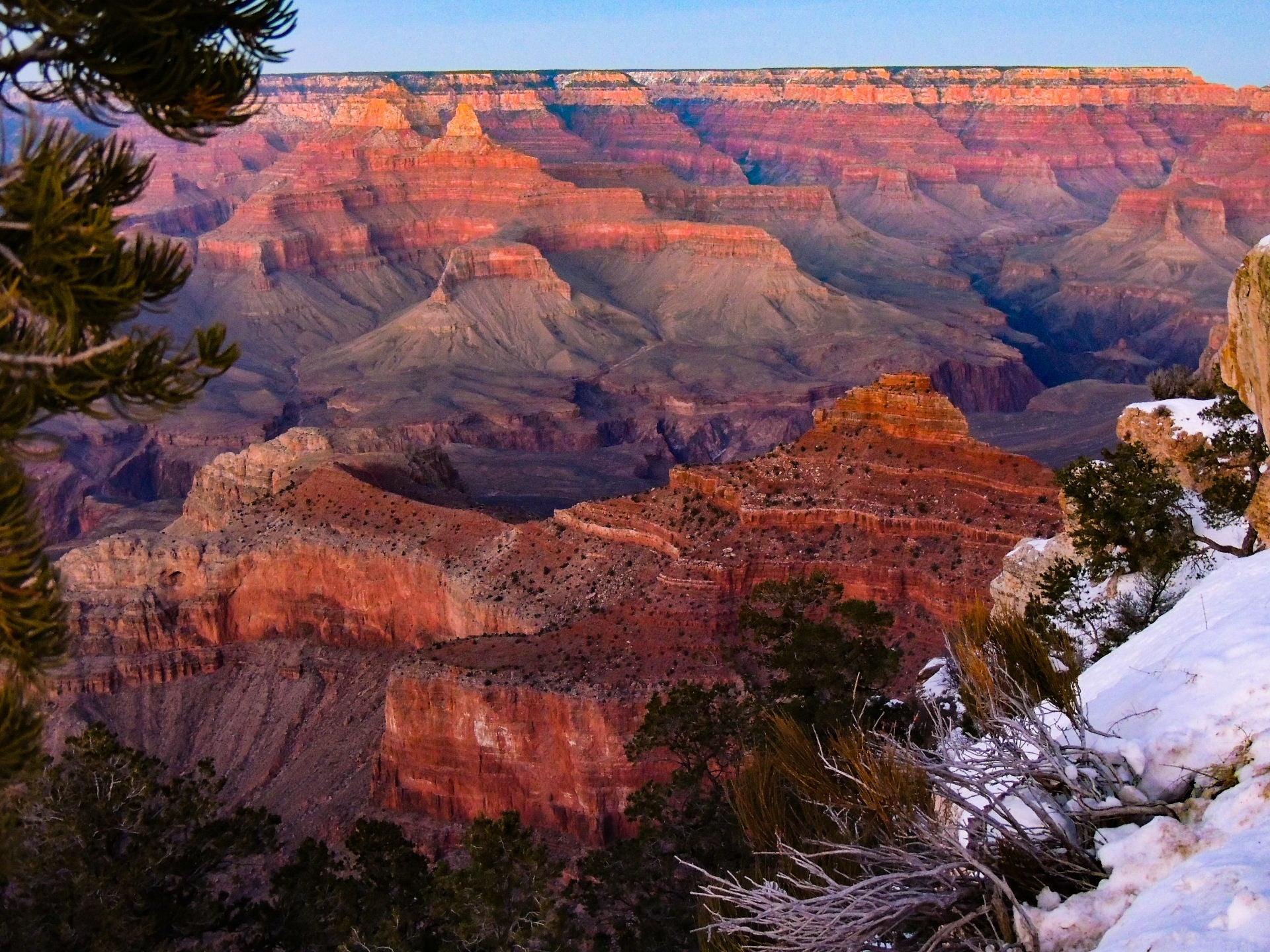
Should you decide to make an overnight road trip to the South Rim, you might consider a ride on the Grand Canyon Railway that begins in Williams, Arizona, and takes you on a two-hour (each way) nostalgic journey to the canyon. Several trains run daily, and there are multiple price ranges available. This is a very popular experience and one we highly recommend. While in Williams, you can enjoy another homage to the past while you cruise down part of the famous Route 66.
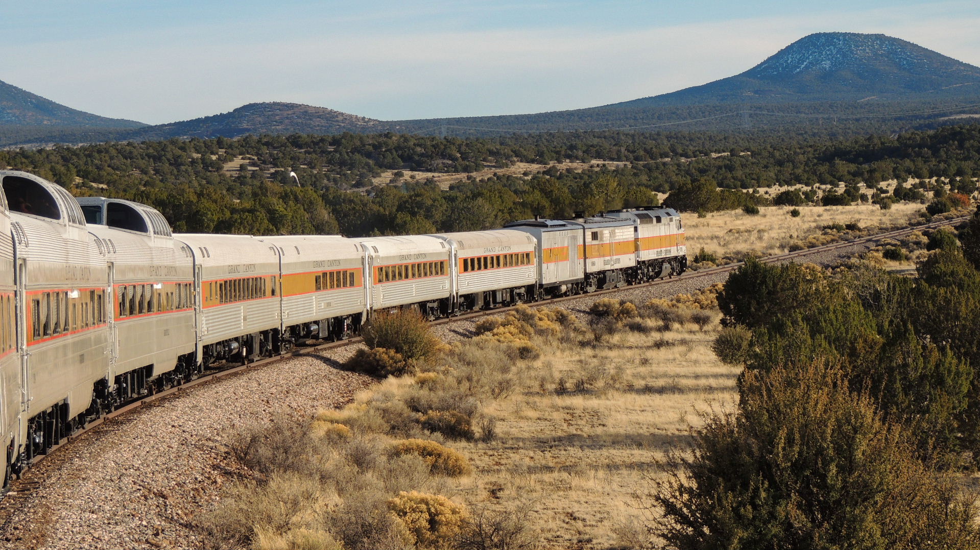
But, the West Rim, which is run by the Hualapai Indian Tribe, is a reasonable driving distance from Las Vegas and this is where you'll find the Skywalk Glass Bridge that extends out over the edge of the canyon so you can look down 4,000 feet.

Where to stay: If you go to the West Rim, the Hualapai Ranch offers rustic cabins for rent. Along with your cabin stay, you also get access to an animatronic "Shootin' Gallery" and free magic and gunfight shows. Horseback rides are available at the ranch starting at $40.
Another nearby option is the Grand Canyon Western Ranch, about 10 miles away. At this ranch, you'll find pine cabins and glamping tents with prices that start around $200-$300 per night. In addition to the tents and cabins, you'll find horseback rides, wagon rides and a gun range.
Related: The best time to visit the Grand Canyon
Antelope Canyon
Driving time from Las Vegas: 4.5 hours
Antelope Canyon is one of the best places we've ever been. This is the longest of the road trips we've recommended from Las Vegas, but it's also our favorite. It's at least a full-day commitment from Las Vegas, 275 miles away in Page, Arizona . In fact, you'll probably want to at least spend the night in Page before making your way back to Vegas.
What to do: What you'll find at Antelope Canyon are two slot canyons that will deliver a physical and visual experience unlike anything else on Earth.
The upper and the lower canyons are located on land of the Navajo Nation and can only be toured with authorized guides. Reservations can be made online and do sell out. Both canyons deliver stunning plays of light on sandstone sculpted by rushing water from infrequent but powerful desert storms. The upper is on ground level, and the lower makes its way through a narrow and winding passageway about 50 feet below ground.
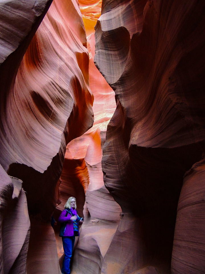
There's no pattern to these natural works of art, just a rhythm of wild and unscripted motion. The walls rise and fall like waves, curl and curve into themselves. There are dynamic photo opportunities throughout the canyons as the walls gather and distribute the light from above in a multi-hued light show.
The Antelope Canyons are a mecca for the greatest of artists and for the iPhone photographer alike, so be sure to bring something to capture the moment.
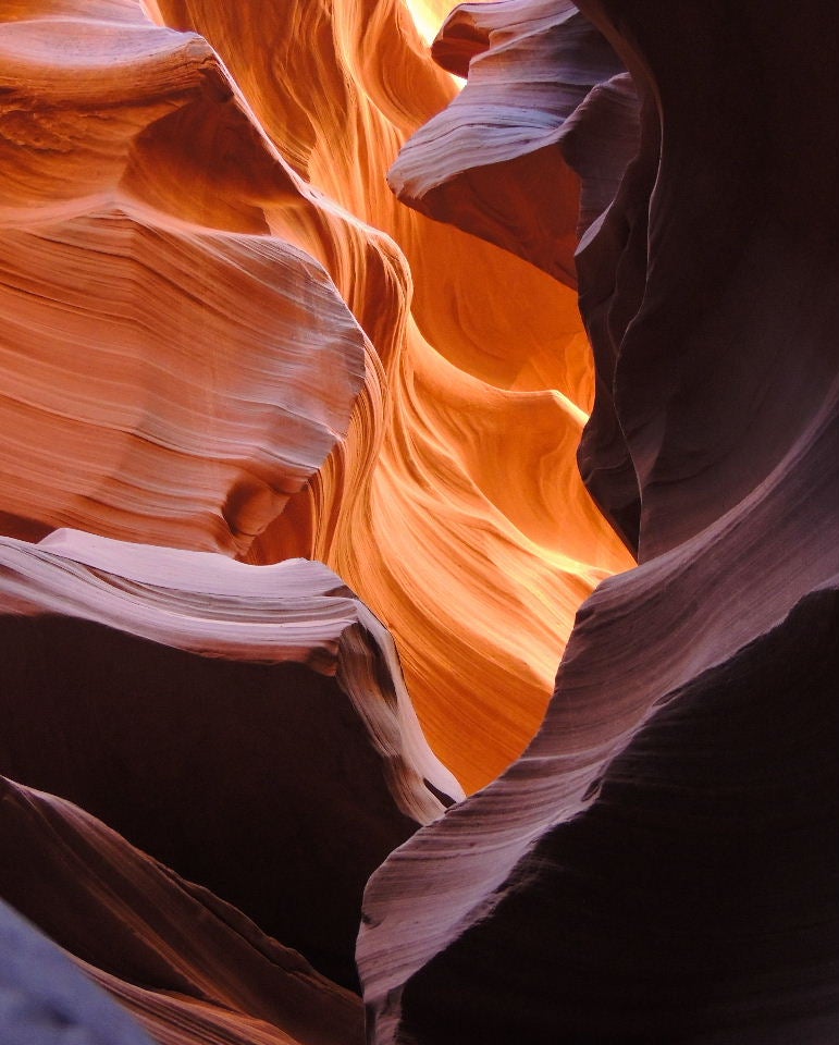
Individually purchased adult tour prices will range from about $50 for the Lower Canyon to $60 for the Upper Canyon. The fees for children are $10 less. Special tours are available at a higher fee that allows extra time in the canyons, emphasize photography or allow access during "peak" times. During normal times, multiple tour companies make day trips to Antelope Canyon with 6 a.m. departures. Basic transportation costs about $65 from Vegas if you aren't driving, and full tours start around $200.
Of course, if you have your own car, you're on your own schedule.
Where to stay : There are a number of budget-friendly properties in Page, about 10 miles from Antelope Canyon. If you want to use your hotel points or free-night certificates, you can pick from the Hyatt Place Page - Lake Powell (12,000 Hyatt points), Hampton Inn & Suites Page - Lake Powell (36,000 - 50,000 Hilton points) or Days Inn, Comfort Inn and Best Western-type properties.
Related: Fun road trips in Arizona
Zion National Park
Driving time from Las Vegas: Three hours
What to do: Zion is like a natural cathedral. It is that inspiring. Just the definitions and spiritual applications of the word Zion should give you a real hint as to the grandeur there.
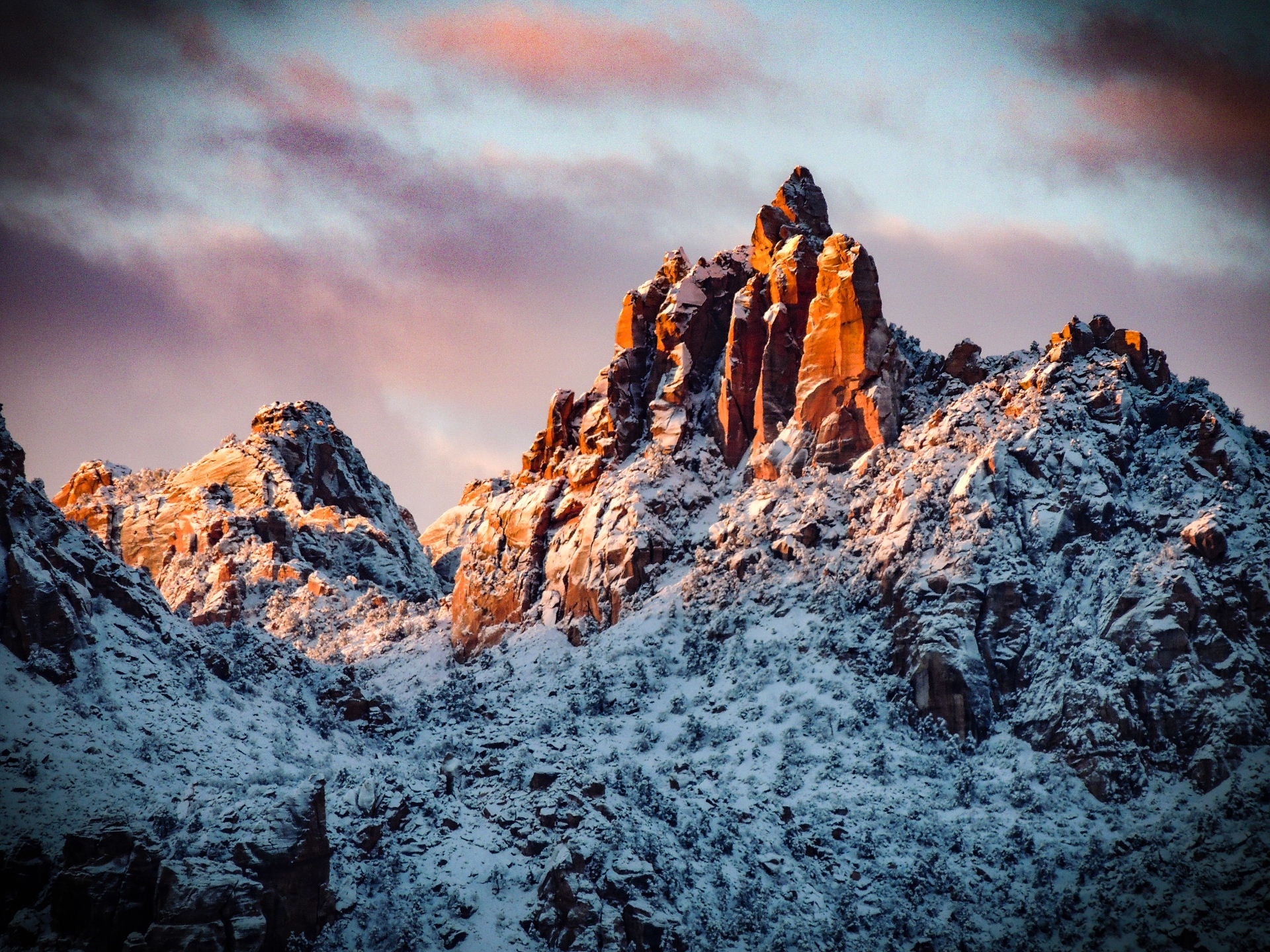
Zion surrounds you, engulfs you and embraces you. And, before COVID-19 hit, it gave a lot of hugs as it was attracting about four million visitors each year. Zion's main features, its most popular venues, are mostly accessed from a single road that parallels the Virgin River. Traffic in the park can be congested, so a huge fleet of shuttle buses are used to minimize traffic.
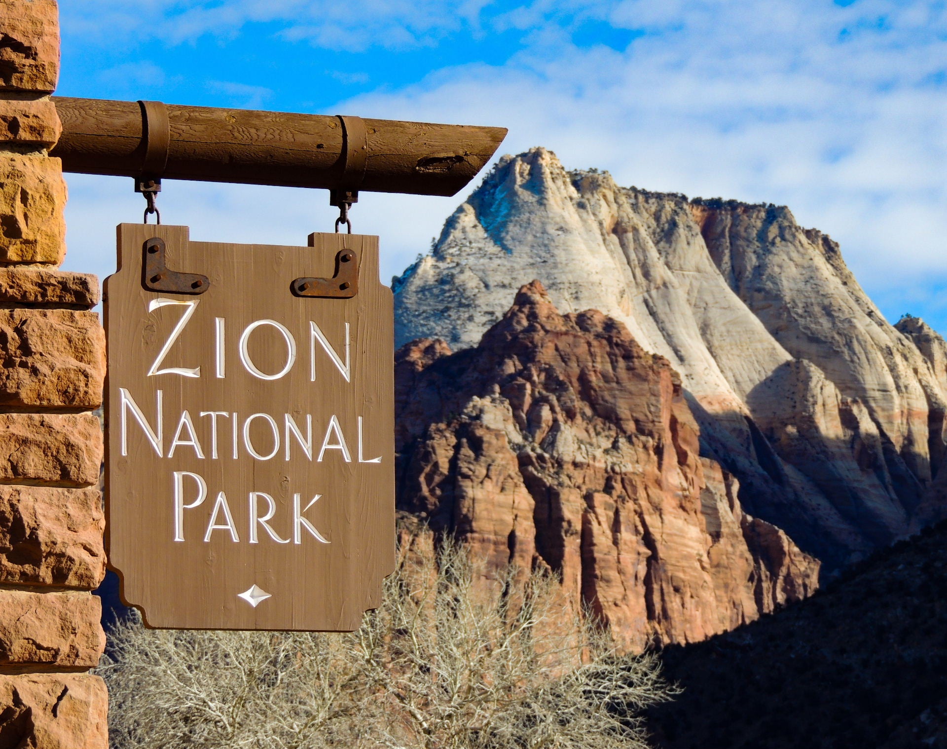
You can appreciate Zion from a distance and get a broad view of the wonders much like an image presented by a panoramic photo. But Zion is best experienced by zooming in on individual segments and becoming more of a participant than a spectator.
Hikes and explorations range from an easy, but rewarding, stroll on the Riverside Walk to an all-day strenuous trek through water to the see the famous Narrows. In between, there is the uncomplicated and straightforward trail to Weeping Rock, the moderately challenging path to the Emerald Pools and The Canyon Overlook and the formidable climb to the breathtaking Angel's Landing.
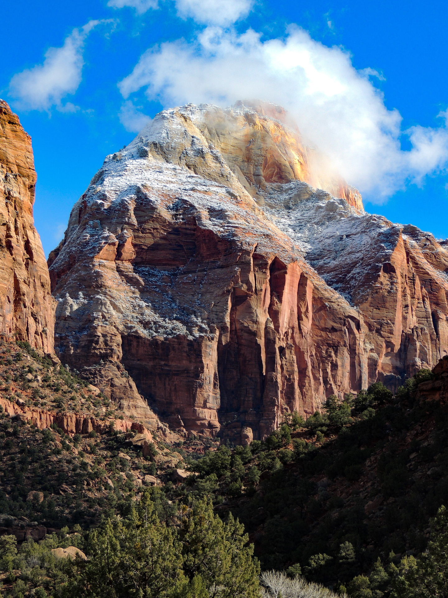
As with most popular destinations, the best time to visit is the off-season when attendance is down. But since most travelers don't always have that scheduling freedom, it is best to simply get out early in the day, ahead of the crowd.
As a personal aside, if time does not permit a true visit to Zion, the spectacular Highway 9 from Springdale to Mount Carmel Junction is worth the time, the effort and the National Park fee. The road bisects part of the park and offers scenery and sights that will have you looking for one of the many turnouts and overlooks to pull into for an even better view. The road has a series of long tunnels that cut through the core of the mountains and the drive through the tunnels and the vistas when you emerge are truly exhilarating. Utah State Highway 9, the Zion Park Scenic Byway, is a travel treasure. (Just watch out for deer crossings.)
Where to stay: Within Zion, your options are either camping in one of the three campgrounds or booking a stay at the Zion National Park Lodge, where rooms and cabins often start at $220+ per night and can book up well in advance. But there are points-friendly options in the area too.

SpringHill Suites by Marriott Springdale Zion National Park sits in the shadow of Zion, and is bookable for 40,000-60,000 Marriott points per night. (Or a free-night certificate available from the Marriott Bonvoy Brilliant card when the room prices at 50,000 points per night or less). The Hampton Inn & Suites Springdale/Zion National Park prices around 50,000 Hilton Honors points per night and the La Quinta Inn & Suites by Wyndham at Zion Park/Springdale is 30,000 Wyndham Rewards points per night.
Related: Where to stay near national parks using hotel points
Bottom line
We love Las Vegas . We love it for what it is and what it will be post-coronavirus pandemic , but if you are looking for a road trip out of Las Vegas, there's plenty nearby that can broaden and enhance the experience. Safe travels!

A UTAH TO ARIZONA ROAD TRIP LOOP FROM LAS VEGAS: SECRETS OF THE SOUTHWEST
A Utah to Arizona road trip is one of the highlights of the great American Southwest. After taking my own Colorado to Utah road trip I became fascinated with the area and eager to know more about its national parks, picturesque western Colorado towns and different Utah and Arizona road trip itineraries . That’s why I asked our guest writer, Jennifer Paquette , to tell us about her own memorable trip. Jennifer shares her secrets of the southwest with us in this this informative post.
The Southwest has always been on my “bucket list” especially a Utah to Arizona road trip , however an international trip always seemed to take precedence over exploring my own country. As the months loomed ahead with time carved out for our annual spring trip but no pen or even pencil marks on the calendar, I realized “need to plan something !” But where could we go that would be new and exciting, plus keep us outside enjoying the great outdoors as much as possible?
Without hesitation, we pulled out our Southwest folder of articles, navigated blogs and national parks sites and began to plan a good ‘ole US of A adventure. Having only seen the Grand Canyon from an airplane, we figured we’d get a little closer. Soon one of my famous aggressive itineraries began to form: a 1,000+mile loop of Zion National Park, Bryce Canyon National Park, Lake Powell, the Grand Canyon and back to Las Vegas on the famed Route 66 . A Utah to Arizona road trip started to take shape. The next step was to apply my three basic travel rules:
- I want to be where the people…aren’t.
- I want to do things out of the ordinary.
- I don’t want to spend a lot of money if I don’t have to.
This might seem next to impossible for a trip that would surely hit a few Disney-like national parks, but my rules had yet to be broken!
Researching dos and don’ts in three different states provided a challenge, as well as a few sets of flight cancellations and shuffling around of new dates and times, which meant hotel and car changes as well. But it was well worth it, for not only did we journey through an amazing part of our country, but I managed to apply my three rules as well. The end result was a delectable feast for the eyes and senses, as we unearthed some sizzling southwest secrets that were just waiting to be revealed.
Where to stay in Las Vegas for all budgets.
A UTAH TO ARIZONA ROAD TRIP

Table of Contents
THE UN-ZION
I thought Zion would be a great introduction to the national parks of the west, until I saw that during the months of March – November the only way you can get up to the trails is on a Disney-like shuttle that left every half hour, with a lottery for the $1 ticket that opened up two months ahead. Determined not to break my first rule of travel, I discovered that about 40 miles north of Zion’s main entrance is the sleeper sister of Zion National Park – a spectacular set of finger canyons and trails called Kolob Canyons .

The word “kolob” is from Mormon scripture meaning “residence closest to heaven”. And indeed, it did seem that way.
The five-mile stretch of Kolob Canyon Road begins at the park entrance and crosses the major fault line which gives rise to the great plateau that houses some of the oldest and youngest rocks in all of Zion. There are two major trails, the one-mile roundtrip Timber Creek Trail at the ridge top offering sweeping vistas of canyon country, and the almost six mile roundtrip Taylor Creek Trail that takes you down the narrow box canyon and across the Zion Wilderness.
Both trails did not disappoint with majestic geological formations as well as very little, to no crowds. Hopping across river rocks in the shade of the canyon valley as the trail crisscrossed a winding creek, was a how-close-to-nature-can-you-get experience. At the end of the trail was an awe-inspiring geological wonder – a double arch formation where you could rest in its shade before hiking back.

These two trails were like a mini version of the main park of Zion – canyons, rivers, arches and other geological wonders all combined in one un-Disney section.
HOW TO HANG WITH THE HOODOOS FROM UTAH TO ARIZONA
On to one of the “Mighty Five” national parks on our Utah to Arizona road trip . The trip to Bryce Canyon is on the famed Highway 89, a stretch of road that overpowers your senses with sweeping ranches (can you say Dallas ? Dynasty ?), livestock only seen in westerns (longhorn steer really do exist!), and teeny tiny towns that consist of a few houses, a gas station and at one junction, an “outlaw saloon.”
Bryce is known for its hoodoos (columns of soft, weathered rocks topped by harder, less easily eroded stone) and the vastness and beauty of the hoodoo amphitheaters is nothing short of breathtaking. There are two main trails, Navajo Loop and Queens Garden, and I highly recommend descending Navajo and ascending via Queens Garden, as the elevations differ between the two.

Bryce’s scenic 18-mile drive is definitely worth it, providing restrooms, a picnic spot, gorgeous vistas and trails to stretch your legs at the final (but should be your first) stop, Rainbow Point. The trick is to stop at all the overlooks on the return trip down, as they’re all on the right-hand side. My favorite was Natural Bridge Overlook, which showcased an 85-foot arch formation of red-hued limestone formed over millions of years by wind, water and chemical erosion. This was one of the most spectacular sites on our Utah to Arizona road trip .
Can’t get enough of beautiful Bryce Canyon and the surrounding area? Here is another spectacular road trip, Bryce Canyon to Capital Reef.

Don’t miss the Bryce Point Overlook, yet another expansive and breathtaking view of the Silent City, an assemblage of hoodoos resembling figures frozen in rock.
Accommodations in majestic Bryce Canyon.

Hoodoo’d out? Give it one last shot as you exit the park. Half a mile north of the Visitor Center is the turnoff for Fairyland Point. The spectacular views of the ballerina-pink hued Fairyland Amphitheater will dazzle you and leave the wonders of Bryce imprinted in your mind for a very long time.
KANAB : READY FOR MY CLOSE UP
Known as “ Little Hollywood ” for having provided the backdrop for many famous Western movies and TV commercials, Kanab, Utah lives up to true wild west kitsch and more. Perfectly located and practically equidistant from Zion and Bryce, this is the place to call home base for your national parks ventures from Utah to Arizona . We stayed at the simple but overly accommodating Days Inn Kanab, whose hearty breakfast of coffee, homemade waffles, omelets, fruit, breads, oatmeal, juices and more gave us the jet lagged jump start we needed by opening their doors at 6am (thank you, thank you!)
No matter how long and exhausting your day is, make the time to explore Kanab. Every turn is photo-worthy, from the covered wagons that adorn the gas stations to the giant “K” scrawled across the mountain overlooking the town. Visit the free Little Hollywood Museum , making sure to head out back and wander among original old movie sets. Eat at Escobar’s for inexpensive and authentic Mexican food with big portions.
Kanab was a secret treat in so many ways.

Where to stay in Kanab, Utah
WHEN GOING FROM UTAH TO ARIZONA, GET BAD IN THE BADLANDS
The road from Utah to Arizona is a pretty cool stretch. Who knew there was so much to do in the 74 miles between Kanab, Utah and Page, Arizona ?
Initially we chose Page as it is a gateway to the wonders of the Colorado River, including Lake Powell, Horseshoe Bend and of course, the Grand Canyon. But first, we had to cross the Badlands of Utah to get there. I had only heard of the Badlands through Stephen King novels, so I was pretty psyched.
Here is where historic Highway 89 can either be just a road from point A to B, or the most remarkable leap back in time to some pretty cool hidden natural wonders of southern Utah.
We were now in the uncharted land of no wi-fi and no cell service so our only guide was the milepost markers. It’s also a place to watch that speedometer and have a good pair of sunglasses. Approximately 11 miles out of Kanab is Johnson Canyon Road, which stretches north along the colorful cliffs of the Grand Staircase Escalante. At first glimpse are idyllic farmhouses and grazing horses, and after about five miles, on the right, were the remnants of the true old West: the dilapidated buildings from the Gunsmoke film set, now on private land. At the eight-mile mark we started to climb through the White Cliffs, with steep bone colored edges and green juniper and sage at the base. The cliffs continue for 18 miles, and if you choose, you can then continue deeper into the Escalante on a dirt road called Skutumpah Road.
Heard songs about the Badlands? Read The Stand by Stephen King? Welcome to milepost marker 31.
A sign that reads “Old Pahreah Townsite”, and a plaque and landmark await you in a small, dirt parking lot. There was a brief “are our tires going to make it?” and “is this in the rental car agreement moment”? before we threw caution to the winds of the Badlands and headed out, billowing clouds of red dust behind us. We were now on a six-mile long dirt road, with undulating hills and narrow twisting turns that crossed rainbow-hued foothills comprised of encrusted minerals of iron oxides, manganese and cobalt. We finally reached a “parking lot” and were pleasantly surprised to find picnic tables and a simple, clean (much needed) restroom. Down a few more narrow, steep hills was the Old Paria Cemetery, which has about 20 graves. Not only were we surrounded by the breathtaking Rainbow Mountains, but we seemed to be the only people there basking in its majesty.

Moving right along on Highway 89…who would have thought one could be obsessed with toadstools? At milepost marker 19.3 is a sign marked “The Toadstools.” Here you’ll find a less-than-a-mile flat ground hike showcasing panoramic views of the colorful badlands and an assortment of wildflowers. The end reward is the majestic Red Toadstool holding court over the Toadstool garden. We roamed child-like through the garden rim discovering other mushroom-shaped hoodoos hidden within the cliffs and few other humans. This was one of the more magical sites we experienced from Utah to Arizona.

Continuing on from Utah to Arizona, highway 89 leads into Page, Arizona, home to Lake Powell, the second-largest manmade lake in the United States. It also houses the Glen Canyon Dam and the secret vista point of Glen Canyon Overlook, where you can climb and roam rock formations and soak in your first glance of the Colorado River, and the mighty dam that supports it.
Page, Arizona accommodations.

Ten miles due south is Horseshoe Bend , the only place I capitulated to not only pay for parking, take a selfie, then leave, but also endure the most people seen so far on this trip (and some feisty mosquitoes). But it was worth it to soak in yet another breathtaking natural wonder of the southwest.

GO EAST YOUNG MAN
I was torn. I wanted to go to the Grand Canyon , but I did not want the crowds. Enter Google, because by simply typing “Grand Canyon no crowds”, I found out about entering the park on Desert View Drive, via the East Entrance. However, depending on where you’re coming from it may be out of the way, but it is well worth it.

The Desert View entrance, via Highway 64 from the east, is the easternmost entrance on the South Rim of the Grand Canyon, and one of the highest, with an elevation of 7,348 ft. The entrance goes through Little Colorado River Navajo tribal park and Little Colorado River Gorge, and we immediately noticed there were fewer cars using this gateway to the Grand Canyon.
Desert View Drive offers some of the most beautiful views of the Grand Canyon, many including the muted blue of the Colorado River as it snakes its way through the rock. There are about eight overlook stops, each more breathtaking than the next.
Where to stay near the Grand Canyon.

We enjoyed leisurely stops at vistas that provided historic stories, incredible views and places to park. Oh, and minimal people.
Nestled somewhere between mile markers 243 and 245 is an unmarked dirt parking lot that is not on any map. Once you park, go around the gate and follow the one-mile trail through the ponderosa pine forest to Shoshone Point, a spectacular rocky overlook vista with an unforgettable canyon view. Picnic tables and restrooms complete the experience. Note that this is not advertised on any park maps, so it is truly a special viewpoint.
Later on, when we got to the main park and did a quick walk to some of the tourist bus vistas, we realized that the Colorado River wasn’t visible from this part of the South Rim. This made our time exploring Desert View Drive even more special, as everywhere we looked, the blue ink of the Colorado River winked back at us.
Note that you can get to Desert View Drive from the main entrance on the South Rim, but since we were coming from Page, we entered from the east.
OTHER NEED TO KNOWS ON A UTAH TO ARIZONA ROAD TRIP
To date, the price for a car to enter the national parks is $35. The America the Beautiful pass , for an annual fee of $80, can be used at over 150 national parks.
– Utah is a “dry state” so buy all your libations before you cross the border. Get more than you think you’ll need, especially if you have a rent a car. Just buy it and let it roll around in the back seat.
– Williams AZ, about 60 miles due south of the Grand Canyon’s main (Southern Rim) entrance is well worth a stop and a walk along Main Street, which is part of historic Route 66.

– Don’t wait until your tank is near empty to buy gas because there may not be a station for hundreds of miles. Distances from Utah to Arizona can be long and populations sparse. Cell service is sketchy and at times you can be the only car on a stretch of road.
Want to know more about this beautiful part of the country? Here are a couple of books to refer to as you explore this spectacular part of the USA.

What are your thoughts on our Utah to Arizona road trip ? I’d love to hear your secrets of the southwest! I’m sure we all have a few…

BTW, if you are getting ready for your trip, make sure to take advantage of these useful, money-saving links to book your trip:
- Research and book your flight with Skyscanner . I have found them to be the best because they list all airlines including the budget ones. You are always sure of having researched all options.
- For car rental around the world, Discover Cars has flexible pickup and drop-off options, I recommend Discover Cars .
- Book your accommodation with Booking.com . I find they have a wide selection and a nice, user-friendly, transparent website.
- Protect your trip and, more importantly, protect yourself with travel insurance. I use Travelinsurance.com and have been very happy with them.
- Looking for a small group tour to unforgettable destinations with top professionals? Intrepid Trave l is your choice.
- For more general tours to any destination or attraction, book with Viator . Check them out.
- Need a visa? Get your visa for all countries with Passport Visa Exp ress.
- Looking for a cool walking tour to explore a city? My favorite walking tours are offered by Take Walks.
- Food and drink tours are the best way to enjoy a city. And Devour Tours are my favorite.
- Looking for a good VPN to protect your security, privacy and freedom online while traveling? Nordvpn is your best option.
- The best and most economical way to stay connected while traveling is with an Airalo eSIM.
I personally use, and can recommend, all the companies listed here and elsewhere on my blog. By booking through these sites, the small commission we earn – at no cost to you – helps us maintain this site so we can continue to offer our readers valuable travel tips and advice.

Talek Nantes
5 thoughts on “a utah to arizona road trip loop from las vegas: secrets of the southwest”.

My road trips in the American West were via the Greyhound buses in the mid-late 1970s. Cheap – yes. Crowds – sometimes. Out of the ordinary? Well, it was quite an adventure for an impoverished English student at the time. And on one trip my luggage was stolen. But for all that, I had a good trip. However, I was limited to where the buses went. I would love to do it again, and be able to go to other parks, spending time where I wanted to. This piece has brought back some great memories. Glad you enjoyed your trip too.

Thanks for reading. It really is an amazing place.

What an absolutely epic trip! It sounds amazing, and I love the no-crowds itinerary.

We are headed back to Utah for the fourth time next month! It is such an amazing place and I have still so much to see. thanks for your tips…pinning for future use!
Yes, it’s an amazing place. Thank you for reading and commenting.
Leave a Comment Cancel Reply
Your email address will not be published. Required fields are marked *
This site uses Akismet to reduce spam. Learn how your comment data is processed .

Disclosure: As an Amazon Associate I may earn from qualifying purchases. Posts may contain affiliate links. If you click on one of them, we may receive a commission at no cost to you.

JOIN OUR NEWSLETTER

Lets Connect
Privacy policy.

Jaw-dropping Grand Circle road trip
- Post last modified: March 21, 2024

Hit the asphalt for the bucket list Grand Circle road trip, taking you to dramatic canyons and unearthly rock formations. It’s a loaded journey that combines the best sights in Arizona and Utah’s mighty national parks. Are you ready for a jaw-dropping drive through the American Southwest?
Disclosure: All listings are independently selected. If you buy something through our links, we may earn an affiliate commission. Learn more ›
Grand Circle route
- Start: Las Vegas
- Grand Canyon
- Antelope & Horseshoe
- Monument Valley
- Canyonlands & Arches
- Capitol Reef
- Bryce Canyon
- Finish: Las Vegas
Head southeast from Las Vegas towards the one-and-only Grand Canyon, breaking off the drive with a stop at the Hoover Dam. After visiting Horseshoe Bend and Antelope Canyon, venture into Utah via the bordering Monument Valley.
While you can take your Grand Circle road trip in either direction, this itinerary runs counterclockwise. It begins with the longest drive (Las Vegas to Grand Canyon), saving the shorter legs and the red national parks in Utah for the end.

- Total distance: 1,177 mi / 1,894 km
- Total driving time: 20.5 h
1. Las Vegas, NV
Yes, the Grand Circle road trip is mostly about the unique nature of the American Southwest. But if you’re down for it, the flashing Las Vegas is always ready to entertain.
Las Vegas Boulevard South is a melting pot of extravagance. Also known as the Strip, it’s a stark contrast to the rest of the Grand Circle itinerary.
On the Strip, one casino after another towers up. Caesars Palace, the Venetian and Bellagio are just a few of the many institutions where activity flows day and night.
If you feel lucky, there’s no better spot.
But you don’t have to gamble to have fun on the Strip in Las Vegas. A prime example is Bellagio’s popular musical fountain show, which caters to roadtrippers of all ages.

Extra stop: The Hoover Dam , an awe-inspiring National Historic Landmark, is located on the way from Las Vegas to Grand Canyon South Rim. It’s just too good of an opportunity to miss.
Route info: There are two Grand Canyon rims: North Rim and South Rim. This itinerary takes you to the South Rim. It’s the most renowned Grand Canyon rim, and it’s open year round.
2. Grand Canyon, AZ
Driving distance: 279 mi / 449 km Driving time: 4.5 h
Grand Canyon is so long, wide and deep that it’s hard to grasp. Luckily, this Golden Circle road trip takes you right to the start of the Grand Canyon adventure, where you can see the magic for yourself.
Grand Canyon National Park is one of the most visited national parks in the USA . It’s an Arizona wonder talked about around the entire globe.
Such celebrated views must be hard to access, right?
Actually, the opposite is true at Grand Canyon South Rim. You can drive your car more or less to the very edge of the over one mile (1,847 m) deep canyon — wow.
The Rim Trail beautifully stretches out along the canyon’s edge. By the easily accessible trail, there are more spectacular overlooks than you can count.

3. Antelope Canyon & Horseshoe Bend, AZ
Driving distance: 132 mi / 212 km Driving time: 2.5 h
The town of Page, Arizona, is spoiled with natural beauty. At its eastern end, you find Antelope Canyon ; across the city, Horseshoe Bend awaits.
Capture the otherworldly Antelope Canyon
Antelope Canyon, boasting wavy canyon walls, is on every photographer’s bucket list. Split into two distinctive parts, both Upper Antelope Canyon and Lower Antelope Canyon offer surreal shapes.
If you take the Grand Circle road trip during the year’s warmer months, you in Upper Antelope Canyon also have the chance to see the so-called light beams. These natural sunlight shows occur at midday between late March and mid-October.
Just pay attention to that you need a guide to venture down into Antelope Canyon. In particular during peak season, from June to August, Antelope Canyon tours book up long in advance.
Fall in love at Horseshoe Bend
It’s just over 5 miles (8 km) from Horseshoe Bend to the beginning of Grand Canyon National Park. Because of the proximity, Horseshoe Bend is often referred to as Grand Canyon East.
But the truth is that Horseshoe Bend offers something unique even for the mighty Grand Canyon.
At the Horseshoe Bend viewpoint, you can enjoy unrivaled views of the Colorado River, the tireless creator of the Grand Canyon. Especially if you visit early or late in the day, it’s one of the most romantic spots on the Grand Circle itinerary.

4. Monument Valley, AZ/UT
Driving distance: 121 mi / 195 km Driving time: 2 h
Monument Valley, on the Arizona-Utah border, may be the coolest road trip destination of them all. It’s a valley in the middle of nowhere where the landscape feels like a different planet.
If you know your movie history, this is nothing new. Monument Valley is where Forrest Gump, in the namesake movie, finally stopped his cross-country running.
The exact spot, the Forrest Gump Point, is as epic as easy to tick off.
For much more scenery, the nearby Monument Valley Tribal Park brims with huge stone structures. As you drive by, it’s certainly a must to enter.

Extra stop: Want to include even more sights on your Grand Circle road trip? If so, on the way from Monument Valley, make a detour to Colorado’s Mesa Verde National Park, home to stunning cliff dwellings. However, it adds 151 miles (243 km) and about 3 hours to the itinerary.
5. Canyonlands & Arches, UT
Driving distance: 148 mi / 238 km Driving time: 2.5 h
The Grand Circle road trip welcomes you to Utah. A hub for adventurers, Moab is the gateway town to both Canyonlands National Park and Arches National Park.
Discover Canyonlands
Canyonlands National Park, southwest of Moab, is the first of Utah’s five mighty national parks on the itinerary. It protects three distinct areas: Island in the Sky, The Needles and The Maze.
Island in the Sky is the park district closest to Moab. Here, jaw-dropping pullouts — showcasing the surrounding desert landscape — and the front-cover Mesa Arch await.
Further south, The Needles stands out for its many rock spires, or needles. It’s a hiking paradise.
The final district, The Maze, requires a warning. It’s a remote four-wheel drive area, which demands both a lot of time and careful planning.
Balance through Arches
North of Moab, a collection of more than 2,000 natural arches has given name to Arches National Park.
Its most famous photographed arch is the Delicate Arch. You can see it from a roadside viewpoint, or for more intimate views, a 3-mile (4.8 km) round-trip hike takes you all the way there.
Beyond the arches, there are many other peculiar rock formations in Arches National Park. Towers, pinnacles and balanced rocks are other park features to enjoy.
The fascinating Balanced Rock continues to defy gravity. One day, its balancing boulder will come down. However, let’s hope it will keep its balance for many years to come.

6. Capitol Reef, UT
Driving distance: 146 mi / 235 km Driving time: 2.5 h
Capitol Reef is a national park for travelers who appreciate the road less traveled. Say hi to the least visited of all the national parks on the itinerary.
Sure, you won’t find the most dramatic canyons or rock formations in Capitol Reef National Park. Yet, it may just be the best stop on the itinerary for history buffs.
Fruita Historic District, Capitol Reef’s heart, is a small national treasure.
From the late 1800s into the 1960s, pioneers planted and harvested fruit trees in the fertile valley. Over the years, to put food on their tables and money in their pockets, families planted loads of trees.
Still to this day, orchards of apples, pears, peaches, apricots and more thrive in Fruita. If you take the Grand Circle road trip during harvest season, be sure to include picking fruit in Fruita on the itinerary.
But the orchards are not the only traces of the historic community. Preserved structures, such as the Gifford Homestead and one-room schoolhouse, tell more stories about past life in Fruita.

7. Bryce Canyon, UT
Driving distance: 118 mi / 190 km Driving time: 2.5 h
Bryce Canyon National Park, home to the world’s largest concentration of rock hoodoos, makes jaws drop daily. It’s a must to include this peculiar gem on your Grand Circle itinerary.
But what are hoodoos? Think sandstone pillars typically topped by higher density, less easily eroded rock. These formations, also known as tent rocks and fairy chimneys, come in thousands in Bryce Canyon.
In particular, the Bryce Amphitheater, the park’s main stage, is dotted with them. Bryce Point, Inspiration Point, Sunset Point and Sunrise Point are some of the best viewpoints easily reached by car.
For more adventure, Bryce’s famous overlooks also function as trailheads. When descending into the depths of the park, you get up close to the tall but friendly Bryce Canyon locals.

8. Zion, UT
Driving distance: 73 mi / 117 km Driving time: 1.5 h
Zion National Park is last but certainly not least on your Grand Circle itinerary. Discover some of America’s most awe-inspiring hikes, lined by red sandstone cliffs and evergreen plants.
Angels Landing is the most storied of them all. This 5-mile (8 km) adventure features thrilling climbs with huge drops. Its demanding elevation change of 1,488 feet (453 m) is as hair-raising as unique.
Keep in mind that, due to its popularity, an Angels Landing permit is required.
Other strenuous, eye-popping hikes in Zion are the Narrows and Observation Point. The latter has an elevation change of 2,148 feet (655 m) but without the tight climbs of Angels Landing.
A less pulsating option, and family favorite, is the round trip 2.2-mile (3.5 km) Riverside Walk. It follows the Virgin River until the canyon gets so narrow that only the river can fit.

Extra stop: Valley of Fire State Park makes your jaw drop one more time. The Nevada state park, between Zion and Vegas, is full of fascinating rock formations.
9. Las Vegas, NV
Driving distance: 160 mi / 257 km Driving time: 2.5 h
The final 160 miles (257 km) complete your ultimate Grand Circle road trip loop. As you arrive in Las Vegas with new memories that last for a lifetime, the road trip adventure is over for this time.

Where to stay along the Grand Circle route
There’s no shortage of exceptional places to stay along the Grand Circle route. We think these two options stand out a little extra, though.
A gateway to Arches and Canyonlands, Red Cliffs Lodge makes eyes pop. Be wowed by the rippling Colorado River, towering rock faces and dusty horse corral (it’s no surprise that Hollywood has taken advantage of the setting).
When visiting Zion, treat yourself to a stay at Cable Mountain Lodge . Picture luxury surrounded by red cliffs, with the national park accessible right across the soothing Virgin River.
Best time to do the Grand Circle road trip
Driving the Grand Circle road trip appeals around the year. However, your timing will heavily influence your experience.
Take off in spring or fall to enjoy moderate temperatures, perfect for tackling tough trails, and uncrowded national parks.
Summer is the year’s busiest period for the itinerary’s national parks. Anticipate hot temperatures (bring plentiful water) and highly trafficked trails.
Go during winter to find a much quieter landscape. Freezing temperatures are likely, especially at high altitudes, but snow-dusted rock formations make up for it.
Grand Circle road trip FAQ
This ultimate Grand Circle road trip is 1,177 miles (1,894 km) long, taking 20.5 hours excluding the time you need for the stops along the way.
The main stops on the Grand Circle drive are Las Vegas, Grand Canyon, Antelope Canyon, Horseshoe Bend, Monument Valley, Canyonlands, Arches, Capitol Reef, Bryce Canyon and Zion. Additional destinations include the Hoover Dam, Mesa Verde and Valley of Fire.
The six national parks on the Grand Circle road trip itinerary are Grand Canyon, Canyonlands, Arches, Capitol Reef, Bryce Canyon and Zion. If you go for the additional Colorado stretch, between Monument Valley and Canyonlands, you add Mesa Verde National Park as a seventh national park.
Some spots on the itinerary, such as Antelope Canyon and Horseshoe Bend, can quickly be explored. Others, including Grand Canyon and Zion, require more time to be fully appreciated. For a relaxing experience, with casual driving, hiking and stargazing, we recommend allowing two weeks or more.
You might also like
- Where to stay near Bryce
- Most scenic places in Utah
- Your USA national parks guide
Sign up for our newsletter to get monthly updates.
Share this story Share this content
- Opens in a new window
Leave a Reply Cancel reply

Epic 7 Day Southwest Road Trip Itinerary
- Post author: Rachel Means
- Post last modified: 2023-12-12
Exploring the American Southwest for the first time is mind-blowing. This landscape is like nothing you’ve ever seen. Is this how westerners feel when they visit the East Coast and see all the green forests?
We took a week to explore this region, and buddy, did we ever explore it. Including mandatory first-time visits to Zion, Bryce Canyon, and Grand Canyon, we crammed in 7 more national parks and other must-see sights for good measure.
If you’re looking for the perfect introduction to this stunning desert region, this 7 day Southwest road trip itinerary is for you!
This post may contain affiliate links. As an Amazon Associate and associate of other programs, I earn from qualifying purchases. This means if you click a link and make a purchase, I may earn a small commission at no extra cost to you.
Table of Contents
7 Day Southwest Road Trip: Itinerary at a Glance
Here’s the quick and dirty itinerary if you’re just looking for inspiration.
Besides Las Vegas, this Southwest USA road trip hits 4 national parks, 1 national conservation area, 1 national recreation area, 1 national monument, 1 slot canyon, 1 state park, and 1 really big dam.
- Death Valley National Park
- Red Rock Canyon National Conservation Area – Valley of Fire State Park
- Zion National Park
- Bryce Canyon National Park – Horseshoe Bend
- Antelope Canyon – Horseshoe Bend – Lake Powell
- Grand Canyon National Park
- Walnut Canyon National Monument – Hoover Dam
Of course, the beauty of this itinerary is it’s flexible.
We recommend making this a 9 day trip: Fly out to Las Vegas Friday after work, spend Saturday exploring Vegas, do the epic 7 day road trip, and end up back in Vegas for some more down time before flying home the next Sunday.
This is not slow travel. This is definitely a go-go-go itinerary that only requires 5 vacation days .
You will not see everything there is to see, but you will see a lot of amazing sights in all of these parks. You’ll be able to check many of them off your national parks bucket list!
Save This Map: 7 Day Southwest USA Road Trip from Las Vegas
We’re making it easy for you to steal this Southwest USA road trip itinerary!
Click the star to the right of the map title, and it will save this map to your Google Drive! To see the map legend, click the sliding bar icon to the left of the map title.
Packing List for this Road Trip
Besides needing the standard road trip packing list , we’ve also listed specific items we found indispensable for this Southwest road trip.
We highly recommend you bring the following and keep them handy in the car throughout your trip.
- America the Beautiful Annual Pass : This is the national park annual pass, costs $80, and will pay for itself more than twice over on this trip alone.
- Water, LOTS of water: This is the desert and you always need water, even in the winter.
- Offline maps or a physical atlas: An actual atlas is the safest, but offline maps are handy so long as your phone is alive.
- Sun protection: sunscreen, wide-brimmed hat, sunglasses, etc.
- Camp blanket: Sit and watch a sunset, or sunrise, or have a picnic lunch in the shade.
- Cooler: Nothing will stay cool in your car for long without a cooler, especially in summer, including your chapstick. (Put it in a Ziploc baggie in your cooler, for real.)
- A light jacket: Elevation change = temperature change. The higher you go, the cooler it gets. Also, the desert gets cold at night.
- Hiking boots: Through dirt, mud, ice, or snow, or something like that…
- Wide angle lens: DSLR fans will know what I mean. This is for Horseshoe Bend specifically but handy elsewhere as well.
- Hiking backpack with comfortable shoulder straps: You need to bring water with you whenever you leave your car, and water gets heavy, so make sure you’ve got cushy straps. Hiking with the 10 Essentials is never a bad idea, either.

One Week Southwest Road Trip from Las Vegas
Let’s break down the road trip itinerary by day.
We’ll give suggestions for things to do in each location, recommendations for where to eat, a head’s up on anticipated costs, tips to look out for, and where to overnight so you’re ready for the next day.
Get an America the Beautiful Annual Pass for this trip! Whether you buy it from a local park near you, at an REI store, or at Death Valley on your first day, this pass is going to save you A LOT of money.
We’ll keep track of exactly how much money it’s saved you as we go through the itinerary, but the punch line is it pays for itself more than twice over on this one week trip alone.
And it’s valid for a year, so who knows what other national park shenanigans you can get up to in that time!
Day 1 – Day Trip to Death Valley National Park

What to Do in Death Valley
- Drive from Vegas – 2 hours
- Zabriskie Point
- Furnace Creek
- Mesquite Flat Sand Dunes
- Artist’s Palette
- Devil’s Golf Course
- Badwater Basin
- Drive back to Vegas – 2 hours
There are a lot of things you can do in Death Valley National Park , but the above list is ambitious for a single day trip, especially if you visit in summer when temperatures soar!
This is the hottest, driest, and lowest point in North America. Don’t underestimate how quickly you’ll get dehydrated or develop heat stroke.
Where to Eat in Death Valley
Packing in a lunch is the easiest option because you can eat whenever you’re hungry, no matter where you are in the park.
Alternatively, Stovepipe Wells has the Toll Road Restaurant.
Entrance Fees/Cost for Death Valley
The Death Valley entry fee is $30 per vehicle and is valid for 7 days.
We strongly recommend an America the Beautiful National Park Annual Pass instead. It will pay for itself almost twice on this road trip alone.
>> Money Saved by the America the Beautiful (ATB) Pass So Far : $30
Tips for Death Valley
- Bring LOTS of water and sun protection. There’s absolutely no shade in this park.
- Download offline maps before you leave Las Vegas.
- There’s basically no cell service out here. Consider putting your phone into airplane mode when you arrive at the park so it doesn’t drain the battery looking for service all day.
Where to Spend the Night
Return to Las Vegas. Stay at The Paris or The Palazzo at The Venetian .
Day 2 – Red Rock Canyon & Valley of Fire

What to Do in Red Rock and Valley of Fire
- Drive 30 minutes to Red Rock Canyon from downtown Las Vegas (arrive at your specific entry time if visiting between Oct 1 and May 31)
- Calico Tanks Hike
- One-way Scenic Drive through the park
- Drive 1hr15min to Valley of Fire State Park (from end of Red Rock one-way route)
- Fire Wave Hike or Rainbow Vista Hike
- White Domes Hike
- Elephant Rock hike, on the way out of the park
- Drive to Springdale, UT – 2.5 hours (and you lose an hour to time zone change)
Our recommendation is to spend the morning in Red Rock Canyon National Conservation Area , drive over lunch to avoid the sun at its highest, spend the afternoon in Valley of Fire State Park , before finally driving up to Utah to spend the night.
>> If you’re visiting in the winter or spring (October through May), timed entry tickets are required for the scenic drive at Red Rock Canyon (most trailheads are along this route). Reserve these online ahead of your trip.
Timed tickets are required for entry between 8AM and 5PM. But if you arrive before 8AM, you don’t need a timed ticket. Something to consider if you want to get in more hikes!
>> If you’re visiting in the summer , swap out the Fire Wave hike for the Rainbow Vista hike.
Due to the exposed nature of the Fire Wave hike and the extreme heat in Nevada in the summers, the park closes the trail from June through September.
Where to Eat
Either pack a lunch or make a quick stop off of the interstate in the Vegas area. Once you get past north Vegas, there’s nothing better than convenience store food.
Reserve some snacks and water in the car for your evening drive.
Once you leave Valley of Fire, there’s a good hour and a half drive before you’ll reach any decent dinner options.
We recommend stopping in St George, UT for dinner , but Springdale is also ok if you know you can make it in time.
Remember, you lose an hour to time zones when you cross the state line. If you leave Valley of Fire at 5PM PST, you won’t get to St George until 7:30 MST or Springdale at 8:30PM MST.
Entrance Fees/Cost for Red Rock Canyon & Valley of Fire
Red Rock Canyon National Conservation Area collects a $15 daily entry fee , plus a $1 reservation fee if you reserve your timed entry online ahead of time.
The America the Beautiful Pass includes Bureau of Land Management sites, too, like Red Rock Canyon. You can get in for free with a pass!
>> Money Saved by the ATB Pass So Far : $45
Valley of Fire State Park charges for day use at $15 per non-Nevada vehicle.
As a Nevada state park, it’s NOT covered by the America the Beautiful Pass. (If you’re a Nevada resident, it’s $10 per vehicle.)
Tips for Red Rock Canyon & Valley of Fire
- Bring LOTS of water and sun protection. There’s a lot of hiking opportunities with minimal shade in both of these parks.
- Red Rock Canyon requires a timed entry ticket for the one-way scenic drive in peak season (Oct 1 – May 31 between 8AM and 5PM).
- Stop at the Red Rock Canyon Visitor Center first, and make sure you know your route before you start the scenic drive. If you miss the parking area for your hike, for example, you have to drive the entire loop and come back around.
Drive to Springdale, UT, right outside the entrance to Zion National Park.
We’re fans of the Holiday Inn Express Springdale/Zion National Park and the Hampton Inn & Suites Springdale/Zion National Park .
Finding an affordable spot in Springdale can be hard. Refer to our complete guide for where to stay near Zion for other options.
Day 3 – Zion National Park

What to Do in Zion
- Start the day hiking The Narrows or Angels Landing (pick one)
- Emerald Pools Trail
- Retrieve your car and drive through the Tunnel to park at the Canyon Overlook trailhead
- Canyon Overlook Trail for sunset
- Drive to Bryce – 2 hours
There’s a lot you can see with a day in Zion National Park. Primarily, though, you’ll be hiking your socks off.
This is Utah’s most popular national park . You will be visiting with thousands of others if you come in the summer.
To help with congestion, shuttle buses are mandatory . No private cars are allowed in the inner canyon, unless you stay at The Zion Lodge.
Exact dates vary but this generally applies May through September and some holiday weekends.
It also means it can take you longer to move around the park. If a shuttle is full, you have to wait for the next one.
We’ve tried to temper the itinerary with this in mind, but if you have more time, feel free to add another hike or two.
Where to Eat in Zion
Packing a lunch or eating at the restaurant at the Zion Lodge (in the park’s inner canyon) is the best way to save time .
You could leave the park and eat in Springdale, which has several options, but that takes time away from Zion activities. Up to you, if the rest is something you want.
For dinner, leave Zion no later than 6PM to get to Bryce before 8PM. In winter, the restaurants in Bryce will all be closed by 8PM. (It’s not a big place.)
Don’t count on finding fast food , either. There aren’t any between Zion and Bryce.
Alternatively, you could eat dinner in Springdale before driving to Bryce after dark. Just remember to take it slow and beware of wildlife once you get on the road.
We saw HERDS of deer along the side of State Route 9 before we made it to US 89. It was definitely nerve-wracking up to that point.
Entrance Fees/Cost for Zion
Zion National Park has a $35 daily entry fee or is covered by the America the Beautiful Annual Pass. The daily entry fee is good for 7 days.
The park shuttle is free, even if you get on in Springdale.
>> Money Saved by the ATB Pass So Far : $80 ( officially paid for itself! )
Tips for Visiting Zion
- Mandatory shuttle during peak season. Factor in time for catching the shuttle between hikes and getting back to your car in late afternoon.
- Leave yourself plenty of time to get out of the parking lot, to get up to and through the Tunnel, and to find a parking spot for the Canyon Overlook Trailhead in time for a sunset hike.
- The Angels Landing hike now requires a permit to hike from Scouts Lookout up to Angels Landing.
- Bring a dry bag if you want to hike The Narrows. The water levels in the river can vary from ankle-deep to waist-deep.
Drive to Bryce (Canyon City) and stay at The Best Western Plus Bryce Canyon Grand Hotel tonight. This allows you get a bright and early start tomorrow.
You can explore Bryce Canyon very thoroughly with just one day , if you get started early enough, which is why we recommend overnighting in Bryce rather than another night in Springdale.
However, there are a grand total of 3 hotels in Bryce , and they can get expensive or sell out in peak season.
We researched places to stay near Bryce and suggest a few options in case everything in Bryce itself is unavailable.
Staying another night in Springdale isn’t the end of the world if you can find availability there and not in Bryce. (Pretty unlikely though, as Zion is more popular than Bryce.)
Just keep in mind the morning rush to get into Zion can slow you down on your commute to Bryce. Yes, you will have to drive through part of Zion National Park on SR 9 to get to Bryce.
Day 4 – Bryce & Horseshoe Bend

What to Do in Bryce Canyon
- Hike early: Sunrise to Sunset Points
- Queen’s Garden/Navajo Loop
- Rainbow Point Scenic Drive
- Mossy Cave hike, slight detour on the way out of town
- Drive 2.75hrs to Horseshoe Bend in Page, AZ
- Catch Horseshoe Bend for sunset (or catch it tomorrow, no worries)
Bryce Canyon National Park is Utah’s second-busiest national park out of its Mighty Five. It also gets very busy in summers, but Bryce hasn’t yet made their shuttle system mandatory.
Ordinarily, we’re all about public transit to reduce congestion. But in order to see as much as possible with one day in Bryce, we recommend you bring your own car.
Most travelers can add another hike to this itinerary and still make it to Horseshoe Bend for sunset.
We added Horseshoe Bend to Day 4’s itinerary purely for the sunset enthusiasts. It is gorgeous, but so is visiting during the day, which you will have time to do tomorrow if you prefer.
Don’t feel bad skipping Horseshoe Bend today if you’d rather do another hike in Bryce instead.
Where to Eat in Bryce & Page
We recommend packing in a lunch or eating at one of the restaurants near the Lodge . Leaving to eat lunch in town and re-entering the park after just wastes precious sightseeing time.
For dinner, we’re assuming you stuck to the itinerary and made it to Page.
We ate at the Dam Diner our first night in town, and it was perfect. Good variety on the menu, delicious food, and the décor is on point!
Entrance Fees/Cost for Bryce & Horseshoe Bend
Bryce Canyon National Park also has a $35 entry fee, good for 7 days .
Or, it’s FREE with your Annual Park Pass , and yes, I’m going to keep saying this until it sinks in.
>> Money Saved by the ATB Pass So Far : $115
Horseshoe Bend has no NPS entrance fee , but the City of Page charges a parking fee for their large, maintained, and police-monitored parking lot at the trailhead.
There used to be a huge safety problem here because people would park along the side of the busy highway and cause accidents dashing across the road to the trailhead or pulling out in front of cars when they left.
The city built a parking lot and now keeps a police presence here so people don’t park on the side of the highway. It’s much safer than it used to be.
Most private vehicles are $10. Ubers are considered commercial vehicles, and they’ll charge them $35 to park. Currently, there is no uber drop off zone so you cannot avoid the parking fee.
For more information, read our review for everything you need to know to hike the Horseshoe Bend Overlook trail.
Tips for Visiting Bryce Canyon & Horseshoe Bend
- You need legit hiking boots to hike in Bryce. In winter, you need waterproof boots and spikes you can attach for traction in snow and slush. In summer, you need that ankle support and boot traction as nearly all hiking trails start out steep as you descend into the canyon. ( Trust us; we learned this one the hard way .)
- On Bryce’s scenic drive, drive all the way up to Rainbow Point first, and then stop at the overlooks on the way back down. It’s easier for flow of traffic.
- Catch Horseshoe Bend for sunset, but beware of the crowds (the parking lot may fill up) and realize that the canyon bend will be in deep shade. For photos of the incredible orange canyon walls and blue river below, visit tomorrow during the day (but you’ll have to pay to park again.)
- Bring a wide angle lens for photographing Horseshoe Bend with a DSLR camera. Some newer cell phones can get it all in frame, but the ratio will create a serious crop if you try to print it later. The wide angle lens gets the whole bend in frame at a ratio that can be easily printed.
Stay the night in Page, AZ. The Holiday Inn Express Page or the Hampton Inn & Suites Page/Lake Powell are our go-to hotel chains ( hello, loyalty points! ) but there are plenty of hotels to choose from in Page.
It’s not a big town. All hotels are close together and equally close to shops and restaurants.
Day 5 – Antelope Canyon, Horseshoe Bend, & Lake Powell

What to Do in Page
- Horseshoe Bend (if missed yesterday or if you want the full-color views)
- Antelope Canyon tour (midday for light beams in Upper Canyon; whenever for Lower Canyon)
- Afternoon at Lake Powell, or drive 2hrs out to Monument Valley and 2hrs back
If you’re new to Antelope Canyon, read this: Upper vs Lower Antelope Canyon: Which is Best to Visit?
It explains the differences between the two, pros and cons for each, and helps you choose which is best for you and your traveling group’s budget, time, and accessibility needs.
Book Antelope Canyon tours as far in advance as you can. They will absolutely sell out months ahead of time.
You can then build the rest of your day around your Antelope Canyon tour time. Horseshoe Bend will only take about an hour, max. That leaves the rest of the day for hiking or boating around Lake Powell.
Glen Canyon National Recreation Area is a sprawling National Park Service site that includes popular spots like Horseshoe Bend, Lee’s Ferry, the Glen Canyon Dam, and Lake Powell.
The most popular areas near Page are Lee’s Ferry, Wahweap, the Glen Canyon Dam, and Antelope Point.
If you opt for the afternoon drive out to Monument Valley , bring lots of water, a few snacks, extra batteries for your camera, and plenty of road trip entertainment.
There is a whole lot of nothing on this drive, except for the amazing scenery.
Where to Eat in Page
Page has a handful of fast food joints for quick eats for lunch, or stop by a grocery store to cobble together an easy picnic lunch while you’re out exploring.
For dinner, ask your hotel concierge which is their favorite restaurant and go there. Big John’s Texas BBQ is a fan-favorite!
Entrance Fees/Cost for Page-area Attractions
Antelope Canyon tour fees vary by time of year and which canyon you visit.
Budget as little as $61 per person for Lower Antelope Canyon in low season to as much as $120 per person for a prime time slot for Upper Antelope Canyon in peak season.
Note that combo tours with other canyons are available in some cases, but will be higher.
Glen Canyon National Recreation Area, which includes Lake Powell, collects a $30 entry fee, valid for 7 days. Once again, it’s also covered by the America the Beautiful Pass if you have one.
Lake Powell’s water levels have been struggling recently. Several marinas, docks, and boat launches are closed due to low water levels. Check the park website before you go to see what’s open.
Lee’s Ferry and the Glen Canyon Dam are pretty much always open, and guided tours of Lake Powell are a good way to let the locals show you around.
>> Money Saved by the ATB Pass So Far : $145
See above (Day 4 – Entrance Fees/Cost) for discussion of costs for Horseshoe Bend. In short, you’ll need $10 to park at the trailhead.
Tips for Visiting Page and its Sights
- Book a midday tour for the epic light beams in Upper Antelope Canyon.
- If you’re visiting in winter, book a cheaper Lower Antelope Canyon tour. The light beams in Upper Antelope aren’t visible in the winter.
- There’s ZERO SHADE at Horseshoe Bend. Bring a wide-brimmed hat and sun protection, no matter the time of year you visit.
Stay another night in Page and relax a bit.
Day 6 – Grand Canyon

What to Do at the Grand Canyon
- Drive to Grand Canyon National Park’s east entrance – 2 hours
- Take your time to drive the Desert View Scenic Drive to the visitor center, stopping at overlooks along the way
- Park at the Visitor Center
- Walk to Mather Point and along the Rim Trail to Yavapai Geology Museum and back
- Shuttle the Orange Route (Yaki Point); Take a quick hike to the Ooh Aah Point.
- Shuttle the Red Route (Hermits Rest Road); Sunset at Hopi Point
- Drive to Flagstaff – 1.5 hours
Grand Canyon National Park is at the top of most people’s national park bucket lists . It’s definitely a sight to behold that you won’t regret!
We didn’t suggest driving up last night because, when coming from Page, you enter via the east entrance of Grand Canyon National Park.
This happens to be right next to the Desert Watchtower , and the drive to the visitor center from here is the Desert View Scenic Drive .
You want to do this drive during the day so you can stop at all the overlooks along the way.
Once you get to the visitor center, you can shuffle the itinerary however you like based on your lunch needs.
If you packed a lunch, you have maximum flexibility, but if you need a restaurant, you need to shuttle to the Village area or out to Tusayan.
The Orange Route requires a mandatory shuttle ride, year-round. The Red Route requires a shuttle ride typically March through November.
Where to Eat in Grand Canyon
If you follow the itinerary, you should arrive at the Grand Canyon Visitor Center a little before or right at lunch time.
The canyon rim is a fantastic place for a picnic lunch , and you’re close to your car if you need to bring anything back after lunch, like a small cooler.
If you prefer restaurants , shuttle over to the Grand Canyon Village or Market Plaza areas for lunch.
You can also shuttle out to Tusayan for lunch and back into the park in the afternoon, but it’ll cut into your sightseeing time by a couple of hours.
In the evening, if you can wait long enough, eat dinner in Flagstaff . This can be difficult in the summer, since sunset is so late, but it’s doable in the winter.
Alternatively, stop in Tusayan or at one of the restaurants in Grand Canyon Village before heading out for an evening drive to Flagstaff.
Entrance Fees/Cost for Grand Canyon
Grand Canyon National Park charges a $35 entry fee, valid for 7 days, and includes both the South Rim and the North Rim.
Or, you guessed it, visit the Grand Canyon for free with an annual park pass.
>> Money Saved by the ATB Pass So Far : $180 ( paid for itself, twice! )
Shuttles around the park’s South Rim are free.
Note : We didn’t include the Grand Canyon North Rim on this road trip itinerary because we’re hitting the highlights and don’t really have time for both rims. If your main focus is the Grand Canyon and you want to see both rims, we have a whole series of Grand Canyon road trip itineraries you may enjoy, whether you’ve got 3 days or 2 weeks for vacation.
Tips for Visiting the Grand Canyon
- Hopi Point is packed for sunset but many overlooks are good for sunset
- Shuttles for the Orange Route (to Yaki Point) are mandatory all year.
- Shuttles for the Red Route (Hermits Rest Road) are mandatory in peak season, usually March through November.
This depends on your budget and availability more than on driving distance for tomorrow’s adventures.
Staying in the park at one of the excellent lodges is always pricey but could be worth the splurge for the views.
Tusayan is right outside the park’s southern entrance, so the convenience factor is high. Prices are correspondingly high and availability is often scarce.
Flagstaff is 1.5 hours from the southern entrance and will always be cheaper and have more availability. Williams is another possibility, slightly closer to the park but fewer hotel options.
Day 7 – Walnut Canyon & Hoover Dam

- If you stayed in Flagstaff, start at Walnut Canyon National Monument to view Native American cliff dwellings.
- Hike the Island Trail.
- Consider hiking the Rim Trail, if you have time.
- Drive 3.5hrs to Hoover Dam (Tours and shops operate on PST, so you gain an hour on the drive)
- Tour Hoover Dam
- Stop for a quick walk out onto the bridge for an iconic Hoover Dam pic
- Continue on to Las Vegas (45 min drive) or one of the suburbs, to your hotel for the night.
Day 7 is sort of a catch-all day for this Southwest USA road trip itinerary. There are a lot of different ways you can spend the day, so long as you end up back in Vegas when it’s all said and done.
Our suggested itinerary above includes more Southwest US must-see sights, but you could spend another half day in Grand Canyon National Park before heading back to Las Vegas in the late afternoon/evening.
Or, there’s the Route 66 Museum in Kingman or a detour out to the Grand Canyon Skywalk on the way back to Vegas.
Maybe you want to beeline back to Vegas and enjoy some down time in a legendary Las Vegas hotel pool, or do some sightseeing in Vegas .
These are all good ideas. Pick whatever suits you best!
Where to eat
Kingman, AZ is a good stop for lunch on the drive back to Vegas. If you follow our itinerary, you should arrive around noon-ish.
Whatever your plans for Day 7, we recommend being back in the Vegas-area for dinner . There is always something open in Vegas.
Entrance Fees/Cost
Walnut Canyon National Monument is $25 entry, valid for one week. But also, it’s covered by the America the Beautiful Pass and could be free for you!
>> Money Saved by the ATB Pass So Far : $205
Hoover Dam tours are NOT covered by the America the Beautiful pass.
Hoover Dam is operated by the Bureau of Reclamation, not the Park Service, and is actually self-sustaining from its ticket sales.
Visiting Hoover Dam can be free if all you want to do is stop and take a picture.
Park at the Bridge Overlook Parking lot, walk up the paved path and along the side of the Pat Tillman Bridge, and get that iconic photo of Hoover Dam. Then walk back to your car and leave.
We highly recommend the in-depth Guided Dam Tour for $30 per person , for all the fascinating stories and details about how this colossal engineering marvel was built with 1930’s technology.
You go inside the dam, see the power plant, see the inspection tunnels, and even get a picture through one of the vents in the middle of the dam.
Hoover Dam also offers a self-guided tour of the visitor center for $10 or a Guided Tour of the Power Plant Only for $15. (Both guided tours include access to the self-guided visitor center tour.)
The parking garage on the Nevada side and Parking Lot 9 on the Arizona side are both $10 flat fee (not hourly) .
Parking in the upper lots on the Arizona side is free , but it is a bit of a walk down to the dam, the visitor center, and the shops.
Tips for Visiting Walnut Canyon & the Hoover Dam
- Walnut Canyon’s Island Trail begins and ends with several flights of stairs. There are benches to rest, but it’s not a mobility-friendly trail.
- Hoover Dam’s Guided Power Plant Tour and Self-Guided Visitor Center Tour tickets are both available for advance purchase online. They often sell out!
- The in-depth Dam Tour tickets are NOT available online. You must be present in person to buy those tickets, first come, first served.
Las Vegas, or one of the surrounding suburbs with easy access to the airport but cheaper hotels.
Reminder, The Palazzo at The Venetian accepts IHG rewards points. #gamechanger
Enjoy exploring the Southwest on this Las Vegas Road Trip Loop!
Whether you spend a week on this road trip or extend it to 9 days for some extra Vegas sightseeing, we hope this Southwest USA road trip was a good introduction to the region and inspires you to come back!
Recap of helpful resources for planning your Vegas road trip loop:
- 35 Fun (and Sober!) Things to Do in Las Vegas
- One Day in Death Valley National Park
- Where to Stay near Zion
- Where to Stay near Bryce
- How to See Everything in Bryce Canyon National Park in One Day
- Upper vs Lower Antelope Canyon: Which is Best for You?
- What to Expect on the Horseshoe Bend Hike
- One Day in Grand Canyon National Park
- 8 Epic Grand Canyon Road Trip Itineraries
Happy travels!

About the Author : Rachel Means
With six-figure student loan debt and only 10 PTO days per year, Rachel started traveling the world. A decade later, she’s paid off her loans, changed careers, and been to 36 US states and 14 countries. She’s an expert at planning and budgeting for travel and loves to help others do it, too! Read her full story here.

You Might Also Like

21 Best Things to Do in Waikiki, Hawaii – Honolulu’s Most Popular Neighborhood

Visiting Monticello, Jefferson’s Beautiful Virginia Plantation Home

Guide to Colonial Dorchester State Historic Site
- Plan a Trip
- Itineraries
- Sign In Account
A National Park Adventure Around The Las Vegas Loop

Looking for a quarantine escape? As we get closer to the end of the worst of the pandemic, the itch to explore every marvel this world has to offer may be creeping up on you. When you hear about the Las Vegas Loop, do not let the glitz, glamour, and glow from the bustling Sin City’s neon signs, wild shows, and 24-hour entertainment fool you. Instead, this epic road trip, takes you to new heights, back in time, and across three states while touring some of the best national parks in the United States.
For this journey, we recommend reserving at least seven days to ensure you take in all the sights and stops along the almost 19-hour trip around this loop. Witnessing the wonder of the Grand Canyon as well as hitting five of the area’s major national parks makes this a trip you won’t want to miss.
General Itinerary
- Start: Las Vegas, NV
- Park 1: Grand Canyon, AZ (South Rim) (1-2 days)
- Park 2: Monument Valley, AZ (1 day)
- Park 3: Arches National Park, UT (1-2 days)
- Park 4: Bryce Canyon National Park, UT (1 day)
- Park 5: Zion National Park, UT (1-2 days)
- End: Las Vegas, NV
Las Vegas, NV to Grand Canyon
To get to Grand Canyon National Par k, it takes between four and five hours (approximately 280 miles). As you leave the Las Vegas city limits, you will eventually pass by Lake Mead . Some of the best viewpoints are along this first leg of the trip to the Grand Canyon, so if you have some spare time or want to stop and stretch your legs for a few minutes, this is a great area to watch the scenery. Checking out the Hoover Dam also makes for a great detour, time permitting of course!
Passing through the Arizona desert on I-40 for a few hours takes you to the city of Williams, where you are presented with the option of driving the rest of the way to the park or taking a break from the driving. When you choose to drive, you get off at AZ-64, a 50-mile stretch of empty, open road that takes you directly to the Grand Canyon South Rim National Park.
However, if you want a cool way to experience the Arizona landscape without missing anything, you may opt for boarding the Grand Canyon Railway (assuming you are there in the morning before the train departs). Boarding this train allows you to enjoy sights that you would not have the chance to catch on the desert-heavy, barren AZ-64. You will arrive at the Grand Canyon just before noon and have the freedom to explore at your leisure until the end of the afternoon.
Both options offer different perks and treats, but they both lead to the same destination: The Grand Canyon South Rim National Park. Here, you can enjoy the beauty of the colorful gorge, shop at the few gift shops available, white water raft in the Colorado River, or hike along the valley floor.
Grand Canyon to Monument Valley
The journey from the Grand Canyon to Monument Valley takes you through time itself! Well, not exactly. The state of Arizona actually does not, in general, observe Daylight Savings Time; however, when you head to the valley, you pass through the Navajo Indian Reservation, which does. Essentially, you will be losing an hour as you pass through, so just keep that in mind!
Along your way, there are several stopping points available to you. Grab that camera or stretch those legs, and consider visiting these spots if time is on your side: Grandview Point (the best for watching the sunrise) Zuni Point, and Desert View Watchtower.
When you finally arrive, head over to the Tribal Park Visitor’s Center. Here, you will be able to catch the best views of Merrick Butte and the Mittens! For those of you crammed in rental cars, we highly recommend you consider using the guided tour. Most of the roads here are considered off-roads, meaning your rental company will likely not be too happy should you acquire a good collection of dings along the way. Not only will you protect your car by choosing the guided tour, but the Navajo guides are also able to immerse you with the best information about what it is you’re seeing.
Monument Valley to Arches National Park & Moab
It is during this leg of the loop where you should plan for more time than a week, we encourage you to explore! It’s a small detour with big rewards! The Bears Ears National Monument area offers some of the best camping, hiking, and outdoor adventures in this part of the country.
If you arrive at Arches National Par k in the morning and the early parts of the afternoon and the crowds are too much for you, check out Canyon Islands in The Sky, which is about 45 minutes away. Exploring Arches in the late afternoon honestly opens up the prettiest views, is the quietest, and typically has the least amount of crowds. Delicate Arch is the most popular one in the park, but this trek requires a 3-mile hike with, at one point, a steep incline.
Other hike options here are abundant. If the quantity is your top priority, then venture down the Devil’s Garden. But it is not all hiking! The 18-mile-long main road winds through most of the park. You may miss the most popular sights, but you won’t feel like you have missed out, either.
Arches National Park to Bryce Canyon National Park
For the approximate 244 miles to Bryce Canyon National Park, you can pass right through many scenic places: Capitol Reef National Park and the Grand Staircase-Escalante National Monument if you have some extra time. When you arrive, head to Inspiration Point, a hill hike that leads to three viewpoints. From there, Sunrise and Sunset Point are also great options—each with its own hikes. Both the Rim Trail and the Under-the-Rim Trail are perfect for more advanced hikers or enthusiasts.
Bryce Canyon National Park to Zion National Park
Drive for about an hour and a half, and you will be at Zion National Park . Of all the places we have mentioned, we recommend you consider spending the extra day in this 7-day itinerary here! When you’re incoming from Bryce, you are greeted at the park by the Zion-Mount Carmel Tunnel. The destination? Smack-dab in the middle of the canyon! That is certainly not a bad entrance.
We consider Zion National Park to be a playground for sightseers, hikers, adventurers/explorers, and campers of all expertise and skill levels. Here, The Narrows is a big focal feature of the park. Starting from the Riverside Walk, you will eventually get onto the From the Bottom Up Trail, which is a 10-mile trek leading to Big Springs. Beyond that, you can enjoy tubing in the Virgin River as well as scenic horseback riding.
Because of its popularity, be prepared for crowds here, unless you start your adventure here early. The visitor’s center does offer both an internal shuttle service as well as one that goes to Springdale (this one is free).
Zion National Park to Las Vegas
The 172-mile trip back to Sin City has surprising adventures, too! From a ghost town to a dinosaur discovery site, this leg is perfect for the whole family, especially if you are tuckered out from all that hiking.
The Grafton Ghost Town’s last residents packed up and left in 1944. While it is the closest stop to Zion, it can be tricky to find. The St. George Dinosaur Discovery Site is a den of dino-impressed sandstone. From skin impressions to footpads and claws, you are bound to enjoy this timeless, geologic spot of fun.
While you head back into the city, you will be able to enjoy the splendor of the Virgin River Gorge, a canyon shaped by the Virgin River. It is here where you will find the best photo ops. And if you happen to pass through here at night, try hopping out of your car and staring up at the stars! Not a ton of people live out there, so there is no better place to stargaze. Before you roll back into Las Vegas, assuming you have the time, we recommend you also check out the Valley of Fire State Park, which is lush with bold outcrops of red Aztec sandstone.
The Las Vegas Loop offers some of the most majestic geologic landmarks on this side of the world. While the color palette skews more toward a kaleidoscopic display the color of some of the more lackluster colors for most of the way, visiting or hiking through these natural wonders developed over millions of years allows you rare glimpses through time to a place detached from most of the modern world.
You will also want to plan ahead as much as possible. Some of these locations are so remote that the typical gas station or rest stop may not be available to you for miles and miles. To make the most out of this trip, spare a few more days for the week-long adventure, so you can fit in a few of the extra things we mentioned or simply spend more time exploring one or two places that stick out to you. Overall, there is no way you will want to miss out on the Las Vegas Loop.

The Best Hiking Trails in Connecticut

The Endless Desert Splendor of Tucson, Arizona

Everything to Include on Your Milwaukee, Wisconsin Itinerary

Things to Do Around Central Florida Other Than Theme Parks

Top Hiking Trails in Missouri

Want to plan your next epic road trip?

Looking to discover new places to wander

The Greenbrier

The St. Augustine Amphitheatre

Findlay Market

Please Touch Museum

Blue Springs State Park

Piedmont Park
There aren't any comments for this article yet.
Report a comment
Please let us know why you want to report the comment from this user :
Thank you. Your report will be reviewed soon

Discovering the Art, History, and Fast Cars of Indianapolis

2024 Travel Trends

Traveling Beneath the Surface - a Breakdown of Fascinating Caves in the US
Share this article:
This website uses cookies
- Cookie Declaration
- About Cookies
- Strictly Necessary
- Performance
Strictly necessary cookies allow core website functionality such as user login and account management. The website cannot be used properly without strictly necessary cookies.
Performance cookies are used to see how visitors use the website, eg. analytics cookies. Those cookies cannot be used to directly identify a certain visitor.
Targeting cookies are used to identify visitors between different websites, eg. content partners, banner networks. Those cookies may be used by companies to build a profile of visitor interests or show relevant ads on other websites.
Cookies are small text files that are placed on your computer by websites that you visit. Websites use cookies to help users navigate efficiently and perform certain functions. Cookies that are required for the website to operate properly are allowed to be set without your permission. All other cookies need to be approved before they can be set in the browser. You can change your consent to cookie usage at any time
Vegas Loop Guide: Price, Map & How to Ride
The Las Vegas Loop was approved for construction in October 2021 by the Clark County Commissioners, making it the first ‘Teslas in Tunnels’ loop in Las Vegas. The loop is a grandiosely designed marvel that cuts down the Las Vegas Convention Center cross-campus walk from a 45-minute walk to a mere 2 minutes loop drive.
It is a very attractive project because it cuts lots of time from major centers in Las Vegas, including the LVCC and the Allegiant Stadium, all for a small bus ticket price. The commute will be shorter, and the one-way rides and tunnel design make it one of the most secure ways to move about the city.
Read on to learn of all the open stations in the Vegas loop. Get to know how to book a ride on the various platforms and how you get to commute from one station to another. Go through the linked Vegas loop maps to see its full scale and future constructions.
Where is the Las Vegas Loop?

So, what is the point of the Vegas loop?
Did you know that about 32 million people visited Las Vegas in 2021? About 2.2 million of said visitors solely attended events and conventions like the CES gadget shows hosted in huge centers, including the Las Vegas Convention Center. All of this equates to huge traffic and lots of commuting hurdles when moving around Vegas.
The Vegas Loop is a project from the Boring Company founded by Elon Musk that aims to solve this problem. It is an underground tunnel network built underneath Vegas to provide fast and unobstructed commutes throughout the city.
It is still an ongoing project, with most of the currently functioning network servicing the Las Vegas Convention Center. The fully completed Vegas Loop will start from the airport, proceed to Allegiant stadium, and connect multiple places till its end on Fremont Street Experience.
Visitors Authority CEO Steve Hill is part of the team that approved the project with the vision of enabling fast and short commutes.
In his prediction, the Vegas Loop is expected to offer two-minute rides between its farthest stations. This is a huge difference compared to the 45-plus minute rides it currently takes to move across such distances.
Vegas Loop will connect many Vegas destinations with the LVCC across 34 miles of tunnels.
The tunnels underneath Vegas only have Tesla vehicles that are operated by chauffeurs. Although higher speeds are expected, the current Tesla speed in the tunnel is 35 miles per hour, and each vehicle only carries three passengers. Book your ticket today to get a joyride in the expansive system.
Las Vegas Tunnel Map: A Wide Las Vegas Shuttle Project
So , how long is the Las Vegas loop?
The loop covers a total of 29 miles (expected 34 miles) with projected 55 stations aimed at linking the Vegas Strip to Harry Reid International Airport, Downtown Las Vegas, and Allegiant Stadium.
Some parts of the project have been completed, but some of the main city-wide access areas are still under construction.

The yellow outlines on the map indicate the operational tunnels that are open to the public. Blue lines show the approved projects that are still under construction or expected to open in the coming few months. Dotted blue lines are the tunnels still under the proposal.
Updates to the Vegas Loop Project: May 2023
The Clark County Commissioners approved an expansion project on the Vegas Loop on May 3 rd 2023. The expansion involves the addition of 18 new stations and roughly 25 miles of tunnels.
As seen in the updated map below (in red), the new Vegas Loop will extend further out from the Vegas Strip corridor. The major stations along the new route include a station on Town Square and another at Blue Diamond.

With that in mind, we can see that the project will extend into Clark Country and not just the Las Vegas city limits.
The 18 proposed stations include:
- Las Vegas Boulevard South and Elvis Presley Boulevard
- 3025 Sammy Davis Jr. Drive
- The Westin Hotel
- Las Vegas Boulevard South and Harmon Avenue
- Spring Mountain Road and Twain Avenue
- Spring Mountain Road and Procyon Street
- UNLV Gaming
- UNLV Athletics
- UNLV Athletics 2
- UNLV Housing 1
- UNLV Housing 2
- Thomas & Mack 2
- 4769 Deckow Lane
- The Virgin Resort Hotel
- Harmon Square
- 5051 Las Vegas Boulevard South
- Town Square Las Vegas
- Blue Diamond and Las Vegas Boulevard South
Currently Operational Vegas Loops and Stops
As seen on the map , the active sections of the Vegas Loop include the Las Vegas Convention Center Loop and the Resorts World Station, connected to the LVCC by Riviera Station.
Las Vegas Convention Center (LVCC) Loop
The LVCC Loop is currently the most widely used section of the entire Tesla Loop project. It consists of three stops that are spread throughout the campus at the LVCC South station, the Central, and the West station.

The small footprint LVCC Loop is expected to extend to 51 stations in addition to the current stops. The Clark County Commissioners approved the expansion in October 2021, opening direct routes from major resorts like the Westgate and Encore. The stops will be spread from Allegiant Stadium, through major points on the Strip, and up to the airport.
Right now, you can only use the tunnel to enter the new West Hall station at LVCC, connecting you to the North, Central, and South Halls.
The Resorts World Passenger station is a recent great addition to the LVCC loop since it offers unobstructed and direct access to the LVCC from the resort. No other hotel or casino has an open station like this, which adds the allure of booking your stay at Resorts World.

At the moment, the Resorts World- LVCC Loop only stops at the Riviera station, near the West Hall in Las Vegas Convention Center, before proceeding to the LVCC West station.
A future phase of the project is expected to make the journey much shorter with a direct link from the Resorts station to the LVCC West station. Please keep in mind you cannot book a ride from the Riviera Station; it is for departures only.
The estimated loop drive time from Resorts World to the convention center is under four minutes. A significant difference compared to the 30-plus minutes walk you would normally take when navigating along the Strip on foot.
Also, walking on the LVCC from West Hall to Central Hall takes about 25 minutes. You can easily save yourself about half an hour by taking the LVCC loop, which shortens the journey to less than 2 minutes.
How to Ride the Vegas Loop?
The Vegas Loop is open to the public at the LVCC Loop and Resorts World Stations alone. LVCC Loop stops have been in operation since April 2021, while the Resorts World station opened in mid-2022.
The best way to experience the full marvel of the Vegas Loop is to drop by the Resorts World Station at the North end of the Strip. Anyone has access, and you can get to move around in the Tesla Model X/Model Y, not only to the LVCC but also in the Resorts World Complex.
However, one thing to keep in mind is that only attendees at the LVCC can use the Vegas loop to stop at the convention center. You are required to have your LVCC pass with you, or you will not be allowed to depart at any of the LVCC stations.
If you are just joyriding, the journey will take you in a loop from and to the Resorts World Station. A day pass for joyriding across the Loop from Resorts World is just $2.50, but you can get one ride for $1.50.
Resorts World president, Scott Sibella, commented that the station is open only during convention days . Future projects will ensure the LVCC loop stays open throughout the week but right now it remains closed when there are no events.
Tesla Tunnel Las Vegas Cost to Ride: Vegas Loop Price
You can check the current pricing of the Las Vegas Loop tickets in the Vegas Loop official booking site if you are wondering how much the Las Vegas loop costs.
Keep in mind that you will need to show valid Las Vegas Convention Center attendee credentials when riding through the loop.
Also Read: The 4 Las Vegas Trams: 3 Free and 1 Paid What is The Best Way To Get Around Las Vegas? The Deuce Las Vegas: Routes Map, Price, Tickets Taxi Fares in Las Vegas MSG Sphere Las Vegas: Interior, Opening Date Bus To Fremont Street
Final Thoughts
So, you may be wondering. With all this convenience, doesn’t it get crowded at the loop? According to the management, the LVCC loop can transport more than 4,400 guests in just one hour. Moreover, every current vehicle in the loop can carry three passengers at a go, with future expansion expecting to have vehicles that can carry 12 passengers.
However, initial reports from the first few weeks of operation show that the 2-minute ride promised by the Visitors Authority CEO is yet to be reached. The LVCC loop reportedly offers 4-minute rides, sometimes five, instead of the promised 2-minute rides.
The short time difference is not a problem for most convention attendees, but many are concerned about its safety in terms of fire hazards and accidents. The Boring Company has been able to put most guests’ minds at ease by ensuring Police and Fire Departments frequently test the systems. As far as the road goes, the Vegas Loop is the future of fast and safe commuting in Vegas.
1 thought on “Vegas Loop Guide: Price, Map & How to Ride”
Took a ride on Vegas Loop first week of February Visiting from Winnipeg Canada 🇨🇦. Saw a video of the loop on T.V couple months before I was there. I was totally impressed with the experience and a Special Thanks to Pam at Resorts WORLD manning the ticket machine and loading the Teslas she went above and beyond to make the experience even better..Totally enjoyed the ride Great idea and will be even better when system is complete.. Thanks 😊
Comments are closed.

7 Epic Road Trips From Las Vegas to National Parks
Las Vegas might just be the most perfect fly and drive road trip city. Let’s face it – U.S. employers aren’t known for having the most generous vacation plans in the world. This causes serious time issues if you enjoy road tripping and visiting national parks west of the 100th Meridien.
However, if you fly into Vegas and road trip from there, in less than seven hours, there are seven national parks – not to mention a whole bunch of other public lands – you can visit pretty easily. Here’s how to do it.
This article contains affiliate links . That means I may receive a commission, at no extra cost to you if you book or buy something from a link I share. This keeps Southerner Says online and on the road . Thank you for your support .
Best Road Trips From Las Vegas to National Parks
With seven national parks in close proximity to Vegas, what’s the closest national park to Las Vegas? Death Valley National Park is the closest national park to Las Vegas. It’s approximately 125 miles from Las Vegas to Death Valley National Park.
Followed by Zion National Park, Joshua Tree National Park, Bryce Canyon National Park, Grand Canyon National Park, Great Basin National Park and Yosemite National Park. All are the parks are around five hours or less, with the exception of Yosemite National Park.
Yosemite is a bit further than the others but it is doable and I wanted to cover it in this road trips from Las Vegas to national parks list since the route via Highway 395 North and across the Tioga Pass into the park is one of the most underappreciated drives in the United States. If you know, you know.
For convenience, I’ve included a map of the road trip routes as well. In the cases where several route options are available, I’ve highlighted my preferred route on the map. Note: You could also visit Sequoia National Park and Kings Canyon National Park from Las Vegas. It’s not included on this list because I have not personally road tripped it from Vegas. I have only visited from Los Angeles.
To use this map, click on the icon on the left hand side of the title to see the map layers. Check or uncheck whichever layer you want to see or don’t want to see. You can also add the map to you own Google account by highlighting the faint star to the right of the title. .
Why Plan Road Trips From Las Vegas
There are several reasons why planning road trips from Las Vegas to national parks is ideal. First, getting to Vegas’s Harry Reid International Airport (LAS) is easy.
Most cities in the United States are no more than a three hour flight away. And if you fly from the east coast, you even get a couple of extra hours of time difference at the beginning of your trip. An early flight from the east coast and you can begin your road trip the same day.
Next, the airport is in an excellent location. If you are someone that’s not really a fan of Vegas, you could fly for your road trip and never even go to the strip if you didn’t want to. Or if you enjoy Las Vegas then spend a few days enjoying the Vegas sights and then head out.
Overnighting near the airport, or in nearby Henderson, Boulder City or even Mesquite, depending which direction your are headed, is a good way to start your road trips from Las Vegas to National Parks. I like the Hyatt Place at Silverton , the Courtyard by Marriott at Green Valley Ranch (great area) and the Fairfield Inn right by the airport.
Third, although it can be hot, the weather is Vegas is just about always perfect. That means no snow and very little rain or thunderstorms which equals fewer weather delays. I’ve been traveling to Vegas at least once a year since 2007 and I’ve only ever experienced one weather delay. (Two now after 2023’s El Niño year)
Finally, rental cars are generally always available in Las Vegas and they are pretty affordable. Prices are usually a fraction of the cost in other cities. DiscoverCars.com provides 24/7 customer service and no hidden fees. You can use them to compare prices and the right vehicle for you.
Now that you know all the advantages of planning road trips from Las Vegas to national parks: which park will you choose to visit first?
What Are the Best Road Trips From Las Vegas to National Parks?
There aren’t too many places in the United States with access to so many public lands, national parks, state parks, Forest Service Land and Bureau of Land Management property, Nevada really comes through. In fact, it’s estimated that almost 88% of Nevada is federal or public land.
Besides what’s mentioned in this article, there are other park sites close to Las Vegas like Tule Springs Fossil Beds National Monument, just a few miles from the Vegas strip and Lake Mead National Recreation Area located in nearby Boulder City . Plus, conservation areas and don’t miss state parks like Valley of Fire .
For simplicity, this article is about parks that have been given national park designation and these road trips from Las Vegas to national parks are the easiest to execute. Note: you could also visit Sequoia Kings Canyon fairly easily from Las Vegas and even though I have visited those parks, I have not visited from Las Vegas.
Las Vegas to Death Valley National Park
Park Alert: Death Valley National Park suffered major damage in August of 2023 when they received a year’s worth of rainfall in several hours. Secondary roads were washed away and Hwy 190, the major route through the park from California to Nevada, was damaged. The park is open but check nps.gov/deva for updates or any road closures.
Located on the border of Nevada and California, Death Valley National Park is one of those parks that everyone should visit at least once. Not only because it’s the lowest and hottest place in North America but because it’s stunning and stark and is full of otherworldly features you can’t see anywhere else in the United States.
Planning a road trip from Las Vegas to Death Valley National Park is easy and as long as you are well prepared you can go just about anytime. It’s a good itinerary for families and solo travelers too. If you happen to be in Las Vegas on business or for a conference, it also can be done as a day trip or with an organized tour.

Best Road Trip Route From Las Vegas to Death Valley
There are several ways to get to Death Valley National Park from Las Vegas. One of the best ways is through Beatty , Nevada, which in itself is a fun little road trip stop. Beatty prides itself on being the the gateway to Death Valley and is only seven miles from the entrance.
Additionally, from Las Vegas, you could drive through Pahrump, Nevada to Death Valley Junction before entering the park. This scenic route from Las Vegas crosses through the Spring Mountain Recreation Area with opportunities for additional stops along the way. Pahrump even has a few wineries you could add to the itinerary.
Things To Do in Death Valley National Park
Death Valley National Park is full of amazing experiences. Everywhere you look is something unique. Some of the most impressive features include Dante’s View, Badwater Basin and my favorite, Ubehebe Crater.
Since Death Valley is a large park, many of the roads are unpaved and require high clearance vehicles and, at times, four-wheel drive. But don’t let that discourage you. There are still plenty of things to do to keep you busy even in a passenger car.
Where to Stay in Death Valley National Park
Death Valley National Park has three hotels in the park. The swanky Inn at Death Valley and the more moderately priced Ranch at Death Valley are both part of the Oasis at Death Valley, a planned resort offering amenities like restaurants, swimming pools and even a golf course in the desert.
And Stovepipe Wells offers hotel rooms in a more laid back, historic village setting with a restaurant, gas station and a general store.
For those who prefer to sleep under the stars, Death Valley National Park has twelve campgrounds in the park. Furnace Creek Campground is the best bet because it’s open year round. Just keep in mind that if you are tent camping, it takes a while for the desert to cool down at night.
For lodging outside the park, the small town of Beatty , just 7 miles from the eastern entrance has a few lodging options , good barbeque and friendly wild burros roaming around town.
How Much Time Do You Need in Death Valley National Park?
To see the top things in Death Valley National Par, you’ll need at least a couple of days to hit the highlights and more if you plan on driving some of the unpaved roads and canyons.
If you have a week, then combine a Las Vegas to Death Valley National Park road trip with a visit to Joshua Tree National Park and the Mojave Preserve for a fun desert loop. There are so many options for extending your road trips from Las Vegas to National Parks itineraries.
When’s the Best Time to Road Trip to Death Valley National Park?
Death Valley National Park is open year round. Peak season is December through April and a typical wildflower season in late March, April and May.
Even though it’s hot in the summer, with careful and thorough planning, you can still visit. Just keep in mind that late summer months are also monsoon and that means rains.
Autumn in Death Valley can still mean high temperatures. My first visit was in the middle of October and temps hovered around 116F during the three days I was there.
For the least amount of crowds and lower temps, November is one of the best times of the year to visit Death Valley National Park.
Las Vegas to Zion National Park
- 2 hours 45 minutes
As you approach Zion National Park , Utah’s first national park, it doesn’t take long to realize why it’s one of the most popular parks in the national park system. The introduction to this park is like no other. The drive in is full of towering red, pink and creamy colored sandstone cliffs all around and the renowned emerald colored Virgin River runs along side the main road into the park.
It’s also unique that instead of being above the canyon looking down. Like at the Grand Canyon and many other parks, you are actually inside the canyon or Zion Canyon, and surrounded by the cliffs and peaks.

Best Road Trip Route From Las Vegas to Zion National Park
One of the things that makes Zion a good road trip option from Las Vegas is the ease of getting there. Most of drive is roomy interstate driving and only secondary roads for the last 30 or so miles unto you reach Springdale, Utah, the gateway city to Zion.
Of course, you could drive secondary roads once you get to Utah, but the I-15 route carved through the mountains is the only direct into Utah route coming from southern Nevada.
The drive from Las Vegas to Zion is so easy that once you exit the interstate in Utah, you’ll feel like you’re practically there. The drive takes no time as the last 25 miles or so passes thorough several cute small towns and some of prettiest vibrant colored landscapes that approach a national park.
Things To Do in Zion National Park
Zion National Park is the only park on this list where visitors are required to ride a shuttle into the main section of the park called Zion Canyon. The most popular hikes like Angel’s Landing (permit required) and the Narrows are located in the canyon.
I do want to mention that even though I fully believe everyone needs to see Zion Canyon via the shuttle, it’s not absolutely necessary to enjoy the park. You still get awesome views from just about anywhere.
Plus, there are several really fun hikes – that are way less crowded – outside Zion Canyon. The Pa’rus Trail, the East Rim trail and the Many Pools Trail are just a few good hikes that don’t require a shuttle ride.
If you are visiting Zion in the busiest months of spring and summer, then use these tips to avoid the crowds in Zion National Park.
Where to Stay in Zion National Park
Because it’s so close to Springdale, Zion National Park has plenty of options for places to stay. The surrounding area, as well as the east side of Zion, has an abundance of hotels, ranches, private campgrounds and BLM land offering dispersed camping.
Inside the park, there’s a lodge and three campgrounds run by the park service. Lava Point is another campground located in the more obscure Kolob Terrace.
Watchman Campground, inside the Zion Canyon is open all year and South Campground, also inside the park, is closed in winter. Reservations for all park campgrounds can be made at recreation.gov.
For a glamping experience, one of my favorite properties near Zion is Zion Wildflower Resort , located in Virgin, just a few miles from the park.
The resort takes advantage of its perfect setting and views near Zion, offering cozy cabins and covered wagons, complete with outdoor community spaces for campfires and relaxing hammocks around the property.
How Much Time Do You Need in Zion National Park?
If you don’t have much time or are headed to another park or public land in southern Utah, it’s possible to drive through Zion on a day trip. To really see all the park and the most popular sights, at least two days is necessary and three days would be best.
Especially if you visit in the warmer spring and summer months when the park is crowded. That way you can take your time and not feel rushed.
When’s the Best Time to Road Trip to Zion National Park?
Zion National Park is open year round. April through October are considered peak season. So late fall is a good time even though at the higher elevation, Zion can get quite cold and even have snow.
One other benefit besides less people in winter is that there’s no shuttle. Typically, the end of November and December, excluding holidays, there’s no shuttle service in the park. That means you can drive your own vehicle into Zion Canyon.
Every year, the National Park Service makes seasonal adjustments to the shuttle schedule so that date could change from year to year. Always check nps.gov for the latest info.
Las Vegas to Joshua Tree National Park
Visiting Joshua Tree National Park on a road trip from Las Vegas is a timeless Nevada to California road trip. Located in southern California, both families and solo travelers alike will enjoy Joshua Tree’s peaceful desert beauty and starry dark skies.
The park is full of protected Joshua trees, interesting rock formations and unique landscapes. Plus, there’s tons of opportunity to see wildlife, including the endangered desert tortoise.

Best Road Trip Route From Las Vegas to Joshua Tree National Park
From Las Vegas there’s a variety of ways to get to Joshua Tree National Park but the most scenic one is the 183 mile drive down Highway 95 south through Searchlight, Nevada and across Mojave National Preserve.
This drive takes you through thousands of Joshua trees before you even get to the park and includes places like historic places Goffs and Amboy , California and even a little of piece of the “mother road” – Route 66.
Things To Do in Joshua Tree National Park
Joshua Tree National Park is a fairly large park but the way it’s organized makes it compact enough to see a lot in a day. With preparation and caution , plenty of easy hikes makes it doable even in summer months when temperatures are the highest. Skull Rock and Keys View are year round must see’s no matter how little time you might have or how high the temps are.
For a fun visitor center experience, the National Park Service has recently collaborated with the nearby town of 29 Palms, local Native American groups and the Bureau of Land Management to construct a new visitor center. The Joshua Tree Cultural Center Information is located downtown 29 Palms and includes a bookstore, a museum with rotating exhibits and the Joshua Tree National Park store.
This area of the California desert is jampacked with outdoorsy activities. Nearby Pioneertown is a crowd pleaser for its distinctive western vibe and Palm Springs and the Salton Sea are less than two hours away.
Also, don’t miss Mojave Trails National Monument for interesting hiking and out of this world topography like lava and volcanic craters.
Where to Stay in Joshua Tree National Park
While there’s no National Park Service lodge or hotel, the high desert around Joshua Tree is full of unique and quirky properties. The Joshua Tree Ranch House and the Joshua Tree Inn are two wonderful properties. Casa de Frank is a stunner too.
For campers, Joshua Tree National Park has no shortage of places to pitch your tent. There are more than 500 campsites inside the park. My favorite campgrounds are the Jumbo Rocks campground and Hidden Valley Campground. Most of those sites can be reserved up to six months in advance via recreation.gov in high season.
How Much Time Do You Need in Joshua Tree National Park?
A Las Vegas to Joshua Tree National Park road trip requires at minimum an overnight stay and preferably, at least, two to three days.
Although, you could combine this road trip stop with a Las Vegas to San Diego road trip, a Las Vegas to Las Angeles road trip or a Las Vegas to Phoenix road trip. The road trip possibilities are endless and you could easily spend a week in the area.
When’s the Best Time to Road Trip to Joshua Tree National Park?
Except for late summer, Joshua Tree National Park is busy pretty all year round. Peak season is March and April and spring in general for wildflower season.
To mitigate that, the National Park Service recommends mid-week trips instead of weekends and holidays. Also try going on Monday through Thursday for less crowds.
With good planning, you can visit in the less crowded, much hotter late summer months. However, it’s imperative that you are prepared.
Have a plan, take plenty of water and limit hiking to early morning. I have been once in August and it was very hot but still enjoyable and I felt like I had the entire park to myself.
Las Vegas to Bryce Canyon National Park
One of Utah’s Mighty 5 national parks, Bryce Canyon National Park is another good option for a road tripping from Las Vegas. If you aren’t familiar with it, Bryce is full of hoodoos or irregular columns of rock.
The bright orange landscape feature looks similar to Cheetos if that crunchy orange snack appeared in nature.
Hoodoos can be found around the world but Bryce Canyon National Park has the largest concentration found anywhere on earth. Long known for its special Native American connections, Bryce Canyon is a spectacular national park road trip from Las Vegas and shouldn’t be missed.

Best Road Trip Route From Las Vegas to Bryce Canyon National Park
The best route from Las Vegas to Bryce Canyon National Park is I-15 through Springdale and Zion National Park. From Zion, Bryce is only 72 miles.
This drive takes you east of Zion to Mount Caramel Junction via Highway 89 to Bryce. In places, this route runs alongside the Little Virgin River and continues onto Utah’s Scenic Byway 12, which is one of my favorite drives in the United States.
If you don’t want to spend time in Zion National Park, then an alternative to go straight to Bryce Canyon, is continuing north on to I-15 to Cedar City, Utah and exiting the interstate there.
This route takes you through the Dixie National Park and near Cedar Breaks National Monument that could also be added to a Las Vegas to national parks road trip.
Things To Do in Bryce Canyon National Park
Of course, Bryce Canyon National Park in known for its stunning views from the amphitheater and various viewpoints throughout the park, but there’s also hiking, horseback riding, ATV tours to the rim of the canyon and amazing fly fishing.
Offering an 18 mile scenic drive that’s perfect for families with children and for those that don’t get around so well anymore, Bryce is ideal. One of my favorite stops on the scenic drive is Natural Bridge.
Bryce Canyon is also close to Red Canyon , a U.S. Forest Service managed site inside the Dixie National Forest. It has its own visitor center, plenty of hiking trails, a couple of campgrounds and just absolutely stunning trails and views.
Where to Stay in Bryce Canyon National Park
The Lodge at Bryce Canyon, located inside the park, is open from April through November and there are two park service campgrounds to accommodate campers.
Reservations for the North Campground can be made through recreation.gov, seasonally, and Sunset Campground is first-come first-served April 15th through October.
The small village of Bryce Canyon City boasts several private campgrounds and hotels but for me Ruby’s Inn is the place to stay. The Syrett Family that owns Ruby’s has an interesting history in the Bryce Canon area and has been taking care of guests for over 100 years.
Ruby’s has hotel rooms at the Best Western brand but also offers lodge stays, campgrounds with RV sites, two restaurants, a general store and tours in the round-up.
How Much Time Do You Need at Bryce Canyon National Park?
You can actually do a lot in a day at Bryce but to see it at its best – sunrise and sunset in my opinion – and really get to know the surrounding area, then I recommend at least two days and three would be even better to include hikes and a ranger led program.
When’s the Best Time to Road Trip to Bryce Canyon National Park?
Bryce is open year round but the peak time is March thorough October. Just remember if you are visiting in winter or passing through, it’s possible to encounter snow in the area.
Check nps.gov and local weather for alerts and closures. Just for context, I visited in the middle of November and it was 18F at night. Too cold to camp for me.
Las Vegas to Grand Canyon National Park
- 4 hours 15 minutes
Arizona’s Grand Canyon National Park is probably one of the most road tripped places from Las Vegas. It’s a classic and one of the Wonders of the World.
Besides the proximity to Las Vegas, one of the things that makes it easy to visit is that the park has three easily accessible national park entrances and one viewpoint area on the western side. Which one you choose to visit will depend on how much time you have and what your objective is.
Grand Canyon West is closest viewpoint from Vegas to see the canyon. This section of the canyon is owned and managed by the Hualapai people and isn’t part of Grand Canyon National Park.
Although, it does have its own unique views and is home to the famed glass Grand Canyon Skywalk that is positioned out over the canyon.

Best Road Trip Route From Las Vegas to Grand Canyon National Park
The easiest way to get to the Grand Canyon National Park’s south entrance from Las Vegas is via Highway 93 through Kingman, Arizona to Interstate 40 and then enter the park at the small town of Tusayan, just 7 miles from the south entrance.
This route takes you near Lake Mead National Recreation Area, Boulder City, the Hoover Dam. The road trip stops are endless.
Things To Do in Grand Canyon National Park
Grand Canyon National Park is a classic road trip destination all on its own. Mainly because I mean, it’s the Grand Canyon! This western part of the U.S. was made for vacations and road trips.
Also, there’s a variety of things to do. From the simplest things – like visiting all the viewpoints on the South Rim to more vigorous activities like hiking or riding horses down into the canyon.
Nearby, Williams and Kingman, Arizona both are on the famous Route 66. Road trippers will find an assortment of museum options, kitschy souvenir shops and historic diners dedicated to this classic cross county route.
This region of northern Arizona is also home to some of the finest national forests in the country and even other national park sites such as Walnut Canyon National Monument with its cliff dwellings, the amazing volcano at Sunset Crater National Monument and a glimpse into past civilizations at Wupatki National Monument .
Where to Stay in Grand Canyon National Park
Out of all the road trips from Las Vegas to national parks, the Grand Canyon probably has the most hotel and camping options. The park’s Grand Canyon Village at the South Rim is known for its popular and difficult to get a room in lodges.
This is also where the world famous Bright Angel Lodge is located. If you are a advance planner, then a overnight at one of these lodges would be the ultimate national park stay. For a more spontaneous trip, there’s an abundance of properties in nearby Tusayan .
The National Park Service has three campgrounds at the South Rim with the closest one being Mather Campground near the Tusayan entrance.
Additionally, there is a campground at the Desert View Campground (closed in winter) and a Trailer Village RV park run by a park concessioner. The surrounding area also has many other private campgrounds, like the family friendly, open year round KOA at Williams .
How Much Time do You Need in Grand Canyon National Park?
You could easily spend a week visiting Grand Canyon National Park and few other places in the area. Three days dedicated to the park itself should be sufficient for the casual visitor but other activities like hiking rim to rim or whitewater rafting would require more time.
When’s the Best Time to Road Trip to Grand Canyon National Park?
Grand Canyon National Park is open year round, weather permitting. Peak season is between Memorial Day and Labor Day but spring break, weekends and holidays during fall and winter are also crowded.
Because of its higher elevation, it’s not uncommon to receive some snowfall in the winter. If you happen to visit when there is snow – enjoy it. It’s unimaginably beautiful in the snow.
Las Vegas to Great Basin National Park
If you’ve only traveled around southern Nevada you might imagine the rest of state looks like the desert scenes you’re used to around Las Vegas. This couldn’t be further from the truth. In fact, in some central and northern areas, Nevada is actually a very green, mountainous state.
Great Basin National Park, located in eastern central Nevada near the Utah border – is a good example of both. One of the lesser visited national parks Great Basin National Park takes some effort there but it’s so worth it to see something completely different from Las Vegas scenery.

Best Time Road Trip Route From Las Vegas to Great Basin National Park
The best scenic drive to Great Basin National Park from Las Vegas is Highway 93 north through ghost towns like Crystal Springs and historic places like Caliente.
This route passes through the actual great basin of Nevada – yes, there is an actual great basin – with farms, green pastures with plenty ponds and water sources. Quite different from southern Nevada.
Things To Do in Great Basin National Park
One of the most popular things to do at Great Basin National Park is the Lehman Cave Tours. This tour is a ranger lead tour through the caves in the park that goes into the geology and the history of the park. Weather permitting, tours are offered year round but might be limited in winter due to colder temperatures. Recreation.gov has tickets that can be reserved in advance.
The 12-mile Wheeler Peak Scenic Drive is another don’t miss activity in Great Basin National Park. This auto touring route is full stops and turnouts with gorgeous views of the mountains. The road is generally open June through October. At the top are alpine lakes to hike and ancient bristlecones to see.
Great Basin National Park is also an International Dark Sky park so make sure you check at the visitor center for any ranger led programs or special nighttime events.
Where to Stay in Great Basin National Park
There’s no park lodge inside Great Basin but nearby Baker offers a few options and Ely , jsut 66 miles away, has even more to choose from.
Inside Great Basin National Park, there are developed five campgrounds. The only one open year round is Lower Lehman Creek. Other campgrounds are usually open May through October, weather permitting.
The Upper Lehman Creek Campground is one of my favorite national park campgrounds I’ve ever stayed in. It’s quiet, wooded and has a small stream that runs through it. If you can snag a site near the water it makes for a wonderful night’s sleep.
How Much Time Do You Need in Great Basin National Park?
Since it is pretty remote, plan on spending at least two days in Great Basin National Park. Realistically, that gives you enough time to see a few things on your travel day from Las Vegas, spend the night and have the next day before continuing on.
Three or four days would definitely be better since there are some a few other things to do in the area. When road tripping from Las Vegas to Great Basin save some time for Cathedral Gorge State Park and Pahranagat National Wildlife Refuge on the way.
When is the Best Time to Road Trip to Great Basin National Park?
Great Basin National Park is open year round with exception of major holidays. Even though it’s a lesser visited park, less than 200,000 people visited in 2023, summer is peak season and when it’s most crowded.
However, to see all the park features and visit the caves, summer and early fall are definitely the best times to visit.
Las Vegas to Yosemite National Park
- 6 hours 20 minutes
A Las Vegas to Yosemite National Park road trip has just about everything imaginable that you could want from a road trip. Deserts, lava fields, alpine forests, mountains, waterfalls, hot springs, rivers – and that’s just getting there.
Once you finally make it to Yosemite, you’ll probably never want to leave because Yosemite National Park is in a word: magical. It’s one of those national parks that everyone needs to visit at least once.

Best Road Trip Route From Las Vegas to Yosemite National Park
From Las Vegas you could drive the interstate route to Yosemite but the best route, in my opinion, is via Highway 395. This gives you the chance to enter the park from the eastern side and see a few things you might not see if you go in on the west side.
Even though it might be slower than driving the interstate and entering at the more popular western entrances, the towns and sights along Highway 395 are unparalleled.
There are plenty of ways to access Highway 395 from Las Vegas. You could even drive Highway 190 through Death Valley National Park to 395 but I’ve included my favorite way in my Google Map above.
That route takes you north on Highway 95 to Nevada Highway 266/California 168 and passes near the Ancient Bristlecone Forest. I strongly recommend adding this stop to your trip. The road out to the national forest visitor center has some of the most amazing views of the Sierra Nevada.
Unfortunately, this route into Yosemite National Park across the Tioga Pass – California’s highest vehicle crossing – is only accessible part of the year. The pass is generally closed from November through late May or early June.
So, if you are visiting Yosemite from Las Vegas in the spring, late fall or winter, you’ll need to use one of the western entrances to Yosemite National Park. Any other time of the year, consider the eastern entrance.
Things To Do in Yosemite National Park
The better question is what can’t you do in Yosemite National Park. As one of this country’s first national parks, Yosemite has been a natural playground since President Lincoln signed the Yosemite Land Grant in1864.
Besides all the normal national park activities like hiking and chasing waterfalls, a couple of my favorite things to do in Yosemite are biking and swimming.
Yosemite has a bike rental program in the park that allows you to download the app and grab a bike at various locations in the park. Turns out that pedaling is one of the best ways to get around around the park and avoid traffic.
For swimming, the Merced River flows right through the park and it’s the perfect opportunity to find your own personal swimming hole. Cathedral Beach Picnic Area is an awesome spot to start looking. This waterside area has great views and easy access to the water.
Where to Stay in Yosemite National Park
Like Grand Canyon National Park and Zion National Park, Yosemite has a plethora of accommodations in the area.
With a multitude of lodges, hotels and cabins in the park and around the perimeter, it’s really just your preference for where to stay. Yosemite hotels are managed by Travel Yosemite. Check their website for reservations.
There’s also tons of campgrounds in the park, however, just like in many popular parks, it can be hard to secure a site. Consider staying in a private campground or a nearby national forest campground.
How Much Time Do You Need in Yosemite National Park?
My answer to this is as much time as you can spare. Yosemite is so gorgeous and so much fun, you may not want to leave. The more time you have the better.
I’m sure there are some people that do it as a daytrip but I would not unless I had been several times. I personally feel like you need at least three days to see the bare minimum.
When is the Best Time to Road Trip to Yosemite National Park?
According the the National Park Service, even though the park is open all year, nearly 75% of visitors come during May through October.
Because of this, the park service implemented a permitted entry to help mitigate the busiest time of the year. You can get a reservation on recreation.gov.
I’ve only visited Yosemite in August and I’ll admit, Yosemite Village felt more like an amusement park than national park. But once you got out of the village it was much better. I hope to visit in winter some time to see the park in the snow.
Tips for Planning Road Trips From Las Vegas to National Parks
See you on the road!

Author: Lori Blalock
A girl raised in the south, Lori is the founder of Southerner Says and has over 100k miles of solo road trip experience. A lover of public lands, sunsets and good barbeque, Lori spends her time in Georgia and Nevada when she isn’t on the road.
Similar Posts

15 Mistakes on a Road Trip You Don’t Want to Make
Taking a road trip is an exciting endeavor but it’s not without its share of potential problems. In this article, learn how to proactively avoid making the most common mistakes on a road trip by being well-prepared to ensure a smooth journey from start to finish.

25 Useful Things You Need to Know About Yellowstone National Park
Yellowstone is one of the biggest and most unique national parks in the United States. To get the most out of your visit, there are a few important things you need to know about Yellowstone National Park before you go. Let’s see what they are.

Camping in a National Park Made Easy: 9 Essential Tips
National park campgrounds tend to be a bit different than private campgrounds. Less amenities and more regulations could impact your stay if you aren’t prepared. Use these 9 essential tips to have the best experience you can camping in a national park.

Las Vegas to Sedona Road Trip: 10 Fun Stops to Make
A road trip from Las Vegas to Sedona takes you from the bright lights of the Vegas Strip to the red rocks of Sedona. Along this road trip route you’ll discover historic western towns, a stretch of an iconic highway and one of the prettiest national forests in the country. Let’s go to Sedona!

17 Magical Things to do in Death Valley National Park
Discover a national park like no other, with unique geological formations, towering sand dunes and colorful sunsets. A good plan of things to do in Death Valley National Park is essential to maximize your time when exploring this large and one of a kind park. My list will help you get started.

The 10 Best Songs For a Road Trip
I love road trips. If I’m not on a road trip, I’m either planning a road trip or dreaming about one. Since road trips and music go together like peanut butter and jelly or in my case – cheese dip and chips, I made a playlist of what I consider the best songs for a…
Leave a Reply Cancel reply
Your email address will not be published. Required fields are marked *
This site uses Akismet to reduce spam. Learn how your comment data is processed .
- Twitter / X
- Readers' Choice
- Food & Drink
- Arts & Culture
- Travel Guides
USA TODAY 10Best
Road trip loop: A unique Denver / Las Vegas itinerary

February 5, 2021 // By Aimee Heckel
By Aimee Heckel Travel Expert February 5, 2021
The road trip from Denver to Las Vegas is a classic road trip for Coloradans – a rite of passage, even. But a straight shot to Vegas isn’t the only way to do it. Find joy in the journey, when you turn the popular Mile High-to-Sin City drive into an adventurous loop.
On the way to Vegas, make a few fun stops at Breckenridge, Grand Junction and Cedar City. Then, after leaving the neon lights of Las Vegas, loop south so you can hit Lake Havasu, Flagstaff, the Grand Canyon, Telluride, Crested Butte and the Buena Vista hot springs, before returning back to Denver.
This road trip will cover just under 2,000 miles, give or take, based on optional attractions along the way. It’s broken into 13 different days, although you will likely want to take more than two full weeks to do it right. An extra day in Cortez will allow more time in Mesa Verde. An extra day in Lake Havasu will mean more time on the water. Stretch it out based on your own interests and schedule.
Advertisement Advertisement
Drive time tops out above 33 hours on the road, but it won’t feel like it, because we’ve broken up the trip so you can drive a short distance every morning and have the full afternoon and evening to explore your destination. Of course, since this is a loop, you can hop on at any point on the map, but we’re starting and stopping in Denver.

Day 1: Denver to Breckenridge
2 hours, 80 miles on I-70
Start the trip with a drive up the mountain to visit a ski resort. Breckenridge, Colorado, is a favorite contender, although you can’t fail with any of the beautiful ski towns along the way: Keystone, Frisco, Copper Mountain, Vail, Beaver Creek.
Breck stands out for its high altitude (9,600 feet); it’s the highest-altitude ski town in the United States. In winter, this means a lot of snow (on average, more than 350 inches a year) and longer ski seasons. You can ski here over spring break.
Beyond skiing, Breckenridge is known for being more laid-back than other ski towns, for its colorful, historic downtown and for hosting many fun festivals.
Make sure you visit the Breckenridge Distillery , the world’s highest distillery. Stay in the middle of the action at Grand Lodge on Peak 7 .
Note: Although it’s only about 80 miles to Breckenridge, the drive time can vary between an hour and a half to more than two, depending on traffic and weather. The best time to drive on Interstate 70 is Monday through Thursday before or after rush hour.

Day 2: Breckenridge to Grand Junction
3 hours, 180 miles via I-70
The drive from Breck to Grand Junction, Colorado is gorgeous, spanning unique rock formations, former mines, canyons and mountain views. Grand Junction is an outdoor-lover’s heaven, in the heart of Colorado’s wine country – and apple orchards in the fall.
Do a cruiser bike wine tour of the more than 20 wineries in Grand Valley; go canyoneering in the Colorado National Monument; and go off-roading in Bangs Canyon. Nearly 75 percent of the land in this area is public, which means 1.8 million acres of endless exploration.
Grab food at the Devil’s Kitchen , a rooftop restaurant and bar with views as delicious as the charcuterie board. The best place to stay in town is the modern Hotel Maverick , located on the campus of the Colorado Mesa University. Request a garden patio room on the first floor, with your own large, private patio looking out onto the lawn.

Day 3: Grand Junction to Richfield
3 hours and 30 minutes, 225 miles on I-70
Follow the red rocks to Richfield, Utah, the largest city in this area. It’s a great hub to visit the Fishlake National Forest, a short drive away via the state highway 119. Fish Lake (the namesake of the forest) is the largest natural mountain lake in Utah, and it’s home to elk, deer, moose and more. It’s also a top place to go fishing, hiking, off-roading and bird-watching.
Stay at the Fish Lake Resorts , featuring a historic lodge built out of native spruce logs. Rent a fully equipped cabin and snuggle up next to the wood-burning stove after a day of fishing and exploring. The Fish Lake Lodge Restaurant is conveniently located on site.

Day 4: Richfield to to Cedar City
2 hours, 115 miles on I-70 and I-15
If you don’t mind a longer drive (just over four hours) and want to spend more time wandering the Strip, you could drive straight from Richfield to Vegas. It’s a simple and mostly direct drive down Interstate 15.
But if you time your trip right and stop in Cedar City, Utah, you might be able to catch the world-famous Utah Shakespeare Festival, taking place from June to October. You can even find charming, Shakespeare-inspired B&Bs, like the Bard’s Inn and Amid Summer’s Inn B&B.
Cedar City offers tons of outdoor excitement year-round, too. It’s considered the “gateway to Utah’s national parks” and makes an ideal home base to visit Zion National Park (one hour away), Bryce Canyon National Park (an hour and a half away), the Brian Head ski resort (40 minutes away) and the Cedar Breaks National Monument (45 minutes).
If you don’t want to make a day trip and are sick of driving, the Dixie National Forest, Utah’s biggest national forest, is just 15 minutes past town.

Day 5: Cedar City to Las Vegas
2 hours and 30 minutes, 171 miles on I-15
The last stretch to Vegas will fly by (although it’s less scenic than the Utah stretch), and before you know it, the open fields transform into flashing lights and a neon glow. While “Sin City” has a reputation for debauchery and gluttony, many people don’t realize Vegas also does health and wellness just as big.
Stay at the MGM Resorts in a Stay Well room, with features like air purification, vitamin C-infused showers, white room lighting, a dawn simulator alarm clock and in-room aromatherapy.
For a healthy Vegas vacay, do yoga at the LINQ on the world’s tallest observation wheel and then visit a spa. The Strip alone has 45 different spas, including some of the highest rated in the world. Try a warm salt stone ritual at the Four Seasons Spa to refresh after five days of driving, before you begin the loop back to Denver.
Skip the casinos and booze and see real costumes and props from the movies at the Marvel’s Avengers Station. Then enjoy a fresh dinner (as in, the herbs are literally growing on your table) at Harvest by Roy Ellamar at the Bellagio Hotel and Casino.

Day 6: Las Vegas to Lake Havasu
2 hours and 30 minutes, 153 miles on US 95
You’re leaving Las Vegas, but the fun has just begun. Instead of taking the same route home, loop south to Lake Havasu, “Arizona’s playground.” With 300 days of sun a year and 400 miles of coastline, this lake is hoppin’, with water sports and beaches with mountain views.
There’s so much to do here – hiking, biking, golfing, off-roading, fishing – so stay an extra few days and party if your schedule allows.
A popular way to immerse yourself in all of Havasu’s outdoor glory is to pop up a tent near the water and camp. You’ll find many campgrounds, but one right on the white sand shores is the Lake Havasu State Park. Dining is casual here, but there are more than 140 options in the city, including the ever-popular Juicy’s . Don’t miss the famed country sausage gravy with breakfast.
Before you leave, check off a bucket-list item and see the London Bridge. Yes, the bridge from the song was relocated to Havasu City.

Day 7: Lake Havasu to Flagstaff
3 hours and 30 minutes, 200 miles on I-40
On your way from Havasu to Flagstaff, Arizona, make a lunch stop in the tiny town of Seligman, Arizona, which claims to be a “birthplace” of historic Route 66. Grab a bite to eat at the 1950's-style Delgadillo’s Snow Cap diner.
Take a day to explore Flagstaff, home to the state’s tallest mountain. Flagstaff is called the City of Seven Wonders for its impressive location in the heart of (you guessed it) seven natural wonders: Grand Canyon, Oak Creek Canyon, Walnut Canyon, Wupatki National Monument, Sunset Crater National Monument, the San Francisco Peaks and the Coconino National Forest.
Get off the highway and into the forest, the most fitting way to experience Flagstaff; it has the largest contiguous forest of Ponderosa pines in the world. Keep with that forest feel and book a stay at the Little America Hotel , built in 1952 in a 500-acre private forest.

Day 8: Flagstaff to the Grand Canyon National Park
1 hour and 30 minutes, 75 miles via US 180 and Arizona Highway 64
The drive from Flagstaff to the Grand Canyon is short, so you have plenty of time to explore the jaw-dropping, 10-mile wide canyon. Hike it, raft through it or even rent a mule to ride it. Refuel at the Grand Canyon Lodge Dining Room, which serves fresh and regionally inspired food, like a bison burger, a “Cowboy Ribeye” with red wine demi glaze, or “Canyon Duck” (smoked and grilled, topped with prickly pear cactus drizzle).
Head to the South Rim to stay the night at the stunning, European-inspired El Tovar Hotel. Rooms come equipped with views of the canyon.

Day 9: Grand Canyon to Cortez
4 hours, 250 miles on US 160
It’s time to venture back to Colorado, but not without stopping at the Four Corners Monument first. This is the only place in the country where you can be in six places at one time: four different states and two tribal parks (it is owned by both the Navajo Nation and the Ute Mountain Ute).
When you get to Mesa County, station at the Canyon of the Ancients Guest Ranch in a private cabin in Cortez, Colorado. If you have time to extend your stay, request a tour by the on-site "rockologist" of the nearby Canyon of the Ancients National Monument. Then, visit the better-known Mesa Verde National Park – both contain artifacts and history of the region’s ancient Native Americans.
Great food is limited in this area, but the best place to eat in Cortez is the Loungin’ Lizard, with hip, comfort food options like smoked pork nachos, Frito pie, country fried chicken and French onion soup.

Day 10: Cortez to Telluride
1 hour and 30 minutes, 76 miles on Colorado Highway 145
Cortez to Telluride, Colorado, is a short but scenic mountain drive through the San Juan National Forest, and you’ll be glad to have the extra time to relax in one of Colorado’s most stunning towns. Telluride is a former mining community turned into a relaxed ski town. You can learn all about it at the Telluride Historical Museum, housed in a turn-of-the-century former miner’s hospital.
The Telluride Ski Resort is the claim to fame in the winter, and the Telluride Bluegrass Festival is a highlight in the summer. In fact, the town is an artsy paradise, with a popular film festival, as well as opera house and semiprofessional theater.
If you can splurge, Lumiere is a luxurious ski lodge that’s hard to beat, with top-notch service, spacious bathrooms, hydrotherapy pools and a European breakfast.
Allred’s is the place to dine in Telluride. This amazing restaurant, perched atop the mountain in a stone dining room, can only be accessed via the gondola.

Day 11: Telluride to Crested Butte
3 hours, 160 miles on US 50
It’s worth the winding, mountain roads from Telluride through Montrose and the Uncompahgre National Forest to get to Crested Butte, Colorado. This mountain town is beloved for its skiing in the winter, mountain biking in warmer weather and golden aspen leaves in the fall.
What you may not know about Crested Butte is it is also the “Wildflower Capital of Colorado” for its brilliant wildflowers that you'll see while hiking these hills. Kebler Pass is a favorite location and photographer’s dream.
For an unmatched experience, stay at the Columbine resort, built on the mountain higher than any other condo complex in Crested Butte with views that seem to go on for eternity. Locals love to dine at relaxed Secret Stash Pizza for the town’s tastiest pizza and wings.

Day 12: Crested Butte to Buena Vista
2 hours, 115 miles on US 50
The best way to wrap up a long, multi-state road trip is with a long soak in natural mineral waters. That’s why the last stop on this loop is Buena Vista, Colorado. Mount Princeton Hot Springs Resort is the region’s best option (technically located in Nathrop, just minutes outside of Buena Vista). This hot springs dates way back to 1860, originally used by Native Americans. The hotel was built in 1879.
You can still stay at the hot springs today. The resort spans 70 acres and offers modern, creekside suites; cozy log cabins; cliffside rooms with panoramic views; hillside rooms near the pool; and the lodge. There’s not much around Nathrop, but luckily there’s a steakhouse on site.
Tip : It’s worth it to book VIP access to the spa and club.

Day 13: Buena Vista to Denver
2 hours and 30 minutes, 125 miles on US 285
Wrap up the trip with some more mountain driving that will eventually pass Morrison and bring you to Denver. Colorado’s capital is packed with lodging options, but one that rises to the top is the artsy and eclectic Maven Hotel . Even if you’ve spent time in Denver before, this part of the city provides a fresh take; the Maven’s located in the Dairy Block, a “micro-district” in downtown.
The coolest thing about the Maven (okay, other than the hanging chairs you can swing in while you wait for an elevator and the oversized wooden hand pointing at the entrance) is the fact that the Maven’s lobby opens up to The Alley, a block-long gathering place packed with local shops, cocktail crafters, chefs and artisans.
Dine at the Denver Milk Market, the nearby food hall. If you’re lucky, maybe you’ll be in town for drag queen bingo brunch.
About Aimee Heckel
Aimee Heckel is a Colorado native, road trip expert and author of "Colorado Day Trips By Theme."
Read more about Aimee Heckel here.
Connect with Aimee via: Website | Facebook | Instagram | Twitter | Pinterest

Construction to begin on high-speed rail between Vegas and California
Privately owned train company Brightline will break ground next week on a $12 billion high-speed rail project connecting Las Vegas and Southern California.
Secretary of Transportation Pete Buttigieg will join company leaders and other officials for the start of construction in Las Vegas on Monday, the Department of Transportation confirmed. The ceremony was first reported by the Las Vegas Review-Journal.
Brightline West benefits from $3 billion in federal funds from President Biden’s Bipartisan Infrastructure Law. Trains could be running as soon as early 2028, in time for the Summer Olympics in Los Angeles.
Travelers have a lot to look forward to. Electric trains will depart every 45 minutes from a Las Vegas station south of the city’s storied Strip and a Southern California station in Rancho Cucamonga, a Los Angeles suburb about 40 miles east of downtown.
Traveling at up to 186 mph — faster than any other train in the United States — Brightline West trains will make the 218-mile trip in about 2 hours and 10 minutes.
“At long last, we’re building the first high-speed rail project in our nation’s history,” President Biden said of Brightline West in December. “We’ve been talking about this project for decades. Now we’re really getting it done.”
Other high-speed railroads that would carry passengers at 200 mph and faster are in the works in California, Texas and the Pacific Northwest.
Driving between Rancho Cucamonga and Las Vegas takes at least three hours without traffic, according to Google Maps.
“You’ll be sitting there flying by on Brightline looking at all these brake lights on the highway and thinking, ‘It sucks to be you,’” said Jim Mathews, CEO of the Rail Passengers Association , said on Friday. “That’s what it’s going to be like for all those people trying to get from greater Los Angeles to Las Vegas.”
Brightline West trains will run along Interstate 15 for nearly their entire journey. They will make two intermediate stops in California: one in Hesperia and one in Apple Valley.
Travelers coming from Los Angeles will have the option of riding Metrolink , Southern California’s regional rail system, to the Rancho Cucamonga station located near the junction of Interstates 10 and 15. The trip between downtown Los Angeles and Rancho Cucamonga takes at least 50 minutes by car without traffic, or 1 hour and 15 minutes on the train.
Speed won’t be the only reason to ride Brightline West.
Brightline’s Florida operation connecting Miami to Orlando opened in September , giving future customers out West an idea of what to expect. Before Brightline’s debut, Amtrak held a monopoly on intercity passenger rail travel for decades.
Stations are spacious with comfortable areas to sit, bars selling craft cocktails and a lounge for premium passengers. Onboard, travelers enjoy assigned seats and fast WiFi. Attendants come down the aisle serving snacks and drinks throughout the trip.
Brightline told investors that it carried a record 258,307 passengers in March, and that one in three of its trains were nearly full.
Brightline’s strong ridership, though slower than initially promised to investors, makes a strong case for building fast and frequent trains between major U.S. cities such as Los Angeles and Las Vegas.
Brightline West estimates that 6 million people will ride its trains during the first full year of operation, according to a federal environmental assessment . That number is projected to grow to as many as 9.2 million people within a decade.
The company estimates that, without the train, three-quarters of its riders would drive between Southern California and Las Vegas. Another 15 percent would fly, and the balance would not make the trip at all.

Pair these L.A. road trips with a hike and a lunch
- Show more sharing options
- Copy Link URL Copied!
In April 2020 — only a month or so into the COVID-19 pandemic — my wife and I were running out of things to do. The novelty of Zoom calls with friends was wearing off. We’d watched lots of movies and TV. We were itching to get out of our apartment, but with the virus still raging, we couldn’t risk being around other people. Then we had an idea: Why not go for a drive?
You are reading The Wild newsletter
Sign up to get expert tips on the best of Southern California's beaches, trails, parks, deserts, forests and mountains in your inbox every Thursday
You may occasionally receive promotional content from the Los Angeles Times.
For our first trip, we drove the length of Little Tujunga Canyon Road in the Angeles National Forest. After that, we were hooked. In the ensuing months, we crisscrossed the Santa Monica Mountains and made trips into Los Padres National Forest and beyond.

My wife bought me a California road atlas, and it became part of our scenic drive ritual: We’d consult its pages for inspiration, looking for two-lane roads and state highways that squiggled through mountain ranges or meandered through deserts. After returning home, I’d highlight our route. Four years after our first drive, the atlas is full of highlights documenting our travels — and there’s still a lifetime’s worth of backroads we haven’t covered yet.
No matter where we go, each drive gives me a deeper appreciation for the incredible range of landscapes in Southern California. And these journeys have led to many rewarding discoveries, from out-of-the-way diners to new trailheads for hiking and biking.

If you’re tired of visiting the same places, it’s time to hit the road. These two trips — all within a three-hour drive of the city — will get you started.
Los Padres National Forest and Carrizo Plain National Monument This route traverses winding mountain roads through Los Padres and spits you out near the southern entrance to Carrizo Plain — a vast preserve of native grassland and a hotspot for wildflowers (at least on some years ) and birdwatching . From Interstate 5, take Exit 205 and head west on Frazier Mountain Park Road. This two-lane road changes names several times as it ascends into the San Emigdio Mountains, passing forested slopes and epic canyon views along the way.
After about 42 miles, you’ll meet California 166. Take a right here and then a left on Soda Lake Road to enter Carrizo Plain National Monument. Drive northwest for 35 miles to the parking lot for the Soda Lake Trail, a short boardwalk that gets you up close to the park’s salt-crusted lake. If you plan ahead, you can also book a guided tour of Painted Rock, a sandstone outcrop with Native American rock art.
Hungry? Head back the way you came, take a right on California 166, and drive west 15 miles to the Cuyama Buckhorn , a renovated ’50s motel, restaurant and bar. The eatery’s Santa Maria-style tri-tip is superb, and if you grab a room, you can turn this scenic drive into a full weekend escape .
Volcan Mountain and Julian This route will take you to Julian , a mountain town famous for its apple orchards and delicious pies. From Interstate 15, take Exit 58 for California 79. Take a right on Pechanga Parkway and head south. The road becomes Pala Temecula Road and emerges into a wide canyon with mountains towering on either side. Take a left at Pala Mission Road and continue east on California 76, which hugs the San Luis Rey River before ascending more than 1,000 feet up a chaparral-covered ridgeline.
After some hairpin turns, the road levels off and skirts Lake Henshaw, a picturesque reservoir. Take a right on California 79, and after 10 miles, take a left on Wynola Road. Follow that road for about 3.5 miles, then take a left on Farmer Road to arrive at Volcan Mountain Wilderness Preserve. Stretch your legs on the Five Oaks Trail , a 1.2-mile path that ascends the western flank of Volcan Mountain and offers sweeping views of the orchards below.
With your appetite revved up, head south on Farmer Road into Julian and make a stop at the Julian Pie Co . Grab a well-deserved slice of apple pie and some apple cider and rest your feet at a picnic table while you chow down.
3 things to do

1. Race plankton in Manhattan Beach In celebration of Earth Day, the Roundhouse Aquarium will hold a day full of educational activities inside and outside its facilities. Highlights include dolphin spotting, a fish feeding, crafts, games, a “shark shack” and, yes, plankton racing. The festivities kick off at 10:30 a.m. Saturday and go until 4 p.m. The event is free, but be sure to register ahead of time at roundhouseaquarium.org .
2. Go gardening in San Pedro Give back to the land by planting native species, removing weeds, mulching and watering the White Point Nature Preserve’s garden with the folks at Palos Verdes Peninsula Land Conservancy. You’ll also have the chance to enter a raffle and take a guided nature walk. As a bonus, refreshments will be provided by Starbucks to keep you cool and hydrated. The three-hour event begins at 9 a.m. Saturday. All volunteers under age 16 should be accompanied by an adult, and all volunteers under age 18 must have a parent or guardian sign a waiver at the event. Register at pvplc.com .
3. Stretch your legs on Venice Boulevard CicLAvia is back. And this time it’s shutting down a 5.75-mile stretch of Venice Boulevard that connects Palms, Mar Vista and Venice Beach for walkers, joggers, bikers, roller skaters, unicyclers, penny-farthings, pogo sticks — anything as long as it’s completely powered by humans. There will be three local hubs along the route where you’ll be able to partake in family-friendly activities, pump air into your bike’s tires, refill your water bottle and use the restroom. Be sure to reference CicLAvia’s digital map so you can scope out the local businesses you’d like to visit along the way. It all takes place from 9 a.m. to 4 p.m. Sunday. For more information about the event and the area it covers, visit ciclavia.org .
The must-read

The Klamath River in Northern California has turned brown and muddy, but that’s a good thing. As Times writer Ian James reports , it’s a side effect of the largest dam removal project in history, which aims to restore the river to its natural state. Four dams are being removed along the Klamath, and the river is passing freely through tunnels in three of them, draining reservoirs and churning up an estimated 2.3 million tons of sediment that had settled along the bottom of those man-made lakes. Although the turbid water might look ugly, restoration advocates and tribal leaders see it as a sign of healing. The muck is passing out of the Klamath, and new life — everything from salmon heading upstream to native plant seedlings along the riverbanks — will soon take its place.
Happy adventuring,

Want to try birding but don’t have binoculars? Head to the Audubon Center in Ernest E. Debs Regional Park. The center is open from 8 a.m. to 4 p.m. Thursday through Sunday, and you can borrow a free pair of binoculars (as well as a birding guide, backpack and other gear) to help you spot the 140 species of birds that call the park home.
For more insider tips on Southern California’s beaches, trails and parks, check out past editions of The Wild . And to view this newsletter in your browser, click here .
Sign up for The Wild
We’ll help you find the best places to hike, bike and run, as well as the perfect silent spots for meditation and yoga.

Michael Charboneau is a freelance writer covering gear and the outdoors, and he’ll be writing The Wild newsletter for the next few months. He has written for a variety of publications, including Men’s Journal, Runner’s World and InsideHook, and he lives in West L.A. When he’s not writing, he can be found running, hiking and biking around Los Angeles and its mountains.
More From the Los Angeles Times

Travel & Experiences
This must be Topanga Canyon
April 19, 2024

You don’t ‘hike’ Fiery Furnace, Utah’s exclusive maze of slot canyons. You get lost in it
April 18, 2024

Will Disneyland get an Avatar land? It’s likely. Here’s what else may be in store
April 17, 2024

Company Town
‘The fairy dust fades away’: Why the people who play Disneyland’s costumed characters are unionizing
IMAGES
VIDEO
COMMENTS
I generally prefer loops and made all of the Las Vegas road trips in this post into loops or partial loops. In this post, you won't find a list of the best day trips or best weekend getaways you can drive to. Instead, you'll find nine awesome road trip routes that start and end in Las Vegas. 1. Zion & Bryce Canyon National Parks.
Total Miles Travelled: 823 miles (from Las Vegas to Phoenix); 784 miles (Las Vegas Loop) Total Driving Time: 14 hours 40 minutes; 13 hours 35 minutes Recommended Trip Duration: 5-7 days. ... you can start your Grand Canyon road trip in Las Vegas or end your southwest adventure in Sin City. If you have a few days to explore Las Vegas, ...
The Boring Company's website provides sample price information on the possible Vegas Loop routes: The five-minute, 4.9-mile ride from Harry Reid International Airport to and from the Las Vegas Convention Center would cost $10. The four-minute, 3.6-mile trip from Allegiant Stadium to the Las Vegas Convention Center will cost $6.
1. Nelson Ghost Town and Eldorado Canyon Gold Mine. 45 minutes from Las Vegas (45 miles) Nelson Ghost Town is an amazing view of what Nevada used to be like many decades ago. Kobby Dagan/Shutterstock.com. Just outside Las Vegas and only a 45 minute drive from the Strip is the ghost town of Nelson.
An Epic 7-Day Grand Circle Road Trip Itinerary. If you're looking for otherworldly views and dramatic landscapes, there's no place like the southwest USA. A road trip itinerary through the "grand circle" (aka a loop between Las Vegas, Utah's five national parks, and the Grand Canyon) is an epic way to see these landscapes firsthand.
1. Grand Canyon, the best 2-day road trip from Las Vegas. ♦ 576 miles, 9 hrs total driving - 2 days, 1 night - Out & back. Taking a road trip from Vegas to the Grand Canyon is one of the best things to do near Las Vegas. Right outside Las Vegas, you'll pass the Hoover Dam, where you can spend a few hours.
9 Day Grand Canyon Road Trip: A More Relaxed Loop from Las Vegas. This 9 day itinerary offers more breathing room than some of the more ambitious routes discussed, and still only requires 5 vacation days. ... 10 Day Southwest Road Trip from Las Vegas. Heavy on national parks, this southwest road trip itinerary uses the Day 0 trick to allow for ...
10 Day Southwest Road Trip. Zion National Park - 4 nights (including a day trip to Bryce Canyon NP) Page - 1 night. Grand Canyon National Park - 2 nights. Sedona, Arizona - 2 nights. Las Vegas - 1 night. If you have 9 or 10 days for your American Southwest road trip, you can follow our complete itinerary.
This ultimate Las Vegas to Grand Canyon road trip loop is 839 miles (1,350 km) long. Driving it takes about 15.5 hours, not including any stops along the way. In contrast, the shortest possible out-and-back route from Las Vegas to Grand Canyon South Rim is 558 miles (898 km). With a driving time of 8.5 hours, it saves you 7 hours, compared to ...
The best 7-day road trip from Las Vegas spans about 1900 miles and takes a total of 32 hours from start to finish. You'll make your way from Vegas to Flagstaff and Albuquerque, visiting the Grand Canyon and passing through several National Parks before looping back towards Sin City. If you feel at home in the desert or surrounded by tall trees ...
10-Day Las Vegas National Parks Road Trip: Logistics Car Rentals. For our road trips, we typically like to pick up rental cars from a nearby airport (there's often more availability at the airports compared to rental car shops in town). For this road trip, aim to pick up a rental car from the LAS airport. We typically like to rent from Hertz.
San Francisco. Las Vegas to San Francisco Road Trip Time & Distance: 564 miles (907km); approx 9h 5 minutes driving time. A road trip from Las Vegas to San Francisco is one you won't forget. There are a few route options but the best is the slightly longer option, about a 12-hour scenic drive.
Antelope Canyon. Driving time from Las Vegas: 4.5 hours. Antelope Canyon is one of the best places we've ever been. This is the longest of the road trips we've recommended from Las Vegas, but it's also our favorite. It's at least a full-day commitment from Las Vegas, 275 miles away in Page, Arizona.
Having only seen the Grand Canyon from an airplane, we figured we'd get a little closer. Soon one of my famous aggressive itineraries began to form: a 1,000+mile loop of Zion National Park, Bryce Canyon National Park, Lake Powell, the Grand Canyon and back to Las Vegas on the famed Route 66. A Utah to Arizona road trip started to take shape ...
9. Las Vegas, NV. Driving distance: 160 mi / 257 km. Driving time: 2.5 h. The final 160 miles (257 km) complete your ultimate Grand Circle road trip loop. As you arrive in Las Vegas with new memories that last for a lifetime, the road trip adventure is over for this time. The perfect Grand Circle drive.
Antelope Canyon - Horseshoe Bend - Lake Powell. Grand Canyon National Park. Walnut Canyon National Monument - Hoover Dam. Of course, the beauty of this itinerary is it's flexible. We recommend making this a 9 day trip: Fly out to Las Vegas Friday after work, spend Saturday exploring Vegas, do the epic 7 day road trip, and end up back in ...
When you hear about the Las Vegas Loop, do not let the glitz, glamour, and glow from the bustling Sin City's neon signs, wild shows, and 24-hour entertainment fool you. Instead, this epic road trip, takes you to new heights, back in time, and across three states while touring some of the best national parks in the United States.
The Las Vegas Loop was approved for construction in October 2021 by the Clark County Commissioners, making it the first 'Teslas in Tunnels' loop in Las Vegas. The loop is a grandiosely designed marvel that ... 3 minutes for the 2.8 miles trip: Resorts World to & from the Las Vegas Convention Center: $3.50: 2 minutes for the 1.3 miles trip ...
Las Vegas to Joshua Tree National Park. 215 miles. 3.5 hours. Visiting Joshua Tree National Park on a road trip from Las Vegas is a timeless Nevada to California road trip. Located in southern California, both families and solo travelers alike will enjoy Joshua Tree's peaceful desert beauty and starry dark skies.
Then, after leaving the neon lights of Las Vegas, loop south so you can hit Lake Havasu, Flagstaff, the Grand Canyon, Telluride, Crested Butte and the Buena Vista hot springs, before returning back to Denver. This road trip will cover just under 2,000 miles, give or take, based on optional attractions along the way.
Electric trains will depart every 45 minutes from a Las Vegas station south of the city's storied Strip and a Southern California station in Rancho Cucamonga, a Los Angeles suburb about 40 miles ...
My wife bought me a California road atlas, and it became part of our scenic drive ritual: We'd consult its pages for inspiration, looking for two-lane roads and state highways that squiggled ...