- Wall maps, travel maps, guide books, globes and more!
- Finishing Options

- Search for:
No products in the cart.
Return to shop
- Personalized Maps
- Best Selling Maps
- Political Maps
- Physical Maps
- Historical Maps
- Africa Maps
- Antarctica Maps
- Australia Maps
- Europe Maps
- North America Maps
- South America Maps
- Country Maps
- International Region & City Maps
- U.S. Region, City, County Maps
- Congressional Maps 2022
- City & County Maps
- Classroom Pull Down Maps
- Topographic Maps
- Foreign Language Maps
- Space, Science, Culture & More
- Map Accessories
- World Raised Relief Maps
- United States Raised Relief Maps
- State Raised Relief Maps
- USGS Region Raised Relief Maps
- National Park Raised Relief Maps
- Other Raised Relief Maps
- Best Selling Combo Maps
- Elementary Classroom Maps
- Middle School Classroom Maps
- High School & College Classroom Maps
- History Maps
- Custom Spring Rollers
- Spring Roller Installation
- NOAA Charts
- U.S. Folding Maps
- Regional Folding Maps
- State Folding Maps
- City Folding Maps
- Continent Folding Maps
- Country Folding Maps
- National Park Maps
- National Forest Maps
- Appalachian Trail Maps
- World Atlases
- U.S. Atlases
- U.S. State Atlases
- Folding Maps
- Professional Driver Atlases
- For Business
- For Decoration

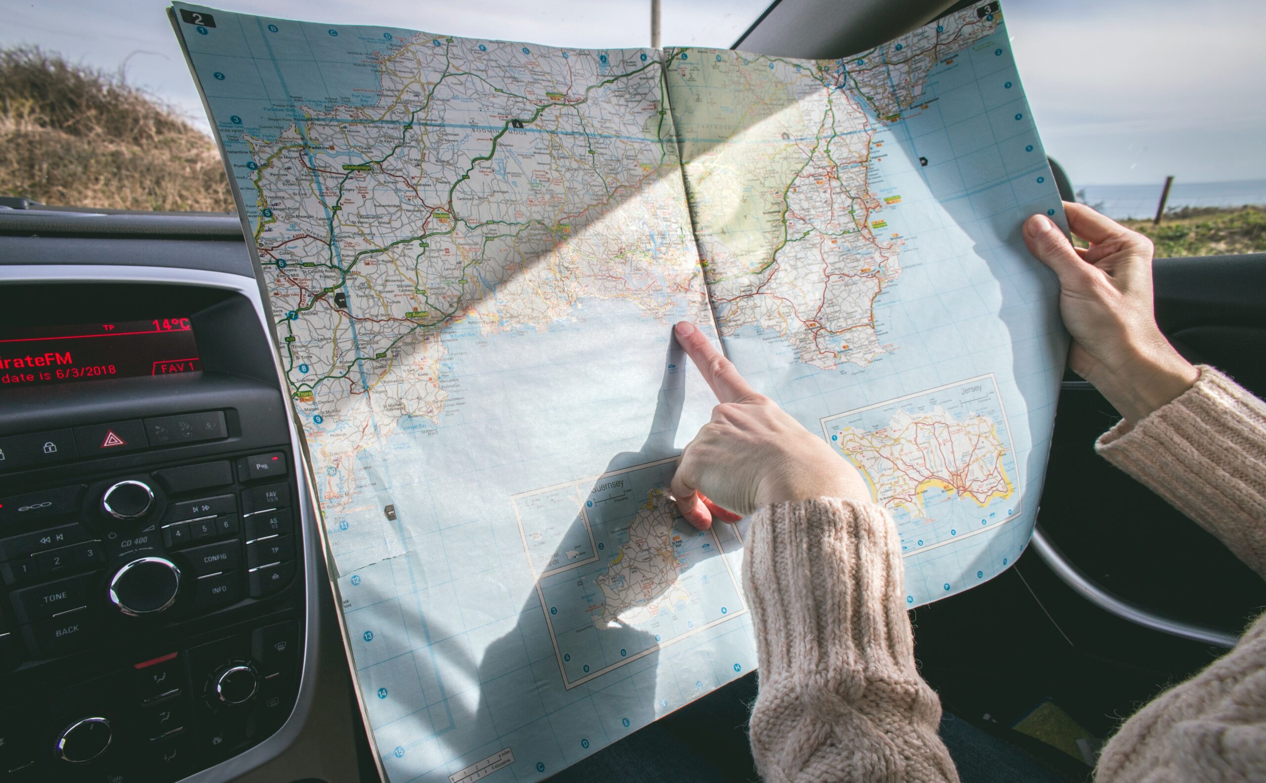
Folding Travel Maps - United States
Browse our large selection of hundreds of United States folding travel maps. This section is divided into U.S. Travel Maps, Regional U.S. Travel Maps, U.S. State Travel Maps, and U.S. City Maps. Get your hands on the right map with the right detail for your next trip abroad. Use the search at the top-right of the website to find a map for a specific region or simply browse the products below. We love technology and enjoy the convenience of GPS, but you can’t plan a trip on a phone screen and navigation doesn’t work where there’s no cell signal. Start your next trip on the right foot with a high-quality folding travel map. Make the most of your next adventure, even if you lose GPS or cell signals. You’ll always be on the correct route with our folding travel maps. Your adventure starts here! Please contact us if you need help choosing the perfect map for your travels.

U.S. Folding Travel Maps

Regional United States Maps
31 Products

US Folding State Maps
103 Products

US Folding City Maps
80 Products
- Continent Maps
- United States Maps
- Kids Section
- International Maps
- States Maps
- USGS Regional Maps
- Map Pins, Markers & Stickers
- Mounting Hardware
- Need Help? 704-332-5557
Username or email address *
Password *
Remember me Log in
Lost your password?

Home Page Index
- Get More Tips

- Bosnia and Herzegovina
- Czech Republic
- United Kingdom
- Washington DC
- West Virginia
- Pennsylvania
- North Carolina
- South Carolina
- Saving Money
- Travel Gear
- Trip Planning
- Quotes & Musings
- Travel-inspired Media
Best Sources For Free Paper Maps for Travel & Crafts
Paper maps are slowly being replaced by maps online, but you can still find a good supply if you know where to look. Do you prefer to have something of quality that you can hold in your hands? You might be wondering where you can find these paper maps. I thought I’d share a few ideas for sources for your next road trip, vacation planning, DIY, or craft project.
Traveling with Purpose is a reader-supported blog. In order to keep the lights on, I sometimes include links to products or services that I recommend. I may get commissions for any purchases that you make through those links, but it won’t cost you any more for the products. As an Amazon Associate, I also earn from qualifying purchases.

Table of Contents
Free or Low-Cost Paper Maps
If you don’t have a stash of paper maps already on hand for your next trip or DIY craft project you can find them in a variety of places. Remember that someone (possibly your own tax dollars) pays for the printing of these maps. Please be courteous and don’t just grab stacks of them. Be conservative and considerate and only take what you will use right away.

Re-Use Maps for DIY and Upcycled Crafts
I’ve shared a few ideas in the past (like this one) about creating fun DIY crafts and gifts using printed and paper maps or recycling maps as wrapping paper. These make perfect personalized items for yourself or gifts for your favorite travel lover. You can customize the project with maps from beloved places. And the best news is that you’re helping the environment by re-using paper that might otherwise end up in a landfill.
Pick up Free U.S. State, City or Regional Maps
Stop by any state, regional or local visitor center in the United States and you’ll likely find dozens, if not hundreds of free paper maps and brochures. If it’s the first visitor center you pass after you enter the state, you’ll often find a huge array of maps and info on every region of the state. Then as you travel throughout the state you can usually find smaller, more specific visitor centers for that region, city, or town with more localized information. In nearly every case they’ll have maps for free or at a very reasonable cost.

Remember, their business is to help you have a good time in their area to help the local economy, so they’re usually happy to give them away. They’ll sometimes even have topographical, biking, and hiking maps, national and state park maps. I’ve also seen paper maps that highlight a specific theme, like historical sites, winery trails, farms, artists, or whatever people might like to see in the region.
The Fun of Using Paper Maps
Some folks might think you’ve lost your mind if you’re looking for paper maps to use on your next road trip. Our culture has become so dependent on technology, Smartphones, personal computers, Smart watches and so much more to do our trip planning and navigation. I’m just as guilty as anyone. If someone asks a question about anything, I’m probably the first person to pull out my phone and look up the answer. My brother, on the other hand, still has an old flip phone with no data service or GPS. He gets around with maps and written directions and he even walks everywhere he can. His life is much slower than most and he likes it that way.
It might be unfathomable for you to imagine managing your trip the old-fashioned way, but I’m here to tell you it IS possible. It takes a bit more time and effort but gives a whole new perspective on travel. You might be surprised at how much more fun you have interacting with humans instead of devices. I recently came across this fun book called “ Paper Maps, No Apps – An Unplugged Travel Adventure “. Johnny Welsh offers a creative and hilarious travel memoir that encourages all of us to unplug more than we do now. Check it out. It will give you a good laugh and maybe a new perspective on technology.
Have Them Mailed to You
Not on the road and can’t get out to a visitor center or tourism office in person? You can find all the U.S. state tourism websites and how to contact them at this U.S.A. government Travel and Tourism page. Oftentimes they have visitor packets that they mail out. Or look for a phone number, email, or web page where you can request items you’re interested in receiving. As postal and printing rates go up, the promotion of sending paper maps may not be as easy to find, but it never hurts to ask. Remember not to waste tax-payer money (including your own) for shipping, printing, and paper. Only request what you know you’ll be using.
For example: Here’s where you can order a Virginia Travel Guide and Map
Amazon Printed and Wall Maps

Of course, Amazon will have a huge variety of maps too. You can find anything from individual city, state, country or world printed paper maps to gorgeous wall maps, map wallpaper, globes, laminated maps, antique and historical maps, and pretty much anything you can imagine.
Etsy Paper Maps and Craft Maps

If you still haven’t been able to find exactly what you want Etsy is filled with all kinds of options for vintage, antique, and modern maps . Some will be authentic and others reproductions. You may even find maps already cut in circles or hearts for your next project. If you’re using them for a craft project, a reproduction is probably your most cost-effective option. There’s no need to pay for an original map if you’re just going to cut it up. Besides, you won’t have to deal with any fold marks.
USGS and Federal Land Maps
Have you ever heard of the USGS? The United States Geological Survey is a science bureau within the United States Department of the Interior. These scientists research and provide vital information about the natural hazards that threaten the lives and livelihoods of the American people and the world.
One of the services that the USGS provides on their website is maps of each U.S. National Forest and Grassland. You can search for these maps by the state they’re in or by name here. These U.S. Forest Service Visitor maps aren’t free, but they offer information on attractions, facilities, services, and opportunities within each National Forest or Grassland.

The USGS also offers a wide variety of other maps in different formats for scientific, educational, or personal interests. Some are downloadable as a PDF (often free), some are printed maps on paper and can be ordered to be mailed to you. Below is a list of some of the various types of maps you’ll find there . I can’t list them all because there are so many different kinds.
Antarctica Maps, County Maps, Geologic Maps, Hazard Maps, Historical Maps, Hydrologic Maps, National Atlas Maps, National Parks Maps, Planets and Moon Maps, State Maps, Topographical Maps, and World Maps.
If you love maps, science, beauty or just enjoy learning, I can guarantee that you’ll spend hours on this site exploring all the interesting information, educational materials, and maps available there. The colorful Colorado Geologic Map above is just one example of the gorgeous maps you’ll find that turn science into art. Have fun exploring!
BONUS: Educational institutions can receive discounts up to 50% on qualifying USGS products too!
International Paper Maps
If you’re based in the U.S. and are looking for maps from other countries, many of them have tourism offices in the United States. This link goes to a list of foreign countries/destinations and regions and their tourist information offices within the United States. Where available, the address, phone number, and website of each are included. If the country doesn’t have a tourism office in America, the embassy or consulate address and tourism board website are provided (if there is a website).
Check Yard Sales, Thrift Stores, Antique Shops, Libraries, Used Bookstores

Prices will vary greatly in these venues depending on the value of the map. You can sometimes find stacks of road maps at yards sales and they’ll pretty much pay you to take them off their hands. Antique shops could be another story as far as price, but you never know what treasures you’ll find there for a reasonable price if you want to haggle.
Libraries often sell outdated books for $1 each at their book sales. You could find old atlas books that are no longer accurate with hundreds of pages of maps. Used bookstores are another great source for maps and atlases and their prices are generally very reasonable. Some stores will even allow you to trade or sell some of your own books in exchange for their products. As a side-note, these are also awesome places to find vintage or antique postcards. They make excellent DIY and craft projects for travel lovers too.
American Automobile Association – AAA Paper Maps

If you or someone you know is a member of AAA you (or they) can pick up a current state map, map of the U.S., or various regional and city maps for FREE. Some international maps are available for free as well. All you have to do is stop by an office and show them your AAA membership card. The selection at each branch will vary and they will generally have more detailed maps for their region. If you’re visiting the other side of the country stop in a AAA office and pick up more specific maps for that area. These free maps are part of the benefit of being a paid member. You may also be able to download and print some maps from their website here.

Mapbox Custom Maps
If you still haven’t found the perfect printed map for your purposes check out “ Mapbox Studio ” online. This map creation tool is available online and through iOS and Android apps for your phone.
“Mapbox Studio is like Photoshop, for maps. We give designers control over everything from colors and fonts to 3D features and camera angles, to the pitch of the map as a car enters a turn.” Mapbox Studio
As a Mapbox user you can create precisely the map you want, then print out the static map yourself. You can also send it to your local printer for higher quality or large format color printing. The possibilities are endless.
Personalized Map DIY Table Project

I recently used free maps to make two upcycled Ikea tables highlighting places where my husband and I have lived. It was a lot of fun, easy, and it really spruced up a couple of dingy-looking tables that were still usable. You can find all the instructions for how to make them here.
Do you have a great source for free or low-cost maps that I’m missing? Have you used maps for a DIY, craft, or upcycled project? I’d love to hear about it. If so, please let me know in the comments below.
This site may contain affiliate links to products or services. Any commissions for purchases made through these links help to keep Traveling with Purpose going. and they don’t add anything to your purchase price. Thanks for your support!
Tags: antique maps , colored paper maps , downloadable maps , Europe paper maps , featured , free maps , historical maps , low cost maps , Mapbox , maps , paper maps , printed maps , U.S. maps , world maps
Category : Gift Ideas , Travel Gear , Travel Inspiration , Travel Tips , Trip Planning
If you enjoyed this article, subscribe to receive more just like it.

Comments (18)
Trackback URL | Comments RSS Feed
Sites That Link to this Post
- Where to Find Info About Historical Travel in the U.S. • Traveling with Purpose : Traveling with Purpose | February 16, 2024

When I lived in Los Angeles I used to make plaster of Paris frames in a mold and then paint or cover them and turn them into photo frames or small mirrors. My favorite ones were always the ones that I used old maps to create and aged the maps with cold tea before varnishing them

Sounds like a fun project! It really is a great craft resource. Thanks for the idea.

I need a free map for Kinston North Carolina 606 Charleston Drive Hampton Virginia 23666
Hi Alvin, Feel free to check any of the sources I have listed.

I’m trying to obtain a map of every state in the united states’for my mother-in-law who is disabled and wants to make one of her walls around her desk a life size map. I’m trying to help her and she’s not having much luck and she may need to have another neck surgery before she can do her hip surgery which has been put off because she has a 96% chance of not making out of anasteshia. Could you please help me with the maps so I can make her a beautiful map of the Union?!
Hi Stacy, Depending on what size you’re looking for it sounds like your best bet may a USA Wall Mural or Wallpaper like the ones at this link. https://amzn.to/3IS3K1i Have fun finding the perfect fit for her.

Really helpful post thank you!

How can I get a Connecticut state map mailed to me?
First option would be to contact the tourism bureau to see if they’ll mail one.

Thanks for this list!
You’re quite welcome!

Do you mail out free maps? Please send one for Ponce, PR and Nashville, TN to the following address: Thanks.

Unfortunately, I don’t, but the blog post lists and links to several sources where you might be able to find them. Best of luck in your search!

I used to collect maps as a kid and it turned into a lifetime obsession. I physically wrote to every state tourism office and received maps from all 50 and Canada.
Sadly, physical maps are disappearing and harder to find.
Noticed that several missed the point that they need to request or find their own maps from the sources listed.
It certainly is becoming a lost art and well worth collecting. So cool that you collected all of them from the US and Canada! Well done.

can you please send me a free paper us map, Shonna Kisner
Hello Darren & Shonna, This post is intended to give you the resources to contact other sources for free maps. Unfortunately, I don’t have maps to send out. Happy hunting!
Leave a Reply
Name ( required )
Email ( required; will not be published )
XHTML: You can use these tags: <a href="" title=""> <abbr title=""> <acronym title=""> <b> <blockquote cite=""> <cite> <code> <del datetime=""> <em> <i> <q cite=""> <s> <strike> <strong>
Sign me up for your weekly newsletter!

Get my newsletters!

Your purchases help me keep the lights on - at no additional cost to you. Thank you!
Traveling with Purpose
- Privacy Policy
World Of Maps.com
Established 1994 - "For the Love of Travel and Maps." - Ottawa, Ontario
Call Customer Service toll free: 1-800-214-8524
- Topographic Maps
- Browse Category
- There's a whole world out there to explore. All you need is a book. shop our Book store
- There's a whole world out there to explore. All you need is a map. shop our topographic maps
- There's a whole world out there to explore. All you need is a map Shop our Educational products
- There's a whole world out there to explore. All you need is a flag. shop our Flags
- There's a whole world out there to explore. All you need is a map. Shop our aeronautical charts
- Decorate your space Printing, Mounting & Framing. shop our Printing Framing Options
- There's a whole world out there to explore. All you need is a map. shop our nautical charts
- There's a whole world out there to explore. All you need is a map. shop our Travel & Adventure maps
- There's a whole world out there to explore. All you need is a globe. shop our globes
Make your own
Books & atlases, travel maps, gifts & travel accessories, flags of the world, maps & posters, let us help you begin your journey..., canadian topographic maps , printed on paper or plastic, world maps of different sizes and styles and other wall maps, globes from small desktop to large floor models, travel books and atlases for all countries and regions, worldwide nautical and aeronautical maps and charts, international and canadian flags.
Navigating the World: A Guide to Traveling with Paper Maps
- July 1, 2022
In today’s digital age, where smartphones and GPS devices seem to have all the answers, the charm of navigating with a paper map might appear to be a lost art. However, there’s an undeniable allure to unfolding a well-worn map and plotting your course with your own two hands. Whether you’re a seasoned traveler or an adventurer seeking a new experience, here’s your comprehensive guide to mastering the art of traveling with paper maps.
1. Embrace the Adventure: Using a paper map is not just about finding your way; it’s about embracing the journey. The tactile experience of unfolding a map and tracing your route allows you to engage with your surroundings on a deeper level. Every fold, crease, and mark on the map tells a story of your travels.
2. Choose the Right Map: Before you embark on your journey, select a reliable paper map of your destination. Look for one that’s up-to-date and provides enough detail to help you navigate comfortably. Tourist information centers, bookstores, or online map retailers are great places to find quality maps.
3. Study Your Map: Before you set off, spend time studying your map. Familiarize yourself with key landmarks, major roads, and geographical features. Identify the main points of interest you want to visit, and trace potential routes connecting them.
4. Plan Your Route: Plotting your route on a paper map requires a bit of planning. Use a highlighter or a pencil to mark your intended path, noting any important turns or intersections. If you’re hiking or exploring areas without well-defined roads, mark your trail and potential landmarks.
5. Pack Essential Supplies: Don’t forget to carry a few essential supplies: a magnifying glass to read small details, a compass for orienting yourself, and a small ruler or straightedge to help you trace accurate lines on the map.
6. Stay Open to Detours: While having a planned route is important, leave room for spontaneity. Paper maps allow you to discover alternate routes or unexpected attractions along the way. Detours might lead you to charming villages, scenic viewpoints, or local eateries that you wouldn’t have stumbled upon otherwise.
7. Use Landmarks as Reference: When navigating with a paper map, use physical landmarks as reference points. Look for distinctive buildings, mountains, rivers, or other features to confirm your location and track your progress.
8. Ask Locals for Assistance: Interacting with locals can enhance your travel experience. If you find yourself a bit lost, don’t hesitate to approach locals for directions. Your paper map can serve as a conversation starter and an opportunity to connect with people from the area.
9. Document Your Journey: Journeying with a paper map provides an excellent opportunity to document your adventure. Take photos of your map at different points along your route, capturing your progress and the annotations you’ve made. These snapshots will become cherished memories of your trip.
10. Combine Modern Tools: While the allure of paper maps is undeniable, modern technology can still complement your journey. Use your smartphone’s camera to capture photos of your paper map, allowing you to zoom in on details or refer back to it if it gets windy or rainy.
In a world of GPS and digital navigation, traveling with a paper map offers a unique and fulfilling experience. It connects you to the traditions of explorers past and allows you to engage more deeply with the world around you. So, the next time you plan your adventure, consider folding up that trusty paper map and setting off on a journey filled with discovery and wonder.
Leave a Reply Cancel reply
Your email address will not be published.
Save my name, email, and website in this browser for the next time I comment.

Subscribe newsletter $ get company news.
List choice Ovatheme
We created the travel agency to combine our passion for travel with our desire to assist leisure, It is a business of details
- Our Packages
- Our Destinations
- Privacy Policy
Contact Info
- M A Link road, Munwarabad, Srinagar
- +91-9103170070
- +91-7006884416
- [email protected]
- © 2023 Meet Tour and Travels, All Rights Reserved.
Home » Gear Reviews » Reviews
Best paper maps

The electrical grid , GPS system , and cell networks are all fragile and can fail quickly in emergencies, much less a SHTF situation. Or maybe you simply don’t have access to a phone/device when you need it. That’s why it’s important to keep a stock of paper maps handy and know how to use them.
Tip : Maps can be more useful than people expect, especially as more of us are growing up without ever needing to actually use a map for figuring out where we are, plotting a course, or finding water. Learn more about how to read a map and how to use a map and compass
Most important bits:
- You should at least have a national road atlas, a state atlas, and a folding topographic map of the local area you can keep in your go-bag.
- You can also buy detailed maps of individual large cities in your area — especially if you’re likely to pass through it when evacuating.
- If you only have one or two maps total, we generally recommend going with laminated/waterproof maps because the durability benefits outweigh the cons of not being able to write directly on them.
- If buying a laminated folding map, you don’t want ones that fail to fold flatly because the extra thickness of the laminate blocks the creases. Well-designed maps will build extra margin around the crease so that everything folds neatly.
- Scale defines how “zoomed in” a map is. Small-scale maps show more area but less detail. Large-scale maps show more detail but less area.
- For national atlases, both Rand McNally and National Geographic are good and very similar.
- DeLorme makes good state atlases for all 50 states. However, they’re limited in city detail, so you may have to obtain a separate map for individual cities.
- The US Geological Survey and National Geographic both offer free topographic maps you can print yourself or have printed. However, the USGS maps are very large and difficult to print.
- MyTopo offers large, waterproof, custom topographic maps of any area you want.

- Rand McNally 2022 Road Atlas with Protective Vinyl Cover
- Check price on Amazon

National Geographic Road Atlas 2022: Adventure Edition
- National Geographic Road Atlas 2022: Adventure Edition (choose between this or the Rand McNally atlas)
- DeLorme Atlas & Gazetteer for your state
- A custom MyTopo map of the area around your house
Other map sources:
- Benchmark state atlases
- City maps from The Map Shop
- TrakMaps for custom topographic maps in Canada
- Free topographic maps from the US Geological Survey
- Free topographic quarter quads from National Geographic
- Free custom topo maps from CalTopo
- Free maps at your local tourist center, library, etc.

Map types you should buy
For personal preparedness, there are a few core map types that make sense to focus on first:
- A road atlas: These large books contain maps of the entire United States, including major metropolitan areas, and some parts of Canada and Mexico. They’re useful for cross-country driving and when you’re away from your usual neck of the woods, but they may not be very useful in remote areas and small towns.
- A state atlas: Of both your state and any adjoining states if you live near a border. These will have county and city maps even for more-remote places and will show details a nationwide atlas won’t, like backroads.
- A folding topographic map: To keep in your go-bag. In a bug-out scenario, you may be on foot and have to navigate with a map and compass with a topographic map. Topographic maps usually show roads as well, but their primary purpose is showing natural features, like elevation and bodies of water.
You may also want maps of cities near you. Both national and state atlases omit street-level detail in cities, especially smaller ones. Maps of major metropolitan areas show more detail and often have detailed maps of surrounding towns (they’re produced by different publishers, The Map Shop is a good resource). If a major map publisher doesn’t offer a map for your town, you may be able to obtain one from the city or county government.
Depending on your area, there are other maps you might consider as well:
- Subway maps: If you live in a major city with a subway line, a map of those lines is nice to have.
- Nautical charts: If you live near the ocean or other big bodies of water like the Great Lakes, it wouldn’t hurt to have a nautical chart of those waters.
- Fish and game maps: Your state’s fish and wildlife department might have maps that highlight good fishing spots or maps of public hunting land.
- National parks and forests: The federal government publishes maps of national parks and forests , and you should get one if you have a national park nearby or plan to travel to one.
Understanding scale
Paper maps can’t be zoomed in and out, so cartographers have to decide what scale to draw them at. Scale is the relationship between size on the map to the size in the real world. For instance, if the scale is set so one inch equals one mile, you know that if you travel three inches on the map, you will have traveled three miles.
Some maps are not drawn to scale and are usually marked as such with “not to scale” or NTS. That means that while an area has been shrunk down to fit on a piece of paper, there is not a direct correlation between measurement units. These maps are fine for finding your way around Walt Disney World but are not fit for preparedness.

The scale doesn’t just define the relationship between small units on the map and large units in the real world, but it also defines how zoomed in and detailed the map is. A small-scale map shows a larger area with less detail, while a large-scale map shows a smaller area in greater detail. It’s a bit counterintuitive. Just remember large is small and the larger the number, the smaller the scale.

The United States Army actually defines three map scales:
- Small: Maps with scales of 1:1,000,000 and smaller for “general planning and strategic studies.”
- Medium: Maps larger than 1:1,000,000 but smaller than 1:75,000.
- Large: Maps of 1:75,000 and larger.
Many road atlases will show a small- or medium-scale map with large-scale callouts of important areas.
Comparison of top map brands
In the United States, there are two major producers of national atlases: Rand McNally and National Geographic. Their atlases are extremely similar. Here’s a roundup of differences:
- The National Geographic atlas is spiral bound and is printed on thicker paper than the Rand McNally, which is bound with staples.
- The National Geographic atlas has brighter map colors than the Rand McNally.
- Rand McNally has clearer exit markers, with white text on a green background just like interstate signs. National Geographic marks exit numbers with little blue numbers that are harder to see.
- The National Geographic atlas costs more than most Rand McNally atlases, but they’re both cheap.

There are other minor differences, but again, they’re both very similar.
For a state atlas, your most consistent choice is DeLorme, a division of Garmin, which produces atlases for all 50 states. The DeLorme maps double as both road atlases and topographic maps. Benchmark makes highly regarded state atlases, but they only cover a handful of mostly western states.
However, even DeLorme’s city views aren’t as detailed as you’d probably like, with smaller streets becoming a tangle of unmarked lines, which is why a city-specific map is good to have on hand.

The standard for foldable topographic maps in the United States is MyTopo , which lets you order custom topographic maps of any location you want. We’ll cover how to order a custom map from MyTopo in this guide. We’ll also point you to resources to download free topographic maps.
For other maps, like individual city maps, check out The Map Shop , which sells maps and nothing but maps.
How often should you buy new maps?
Rand McNally and National Geographic update their road atlases every year. New roads are added, old roads are closed, etc., so you want the most up-to-date information. You should replace them at least once every five years or so, but ideally every year.
The DeLorme atlases are less consistent. If you look at copyright dates for the various state atlases , they range all the way from 1999 to the current year. You might check every other year or so to see if a new edition has been published.
As for topographic maps, the terrain doesn’t change very often and the government can take decades to update the data. If you have a map of the area around your home, order a new one if any major changes happen in your area. Otherwise, you should be fine replacing the map when it wears out. Always get a fresh, up-to-date map of an unknown place.
Geodetic datums
When choosing and comparing topographic maps, it’s important to understand the concept of geodetic datums. Think of these like map languages, and it’s very important to make sure that whenever you compare two maps that you’re speaking the same language.
In the simplest terms, a datum is the model of the earth on which cartographers base their maps. Here are the three most common datums used in United States maps:
- NAD27: The North American Datum of 1927, which is most commonly found on historical maps published through 2006 .
- NAD83: The North American Datum of 1983, which is the more current datum.
- WGS84: Short for the World Geodetic System of 1984. This is the datum used by the Global Positioning System.
It’s very important when comparing maps to ensure that they’re using the same datum. For instance, if you’re referring to a historical map using NAD27 and another party you’re communicating with is using a NAD83 map, your coordinates may not match up at all!
NAD83 and WGS84 are often used interchangeably, and that’s fine for land navigation. However, there are slight differences that make them not interchangeable for precision applications, like land surveying.
There are new datums set to replace NAD83 in 2022, though that may be delayed. For now, NAD83/WGS84 are the most current datums in common use.
In short, you don’t need to know the technical details of datums, just know how to identify them on your map and know which one it uses.
Meet the US Geological Survey
The US Geological Survey (USGS) creates topographic maps of the entire United States. They provide free maps you can print yourself or you can order maps from them for a nominal fee. Many commercial topographic maps are based on USGS maps.
USGS maps divide the United States into quadrangles, each representing 100,000 meters (100 km), presented at 1:24,000 scale (except for some places, like Alaska and Puerto Rico, which are displayed at different scales). They’re called 7.5-minute maps because they represent 7.5 minutes of latitude and 7.5 minutes of longitude.
Searching the USGS store can bring up several types of maps for any given location, but there are two we’re concerned with:
- Historical Topographical Maps: These hand-drawn maps produced through 1992 used the NAD27 datum and contain much more detail than newer maps.
- US Topo maps: These are the maps the USGS has produced since 2009. They use the NAD83 datum. They are less detailed than historical maps because they are built from GIS databases instead of land surveys.
Due to budget cuts over the years, USGS had to abandon field collection of data, which means that while newer maps are compatible with GPS systems, they don’t reveal as much information, such as:
- Recreational trails: The USGS is working to add more of these as time goes on.
- Buildings and structures: Older maps marked public buildings like courthouses, libraries, and bridges. USGS is trying to integrate these.
- Powerlines and pipelines: Older maps had these, but newer maps probably never will due to security issues.
- Remote roads: The USGS is trying to work with other federal agencies to map these backroads.
- Public landmarks: Some are marked, such as the White House, but many are still missing.
- Recreational features like campgrounds, boat docks, swimming pools, etc.: The newer maps show a few provided by the US Forest Service and National Park Service, but the USGS says they’re not high priority.
If you have to pick one, you’re better off with the newer US Topo maps, since they use the NAD83 datum and have the most up-to-date information. However, comparing it against a historical topographic map may reveal interesting details not on the newer maps.
MyTopo sells maps based on the historical topographic maps but updates pertinent information and bases them on the NAD83 datum. We’ll cover how to obtain a custom map from them below.
How to download USGS maps
- USGS Store Map Locator
- Type an address into the Map Locator field
- Click the suggested address that appears below the search field
- Click the blue pin that appears on the map
- Click View Products

A list of available maps appears. You can click View PDF by a map listing to download a PDF of that map. The most recent maps are marked 2019.

Be aware that these PDF files are very large, 100 MB or more. You can view them in any PDF reader, but slower computers may struggle with rendering the files.
Free topographic maps from National Geographic
National Geographic also offers free topographic maps, adapted from historical USGS maps and split into quarter-quads to make them easy to print. The maps may have out-of-date details, but they’re a cheap and easy option.
Zoom in on the map in the area you’re interested in mapping. Click the red square near the general area and then click the map in the pop-up, which gives you a PDF of the desired map.

The first page is an index with a red outline around the mapped quad. Each quad is marked with a page number. Each page displays that quarter quad.

Viewing, printing, and protecting USGS and National Geographic Maps
The National Geographic maps are easy to print since National Geographic splits each quad into 8.5×11-inch quarters that you can print on Letter-sized paper on any color printer. If you have access to a color laser printer, it will produce better results. Inkjet printers tend to bleed and make details fuzzy.
You may also consider higher-quality paper. Rite in the Rain makes a waterproof copier paper that works with laser printers (not inkjets!). If you print on standard paper, you’ll want to laminate the map so it isn’t ruined by moisture. There are self-laminating sheets that don’t require a machine, but they’re glossy and thus hard to read in the sun. A better option is a laminating machine or a trip to a copy shop that can do it for you.
USGS maps are much harder to print because they’re 24×29 inches. A print shop should be able to make a print that large, but the best option, if it’s available to you, is a plotter. Unfortunately, plotters aren’t common, but if you have a university nearby with a GIS department, they probably have one and might make a print for you.
However, for maps that size, buying a map from MyTopo is probably a better and more cost-effective option. It will be printed on waterproof paper and pre-folded to fit in your go-bag.
Another option to consider with PDF maps is to carry a tablet in the field, like an iPad or a Samsung Tab. The advantage is you can carry dozens of maps with you in the field without an Internet connection. The disadvantage is that the battery must be charged and the tablet could break.
You can offset these drawbacks with a durable case, like an Otterbox, and with an external battery pack paired with a solar charger . However, you should still have at least one paper map of your area that can’t break and doesn’t require batteries.
T.Rex Arms has published a video exploring these options.
How to order a topographic map from MyTopo
You can download USGS maps for free and have them printed wherever you want, but they have drawbacks:
- The newer US Topo maps aren’t as detailed as the old ones
- The newer US Topo maps also have satellite imagery, which can obscure the contour lines when printed
- You have to find a printer that can print large maps in high resolution
- Since the maps are broken up by quadrangles, you may need several maps to cover the area around your home if it’s near an edge
The National Geographic maps are free and easy to print, but are out of date and only show a quarter of a quad.
MyTopo offers custom USGS maps for a reasonable price, about $20 after shipping. Here are some of the advantages of buying a map from MyTopo:
- They’re based on the more-detailed USGS historical maps but are updated with recent information , like roads
- They can be customized to be centered on an address, like your home
- They can be ordered with custom options like property lines and shaded contour relief
- They can be ordered to use the NAD83 datum instead of the older NAD27 datum
- They’re printed on waterproof, tear-resistant paper
Update : As of Feb. 2022 the only way to buy a custom map from MyTopo is to call 877-587-9004. Once they finish the site redesign the following instructions should work again.
We’re not sponsored by MyTopo, it’s just a great resource for topographic maps that can fit in your go-bag. However, it offers an overwhelming number of options, so here’s how to order a useful map:
- Visit MyTopo
- Click Search Maps Now
- Enter an address in the search field, like your home address

- Click Continue to Step 3
- You’re presented with printing options. For a map to stick in your go-bag, select Waterproof “Outdoor” Map and Folded.
- Click Continue to Step 4.
- Enter a custom title, subtitle, and owner name if you want.
- For Lat/Lon, select Tic Marks. That will note latitude and longitude coordinates on the outside of the map but won’t add extra lines to the map itself. The more lines on the map, the harder it will be to read.
- For UTM / MGRS / USNG, select Full Grid Lines. We want those gridlines on the map for navigation.
- Under Datum, leave it at NAD83/WGS84.

- Click Preview and then “View a preview of your printed map,” which opens a new window that generates a preview of the map.

- If you want to edit the map, return to the first window and click Edit Map. Unfortunately, that takes you back to the second step and you’ll have to click through again to adjust options.
- If you’re satisfied with the map, click Add to Cart.
- Click Begin Checkout and conclude the checkout process.
You can submit private feedback to editor@theprepared.com
Vacation traveling and bugout bags: How do you pack to stay prepared?
Had a road trip - felt very unprepared, how we can teach children and youth prepping skills.
- Emergency preparedness checklist: prepping for beginners
- Rational reasons why you should be prepared
- Sane Prepper Mantra: Common sense rules
- Why you should share your prepping
- Prepping Basics
- Gear Reviews
- Emergency Scenarios
- Bug Out Bags
- Bug Out Vehicles
- Prepared Home
- Survival Skills
- Self Defense
- Your Situations
- Course Login

Maps For Travel
Paper maps | wall maps | globes | travel maps | nautical charts | 3d raised relief maps | world maps.
Paper maps are making a comeback as people desire a tangible connection to the physical world and a sense of adventure. Maps, globes, nautical charts, and 3D raised relief maps are gaining popularity once again, providing a real and meaningful way to explore the world. Learn more about the resurgence of paper maps and how they can help you discover the world!
Hallmark movies often feature female protagonists embarking on a journey to discover a new appreciation for the world around them, both physically and emotionally. These journeys often lead to self-discovery and exploration.
Photo Credit: HallmarkChannel.com
This post may contain affiliate links. Please read my disclosure and privacy policy .
Table of Contents
In the modern world, it’s easy to feel stuck in a routine and forget to be adventurous. It’s important to remember that life is an adventure, full of new experiences and opportunities.
Beyond GPS Directions
GPS directions may be convenient, but they can limit exploration. To discover new places, try taking a road trip with frequent stops or researching unique locations online. Don’t lose the joy of travel by relying solely on GPS.
Benefits of Maps
Maps give a bird’s eye view of the world. They show the topography of the land, including waterways and vegetation. Maps also help us locate landmarks and transportation hubs, cultural and religious sites. We can use maps to plan journeys, determining the best route, distance and travel time.
"Dear Reader, Get out your map, pick somewhere and just run." Taylor Swift
When it comes to travelling and making new discoveries, paper maps are the best way to go! A piece of paper can be folded up and tucked away in a pocket or bag – much easier than lugging around a heavy atlas! Even better, I love just unfolding my map and exploring the region indicated: looking at roads, rivers and points of interest that I hadn’t known about. It’s almost like being an explorer, discovering something anew – I get so excited with each journey! Paper maps are definitely my favorite way of seeing the world.

Randy McNally Folded Maps

Folded with flags and facts from National Geographic
Wall maps bring art, style, and color to any room. Teach kids geography and learn about cultures, history, and travel. Use wall maps as a backdrop for your travel stories or create nesting collages in separate rooms to transport you from place to place!

Bright Standards
Nautical Charts
Explore seas with nautical charts! They provide detailed illustrations of shorelines and seafloors, and offer insight into coastlines, reefs, and mysterious creatures. Discover adventure at every turn – from dolphins to starfish. Don’t forget your nautical chart on your next journey!

National Ocean and Atmospheric Administration Chart 411

NOAA Chart 11013

NOAA Chart 18640
Spinning a globe is a special way to explore our planet and learn about different countries. Globes offer incredible detail and a fun way to hunt for global geography.

This antique globe adds elegance to any space.

I've had the pleasure of working in 3 different libraries, and each one has a version of this Replogle globe. It's always a hit with students who love spinning it and discovering new things! 🌎

Old World Christmas shop
3D Raised Relief Maps
Discover Earth through 3D relief maps, featuring mountains, forests, streets, lakes, and rivers. They are interactive and provide information on historical sites and other landmarks. Find them online or in specialty stores. High-quality maps last longer but come at a higher cost. Detailed information about locations is available for free online.

Hubbard Scientific 3D Raised Relief Maps
Personalized Maps
Create your own personalized travel map and display the story of your travels with friends and family. Choose from a variety of sizes, styles, and designs, and even add a custom tagline. Take it one step further and mount it with Moore Map pins to remember all those special moments. Perfect for the adventurous soul in all of us.

Personalized vintage world map canvas with push pins in 3 sizes with personalized name or a quote from Holy Cow Canvas

This stretched canvas print comes equipped with a heavy-duty internal frame and a wood fiber backing perfect for push pins from Conquest Maps
Maps offer an interactive way to explore the world with fun facts and insights about topography and landmarks. Get started today with free online resources or by buying a map and start uncovering the world from home.
Pin for Later

More Hallmark Settings

New York City as a setting in Hallmark Movies

DIY Built in Bookshelves to make a Library

Lake Austin Spa Resort | Wellness Resort Self-Care Trip
Latest posts.

Hallmark Channel’s ‘Spring into Love’ Movies

‘The Way Home’: Hallmark Series with Andie MacDowell

Easter Gifts, Shopping & Movies on Hallmark Channel, including new movie, An Easter Bloom and

Hallmark Channel Chief Fan Officer Winner #1 Fan 2023

Mother’s Day Cards, Gifts, Travel, Food, Celebrations & Hallmark Movies!

Hallmark Movies about Christian Faith with DaySpring | An Easter Bloom
Subscribe for: 'you in a hallmark movie'.
Jenny Forwark, All Rights Reserved 2024
TERMS AND CONDITIONS | PRIVACY POLICY | DISCLOSURE

Folded Map: United States
Rand McNally folded maps have been the trusted standard for years, offering unbeatable accuracy and reliability at a great price.
- Interstate and U.S. highways
- Indications of cities, points of interest, airports, boundaries, and more
- Mileage chart
- Mileage & driving times map
- National facts and symbols
- Toll roads chart
- United States physical map
- Visitor information
- Copyright 2022
Product Details
Measures 4.125" x 9" and folds out to 25.5" x 36.75".
Description
Reviews (0), additional info, be the first to write a review, related products.

Easy to Read: Central United States

Folded Map: Eastern United States

Easy to Read: Western United States

Folded Map: Hawaii State Map

ProSeries Wall Map: United States

How To Make A Travel Map [Tips and Free Template]
Planning a trip abroad? If you want your trip to go smoothly, especially if traveling with a group, you'll want to make a travel map.
Chelsey Roney
CEO, Co-Founder

Putting together a travel map can be a fun and insightful exercise that helps you throughout your journeys. Any seasoned traveler knows that planning and anticipating your trip is an enjoyable part of the process. And they also know that, when it comes to having a positive experience, a little bit of planning and preparation goes a long way.
That’s why we put together this guide on how to make a travel map. We hope that you find this advice useful during your itinerary. You may even find that your travel map is a wonderful way to remember your trip long after the travel dates have come and gone. Without further ado, let’s dive into some FAQs about travel planning maps.
What is a Travel Map?
A travel map is any kind of representation of the places you’re going. It can help you keep track of places you want to go and the information you need to remember. Back in the old days, a travel map would be on paper. While some people may prefer the nostalgia of putting together a paper map, most people in the 21st century prefer a more high-tech solution. You can put together a group travel map on many types of mapping software.
Those who use Google maps or Apple Maps may lean towards their preferred daily navigation tool. However, there is also value in finding a more niche solution to this exciting project of putting together a personal travel map . Before we dive into the specifics of how you can put together your very own travel map, let’s take a look at some of the benefits that a travel itinerary map has to offer.
Benefits of a Travel Map
First and foremost, having a travel map will help you keep your itineraries organized. If you’re hoping to make the most of your trip and see every site that you had on your bucket list, a bit of organization goes a long way. After all, you don’t want to waste precious time and energy on your vacation or travels trying to figure out basic logistics that you could have researched beforehand if you were more diligent.
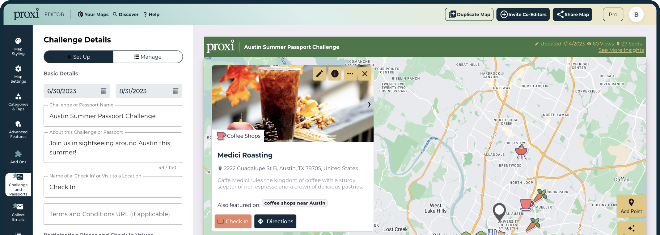
A travel map can also be a good opportunity to share information and collaborate with your travel partners. Different people have different visions of the ideal journey. Therefore, collaboration and communication are quite important. Some tools (such as Proxi) offer the opportunity to build a travel map together on a single platform from multiple accounts. This can help reduce miscommunications and frustrations over poorly planned Itineraries.
What to Include in Your Travel Map?
Now that we’ve talked about the benefits of putting together a travel map, let’s take a look at a few of the most common elements that you want to consider adding to yours. We’ll start with some basic trip amenities that any traveler will need to consider. From there, we can talk about the specifics of your journey.
Hotels and Accommodations
On your trip, you will obviously need a place to stay. The exact hotel that you choose will depend on your budget and your plans during your stay. But a few things to always look for are location, quality, and price.
You want a hotel that is located close to the attractions you’ll be visiting. It’s also worth considering if the area your hotel is in is walkable and if it has connectivity with local trains, buses, bike shares, and other transit options. Checking Google reviews and other customer feedback can help you decide between the hotel options.
Price is a concern for most travelers to some degree, so you will want to understand the cost of each option as well. Once you have chosen a hotel, your travel map can help you remember key details such as the address, check-in hours, and where you will be heading out to once you leave your hotel
Sights and Attractions
Add attractions your want to see. Now that we’ve taken care of accommodations let’s dive into the attractions! You can find information about the attractions in the area you’re traveling to by creatively scouring the web. Platforms like Yelp, Reddit, and even Quora are good places to start . If you can find a travel blog or YouTube channel with more personal and subjective content from creators you love, that may help even more. Once you’ve chosen the attractions you’d like to visit, you can use your travel map to keep track of information such as the address, the ticket page, the hours, when you will go, and any relevant links to reservations.
Travel Arrangements
A Travel map is also a good place to keep track of your arrangements. There’s nothing worse than arriving at an airport or train station and not being able to find your boarding pass. So why not keep your ticket links directly in a unified and cohesive travel map? You can also note down information such as station location, transit to the airport, and departure times of all your journeys.
When traveling with a large group, these situations can be particularly chaotic or even stressful if not managed well. In order to coordinate your party when heading to the airport, train station, or bus terminal, digital tickets and a readily accessible itinerary are invaluable.
Food, Drinks, and Dining
A key part of experiencing any local culture is finding the food fare. If you do research beforehand, you can take note of the restaurants you would most like to visit. Of course, you can also add information on hours, menu items, reservations, and the address for any dining establishments you will be patronizing.
With a digital travel map, you can start researching (and anticipating) all the amazing food, drinks, and experiences you will have. And all that research can be stored and accessed, making for a wonderfully seamless chain of events.
Additional Tips
By now, your travel vision is really beginning to take shape. The big day is approaching, and soon you will be on your way to experience new things and build memories that will last a lifetime. Here are some final tips to put the finishing touches on your travel map and be fully prepared for everything that life – and your journey – will throw at you.
Take Advantage of the Cloud
Use an online map maker so you can access your map anywhere. There’s nothing worse than putting tons of work into a map that you then leave in the hotel at the most crucial moment. An online map will allow you to access the same information from multiple devices, and it will make it easy to share that information among multiple people.
While there is certainly some nostalgic value in a paper map, we would recommend buying one for a souvenir if you really want one but relying on a more modern and robust digital solution for your day-in and day-out travel necessities.
Get Organized and Create Categories
Group map pins into different categories to help keep things organized. For example, you may wish to group all of the museums you will be visiting into one category and all of the architectural sites you wish to experience in a different one. Things such as accommodations, hotels, and transit can also deserve their own categories.
The exact division of locations into distinct categories is ultimately up to you, but you want to pick a consistent theme that is practical for the purposes of your particular travel experience. Grouping pins in this fashion can also help make sure that everyone on the trip gets to have their own input. Group travel is sometimes challenging, but good communication can help.
Add Photos and Organize Memories
A digital travel map with pins is useful for more than just planning. The great thing is that you can later use the pins to upload photos of your vacation if you are using a proper travel map software such as Proxi. You can upload photos of your vacation to each respective pin, turning your map into a photo album.
With Proxi, you can also embed this on your blog, so others can follow along with your journey. Our platform was made with adventurous and creative travelers like you in mind, so make sure to check us out and see everything that proxy has to offer. It will help you make the most of your trip and will also help you organize and share all the memories and experiences that you take in along the way.
Check Out Our Travel Map Template
Ready to start creating your travel map for your upcoming trip?
Spend some time exploring our free Travel Map Template for group trips.
Just pick the city or region you’ll be traveling to and start marking down the information that is most useful to you. Our design is intended to put powerful map-creation tools into the hands of everyday travelers like you. We hope you’ll enjoy our work. But most importantly…be sure to enjoy your trip!
Related Articles

Get Inspired
Adventure awaits.
How would you like to plot your course!?
- Graphic design
- Contact us
- Competencies
Main Pocket Multilingual Postcard
Multilingual Moscow Metro map in high resolution TIFFs
Overview Hi Res
Google will now let you use AI to build travel itineraries for your vacations

As we inch toward the summer holidays, Google is announcing a slate of travel updates that place it squarely in the travel planning process and give it a lot more insight into purchasing intent in the travel sector.
First up, Google is rolling out an update to its Search Generative Experience (SGE) that will allow users to build travel itineraries and trip ideas using AI, the company announced on Wednesday.
The new capability — currently only available in English in the U.S. to users enrolled in Search Labs , its program that lets users experiment with early-stage Google Search experiences and share feedback — draws on ideas from sites across the web, along with reviews, photos and other details that people have submitted to Google for places around the world.
When users ask for something like “plan me a three day trip to Philadelphia that’s all about history,” they will get a sample itinerary that includes attractions and restaurants, as well as an overview of options for flights and hotels, divided up by times of day.
For now, the itineraries are just that: There are no options to buy services or experiences on the spot. When you’re happy with your itinerary, you can export it to Gmail, Docs or Maps.
Google has not commented on when or if it might roll this out more widely. But it points to how the company is experimenting with how and where it can apply its AI engine. A lot of players in the travel industry may be eyeing up the role that generative AI will play in travel services in the coming years — some excitedly, some warily. But even now, startups like Mindtrip and Layla , which provide users with access to AI assistants that are designed to help you plan your trips, are already actively pursuing this.
But with this new update, Google is taking on startups like these while also gathering data about travel purchasing intent (useful for its wider ad business) and learning what kind of appetite its users might have for such services.
Image Credits: Google
Google also announced that it’s making it easier to discover lists of recommendations in Google Maps in select cities in the U.S. and Canada. If you search for a city in Maps, you will now see lists of recommendations for places to go from publishers like The Infatuation, as well as from other users. You will also see curated lists of top, trending, and hidden gem restaurants in 40+ U.S. cities.
Finally, the company is adding new tools to help you customize lists you create, so you can better organize your travel plans or share your favorite spots with your friends and family. You can choose the order the places appear in a list so you can organize them by top favorites or chronologically like an itinerary. Plus, you can link to content from your social channels.

Interactive map shows world most dangerous countries to travel to with warning issued
T he world is full of incredible places to visit and experience. However, the Foreign, Commonwealth and Development Office (FCDO) has produced a list, which you can see visualised in this map , that outlines the countries that are currently deemed unsafe to travel to.
Countries like Syria, Russia, Lebanon are on the list. Meanwhile, other countries, which were previously deemed as safe to visit, are now described as off limits and no go zones for tourists.
The uploaded FCDO list has added Russia, Ukraine, Iran, Sudan, Lebanon and Israel, along with Belarus and the Palestinian territories. All of these countries are represented by grey on the map, meaning visiting there poses the greatest potential dangers.
Frightening map shows Los Angeles sustaining huge damage in simulated nuclear attack
Map shows New York UFO sightings since the year 2000 with thousands spotted
If you can't see the map below, click here.
There are now 24 countries on this list, which is about 20% of all the land in the world. Another 42 countries are also considered a risky because of factors like war and terrorism.
Certain countries have seen a change in their travel status, however. Parts of Africa's Burundi and Mauritania, once completely off-limits, are now considered safe enough for foreign travellers.
War has been a significant factor in the tightening of borders worldwide. Conflicts in Ukraine and Gaza has led to a reassessment of these countries and their nearby regions: Russia and Belarus were added to the no-go list in February 2022, while Israel, Lebanon and Palestine were listed in October 2023.
Iran, once a bustling hub of international travel, has been completely off-limits since 2019 due to safety concerns. Sudan, which experienced a civil war outbreak in 2023, is also now out of bounds.
The risk level has also increased in traditional tourist hotspots. Due to violent crime, the FCDO has issued warnings against some parts of Mexico, while certain regions in Tanzania, popular among Britons, are considered unsafe.
Uzbekistan, an ancient state along the Silk Road, now has danger zones despite previously being problem-free. The same applies to parts of Moldova, an EU candidate hoping to join the bloc by the end of the decade.
For the latest local news and features on Irish America, visit our homepage here .

7 Free Travel Planning AI and ChatGPT Apps to Get an Instant Itinerary
These free travel planning apps use AI and machine learning to prepare a holiday itinerary for you in seconds.
Quick Links
- PLAN by ixigo
- Trip Planner AI
- Vacay Chatbot
Key Takeaways
- Layla, Wonderplan, and PLAN by ixigo are AI travel planning apps with customizable itineraries.
- iplan.ai offers detailed itineraries for popular tourist cities based on interests and budget.
- Curiosio plans road trips on all continents, while Trip Planner AI helps with activity selection and cost estimation.
You can tell a travel agent your preferred dates, the place you want to visit, and your budget, and expect a full itinerary of what to do there based on your preferences. But can AI do the same job?
These free travel planning apps use AI and machine-learning tools like ChatGPT to prepare an itinerary for you in a few seconds, and we took them for a spin.
Layla describes itself as an AI trip planner, meaning you can use it to decide your vacation destination, create itineraries, and find suitable hotels and flights.
If you are uncertain about your destination or would like suggestions, you can ask Layla for advice regarding your trip. Otherwise, enter your destination and ask Layla to create your itinerary. Within a few seconds, you'll get a detailed plan for your trip.
As Layla is a chatbot, you can enter a prompt to ask it to change your itinerary. For instance, ask it to focus more on outdoor activities or include local restaurants. If you're unsatisfied with the activities planned on any particular day, you can give instructions and ask Layla to regenerate that part only.
Once you've perfected your itinerary, you can share it with your friends via a URL or add it to your bucket list.
2. Wonderplan
Wonderplan is a wonderful AI tool for planning your trip. To create your itinerary, Wonderplan first asks you to enter your destination country and city, your budget, the number of days you'll be staying, and your interests.
It then creates a travel plan within a few minutes, displaying various places to visit, their descriptions, and the time usually spent at each location. Although Wonderplan doesn't show the trip map, it does provide a link to Google Maps for each place.
It also displays different types of accommodation available (like Airbnb, hotel, or hostel) and their respective costs. Similarly, there are details about transportation, food, and activities. This way, you can estimate the potential cost of your trip.
In addition to your itinerary, Wonderplan also shows essential information about the country you're visiting. These include the currency conversion rate, electricity plug type, languages spoken, weather, and popular conveyances.
3. PLAN by ixigo
PLAN by ixigo starts by asking you about your dream destination. Then, it provides an option to describe the type of experience you want to have. This is just like a ChatGPT prompt, so you can enter anything you wish.
For example, you can specify the duration of your stay, your interests, the kinds of activities you're looking for, whether you have a family with you, and so on.
But if you can't think of any prompts, PLAN by ixigo provides a few trip ideas, so you can always select those. PLAN by ixigo then shows a day-wise plan, showing what you can do in the morning, afternoon, and evening.
However, if the suggested itinerary doesn't sound appealing, you can again enter a prompt to edit it.
4. iplan.ai
While iplan.ai doesn't mention which AI or machine-learning algorithm it uses, the results are fantastic enough to gloss over that. The app works beautifully on phones to give you a full itinerary for any one city at a time, depending on how many days you have there.
The app first asks you to name the destination city. As far as we checked, iplan.ai works best for popular tourist cities, not offbeat or obscure travel. Next, note how many days you will be there, and then choose your free time each day—a cool step to ensure a better itinerary if you already have some plans, but not a whole days worth.
Tell iplan.ai if you're traveling solo, as a couple, with family, or with friends, and then choose your interest among topics like history, art and culture, nature, entertainment, shopping, food, sports, relaxing, etc. Finally, choose between an economy, normal, or luxury budget.
After a few minutes, iplan.ai gives you a day-wise itinerary for your trip. It's plotted on a map so you can see all the locations, and each point of interest has a brief description along with estimated travel time.
The app has both free and paid plans. With a paid account, you can share the trip plan with your friends and access it offline. Another limitation of iplan.ai is that you can't get an itinerary for a multi-city trip. For now, you'll need to make a plan for each city you're visiting, one at a time.
Download: iplan.ai for Android | iOS (Free, Paid)
5. Curiosio
The easiest last-minute travel plan is to get into a car and drive. Curiosio specializes in helping you plan an itinerary for a road trip to several major countries on all continents. It doesn't cover every single place, but the existing collection is impressive enough.
Curiosio uses its own AI engine, Ingeenee, which is trained on several crowdsourced travel-based resources, such as Wikivoyage, Wikipedia, Wikidata, Freebase, DBpedia, GeoNames, OSMNames, and OpenStreetMap. Through this dataset, it can chart an itinerary that meets your requirements across various parameters.
You can set options for a round trip or a one-way trip with starting and finishing points. If there are any places you want to visit on the way, add them in. Then set the number of travelers, dates of the journey, what vehicle you're using, total budget, and whether you want to visit places that spark curiosity or are obscure. The AI will usually give you multiple plans and routes for these options.
The itinerary includes a map of your route and a day-wise breakdown of where you'll be going and what you'll be seeing. Each point of interest is clickable to find more information about it. There are easy ways to share your itinerary with co-travelers, print it out, or even export it to Google Maps. Curiosio is one of the best road trip planners for your next adventure .
6. Trip Planner AI
Trip Planner AI plans a perfect trip to your dream destination. Begin creating your itinerary by entering the city you wish to visit and traveling dates. You can add multiple destinations here.
Then, select the kinds of activities you prefer, the number of people, and whether you're traveling with friends or family. Trip Planner AI asks you about your dietary preferences and budget.
As an optional step, you can specify the place where you'll be staying so that it creates an itinerary accordingly. If you haven't decided on your lodging yet, you can explore hotels suggested by Trip Planner AI.
Finally, Trip Planner AI generates a detailed itinerary, a map, and basic information about the city you're visiting. For each destination, it provides the details of the place, expected traveling time, and cost. Though it provides a complete plan for your trip, you can manually add or remove activities from your itinerary. You can also invite your friends to edit the itinerary and download it as a PDF.
7. Vacay Chatbot
Vacay Chatbot is not a dedicated itinerary maker but an AI chatbot that acts like your travel advisor. So, you can ask it to give travel recommendations, compare different destinations, and, of course, create an itinerary. If you've previously used AI chatbots like ChatGPT, you'll find this trip planner easy to use.
Just enter a prompt specifying your destination and trip details and ask Vacay Chatbot to create an itinerary. You can include details like your trip duration, budget, preferences, number of travelers, etc. The more details you provide, the better your itinerary will be.
One of the downsides of using Vacay Chatbot is that it doesn't provide a map for your trip. However, you can use these apps to plot your itinerary on a map .
All these travel planning AI apps urge you not to use the itinerary as-is and only treat it as a template or guide to begin planning your trip. This is because they currently have several limitations, like databases that aren't recently updated or require specific prompts from the user.
A real human travel agent will still give you a more customized itinerary, but it will cost you a few bucks. If you want a free base guide, more basic travel planning apps are a good starting point.
Advertisement
How the Key Bridge Collapsed in Baltimore: Maps and Photos
By Weiyi Cai , Agnes Chang , Lauren Leatherby , Lazaro Gamio , Leanne Abraham and Scott Reinhard
On Tuesday, a major bridge in Baltimore collapsed into the water seconds after it was struck by a cargo ship, sending vehicles on the bridge into the river below. The ship lost power and issued a mayday call shortly before it hit the bridge.

The ship, a 948-foot-long cargo vessel called Dali, was about a half hour into its journey toward Colombo, Sri Lanka, when it hit a main pillar of the bridge. All crew members are safe, according to the ship’s owners.
Follow our live coverage .
A mayday call from the ship gave officials enough time to stop traffic at both ends of the bridge. The waters where the bridge collapsed are about 50 feet deep. By Tuesday morning, six construction workers who had been fixing potholes on the bridge remained missing as divers and other emergency workers on boats and helicopters continued to search for them. Two others had been rescued, and one was in the hospital.
Francis Scott
Patapsco River
The ship left the Port
of Baltimore around
1 a.m. on Tuesday.
Where impact occurred
Direction of the ship
The ship hit the
bridge at 1:28 a.m.
The ship hit the bridge at 1:28 a.m.
Where impact
Source: Spire Global
The New York Times; satellite image by Google Earth
The lights of the ship flickered on and off as it lost power in the minutes before the ship changed bearing and hit the bridge.
Ship approached from
the Port of Baltimore
Road repair crews
Ship changed heading
as it neared pillar
Ship hit pillar
Southern and central spans
of bridge began to collapse within
seconds of impact
Northern span began to
collapse seconds later
Within 30 seconds of impact,
the central part of bridge had
entirely collapsed.
Source: StreamTime Live via YouTube
Timestamps are from StreamTime Live video.
The New York Times
The Francis Scott Key Bridge was opened in 1977 and carried more than 12.4 million vehicles last year. The bridge was one of the three major ways to cross the Patapsco River and formed part of Baltimore’s beltway.
The Port of Baltimore is a major trade hub that handled a record amount of foreign cargo last year. It is an especially important destination — the nation’s largest by volume last year — for deliveries of cars and light trucks.
Ship impact
To Chesapeake Bay
Sources: Maryland Port Administration, OpenStreetMap, MarineTraffic
Note: Ship positions are as of 2:46 p.m. Eastern time.
Overall, Baltimore was the 17th biggest port in the United States in 2021, ranked by total tons, according to the Bureau of Transportation Statistics. The bridge collapse brought marine traffic there to a standstill, with seven cargo or tanker ships stranded in the harbor as of Tuesday afternoon.
Gov. Wes Moore declared a state of emergency for Maryland and said that his office was in close communication with Pete Buttigieg, the U.S. transportation secretary. The White House issued a statement saying that President Biden had been briefed on the collapse.

Erin Schaff/The New York Times
- Share full article
Claudia Looi
Touring the Top 10 Moscow Metro Stations
By Claudia Looi 2 Comments

Komsomolskaya metro station looks like a museum. It has vaulted ceilings and baroque decor.
Hidden underground, in the heart of Moscow, are historical and architectural treasures of Russia. These are Soviet-era creations – the metro stations of Moscow.
Our guide Maria introduced these elaborate metro stations as “the palaces for the people.” Built between 1937 and 1955, each station holds its own history and stories. Stalin had the idea of building beautiful underground spaces that the masses could enjoy. They would look like museums, art centers, concert halls, palaces and churches. Each would have a different theme. None would be alike.
The two-hour private tour was with a former Intourist tour guide named Maria. Maria lived in Moscow all her life and through the communist era of 60s to 90s. She has been a tour guide for more than 30 years. Being in her 60s, she moved rather quickly for her age. We traveled and crammed with Maria and other Muscovites on the metro to visit 10 different metro stations.

Arrow showing the direction of metro line 1 and 2

Moscow subways are very clean
To Maria, every street, metro and building told a story. I couldn’t keep up with her stories. I don’t remember most of what she said because I was just thrilled being in Moscow. Added to that, she spilled out so many Russian words and names, which to one who can’t read Cyrillic, sounded so foreign and could be easily forgotten.
The metro tour was the first part of our all day tour of Moscow with Maria. Here are the stations we visited:
1. Komsomolskaya Metro Station is the most beautiful of them all. Painted yellow and decorated with chandeliers, gold leaves and semi precious stones, the station looks like a stately museum. And possibly decorated like a palace. I saw Komsomolskaya first, before the rest of the stations upon arrival in Moscow by train from St. Petersburg.
2. Revolution Square Metro Station (Ploshchad Revolyutsii) has marble arches and 72 bronze sculptures designed by Alexey Dushkin. The marble arches are flanked by the bronze sculptures. If you look closely you will see passersby touching the bronze dog's nose. Legend has it that good luck comes to those who touch the dog's nose.

Touch the dog's nose for good luck. At the Revolution Square station

Revolution Square Metro Station
3. Arbatskaya Metro Station served as a shelter during the Soviet-era. It is one of the largest and the deepest metro stations in Moscow.

Arbatskaya Metro Station
4. Biblioteka Imeni Lenina Metro Station was built in 1935 and named after the Russian State Library. It is located near the library and has a big mosaic portrait of Lenin and yellow ceramic tiles on the track walls.

Lenin's portrait at the Biblioteka Imeni Lenina Metro Station

5. Kievskaya Metro Station was one of the first to be completed in Moscow. Named after the capital city of Ukraine by Kiev-born, Nikita Khruschev, Stalin's successor.

Kievskaya Metro Station
6. Novoslobodskaya Metro Station was built in 1952. It has 32 stained glass murals with brass borders.

Novoslobodskaya metro station
7. Kurskaya Metro Station was one of the first few to be built in Moscow in 1938. It has ceiling panels and artwork showing Soviet leadership, Soviet lifestyle and political power. It has a dome with patriotic slogans decorated with red stars representing the Soviet's World War II Hall of Fame. Kurskaya Metro Station is a must-visit station in Moscow.
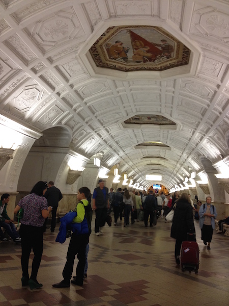
Ceiling panel and artworks at Kurskaya Metro Station

8. Mayakovskaya Metro Station built in 1938. It was named after Russian poet Vladmir Mayakovsky. This is one of the most beautiful metro stations in the world with 34 mosaics painted by Alexander Deyneka.

Mayakovskaya station

One of the over 30 ceiling mosaics in Mayakovskaya metro station
9. Belorusskaya Metro Station is named after the people of Belarus. In the picture below, there are statues of 3 members of the Partisan Resistance in Belarus during World War II. The statues were sculpted by Sergei Orlov, S. Rabinovich and I. Slonim.

10. Teatralnaya Metro Station (Theatre Metro Station) is located near the Bolshoi Theatre.

Teatralnaya Metro Station decorated with porcelain figures .

Taking the metro's escalator at the end of the tour with Maria the tour guide.
Have you visited the Moscow Metro? Leave your comment below.

January 15, 2017 at 8:17 am
An excellent read! Thanks for much for sharing the Russian metro system with us. We're heading to Moscow in April and exploring the metro stations were on our list and after reading your post, I'm even more excited to go visit them. Thanks again 🙂

December 6, 2017 at 10:45 pm
Hi, do you remember which tour company you contacted for this tour?
Leave a Reply Cancel reply
You must be logged in to post a comment.
Please go to the Instagram Feed settings page to create a feed.
Your ultimate guide to the total solar eclipse, its path and how to watch
Mark your calendars — on April 8, a total solar eclipse will sweep across North America , blocking out the sun momentarily for millions of viewers along a path stretching from northern Mexico to Maine.
Not since 2017 has the United States experienced a total solar eclipse, and we won’t see another until 2044. Here’s everything you need to know to prepare for this rare celestial phenomenon.
2024 total solar eclipse
A total solar eclipse will pass across the United States on Monday, April 8. See what the eclipse will look like in your city .
Path of totality: Our interactive visual map allows you to traverse the eclipse’s path from Mexico to Maine. If you’re traveling for the eclipse , we rounded up the top things to do in several major cities prime for viewing. In Carbondale, Ill., lucky residents are preparing to experience totality for the second time in seven years .
Preparing for the eclipse: The most important thing you’ll need is eclipse glasses — here’s how to get them and avoid buying fakes . If you want to capture the magic of the moment, check out our guide for photographing the eclipse with your phone. Here’s what to expect in terms of cloud cover and eclipse traffic .
The science: This eclipse may be especially dramatic because the sun is at its most active period in two decades. In the past, solar eclipses have helped scientists learn more about the universe . Here’s everything else you need to know about the solar eclipse.
- Your ultimate guide to the total solar eclipse, its path and how to watch Earlier today Your ultimate guide to the total solar eclipse, its path and how to watch Earlier today
- Solar eclipses can make their own weather. Here’s how. Earlier today Solar eclipses can make their own weather. Here’s how. Earlier today
- Here’s an unofficial playlist for watching the solar eclipse 3 hours ago Here’s an unofficial playlist for watching the solar eclipse 3 hours ago

Breaking News
Romania and Bulgaria join Europe’s Schengen travel zone but keep land border checks

- Show more sharing options
- Copy Link URL Copied!
Romania and Bulgaria partially joined Europe’s ID-check-free travel zone on Sunday, marking a new step in the two countries’ integration with the European Union.
After years of negotiations to join the Schengen Area , there is now free access for travelers arriving by air or sea from both countries. However, land border checks will remain in place due to opposition primarily from Austria, which has long blocked their bid over illegal migration concerns.
EU Commission President Ursula von der Leyen hailed the change as a “huge success for both countries” and a “historic moment” for what is the world’s largest free travel zone.
Travel & Experiences
Schengen agreement: Understand the 90/180 rule before European travel
Question: Twice a year for more than 10 years, I have been flying to Zurich, Switzerland, from LAX.
March 30, 2015
The Schengen Area was established in 1985. Before Bulgaria and Romania’s admission, Schengen consisted of 23 of the 27 EU member countries, along with Switzerland, Norway, Iceland and Liechtenstein. Around 3.5 million people cross an internal border each day.
Austria vetoed Romania and Bulgaria’s admission into the Schengen zone at the end of 2022 but allowed Croatia full accession. Bulgaria and Romania joined the EU in 2007 and Croatia in 2013.
Siegfried Muresan, a Romanian member of the European Parliament, told the Associated Press that it is “an important first step” that will benefit millions of travelers annually.
“Bulgaria and Romania have been fulfilling all criteria for joining the Schengen Area for years — we are entitled to join with the terrestrial border as well,” he said, adding that it “will offer additional arguments to the last EU member state that has been vetoing the full accession.”

World & Nation
Croatia set to adopt euro currency and borderless EU travel in the new year
As of Jan. 1, Croatia will use the EU’s common currency and join its borderless travel area, a milestone since gaining independence 31 years ago.
Dec. 22, 2022
Romanian Prime Minister Marcel Ciolacu called it a “well-deserved achievement” for Romania that he said will benefit citizens who can travel more easily and will bolster the economy.
“We have a clear and firmly assumed government plan for full accession to the Schengen Area by the end of the year,” he said.
The EU’s executive branch, the European Commission, has said for more than a decade that Romania and Bulgaria both meet the technical criteria for full accession, which requires unanimous support from their partners. Both countries have agreed to implement random security screening at airports and maritime borders to combat illegal migration and cross-border crime.
“Bulgaria’s full accession to Schengen will happen by the end of 2024,” Kalin Stoyanov, Bulgaria’s interior minister, told reporters on Sunday. “We showed and continue to show to illegal migrants that they should not take the road to Europe through Bulgaria.”

EU countries wrestle with a proposed ban on Russian tourists
Northern European Union countries are calling for a broad ban on tourist visas for Russian citizens, but Germany, among other EU members, demurs.
Aug. 31, 2022
The lifting of border control is expected to facilitate operations at Bulgaria’s four international airports, which in 2023 saw nearly 11 million passengers, according to official data.
The airport in the capital, Sofia, serves as the biggest hub for Schengen flights, which constitute 70% of all flights, airport representatives said.
While the eased regulations are expected to positively impact the tourism sector, members of the European Parliament have voiced concerns about long queues at the EU’s land borders and the impact it can have on trade in the bloc’s single market, as well as the health and safety of drivers.
Truck drivers are frequently stuck in kilometers-long queues at the borders of both Romania and Bulgaria. The Union of International Carriers in Bulgaria estimates delays cost the sector tens of millions of euros each year.
Stephen McGrath and Veselin Toshkov write for the Associated Press. McGrath reported from Sighisoara, Romania.
More to Read

Lithuania to close 2 more checkpoints with Russian ally Belarus as tensions along border rise
Feb. 21, 2024

Ukraine gets EU membership boost, but no new European aid, after setback in U.S.
Dec. 15, 2023

In stunning reversal, European Union agrees to open membership talks with Ukraine
Dec. 14, 2023
Start your day right
Sign up for Essential California for news, features and recommendations from the L.A. Times and beyond in your inbox six days a week.
You may occasionally receive promotional content from the Los Angeles Times.
More From the Los Angeles Times

Trump set to appear at a fundraiser for a creator of his ‘family separation’ policy
April 4, 2024

Peter Schey, longtime Los Angeles champion of immigrant rights, dead at 77
April 3, 2024

Panama and Colombia fail to protect migrants on Darien jungle route, Human Rights Watch says

Trump escalates immigration rhetoric, accusing Biden of causing border ‘bloodbath’
- Articles >
The Moscow Metro Museum of Art: 10 Must-See Stations
There are few times one can claim having been on the subway all afternoon and loving it, but the Moscow Metro provides just that opportunity. While many cities boast famous public transport systems—New York’s subway, London’s underground, San Salvador’s chicken buses—few warrant hours of exploration. Moscow is different: Take one ride on the Metro, and you’ll find out that this network of railways can be so much more than point A to B drudgery.
The Metro began operating in 1935 with just thirteen stations, covering less than seven miles, but it has since grown into the world’s third busiest transit system ( Tokyo is first ), spanning about 200 miles and offering over 180 stops along the way. The construction of the Metro began under Joseph Stalin’s command, and being one of the USSR’s most ambitious building projects, the iron-fisted leader instructed designers to create a place full of svet (radiance) and svetloe budushchee (a radiant future), a palace for the people and a tribute to the Mother nation.
Consequently, the Metro is among the most memorable attractions in Moscow. The stations provide a unique collection of public art, comparable to anything the city’s galleries have to offer and providing a sense of the Soviet era, which is absent from the State National History Museum. Even better, touring the Metro delivers palpable, experiential moments, which many of us don’t get standing in front of painting or a case of coins.
Though tours are available , discovering the Moscow Metro on your own provides a much more comprehensive, truer experience, something much less sterile than following a guide. What better place is there to see the “real” Moscow than on mass transit: A few hours will expose you to characters and caricatures you’ll be hard-pressed to find dining near the Bolshoi Theater. You become part of the attraction, hear it in the screech of the train, feel it as hurried commuters brush by: The Metro sucks you beneath the city and churns you into the mix.
With the recommendations of our born-and-bred Muscovite students, my wife Emma and I have just taken a self-guided tour of what some locals consider the top ten stations of the Moscow Metro. What most satisfied me about our Metro tour was the sense of adventure . I loved following our route on the maps of the wagon walls as we circled the city, plotting out the course to the subsequent stops; having the weird sensation of being underground for nearly four hours; and discovering the next cavern of treasures, playing Indiana Jones for the afternoon, piecing together fragments of Russia’s mysterious history. It’s the ultimate interactive museum.
Top Ten Stations (In order of appearance)
Kievskaya station.
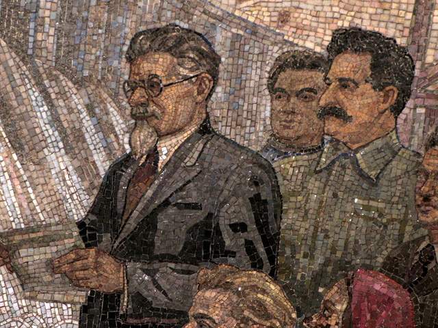
Kievskaya Station went public in March of 1937, the rails between it and Park Kultury Station being the first to cross the Moscow River. Kievskaya is full of mosaics depicting aristocratic scenes of Russian life, with great cameo appearances by Lenin, Trotsky, and Stalin. Each work has a Cyrillic title/explanation etched in the marble beneath it; however, if your Russian is rusty, you can just appreciate seeing familiar revolutionary dates like 1905 ( the Russian Revolution ) and 1917 ( the October Revolution ).
Mayakovskaya Station
Mayakovskaya Station ranks in my top three most notable Metro stations. Mayakovskaya just feels right, done Art Deco but no sense of gaudiness or pretention. The arches are adorned with rounded chrome piping and create feeling of being in a jukebox, but the roof’s expansive mosaics of the sky are the real showstopper. Subjects cleverly range from looking up at a high jumper, workers atop a building, spires of Orthodox cathedrals, to nimble aircraft humming by, a fleet of prop planes spelling out CCCP in the bluest of skies.
Novoslobodskaya Station
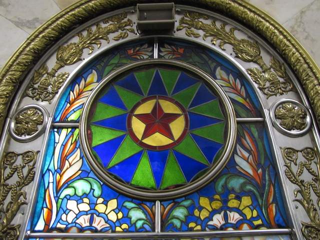
Novoslobodskaya is the Metro’s unique stained glass station. Each column has its own distinctive panels of colorful glass, most of them with a floral theme, some of them capturing the odd sailor, musician, artist, gardener, or stenographer in action. The glass is framed in Art Deco metalwork, and there is the lovely aspect of discovering panels in the less frequented haunches of the hall (on the trackside, between the incoming staircases). Novosblod is, I’ve been told, the favorite amongst out-of-town visitors.
Komsomolskaya Station
Komsomolskaya Station is one of palatial grandeur. It seems both magnificent and obligatory, like the presidential palace of a colonial city. The yellow ceiling has leafy, white concrete garland and a series of golden military mosaics accenting the tile mosaics of glorified Russian life. Switching lines here, the hallway has an Alice-in-Wonderland feel, impossibly long with decorative tile walls, culminating in a very old station left in a remarkable state of disrepair, offering a really tangible glimpse behind the palace walls.
Dostoevskaya Station

Dostoevskaya is a tribute to the late, great hero of Russian literature . The station at first glance seems bare and unimpressive, a stark marble platform without a whiff of reassembled chips of tile. However, two columns have eerie stone inlay collages of scenes from Dostoevsky’s work, including The Idiot , The Brothers Karamazov , and Crime and Punishment. Then, standing at the center of the platform, the marble creates a kaleidoscope of reflections. At the entrance, there is a large, inlay portrait of the author.
Chkalovskaya Station
Chkalovskaya does space Art Deco style (yet again). Chrome borders all. Passageways with curvy overhangs create the illusion of walking through the belly of a chic, new-age spacecraft. There are two (kos)mosaics, one at each end, with planetary subjects. Transferring here brings you above ground, where some rather elaborate metalwork is on display. By name similarity only, I’d expected Komsolskaya Station to deliver some kosmonaut décor; instead, it was Chkalovskaya that took us up to the space station.
Elektrozavodskaya Station
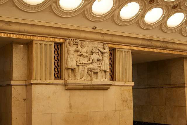
Elektrozavodskaya is full of marble reliefs of workers, men and women, laboring through the different stages of industry. The superhuman figures are round with muscles, Hollywood fit, and seemingly undeterred by each Herculean task they respectively perform. The station is chocked with brass, from hammer and sickle light fixtures to beautiful, angular framework up the innards of the columns. The station’s art pieces are less clever or extravagant than others, but identifying the different stages of industry is entertaining.
Baumanskaya Statio
Baumanskaya Station is the only stop that wasn’t suggested by the students. Pulling in, the network of statues was just too enticing: Out of half-circle depressions in the platform’s columns, the USSR’s proud and powerful labor force again flaunts its success. Pilots, blacksmiths, politicians, and artists have all congregated, posing amongst more Art Deco framing. At the far end, a massive Soviet flag dons the face of Lenin and banners for ’05, ’17, and ‘45. Standing in front of the flag, you can play with the echoing roof.
Ploshchad Revolutsii Station
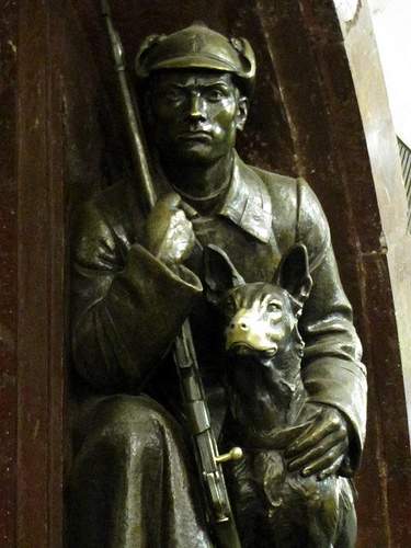
Novokuznetskaya Station
Novokuznetskaya Station finishes off this tour, more or less, where it started: beautiful mosaics. This station recalls the skyward-facing pieces from Mayakovskaya (Station #2), only with a little larger pictures in a more cramped, very trafficked area. Due to a line of street lamps in the center of the platform, it has the atmosphere of a bustling market. The more inventive sky scenes include a man on a ladder, women picking fruit, and a tank-dozer being craned in. The station’s also has a handsome black-and-white stone mural.
Here is a map and a brief description of our route:
Start at (1)Kievskaya on the “ring line” (look for the squares at the bottom of the platform signs to help you navigate—the ring line is #5, brown line) and go north to Belorusskaya, make a quick switch to the Dark Green/#2 line, and go south one stop to (2)Mayakovskaya. Backtrack to the ring line—Brown/#5—and continue north, getting off at (3)Novosblodskaya and (4)Komsolskaya. At Komsolskaya Station, transfer to the Red/#1 line, go south for two stops to Chistye Prudy, and get on the Light Green/#10 line going north. Take a look at (5)Dostoevskaya Station on the northern segment of Light Green/#10 line then change directions and head south to (6)Chkalovskaya, which offers a transfer to the Dark Blue/#3 line, going west, away from the city center. Have a look (7)Elektroskaya Station before backtracking into the center of Moscow, stopping off at (8)Baumskaya, getting off the Dark Blue/#3 line at (9)Ploschad Revolyutsii. Change to the Dark Green/#2 line and go south one stop to see (10)Novokuznetskaya Station.
Check out our new Moscow Indie Travel Guide , book a flight to Moscow and read 10 Bars with Views Worth Blowing the Budget For
Jonathon Engels, formerly a patron saint of misadventure, has been stumbling his way across cultural borders since 2005 and is currently volunteering in the mountains outside of Antigua, Guatemala. For more of his work, visit his website and blog .

Photo credits: SergeyRod , all others courtesy of the author and may not be used without permission
COMMENTS
Browse our large selection of hundreds of United States folding travel maps. This section is divided into U.S. Travel Maps, Regional U.S. Travel Maps, U.S. State Travel Maps, and U.S. City Maps. Get your hands on the right map with the right detail for your next trip abroad. Use the search at the top-right of the website to find a map for a ...
National Geographic Maps makes the world's best wall maps, recreation maps, travel maps, atlases and globes for people to explore and understand the world. Our printed paper maps are the most accurate and authoritative maps in the world.
Omnimap has over 200,000 map items on our web site and is one of the world's largest specialty retailers of paper and digital maps, hiking guides, map pins, flags, and more.. Our specialty is international maps and we offer topographic maps, travel maps, and wall maps for nearly all countries and regions of the world. We also offer over 100,000 topographic, road, and city maps and atlases for ...
Re-Use Maps for DIY and Upcycled Crafts. I've shared a few ideas in the past (like this one) about creating fun DIY crafts and gifts using printed and paper maps or recycling maps as wrapping paper. These make perfect personalized items for yourself or gifts for your favorite travel lover.
Best Sellers in Travel Atlases & Maps #1. Rand McNally 2024 Large Scale Road Atlas - 100th Anniversary Collector's Edition (The Rand McNally Large Scale Road Atlas) Rand McNally. 4.7 out of 5 stars ... Map Paper: Quad Ruled Book for Map Making. RPG Masters. 4.5 out of 5 stars ...
⭐⭐⭐⭐⭐I absolutely love the Rand McNally Folded Map: United States Map! It's incredibly easy to read, making navigation a breeze. What I appreciate most is how portable it is - perfect for taking on road trips or stashing in the glove compartment.The compact size means it takes up very little space, yet provides comprehensive coverage of the entire United States.
Eaasty 50 Disposable World Map Paper Placemats Vintage World Map for Old Paper Retro Style Decorative Travel Adventure Table Mat for Geography Learning Education Traveler Theme Crafts (13.4 x 9.45'') ... Teacher Created Resources Travel the Map Computer Paper, 8.5" x 11", 50 Sheets. 4.7 out of 5 stars. 96.
Buy wall maps, paper maps, maps of the earth, globes, travel books, trip guides, flags and flag poles, and more at WorldOfMaps.com! ... Canada, and The World since 1994! World Of Maps.com. Established 1994 - "For the Love of Travel and Maps." - Ottawa, Ontario Call Customer Service toll free: 1-800-214-8524 . Topographic Maps; Browse Category ...
Check out our travel map paper selection for the very best in unique or custom, handmade pieces from our maps shops.
Check out our travel maps paper selection for the very best in unique or custom, handmade pieces from our maps shops.
The tactile experience of unfolding a map and tracing your route allows you to engage with your surroundings on a deeper level. Every fold, crease, and mark on the map tells a story of your travels. 2. Choose the Right Map: Before you embark on your journey, select a reliable paper map of your destination. Look for one that's up-to-date and ...
The United States Army actually defines three map scales: Small: Maps with scales of 1:1,000,000 and smaller for "general planning and strategic studies." Medium: Maps larger than 1:1,000,000 but smaller than 1:75,000. Large: Maps of 1:75,000 and larger. Many road atlases will show a small- or medium-scale map with large-scale callouts of important areas.
Create your own personalized travel map and display the story of your travels with friends and family. Choose from a variety of sizes, styles, and designs, and even add a custom tagline. Take it one step further and mount it with Moore Map pins to remember all those special moments. Perfect for the adventurous soul in all of us.
Description. Rand McNally's United States folded map features clear, easy-to-read cartography showing all Interstate and U.S. highways, along with clearly indicated cities, points of interest, airports, boundaries, and more. Rand McNally folded maps have been the trusted standard for years, offering unbeatable accuracy and reliability at a ...
A travel map is any kind of representation of the places you're going. It can help you keep track of places you want to go and the information you need to remember. Back in the old days, a travel map would be on paper. While some people may prefer the nostalgia of putting together a paper map, most people in the 21st century prefer a more ...
Free Montana State Map - They offer a free winter guide in addition to the state map, but I can give you said guide right here. Step 1: stay inside. Step 2: go outside once spring arrives. ( mt dot map) Free Nebraska State Map - Nebraska wants us to "share the road trip.".
Map Paper Fans-Travel Decor-Paper Rosettes-Travel Theme Party-Travel Decor for Wall-Baby Shower Decoration-Adventure Wedding Decor (3.2k) $ 6.00. Add to Favorites 12 Vintage World Maps Junk Journal Paper Pack Ephemera Kraft Paper for Journaling and Scrapbooking (1.4k) $ 11.16. Add to Favorites ...
Multiple readers sent around this Atlantic story on The Evolution of Moscow's Metro Maps, with a link to Artemy Lebedev's online collection of Moscow Metro memorabilia. Below is the fir…
GPS and even paper map navigation don't compare to how humans found their way for millennia. People first made maps as early as 16,500 BCE with stars and other landscape features etched on rocks ...
Map 2.0 archived. Map 3.0. 2100 map . Official maps: In metro cars. Line maps. At stations. Main Pocket Multilingual Postcard Multilingual Moscow Metro map in high resolution TIFFs. Overview Hi Res
First up, Google is rolling out an update to its that will allow users to build travel itineraries and trip ideas using AI, the company announced on Wednesday. The new capability — currently ...
THE UK Foreign Office has issued travel warnings for 66 countries, with 24 of them being completely off-limits. Here is the full list of countries Britons are banned from travelling to.
Key Takeaways. Layla, Wonderplan, and PLAN by ixigo are AI travel planning apps with customizable itineraries. iplan.ai offers detailed itineraries for popular tourist cities based on interests and budget. Curiosio plans road trips on all continents, while Trip Planner AI helps with activity selection and cost estimation. You can tell a travel ...
March 26, 2024. On Tuesday, a major bridge in Baltimore collapsed into the water seconds after it was struck by a cargo ship, sending vehicles on the bridge into the river below. The ship lost ...
6. Novoslobodskaya Metro Station was built in 1952. It has 32 stained glass murals with brass borders. Novoslobodskaya metro station. 7. Kurskaya Metro Station was one of the first few to be built in Moscow in 1938. It has ceiling panels and artwork showing Soviet leadership, Soviet lifestyle and political power.
April 4, 2024 at 7:00 a.m. EDT. People gather in D.C.'s Farragut Square to watch the 2017 solar eclipse. (Oliver Contreras for The Washington Post) 5 min. Mark your calendars — on April 8, a ...
Google Maps is here for summer travelers with trending locations, off-the-radar ideas, and more AI. The platform is rolling out a ton of new features to help you plan your next trip. The weather ...
March 31, 2024 10:14 AM PT. SOFIA, Bulgaria —. Romania and Bulgaria partially joined Europe's ID-check-free travel zone on Sunday, marking a new step in the two countries' integration with ...
Have a look (7)Elektroskaya Station before backtracking into the center of Moscow, stopping off at (8)Baumskaya, getting off the Dark Blue/#3 line at (9)Ploschad Revolyutsii. Change to the Dark Green/#2 line and go south one stop to see (10)Novokuznetskaya Station. Check out our new Moscow Indie Travel Guide, book a flight to Moscow and read 10 ...