- Winter Sports
- Water Sports
- Outdoor Sports
- Packing Lists
- December 2023
- November 2023
- October 2023
- August 2023
- January 2023
- December 2022
- November 2022
- October 2022
- August 2022
- December 2021
- November 2021
- September 2021
- August 2021
- February 2021
- October 2020
- September 2020
- August 2020
- February 2020
- January 2020
- December 2019
- November 2019
- October 2019
- September 2019
- August 2019
- February 2019
- January 2019
- December 2018
- November 2018
- September 2018
- August 2018
- February 2018
- January 2018
- October 2017
- August 2017
- October 2016
- September 2016
- February 2016
- January 2016
- October 2015
- September 2015
- August 2015
- February 2015
- January 2015
- December 2014
- October 2014
- September 2014
- January 2014
- December 2013
- November 2013
- September 2013
- January 2013
- December 2012
- November 2012
- October 2012
- September 2012
- August 2012
- February 2012
- January 2012
- November 2011
- August 2011
- October 2010


Tour tip: Hike to the Seekarspitze (2,053 m)
Half day tour with view of the achensee.
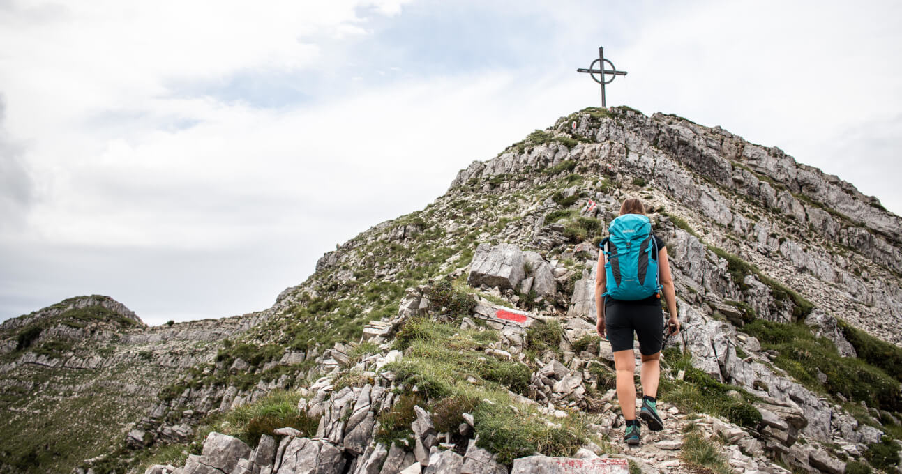
Lake Achensee – also called the “Fjord of the Alps” – is a popular destination for many hikers and mountaineers. Around it there are several peaks from which you have a wonderful view of the turquoise lake – which from the top looks very much like a fjord. The tour to the Seekarspitze, which is located on the western shore, is popular and offers at the summit much more than just a great view to the Achensee.
- Start and end point: Achenkirch car park
- Duration / walking time: 5 hours
- Path length: 11 km
- Verticals meters 1.100 hm
- Difficulty: Medium
- Refreshment stop(s): Seekaralm (mid May to mid October)
Tour description
The hike to the Seekarspitze has been on my “summit list” for quite some time. On the one hand, because the tour is varied and a bit demanding. And on the other hand, because the mountain lures with a great view. From Munich we are in about 1.5 hours at the Achensee, which is just behind the Austrian border.
Tip: On the car trip to the Achensee you drive along the beautiful Sylvensteinspeicher. Here it is worth making a short stop to enjoy the view of the reservoir and the Karwendel mountains.
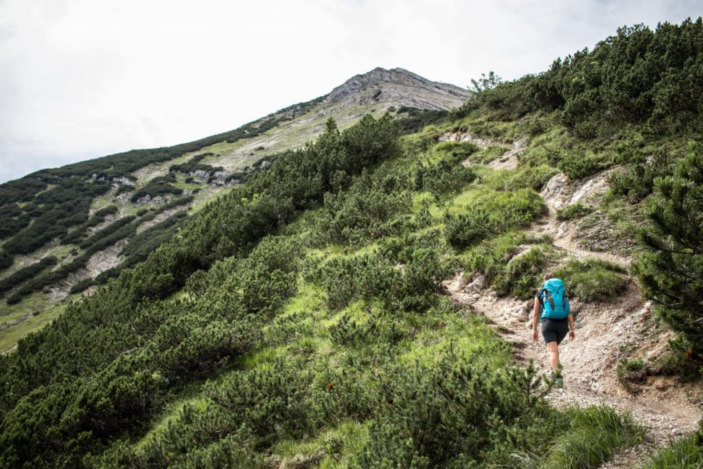
We park our car at the chargeable car park in Achenkirch, where the tour also starts directly. First we pass the river before we turn onto the wide forest road. Even if the path is not very spectacular at first, it is steep. However, we can branch off from the forest road again and again onto narrower hiking trails, which are much more enjoyable and lead us through the shady forest – as long as we follow the signposts towards the Seekaralm we are on the right track. During the hike we see our destination of the day flashing out again and again – the rocky and steep ridge of the Seekarspitze.
High quality hiking backpacks in various sizes and colors can be found at Tatonka.
Go to hiking backpacks
After about 1.5 hours we reach the Seekaralm, which is managed during the summer months – so half of the ascent is done. From the alp it gets much steeper, in front of us are about 500 s of altitude difference on 1.5 kilos.
Tip: In the summer months the Seekaralm is run by farmers, cows graze on the pasture and you can also stop for a bite to eat. Here you can get really tasty Kaiserschmarrn (fluffy and sugared pancake with raisins) and Skiwasser (translated: ski water), which you should not miss!
From the Alm we follow the signs and markings. First we walk across green meadows, then we pass the mountain pines and then we walk directly on the edge of the ‚pyramid‘ to the cross on the summit. From here the path is steep and exposed, a few passages demand some climbing skills. It’s best to stop and let your eyes wander – it’s worth it! In doing so, we also realize how steep the path we have travelled so far really is.
After about 3 hours we have reached our destination: We are standing at the summit cross of the Seekarspitze and look down to the Achensee, which once again shows itself from its most beautiful side. Even if it is cloudy, this does not harm the mood, quite the contrary. It is totally quiet, as there are only a few other hikers on the way and so we can enjoy this idyll for quite a while.
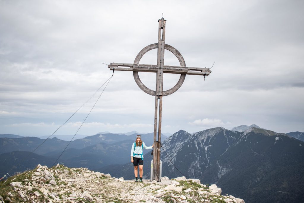
From the summit we have a great 360 degree view: In the east to the Rofan mountains (e.g. Guffert, Unnütz) and in the west to the Karwendel mountains (e.g. Montscheinspitze, Sonnjoch). With this panorama, the snack tastes twice as good!
After we have enjoyed the view and our snack, we descend again on the same path, but of course we treat ourselves to a cool drink at the Seekaralm and don’t miss the chance to share a Kaiserschmarrn – after the steep ascent and descent we definitely deserve it!
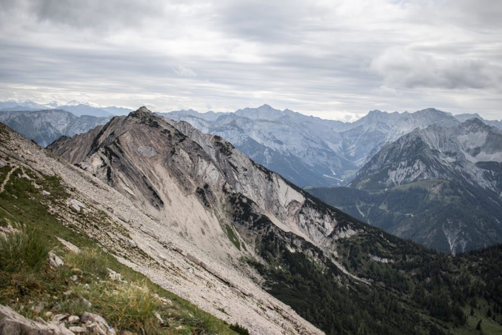
Alternative descent routes
If you want you can extend the tour either by (1) crossing the ridge to the Seebergspitze or (2) walking part of the ridge.
(1) If you have a lot of time and stamina, you can hike along the ridge further south to the Seebergspitze. For this ridge hike you should be sure-footed and free from vertigo. From the summit you descend to the Pasillalm, where you follow the signs to Achenkirch. Here you pass the Seekaralm again. For this two-summit tour you need about 1 hour from the peak of the Seekarspitze.
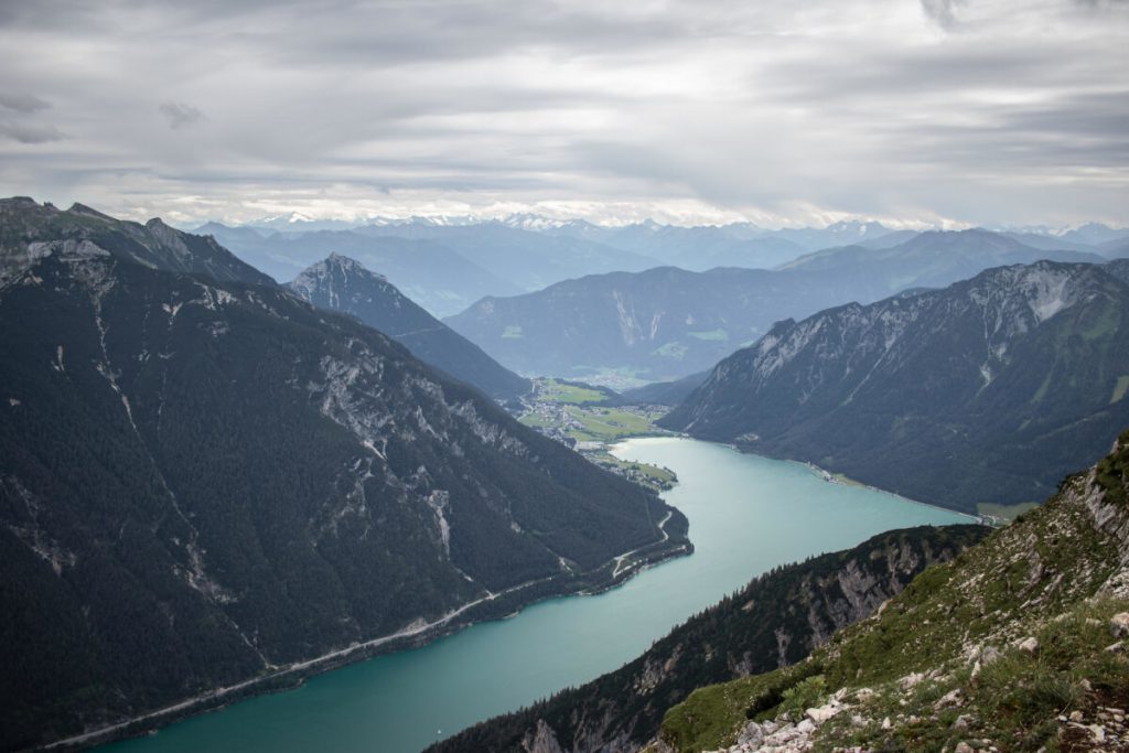
(2) If you don’t want to climb the second summit anymore, you still don’t have to miss the ridge walk and can extend your hike as a round trip. To do so, follow the ridge path for about 45 minutes and then follow the signpost to the right, heading west. The path leads you through a beautiful larch forest towards Pasillalm. From here you follow the signs further towards Achenkirch and pass the Seekaralm.
How about another tour tip? Hike to the Rote Flüh – Via the Gimpelhaus to the Rote Flüh (2,108 m) in the Tannheimer Tal .
Trekking Guide
Tour tip: hike to the rote flüh.
Maria Hoier
You might like it too.
Tour tip: From Lermoos to the Wolfratshauser Hütte (1,751 m)
Alpine crossing part 4: Booking huts
Tour tip: Roundtrip Schäfler & Ebenalp in Swiss Appenzell
Wandern im Winter
Skitourenkurs
Unterwegs am Nockberge-Trail
Hochwanner - Bike & Hike
Klettersteig-Spezial
Unfall am Berg
Bergtour - seebergspitze - seekarspitze.
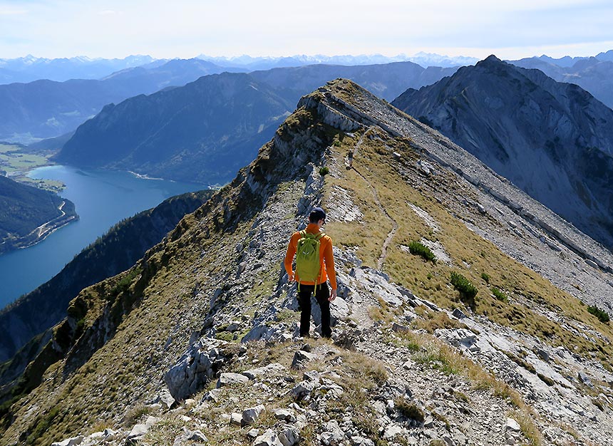
Seebergspitze (2085 m) - Seekarspitze
Bergtour | karwendel | achenkirch 1450 hm | insg. 07:30 std. | schwierigkeit (3 von 6).
Um diese Funktion zu nutzen, loggen Sie sich bitte ein.
Tour mit Freunden teilen
Tourensteckbrief Seebergspitze - Seekarspitze
Bilder zur Tour
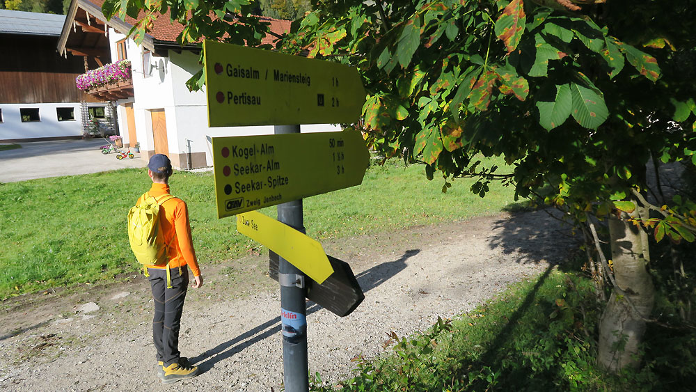
Am Ausgangspunkt hinterm Parkplatz ist die Tour gut ausgeschildert.
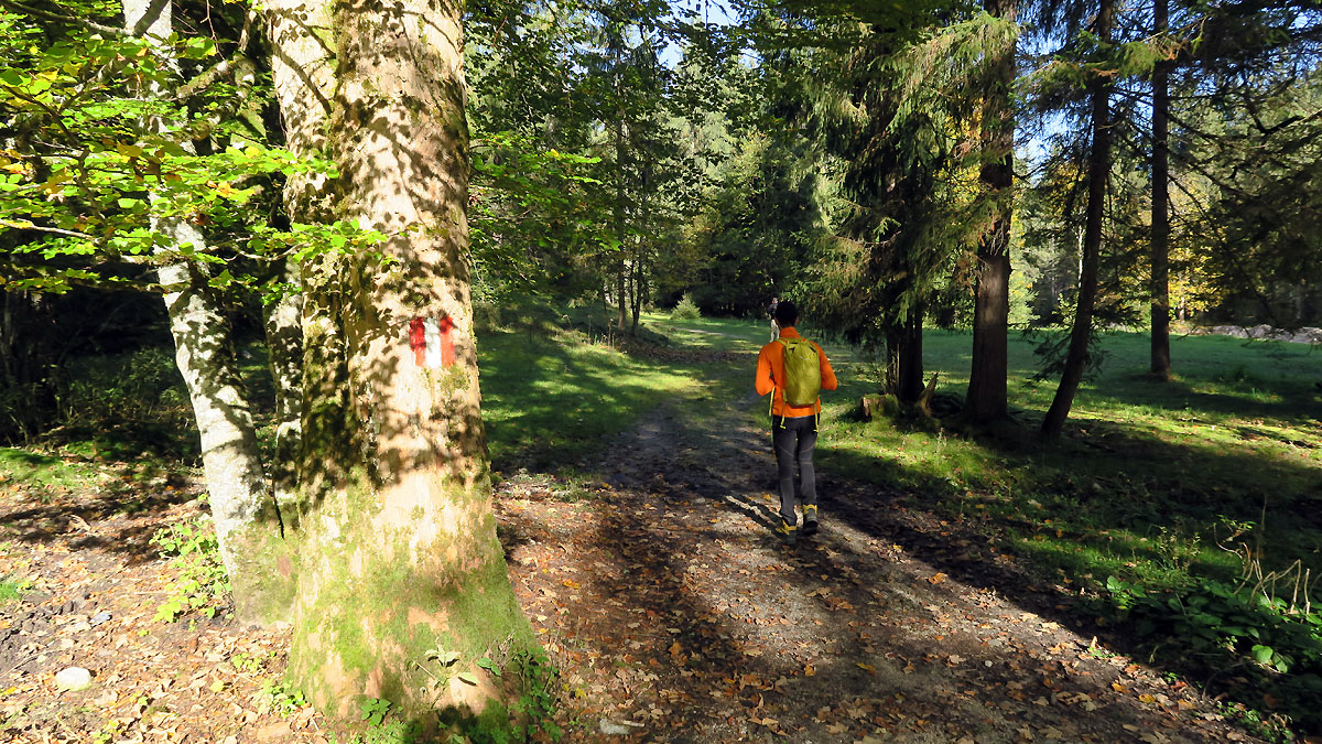
Nach der Gabelung geht es ein kurzes Stück ganz gechillt ins Oberautal.
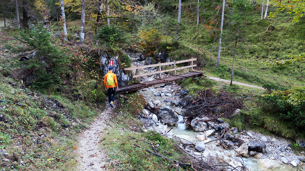
Hinter der Brücke beginnt der steile Waldweg.
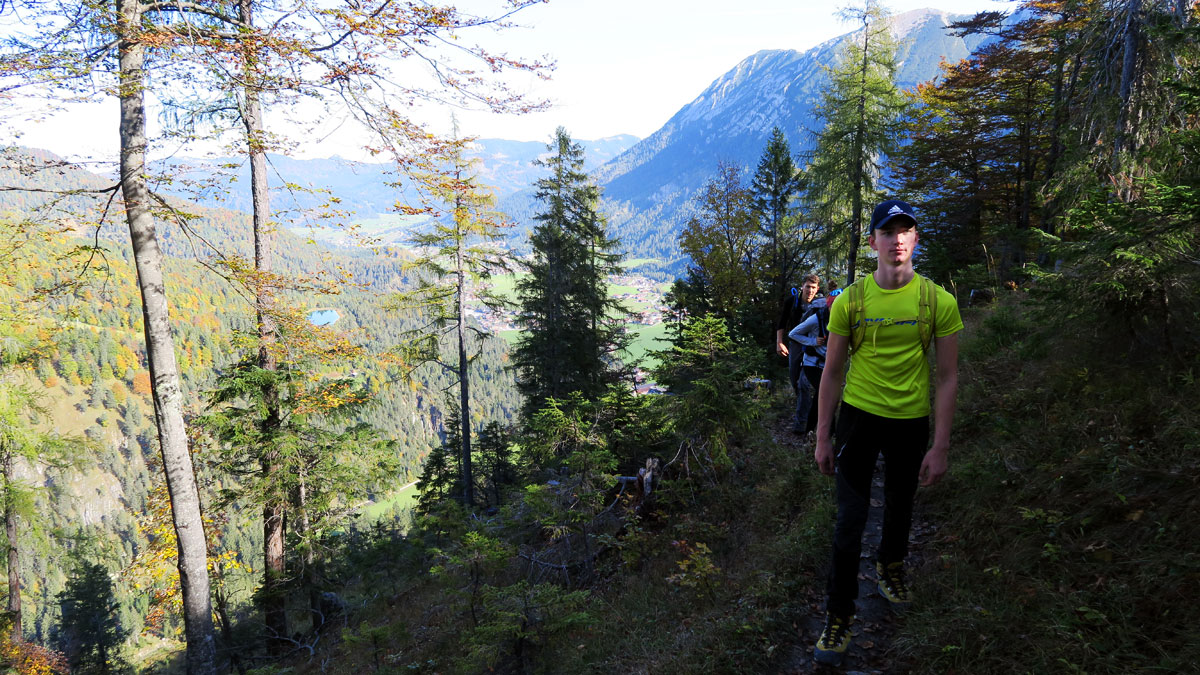
Durch sehr schönen, aber steilen Bergwald geht es hinauf.
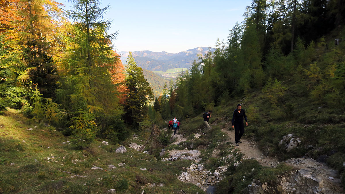
Dann führt eine Mulde in freies Gelände.
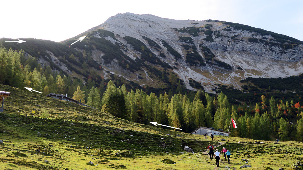
Bei der Seekaralm kann man den Gipfelanstieg zur mächtigen Seekarspitze gut erkennen. Siehe Pfeile im Bild.
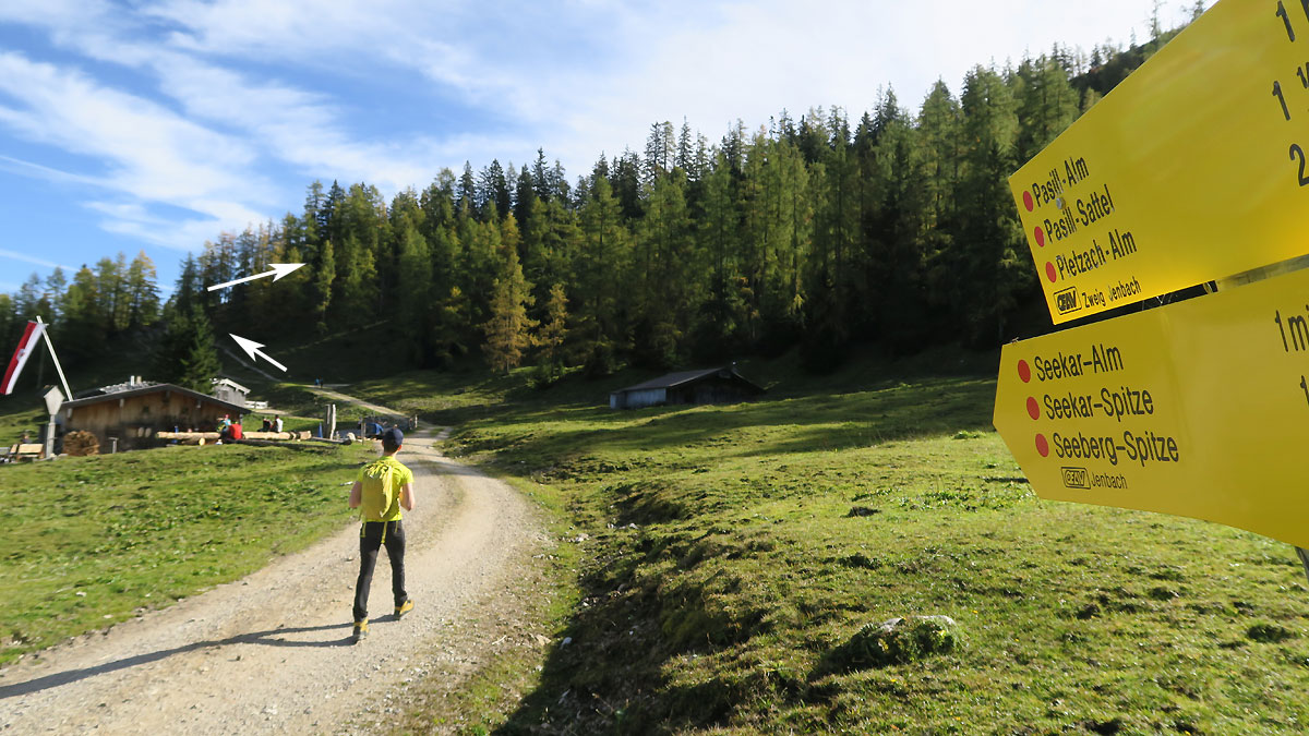
An der Seekaralm
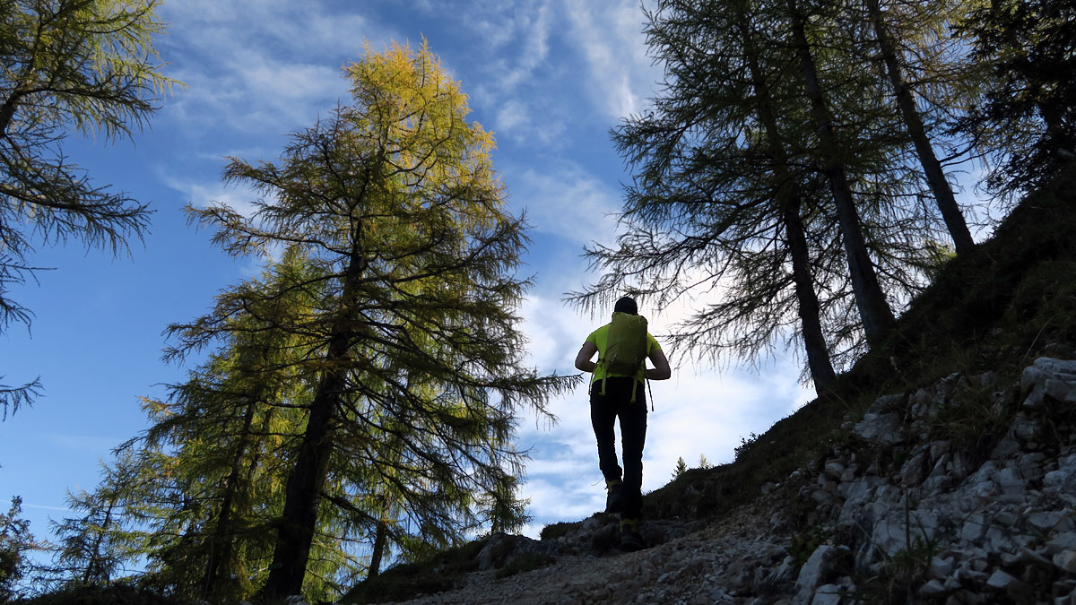
Gleich ist der Rücken erreicht, der hinauf zur Seekarspitze führt.
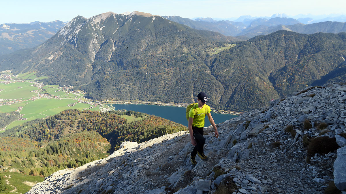
Am Gipfelrücken - im Hintergrund der Unnütz
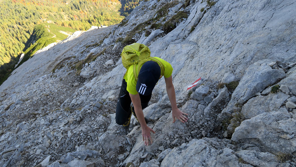
Am Gipfelrücken - steil, aber nicht schwierig
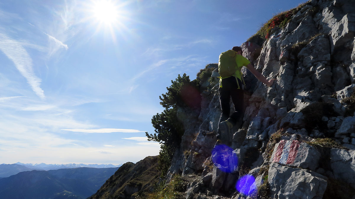
Ein paar ganz einfache Felsstufen leiten zum Gipfel.

Bereits am Gipfelgrat ist die Aussicht gigantisch!
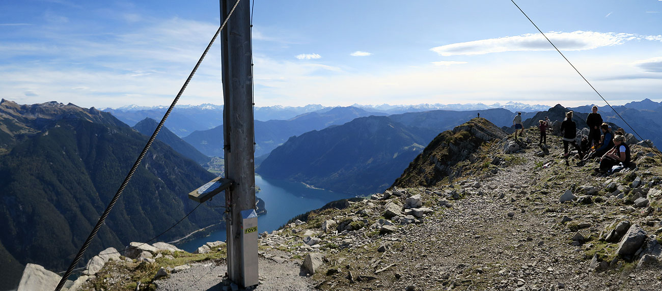
Der erste Gipfel - die Seekarspitze mit Rofan (li.), Achensee und Alpenhauptkamm.
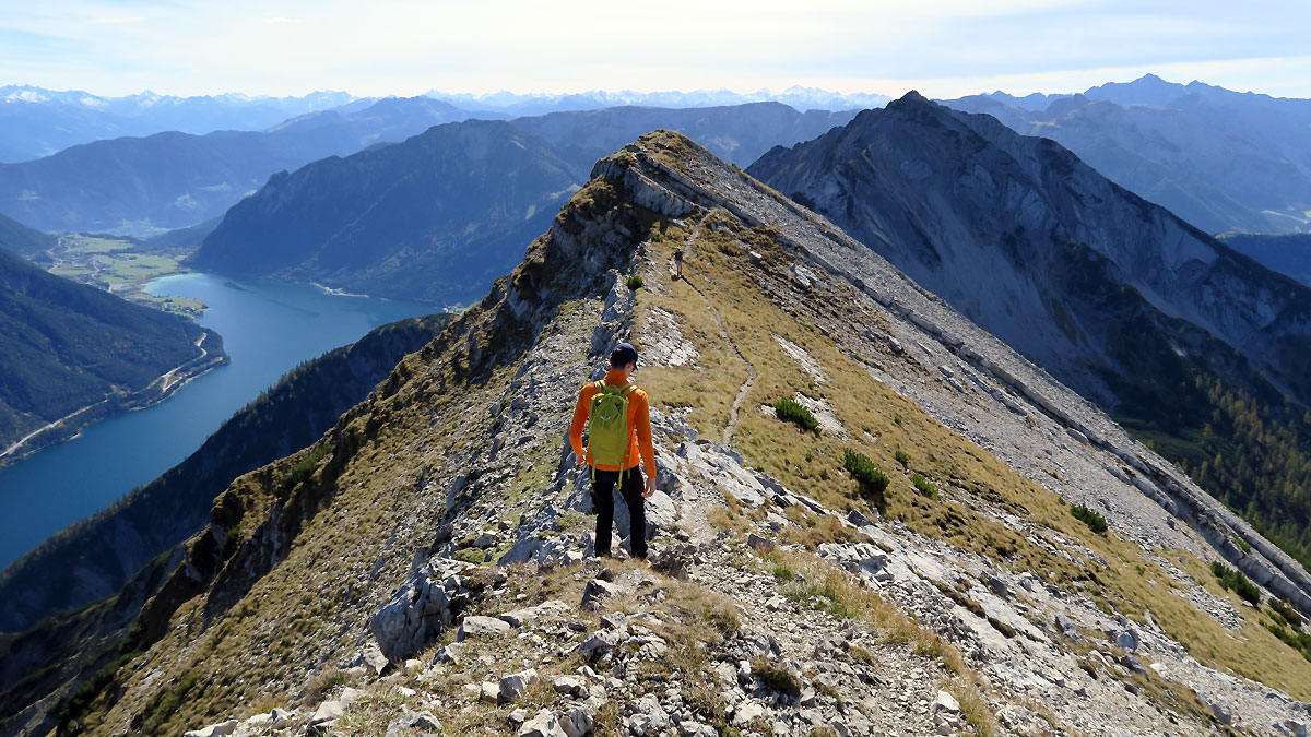
Gipfelüberschreitung zur Seebergspitze (im Hintergrund)
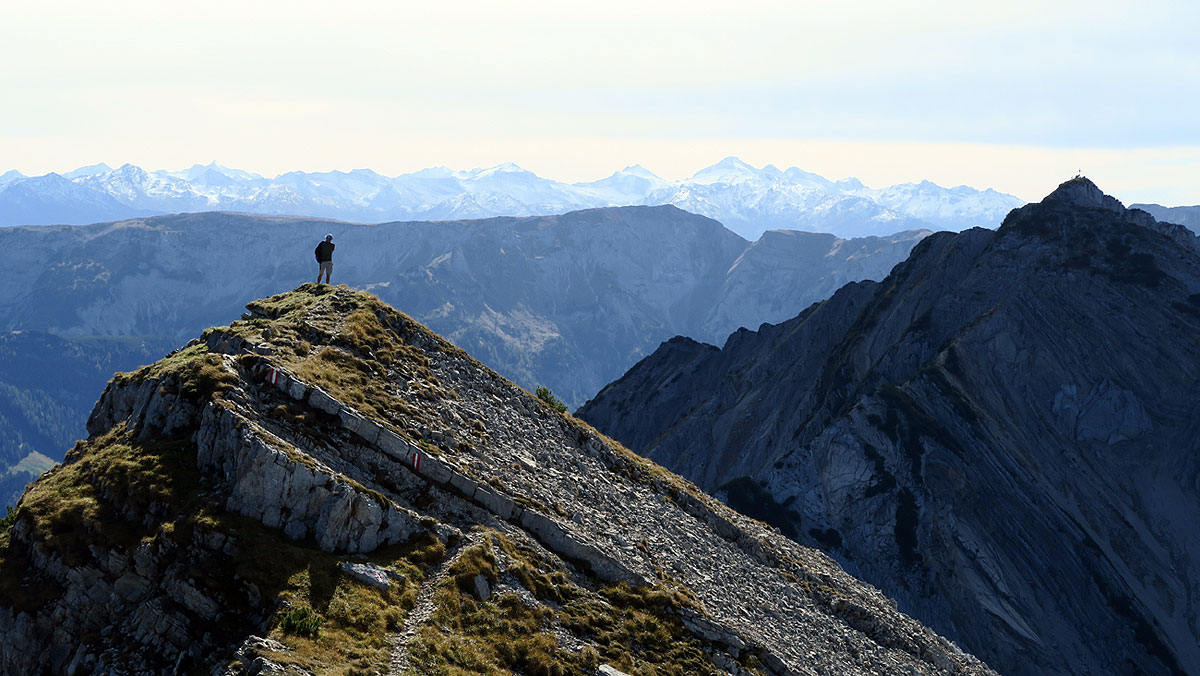
Bei der Überschreitung genießt man fantastische Ausblicke auf die Hintertuxer Gletscherberge - rechts die Seebergspitze
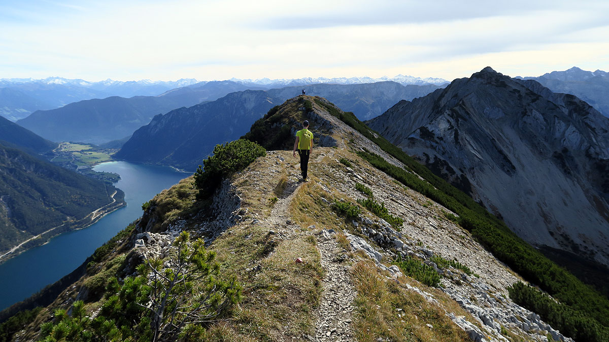
Meist geht es ganz einfach über den Grat....
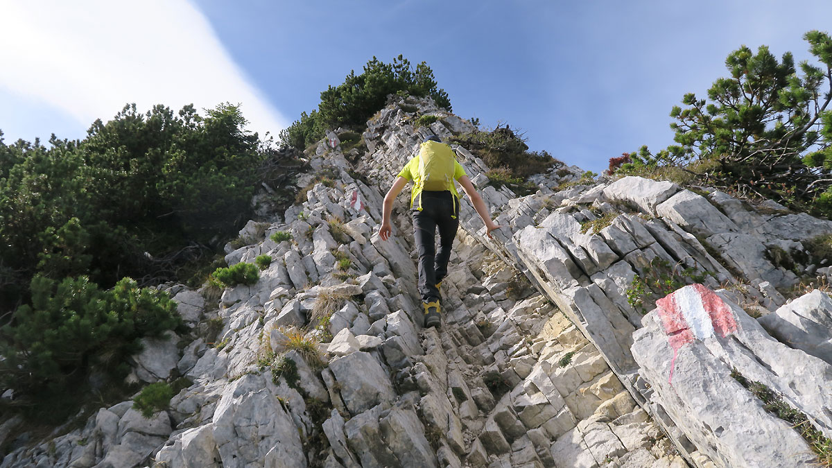
...und manchmal muss man auch mit der Hand hinlangen.
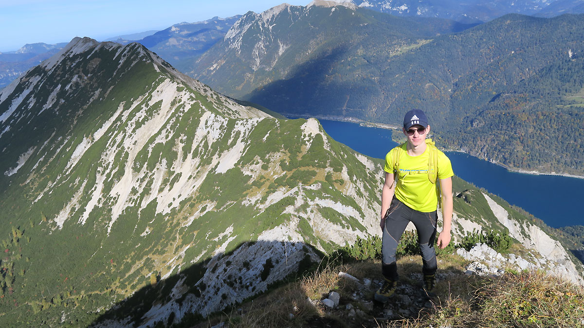
Beim steilen Gipfelanstieg zur Seebergspitze mit Rückblick auf den gesamten Kamm zur Seekarspitze.
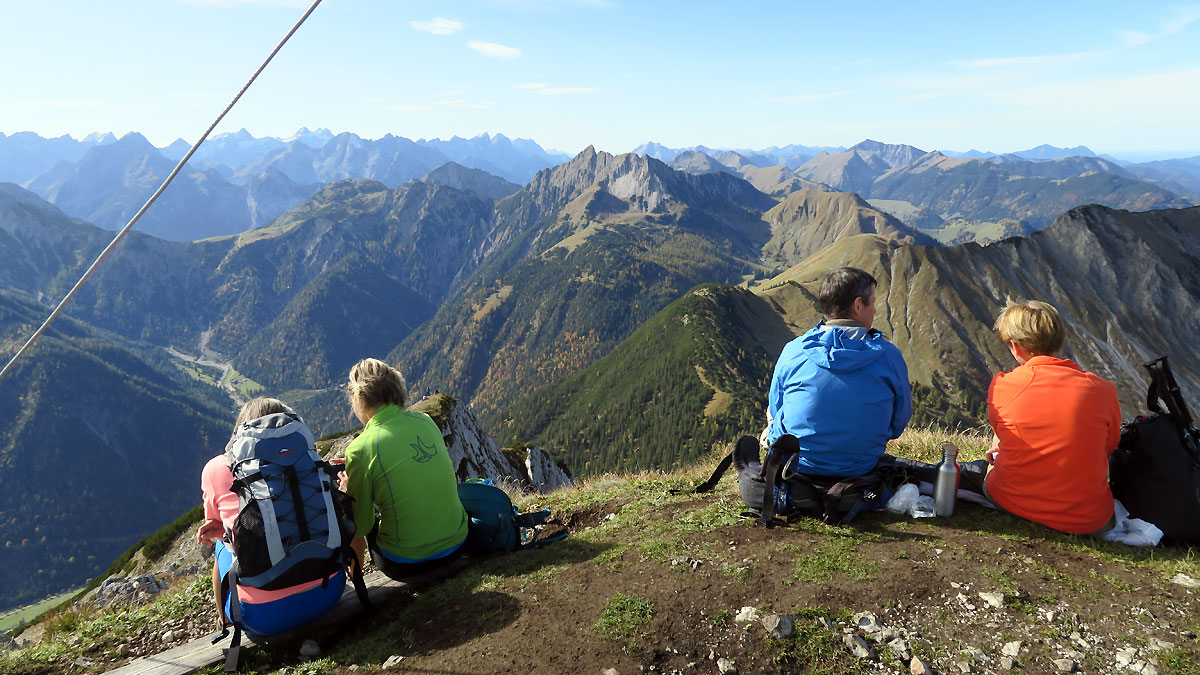
Am Gipfel der Seebergspitze mit Blick ins Herz des Karwendelgebirges. Etwas rechts der Bildmitte die Montscheinspitze.
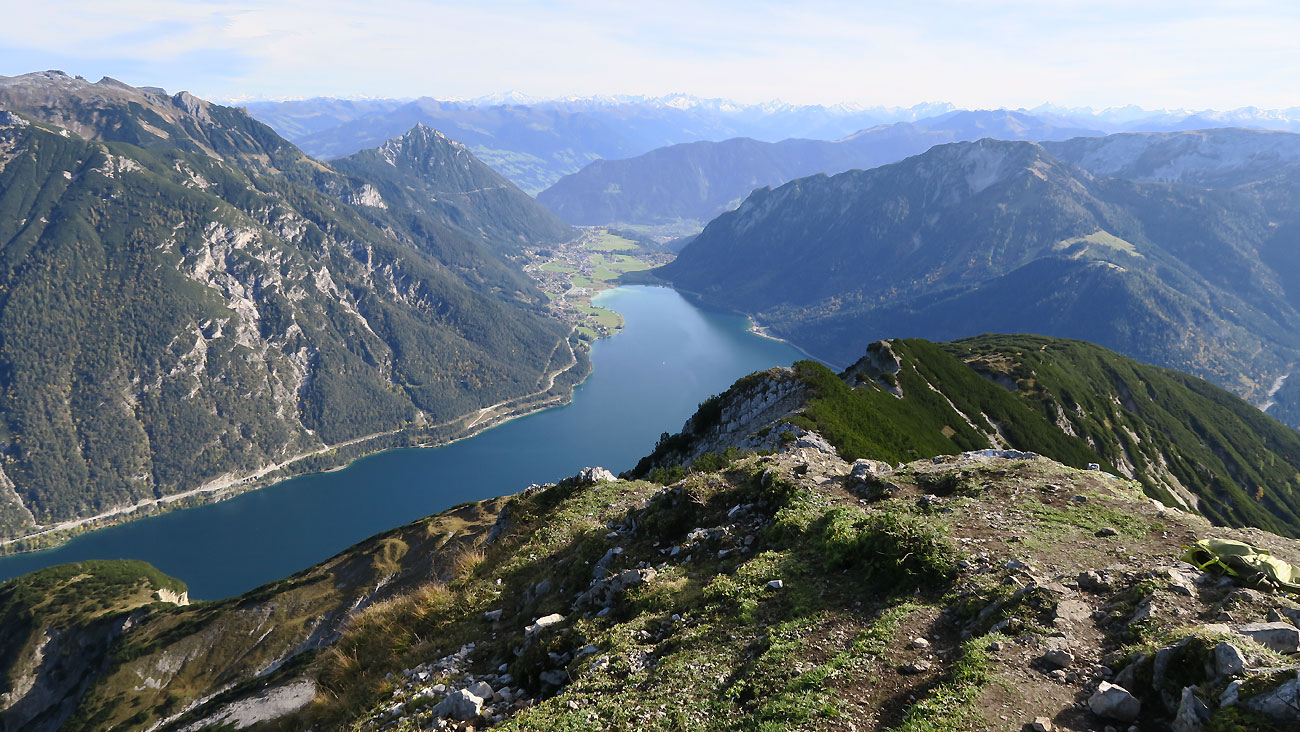
Man kann sich kaum sattsehen! Am Gipfel der Seebergspitze mit Blick Richtung Süden.
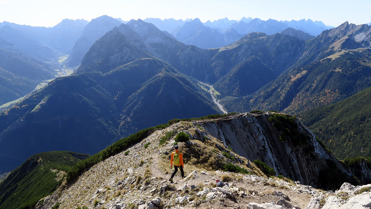
Auch beim Abstieg über den Westgrat zum Pasillsattel ist noch einmal Trittsicherheit gefragt.
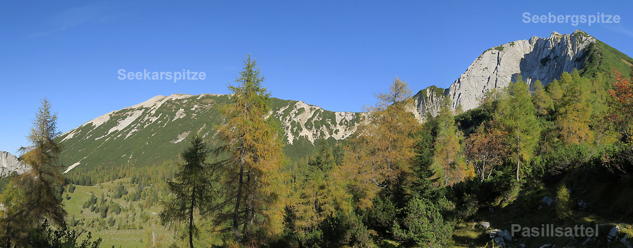
Am Pasillsattel - Blick auf den gesamten Grat von der Seekar- bis zur Seebergspitze.
Karten und Routenskizze
Auf dem Kartenausschnitt können Sie die Lage der Tour und die Anfahrt nachvollziehen. Soweit ein GPS-Track hinterlegt ist, dient die Karte auch als Routenskizze.


Download GPS Daten
Wettervorhersage.

Videos und Audio
Top - Bergtouren aus der Region Karwendel
Hier finden Sie die schönsten Touren aus dieser Gegend. Die Region Karwendel ist bekannt für ihre Vielfalt, für ihren landschaftlichen Reiz und hohen Erholungswert. In unserem Tourenarchiv finden Sie dazu Gebietsinformationen und weitere lohende Routenvorschläge mit Bildern und GPS-Daten.
Kommentar zur Tour
Es gibt keine kommentare zu dieser tour..

- Trip Reports
- Areas & Ranges
- Huts & Campgrounds
- Logistical Centers
- Fact Sheets
- Custom Objects
- Plans & Partners
- Seebergspitze

- Additional Parents
- Climber's Log Entries (1)
- Comments (2)
- Additions & Corrections
A long and high, south to north running ridge is bordering Achensee lake to the west; the southern end of it is called Seebergspitze. Seebergspitze and the northern end of this ridge, Seekarspitze , are two well known and popular hiking summits, the ridge itself is a nice traverse, too. Jammed between the much higher mountains of Rofan to the east and the Karwendel ranges to the west and south, Seebergspitze and the ridge traverse to Seekarspitze nevertheless offers good views on the adjacient ranges and areas.
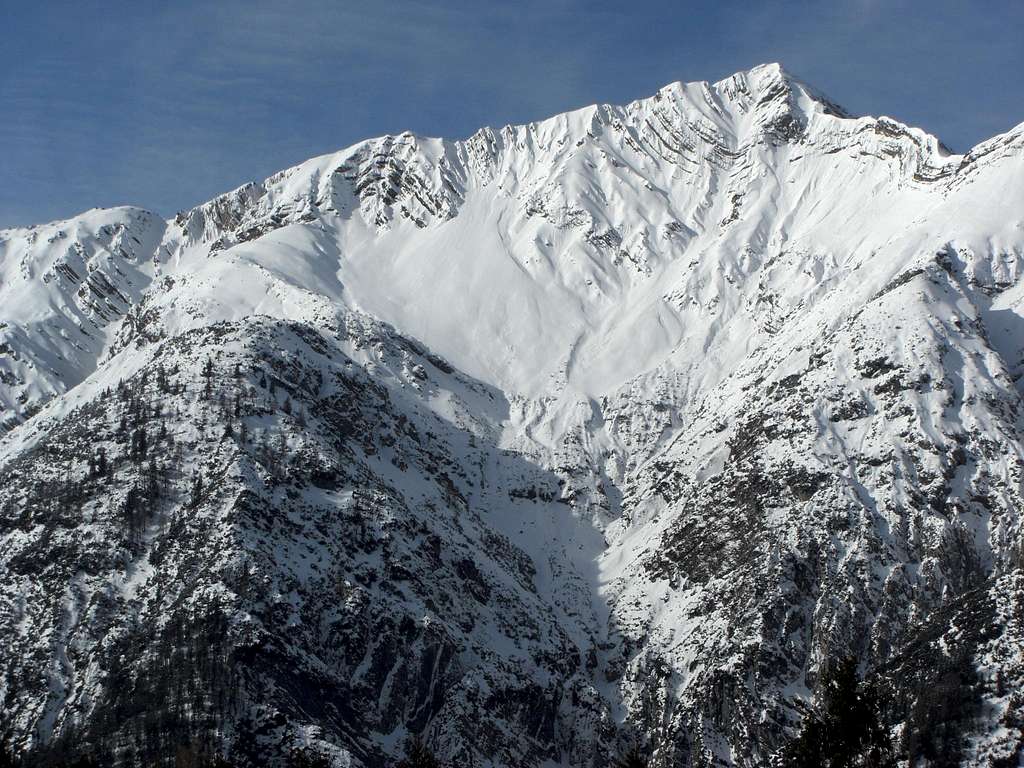
To the south, Seebergspitze shows steep dwarf pine and alpine wood slopes, building the northern delimitation of Pertisau village and Pletzach valley. The rugged eastern rock face above Achensee lake is always a spectacular sight. The western slopes down to the lush meadows of Pasillalm and wild Oberautal are steep and rugged, too. There is an east ridge down to Pasill col , which links the Seekar – Seeberg ridge with the even longer and more remote ridge between Hohe Gans and Schreckenspitze , some rather unknown summits of Pre-Karwendel mountains . “Pfanne” (pan) is called a small cirque northwest of the summit of Seebergspitze framed by steep limestone slabs. From may through july beautiful and abundand wildflowers are blossoming on the meadows and even in the rock parts of that mountain. From time to time, an ibex, coming from Karwendel ranges, visits the Pasillalm area and the Seeberg – Seekar ridge. Pasillalm, a little alp village, offers food and drinks in the summer months. The traverse route to or from Seekarspitze with the descent via Pasillalm, to Pertisau or to Achenkirch village and a return trip on the Achensee ships can make a more than satisfying day on Seebergspitze.
- Getting There
The main trailheads for Seebergpitze are: Achenkirch / Scholastika, parking area “Hinterwinkl” ; Pertisau ; best parking area is Cableway parking area or Pletzachalm parking area (short toll road). You reach Achenkirch or Pertisau:
- For Achenkirch take the last exit “Achenkirch / Hotel Scholastika” and then the third road on your right; this one goes to the Hinterwinkl parking area.
- For Pertisau go on road 181 to Maurach and take road L 220 to Pertisau . You find the cableway parking area on the west end of the village. Other parking possibilities are insid ethe village. If you follow the road further on you reach Pletzach Alm (toll road, about 3 km from Pertisau).
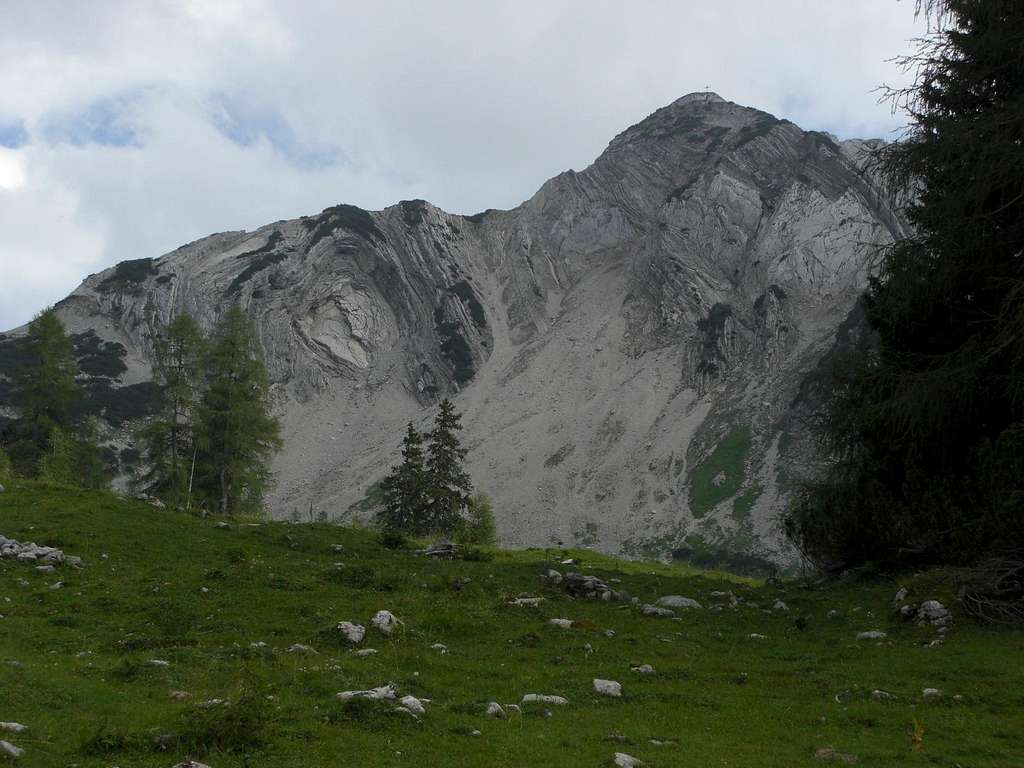
- For Achenkirch take the first exit “Achenkirch / Hotel Scholastika” and then the third road on your right; this one goes to the Hinterwinkl parking area.
- For Pertisau go on road 181 to Maurach and take road L 220 to Pertisau. You find the cableway parking area on the west end of the village. If you follow the road further on you reach Pletzach Alm (toll road, about 3 km from Pertisau).
The next railway station is at Jenbach / Inntalvalley. See the railway schedule of ÖBB here . From Jenach take the Achensee Railway to Pertisau and the ship to Achenkirch / Scholastika. The timetables can be checked here . Alternatively take the bus number 4080 from Jenbach to Pertisau or Achenkirch.
- Routes Overview
The following main routes are leading to Seebergspitze:
Pertisau direct route
Pertisau - Pasillsattel route
Traverse to Seekarspitze
Seekaralm – Pasillalmen route
Oberautal route
Trailhead: Pertisau Cableway parking area (or village)
Route Details: Cross Pertisau village in northern direction, cross the Pletzach creek on a foot bridge and go left or right, until a trail branches off and ascends the south slopes of Seebergspitze. Both trails meet at about 1450 m height. Follow the steep trail up to Roßalm (ruins) and to the summit.
Trailhead: Pletzachalm parking area
Route Details: From Pletzachalm parking area shortly go north on a road and follow the forest road zigzagging up the south slopes of Pasillsattel . Alternatively use the trail right of the road to shortcut some switchbacks. At the end of the road (approximately at 1260 m) follow the trail up to Pasillsattel. Turn right on the trail to the Seebergspitze west ridge and follow the trail up this ridge through dwarf pine thickets until you reach the summit (short rock scramble at the end of the route).
Trailhead: Seekarspitze
Route Details: Descend on the steep north ridge trail, starting at Seebergspitze summit (some rock scramble) until you reach the lowest notch between Seebergspitze and Seekarspitze (1924 m). Follow the trail, ascending the Seekarspitze south ridge on the ridge crest or sometimes left or right of it until you reach the Seekarspitze summit.
Trailhead: Hinterwinkl parking area
Route Details: At the parking area cross Oberautal creek and follow the forest road. At a road junction take the left, ascending road and follow it up to Koglalm . You may use the old trail in the upper part which branches off to your right after the second switchback and does some nice shortcuts between the roads switchbacks and joins the road again near Koglalm. From Koglalm follow the road to Seekaralm or use again the old trail which branches off to your left after the crossing of a creek. The trail rejoins the road near Seekaralm.
You reach Seekaralm alternatively by using the trail north of Oberautal creek top the northwest and west. Take the first trail to your left, cross the creek and ascend the woods on the trail; this one, too, brings you up to Seekaralm. At Seekaralm take the left forest road which circles round the northern slopes of Seekarspitze and ascends the western slopes of the mountain to a col, called “ Die Winteränger ” between the Seekarspitze – Seebergspitze ridge and a secondary summit, called Schoberkopf and Wilde Kirche , standing amidst the meadows of Pasillalmen. At the col there is a trail junction, take the left hand trail whichs ascends the cirque, called “ Pfanne ” to the lowest notch in the ridge Seekarspitze – Seebergspitze (1924 m). Turn right on the north ridge trail to Seebergspitze.
Alternatively descend from “ Die Winteränger ” to Pasillalmen on the forest road and take the trail to Pasillsattel . Turn left there on the trail via west ridge (some easy rock scrambling) to Seebergspitze.
Route Details: This trail unfortunately is officially closed due to some landslides below Schreckenspitze in Oberautal. The trail, however, can be used but is no longer maintained, so you may meet some nasty parts. Cross the Oberautal creek at the trailhead, follow the forest road and take the right road at the first road junction. Cross the creek again, go straight on and turn left on Oberautal forest road . Follow this road into Oberautal until you arrive at the first switchback. Take the trail branching off to your left and follow that now closed and not maintained trail until you arrive at Pasillalmen . At Pasillalmen take the forest road to your left and follow the road up to the col “ Die Winteränger ”. At the trail junction follow the right trail, ascending the cirque “ Pfanne ” to the lowest notch in the ridge Seekarspitze – Seebergspitze (1924 m). Turn right on the north ridge trail to Seebergspitze.
Alternatively turn left at Pasillalmen on the trail to Pasillsattel and then via west ridge (some easy rock scrambling) to Seebergspitze.
- Red Tape & Accommodation
Seebergspitze is part of the Alpenpark Karwendel , an important National Park of Tirol / Austria. The entrance is free.
Please respect the following rules in the National Park:

You find accommodation at:
Mountain huts:
- Pasillalm (food and drinks, no lodging)
- Seekaralm (food and drinks, no lodging)
- Gear & Mountain Condition
Seebergspitze is a nice hike during spring, summer and autumn. Normal hiking gear and good boots are sufficient.
Gaiters can be useful during a springtime hike.
Current Weather:
- Maps & Guide Books
Alpenvereinskarte , scale 1 : 25.000, number 5/3 , Karwendelgebirge Ost ,
trails, with UTM grid, München 2005
Bayerische Topographische Karte , scale 1 : 50.000, map number UK50-51 , Karwendel , Landesamt für Vermessung und Geoinformation Bayern, 2008, with UTM-grid for GPS
Heinrich Klier, Fritz März, und Walter Klier: Alpenvereinsführer Karwendelgebirge alpin , Bergverlag Rother, 2005
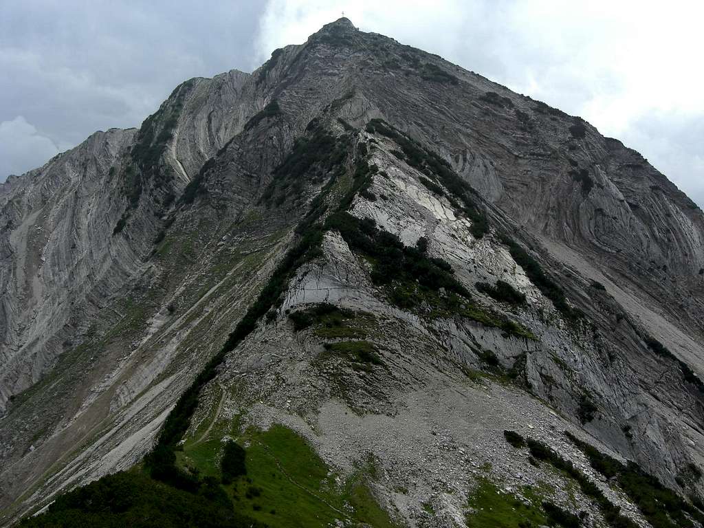
View Seebergspitze Image Gallery - 9 Images
- Nearby Mountains & Rocks
- Interactive Map
- Mountains & Rocks in Austria
Parents refers to a larger category under which an object falls. For example, theAconcagua mountain page has the 'Aconcagua Group' and the 'Seven Summits' asparents and is a parent itself to many routes, photos, and Trip Reports.
- Birkkarspitze
- Ödkarspitzen
- Kaltwasserkarspitze
- Bettelwurf, Großer
- Hintere Bachofenspitze
- Marxenkarspitze
- Kleiner Lafatscher
- Eiskarlspitze
- Breitgrieskarspitze
- Laliderer Spitze
- Sonntagkarspitze
- Hohe Fürleg
- Pleisenspitze
- Walderkampspitze
- Vordere Brandjochspitze
- Hochnisslspitze
- Große and Kleine Stempeljochspitze
- Larchetkarspitze
- Östliche Karwendelspitze
- Vogelkarspitze
- Tratenspitze
- Lamsenspitze
- Hoher Gleiersch
- Hintere and Vordere Schlichtenkarspitze
- Steinkarlspitze and Rotwandlspitze
- 43 More
You need to login in order to vote!
Don't have an account.
- Rating available
- Suggested routes for you
- People who climb the same things as you
- Comments Available
- Create Albums
- Route Finder
- Route Planner
- Travel Guide
- Places to visit
- Eat & drink
- Accommodation
- Ski resorts
- Current Conditions
- Avalanche Report
- Collections
- Travel Stories
- Publications
3 summit ski touring circuit in Obertauern - Seekarschneid, Seekarspitze and Plattenspitze

The meadows are already lush green, there have been colourful flowers in the garden for weeks and the fruit trees are already in bloom. Although it is already the beginning of May, we are experiencing an (unnecessary) cold snap. To "compensate" for this, we want to do at least one more proper ski tour: We are looking for a tour with a very high starting point and the ground should be a meadow, not large rocks. Obertauern fulfils these requirements perfectly, and once the lift season is over, the artificial snow slopes can be used to ski down to the car! But basically the tour is possible and beautiful throughout the winter!
According to the Swiss ski touring scale , the tour is classified as not very difficult WS from 30 degrees can be categorised.
Video of the tour
Author’s recommendation

Track types
Safety information, tips and hints.
Touristinfo Obertauern ; Ski area Obertauern ; Avalanche report ; News from the author on Facebook
Destination
Turn-by-turn directions.
Summit circuit: Start from the car park over the skiers' bridge and next to the Grünwaldkopfbahn cable car up the valley descent in a northerly direction. Now head south-west (left) past the Grünwaldsee and continue uphill on the piste coming from the Seekareck. After the flat section, cross the open terrain to the north (right) below the steep terrain to the eastern slope and continue ascending on this. The cornice on the Schneid can usually be easily negotiated to reach the southern summit of the Seekarschneid . All hail the mountain!
Enjoy the fantastic descent down the eastern slope (approx. 30 degrees), which often has good firn in spring. Then you slide down the flatter terrain in a south-easterly direction until you reach the pistes leading down from the Panoramabahn. Do not ascend the western (black) piste here, but instead take the more comfortable right-hand (red) piste up to the mountain station. Cross past this to the eastern slope, over which you then climb further up to the ridge and set up the ski depot there. The last few metres to the summit of the Seekarspitze are covered on foot. All hail the mountain!
Now back down the east side and continue on the piste to the Seekarhaus area. Here you put on your skins again and head eastwards (right) under the Hundskogel cable car. After a flat section, cross the steep ridge (approx. 30 degrees) to the pre-summit and continue to the summit of the Plattenspitze , where there is a large mast that can be seen from afar. All hail the mountain!
The descent takes you from the summit directly onto the beautiful south-facing slope and then between a few rocks back onto the pistes. Follow these down to Obertauern.
Way back: Here you put on your skins one last time, cross the bridge and head up the opposite slope at least as far as the wide Ziehweg (family descent). From here you can glide back to the car!
Public transport
Coming from the north, we leave the A10 Tauern motorway at the Altenmarkt junction and follow the main road in the Ennstal valley to Radstadt. After the village, turn right and take the pass road to Obertauern.
Coming from the south, leave the A10 motorway in St. Michael and turn left in Mauterndorf to reach the Obertauern pass.
Coordinates
Book recommendation by the author.
Alpinverlag: Ski Touring Guide Austria ; Schall-Verlag: Ski Touring Atlas Austria East
both available from freytag & berndt
Author’s map recommendations
freytag & berndt : WK 202 Radstädter Tauern - Katschberg - Lungau, hiking map 1:50,000
Book recommendations for this region:
Localization
Similar routes nearby
- Seekarspitze 2350m
- Seekareck 2217m
- Seekarschneid 2288m
- Zehnerkarspitze 2382m
- Kleine Kesselspitze and Gamsspitzl from Obertauern
Questions and answers
Would you like to ask the author a question?
Help others by being the first to add a review

Photos from others
Avalanche conditions, weather at the route's trailhead.
- Show images Hide images
- 4 Waypoints
Excursions and leisure tips for the region
- Route planner
Jan experienced this adventure with komoot!
Have your own adventure with the #1 outdoor app today., achenkirch - seekarspitze - seebergspitze - pertisau, tour overview, seekarspitze (2.053 meter).
Mountaineering Highlight
Seebergspitze (2.085 Meter)
Tour profile, speed profile.
November 6, 2018
- Create a Copy of This Tour
- Download GPX file
- Report Tour
You Might Also Like
Hiking Collection by Vakantie in Oostenrijk
Hiking Collection by Alpbachtal
Mountain Biking Collection by Achensee
Mountain Biking Collection by Alpbachtal

IMAGES
VIDEO
COMMENTS
1,609 m. 2,073 m. 931 m. A mountain tour with great views takes us over the two peaks of the Seekarspitze and the Seebergspitze. This tour first leads from the Achensee to the Seekaralm. From there the trail leads up to the Seekarspitze on a steep and in places exposed path. Then follow the meadow ridge to the Seebergspitze.
Tolle Tour mit prima Achensee-Blick! Alternativ kann man auch noch die Seebergspitze "mitnehmen": Tourenbeschreibung Seekarspitze und Seebergspitze > Zusammenfassung Seekarspitze. Art: Mittelschwere Bergwanderung (Tendenz zu schwer) Höhenmeter: ca. 1100hm im Auf- und Abstieg; Gehzeit: Gesamt 5h - Aufstieg ca. 3h, Abstieg ca. 2h
Tour description. The hike to the Seekarspitze has been on my "summit list" for quite some time. On the one hand, because the tour is varied and a bit demanding. And on the other hand, because the mountain lures with a great view. From Munich we are in about 1.5 hours at the Achensee, which is just behind the Austrian border. ...
March 22, 2024. Seekarspitze (2053 m) and Seebergspitze (2085 m) are the mountains that flank Lake Achensee to the west, across from the Rofan mountains, in Tyrol, Austria. One of the best ways to experience Lake Achensee is from the high trail that connects the Seekarspitze and Seebergspitze peaks. This long ridge trail provides sweeping views ...
Am Samstag sind wir dann auf die Seekarspitze vom Wanderparkplatz in Achenkirch über die Seebergspitze und dann über Pertisau zurück nach Achenkirch entlang am Achensee. Eine wahnsinnig schöne Tour mit viel abwechslungsreichem Gelände, wenig Leuten und natürlich mit einer super Aussicht auf den Achensee und die umliegenden Berge.
The crossing of the Seeberg and Seekarspitze over the long ridge ridge is probably one of the most beautiful mountain hikes in the Karwendel with fantastic panoramic views of the Achensee, Rofan mountains, main Alpine ridge, Karwendel mountains, Alpine foothills etc. ... Seeberg- and Seekarspitze - high above the Achensee (round tour) ...
This route is the winter ski tour route, too! Seekarspitze summit. The connecting ridge to Seebergspitze as seen from Seekarspitze summit. Traverse to Seebergspitze. Trailhead: Seekarspitze. Route Details: Just follow the trail on the ridge crest or left / right of it into the deepest notch between the two summits (1924 m).
Seekarspitze is an expert mountaineering route: 9.89 km and takes 05:51 h. View this route or plan your own!
Routes Austria Karwendel Seekar and Seebergspitze - round tour above Lake Achensee. Share Bookmark Create 3D video My Map Print GPX KML FIT Plan a route here Copy route Plan a joint trip Embed Fitness Report a Concern Top recommended route Seekar and Seebergspitze - round tour above Lake Achensee ...
Top - Bergtouren aus der Region Karwendel. Hier finden Sie die schönsten Touren aus dieser Gegend. Die Region Karwendel ist bekannt für ihre Vielfalt, für ihren landschaftlichen Reiz und hohen Erholungswert. In unserem Tourenarchiv finden Sie dazu Gebietsinformationen und weitere lohende Routenvorschläge mit Bildern und GPS-Daten.
Discover the best hikes and paths to Seekarspitze in Pertisau, Schwaz. Explore it on the map and plan your own route to Seekarspitze. komoot. Discover; Route planner; Features; Discover. Seekarspitze. 108 Photos. Seekarspitze. Hiking Highlight. Recommended by 133 hikers. ... Lord-on-Tour 👣🚲🏔️🇪🇺 ...
Seekarspitze is the central figure of the Obertauern Pass plateau. The slopes of this quite appealing summit are due to the ski circus completely degraded. ... (2012) more than 30 people were ascending up the ski terrains on tour skis, some of them were negotiating also the summit itself, despite hard snow and some ice on the summit ridge.
Seekarspitze to the Seebergspitze - ridge walks in Tyrol is an expert Hiking Tour: 11.8 km and takes 06:46 h. View this route or plan your own!
Ausflugsziele und Freizeittipps in der Region. Anspruchsvolle Bergtour hoch über dem Achensee. Gemütlicher Anstieg bis zur Seekaralm, für den Aufstieg zur Seekarspitze ist Trittsicherheit und Schwindelfreiheit erforderlich. Die Busse verkehren hier nur selten, weshalb man dem Fahrplan besondere Aufmerksamkeit schenken sollte.
Seekarspitze. A beautiful peak which towers above the bright blue Achensee lake. Ski Touring Difficult. Distance 7.5 km Ascent 1.2 km Descent 883 m Duration 4-5 hrs Low Point ... A stunning tour with a mountaineering feel and an exciting descent. Difficulty. Difficult. Serious gradient of 30-38 degrees where a real risk of slipping exists ...
Traverse to Seekarspitze. Trailhead: Seekarspitze Route Details: Descend on the steep north ridge trail, starting at Seebergspitze summit (some rock scramble) until you reach the lowest notch between Seebergspitze and Seekarspitze (1924 m). Follow the trail, ascending the Seekarspitze south ridge on the ridge crest or sometimes left or right of it until you reach the Seekarspitze summit.
The described ski tour in Obertauern leads over the highest peaks that tower above the ski area on the north side. The Seekarschneid (2,288 m), the Seekarspitze (2,350 m) and the Plattenspitze (2,293 m) are climbed in a clockwise direction, each with beautiful descents in open terrain. ... The last few metres to the summit of the Seekarspitze ...
Komoot user Jan recorded a mountain climbing Tour: Achenkirch - Seekarspitze - Seebergspitze - Pertisau. See this route and plan your own adventure with komoot! Jan went on an outdoor adventure with komoot! Distance: 13.1 km | Duration: 06:37 h. ... Achenkirch - Seekarspitze - Seebergspitze - Pertisau ...