9 Stunning Backpacking Trips in the U.S. You Should Know About

This article on the best backpacking trips in the U.S. is brought to you by Gregory , the makers of hiking backpacks that are tough enough for day hikes, weekend trips and thru-hiking adventures.
Backpack camping—an approach that involves hiking to your campsite, usually carrying a hefty backpack of gear with you—isn’t for everyone. The KOA North American Camping Report of 2019 supports that statement; while camping popularity in the U.S. has overall reached new heights among a wider audience of households in recent years, those new campers are generally drawn to car camping, glamping, and the more convenient destinations. Which means that backpacking continues to offer an escape from the crowds.
Venture out on a backcountry trail in any crowded national park and you’ll find the crowds all but disappear, just a few miles in. If you bring your camping supplies with you, a secluded, quiet camping experience awaits you in the wilderness.
The best backpacking trips in the U.S. span a range of experience levels. Once you’ve collected your gear (with some help from our backpacking checklist ), it’s time to pick a trail.

9 Bucket List Backpacking Trips in the U.S.

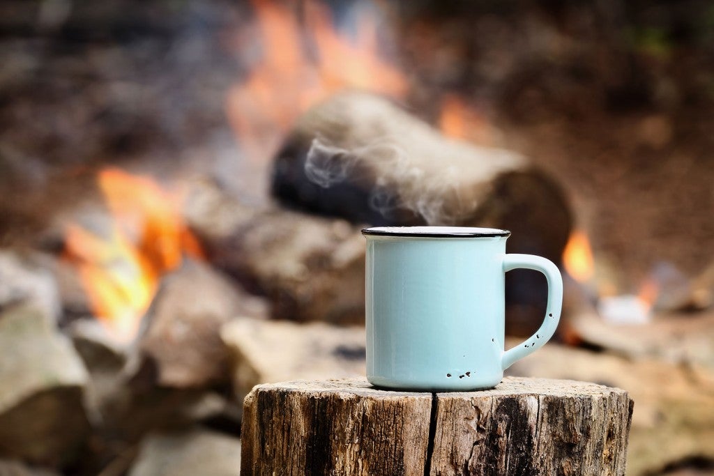
Photo Courtesy of William Saunders
This list of backpacking trips in the U.S. offer a range of accessibility depending on your skills and experience. No matter the experience level required, they’re all stunning and enjoyable. Researching this backpacking resource definitely made us want to get away from our computers and hit all of these trails.
1. The Lost Coast Trail —Northern California
Length: 24 miles Elevation Change: 1,542 feet Days: 2-4 Trailheads: Mattole Beach, Black Sands Beach
California’s Golden Coast gets visitors galore, with hotspots mostly south of the Bay Area. But head north, beyond the hillside mansions where the famous Pacific Coast Highway disconnects from the coastline, and you’ll find the Lost Coast Trail along the state’s King Range National Conservation Area. As a wilderness trail along some of the state’s rockiest beach terrain, this backpacking trip is relatively short, but the rock scrambles and sand dunes along the way make challenge and rewarding option for beginners.
Backpacking this trail requires an overnight permit from the Bureau of Land Management, available online from Recreation.gov. The trail is best done via a shuttle service between the two trailheads, as either route is point-to-point.
2. The North Coast Route —Olympic National Park,Washington
Length: 20 miles Elevation Change: 200 feet Days: 2-4 Trailheads: Rialto Beach, Ozette Campground
Positioned along the coastal portion of Washington’s Olympic National Park, this 20-mile backpacking trail is an ideal entry point for inexperienced backpackers with a penchant for seaside views. Backpackers will find a relatively flat shoreline and fair weather seasonally along this trail, ideal for a long weekend backpacking trip on the Olympic Peninsula. With one of the lowest elevation gains on this list, hikers looking to test their distance-per-day will find a perfect path ahead.
Camping along the trail is done at established campgrounds between the trailheads, and no permit is needed for the hike itself. Keep your eyes peeled for tidepools teeming with life, as much of the coast’s rocky shore plays host to underwater life.
3. Lake Aloha Trail —Central California
Length: 12 miles Elevation Change: 1,873 feet Days: 2-3 Trailheads: Echo Lake Trailhead
The Lake Aloha trail, on the southern end of California’s Lake Tahoe, is seemingly custom built for entry-level backpackers interested in a postcard-worthy view. A hike along this 12-mile loop trail takes you along a number of alpine lakes in the Desolation Wilderness, and brings you up 1,800 feet in total. Take a leisurely pace to make the incline portion much easier, and after a long sweaty hike, take a swim in Lake Aloha, where there’s dispersed camping along a ridge nearby.
Since this is one of the best backpacking trips in the U.S., snagging a reservation for camping in the area can be tough—look to plan this trip early in the off-season, and expect to check online regularly for openings. Campfires are never allowed in the Desolation Wilderness, and campers should check out safety tips from the Lake Tahoe Basin Management Unit .

The Timberline Trail
4. Mount Sterling Loop Trail (Via Low Gap) —Great Smoky Mountains National Park, Tennessee
Length: 28.5 miles Elevation Change: 8,110 feet Days: 4-5 Trailheads: Low Gap Trailhead, Big Creek Trailhead
Situated in the country’s most visited national park, the Mount Sterling Loop Trail offers an intermediate-level backpacking trip to the peak of one of the tallest points in the park. Hike from the Low Gap trailhead in Crosby, NC and pass through old growth forests—crossing state lines into Tennessee on your way. You’ll follow the Big Creek to the summit of Mount Sterling, where you’ll come across a firetower, built during the 1930s by the Civilian Conservation Corps—perfect for getting sweeping views of the misty mountains. Continue on from the summit and you’ll complete a loop around the mountain, circling back to the Low Gap Trailhead. The total 8,000+ elevation gain is subtle on the majority of the trail, although some points climb sharply via switchbacks as you begin to circle the mountain.
As part of the Great Smoky Mountains National Park , backcountry camping on this trail requires a backcountry permit from the park office, alone with reservations made in advance for campgrounds/shelters along the way. More information on reservations and permits can be found from the park’s Backcountry Office at 865-436-1297.
5. Timberline Trail —Mount Hood National Forest, Oregon
Length: 38.3 miles Elevation Change: 9,000 feet Days: 4-5 Trailheads: Timberline Lodge
Mount Hood is one of Oregon’s Seven Wonders, an active volcano just about an hour outside of Portland. While many make a point to visit the mountain’s cozy Timberline Lodge, backpackers looking for a more scenic view of this monolith can venture out on the Timberline Trail which circles the mountain. Start from the parking lot of Timberline Lodge and head east or west on the trail to get started; you’ll traverse roughly 9,000 feet of elevation change over about four days. The loop will circle you back to Timberline Lodge, where you should relax apres-hike with a warm drink indoors.
This trail involves a decent amount of trail merges, so be careful when navigating that you don’t make a wrong turn on to various off-shoots. The Timberline Trail can be dangerous when inclement weather is present, as with any instance of high-elevation hiking, you should feel confident that your backpacking skills match the worst weather scenarios you might face. No permits are needed for the hike.
6. Cottonwood Marble Canyon Loop Trail —Death Valley National Park, California
Length: 26-28 miles Elevation Change: 5,613 feet Days: 3 Trailheads: Stovepipe Wells
With terrain and scenery pulled straight from Mars, hiking around Death Valley National Park (or the Mojave desert in general) is as interesting as it is intense. The Cottonwood-Marble Canyon Loop Trail takes backpackers through a dry and stark terrain, and requires more planning than a typical backpacking trip. The trail, running close to 30 miles in a loop, will connect from the Stovepipe Wells trailhead, and can take about 3 days. As with most desert backpacking, you must plan your trip around water resources—this trail offers a few natural streams at some campsites but water is scarce for the majority of the hike. Along with plenty of water, be sure to bring a water filter to refill when available.
Getting to the trailhead requires a 4WD vehicle at all times of the year, but no pre-planning for a permit is needed. Permits are available for free at visitor contact stations across the park. The challenge of this trail lies mainly in the difficult conditions of the desert, so be sure to read Death Valley National Park’s tips on planning this hike in advance.

The John Muir Trail
7. The John Muir Trail —California
Length: 221 Miles Elevation Change: cumulative 47,000 feet Days: 20-30 Trailheads: (Southbound) Happy Isles, Sunrise Lakes, Glacier Point, Lyell Canyon
Cutting more than 200 miles through central California’s Sierra Nevada mountains, the John Muir Trail is as legendary as it is scenic. Plan for close to a month of hiking, camping, and exploring part of the state’s rocky, snow-spotted terrain, with an elevation gain more than 1.5 times the height of Mount Everest.
Getting yourself a backpacking permit for the John Muir Trail might be one of the hardest parts of this trip. Hikers should plan to enter the online lottery system as early as possible, about 24 weeks before your planned trip, or possible chance a first-come, first-served permit available from the ranger station. As well, hikers should plan out resupply stops at certain campsites and vantage points along the way.
8. The Wonderland Trail —Mount Rainier National Park, Washington
Length: 93 miles Elevation Change: cumulative 22,000 feet Days: 12-14 Trailheads: Fryingpan Creek Trailhead
With so many amazing mountains to climb and trails to backpack in the Pacific Northwest, it’s hard to think there could be one trail that stands above the rest. At least in elevation, the Wonderland Trail around Washington’s Mount Rainier does just that, circling the PNW’s only mountain over 14,000 feet.
The trail itself isn’t as lengthy as other advanced backpacking trips, but serves as a short-but-tough alternative to many other trails. Climbing over 22,000 feet in cumulative elevation gain along the Wonderland Trail, you’ll enjoy dense evergreen forests and snowy peaks year-round.
The trail’s high elevation is a serious consideration as thin air can wear on hikers who aren’t used to these conditions. Take caution when beginning and ending the trip, as acclimation might be necessary for a comfortable hike. While specific permits aren’t required to thru-hike the trail, a general wilderness permit is required for backcountry camping along the way.
9. The Long Trail —Vermont
Length: 272 miles Elevation Change: cumulative 69,000 feet Days: 20-30 Trailheads: Appalachian Trail Vermont/Massachusetts, Journey’s End Road
While it may not rival some of the more scenic trails in the western U.S., Vermont’s Long Trail offers hikers a look at a stunning variety of nature along one of the greenest states east of the Mississippi River. Stretching 272 miles from the southern border with Massachusetts to the Canadian border to the north, the oldest thru-hiking trail in the United States spares no view of the Green Mountain State throughout. What this hike lacks in dramatic views akin to the western U.S., it makes up for in greenery and ease‚ with a relatively balanced elevation incline throughout. While trail conditions can get muddy starting in the late summer and early fall, hiking through the New England fall foliage is one of the most popular attractions for the backpacking trip. Finishing the trail from north to south or south to north earns you the title of “End-to-Ender,” a boast-worthy epithet you can share at the breweries along the trail .
Planning for this hike is pretty simple; no permits are required for hiking or camping along the way. The Green Mountain Club has maintained the trail since its establishment in 1930, and offer tips and guidebooks online and in print for hikers planning ahead.
This post was brought to you by our pals at Gregory .
From small day hiking backpacks to top-of-the-line backpacking backpacks — Gregory has you covered!
Related Campgrounds:
- Clear Lake Campground , Mount Hood National Forest, OR
- Tahoe Valley Campground , South Lake Tahoe, CA
- New Melones Lake Camping , CA
- Sly Park Campground , Pollock Pines, CA
Popular Articles:
- Get the Latest 2023 Camping Travel Trends
- How To Find Free Camping in National Forests
- The Checklist Every First Time RVer Needs
- Find Free Camping With The Dyrt Map Layers
- The Ulimate Boondocking Guide To Free Camping
- Everything You Need To Know About Wifi For Your RV
- 7 of The Best Overland Routes in North America
- 14 Wilderness Survival Tools You Should Have in The Backcountry
- Here's What To Add To Your Primitive Camping Checklist
Kevin Johnson
Kevin is the Assistant Editor for The Dyrt, with bylines in National Geographic Traveler and Atlas Obscura. Although originally from the swamps of Washington, D.C., he's now based in the trees of Portland. He's been interested in geography and travel since seeing his first map as a kid, and is now working toward seeing it all in person. You can find him exploring the coastal beaches or a record store in his free time.
More Articles
7 Coffee Gear Essentials for Campers Who Need Their Caffeine (Like, Now)
On my daily commute to The Dyrt’s office in Portland, Oregon, I find myself passing five coffee shops within a 15-minute bike ride. Portland is…

Pickleball Has Become a Favorite Sport at RV Parks Across the Country
This article is brought to you by Liquid IV, which is the perfect addition to your pre- or post- workout routine. Get all the hydration…
14 Incredible Backpacking Trips in 14 U.S. National Parks
Plan a cross-country tour of the backcountry.
By: The Outbound Collective + Save to a List

The national parks are a treasure for all of us to enjoy. While you can gain a strong appreciation for the parks by driving the main roads and stopping at the most popular attractions, we think the best way to connect with these specials lands is to spend a night or two in the backcountry.
Not only will you find more solitude and peace, you'll also cover more ground and get a better sense for the park's untouched landscape. You could plan an epic road trip to all 14 of these parks or start knocking them off one-by-one, but whatever you do, make sure these backpacking trips are on your adventure bucket list.
1. Backpack Bryce Canyon’s Under the Rim Trail

Distance: 23.79 miles Elevation: 5794 feet Type: Out-and-back
Want to see Bryce without the crowds? This is the hike for you! Get a permit at the visitor center and don't forget a bear barrel to keep your food safe. Parking here is limited, so consider getting dropped off and picked up to avoid issues stashing your car. Look for The Hat Shop, an area with hoodoos - a collection of unique towering rocks. You may not see other people on the trail, so expect isolation. Be careful as you navigate the trail as it does require attention as you get to the more primitive area past Yellow Creek campground. Enjoy shady areas as this trail can get hot!
2. Backpack Rocky Mount Trail in Shenandoah National Park

Distance: 9.58 miles Elevation: 2200 feet Type: Loop
Bring your furry pal on this nearly 10-mile loop with incredible views of surrounding Shenandoah National Park. Park and fill out a permit at Two Mile Overlook a little way down Skyline Drive from the trailhead. The hike starts in a wooded area and then follows a ridgeline before a stretch upward toward Rocky Mount - a peak overlooking the Blue Ridge and Shenandoah River. Expect to rock hop streams near Gap Run during your descent. If you stay overnight, consider camping near the flat areas around Gap Run.
3. Backpack Paintbrush and Cascade Canyons, Grand Teton National Park

Distance: 18.77 miles Elevation: 4088 feet Type: Loop
Pack a fishing pole for this popular and challenging overnight trail in the Tetons. Park at the String Lake parking lot to reach the trailhead. Get permits ahead of time as this area is well-traveled - especially during the summer months. You'll reach Holly Lake around 6 miles in, and there are three sought-after campsites around the shores. Stash your food in the bear resistant storage containers available on-site. If you backcountry camp, bring bear barrels and hang your food. The higher elevations here often have snow year-round, so be sure you have adequate footwear and consider an ice axe early or late in the season. Dogs are not allowed on this trail.
4. Hike the Little River Trail to Backcountry Campsite #30, Great Smoky Mountains National Park

Distance: 12.34 miles Elevation: 412 feet Type: Out-and-back
This 12+ mile trail is located in Great Smoky Mountains National Park and follows a reclaimed railway bed along the Little River. Along the way, you'll pass some abandoned buildings that were once vacation homes. They are dilapidated, so don't explore. Keep en eye out for Troll Bridge near the beginning of the trail. You'll also pass Husky Branch Falls and intersect the Cumberland Gap trail. There are several campsites (including a group one) with spots for tents and hammocks.
5. Backpack Sunrise Lakes to Clouds Rest in Yosemite National Park

Distance: 18.93 Miles Elevation: 1775 Feet Type: Loop
Head to the Tenaya Lake Trailhead to hike 2.5 miles to Clouds Rest, or take the turn to Sunrise Lakes. Pack in a lot of water here as you'll need it! The trail is challenging, and can take hikers more than 12 hours to complete. It is a popular day hike, so consider camping to enjoy some quiet hours when day traffic is done.
6. Backpack to Cracker Lake in Glacier National Park

Distance: 12.72 Miles Elevation: 14,000 Feet Type: Out-and-back
Cracker Lake is less popular than nearby Iceberg Lake, offering the opportunity for solitude and relaxing on the beach. The turquoise water is accessible after hiking 6.1 miles through forest, past waterfalls and an abandoned mine, and even crossing several creeks. Some people hike here in back in a day, while others stay at several tent sites around the lake.
7. Backpack the High Divide and Seven Lakes Basin in Olympic National Park

Distance: 19.93 Miles Elevation: 5,056 Feet Type: Loop
This nearly 20-mile hike has unreal views of Mount Olympus and the Bailey Range near Port Angeles, Washington. Start at the Sol Du Lac trailhead and walk to Sol Du Lac Falls. You'll cross several footbridges over the river while climbing upward toward Deer Lake. There are campsites around the water, and people fly fish here so bring a rod and fishing license! Watch for bears - there are tons of huckleberry bushes.
To continue on, follow the path past the lake and over the marsh. You'll walk through subalpine meadows (full of wildflowers in the summer!) and up a steep ridge past gnarled hemlock trees. Many people stop to camp or turnaround at Lunch Lake Campground around (mile 9), or spend the night a little further at Heart Lake Campground (mile 11). After your night in a tent, stop at Sol Duc Hot Springs on your way out to soothe sore muscles from your hike.
8. Backpack to Lake Verna in Rocky Mountain National Park

Distance: 13.5 Miles Elevation: 2500 Feet Type: Out-and-back
This trip is on the west aka "quiet side" of Rocky Mountain National Park. It starts near Grand Lake and has 8 campsites available from the trailhead, the closes at Lower East Inlet (2.35 miles in) and furthers Lake Verna (7 miles in). You'll hike through forest full of pine trees and wetlands and along alpine lakes. Many people basecamp at Lake Verna and then hike from their tent to photograph the stunning area or fish. Get a fishing license ahead of time. The trail is well-established and features clear directional and campsite signage. Fires are not allowed here during any season, so bring a camping stove if you plan to cook meals or beverages.
9. Backpack the Chisos Mountains in Big Bend National Park

Distance: 15.3 Miles Elevation: 3737 Feet Type: Loop
This 15-mile trail follows the Chisos Mountains along the Mexican border in Big Bend National Park. This remote corner of the Chihuahuan Desert offers stunning views if you're willing to hike narrow canyons and exposed cliffs. Backpackers can camp at the South Rim at backcountry sites where they may feel relief from the intense heat. Start at the trailhead next to Chisos Mountai nLodge and follow the Laguna Meadows Trail. You'll switchback Emory Peak (Texas' highest mountain at 7,200 feet) before camping near the South Rim. The next day, walk around the rim and take in cliff views before hiking Boot Canyon Trail and checking out Boot Pinnacle - a rock that resembles an upturned cowboy boot! You'll finish up your hike back at the lodge trailhead. As you exit the park, consider stopping in Terlingua , a ghost mining town inside the park.
10. Backpack Redwood National and State Parks

Distance: 4.41 Miles Elevation: 1043 Feet Type: Loop
Strap on your pack and meander among stunning redwoods on this California trek! Start by visiting the rangers station to learn about beach campsites for your first relaxing night. Tall Trees Grove has many options for dispersed camping, but there is no drinking water, so be sure to pack plenty in.
On your second day, head to Kuchel Visitor Center in Tall Trees Grove to get a permit and gate access code. Use the code on the dirt road to Tall Trees Trailhead, around 45 minutes away. Expect trailhead bathrooms but not enough space for trailers or RVs. While the hike here is just a .5 loop, many people take hours to complete it as they wonder at the Redwoods. Camp on Redwood Creek gravel bars and enjoy the unmatched stars thanks to minimal light pollution.
On day three, don water shoes or hiking boots and wade 1.7 miles in Redwood Creek. Spend a night near the Emerald Ridge Trailhead, potentially hiking downriver to camp before hiking back up river and floating in an inner tube down to your site. This lazy river is a blast for all ages and a unique way to see the Redwoods. On day 4, hike .9 miles on the Emerald Ridge Trail back to your vehicle in the parking lot. Don't have four days? Pick a shorter section of the above itinerary and you'll still have plenty of time to take in the one-of-a-kind trees.
11. Backpack Isle Royale National Park’s Greenstone Ridge Trail

Distance: 41.12 Miles Elevation: 3235 Feet Type: Point-to-Point
Isle Royale National Park is one of the least visited of public lands, making the perfect place for some peace and quiet. This unique park is located in Lake Superior and is home to many moose and wolves. To get there, book a ferry ride across Lake Superior to Isle Royale in advance. The ferry runs several times a week from Grand Portage Minnesota and Copper Harbor Michigan to several places on the island. The vessel does not move cars - just people!
Once on the island, you'll have to choose from two routes. The first, Minong Ridge runs along the north coast and is about 30 miles one-way. It ends at Minong Mine, a ferry stop. Greenstone Ridge Trail follows the center of the island, which some people prefer as there is more diverse landscape from orchid-filled bogs to interior lakes and the treeless Greenstone Ridge. For a 3-4 day hike, take this route and catch the ferry at Daisy Farm at mile 35. For a full hike, walk 45 miles from Windigo to Rock Harbor, another ferry point.
12. Backpack the Grand Canyon Rim-to-Rim-to-Rim

Distance: 45.6 Miles Elevation: 10141 Feet Type: Out-and-back
Sure, you could drive to a Grand Canyon lookout point and take in the views. But, backpacking the rim to rim is one of the best ways to get up close and personal with this Natural Wonder of the world. Start your journey at North Kaibab Trail at the North Rim. Expect drinking water pump stations and bathrooms at multiple points along your hike. Ask rangers which will be open as some are seasonably available.
Bring trekking poles - you'll need them as you ascend 14 miles and around 5,700 feet to camp at Bright Angel Campground on night one. Be sure to stop at Ribbon Falls around mile 7. Book a campground permit well in advance as this is a popular place to rest. Consider reserving a meal for pick up at Phantom Ranch Restaurant to reduce the amount of food you have to pack in.
Day two requires hiking 19 miles with nearly 5,000 feet of elevation up and down. Leave Bright Angel Campground before sunrise to enjoy stunning sunlight and changing sky colors as you hike toward the South Rim. This early start also helps hikers avoid the intense midday heat. You'll walk to the South Rim, checking out awesome vistas along the way. Stop to eat and rest before returning the way you came and heading back to Bright Angel Campground.
On day three, hike the 14 miles and around 5,700 feet back up to the North Rim on North Kaibab Trail. If you'd like a more leisurely pace, consider extending your trip by another day so you can rest at the campground. Reserve backcountry permits before your trip.
13. Backpack the Great Sand Dunes

Distance: What you make of it! Elevation: What you make of it! Type: What you make of it!
Great Sand Dunes National Park covers over 30 square miles with more than 5 billion cubic meters of sand. The tallest dunes in North America rise 750 feet high in this Southern Colorado park, offering amazing views of the Sangre de Cristo Mountains. You can wander the dunes here following whatever "path" you'd like. There are specific day-use areas that do not allow camping, so be sure to stay the night at one of the seven designated sites along Sand Ramp Trail. There are also 20-non-designated sites in the Dunes Backcountry, at least 1.5 miles west of the Mendano Creek bed beyond the day-use area and west of the high ridge.
Reserve a non-refundable $6 permit here online ahead of time. On-site permits are no longer available.
14. Backpack the Joint Trail in Canyonlands National Park's Needles District

Distance: 19.06 Miles Elevation: 3028 Feet Type: Loop
Two hours southwest of Moab, you'll find the Needles Visitor Center . Stop here to pick up backcountry permits and chat with the rangers about upcoming weather and trail conditions. Make sure to ask about drinking water sources as there may not be any once you head on the trail.
When you're ready, park at The Needles Campground and follow one of multiple trails between Salt Creek Canyon and The Grabens. Check out Chesler Park for grasslands, Big Spring for a wider canyon, and Wooden Shoe Canyon or Elephant Canyon if you're looking for a narrow canyon experience.
Add Joint Trail to your must-visit list. This deep slot canyon trail in Chesler Park has far fewer visitors than the popular Antelope Canyon, but offers similar neat fissures to explore. One Outbound User recommends checking your map every time you see a trail sign as it is very easy to get disoriented in this rocky environment. Climbers will dig the bouldering opportunities in this unique part of the park.
Consider backcountry camping at a high point on your journey, or return to The Needles Campground. Please note that human waste must be removed from this area to protect the desert. Purchase wag bags (waste bags) from the Visitor Center or bring your own and be prepared to pack in everything you bring out on trail.
Cover photo: Christin Healey
We want to acknowledge and thank the past, present, and future generations of all Native Nations and Indigenous Peoples whose ancestral lands we travel, explore, and play on. Always practice Leave No Trace ethics on your adventures and follow local regulations. Please explore responsibly!
Do you love the outdoors?
Yep, us too. That's why we send you the best local adventures, stories, and expert advice, right to your inbox.

Journey to Wyoming’s premier snowmobiling destination: Togwotee Mountain Lodge
Samuel Brockway
A couple of snowmobiling newbies hop aboard some steel horse sleds to explore the mountains of Wyoming.

Hiking in comfort: a review of Danner Mountain 600 Evo boots
Meghan White
Picture this: a crisp morning in San Diego, the sun peeking over the horizon, casting a warm glow over Oak Canyon in Mission Trails Regional Park.

A peek through God's window
Heather Arnold
There is something about the promise of a warm sunrise and the open road. I answer the call of the mountains. And find peace and calm. And a healthy dose of waffles and walks!

Three-day winter itinerary for Yosemite National Park
Cindy Villasenor

Big Bend Bound: Crafting Your 3-Day Adventure
Erin Newman-Mitchell
The unparalleled beauty of the landscapes and mesmerizing dark skies at Big Bend National Park make for an essential bucket list experience. I’ll highlight and recommend some of my favorite things to see and do to help you make the most of your West Texas visit.
- Local Adventures
- Tours and trips
- Camping Nearby
- Outbound PRO Membership
- Add your property
Mobile Apps

© 2024 The Outbound Collective - Terms of Use - Privacy Policy

10 Best Backpacking Trips in U.S. Parks
This year the National Park Service (NPS) celebrates its 100th birthday. Over the past century, the agency has protected and managed a system that has grown to now include 59 parks in 27 states and ranges from famed summer-vacation destination icons like Yellowstone and Yosemite to the remote 8.4 million wild acres of Alaska’s Gates of the Arctic and tropical paradises like Florida’s Dry Tortugas. Of course, the parks can be popular, but don’t let that scare you away this summer. The best way to truly immerse yourself in these wild landscapes is to get away from the gawking roadside crowds and spend days exploring their deep, primal secrets by foot. To that end, and to celebrate a hundred years of the NPS, we offer up these best ten backpacking trips in the parks.
- Nat Geo Expeditions
LIMITED TIME OFFER
Receive up to 2 bonus issues, with any paid gift subscription!
Related Topics
- BACKPACKING
- NATIONAL PARKS
You May Also Like

These are the 10 most popular national parks

How to visit Lake Clark National Park and Preserve

National parks overcrowded? Visit a national forest.
These national parks are home to some of the most incredible U.S. landmarks

The essential camping checklist for beginners
- History & Culture
- Photography
- Environment
- Paid Content
History & Culture
- Mind, Body, Wonder
- Terms of Use
- Privacy Policy
- Your US State Privacy Rights
- Children's Online Privacy Policy
- Interest-Based Ads
- About Nielsen Measurement
- Do Not Sell or Share My Personal Information
- Nat Geo Home
- Attend a Live Event
- Book a Trip
- Inspire Your Kids
- Shop Nat Geo
- Visit the D.C. Museum
- Learn About Our Impact
- Support Our Mission
- Advertise With Us
- Customer Service
- Renew Subscription
- Manage Your Subscription
- Work at Nat Geo
- Sign Up for Our Newsletters
- Contribute to Protect the Planet
Copyright © 1996-2015 National Geographic Society Copyright © 2015-2024 National Geographic Partners, LLC. All rights reserved
You are using an outdated browser. Please upgrade your browser or activate Google Chrome Frame to improve your experience.

- Trip Styles
- Destinations
15 Best Beginner Backpacking Trips in the U.S.
- All Inspiration and Destinations
- Canadian Rockies
- New Hampshire
- New Zealand
- North Carolina
- Vancouver Island
- Washington State

If you’re new to backpacking, you may have a lot of questions , like what to pack , what to eat , and — most excitingly — where to go. In the US, you have dozens of beginner backpacking trips at your fingertips. Whether you want to plan an epic hiking vacation to your favorite national park or you want to hit the trails closer to home, you’ll have options.
When planning your first backpacking trip, you can either, 1) choose a trip within your comfort zone and go with family, friends, or a partner or 2) join a guided trip so you can learn new skills, develop friendships, and take on a more difficult challenge. Some people try to fit too much into their first backcountry trip and end up ditching the pack for good after their adventure is over. Or, they don’t set their sights high enough and end up underwhelmed, wondering why anyone would willingly lug 30 pounds of gear into the backcountry.
We know that if you’re backpacking, you want to escape the crowds, take in stunning views, and put in some effort. So, we want to help you plan a trip that will make you fall in love with the sport so that every time you dust off your backpack, a smile spreads across your face. If you’re looking for inspiration for your first backpacking trip (or your second, third, or seventieth), we’ve compiled a list of 15 beginner-friendly backpacking trips and trails across the United States that will immerse you in wild environments and challenge you just the right amount.
Explore Your World with Award Winning Guides
how to choose an appropriate trail
While each new backpacker is entering into the sport with a different set of skills and fitness levels, we’ve crafted a list of trips with all beginner backpackers in mind. These trips fit a few criteria:
- You’ll hike relatively low-mileage for the length of the trip.
- The trails don’t have extreme elevation gain for the region.
- They travel on well-maintained trails and avoid tricky terrain like boulder fields.
- You’ll get a lot of bang for your buck, whether in the form of peaks, alpine lakes, or lush meadows.
However, backpacking is never easy (or else we’d never do it!) — so, if you want to maximize your fun, be sure to train for your backpacking trip .
1. Point of Arches, Olympic National Park

Mileage: 8 miles out-and-back | Length: 2 – 3 days | Elevation Gain/Loss: 200 feet
Point of Arches is a perfect beginner backpacking destination on the edge of Olympic National Park, accessed via the Makah Reservation. You can hike this trail as an overnight, but if you have a third day to spare, you won’t be disappointed by the abundance of tidepools to explore and wildlife to observe. The sea-stack studded coastline is complemented by lush forests, which are home to banana slugs, Roosevelt elk, and black bears. Each night, as the sun sets over the Pacific Ocean and you fall asleep to the sound of crashing waves, you’ll start scheming up your next trip.
Why is it great for a beginner?
This relatively-flat trail gives you quick access to a stunning beach environment, without much hard hiking or elevation gain. In fact, we offer this as a family-friendly trip option. You’ll get the pay-off of a bigger backpacking trip, but without all the work. So, pack a chair and relax on the beach as seals play in the coastal waters and eagles fly along the bluffs hunting for fish.
Unlike many beach destinations, the campsite near Point of Arches sits along a creek, so you don’t have to pack in water for your whole trip — just a water filtration device.
logistics and permits
You’ll need to secure two permits to make this trip a reality. First, you’ll need to pick up a Makah Recreation Pass ; it costs $10 and is good for an entire year. You can get one in Neah Bay at the marina, the general store, the mini-mart, and the tribal center, among other areas. Also, as this trail enters into Olympic National Park, you will need a Wilderness Camping Permit for any overnight stays in the park. Make sure you reserve this in advance. However, if you join a guided trip, we take care of all permits and reservations for you!
As of February 2021, this trail is closed due to COVID-19, as are many of the coastal areas of the park because they are on tribal lands. If you’re looking for an alternate route in Olympic National Park, the Seven Lakes Basin backpacking loop is a great — yet more difficult — alternative.
Guided Trip Options
Wildland Trekking offers this trip as a guided backpacking adventure package with expert guides, gear, meals, transportation and more all included! Click here to learn more!
2. Shining Rock Wilderness, North Carolina

Mileage: 22 miles roundtrip | Length: 4 days | Elevation Gain/Loss: 2,300 feet with backpacking packs (plus 1,700 ft with a day pack)
The Shining Rock Wilderness in the Blue Ridge Mountains of North Carolina is one of the most spectacular East Coast backpacking destinations. The name comes from a unique geologic outcropping of quartzite rock that guards the summit of Shining Rock. Not only will these rocks dazzle you with their beauty, but they also provide a great perch to look out across the sweeping views of the surrounding peaks. On your trek, you’ll hike past cascading waterfalls and swimming holes that are perfect for a dip in the right season.
Relatively short-mileage days lead to exciting destinations. And while many beginner-friendly backpacking trails are packed with crowds, you can find mountain solitude in the Shining Rock Wilderness. Plus, a two-night backcountry basecamp lowers the number of miles you need to hike with a full pack. One of the hardest parts of backpacking is fine-tuning your pack packing routine, so you’ll appreciate the layover day when you get to leave your tent set up.
You don’t need to obtain a permit to backpack in Pisgah National Forest. However, due to the prevalence of black bears in the area, you must carry all your food and scented items in bear canisters .
This trail is in a wilderness area , so as with all backpacking trips, please leave no trace and minimize signs of human impact. We recommend first hiking in this area with a guiding company because the trails are not signed or blazed, unlike more popular destinations such as Great Smoky Mountains National Park. However, if you do choose to backpack alone in this region, carry and map and compass so you can navigate the trails.
3. Golden Cathedral, Grand-Staircase, Utah

Mileage: 10 miles roundtrip | Length: 3 – 4 days | Elevation Gain/Loss: 1.100 feet
The Golden Cathedral is a stunning display of geologic processes set in Neon Canyon. On this trip, you set up a basecamp along the Escalante River so you get to enjoy both the lush desert oasis and impressive slickrock features, like the pothole arch pictured above. While camping is not permitted in Golden Cathedral to protect the fragile environment, you’ll enjoy your sandstone surroundings as you explore the labyrinth of canyons during the days. Plus, southern Utah is known for its endlessly dark night skies. So as you peer out of your tent at night, be sure to gaze up between the canyon walls to see a smattering of stars.
This low-mileage trip is doable as a day hike, but spending the night between the narrow canyon walls in red rock country is quite the experience. You’ll carry a pack on the first and last day of your trip, setting up basecamp once you arrive in the canyon. Then, on your layover days, you’ll have time to explore slot canyons and washes without the weight of your pack. Unlike some desert hikes, this destination has plenty of water, so while you’ll need to stay hydrated, you won’t weigh your pack down with a trip’s worth of H20.
While this is a great first beginner backpacking trip with a guiding company, it can be a challenging trail to navigate on your own. However, if you plan to go solo, follow the cairns (piles of rocks) and keep your senses engaged so you don’t get lost. Don’t forget the map and compass!
Stop by a ranger station to obtain a free backcountry permit. Study up on desert leave no trace procedures, as this unique environment requires that you travel mindfully.
Also, check the forecast before you go because flash floods can be an incredible danger in canyon country. During certain times of the year, you may need to wade through thigh-deep water in the canyons. Bring along a pair of hiking sandals and trekking poles to make the journey more fun!
4. Tuolumne Meadows area, Yosemite

Mileage: 20 miles roundtrip | Length: 3 – 4 days | Elevation Gain/Loss: 1,300 feet with a pack ( + 1,700 as a day hike)
The Tuolumne region of Yosemite National Park is defined by expansive green meadows, dome-shaped mountains, and the pinnacle spires of the Cathedral Range. Water flows freely through the Grand Canyon of the Tuolumne, where you can witness cascades tumbling down silver slabs of granite. On our Yosemite Alpine Meadows and Waterfalls Trek , you can see some of the best that it has to offer on a moderate trip.
Unlike the Yosemite Valley, Tuolumne Meadows has high-elevation trailheads with relatively flat relief landscapes and far fewer crowds. Water is plentiful and the views are outstanding. Up in Tuolumne, wildlife is less accustomed to humans, so you’ll have fewer concerns about a hungry bear sneaking into camp.
The campsite along this route (where you’ll stay for two nights) has treated water and solar-powered outhouses for ultimate backcountry comfort. Plus, unlike many areas in Yosemite National Park, you’ll have access to bear boxes at camp, so you won’t have to carry bear canisters which are heavy and inconvenient.
You’ll need to obtain a permit to stay overnight in the backcountry of Yosemite National Park. We recommend you reserve a permit in advance, however, some first-come-first-served permits are available if you visit the ranger station the morning before your intended trip. If you’re traveling during the weekends or holidays, don’t expect to get a last-minute permit.
5. Havasupai Garden, Grand Canyon

Mileage: 15 miles roundtrip | Length: 3 days | Elevation Gain/Loss: 3,000 feet with a pack ( + 1.500 ft as a day hike)
Okay, no backpacking trip in the Grand Canyon is exact beginner-friendly because of the nature of the terrain. However, if you’re set on hiking Arizona ‘s Grand Canyon for your first backpacking trip, the Havasupai Garden backpacking trip is a solid choice. Instead of backpacking to the bottom of the canyon, you’ll hike down the iconic Bright Angel Trail and stay at Havasupai Garden (a lush oasis with plenty of shade). The next day, you’ll hike down to the Colorado River without a big pack on your back. This three-day excursion allows you to experience the canyon beyond the rim — something not a lot of visitors can say. And as you enjoy dinner and panoramic views at Plateau Point, you’ll feel glad you put in the effort.
Havasupai Garden is a bit of an oasis, offering hikers more shade and water than other areas along the canyon. Potable water is available year-round to hikers. These qualities are important because heat and dehydration are two of the most dangerous factors for visitors. Additionally, this trail has less elevation gain and loss than other Grand Canyon trips. You’ll still get the expansive views and magic feelings that come along with an overnight stay in the Grand Canyon , without the knee-pounding descent to the bottom. Plus, this campground has toilets, so you don’t have to worry about properly burying or packing out your waste.
You must reserve and obtain a permit to backpack in Grand Canyon National Park. Because of the popularity of this park, these permits can go quickly! A few permits for Corridor campgrounds (including Havasupai Garden) are available for walk-ups at the Backcountry Information Center in the park.
Just because the Havasupai Garden Campground is more accessible than many backcountry campsites doesn’t mean you shouldn’t take it seriously. Anytime you’re hiking below the canyon rim, you need to carefully consider the conditions, your water capacity, and your fitness level. In the hot seasons, start early to avoid mid-day heat; this is an unforgiving climate and many hikers have died by setting out unprepared. Hiking with a guide can ensure that you have the tools you need to successfully backpack in the Grand Canyon .
6. White Mountain Hut to Hut, New Hampshire

Mileage: 15 miles point-to-point | Length: 3 – 4 days | Elevation Gain/Loss: 3,600 feet
Traversing an alpine ridgeline and staying at high mountain huts — you expect that in Europe, but not in the U.S., right? But in the White Mountains of New Hampshire, you can enjoy the luxury of backcountry accommodations with the adventure of the alpine. Similar to the popular Presidential Peaks Traverse but less daunting, the High Peaks of the Pemigewasset Hut to Hut Trek offers the same appeal for a fraction of the difficulty. Staying along the Appalachian Trail (AT), you’ll bag peaks during the day and settle into cozy mountain huts at night. These trails offer a sense of camaraderie that is often hard to find when backpacking. As travelers from all over the world stay at the mountain huts, you’ll be able to chat about your hike over dinner.
On a hut-t0-hut trek , you’ll get to leave the tent and sleeping pad behind, shedding some of the heavy weight required for backpacking trips. If you’ve always wanted to spend the night in the backcountry, but aren’t ready to give up the luxuries of a bed, toilets, and running water, this will be a great introductory trip.
Also, you’re hiking above treeline for most of your trek, so the views per mile are exceptional. But, the terrain is a bit rougher than some of the other trails on this list.
Because this trek takes place primarily above the treeline, you should check the forecast , have good decision-making skills, and stay aware of thunderstorm conditions. The White Mountains are notorious for their erratic weather, so make sure to be prepared for some wild winds and weather.
You should book your stays in the AMC huts in advance. If you plan a point-to-point traverse, check out the shuttle system to ensure you can get back to your car at the end of your journey. The Appalachian Mountain Club strongly recommends reserving your shuttle; walk-ons are only accepted when space is available.
7. Lake Blanche, Wasatch Range, Salt Lake City

Mileage: 7 miles out-and-back | Length: 2 days | Elevation Gain/Loss: 2,700 feet
Lake Blanche is a popular day hiking destination in Big Cottonwood Canyon outside of Salt Lake City. Those that pack a bag to spend the night near the lakeshore (well, 200 feet from the water’s edge) will be rewarded by dwindling crowds and dazzling alpenglow on Sundial Peak. As you approach the photogenic basin, keep an eye out for moose grazing on aspens. Once you’ve set up camp, hike the spur trail to explore Lake Florence and Lake Lillan.
This backpacking trip can be completed as a quick overnight, as it is incredibly accessible from Salt Lake City, Utah. While the trail has a fair amount of elevation gain, the low mileage (3.5 one-way) makes this trip achievable for most first-time backpackers. Once you set up camp, you’ll have access to water. Also, while solitude can be desirable, you probably won’t be alone if you camp near Lake Blanche. Some first-time backpackers may feel reassured at the presence of other humans.
You do not need any permits for this backpacking trip. Check out the Uinta-Wasatch-Cache National Forest backcountry regulations before you go.
However, no swimming or campfires are allowed. Respect the watershed and don’t wash your dishes in the lake.
All-inclusive Backpacking Adventures
8. Heart Lake and Mount Sheridan, Yellowstone

Mileage: 23 miles roundtrip | Length: 3 days | Elevation Gain/Loss: 900 feet (+ 1,800 as day hike from camp)
This remote region of Yellowstone is teeming with wildlife, rolling meadows, expansive lakes, and geothermal features. So what more could you ask for? Well, when you backpack to the shores of Heart Lake, you won’t want to miss Mount Sheridan. Adding on a summit attempt to an already fantastic hiking trail really elevates this itinerary. This area is so classically Yellowstone that you’ll fall in love with the subtleties, like a pine marten running through the trees, the feeling of the wind as you approach the ridgeline, and the rising steam of the hot springs along Witch Creek.
The Heart Lake Trailhead in Yellowstone National Park is a great jumping-off point for many backpacking trips, including our Heart Lake and Mount Sheridan and Heart Lake/Snake River trips. While they are both great options for a new backpacker, the Heart Lake/Mount Sheridan trip doesn’t require a shuttle, making it easier to execute for non-guided hiking parties.
You’ll set up a basecamp for two days near Heart Lake. There, you’ll get to relax along the lakeshore in the evenings. On your layover day, you’ll hike into the alpine during your summit attempt of Mount Sheridan. If you make it to the top (and even if you don’t), you’ll get sweeping views of the Absaroka Range, the Tetons, and Yellowstone Lake.
The rewards are big for a relatively flat 8-mile hike in to camp. This itinerary gives you plenty of downtime to enjoy the leisurely pleasures of backpacking, while also ensuring you work hard to get a well-rounded experience in Yellowstone.
When it comes to the Greater Yellowstone Ecosystem (Yellowstone, into the Tetons and beyond), you’ll have one big safety consideration when backpacking. Grizzly bears. This not-so-small detail is one of the only reasons this isn’t an ideal beginner trip. However, the elevation gain and mileage are very achievable by most beginners. So, if you like the idea of this trip but aren’t keen on hiking in grizzly country, join us on a guided trip and we’ll help you build the skills you need to travel with confidence.
If you do decide to hike in grizzly country without a guide, be sure to read up on safety protocol, hike smart, carry bear spray, and keep a bear-safe camp. You’ll also need to be prepared to hang all of your food at the designated bear hangs in the Park. We’ve written all about in this blog post .
If you want to stay overnight in Yellowstone National Park, you’ll need to obtain a permit . Heart Lake is one of the more popular backpacking destinations in the park, so you should make an advanced reservation. However, permits are also available for walk-ups up to two days before your trip date. If you do decide to chance your trip with a last-minute permit, you should have a backup itinerary in place in case you can’t secure your ideal campsite.
9. Ancient Lakes, Eastern Washington

Mileage: 4 miles out-and-back | Length: 2 days | Elevation Gain/Loss: minimal
If you’re searching for the perfect early-season overnighter, look no further than Ancient Lakes near Quincy, Washington. This desert oasis is close enough to Seattle that you can squeeze in a quick weekend trip even if you only have Saturday and Sunday to play. As you wander among the columnar basalt rocks, you’ll watch waterfalls splash over the edges and create green streaks of life on the walls. Once you arrive at the lake, you’ll find many paths to explore the area. And nearly every campsite you can find has great views of the dark night sky.
Low-mileage and minimal elevation gain make this a great trip for beginners, kids, and the pup. While you do need to pack in all your water, you shouldn’t be deterred because you only have a 2-mile hike to the lake.
logistics and permits’
Pack in all the water you’ll need for your overnight trip! Even though you are hiking to lakes, all of the water is irrigation water from nearby farmlands. Agricultural runoff pollutes these water sources, so you’re better off bringing potable water from home. Also, you may want to avoid this one during the hot summer season. If you do backpack in this area during the summer, keep an eye out for rattlesnakes.
You do not need a permit to camp overnight in the Quincy Wildlife Recreation Area. However, you’ll need a Discover Pass to park at the trailhead.
10. Superior Hiking Trail, Minnesota

Mileage: varies (10+ mile one-way) | Length: varies (2+ days) | Elevation Gain/Loss: varies
We’re not recommending that you hike all 310 miles of this thru-hike for your first backpacking trip (not that we’d stop you…), but the Superior Hiking Trail (SHT) in Minnesota has many trail sections that you can complete in a weekend or on a three-to-four-day trip. Weave in and out of deciduous forests as you follow the shore of Lake Superior. You’ll cross deep gorges, pass fairytale-esque waterfalls, and even find your fair share of swimming spots. In the autumn, you’ll hike to vistas to see a sea of reds, oranges, and yellows. While the entire trail is stunning, some standout sections are from Caribou Falls State Wayside to Lutsen and from Two Harbors to Silver Bay .
The SHT hiker’s shuttle makes it easy to customize your route for your timeline and hiking ability, without having to do an out-and-back hike. Just choose one of 50 different trailheads and hike north or south! Most hikers travel from south to north. The trails are well-marked with a blue blaze.
When you’re on the trail, you encounter designated campsites very frequently. So, you never have to hike far to find a place to rest your head (unless you want to pack in the miles!) Additionally, some sections of the trail pass through towns. If you’re considering your first thru-hike or week-long trip, restocking supplies is incredibly easy.
No permits or reservations are required to hike and camp along the SHT. During busy weekends, you may have to share campsites with other hiking parties.
The trail does pass through state parks. In these areas, you can only camp with a reservation and fee. If you don’t want to make reservations, plan your itinerary so you camp in the other numerous campgrounds.
11. Glacier Gorge, Rocky Mountain National Park

Mileage: 10 miles roundtrip | Length: 2 – 3 days| Elevation Gain/Loss: 1,700 feet
If you don’t mind the company of other hikers, Glacier Gorge is a fantastic destination for a first backpacking trip in Rocky Mountain National Park . It’s hard to snag a backcountry permit for this coveted area, but if you do, you’ll stay in one of two designated campsites — either in the Glacier Gorge Valley or along Andrews Creek. If you’re staying at Andrews Creek, establish your basecamp and set out on a hike to Sky Pond , a sparkling alpine lake nestled beneath Taylor and Powell Peaks. Spend an extra day exploring the area and head up to Andrews Glacier. If you’re at the Glacier Gorge site, bring a fishing rod and test the waters at Jewel Lake. Or, hike up to Black Lake and Ribbon Falls.
The campsites are relatively close to the trailhead. Once you set up camp, you’ll have opportunities to explore stunning high mountain lake basins without the weight of a heavy pack. Starting from the Glacier Gorge Trailhead, you don’t have to gain much elevation to get some pretty impressive views.
You’ll need to reserve a wilderness camping permit if you plan to spend the night in Rocky Mountain National Park. As there are only two designated campsites in this area, the spots fill up quickly. If you plan to fish, you’ll need a valid Colorado fishing license .
In Rocky Mountain National Park, you must carry and store all your food and scented items in a bear canister. This is the only food storage method permitted in this park.
12. Observation Peak Trek, Yellowstone National Park

Milage: 10MI / 16KM roundtrip | Length: 2-3 days | Elevation Gain/Loss: 1300 ft
If you’re looking for an introduction to backpacking that will have you deep in the backcountry without having to hike for days, then a trek to Observation Peak is an excellent option. In the heartland of wild Yellowstone National Park, this relatively popular trail can be done in 2 or 3 days and gives you some of the most stunning scenery in the park. You can either chose to day hike to Observation Peak with a basecamp at Cascade Lake or include this summit on the first day of your trek before setting up camp. With moderate elevation gain and well maintained trails coupled with stunning lakes and vistas, this trail is one of the best extended weekend options in Yellowstone.
Why is it Great for a beginner?
An Observation Peak trek is a great option for first time backpackers as there are so many options for customizing the trip to what you want. Depending on if you are going for 2 or 3 days, you have options to hike to Observation Peak and take in the views, stroll to Grebe Lake and fish for trout, or simply relax at Cascade Lake if you want to rest your legs. Plus, the milage is minimal and doesn’t leave you exhausted by the time you reach camp. This trail is popular enough to make first time backpackers feel comfortable with others around, but doesn’t have so many people as to spoil the wilderness effect.
Logistics and Permits
The biggest logistical concern of hiking in Yellowstone is the wildlife. Grizzly bears are very active in this area and other wildlife such as bison and elk can also pose danger to hikers. This is one of the only downsides to embarking on this trip as an introduction to backpacking. However, with the moderate elevation and easy milage, you’ll be able to prepare for the possible dangers of wildlife and still complete this trip safely. If the wildlife seems like a bit much but the hike sounds appealing, Wildland Trekking offers this trip in both 2 and 3 day options so that you can get your feet wet before going out there on your own.
Like everywhere in Yellowstone, permits are required for overnight camping. Yellowstone’s traditional backpacking season is shorter than other national parks, mostly limited to summer, so you’ll want to make advanced reservations to ensure you get the route you want. Walk up permits are available at ranger stations 1 or 2 days before you begin your trek, but they go quickly each morning. It’s a good idea to have a back up itinerary in case you don’t get the permit you want. Permits are included on guided trips
Wildland Trekking offers this trip as an all-inclusive guided hike with meals, gear, transportation, permits, and an expert mountain guide all included. Guided trips are a great way to find out what backpacking is like before getting out there on your own. Click here to learn more!
13. Little Lakes Valley, Inyo National Forest, California

Milage: 8-10MI / 13-16KM Roundtrip | Length: 2-3 days | Elevation Gain/Loss: 1218 ft
Just north of Bishop on California’s Highway 395 is a blink-and-you’ll-miss-it turnoff with one of the Eastern Sierra’s best short distance hiking destinations: Little Lakes Valley. This valley, accessed from Mosquito Flats , is a great destination for a first time backpacking trip. With over a dozen serene alpine lakes, this valley is overflowing with campsite options, day hiking, fishing, and stunning views. While the trail is easily assessable, it’s no overly crowded and with the abundance of campsites, hikers may get an opportunity to have a lake to themselves. Located in the Inyo National Forest, there’s much less competition for permits compared to national park trails, but the scenery is no less spectacular.
Little Lakes Valley is great for beginner backpackers because of the big bank for your buck (or view for your step) that you get on this short and relatively flat trail. There is some elevation gain on the way into the valley, but that means it’s downhill on the way back! The abundance of lakes and streams make finding water a breeze and the pristine lakes with a back drop of snow capped, jagged peaks is unbeatable. Plus, the trail is easily accessible from Highway 395 and Tom’s Place at the turnoff is a great place to spot at for a burger on the way out!
Logistics for backpacking in Little Lakes Valley are pretty minimal as the short trail is out and back and there is only one access point. Your biggest concern is going to be the elevation as the trailhead is over 10,000 ft above sea level. All backpackers (not just beginners) who don’t live at elevation should spend at least one night (if not two) at a nearby campground that’s around 7,000 to 8,000 ft in order to acclimate to the elevation. Convict Lake is a good, close-by option for this.
Only attempt this hike in summer and early fall and make sure to check the weather before you go to assess road and snow conditions. Permits are required to spend the night here, but there is much less competition for them compared to national parks. You can make reservations online or get walk up permits at Inyo National Forest’s backcountry permit office.
This is bear country and you will need to use bear resistant containers for all food and smelly items. There are no campfires allowed anywhere in the valley and water collected from lakes and streams should be filtered.
14. Half Dome, Yosemite National Park

Milage: 16MI / 26KM Roundtrip | Length : 4 days | Elevation Gain/Loss: 2845 ft
First, a disclaimer: this trip is hard. Hiking to and up Half Dome is a challenge with large elevation gains and lots of exposure to heights. Beginning with the Mist Trail and ending with hiking the cables , this hike is not to be underestimated. But the views from the top are worth it. While many people do this hike in a single day, backpacking to the base of Half Dome and then summiting in the morning before any day hikers arrive is a great option, allowing you to skip the extremely long and strenuous milage day. It is notoriously difficult to get permits to hike Half Dome, but the backpacking permit is separate from the day hiking permit and will be easier to get.
So if this trip is so hard, why is it included in this list of best trips for beginner backpackers? Well, beginner trips don’t necessarily mean easy trips. If you are already an avid outdoors person, in good physical condition, and accustomed to hiking, you might want your first backpacking trip to be a bit of a physical (if not a technical or logistical) challenge. In this case, Half Dome may be a great option for you, especially if you’ve already done it as a day hike.
While the elevation is still hefty even for avid hikers, backpacking to the monolith cuts down the milage to reasonable days, making a backpacking trip arguably easier than a day hike. Of course, you might consider going with a guiding company due to the somewhat technical terrain on the granite and to avoid the hassle of getting permits.
Hiking Half Dome comes with some logistics to work out. The cables on the last miles of the climb are only up from late May through early October when there won’t be snow and ice on the granite. In addition, you won’t be able to hike on a rainy day (or even a day that is threatening rain) as the granite becomes extremely slippery when wet. Most accidents happen in wet weather. Check the forecast and make sure there are no storms brewing.
Permits are notoriously difficult to obtain for Half Dome, but backpacking permits are a little bit easier as you are not competing against all the day hikers for a spot. You can reserve permits on the National Park Service’s website.
The trail is in and back, so you won’t have to worry about transportation if you park your car at the trail head. Remember, this trail is commonly done as a day hike, so don’t expect to have backcountry solitude on this trek.
Backpacking to Half Dome with a guiding company can be a great way to challenge yourself physically, but have an expert guide to show you the ropes of backpacking before you get out there on your own. We offer this trek as a guided tour for anyone wanting a bit of a challenge with great rewards. All of our trips are all-inclusive with meals, gear, transportation, permits, and an expert mountain guide all included. Click here to learn more!
15. West Rim, Zion National Park

Milage: 16MI / 27KM Point to Point | Length: 2 days | Elevation Gain/Loss: 1700 ft
Beginning far from the gorgeous yet busy canyon that is Zion’s main attraction, the West Rim trail is a scenic, mostly downhill, 2 day backpacking trip that will knock the socks off any first time backpacker. Even seasoned backpackers will be kept interested on this moderate trail with non-stop views of Zion’s majestic red rock canyons and some campsites from which you can see both the sunset and the sunrise. Beginning at Zion’s highest point at Lava Point and hiking down toward the canyon, this trip takes hikers up to the alpine portions of Zion and then down into traversing through the classic canyons. And to top it all off, you’ll end at Scout Lookout with some of the most famous views in the park.
The West Rim in Zion is a great trip for first time backpackers because it is simply loaded with gorgeous views and isn’t too strenuous. You’ll be able to take leisurely mornings when hiking this trail over two days and if you start at Lava Point, it’s almost entirely downhill! (You will want to bring trekking poles however, all that downhill hiking can be hard on the knees). The elevation and milage are moderate and you simply can’t beat the views down into the canyon. While Zion is known for its crowds, you won’t find this trail overly crowded, giving first time backpackers a chance for some solitude on the trail.
Zion’s West Rim comes with a few logistical issues, but none that a first time backpacker can’t figure out. The trail is out and back so you will need to either park a car at the end of the trail and drive a second one to the trail head or use a shuttle service. Shuttles can be arranged from town easily.
Another logistical concern is water. There are seasonal springs along the trail, but the only one that flows year round is Cabin Spring. Water from streams and rivers may be impacted by a recent bacteria bloom that contain cyanotoxins, making the water unsafe for drinking and swimming. Please see the Zion’s official website for current updates on the cyanobacteria bloom.
Permits are required for overnight use and they double as campsite reservations for one of the 9 campsites along the trail. Walkup permits are available, but it’s best to reserve them online to make sure you get the permit you want. Zion has stricter regulations about backpacking compared to other national parks, so make sure to read the trail rules before setting out.
About Hannah Singleton

Hannah is a content strategist, writer, and guide for Wildland Trekking Company. She was born and raised on the East Coast but currently resides in Salt Lake City, UT where she spends her time exploring the wonders of the Rocky Mountain West. You can check out more of her freelance writing at www.hannah-singleton.com.

wildland Wires
Sign up to receive our exclusive Wildland Wire emails and stay up to date with Wildland Trekking's promotions, discounts, contests, outdoor tips and tricks, trip reports and more!
- >", "name": "top-nav-watch", "type": "link"}}' href="https://watch.outsideonline.com">Watch
- >", "name": "top-nav-learn", "type": "link"}}' href="https://learn.outsideonline.com">Learn
- >", "name": "top-nav-podcasts", "type": "link"}}' href="https://www.outsideonline.com/podcast-directory/">Podcasts
- >", "name": "top-nav-maps", "type": "link"}}' href="https://www.gaiagps.com">Maps
- >", "name": "top-nav-events", "type": "link"}}' href="https://www.athletereg.com/events">Events
- >", "name": "top-nav-shop", "type": "link"}}' href="https://shop.outsideonline.com">Shop
- >", "name": "top-nav-buysell", "type": "link"}}' href="https://www.pinkbike.com/buysell">BuySell
- >", "name": "top-nav-outside", "type": "link"}}' href="https://www.outsideonline.com/outsideplus">Outside+
Become a Member
Get access to more than 30 brands, premium video, exclusive content, events, mapping, and more.
Already have an account? >", "name": "mega-signin", "type": "link"}}' class="u-color--red-dark u-font--xs u-text-transform--upper u-font-weight--bold">Sign In
Outside watch, outside learn.
- >", "name": "mega-backpacker-link", "type": "link"}}' href="https://www.backpacker.com/">Backpacker
- >", "name": "mega-climbing-link", "type": "link"}}' href="https://www.climbing.com/">Climbing
- >", "name": "mega-flyfilmtour-link", "type": "link"}}' href="https://flyfilmtour.com/">Fly Fishing Film Tour
- >", "name": "mega-gaiagps-link", "type": "link"}}' href="https://www.gaiagps.com/">Gaia GPS
- >", "name": "mega-npt-link", "type": "link"}}' href="https://www.nationalparktrips.com/">National Park Trips
- >", "name": "mega-outsideonline-link", "type": "link"}}' href="https://www.outsideonline.com/">Outside
- >", "name": "mega-outsideio-link", "type": "link"}}' href="https://www.outside.io/">Outside.io
- >", "name": "mega-outsidetv-link", "type": "link"}}' href="https://watch.outsideonline.com">Outside Watch
- >", "name": "mega-ski-link", "type": "link"}}' href="https://www.skimag.com/">Ski
- >", "name": "mega-warrenmiller-link", "type": "link"}}' href="https://warrenmiller.com/">Warren Miller Entertainment
Healthy Living
- >", "name": "mega-ce-link", "type": "link"}}' href="https://www.cleaneatingmag.com/">Clean Eating
- >", "name": "mega-oxy-link", "type": "link"}}' href="https://www.oxygenmag.com/">Oxygen
- >", "name": "mega-vt-link", "type": "link"}}' href="https://www.vegetariantimes.com/">Vegetarian Times
- >", "name": "mega-yj-link", "type": "link"}}' href="https://www.yogajournal.com/">Yoga Journal
- >", "name": "mega-beta-link", "type": "link"}}' href="https://www.betamtb.com/">Beta
- >", "name": "mega-pinkbike-link", "type": "link"}}' href="https://www.pinkbike.com/">Pinkbike
- >", "name": "mega-roll-link", "type": "link"}}' href="https://www.rollmassif.com/">Roll Massif
- >", "name": "mega-trailforks-link", "type": "link"}}' href="https://www.trailforks.com/">Trailforks
- >", "name": "mega-trail-link", "type": "link"}}' href="https://trailrunnermag.com/">Trail Runner
- >", "name": "mega-tri-link", "type": "link"}}' href="https://www.triathlete.com/">Triathlete
- >", "name": "mega-vn-link", "type": "link"}}' href="https://velo.outsideonline.com/">Velo
- >", "name": "mega-wr-link", "type": "link"}}' href="https://www.womensrunning.com/">Women's Running
- >", "name": "mega-athletereg-link", "type": "link"}}' href="https://www.athletereg.com/">athleteReg
- >", "name": "mega-bicycleretailer-link", "type": "link"}}' href="https://www.bicycleretailer.com/">Bicycle Retailer & Industry News
- >", "name": "mega-cairn-link", "type": "link"}}' href="https://www.getcairn.com/">Cairn
- >", "name": "mega-finisherpix-link", "type": "link"}}' href="https://www.finisherpix.com/">FinisherPix
- >", "name": "mega-idea-link", "type": "link"}}' href="https://www.ideafit.com/">Idea
- >", "name": "mega-nastar-link", "type": "link"}}' href="https://www.nastar.com/">NASTAR
- >", "name": "mega-shop-link", "type": "link"}}' href="https://www.outsideinc.com/outside-books/">Outside Books
- >", "name": "mega-veloswap-link", "type": "link"}}' href="https://www.veloswap.com/">VeloSwap
- >", "name": "mega-backpacker-link-accordion", "type": "link"}}' href="https://www.backpacker.com/">Backpacker
- >", "name": "mega-climbing-link-accordion", "type": "link"}}' href="https://www.climbing.com/">Climbing
- >", "name": "mega-flyfilmtour-link-accordion", "type": "link"}}' href="https://flyfilmtour.com/">Fly Fishing Film Tour
- >", "name": "mega-gaiagps-link-accordion", "type": "link"}}' href="https://www.gaiagps.com/">Gaia GPS
- >", "name": "mega-npt-link-accordion", "type": "link"}}' href="https://www.nationalparktrips.com/">National Park Trips
- >", "name": "mega-outsideonline-link-accordion", "type": "link"}}' href="https://www.outsideonline.com/">Outside
- >", "name": "mega-outsidetv-link-accordion", "type": "link"}}' href="https://watch.outsideonline.com">Watch
- >", "name": "mega-ski-link-accordion", "type": "link"}}' href="https://www.skimag.com/">Ski
- >", "name": "mega-warrenmiller-link-accordion", "type": "link"}}' href="https://warrenmiller.com/">Warren Miller Entertainment
- >", "name": "mega-ce-link-accordion", "type": "link"}}' href="https://www.cleaneatingmag.com/">Clean Eating
- >", "name": "mega-oxy-link-accordion", "type": "link"}}' href="https://www.oxygenmag.com/">Oxygen
- >", "name": "mega-vt-link-accordion", "type": "link"}}' href="https://www.vegetariantimes.com/">Vegetarian Times
- >", "name": "mega-yj-link-accordion", "type": "link"}}' href="https://www.yogajournal.com/">Yoga Journal
- >", "name": "mega-beta-link-accordion", "type": "link"}}' href="https://www.betamtb.com/">Beta
- >", "name": "mega-roll-link-accordion", "type": "link"}}' href="https://www.rollmassif.com/">Roll Massif
- >", "name": "mega-trail-link-accordion", "type": "link"}}' href="https://trailrunnermag.com/">Trail Runner
- >", "name": "mega-tri-link-accordion", "type": "link"}}' href="https://www.triathlete.com/">Triathlete
- >", "name": "mega-vn-link-accordion", "type": "link"}}' href="https://velo.outsideonline.com/">Velo
- >", "name": "mega-wr-link-accordion", "type": "link"}}' href="https://www.womensrunning.com/">Women's Running
- >", "name": "mega-athletereg-link-accordion", "type": "link"}}' href="https://www.athletereg.com/">athleteReg
- >", "name": "mega-bicycleretailer-link-accordion", "type": "link"}}' href="https://www.bicycleretailer.com/">Bicycle Retailer & Industry News
- >", "name": "mega-finisherpix-link-accordion", "type": "link"}}' href="https://www.finisherpix.com/">FinisherPix
- >", "name": "mega-idea-link-accordion", "type": "link"}}' href="https://www.ideafit.com/">Idea
- >", "name": "mega-nastar-link-accordion", "type": "link"}}' href="https://www.nastar.com/">NASTAR
- >", "name": "mega-shop-link-accordion", "type": "link"}}' href="https://shop.outsideonline.com/">Outside Shop
- >", "name": "mega-vp-link-accordion", "type": "link"}}' href="https://www.velopress.com/">VeloPress
- >", "name": "mega-veloswap-link-accordion", "type": "link"}}' href="https://www.veloswap.com/">VeloSwap
2-FOR-1 GA TICKETS WITH OUTSIDE+
Don’t miss Thundercat, Fleet Foxes, and more at the Outside Festival.
GET TICKETS
OUTSIDE FESTIVAL JUNE 1-2
Don't miss Thundercat + Fleet Foxes, adventure films, experiences, and more!

The 10 Best Backpacking Trails in Our National Parks
Ditch the crowds as you hike, camp, and revel in the most stunning backcountry landscapes in the U.S. They don't call one circuit Wonderland for nothing.

Heading out the door? Read this article on the Outside app available now on iOS devices for members! >","name":"in-content-cta","type":"link"}}'>Download the app .
As we started our three-day backpacking trip along the northern rim of Yosemite Valley, the trailhead was a zoo. And this was several years ago, even before the pandemic accelerated visitation to our national park system. Still, Yosemite National Park has always been a popular destination, notorious for crowds over the decades. But after we hiked just two hours on Upper Yosemite Falls Trail, the masses had thinned, and by the time we reached the rim above the valley, our group of six had the place to ourselves.

That’s the beauty of backpacking in our national parks; you can leave the traffic jams and crowded parking lots behind in just a few miles. With some planning and hard work, you can enjoy the country’s most iconic landscapes in relative solitude.
Here, I’ve detailed 10 of the best backpacking trails within our national parks. A few I’ve done myself, while others are still on my bucket list. I’ve included something for everyone, from quick overnight jaunts to week-long treks that require serious legs and logistics.
1. Chesler Park, Canyonlands National Park, Utah

Distance: 14 miles, overnight
Why It’s Great: This lollipop loop in the remote Needles District takes you through the sort of desert terrain, from slot canyons to arches, that draws so many of us to the landscape of Canyonlands.

Hike It: The route is moderate in length, but the terrain and lack of water and shade make it best suited for experienced backpackers. Starting at the Elephant Hill Trailhead, combine four trails (Elephant Canyon Trail, Druid Arch, Joint Trail, and Chesler Park), following cairns and well-signed trail junctions across slickrock and sandy washes. Most people hike it clockwise, and to get a broad view of the Needles District before descending into Elephant Canyon. There, you’ll squeeze through boulders and climb stairs through notches in vertical stone walls. At the end of Elephant Canyon Trail, you should tack on the four-mile out-and-back side trip to the 150-foot-tall Druid Arch for one of the best views in the Needles district . Carry on to Chesler Park proper, a broad circular valley with tall grasses hemmed in almost entirely by sandstone spires. Continue on the 1.5-mile Joint Trail, on the southern edge of Chesler Park—another highlight, as it has you scrambling along sandstone slopes, squeezing through boulders, and venturing into tall, narrow slot canyons.

Logistics: Elephant Hill Trailhead is accessible via two-wheel-drive vehicles and has pit toilets. Grab a permit up to four months before your trip ($36 per reservation, plus $5 per person, maximum seven people per permit). Reliable water sources are scarce, so plan to pack in all you need: the National Park Service and other government officials recommend at least one gallon per person, per day. Fall and spring are the best seasons to go, though winter has its charms if you have the right gear, including a zero-degree sleeping bag. Trekking in summer heat is not recommended for safety reasons.
2. North Rim Loop, Yosemite National Park, California

Distance: 17 miles, two nights
Why It’s Great: You’ll see Yosemite Valley —one of the best damn parks in the system, in my opinion — from a whole different perspective and enjoy one of the greatest camp spots in the country.
Hike It: From Yosemite Falls Trailhead, the North Rim Loop begins behind the historic climbers’ Camp 4, ascending Yosemite Falls Trail to the top of the tallest waterfall in North America. The trail ascends 2,700 feet, giving you a spectacular view, and the falls are so close you can feel the spray on your face.
Yosemite’s backcountry has a dispersed camping policy, which means you can pitch a tent anywhere as long as it’s four miles from a trailhead and 100 feet from water or a trail. We found a quiet campsite tucked under tall pines next to Lahamite Creek, which holds ice-cold swimming holes perfect for summer visits. My group, which was full of climbers, spent hours bouldering near the water.
The highlight of day two is the view from North Dome, across Tenaya Canyon to Half Dome. Take the quick .5-mile side trip to Indian Arch, the only natural arch in Yosemite, before pitching a tent on Snow Creek Promontory, a granite dome directly across the valley from Half Dome and Mount Watkins. This is the finest place I’ve ever pitched a tent in my life, thanks to the view and exposure. Day three drops you off the north rim via the Snow Creek Trail, which loses 2,700 feet in nine miles into Tenaya Canyon, offering panoramas of the stunning monoliths of Half Dome, Quarter Dome, and Clouds Rest. You’ll pass by Mirror Lake in Tenaya Canyon with North Dome, Half Dome, and Mount Watkins in the background.

Logistics: A limited number of permits are available, designated by trailhead (apply for the Yosemite Falls Trailhead). Exactly 60 percent of the permits ($10 application fee, $5 per person, maximum 15 people per permit) are issued 24 weeks in advance, and 40 percent seven days in advance. This trip is good as soon as the snow melts (usually late April or early May). Do it in June or July if you want to see Yosemite Falls at its peak. You’ll find creeks along the route, so bring a filter You’ll find creeks along the route, so bring a filter (and a backup such as iodine tablets, or be ready to boil water).
3. Coast Trail, Point Reyes National Seashore, California

Distance: 17 miles, overnight
Why It’s Great: This quick trip delivers you to secluded beaches and coastal bluffs in a wilderness area.
Hike It: The 17-mile-long Coast Trail makes the most of the remote landscape of Point Reyes National Park, where rocky headlands meet beaches and the raucous Pacific Ocean. The trail runs through the Phillip Burton Wilderness, reducing the number of people you’ll encounter (no vehicles allowed in wilderness). It meanders past a series of dramatic beaches that line Drake’s Bay; Wildcat Beach is the biggest, stretching for three miles. Sculptured Beach sits amid tall bluffs, with two creeks carving through the sand into the Pacific.
Coast Trail also dips inland several times, passing natural lakes and climbing to the top of rocky bluffs offering long-range views of the Pacific and its rugged coastline. You’ll have the chance to take a two-mile out-and-back side trip to Alamere Falls along Wildcat Beach, where Alamere Creek tumbles 40 feet over a cliff onto the sand. With multiple trails intersecting the entire Coast Trail, there are many such options for small loops and side hikes. To extend the trip, create a bigger loop incorporating some of the inland trails, some of which follow a ridgeline through a Douglas fir forest. You can even climb the 1,407-foot Mount Wittenburg, the highest point in Point Reyes National Seashore.

Logistics: Camping is only allowed at established campgrounds within Point Reyes, and the Coast Trail has two options. Coast Campground, towards the northern end of the trail, has 14 sites tucked into a valley and protected from the ocean wind, though the beach is an easy 200-yard walk from your tent ($30 per night, max six people per site). Wildcat Campground, towards the southern end, has five sites on a bluff above the beach ($30 per night, up to six people). Get a free permit up to three months in advance for either campground. There’s potable water at any backcountry campground within the national seashore.
Point Reyes is a treat any time of year, but keep an eye out for beach closures during winter to protect fragile wildlife. Summer is obviously your best bet if you want to go swimming. If you do this hike as a point to point, plan to leave shuttle vehicles at both trailheads.
4. Rim to Rim, Grand Canyon National Park, Arizona

Distance: 24 miles, two to three days
Why It’s Great : This classic Grand Canyon adventure is as challenging as it is beautiful, showing backpackers what’s fondly known as the biggest ditch in America from a variety of perspectives most visitors never experience.
Hike It: The Rim to Rim in the Grand Canyon might be the ultimate bucket-list backpacking trail. It’s possible to complete the Rim to Rim in a day, but this is a burly hike with 6,000 feet of elevation drop on the descent and 4,500 feet of climbing on the ascent, so breaking it up with an overnight is kinder to your knees.
The most popular route follows the North Kaibab Trail from the North Rim down to the Colorado River and up to the South Rim via the Bright Angel Trail. The landscape is surprisingly lush as you begin at the North Kaibab Trailhead, with aspens and evergreens flanking the path. You quickly leave the foliage behind while switchbacking down along Redwall cliffs, reveling in the exposure and views deep into the interior.
If you want to break this up into a three-day trip, get a permit for Cottonwood Camp, roughly seven miles from the trailhead (see below for permit instructions). You’ll pass the hundred-year-old Phantom Ranch, which has lodge rooms and a restaurant, just before reaching Bright Angel Campground. Even if you can’t score a reservation at Phantom Ranch, grab a meal from its restaurant, the Canteen, which serves a full sit-down breakfast and dinner (choose from stew or steak) and an old-school “hiker’s sack lunch” with salami and cheese.
After crossing the Colorado on Silver Bridge, a hiker-only overpass, you’ll climb out of the canyon on the Bright Angel Trail. The views are outstanding, with a literal oasis roughly halfway up, and the switchbacks towards the top of the climb will challenge even the most hardcore hiker. I tackled the Bright Angel as an out-and-back in my early 20s, and I still consider it one of my toughest day hikes. It was so easy going down to the river in the morning, and brutal climbing back up.

Logistics: The top of Bright Angel Trail is closed until mid-April 2024 for waterline replacement work. Check on its status before planning your hike. Snag a permit up to six months in advance for one of the 30 sites at Bright Angel Campground ($10 per permit, $15 per person each night, up to six people per site) through the lottery system via Recreation.gov . As for timing, prime season falls between May and October. If you hike in the summer, start your days at sunrise to avoid peak temperatures. If you’re following the North Kaibab/Bright Angel route, you can find water and restrooms along the way. It’s easy to get a shuttle at the end of your hike to take you back to the North Rim. Or, really go for it: plan ahead with permits, water, gear, and food, and you can turn return via the North Kaibab trailhead for a 48-mile out and back.
5. Wonderland Trail, Mount Rainier National Park, Washington

Distance: 93 miles, seven to 14 days
Why It’s Great: This massive loop is loaded with rainforests, high meadows full of wildflowers, and endless views of Mount Rainier, which has more glaciers than any other mountain in the lower 48.

Hike It: The Wonderland Trail circles Mount Rainier, climbing a total of 24,000 feet , with immensely varied terrain ranging from temperate rainforests to alpine tundra. The hike is located entirely in Mount Rainier National Park .

Most hikers tackle the route clockwise, starting from Longmire, Sunrise, and Mowich Lake. Longmire Trailhead, home to a ranger station and the seasonally open Longmire Wilderness Information Center, is the standard starting point. Longmire was once the site of the park’s original headquarters (now in Ashford). The compound, with an inn and museum, is a National Historic District.
The Wonderland is hard, but you’ll experience the best Mount Rainer National Park has to offer, from remote alpine lakes to volcanic ridges, and from a bevy of wildflowers to the many perspectives of Mount Rainier. The climb to Panhandle Gap, a high-alpine pass with scree slopes and expansive views, is stunning, as is the glassy St. Andrews Lake, framed by Rainier in the background.

Logistics: Mid-summer (June and July) is the best time to go: the snow has melted and the wildflowers are popping. There are 18 developed campsites along the trail. Permits are released during an early-access lottery beginning in February and ending in March (dates TBA, $26 per permit for up to 13 days (the 14 days above is a conservative estimate, and in that case, the person would walk out on the last day rather than need another night) and five people per site). The remaining permits are available starting April 25. You can cache food beforehand at certain campgrounds and ranger stations (you can mail food or drop if off in a plastic container such as a five-gallon bucket) to lighten your load. along the trail to lighten your load.
6. Teton Crest Trail, Grand Teton National Park, Wyoming

Distance: 40 miles, three to five days
Why It’s Great: This trail offers a bounty of wildlife spotting, views of glaciated peaks, and travel on high-alpine passes in the southern portion of Grand Teton National Park .
Hike It: The Teton Crest Trail officially starts outside of the park, at Phillips Pass in Jedediah Smith Wilderness, and ends at String Lake, after gaining more than 9,000 feet of elevation along the way. The majority of that gain comes during a couple of gradual ascents, which make this trek surprisingly user-friendly.
Many backpackers take the Aerial Tram from Teton Village to the top of Rendezvous Mountain, to cut a few miles and 2,400 vertical feet off the itinerary. No shame in that game. Also, the chances of seeing elk and moose on this hike are high, especially around the backcountry lakes. The 2,800-foot climb up to Paintbrush Divide, toward the end of the hike if you’re headed north, is the toughest. The views into the hearts of various canyons and from above-treeline passes will entertain you the whole way, and you’ll likely only see a few other backpackers.

Logistics: Snag a permit early ($20 per permit, $7 a night per person, max six people per site). The park released them on January 10 at 8 A.M. MST, and they go fast. Fortunately, two-thirds of the permits are withheld for walk-up reservations one night in advance of your trip during hiking season (May through October). Hit this one in late June through August for the warmest conditions.
7. Under the Rim Trail, Bryce Canyon National Park, Utah

Distance: 23 miles, three days
Why It’s Great: Everyone sees Bryce from the top of the canyon, but this trail drops well below the rim, providing solitude and the opportunity to see it from the bottom.

Hike It: Bryce Canyon is known for its desert landscape and hoodoos, most accessible by easy trails and overlooks. Still, step into the backcountry on the Under the Rim trail and you’ll see a whole new aspect, because there are trees and creeks in the desert. Honestly.

Hikers will find plenty of Bryce’s signature rock spires on this route , as they descend deep into the eastern edge of the plateau, where meadows and forests of thriving ponderosa pine and aspen trees thrive. Views of towering orange cliffs and vistas extend into the Grand Staircase. And don’t worry: an area dubbed “Hat Shop” is loaded with Bryce’s famous hoodoos, or sandstone columns left by weather and erosion, many capped by boulders of more resistant rock. The trail gains 5,500 feet in 23 miles, so it’s not a leg burner. Most people hike the Under the Rim heading north from Rainbow Point to Bryce Point. Aim to camp at Natural Bridge and Yellow Creek if you’re breaking this up into three days.

Logistics : Get a permit for campsites up to three months in advance ($10 per permit, $5 per person, maximum six people per site). Water sources are unreliable, so bring your own (again, one gallon per person , per day).
Bryce has a free park shuttle, but unfortunately it doesn’t run to Rainbow Point, so you’ll need two cars (or can hire a private shuttle from Bryce Canyon Scenic Tours, from $15 per person). To preserve the fragile ecosystem, camp only in one of the six designated campsites along this trail. June to September promise the most pleasant weather.
8. Bechler River Traverse, Yellowstone National Park, Wyoming

Distance: 35 miles, four to five days
Why It’s Great: This multi-day backpacking trip has everything you want out of your Yellowstone National Park visit: geothermal features, waterfalls, wildlife, meadows…and none of the crowds.
Hike It: Start near Old Faithful and pass the Lone Star Geyser before dipping into the backcountry and leaving the hordes behind. You drop into Bechler Canyon, where the river carves a dramatic gorge through the southwestern corner of Yellowstone, creating a series of waterfalls. Colonnade Falls has to be the best, dropping more than 100 feet in two parts. You’ll pass a number of geothermals, especially in Shoshone Geyser Basin, including “Mr. Bubbles,” a hot spring on the edge of the Bechler River where you can soak safely. Further, you reach an awesome view of the Teton skyline across the grasses and streams of Bechler Meadows. This route also has a high success rate for wildlife sightings, such as of bison and potentially even wolves. Optional side hikes to destinations like the three-mile out-and-back to Shoshone Lake with its excellent trout fishing beg you to tack on extra days.

Logistics : Permits are first allocated through an Early Access Lottery on March 1 at 8 A.M. MST ($10 reservation fee, $5 per person per night). A general-permit sale starts April 26 at 8 A.M. MST. You can also score walk-up permits two days in advance of a trip. There are a few river crossings, so it’s best to wait until August or early September, when the temperature is warm and the snowmelt has settled. Mosquitos can be bad in July, too. Carry bear spray, as this is grizzly country, and know how to use it . Use the food-storage boxes at each designated campsite and never, ever take any food into your tent with you.
9. Appalachian Trail Section in Great Smoky Mountains National Park, Tennessee and North Carolina

Distance: 72 miles, seven days or more
Why It’s Great: This is a gorgeous stretch of the most famous footpath in America. You can spend the night in trail shelters, which helps save weight, while the forest changes from dense hardwoods at the lower elevations to sparse evergreens on the ridgelines. You’ll also cross some of the tallest peaks east of the Rockies, such as 6,593-foot Mount LeConte.
Hike It: The Appalachian Trail travels north through the length of Great Smoky Mountains National Park , following the North Carolina/Tennessee border from Lake Fontana to Davenport Gap. The trip starts with a big climb that culminates at Shuckstack Fire Tower, then undulates along the roof of the Southern Appalachians for 20,000 feet of elevation gain. I’ve hiked most of the AT in the Smokies as a series of day hikes, and the terrain is surreal. You’ll also encounter few people throughout most of the trail, as most hikers in GSMNP choose short trails close to parking.

At the 6,593-foot Mount LeConte, a concrete lookout platform offers views of the park all the way back down to Lake Fontana. Such spectacular moments abound, from the 360-degree vistas from the outcropping Rocky Top to the picture-perfect stone lookout tower on Mount Cammerer. Spending your nights in the AT’s signature three-sided trail shelters is just fun.

Logistics: You need a permit to stay in or around the AT shelters ($8 per night per person, max eight people per site). Get them up to 30 days in advance. Water is plentiful throughout this stretch, but bring a filter. You can hike the AT year round, although winter will be icy and snowy and requires a whole gear re-think. Summer is delightful, as you’ll be above 5,000 feet for the most part, and fall offers incredible views of foliage.
10. North Country National Scenic Trail, Pictured Rocks National Lakeshore, Michigan

Distance: 42 miles, four days
Why It’s Great: This slice of the 4,800-mile-long North Country National Scenic Trail traces the edge of Pictured Rocks National Lakeshore, Michigan, and is packed with dunes, bluffs, beaches, and waterfalls as you walk along the rim of the biggest, deepest lake in North America.
Hike It: The North Country National Scenic Trail runs east to west for 4,800 miles, crossing eight states. A particularly beautiful portion joins the Lakeshore Trail through Pictured Rocks National Lakeshore, following the edge of Lake Superior, which at 2,900 cubic miles is so large it could be an inland sea. Much of the trail travels through the forest above the water, though hikers occasionally dip down to the water, where rocky beaches meet tumultuous waves. You’ll pass the Au Sable Light Station, cross over dunes, and spend miles atop sandstone cliffs that rise 200 feet above the waves. The waterfalls along the way include Spray Falls, which drops directly into Superior.

Logistics : Get a permit starting on Jan. 1 at 10 A.M. EST ($15 reservation fee, $5 per person per night, maximum six people per site). May and October can be snowy and cold, so aim for late summer after the black flies have died down (they’re usually active in June). You’ll find water sources throughout, but bring a filter.
That’s it, coast to coast: brilliant backpacking trails in our national parks, so stop dreaming and start planning. Snag a permit, grab your pack, lace up your boots, and go.
Graham Averill is Outside magazine’s national parks columnist. He thinks day hikes are great, overnights are better, and multiday adventures are best. His favorite backpacking trip ever in a national park? North Rim, hands down.

For more by Graham Averill, see:
Mountain Towns With Cabins You Can Actually Afford to Buy
How to Score the Best National Park Campsites for Summer
The Best Budget Airlines—and Adventure Locales They Go To
The 18 Best State Parks in the U.S.
To read about historic lodges and architecture in our national parks, see:
The 20 Best National-Park Lodges in the U.S.
- Canyonlands National Park
- Grand Canyon
- Grand Teton National Park
- Great Smoky Mountains National Park
- Mount Rainier National Park
- Yosemite National Park
Popular on Outside Online

Enjoy coverage of racing, history, food, culture, travel, and tech with access to unlimited digital content from Outside Network's iconic brands.
- Clean Eating
- Vegetarian Times
- Yoga Journal
- Fly Fishing Film Tour
- National Park Trips
- Warren Miller
- Fastest Known Time
- Trail Runner
- Women's Running
- Bicycle Retailer & Industry News
- FinisherPix
- Outside Events Cycling Series
- Outside Shop
© 2024 Outside Interactive, Inc
Create an account
Start your adventure today.
Already a member? Login

10 Best Backpacking Trips in the US to Rediscover the Importance of Nature
Quick navigation.
- ALASKA: Kesugi Ridge in Denali State Park
CALIFORNIA: The John Muir Trail
Wyoming: teton crest trail, maine: part of the appalachian trail, new hampshire: pemi (pemigewasset wilderness) loop, utah: the highline trail in utah’s uinta mountains, washington state: mount rainier national park’s wonderland trail, colorado: the four pass loop, in maroon bells-snowmass wilderness area.
- CALIFORNIA: The Lost Coast Trail - North
VERMONT: Long Trail
Best treks and backpacking trails, join our newsletter.
Get a weekly dose of discounts and inspiration for adventure lovers
This vast country has an abundance of wilderness – start planning your next trip now!

“Climb the mountains and get their good tidings. Nature's peace will flow into you as sunshine flows into trees,” wrote environmentalist John Muir. Muir, who died in 1914, was perhaps America’s first environmental activist. The Scottish son of a clergyman, Muir believed in nature’s capacity to revitalize the human spirit and lobbied for the first national parks so ordinary people could reconnect with the wild. In today’s increasingly over-scheduled, screen-based world, Muir’s vision has never seemed more prophetic. Here are America's 10 best backpacking trips that will help you to rediscover the importance of nature.
The Kesugi Ridge trail offers days of stunning panoramas of the Alaska Mountains including Denali (also known as Mount McKinley), America’s tallest mountain. The hike can be accessed at several points with the longest route roughly 57.9 km . It is important to research your route because some access points may be closed due to flooding or an excessive number of bears. Which brings up another point, bear spray is a must. Because this trail is in Alaska, timing is important. This a trail best hiked during the summer and fall - late August and September are considered fall. The trail itself is easy to follow, although fog can be an issue so a compass is recommended. In good weather the views are unobstructed for days.

Hike the Panorama trail to see the best of Yosemite Valley
If you don’t want to do the whole thing, check out 10Adventures Yosemite region

Teton Crest Trail hike in Grand Teton National Park is one of America’s 10 Best Backpacking Trips
10Adventures covers the best hikes in the Tetons as well.

Looking down on the lake from Appalachian Trail in Maine which is one of America’s 10 Best Backpacking Trips
Maine’s 160.9 km Wilderness is the longest part of the Appalachian Trail that never crosses a paved road. It begins at Monson, Maine, and ends at the northern terminus of the trail at Katahdin Mountain in Baxter State Park. Famous for its isolation, the 160.9 km Wilderness can also be dangerous for non-expert hikers and a downright grind in spots. For those looking for a less arduous adventure, the first 48.3 km offers a great hike through rugged but beautiful terrain with 70 percent fewer miles. Highlights include Lower Wilson Falls, the biggest waterfall on the Appalachian Trail, clear running streams and plenty of panoramic vistas from rocky mountaintops. Most people finish this hike in three days.

Profile Lake in New Hampshire is one of America’s 10 Best Backpacking Trips
The Pemi Loop is 50.7 km of intense hiking – more than 2,743 m in elevation gain – with eight 1,219 m -plus peaks encircling the western half of New Hampshire’s Pemigewasset Wilderness. Featuring rugged terrain and spectacular vistas, this trip is best done in two or three days. Each of the peaks offers panoramic vistas and four additional 1,219 m summits can be reached via short day hikes. While the rewards are high, the demands are also, so only embark on this trail if you are sure your knees are up to it. Because significant sections are exposed, it is also important be prepared for the White Mountain’s notoriously variable weather conditions. Bears are also found in the Pemigewasset Wilderness, so carrying bear spray is a very good idea.

The Highline Trail in Utah is one of America’s 10 Best Backpacking Trips
If you are looking for a trail less traveled, the Highline Trail through Utah’s Uinta Mountains is worth your consideration. Roughly 120.7 km through challenging terrain, most of which is around 3,353 m in elevation with the highest point about 3,840 m , this trail can be difficult and above all remote, so make sure you are well prepared for a wilderness experience largely above the tree line. That said, the Highline Trail is justifiably revered by hikers and if you enjoy having long stretches of trail to yourself, serene lakes, gorgeous views of high mountains, pine forests and lots of wildlife, put this trail on your list.
Check out our favourite day hikes in the Uintas .

Wonderland Trail in Mount Rainier National Park is one of America’s 10 Best Backpacking Trips
Encircling Mount Rainier, the Wonderland Trail is about 149.7 km long and is considered a strenuous trail with more than 6,706 m of cumulative elevation gain. Most people complete the trail in 10 to 14 days. With almost every section of the trail ascending or descending, the environment and even the micro-climate is constantly changing. Hikers will see glaciers, cascading waterfalls, subalpine meadows, lakes, canyons and stands of temperate rain forests. There are several river crossings, including two suspension bridges and some primitive log bridges. During the most popular hiking season in late summer, the weather is more likely to be dry and sunny but during the spring, as well as the first half or so of summer, rain, snow and swollen rivers can create hazards. Camping is allowed in designated camps only and permits are required.
If you'd like to experience a beautiful and challenging day hike in Washington, check out the Yellow Aster Butte trail in Mount Baker area.

The Four Pass Loop in Maroon Bells is one of America’s 10 Best Backpacking Trips
The Four Pass Loop through the Maroon Bells Mountains offers world class scenery including rugged mountain peaks, beautiful wildflowers in alpine meadows and pristine mountain lakes. Normally this loop takes three or four days and hikers will be challenged by four mountain passes, each over 3,658 m and the highest – West Maroon Pass – 3,810 m . Because of the elevation, it is probably best to plan your trip for late summer or early fall. Earlier in the season, snow melt creates swift running rivers. Overnight hikers are also required to use approved bear food storage containers. Free permits must be obtained at the trailhead.
Check out our favourite day hikes around Aspen .
CALIFORNIA: The Lost Coast Trail - North ( 40.2 km )

The Lost Coast Trail in California is one of America’s 10 Best Backpacking Trips
Named for its tendency to vanish at high tide, and the scarcity of roads in the area, the northern section of the Lost Coast Trail passes through a slice of California’s coast so rugged that it literally drove the Pacific Coast Highway inland. Here, the mountains of the King Range meet the ocean and the trail winds through hidden beaches and up rugged highlands to soaring vistas above the Pacific Ocean. The scenery is stunning, but because much of the trail is beach, which literally disappears twice a day, it is important to study the tides and plan accordingly. Bear spray is also required and because the rainfall amounts can reach more than 3 m a year, it is best to plan for a deluge, although precipitation in July and August is much less than during the winter months.

Long Trail hike in Vermont is one of America’s 10 Best Backpacking Trips
Stretching 434.5 km from the Massachusetts border to Canada, the Long Trail, which travels along the spine of Vermont’s Green Mountains is this country’s oldest long-distance hiking path, conceived in 1909 and finally completed in 1930. Offering more backcountry than wilderness, the trail climbs rugged peaks and passes pristine woodland ponds, hardwood forests, alpine sedge and swift-flowing streams. In addition to the central footpath, there are 297.7 km of side trails and roughly 70 backcountry campsites. A thru hike will take 20 to 30 days, but there is plenty of opportunity for section hiking. As with any hike involving exposed terrain, take appropriate precautions during inclement weather, and also be aware that this trail can be muddy in sections and bring plenty of extra socks.
Did you like this article? Check out our 10 Best Day Hikes in the US or the best long-distance hikes in the US .
Check out our series of articles on the best treks and backpacking trails on earth!
- 10 Best Treks in Africa
- 10 Best Treks in Asia
- 10 Best Treks in Australia
- 10 Best Treks in Canada
- 10 Best Treks in Europe
- 10 Best Treks in New Zealand
- 10 Best Treks in the UK
- 10 Best Treks in the US
- 10 Best Backpacking Trails in Canada
- 10 Best Backpacking Trails in Western Canada
- Best Treks in Iceland
- Best Treks in Nepal
Top Destinations
Tour activities, top regions, get travel inspiration and discounts.
Join our weekly travel newsletter
11 Epic Multi-Day Hikes in America’s National Parks
By: Author Bram Reusen
Posted on Last updated: April 12, 2023
I can’t think of (m)any activities that offer a better national park experience than an overnight hiking trip!
Heading deep into a park’s backcountry, setting up camp, exploring an unspoiled landscape, encountering wildlife,… Spending any number of nights backpacking in one of the national parks is something you’ll never forget.
11 Awesome National Parks for Backpacking Trips
1. appalachian trail – shenandoah national park, virginia, 2. wonderland trail – mount rainier national park, washington, 3. john muir trail – yosemite, sequoia & kings canyon national parks, california, 4. grand canyon rim-to-rim hike – grand canyon national park, arizona, 5. painted desert backpacking trip – petrified forest national park, arizona, 6. chisos mountains – big bend national park, texas, 7. the wilderness coast – olympic national park, washington, 8. teton crest trail – grand teton national park, wyoming, 9. haleakala crater crossing – haleakala national park, hawaii, 10. coastal trail – redwood national & state parks, california, 11. cascade pass to stehekin – north cascades national park, washington, wildlife safety while backpacking in the national parks, other national park activities.
Below, I’ve collected the best multi-day hikes in America’s national parks. From the ancient forested mountains of the East to the Southwestern deserts and canyons to the volcanoes and coasts of the Pacific Northwest, you’ll find epic long-distance trails in every corner of the country.

This best national parks for backpacking post contains affiliate links. You can read more about our Terms of Use / Disclosure here .
Best Multi-Day Hikes in USA National Parks

There are more than 500 miles of hiking trails in Shenandoah National Park , climbing up to granite summits or running down into the park’s characteristic woodland hollows. This includes 105 miles of the legendary Appalachian Trail.
Snaking its way for over 2,180 miles from Georgia to Maine, the Appalachian Trail—or AT—runs along the entire length of Shenandoah National Park , the only national park in Virginia .
It follows Skyline Drive , occasionally crossing this scenic mountain road and continuing on the other side.
The Appalachian Trail enters Shenandoah at the Rockfish Gap Entrance Station in the south, leaving the park in its far northern section. The trail runs across the crest of the Blue Ridge Mountains, summiting several peaks and offering spectacular views on the way.

Backcountry camping is allowed in Shenandoah National Park, but there are also four developed campgrounds, two historic lodges and several cabins available.
Additionally, the Potomac Appalachian Trail Club operates six primitive cabins on or near the Appalachian Trail in Shenandoah National Park.
More Information

- Distance: 105 miles
- Duration: 7 days
- Best time to hike: April through May and July through October; June is the busy “thru hiker season”
- Learn more: Appalachian Trail Conservancy

One of the best backpacking loops in the Pacific Northwest, the Wonderland Trail circumambulates mighty Mount Rainier.
It’s 93 miles long with a cumulative elevation gain of about 23,000 feet. The trail passes through several major life zones in Mount Rainier National Park , dipping into forests and descending into valleys, climbing slopes and cresting ridges.
This is one of the best multi-day hikes in America’s national parks, mainly because of its variety and difficulty, but also because it offers glorious views of “Tacoma”, one of the Native American names for Mount Rainier.

Most people complete their Wonderland Trail hike in 10 days, but the National Park Service allows 14 days to complete it.
On the way, there are numerous campgrounds, including three developed campgrounds and no fewer than eighteen backcountry wilderness camps.
Note that you’ll need to get a wilderness permit for all overnight trips in the wilderness of Mount Rainier National Park.

- Distance: 93 miles
- Duration: 10-14 days
- Best time to hike: Late-July to mid-September
- Learn more: The Wonderland Trail

If you’re looking for the best overnight backpacking trails in the national parks, I don’t think there’s a better one than the epic John Muir Trail.
The simple reason for this is that it runs through no fewer than three California national parks, overlaps with the Pacific Crest Trail and features some of the greatest mountain scenery in the country.
And if that’s not enough, this is also the place that enjoys the sunniest and mildest climate of any major mountain range on Earth.
The John Muir Trail starts in the heart of one of the grandest U.S. national parks —the Yosemite Valley. It then runs through the Ansel Adams Wilderness and Sequoia National Park before ending at the summit of Mount Whitney in Kings Canyon National Park, the highest mountain in the continental United States (14,505 feet).

Most of its course is in designated Sierra Nevada Mountains wilderness. On this sensational multi-day hike through three national parks, you’ll wander across alpine meadows, along shimmering lakes, past sheer granite cliffs and underneath towering peaks.
It’s truly a once-in-a-lifetime national parks experience, one of the absolute best backpacking trails in America.

- Distance: 211 miles
- Duration: 3 weeks
- Best time to hike: early-July through September
- Learn More: Pacific Crest Trail Association

For an epic adventure in a desert wilderness, there are few—if any—better backpacking trips in America than a Grand Canyon crossing. Hiking the Grand Canyon from rim to rim means descending all the way to the bottom of one of the world’s largest canyons and climbing back out.
It’s a multi-day national park hike that’ll test your mental strength, push you to your physical limits, and engrave amazing moments in your memory.
This is, however, not simply a “walk in the park.” In fact, a rim-to-rim hike in Grand Canyon National Park can have disastrous consequences for people who are unprepared or misjudge their fitness levels.
That said, if you’ve trained, done your research and have the proper hiking gear, you’re in for the adventure of a lifetime. This is without question one of the best backpacking trips in national parks in the U.S.
Basically, you have two options to hike from the North Rim down to the Colorado River and up to the South Rim. (This north-south route is recommended because the way up is significantly shorter—the North Rim is over 1,000 feet higher than the South Rim.)
- North Kaibab Trail to River Trail to Bright Angel Trail
- North Kaibab Trail to South Kaibab Trail
I’d suggest the first option, the North Kaibab Trail down and Bright Angel Trail up, simply because, even though it’s a little longer, it brings you straight into Grand Canyon Village.

Since this is a point-to-point hike, you’ll either need to have two cars or use a transportation service. In case you only have one car, a great solution is taking the Trans-Canyon Shuttle , which commutes between the North and South Rims. One-way tickets cost $90.
During this hike, you’ll walk through every life zone between Mexico and Canada. The Grand Canyon is home to five of the seven life zones on Earth and three of North America’s four types of desert.
On the way, you’ll also pass three of the four areas of geological time. This is, quite literally, a journey through time and space.
The National Park Service recommends taking your time for this challenging hike—it’s 5,740 feet down and 4,340 feet up. Most hikers complete the 24-mile crossing of the Grand Canyon from rim to rim in four days and three nights.
There are three campgrounds on the way—Cottonwood, Bright Angel and Indian Garden—while the very popular Phantom Ranch offers more “luxurious” accommodation near the Colorado River.

- Distance: 24 miles
- Duration: 4 days
- Best time to hike: April-May and September-October
- Learn more: Grand Canyon Backcountry Trails

For a short backpacking trip in one of the national parks, Arizona’s Petrified Forest National Park is a great option. It’s really accessible—the only national park with a section of Route 66 —and doesn’t require a whole lot of preparation.
There’s plenty to see and do in Petrified Forest , from admiring colorful petrified wood to walking through amazing mesas and visiting historic sites. In the park’s northern area, you’ll find the spectacular Painted Desert.
A wild desert filled with multicolored badlands, the Painted Desert is one of the greatest wild camping areas in the national parks. The park’s only road, which runs along the plateau above the Painted Desert, offers panoramic views.
From Kachina Point, near the Painted Desert Inn, one of my favorite national park buildings, the Painted Desert Wilderness Access Trail snakes down into the badlands below.
Once you’re at the bottom, less than a mile from the rim, the trail suddenly disappears and you’re free to wander around as you please.

You can literally go and camp wherever you want in the designated National Wilderness Area.
The only requirements are that you camp at least a mile from the trailhead, don’t leave any waste behind and don’t take anything that doesn’t belong to you. Charcoal or wood fires aren’t allowed either. Besides that, you basically have unlimited backpacking freedom.
Backpacking in the Painted Desert, one of my favorite national park camping experiences , can be an easy overnight trip or a multi-day adventure deep into the desert wilderness. It’s phenomenal, especially because the star-peppered night sky is breathtaking .
- Distance: At least 2 miles
- Duration: 2-5 days
- Best time to hike: March-May and September-October
- Learn more: Painted Desert Camping Guide

The Chisos Mountains, with 7,825-foot Emory Peak as their pinnacle, are the only mountain range in America located entirely within one national park.
A remote area in southwestern Texas, it’s a true backpacker’s paradise. Prepared and experienced hikers will find hundreds of miles of trails to explore here. Much of it is desert hiking, though, with complex topography and occasionally unclear trails.
This means you’ll need a topographic map and compass—and the skills to use them. Other Big Bend National Park backpacking essentials include proper hiking boots , plenty of food and water, a hat and sunscreen, and a good backpacking tent.
There’s no distinct route that’s “better” than any other in the Chisos Mountains. Simply put, wherever you go, it’ll be amazing.
The numerous Big Bend National Park hiking trails in the Chisos Mountains allow you to piece together relatively short loops, while also offering you to opportunity to create an epic long-distance desert adventure.

This map shows all the backpacking trails in the Chisos Mountains, as well as the 42 backcountry campsites, which are divided into 14 camping areas. You’ll need a backcountry permit for overnight hiking in Big Bend National Park, as well as a detailed itinerary description.
Additionally, black bear and mountain lion encounters aren’t unusual in these wild mountains. So, it’s very important to know what to do when you see one. (See below for more information about wildlife safety while backpacking in national parks.)

- Distance: Everything from 5 miles to 20+ miles
- Duration: 2 days to a maximum of 14 consecutive nights
- Best time to hike: Late-spring and early-fall
- Learn more: Backpacking in Big Bend

UNESCO World Heritage-listed Olympic National Park protects more than 73 miles of the wildest and most pristine natural coastline in the lower 38 states.
It’s a magnificent coastal wilderness with only a few road access points, a place characterized by crashing waves, sea stacks, dramatic cliffs, dense forests and abundant wildlife. The Wilderness Coast offers some of the best multi-day hikes in national parks.
There are several short and long hiking routes along the coast of Olympic National Park, divided into the North Olympic Coast and South Olympic Coast trails.
For a quick taste of this coastal wilderness, you can go for a 1-mile one-way overnight hike to Hole-in-the-Wall on Rialto Beach. On the opposite side of the Olympic backpacking spectrum lies the epic 35-mile multi-day hike from Shi Shi Beach to Rialto Beach .

Backpacking the Olympic National Park coast involves quite a lot of beach hiking. This means that it’ll take a lot longer to cover certain distances than what you might be used to. Keep this in mind when planning your trip.
It’s also important to be aware of and keep an eye on the tides. Since this coastal adventure will take you past several headlands and cliffs, it’s possible to get cut off by the high tide.
Unlike the other long-distance hikes in national parks featured in this post, your Wilderness Coast packing list must include a tide chart and a watch. (Phones can die, so a watch is absolutely essential.)
While a multi-day backpacking trip along the Olympic National Park coast requires preparation, permits, awareness and skills, it’s a phenomenal experience.
You’ll get to explore one of America’s most rugged coastlines, which comes with world-class wildlife viewing opportunities. Black bears, elk, whales, sea otters, bald eagles and countless tide pool creatures all call this coast home.

- Distance: From 1 mile to 35+ miles
- Duration: 2-7 days
- Best time to hike: April through October
- Learn more: Hiking the Wilderness Coast

One of the best national parks for backpacking among wildlife, Grand Teton National Park is home to iconic American megafauna, from grizzly bears , mountain lions and wolves to elk, American bison and moose. It’s one of my top national parks to see wild animals.
Grand Teton is also home to one of America’s greatest long-distance national park trails. The Teton Crest Trail runs through the park’s high country, from lake to lake, across ridges, mountain passes and mountain meadows.
A combination of several short trails in Grand Teton National Park, the Teton Crest Trail’s distance varies depending on which trails you link together. Typically, this spectacular multi-day trek is between 35 and 45 miles long .

A popular starting point is the Granite Canyon Trailhead near the park’s southern boundary. The trail then climbs through Granite Canyon to the Death Canyon Shelf, continuing across the Grand Teton high country to either Cascade Canyon or the Paintbrush Divide.
The long version of the Teton Crest Trail (down Paintbrush Canyon) ends at the Leigh Lake Trailhead, while a shorter route (down Cascade Canyon) terminates at the Jenny Lake Trailhead.
For an overview of the Grand Teton National Park trail options for a multi-day Teton Crest hike, check out the park’s backcountry trip planner .
Obviously, this is bear country—both grizzlies and black bears abound here—and it’s mandatory to carry bear cannisters on backpacking trips in Grand Teton. Always carry bear spray, too, and know how to use it !
More information

- Distance: 35 to 45 miles
- Duration: 3-5 days
- Best time to hike: June through September
- More information: Grand Teton Backcountry Camping

Rising more than 10,000 feet above the Pacific Ocean, the Haleakala Volcano dominates eastern Maui, Hawaii. This majestic mountain is home to some of the world’s most remarkable landscapes, animals and plants.
It also offers one of the greatest backpacking experiences in the United States.
The Haleakala Crater—technically a valley—is in Haleakala National Park’s Summit Area, a place home to numerous cinder cones and an aeolian cinder desert.
There are some amazing day hikes in this area , as well as a little shrubland campground . Backpackers, too, can explore and wander to their heart’s content.
Two trails lead deep down into the Haleakala Crater: the Halemau’u Trail and the Keonehe’ehe’e Trail (also known as the Sliding Sands Trail).
The shortest route across the Haleakala Crater is the Sliding Sands Trail. Starting at the Haleakala Visitor Center near the summit, it runs to the Kapalaoa Cabin (5.6 miles from the trailhead) and continues to the Palikū Cabin and Campground at the far end of the crater (another 3.3 miles).

After spending a night or two at the Palikū Campground, you can retrace your steps the way you came. I do recommend, however, taking a detour along Pele’s Paint Pot, one of Haleakala’s most scenic areas . That detour will add about one extra mile to your return trip.
Note that wilderness camping in Haleakala National Park require a permit. These permits are free, issued on a first-come first-served basis, and require a photo ID and 10-minute orientation.
Additionally, I have to point out that, although you may be in Hawaii, this is desert hiking at its finest. Water is extremely scarce or unavailable altogether, while shade is almost non-existent.
Bring plenty of water, wear a hat and slop on sunscreen. You’ll need it all.
- Distance: At least 18 miles
- Duration: 2-3 days
- Best time to hike: All year
- More information: Wilderness Camping in Haleakala

Although the Redwood National and State Parks are best known for their towering redwoods, you can experience an entirely different side of the park complex on the Coastal Trail.
Running from Crescent Beach to Elk Meadow, this fantastic 70-mile Redwood trail parallels the rugged Pacific coast of Northern California.
Along the way, hikers can explore tidepools, walk alongside redwood-topped cliffs and across sandy beaches. Wildlife abounds here, from sea gulls, starfish, crabs and sea lions to Roosevelt elk and the occasional black bear.

There are five backcountry campgrounds along the trail, located conveniently within a day’s walk from one another.
The trail also passes by the extraordinary Fern Canyon and Gold Bluffs Beach and Campground , two of my favorite areas in the entire Redwood National and State Parks complex.

- Distance: 70 miles for the whole thing; shorter sections possible, too.
- Duration: 6-7 days
- Best time to hike: Summer
- More information: Coastal Trail Sections

With no less than 93% of its area designated as wilderness, the North Cascades National Park Service Complex is the ultimate backpacking paradise. There’s only one road in North Cascades National Park—and it’s barely 6 miles long and unpaved.
At the end of that road, however, is the starting point of one of the best backpacking trips in America’s national parks. The Cascade Pass Trail takes hikers to the alpine meadows, glaciers and epic views of the North Cascades.
At 3.7 miles one way, this is the most popular day hike in North Cascades National Park. (It’s the only car-accessible trailhead in the national park, too.)
From Cascade Pass, you can take a side trip on the Sahale Arm Trail to the base of the massive Sahale Glacier. Beyond Cascade Pass beckons a pristine mountain wilderness dotted by a handful of backcountry campsites.
This is also a wildlife haven, a landscape inhabited by pikas, marmots, mountain goats, deer and black bears. A few grizzlies are thought to live in these mountains, too, but confirmed sightings, let alone encounters, are extremely rare.

From the pass, the Cascade Pass Trail winds its way eastward and downward to Stehekin, a remote lakeside community that’s accessibly only on foot or by boat. At High Bridge, you can hop on the shuttle bus to Stehekin village.
Doing the Cascade Pass to Stehekin hike as a one-way thru hike requires some serious logistical planning, though. You’ll need both a car shuttle between two quite remote spots, as well as a pre-booked ferry ticket from Stehekin to the town of Chelan across Lake Chelan.
Alternatively, you could also hang out in Stehekin for a day or two before hiking back across Cascade Pass to the trailhead parking lot.

- Distance: 23 miles one way
- Duration: 3-4 days
- Best time to hike: July through September
- More information: Cascade Pass Trail Description
Going on multi-day hiking trips in America’s national parks almost always means hiking in places where wildlife is present. This wildlife includes shy and usually docile creatures such as marmots, deer and birds, but also larger and potentially dangerous animals.
Backpacking in wildlife country requires some preparation, to keep both you and the animals safe.

Especially bears are on the radars of most national park backpackers, but there are also several other animals you may have to look out for. Those include mountain lions (also known as cougars or pumas), rattlesnakes, elk, moose, mountain goats and bison.
I’ve written wildlife safety guides about the animals you’re most likely to run into when backpacking in national parks. Encounters with these animals could turn nasty if you don’t know what to do or how to behave.
Therefore, if you’re going on a multi-day hike in a park where any of these animals are present, it’d be a good idea to read through the blog posts below.
In any case, it’s smart to always bring bear spray on overnight hikes in national parks.
This potent type of pepper spray works on basically all animals that have a nose, eyes and lungs. This includes black and grizzly bears (obviously), but also mountain lions, wolves and even moose and elk.
Have You Ever Been on a National Park Backpacking Trip? Which Are Your Favorite Long-Distance Trails in National Parks? Share Your Adventure Below!
- Bird Watching
- Mountain Biking
- Road Cycling
- Scenic Drives
- Snowshoeing
- Northern Lights Viewing
- Wildlife Watching
Privacy Overview
- >", "name": "top-nav-watch", "type": "link"}}' href="https://watch.outsideonline.com">Watch
- >", "name": "top-nav-learn", "type": "link"}}' href="https://learn.outsideonline.com">Learn
- >", "name": "top-nav-podcasts", "type": "link"}}' href="https://www.outsideonline.com/podcast-directory/">Podcasts
- >", "name": "top-nav-maps", "type": "link"}}' href="https://www.gaiagps.com">Maps
- >", "name": "top-nav-events", "type": "link"}}' href="https://www.athletereg.com/events">Events
- >", "name": "top-nav-shop", "type": "link"}}' href="https://shop.outsideonline.com">Shop
- >", "name": "top-nav-buysell", "type": "link"}}' href="https://www.pinkbike.com/buysell">BuySell
- >", "name": "top-nav-outside", "type": "link"}}' href="https://www.outsideonline.com/outsideplus">Outside+
Become a Member
Get access to more than 30 brands, premium video, exclusive content, events, mapping, and more.
Already have an account? >", "name": "mega-signin", "type": "link"}}' class="u-color--red-dark u-font--xs u-text-transform--upper u-font-weight--bold">Sign In
Outside watch, outside learn.
- >", "name": "mega-backpacker-link", "type": "link"}}' href="https://www.backpacker.com/">Backpacker
- >", "name": "mega-climbing-link", "type": "link"}}' href="https://www.climbing.com/">Climbing
- >", "name": "mega-flyfilmtour-link", "type": "link"}}' href="https://flyfilmtour.com/">Fly Fishing Film Tour
- >", "name": "mega-gaiagps-link", "type": "link"}}' href="https://www.gaiagps.com/">Gaia GPS
- >", "name": "mega-npt-link", "type": "link"}}' href="https://www.nationalparktrips.com/">National Park Trips
- >", "name": "mega-outsideonline-link", "type": "link"}}' href="https://www.outsideonline.com/">Outside
- >", "name": "mega-outsideio-link", "type": "link"}}' href="https://www.outside.io/">Outside.io
- >", "name": "mega-outsidetv-link", "type": "link"}}' href="https://watch.outsideonline.com">Outside Watch
- >", "name": "mega-ski-link", "type": "link"}}' href="https://www.skimag.com/">Ski
- >", "name": "mega-warrenmiller-link", "type": "link"}}' href="https://warrenmiller.com/">Warren Miller Entertainment
Healthy Living
- >", "name": "mega-ce-link", "type": "link"}}' href="https://www.cleaneatingmag.com/">Clean Eating
- >", "name": "mega-oxy-link", "type": "link"}}' href="https://www.oxygenmag.com/">Oxygen
- >", "name": "mega-vt-link", "type": "link"}}' href="https://www.vegetariantimes.com/">Vegetarian Times
- >", "name": "mega-yj-link", "type": "link"}}' href="https://www.yogajournal.com/">Yoga Journal
- >", "name": "mega-beta-link", "type": "link"}}' href="https://www.betamtb.com/">Beta
- >", "name": "mega-pinkbike-link", "type": "link"}}' href="https://www.pinkbike.com/">Pinkbike
- >", "name": "mega-roll-link", "type": "link"}}' href="https://www.rollmassif.com/">Roll Massif
- >", "name": "mega-trailforks-link", "type": "link"}}' href="https://www.trailforks.com/">Trailforks
- >", "name": "mega-trail-link", "type": "link"}}' href="https://trailrunnermag.com/">Trail Runner
- >", "name": "mega-tri-link", "type": "link"}}' href="https://www.triathlete.com/">Triathlete
- >", "name": "mega-vn-link", "type": "link"}}' href="https://velo.outsideonline.com/">Velo
- >", "name": "mega-wr-link", "type": "link"}}' href="https://www.womensrunning.com/">Women's Running
- >", "name": "mega-athletereg-link", "type": "link"}}' href="https://www.athletereg.com/">athleteReg
- >", "name": "mega-bicycleretailer-link", "type": "link"}}' href="https://www.bicycleretailer.com/">Bicycle Retailer & Industry News
- >", "name": "mega-cairn-link", "type": "link"}}' href="https://www.getcairn.com/">Cairn
- >", "name": "mega-finisherpix-link", "type": "link"}}' href="https://www.finisherpix.com/">FinisherPix
- >", "name": "mega-idea-link", "type": "link"}}' href="https://www.ideafit.com/">Idea
- >", "name": "mega-nastar-link", "type": "link"}}' href="https://www.nastar.com/">NASTAR
- >", "name": "mega-shop-link", "type": "link"}}' href="https://www.outsideinc.com/outside-books/">Outside Books
- >", "name": "mega-veloswap-link", "type": "link"}}' href="https://www.veloswap.com/">VeloSwap
- >", "name": "mega-backpacker-link-accordion", "type": "link"}}' href="https://www.backpacker.com/">Backpacker
- >", "name": "mega-climbing-link-accordion", "type": "link"}}' href="https://www.climbing.com/">Climbing
- >", "name": "mega-flyfilmtour-link-accordion", "type": "link"}}' href="https://flyfilmtour.com/">Fly Fishing Film Tour
- >", "name": "mega-gaiagps-link-accordion", "type": "link"}}' href="https://www.gaiagps.com/">Gaia GPS
- >", "name": "mega-npt-link-accordion", "type": "link"}}' href="https://www.nationalparktrips.com/">National Park Trips
- >", "name": "mega-outsideonline-link-accordion", "type": "link"}}' href="https://www.outsideonline.com/">Outside
- >", "name": "mega-outsidetv-link-accordion", "type": "link"}}' href="https://watch.outsideonline.com">Watch
- >", "name": "mega-ski-link-accordion", "type": "link"}}' href="https://www.skimag.com/">Ski
- >", "name": "mega-warrenmiller-link-accordion", "type": "link"}}' href="https://warrenmiller.com/">Warren Miller Entertainment
- >", "name": "mega-ce-link-accordion", "type": "link"}}' href="https://www.cleaneatingmag.com/">Clean Eating
- >", "name": "mega-oxy-link-accordion", "type": "link"}}' href="https://www.oxygenmag.com/">Oxygen
- >", "name": "mega-vt-link-accordion", "type": "link"}}' href="https://www.vegetariantimes.com/">Vegetarian Times
- >", "name": "mega-yj-link-accordion", "type": "link"}}' href="https://www.yogajournal.com/">Yoga Journal
- >", "name": "mega-beta-link-accordion", "type": "link"}}' href="https://www.betamtb.com/">Beta
- >", "name": "mega-roll-link-accordion", "type": "link"}}' href="https://www.rollmassif.com/">Roll Massif
- >", "name": "mega-trail-link-accordion", "type": "link"}}' href="https://trailrunnermag.com/">Trail Runner
- >", "name": "mega-tri-link-accordion", "type": "link"}}' href="https://www.triathlete.com/">Triathlete
- >", "name": "mega-vn-link-accordion", "type": "link"}}' href="https://velo.outsideonline.com/">Velo
- >", "name": "mega-wr-link-accordion", "type": "link"}}' href="https://www.womensrunning.com/">Women's Running
- >", "name": "mega-athletereg-link-accordion", "type": "link"}}' href="https://www.athletereg.com/">athleteReg
- >", "name": "mega-bicycleretailer-link-accordion", "type": "link"}}' href="https://www.bicycleretailer.com/">Bicycle Retailer & Industry News
- >", "name": "mega-finisherpix-link-accordion", "type": "link"}}' href="https://www.finisherpix.com/">FinisherPix
- >", "name": "mega-idea-link-accordion", "type": "link"}}' href="https://www.ideafit.com/">Idea
- >", "name": "mega-nastar-link-accordion", "type": "link"}}' href="https://www.nastar.com/">NASTAR
- >", "name": "mega-shop-link-accordion", "type": "link"}}' href="https://shop.outsideonline.com/">Outside Shop
- >", "name": "mega-vp-link-accordion", "type": "link"}}' href="https://www.velopress.com/">VeloPress
- >", "name": "mega-veloswap-link-accordion", "type": "link"}}' href="https://www.veloswap.com/">VeloSwap
2-FOR-1 GA TICKETS WITH OUTSIDE+
Don’t miss Thundercat, Fleet Foxes, and more at the Outside Festival.
GET TICKETS
OUTSIDE FESTIVAL JUNE 1-2
Don't miss Thundercat + Fleet Foxes, adventure films, experiences, and more!
The 50 Best Hikes in the U.S.
With the help of our friends and readers, we set out to find the best trail in all 50 states. from epic thru-hikes to short jaunts, these were the ones that rose to the top..
Heading out the door? Read this article on the new Outside+ app available now on iOS devices for members! >","name":"in-content-cta","type":"link"}}'>Download the app .
In planning this story, we set out to do the impossible: find the best hike in each state. Turns out, “best” means something a little different to everyone. So rather than tinker with formulas, we turned to our most trusted source: you. Hikers from across the country flooded our inboxes and DMs to tell us about their favorite trail. We heard compelling descriptions of crowd-free sunset views , of shimmering alpine lakes , of nostalgia for places with personal significance, and so much more. From there, we narrowed the nominees down to these 50 picks. Our list might be contentious, but behind each entry is a passionate champion who convinced us that their trail is worth visiting. So, are these really the best hikes in the US? Read on, and decide for yourself.

Alabama: Pinhoti National Recreation Trail
Length: 337 miles
Not many people know about the fantastic hiking in Alabama, and the Pinhoti Trail is this underrated state’s crown jewel. On my favorite section, about 10 miles from the trail’s southern terminus, I find solitude from step one. My daughter and I hike along a creek, where mini waterfalls surprise us as we wander under a canopy of fragrant longleaf pine and towering oak trees. Mile after mile, we don’t see any other hikers. The Pinhoti is full of unexpected delights, but they don’t come easy. My feet grow sore from the ups and downs, but I’m eventually rewarded: We reach an overlook of the southernmost Appalachians ; views over their green ridgelines make every step worth it.
Despite the trail’s remoteness, a strong hiking community makes me feel safe and welcome as I section-hike the Pinhoti, preparing myself for an eventual thru-hike. Because of its length and reputation for being well-maintained, the Pinhoti serves as a training ground for hikers preparing for treks on some of America’s more popular long trails. I read these hikers’ rave reviews of the Pinhoti online and can’t help feeling a sense of pride; I’ve always known it was special.
As my daughter and I hike back the way we came, I think about how the next time I walk this section of trail, I may be starting a thru-hike of my own. I can’t wait.
Sarita Johnson of Montgomery, AL, has been section-hiking the Pinhoti Trail for three years between working full time and caring for her three kids. “I always carry a lightweight chair in my pack. I’ve gotten enough bug bites along the Pinhoti that it’s worth bringing something to sit on,” she says.

Alaska: Resurrection Pass Trail
Length: 38 miles
I descended into the valley as dusk settled into the nooks of Chugach National Forest . My feet ached—this the most miles they had seen since I climbed on board a commercial fishing boat at the end of May four months ago. Sixteen hours earlier, I had been packing for three nights on Resurrection Pass , looking forward to processing my summer through the repetitive motion of a hike in solitude along the 38-mile trail.
Dena’ina Ełnena, (Land of the Dena’ina Dené Peoples) hosts some of the most well-loved and accessible trails in Alaska. In the winter, Resurrection Pass is a popular ski area, and in summer provides ample hiking, biking, and horseback riding opportunities. From a forest floor layered with heshkegh ka’a (devil’s club) and protected by a thick canopy of spruce and ancient cottonwood, the trail ascends to an upper valley of rolling tundra.
Resurrection Pass connects the Turnagain Arm, a narrow channel between the Chugach and Kenai mountains, and the Kenai River, a stretch of glacial blue majesty which used to host one of the largest king salmon runs in Alaska. This area has seen an influx of change since Captain Cook’s violent voyage of 1778, which resulted in the colonization of Alaska. Within my lifetime, fire and beetle kill have altered the landscape, and traffic has increased on the Kenai Peninsula as tourists and new residents seek “the last frontier.”
While walking, I thought of my grandfather, a Deg Xit’an Dené man who has stories of hiking 40 miles in a day looking for beaver, martin, lynx, wolverine, and snowshoe hare. Trails like the Resurrection have always connected Indigenous peoples for trade and travel between areas of natural abundance. Hiking allows us to move with intention, and asks us to pause and begin to understand the balance needed to take only what is necessary from these places.
Despite its proximity to Anchorage, you can escape the sound of engines and decompress on the trail. If you get the chance, I encourage you to travel at any pace that allows you to reflect on the vibrance of the land, the use of trails when they were necessary parts of life, and recognize the original peoples of the land, the Dene’ina Dené, who have seen a massive influx of settlers on their land.
Deenaalee Hodgdon is a nomadic Deg Xit’an Dené and Sugpiaq descended from the Yukon River and Bristol Bay. They split the seasons between subsistence and commercial fishing in Bristol Bay and various forms of storytelling and artwork through the winter. Deenaalee is currently telling stories on Lower Tanana Dené lands in Fairbanks, AK. Their favorite trail snacks are salmon strips and dried moose meat.

Arizona: Hermit-Tonto-Boucher Loop
Length: 23.5 miles
You can escape the crowds at the Grand Canyon with this three-night loop, but you will have to earn the privilege. This adventure-packed route is perilously steep at times, with exposure thrown in for extra thrills. But when you watch the sun rise and set just a few steps from your tent on a broad ledge 1,200 feet below the South Rim’s Yuma Point, you’ll forget the suffering it took to get here.
Do the loop counter-clockwise so you descend the better-maintained Hermit Trail and climb up the precipitous Boucher Trail. The first day you’ll drop almost 4,000 feet in about 8 miles while overlooking the gaping chasm of Hermit Canyon, a sheer-walled defile so dramatic that it could be a national park all by itself. At Hermit Camp, soak your weary feet and knees in the clear creek while you filter water.
The next day you’ll leave the tourists far behind as you follow the Tonto Trail 4.6 miles, hugging the Inner Gorge Rim on your way to Boucher Creek. Take in vertigo-inducing sights of the roaring Colorado River almost straight below, then relax beside a perennial stream before you mosey 1.8 miles down to the mighty Colorado. The third day, grind your way up the Boucher Trail, a route park rangers call the most difficult, hazardous, and demanding on the South Rim. Believe the hype: You climb 1,800 feet to the top of the Red Wall Limestone in only 1.5 miles. After an easy 0.7-mile traverse, climb another 1,000 feet steeply up through the red rock. Near the top is the crux of the entire hike: The final scramble is the steepest, most exposed part of the entire loop. This section became even more difficult in 2021 when a rockslide covered it with loose rocks and debris. Use great caution climbing it.
Soon enough you’ll be relaxing at your dry camp on the sandstone promontory below Yuma Point. Drink in the sunset view, possibly the best in the canyon below the rim; the campsite lies on a point with a drop-off of hundreds of feet on three sides, offering broad views across the entire Grand Canyon. You’ve earned it. The next day’s final 5 miles will be a piece of cake.
Laurence Parent came to love hiking naturally, having grown up in the southwestern national parks where his father worked. While he was once an engineer, for many years he’s been a full-time writer and photographer, particularly of outdoor subjects. Among his 45 books are three hiking books for Falcon Guides on New Mexico and Texas. He lives in Prescott, AZ.

Arkansas: Ozark Highlands Trail Through Hurricane Creek Wilderness
Length: 10.2 miles
The midriver pool by our campsite was still, deep, and the kind of teal blue that seemed to melt away the summer heat just by looking at it. This was what we had come for, driving eight hours from the plains of central Oklahoma along twisting country roads for a taste of Hurricane Creek in Arkansas’s Ozark Mountains .
My dad and I arrived at the trailhead near Fort Douglas for this section of the 270-mile Ozark Highlands Trail and emerged from the car to near-solid heat and a chorus of cicadas buzzing from the surrounding beech trees. It’s best to hike in this area during the early spring or fall when temperatures are milder, making for a more pleasant climb out of the sloping river valley. The first time I hiked this trail, the creek’s clear blue waters and milky waterfalls struck a sharp contrast with the brittle brown of the hardwood forest. As someone who grew up in the Pacific waters of O’ahu, I seek places to submerge myself, preferring warm forest pools to icy mountain plunges. So we returned at a time when the languishing portions of the creek were more amenable to swimming. We were not disappointed.
Our second night out on the trail , we set up camp adjacent to a large slab of shale, pockmarked with small pools of rainwater. The canopy opened to reveal the creek rushing just below, depositing sun-warmed waters into yawning blue swimming holes. I spent an unforgettable afternoon diving endlessly into the creek and snapping pictures of the scalloped, moss-dappled cliffs as iridescent black and blue butterflies flitted by. It’s a memory I won’t soon forget.
Kaily Heitz is a postdoctoral fellow in the Department of Geography and Environment at the University of Texas at Austin, and is a lifelong backpacker and climber. Her go-to trail dinner is tuna macaroni and cheese. She recommends that folks pack bug spray, a good map, and a swimsuit for this trail. Kaily has called Stillwater, OK, Chicago, IL, and Oakland, CA home.

California: PCT from Tuolumne to Agnew Meadow
Length: 27.5 miles
“There’s no bathroom here,” the Yosemite ranger says, her back to us. “Oh, we’re actually here for our permits,” Dad responds. People don’t usually backpack the Ansel Adams Wilderness in mid-October, the ranger’s furrowed brow says. And apparently she’s right. Over this stretch of the Pacific Crest Trail , we meet only a handful of other parties. There’s plenty else to see: 8 miles of the Lyell Fork of the Tuolumne snaking along the canyon’s glaciated granite; the morning sun climbing above the forested Kuna Crest, softening the frozen soil surrounding our dispersed campsite; the snow-dusted Cathedral Range and partially-frozen glacial cirque lakes as we ascend Donahue Pass towards the Great Western Divide and the eastern Sierra.
I grew up not far from here, in the Auburn foothills of the Sierra . My dad’s been backpacking since the 1970s, but has never hiked the range’s east side. “I just love the west,” he confesses as we pump water before our final push up the pass. “And I’ve always had a bias against the east.” His smile is guilty: He should know better. Mine is eager: He’ll soon find out.
A few thousand feet later, we step into Inyo National Forest and onto dark eastern Sierra soil. Banner Peak juts skyward from the Ritter Range, celebrating itself amongst a history of earthquakes and glaciers, weather and time. Spires of metamorphic lava rock climb up Koip Crest to our left. A grove of solitary foxtail pine stands solemnly in the sedge grass valley below. Prints of gray ground squirrel and California coyote and brown bear appear in six inches of snow that amass around our tent on our fourth and final morning. It’s all the best that this region has to offer.
“I guess there’s a lot more to the eastern Sierra,” Dad grins as we leave the PCT through the Agnew Meadow trailhead. Mammoth Mountain is now in front of us. Metavolcanic minarets are to our left, Devils Postpile to our right. Peaks and valleys and rivers and forest are behind us. And over 2,600 yet-to-be-explored miles of the PCT are all around.
Benje Williams is a writer living in New York City and cofounder of Understory, a nonprofit working to restore forest landscapes. He is a Public Voices fellow with the OpEd Project and Yale Program on Climate Change Communication and loves hiking with old-school topo maps.

Colorado: Uncompahgre Peak
Length: 13.4 miles
Uncompahgre Peak is a mountain of haves and have-nots. What it does have: proud status as the sixth-tallest Colorado Fourteener; an exciting, keeps-you-on-your-toes Class 2 scramble up to the summit plateau; and finally, commanding views of the San Juans , the state’s most roughhewn and remote range.
What Uncompahgre lacks: crowds, a characteristic that it would surely share with its fellow Fourteeners if it was closer to Denver (or, really, a population center of any notable size; tiny Lake City nearby is a great trail town, but it too is delightfully remote). The mountain also doesn’t have the exposure, ultralong approaches, and a slog out that seem befitting for a peak of this stature.
All that makes for an unspoiled Colorado summit experience. To up the wow-factor even more, the best approach to Uncompahgre is from the Matterhorn trailhead. While the Nellie Creek trailhead is the closer option, setting out from Matterhorn Creek sends you through bowls of expansive alpine meadows, where Sound of Music meets the Centennial State.
You’ll pass beneath the craggy, triangular east face of the Wetterhorn—another Fourteener—before cresting a mini-pass and laying eyes on Uncompahgre in all its blocky glory, a ship set sail on a sea of high-altitude greenery. The trail that curls up the mountain’s southeast ridge is hidden from view, and the ascent looks intimidating. Stopping again at this point on the way back, the “Dang, I climbed that?” factor will be off the charts.
While Uncompahgre can be done as a dayhike, the meadows surrounding the peak offer pristine camping. And don’t worry, you can brag about how cool it was when you get home: The crowds aren’t coming here any time soon.
Eli Bernstein is Backpacker’s senior gear editor, originally hailing from New Rochelle, NY. He climbed Uncompahgre Peak on his first backpacking trip after moving to Colorado, and that four-day circuit remains his favorite hike.

Connecticut: Blue Trail, Sleeping Giant State Park
Length: 2.9 miles
That this verdant quad-buster of a hike exists in one of the most densely populated areas of the country is a miracle. The Blue Trail , my go-to for a weekend respite or even a pre-work stress release, is just 15 minutes from New Haven . Its craggy sandstone and conglomerate rocks and 600-feet-per-mile grade deliver an injection of true adventure in an area where that’s not a common word. The Blue Trail begins along the Mill River and climbs quickly—at times approaching a 60-percent grade—through hickory, beech, and oak trees. Steep, non-technical scrambling leads you to a stone lookout tower built in the 1930s at the mile-and-a-half mark. From the tower’s upper level, enjoy views over green hills (in fall, see vibrant reds and yellows), the nearby summit of 676-foot Mt. Carmel to the east, and the blue waters of Long Island Sound to the south. While this particular trail offers a nice physical challenge, easier paths nearby lead to the same view, so there’s a route for everyone. From the top, you can descend the Tower Trail to turn your outing into a loop hike, or go back the way you came. It’s the fastest way to escape the city bustle for some nature therapy.
Julia Monk is a PhD student in ecology at Yale University, originally from New York City. Her fieldwork takes her hiking deep into remote sections of the Andes in Argentina, where sometimes she doesn’t see other people for weeks at a time. H er field site lies along the Inca Trail.

Delaware: Bob Trail
Length: 4.5 miles
The interlocking trails at Trap Pond State Park are best measured in one simple way: smiles per mile.
You won’t mistake the 2,685-acre park for the vastness of the desert southwest or the otherworldliness volcanic northwest—as the nation’s second-smallest state, Delaware doesn’t have that kind of real estate.
But if you want to introduce kids to the outdoors, clear your head of the weekday clutter, or launch a mini-vacation, the park’s Bob Trail will do nicely. It is a terrific introduction to the Chesapeake Bay Gateways and Watertrails Network, a regional partnership with the National Park Service.
The 4.5-mile trail—just call it “The Bob”—is the longest in the park. Bald cypress trees poke out of the wetlands along the trail singly and in small groves, their bulbous trunks casting spooky reflections and their feathery needles rustling in the breeze. You don’t have to wait until sundown to spin a yarn about pirates and buried treasure on The Bob.
You are never far from the water’s edge, either. The Bob leads you past the boat launch for Trap Pond and adjacent Raccoon Pond for paddling, fishing, and birding opportunities (see great blue herons, belted kingfishers, turkey vultures, and more). An adjacent campground has tent sites, cabins, and yurts. In such a small state , you can still have big adventure.
Candy Thomson s pent 40 years gathering facts as a journalist and an equal amount of time spinning tales on the trails and waterways of the Mid-Atlantic. Passing along tips as the Baltimore Sun’s outdoors writer was the best job ever. Having the right outdoor gear was Thomson’s ticket to covering five Olympics.

Florida: Florida Trail Through Rice Creek Conservation Area
Length: 2.4 miles
My favorite way to kick off the new year is with a hike, and this year, I decided to visit my favorite section of the Florida Trail at Rice Creek Conservation Area. On New Years Day, I pulled up to the trailhead at what was once an 18th century rice plantation. As soon as I stepped out of the car, two bald eagles flew overhead. Wildlife sightings of everything from otters to alligators aren’t unusual on this trail, but this felt like an especially good omen. Rice Creek is mostly swampland, and the hike took me over narrow boardwalks and bridges through cypress groves and mixed forest. When the boardwalks disappeared, I hopped between large palmetto leaves like stepping stones over the marshy ground. Just off the trail sits the seventh-largest cypress tree in the state; knobby cypress “knees” protrude from the ground near its base, creating a mystical effect. I thought to myself that it looks like somewhere you might find a gnome living.
Rice Creek makes for a good dayhike-loop, but the Florida Trail stretches hundreds of miles in either direction, making it a perfect section on a longer trek, too. The conservation area features one stilted shelter that thru-hikers refer to as the “Rice Creek Hilton.” As I hiked back to my car, I thought about the rich history of this area, its evolution from wild swamp to a commercial plantation and now back to conservation land. I’m only here for a small portion of this history, but those huge cypress trees have seen it all.
Chelsea Collinson, from Gainesville, FL, is the community outreach manager for the Florida Trail Association. Collinson has completed the 52 Hikes Challenge (one hike a week for a whole year) twice—going on three times. She’s had to end a hike early on multiple occasions due to an alligator blocking the trail.

Georgia: AT from Neels Gap to Hogpen Gap
Length: 6.5 miles
As soon as I start the initial climb on my first multiday hike along the Appalachian Trail , I know I packed too much gear. My pack, loaded down with camera equipment, sits heavy on my shoulders, the imbalance threatening to tip me over. But as soon as I come to the first viewpoint atop 3,806-foot Levelland Mountain, I forget all about the weight. Layers of blue-green mountains stack into the distance. This route links more than half a dozen peaks over 3,500 feet, and the ups and downs give me a sense of pride at every overlook. It’s rare to stay so high in Georgia, but on this trail the long views don’t stop—on 3,783-foot Green Cliff Top, a sheer dropoff gives way to westward views over the green expanse of Chattahoochee National Forest . I’m panting for breath in the summer heat as I take in the 180-degree vista, but it couldn’t be a more perfect day. The sky is blue, the views are expansive, and I have one more mountain ahead of me before I reach Hogpen Gap, the end of my hike. These handful of miles have made me a backpacker for life.
Kimie Yates is a landscape and adventure photographer from Macon, GA. She travels in her van with her husky, Bodhi, and never leaves home without her camera.

Hawaii: Kukui Trailhead to Lonomea Backcountry Site
I stand alongside the river, watching the water staircase its way down the gorge over boulder fields and cliff edges. It branches off into waterfalls, filling inviting pools below, while the red, towering canyon walls rise more than 2,000 feet above my head.
The red rocks are reminiscent of the southwest, but the river banks—full of guava, avocado, mango, and kukui nut—are constant reminders of my tropical location.
I’m deep within the backcountry of Waimea Canyon , also known as the “Grand Canyon of the Pacific,” on Kauai. It’s 3,600 feet deep, a mile wide, and close to 14 miles long. The rim of Waimea Canyon is one of the most-visited places on Kauai, riddled with scenic overlooks and criss-crossed by helicopter fly-overs. Down here, though, it still feels like one of the least-explored places in Hawaii, where the wilderness remains untamed. Four swimmable pools, filled by waterfalls and within a short walk of the most remote campsite, Lonomea, offer absolute tranquility and the chance to swim beneath the towering canyon walls.
It’s not the Hawaii you picture when you close your eyes—it’s nowhere near the beach, and there’s more red rock than rainforest— but that’s exactly why I love it. All the other islands have those beautiful beach hikes or volcanic terrain; this 5.3-mile adventure is one of a kind, and not overcrowded like other trails. With permits limited to one eight-person group per night, Lonomea guarantees privacy and even a little bit of convenience, with a covered shelter, cooking pit, and composting toilet in the wooded area adjacent to the river. With plenty of side canyons to explore, I recommend a two-night stay. Hot tip: Pack a small, inflatable inner tube to ensure maximum relaxation in the waterfall pools.
Will McGough runs tent testing for Backpacker and is based in Palisade, CO. He is currently obsessed with slow-cooking soups over a campfire, which often makes his friends hangry.

Idaho: Sawtooth Wilderness Loop
Length: 63 miles
This loop is a contender for best in the country—not just best in the state. Located near Stanley, Idaho and contained within the Sawtooth Wilderness , the hike begins at the Grandjean Campground and immediately climbs into the subalpine. Most backpackers go clockwise to get the scar of a wildfire behind them at the beginning of the trip. After 10 miles of burn, the trail rises over an alpine pass at 8,700 feet before joining the shores of Sawtooth Lake , the largest on the loop. From the lake, hundreds of jagged rock spires line 10,000-foot ridgelines in all directions. Sawtooth Lake is the perfect spot to camp on night one, with numerous well-used campsites.
From the peaceful lake, a 3,000-foot descent over 6 miles ends at the first bail-out option at the Redfish Creek-Baron Creek Trail junction. From there, begin a long, slow climb along Baron Creek. The ascent back to 9,000 feet is surrounded by small ponds, alpine meadows, and aspen groves. Baron Lake and Upper Baron Lake offer some of the most scenic campsites of the entire wilderness , with the upper lake nestled just one step up from the lower lake among a backdrop of toothy granite ridgeline.
Perfectly still water reflects the unique rocks of the landscape, and Redfish Lake Creek flows between lakes on the descent to the Mt. Cramer Trail. On the way to the high point, lake after lake quietly sit among amphitheaters of granite, with the final switchbacks to 9,466 feet visible on the ridge above. After all that hard-earned elevation, the route stays high for 14 miles. A slow descent along a gentle creek closes the loop.
The consistent views of summits, clear mountain lakes, and wildlife sightings—from elk to wolverines—make this loop one of the most rewarding mile-for-mile backpacking trips I’ve ever done.
Jeff Garmire has hiked 30,000 miles through 42 states but still has an irrational fear of horses, especially when attempting to share the trail with them. He is from Bozeman, MT.

Illinois: Swallow Cliff Woods
Length: 8 miles
In Illinois , any topography is exciting. Growing up, that made Swallow Cliff, only a few miles from my childhood home, a near-mythical place. Formed 12,000 years ago by retreating glaciers, the 100-foot-tall bluff has served as the home to a ski jump, a set of toboggan slides, and a 125-step limestone staircase carved by Works Progress Administration laborers in 1930. Though the ski jump was torn down in 1943, the stairs still stand, and are often covered by hordes of suburbanites getting their cardio in.
Beyond the crowds lie 20-plus miles of gravel and dirt trails. In high school, my cross country team ran these trails almost every day, creating our own names for each segment and loop. “Double Loop,” as we called it, marked in yellow on the map and trail markers, winds 8 miles through oak and hickory forest, wetlands, and meadows. Creeks flow through the bottom of steep ravines, and expansive views of the open woodland ecosystem await at the top of the bluff.
To do the loop, start from the Swallow Cliff Woods North parking lot, head east on the yellow trail, following the bottom of the bluff under La Grange Road and across Kean Avenue before you swing around and climb up to the top. Once you cross under La Grange a second time, stay on the yellow trail to enter the second part of “Double Loop,” crossing Willow Springs Road and heading back down the bluff (along “Forever Hill,” as it was known to us). After conquering a series of steep rollers and going over Willow Springs Road again, the trail returns to the bottom of the bluff and deposits you once again at the parking lot. You’ll head back to the surrounding urban sprawl having passed through the most remote place in Cook County with sore quads and a smile on your face.
David Gleisner is an avid runner, hiker, and writer from Orland Park, IL and has an unrequited love for exhausting himself up steep hills. He has better access to this unique brand of suffering in his current home of Boulder, CO.

Indiana: Tecumseh Trail
Length: 42 miles
Backpacking opportunities may not abound in Indiana , but that doesn’t mean there aren’t any at all. The Tecumseh Trail provides a perfect weekend outing close to Indianapolis. Only an hour drive from the city, it’s easy to reach on a Friday after work or get an early start on Saturday morning. Best done as a shuttle hike, this well-maintained path winds through dense forest, rolling hills, and quaint towns. The scenery is distinctly Indiana : thickly-forested groves, bridges over stream crossings, and a portion of trail along the shore of serene Yellowwood Lake. Three pristine cabin-style and lean-to shelters provide options for overnighters. Two of the shelters were built in the last two years, and they’re ideally located for splitting the trail in half or turning it into a two-nighter over a weekend. Catch splashy fall foliage in autumn, or visit in the middle of winter to have the trail to yourself.
[Editor’s Note: Indiana’s Tecumseh Trail has been closed since May 2020 from State Road 45 to the parking area south of Beanblossom Creek. The trail is bisected by a railroad crossing. Hikers who cross the tracks or divert to an adjacent road will be trespassing. The Knobstone Hiking Trail Association is working on a solution to reopen the trail.]
Brian Ainley travels all around the world to mountaineer, backpack, and climb when he’s not exploring near his hometown of Carmel, IN. He summited Aconcagua in 2020 and has climbed Mt. Kilimanjaro.

Iowa: Brent’s Trail
Think there’s no such thing as ridgelines in the midwest? Brent’s Trail proves otherwise. You’ll use your quads plenty on this hilly adventure through hardwood-forested valleys, grassland, and over rounded spines overlooking bucolic farmland . Formed over thousands of years from windblown soil, the Loess Hills make for 1,600 feet of elevation gain over 8 miles (arrange a shuttle, or relive the wonder to make it a 16-mile out-and-back) with plenty of opportunities for dispersed camping along the way. From the high point at nearly 1,500 feet, take in the placid views of vast prairie, rolling forested hillsides, and neat fields below. The well-maintained trail winding up challenging-yet-approachable grades is a treat for flatlanders, as is the ample shade from dense oak, walnut, hickory, and elm trees. With this gem in my own backyard, I know that even the Midwest has something special to offer hikers.
Amy Alvarez is a working mom of three from Davenport, IA. She enjoys taking her kids hiking around the Midwest and watching them form their own connections with the outdoors.

Kansas: Tallgrass Prairie National Preserve Scenic Overlook Trail
Length: 3.2 miles
Roam with wildlife on this mellow trail through open Windmill Pasture in Tallgrass Prairie National Preserve . There’s plenty of tranquility to be found amidst the rustle of waving switchgrass and birdsong from nearby sparrows, warblers, and finches; nearly 150 species of birds can be spotted on the preserve . Limestone deposits along your route tell the story of when the area was once a vast body of water that geologists call the Permian Sea. From the overlook at almost 1,500 feet (about 3 miles from the visitor center), take in panoramic views of rolling grass prairies , clusters of cedar trees in the distance, and a herd of reintroduced bison (make sure to observe them from a safe distance). In spring, sunflowers and asters bloom among the lush green grasses, creating an explosion of color. From the overlook, extend your hike onto one of the many other trails on the preserve, or head back to the visitor center.
Buffy “ “Compass ” Sawyer grew up in south-central Kansas and discovered hiking when she moved to the Pacific Northwest. She’s thru-hiked England’s Cotswold Way and section-hiked long trails across the U.S. “Whatever trail I am on, I feel blessed to enjoy the peace and adventure that only the outdoors can give,” she says.

Kentucky: Sheltowee Trace Trail
Length: 343 miles
Walking the Sheltowee Trace National Recreation Trail is like attending a 343-mile-long geology lesson. Towering sandstone cliffs, cavernous ravines, and steep rocky ridges—the result of millions of years of weathering and erosion—form a scene that turns more dramatic with each step. White blazes link this path across the 708,000-acre Daniel Boone National Forest—one of my family’s favorite outdoor-adventure getaways, stretching from eastern Kentucky to northern Tennessee. Start just north of Morehead, a small Kentucky trail town bursting with comfort food, then make your way south and prepare to be amazed.
By mile 70, the Red River Gorge’s looming cliffs and soaring arches shade the trail. Sheltowee Trace meanders through the heart of this rock-climbing destination, known as “The Red” for its bright sandstone. Take a quick detour through Natural Bridge State Resort Park just before mile 84 to admire The Red’s most famous attraction: a 78-foot-wide sandstone arch that towers 65 feet above the deep green hemlocks and pines.
Continue south to reach Cumberland Falls State Resort Park. In this “Niagara of the South,” the Cumberland River plummets 60 feet into a boulder-dotted gorge. The hike’s final 100 miles wind through equally as impressive topography, with a patchwork of sandstone bluffs, arches, and gorges in Big South Fork National River and Recreation Area. Hikers relish Sheltowee Trace’s final views alongside the area’s four-legged residents: black bear, bobcats, elk, and gray fox. This enchanting two-to-three-week trek shows a wilder side of Kentucky—a side those of us born and raised around coal country are excited for the world to see.
Stephanie Vermillion was born and raised in Ohio. She currently lives in Cleveland and spends most non-working hours exploring her home region’s beauty while leaving no trailmix M&M left uneaten.

Louisiana: Bayou Coquille Trail and Marsh Overlook Trail
Length: 1.8 miles
The Bayou Coquille trail rambles along the edge of a peaceful wetland, the ancestral home of the Chitimacha and Houma Tribes and, historically, the pirate Jean Lafitte, who temporarily abandoned his life of crime to defend New Orleans during the War of 1812. Before that he and his brother ran a succesful smuggling port in the bay this bayou borders. The winding path tempts hikers into slowing down and immersing themselves among the live oaks and giant palmettos. Every season brings a new surprise, from the native irises blooming in the spring to the palm-sized lubber grasshoppers ambling about in the heat of the summer. Where the Bayou Coquille Trail meets the Marsh Overlook Trail, the path changes from dirt to a wooden boardwalk through a storybook cypress-and-tupelo swamp. Giant golden silk spiders spin webbed walls along the route, while only steps away, alligators peer over the water’s edge. Near the end of the trail, the boardwalk rises into a bridge over the Pipeline Canal/Upper Kenta Canal, offering a glimpse of the distant skyline of downtown New Orleans. From there, drop to an elevated platform with expansive views of a freshwater marsh, its gently waving grass reaching out to the horizon. Bayou Coquille is a prime example of the timeless bayou wilderness that makes Louisiana special.
Kristy Christiansen lives in New Orleans, LA, with her husband and three boys. When not hitting the trails in Louisiana, they travel the country collecting National Park Junior Ranger badges.

Maine: The Knife Edge
Length: 2.2 miles
We’re atop Baxter Peak, the highest point on Mt. Katahdin in Baxter State Park . On any other day we might lounge here for hours, but this time my group is on the move: Clouds are rolling in, and we want to experience the exposed Knife Edge in all its glory before they arrive. We tiptoe out onto the mile of sharp, rocky ridgeline, the world dropping away to either side. from our new viewpoint we gaze down on Chimney Pond, nestled among the myriad smaller peaks in the park, where we began our approach; on our right, the leafy wilderness extends for miles, hiding the road we drove in on. The Knife Edge itself varies from smooth, along the flat spine of the ridge, to jumbled boulders requiring scrambling with nothing but air on either side. Halfway across our tightrope journey, we sit to snack on a flat rock. Now that I’m not focused intently on watching my footing, I can truly absorb the view I’ve been surrounded by this whole time; endless forests to the horizon, broken by a few ponds and smaller peaks. I scoot to the edge and let my feet dangle over—it’s like I’m sitting at the rim of a giant bowl made of jagged rock. Filled with awe (and a few handfuls of GORP), we continue along the Knife Edge. The clouds never do roll in, so the woods below remain our backdrop as we revel in the airy feeling of our 5,000-foot-high perch. An hour after setting out, we arrive at Pamola Peak, the other end of the ridge. It’s named for the moody Penobscot god of storms, but today he must have been in a good mood.
August Posch lives in Portland, ME, and loves to hike and run to the top of mountains all across the Northeast. He enjoys wearing brightly colored shoes, and he always carries an extra snack.

Maryland: AT from Harper’s Ferry to Pen Mar Park
Length: 41 miles
Considered easy by thru-hiker standards, the 41 miles of the Appalachian Trail that run through Maryland are a fantastic backpacking route that can be covered in a few days. The abundant maple and chestnut trees lining the pathway between Harpers Ferry and Pen Mar Park create a peaceful (and wonderfully shady) green tunnel in the summer months, and the comparatively gentle terrain lets even new hikers easily complete a multiday trip.
Those 41 miles still manage to pack in a lot of highlights: Panoramic views of the Potomac River at Weverton Cliffs encompass three states. You also earn striking vistas of rural Maryland at Annapolis Rock and a look into the green Cumberland Valley at Pen Mar County Park. Pen Mar opened as an amusement park in 1877 but has since been converted to a pavilion with a lookout point, plus potable water for backpackers. The well-cared-for trail plus stellar views make this easygoing section of a notorious trail an experience on par with any mountain wilderness.
Nalini Ravindranath, better known as “Hiking Misadventures” on social media, started her outdoor journey in 2014 when she jumped into a six-month trek of the Appalachian Trail. She loves sharing her stories in hopes of inspiring other people, especially women of color, to pursue their own adventures. You’ll never find her on the trail without a Snickers bar.

Massachussetts: Mt. Wachusett
Length: 3.5 miles
This short and satisfying hike to the summit of one of central Massachusetts ’ round mountaintops is our family favorite. Mt. Wachusett isn’t the tallest, longest, or hardest trail in the state: It is remarkable instead for never disappointing, no matter how many times we repeat it. It’s not a strenuous hike, where all the wonder gets squandered from exhaustion. Instead this trail impresses itself gently upon us, and we love it more every time we hike it. As you gain elevation, clamber up ledges of exposed schist to find yourself in the comforting shelter of some of the oldest forest in the state. Red maple, sugar maple, yellow birch, red spruce, and eastern hemlock—some nearly 400 years old—keep you company on the climb.
At the junction with the Harrington Trail, turn right towards the summit. This short, steep section will bring you to the mountain’s flat apex. On clear days, spot the granite bulge of New Hampshire’s Mt. Monadnock to the north, the soft green hump of Mt. Graylock to the west, and the skyline of Boston to the east.
In our opinion, though, the trail is best in the winter, when it’s emptied of people and often covered with snow. As our boots crunch over frozen leaves , we stop and listen. Beneath the snow and ice, water trickles slowly on its course down to the mountain, where it will ultimately drain into the Ware River. This is the reason we return to nature, again and again; this is peace.
Aloyah Isa lives in central Massachusetts and loves to explore and contemplate in the magical woods that surround her. On the trail, she snacks on Lily’s coconut dark chocolate.
Endria Richardson is a queer Black and Malaysian writer, editor, and climber from Worcester, MA. Her favorite trail snack is canned smoked oysters or sardines paired with Triscuits.
Michigan: Greenstone Ridge Trail
Length: 43 miles
There’s no easy approach to the Greenstone Ridge Trail, the 43-mile traverse of Isle Royale National Park . You’ll need three hours to cross Lake Superior from the ferry dock on Michigan’s mainland (45 minutes if you splurge for seaplane tickets) and have to time that for between spring and fall, when the ferry operates. But Isle Royale’s isolation is precisely the reason to visit. After leaving the Superior-splashed gray rocks at Windigo, the trail climbs through spruce forest, with knee-high ferns to either side. The dominant color is deep green except for tiny white Canada Mayflowers and pink lady slippers. By late summer, the forest’s thimbleberry crop is so prolific that ripe fruit litters the trail, making any moment a good time for a snack break.
Twenty miles in, the Greenstone breaks out of the forest. Wild roses and bluebells line the trail as it passes through thigh-high grass meadows. Scramble up exposed granite knobs or climb Mt. Ojibway’s old fire tower for views that open up to the area’s main attraction: Isle Royale’s narrow, rocky inlets to the east, Rock Harbor Lighthouse to the south, and Ontario to the north. At dusk, you’ll hear the tremolo calls of the island’s resident loons and, after dark, a million stars illuminate a sky free of light pollution. And you’ll have it all to yourself.
The Greenstone traditionally finishes with a burger and beer at Rock Harbor Lodge, Isle Royale’s only hotel and restaurant. With a little luck, you’ll encounter the island’s favorite mammal here, the moose. You’re unlikely to stumble across this lumbering giant along the Greenstone, partial as it is to the sheltered coves of Lake Superior. But moose make an exception for the tidy lawns surrounding the lodge; like backpackers, they appreciate an easy meal.
Amy S. Eckert is a Michigan-based outdoor writer known on the trail as “The Happy Wanderer.” She makes a point of saving space in her backpack for her too-heavy-but-beautiful wildflower identification book.

Minnesota: Superior Hiking Trail
Length: 310 miles
Thirty-five years ago, the idea seemed ludicrous: Build a miniature long trail in Minnesota’s Arrowhead region, snugged against Lake Superior’s North Shore. But the locals knew what they were doing. The land they had in mind encompassed a portion of the jagged Sawtooth Mountains, Superior National Forest, eight state parks, and the shores of Lake Superior. It would be a challenging trek, but the rewards would be plenty: dense forestland, thundering waterfalls, rushing rivers, and steep, rocky crags offering panoramic views.
Today, the Superior Hiking Trail (SHT) is consistently ranked among the nation’s finest long trails. The 310-mile path’s southern end starts in the deep woods on the Minnesota-Wisconsin border, just south of Duluth. Its northern terminus is the remote 270 Degree Overlook near the famed Boundary Waters. Standing atop this rocky promontory, you can see straight into Ontario, Canada.
Stunning as this path is, you must take any trip along it seriously. While the SHT generally tumbles atop the soaring bluffs lining the North Shore, these outcroppings are repeatedly sliced apart by a series of rivers that rush into Lake Superior with a frenzied roar. This means you’ll be scrambling up and down those drainages over and over again. Don’t let that distract you from the beauty, though. My personal favorite section is Pincushion Mountain, near Grand Marais, where the view over the forest and Lake Superior has to be seen to be believed.
Thankfully, the trail’s brutal elevation changes (over 60,000 vertical feet) are overshadowed by its beauty. Think eye-popping views of Lake Superior, a vast, sapphire blanket that melts into the horizon; stately stands of oak, aspen, spruce, and birch; terrain that’s covered in colorful wildflowers in spring, then fiery red and orange foliage come fall. There are fun surprises, too, like the popular swinging bridge in Jay Cooke State Park and the Drainpipe, a 150-foot-long scramble through a rocky crevice in Tettegouche State Park.
Like the Appalachian Trail, the SHT is dotted with established campsites and numerous trailheads, making it easy to access. Local shuttle services assist with hikes of any length, and the North Shore towns make it simple to resupply.
Melanie Radzicki McManus writes about hiking, travel, and fitness from her home in Sun Prairie, WI. During the last decade, she has hiked more than 9,000 miles around the globe, including thru-hikes of six of America’s 11 National Scenic Trails. True to her home state, her favorite trail snack is fresh cheese curds.
Note: This article originally stated that this route was suitable for any level of backpacker. The trail is grueling and difficult, and many hikers bail out early; preparation and expertise are the best way to ensure success.

Mississippi: Davis Bayou Trail
Length: 5 miles
The Davis Bayou Trail in Gulf Islands National Seashore weaves in and out of coastal ecosystems, from marshlands to sand dunes to forests, showing off the best of wild Mississippi . The dunes are home to the endangered Perdido Key beach mouse, while the maritime forests of saw palmetto, magnolia, and pine hold together the shoreline and shelter migratory birds and armadillos. Scattered viewing decks along the 5-mile web of short, interconnected trails look out at bayous frequented by alligators and brown pelicans. At the ranger’s office that marks the turnaround point, you get 360-degree views of the Gulf of Mexico and the Mississippi Sound, with nothing but barrier islands and ocean stretching to the edge of the horizon. Start your hike early to reach this spot just in time for sunrise over the ocean. Bonus: Early morning is one of the best times for birdspotting, too.
Lee Trebotich grew up in Mississippi and spent years as a park guide at Gulf Islands National Seashore. He is incredibly proud of his 20-by-20-foot gear room. He’s now based in Asheville, NC, and always keeps emergency coffee in his hiking pack.

Missouri: Mina Sauk Falls
Length: 2.9 miles
This trail starts with a bang on top of Taum Sauk Mountain , the highest point in Missouri at 1,772 feet. From the boulder-strewn mountaintop, the path drops a mile to views across the St. François Mountains and Arcadia Valley, a vista that blows away every new hiker I bring there—even the Missouri natives. “Yes”, I tell them, “we really do have mountains here!” Walking another half mile brings you to Mina Sauk Falls , the tallest in Missouri at 132 feet. The cascade flows over a series of stair-stepped ledges to a pool carved from the same dark rock as the cliffs. I love this hike no matter the season. In the spring, wildflowers bloom beside the trail and rain swells the falls to a roar; in the summer, it’s the perfect spot for a picnic; in fall, the leaves blaze with color; and in winter, it sometimes gets cold enough to freeze the entire cascade. The weather makes no difference, either: One of my favorite memories of Mina Sauk is sitting beside the falls in the pouring rain as the storm raged all around me. It has everything you could possibly want in a hike, all an easy drive away from the city.
Debbie Njai, of St. Louis, MO, is the Founder and Executive Director of Black People Who Hike, an organization that serves as a platform to empower, educate and reengage Black people to the outdoors. Debbie’s environmental work also includes serving as Board Vice President for the Missouri Coalition for the Environment, Missouri’s longest-standing grassroots environmental organization.

Montana: Gallatin Crest Trail to Windy Pass
Length: 25.6 miles
The Gallatin Crest trail is a 25.6-mile stretch of ridgeline that in summer is blanketed by wildflowers. When traveling from north to south (most common), the route’s first 7 miles from Hyalite Canyon feature numerous waterfalls in the Hyalite Creek drainage before reaching the summit of 10,298-foot Hyalite Peak and the alpine terrain ahead. From Hyalite Peak to Windy Pass, the trail remains almost exclusively above treeline, winding along the grassy Gallatin Crest while revealing incredible views of the glacier-carved Paradise Valley and the Absaroka and Madison ranges. Hikers frequently spot elk, mountain goats, and bighorn sheep, and while grizzlies tend to keep to themselves, this is definitely bear country. Conveniently, the only reliable water sources (a small lake and a spring) are at about the halfway point, where the trail takes a brief diversion from the Crest, dipping into a forested basin and making for an excellent campsite . Few trails in Montana have the combination of all-ecompassing views and the wild, alpine character of the Gallatin Crest, making it a trek that shouldn’t be missed.
Peder Anderson lives in Bozeman, MT, where he works as a primary care physician, works harder to keep up with his two sons, and spends as much time as possible in the mountains running, skiing, and climbing. He is the recently retired race director of the Devil’s Backbone Ultra, a trail run along the Gallatin Crest.

Nebraska: Nebraska National Forest at Halsey
Length: 3 miles
You might not expect to find a full-fledged forest on the high plains of Nebraska , and at the turn of the 20th century, you wouldn’t have. But beginning in 1908, by proclamation of President Theodore Roosevelt, the Federal Division of Forestry began planting conifers on a swath of western Nebraska’s rolling, grassy hills. More than 110 years later, those now-full-grown trees are protected as part of Nebraska National Forest , the largest human-created forest in the United States.
Located near the town of Halsey, the forest’s 141-square-mile Bessey Ranger District is an offbeat, surprisingly wild destination, and with next to no trails, it’s up to you to choose your own adventure. Start on the only marked hiking path in the area, a sandy, 3-mile-long trail winding over the hilltops and past snatches of prairie. At the end, climb to the top of Scott Fire Tower, a 50-foot-high observation post that’s still in use, and scope out your route. From there, you can link together cattle paths and old forest roads around towering ponderosas and through patches of grazed-down grassland , topping off your water at windmill-festooned cattle tanks dotted around the forest. Here and there, you’ll pass the occasional grove of cedar or pine trees planted in stick-straight rows, a reminder that Nebraska National Forest could have ended up as logs. After spending time here, I’m glad that it didn’t.
Adam Roy, Backpacker’s senior digital editor, lives in Denver and carries a clip-on macro lens for his phone on every hike so he can take photos of new and interesting spiders.
Nevada: Ruby Crest Trail
Length: 33 miles
Rising out of the Great Basin Desert, the Ruby Mountains play host to a winding, 33-mile track that looks more like it was transplanted from the High Sierra than anything found in mostly dry and dusty Nevada . The gradually rising hills covered in sagebrush that characterize the Great Basin disappear almost immediately as you climb into forested Lamoille Canyon, heading south into the heart of the Rubys. With the desert out of sight, the path quickly ascends onto alpine ridges dusted with lupine. Mountain goats frequent the cliff-scattered sides of the surrounding peaks; the mountains themselves are capped with snow for most of the year, raising jagged summits to a clear blue sky. By day two, the climb into high-elevation meadows, broken occasionally with stands of evergreens, is complete, the sagebrush flats all but forgotten. With a high point over 11,000 feet, the range is tall enough to trap atmospheric moisture as it heads elsewhere, and supports a correspondingly vibrant ecosystem; not just mountain goats but also mule deer, mountain lions, pikas, beavers, and cutthroat trout. Wildlife, alpine views, and cloudscraping peaks: This hike has everything I could ever want.
Samantha Milner can be found exploring the mountains in northwest Montana from her home base in Kalispell. She thinks the secret to success while hiking is to carry a trusty hunting knife, a bag of brownies, and hot coffee at all times.

New Hampshire: Pemigewasset Loop
Length: 31 miles
Alpine ridges, sweeping mountain views, deep forest—this loop in New Hampshire’s White Mountains has it all. The 31-mile circle of connected trails winds through the western portion of the Pemigewasset Wilderness , the largest such-designated region in the state. Huts, tent sites, and dispersed camping (check regulations first) offer a wide range of accommodations for backcountry travelers.
With eight peaks above 4,000 feet, the Pemi has a lot of climbing—just over 9,000 feet of it. From each summit, you can see the others you’ve already traversed. The high peaks of the Whites all around will distract you from the exertion. You can’t see a single road or sign of civilization besides the backcountry huts on the entire loop; it really is wilderness. One particularly impressive stretch: Franconia Ridge and Garfield Ridge, where the trail stays above treeline for nearly 4 miles, surrounded by mountain vistas.
It’s a tough trail, like many in the Whites, with steep, boulder-choked sections that head straight uphill. The positives, though—the views, the wilderness, the alpine camps—are well worth it. Experienced hikers can make it a winter trip, too, for utter solitude where the only sound is the wind whistling through the bare branches of the hardwoods .
Harry Lichtman is a self-taught professional landscape photographer based in Newmarket, NH. Backpacking adventures have brought him all over the world, but the White Mountains still provide some of the most challenging and inspiring terrain. He can often be found dipping Nature Valley bars in hot chocolate or oatmeal for his backcountry breakfast.

New Jersey: Giant Stairs
Length: 4.3 miles
Towering hundreds of feet above the Hudson River in New Jersey , just a few miles north of New York City, is one of my favorite hikes. Coming in at 4.3 miles, this trek through woods and high cliffs is the best way to spend an afternoon or even a full day in the area.
Giant Stairs trail begins right off the Palisades Interstate Parkway in Palisades Park. Things start off easy as you make your way toward the cliffs edge of the Palisades through dense deciduous forest, often accompanied by birdsong. After a third of a mile, make your way down to the shoreline of the Hudson, dropping through the cliffs themselves; beside the river you’ll soon enter a scrambly talus field with panoramic views across the water. And while the trail does start in New Jersey , you pass a border monument on your descent, crossing briefly into New York before reaching a small waterfall.
The trail gets its name from years of erosion and rockslides that caused boulders—some the size of trucks—to fall from the cliffside. To complete the hike, scramble over hundreds of these rocks, some dwarfing the hikers that climb them. Stamina, concentration, and steady feet are all key, but finding a little bit of the wild in New Jersey is a delightful reward.
Richard De Fino is a New York-based writer and columnist. Having spent a year living in the Adirondacks, he loves exploring new hiking destinations with his family from nearby Hamburg, NY, and carries a mini notebook on every hike for jotting down observations and writing ideas.

New Mexico: Lake Katherine
Distance: 13 miles
The high desert of northern New Mexico is more than agave, cactus, and sandy arroyos. It’s also fringed by 12,000-foot peaks and glistening alpine lakes. Lake Katherine is one of the region’s finest, tucked into the Pecos Wilderness below the sloping, rocky flanks of Santa Fe Baldy Peak. The 6.5-mile route to it starts just off the parking lot at Ski Santa Fe, and climbs up the Winsor Trail through conifer forest and aspen groves. After about 4 miles, the trail switchbacks up to the top of a saddle and intersects with the Skyline Trail, which then descends to reach the lake on the other side. Some folks hike or run the 13 miles and 1,500 feet of vert round-trip in one day. To each their own, but I say they’re missing out. The area around the lake holds what is easily some of the state’s finest camping (pitch more than 200 feet from the shore). If your legs are feeling spry in the morning, tag the summit of Santa Fe Baldy—roughly 2.5 extra miles and 1,000 additional feet of vertical gain. Loop down the opposite side of Baldy to rejoin the Skyline Trail, which takes you back down to the wooded Winsor Trail and your car. A weekend in the alpine cool is magic in a state that’s mostly desert.
Ariella Gintzler is a senior editor at Outside magazine. She lives in Santa Fe, NM, and always bakes too much banana bread before a big hike.

New York: Great Range Traverse
Length: 2o.7 miles
It takes most people years to bag all of the Adirondack 46ers (summits above 4,000 feet). But for the determined (or impatient), this lofty ridgeline loop will give you the best taste of what the range has to offer and allow you to tick off eight 46ers in one hike.
Starting in the dense, wet forests of Keene Valley, the Great Range Trail undulates higher and higher as it heads south. The first summits are tree-cloaked, with minimal views, but the trail eventually deposits you on mountaintops with glimpses over the forest and climbs to broad, craggy peaks speckled with alpine tundra, including 5,344-foot Mt. Marcy, the state’s tallest. Done in its entirety (there are plenty of places to cut the hike short if you’re looking for something less ambitious), the 20.7-mile GRT will bag you nine summits (including one non-46er) with nearly 10,000 feet of elevation gain, and deliver view after view of the High Peaks Wilderness and its rocky peaks, crystal blue lakes, and thick woodland.
Along the way, the trail is about as Adirondack as it gets: so steep that builders decided putting in ladders and rock steps up bare granite would be easier than switchbacks. Some sections are akin to a climbing pitch, with yellow blazes on the rock telling you to just go “up.”
Pack light and complete the loop from the Rooster Comb parking lot to The Garden in a day (they’re close enough together that you can walk from one to the other without needing a shuttle car), or take advantage of the plentiful campsites along the way. While you’ll need to drop off of the ridge for most camping (aside from an established tent site between Basin and Haystack mountains), the hike down after summiting Marcy passes a slew of lean-to shelters (first-come, first-served) that you can take advantage of before finishing up.
Even once you’re off the ridge, the trail passes through meadows and along babbling streams. There are plentiful spots to cool your feet in the water before finishing the mellow-but-rolling hike out, already well on your way to becoming an Adirondack 46er.
Ryan Wichelns grew up just south of the Adirondacks and credits his passion for hiking, backpacking, ice climbing, and mountaineering to the High Peaks he spent every weekend in. Now, having lived in four different states and visited countless others, he still has a hard time calling any range but the Adirondacks home. He lives in Ridgway, CO.

North Carolina: Art Loeb Trail
Length: 30.1 miles
So you want to experience the entire Appalachian Trail, but only want to take a single Friday off work? Some might say you’re asking for too much. We say we’ve got just the hike for you.
A popular trial run for soon-to-be thru-hikers, North Carolina’s Art Loeb Trail is a cherry-picked sampler of the best the AT has to offer. In just 30 miles, you’ll cross vast highlands, duck through rhododendron tunnels, and teeter atop cliffs that launch soaring views across miles of hardwood canopy. You can complete the Art Loeb in two days, but most hikers choose to do it in three—with over 9,000 feet of vertical gain and nearly as much loss, it’s as good of a sampling of the AT for your quads as it is for your peepers. But the burn isn’t for naught: The Art Loeb summits a number of knobs and peaks —including three over 6,000 feet—which means you’ll never be long without a view.
Corey Buhay learned everything she knows about backpacking in the hills of North Carolina. She now lives and writes in Boulder, CO, and eats trail pad thai at every opportunity.

North Dakota: Maah Daah Hey Trail
Length: 144 miles
I read about the Maah Daah Hey in Backpacker several years ago. When I finally visited North Dakota last year, I didn’t have the kind of time you need to hike its entire 144 miles point-to-point, but I wanted to experience a few nights on the open prairie. I decided to do a 30-mile out-and-back to see what it was like. After obtaining a free backcountry permit in Medora, I set off, walking through Cottonwood Campground and fording the Little Missouri River to join the trail. Nothing screams adventure like crossing a river with a majestic bison herd nearby. Once I got to the other side, it felt like entering another world. Those first few steps were a door to untamed nature—the rich, sun-drenched, vast Badlands . It was instantly the ultimate wilderness for me.
The trail is well-marked with posts, but gets more overgrown the farther you hike. I headed along the river for about 2 miles to my first primitive campsite. That evening, I set up my tent on top of a hill overlooking the river, perfectly situated to watch the bison families grazing down below. I gazed up at a crescent moon and the Milky Way through my rainfly-free tent as I slowly fell asleep amidst a deep silence.
The next day, I woke at sunrise and started a 12-mile trek to my next and last campsite. The terrain provided little to no shade or water, but the views were magnificent: eroding hillsides with elk trotting on their ledges, horses, and swaying grasses, all backed by the sweet scent of sagebrush. I couldn’t resist inhaling deeply. The elevation gain wasn’t bad, either, except for a few switchbacks before my second camp, this time nestled among fragrant shrubs and wildflowers. I backtracked my steps the next day, and while I only spent a few days roaming the prairie, the bliss of solitude and feeling of raw adventure will stay with me forever.
Alina Stobiecka is originally from Krakow, Poland, and now lives in Bellingham, WA. “My uncle, back in Poland, got me into the outdoors as a little girl,” she says. “We walked in the woods every Sunday, and it ignited my passion to see more of nature. It delivers a sustainable stoke that other things just don’t.”

Ohio: Wildcat Hollow Trail
Length: 17.2 miles
“I’m fishing for people, man,” said a voice in the trees. Ahead of me, hanging at eye level over the trail, was a marijuana-packed glass pipe on a string.
“Right on, dude,” I said as my partner and I hiked past. “Good luck.” In another hundred yards or so, where the trail arched left along a creek, a group of nudists held hands and lazed about on the water’s edge. My friend and I exchanged glances, giggled, and hiked on. At less than a mile from the trailhead , it was an auspicious beginning to what would become my favorite backpacking trip in my home state of Ohio .
I was an adventure recreation major at nearby Ohio University in Athens, and I spent a lot of time wishing I was somewhere else. I loved OU and my friends, but yearned for high, rocky summits and true wilderness—what corn- and soy-blanketed Ohio lacked. Along the Wildcat Hollow Trail , I found something darn close: a corrugated topography of steep hillsides, sedimentary rock cut by clear creeks, valleys like grand halls, dreamy campsites, and—aside from that Rainbow Gathering near the trailhead—no other hikers. It felt a lot like that somewhere else I craved.
There are two loop options: a 5-miler perfect for a leisurely dayhike (use the Wildcat Hollow Connector Trail) and a 17.2-mile jaunt that slots well into a weekend. We hiked the Wildcat Hollow Trail counter-clockwise, starting in a wide valley of beech and oak laced with shallow creeks. About 2 miles in, the trail rose into the pines. At just over 1,000 feet, it leveled off, and we rambled along an honest-to-God craggy ridgeline with intermittent views of the surrounding quarter-million-acre Wayne National Forest, the only national forest in the state. We passed an amazing campsite on a jagged highpoint too early in the day (go counterclockwise, and you’ll arrive right on time) and continued on, losing elevation until we reached a wide valley with towering trees and dappled light and made camp, a throne in a huge castle of trees.
Our hike out the next morning was easy. Of course, we took it slow after an extended breakfast to savor every remaining step.
Shannon Davis is editor-in-chief at Backpacker and lives with his son, black lab, and several chickens outside of Lyons, CO, where he’s also a volunteer firefighter. He regrets not packing enough sour gummy snacks on most trips. But not socks: ”Whether on Denali or in Wildcat Hollow, I always pack three pairs, rotating between two and keeping one sacred. Sacred socks are for sleeping, chilling, and emergencies only,” he says.

Oklahoma: Ouachita Trail
Length: 192 miles
The Ouachita Mountains in southeastern Oklahoma are, depending on your perspective, either the beginning or the tail end of the Appalachian Mountains. It shouldn’t surprise you then (but probably still does) that this corner of the state is a roller coaster of hills—we call them mountains here—that, at their highest, reach nearly 3,000 feet in elevation.
The knobby peaks are girded with dense stands of pine, oak, and hickory that in autumn paint a picture of reds, oranges, and yellows so vivid they would have Monet itching for his brushes. Buffalo and elk once roamed the valleys, but today it’s black bears and white-tailed deer that spring up from the tall grasses. Cold creeks slice the valley with rushes of clear water. My great uncle Blackey had a still in the hills until the sheriff found him, and they shot it out. He’s buried out there—not a bad place to spend eternity.
Today, the Ouachitas boast the 192-mile Ouachita National Recreational Trail that also arguably begins or ends in Oklahoma, near the town of Talihina, and runs east into Arkansas. While the Ouachitas aren’t as rugged and raw as the Rockies or as endless as the Great Smoky Mountains, they are steep enough to drain your tank— the trail has 34,000 feet in elevation gain—and provide plenty of “oh wow,” moments. Here, too, you’ll likely be by yourself: Backpacker once ranked this trail third for solitude for long-distance trails—only about 50 hikers a year trek the entire distance. Better still: Twenty-one log shelters dot the trail and are spaced about 10 miles apart, although you can camp just about anyplace along the route. Hiking here as a child made me a life-long adventurer.
Duane Raliegh is the editor-in-chief of Climbing (a sibling publication of Backpacker). He recently moved from Carbondale, CO, to Asheville, NC, to rediscover deciduous forests and explore the area’s wealth of rock climbing.

Oregon: Three Sisters Loop
Length: 48 miles
No one is better at lending a fresh perspective on your own backyard than an out-of-state hiker. My sister, who lives in Colorado, had been pestering me for years to hike the Three Sisters Loop in central Oregon—an area I had purposefully avoided for roughly a decade. The 48-mile circuit circumnavigates the alpine “Sisters” (North, Middle, and South), linking several different trails (including the Pacific Crest Trail) as it passes by 9,180-foot Broken Top, a stratovolcano, and offers plenty of blue-green lakes in between.
But as a jaded Oregonian, I knew the Three Sisters Loop was as crowded as trails could get in this region, owing to its proximity to Bend and my hometown of Portland, just three hours away. But when my sister showed up at my doorstep, I dutifully packed my bag and started the drive south with her to the Pole Creek trailhead. “I’m so sick of crowds,” I complained as we organized our gear, eyeing the parking lot full of Subarus. “You’ve never even done this hike!” she pointed out.
The moment we turned onto the Green Lakes Trail and began heading south, my agoraphobia melted away: The massive Hayden and Diller glaciers loomed from the craggy faces of Middle Sister, while subalpine evergreens dotted the path between clear lakes. If there were crowds, I didn’t notice them as I jumped into the bracing cold of Moraine Lake and, later, Green Lake, surrounded by ash-gray peaks and its source, the Lewis Glacier, 2,500 feet above.
Still awestruck, I didn’t even mind the assembly line of dayhikers filing up and down South Sister, the tallest of the group, during our off-day summit bid—a 7-mile- roundtrip addition. As we reached the peak, passing the Gatorade-blue Teardrop Pool (the highest-elevation body of water in Oregon at roughly 10,000 feet), it seemed like the entire state spread out in front of us: The other two Sisters and Broken Top stood dramatically in the foreground, with Bachelor, Jefferson, and Hood dotting the horizon. It’s the trail’s busiest stretch, but it’s also a view that everyone deserves to see.
On our final day, we stepped off the PCT for a quick detour to North Matthieu Lake, passing through burn scars from the 2017 Milli Fire. As I towelled off next to the turquoise pool, my sister smiled and pointed all around at one thing we couldn’t see: anyone else. We’d found our solitude.
Benjamin Tepler is Backpacker’s assistant gear editor. He lives in Middlesex, VT and says his biggest weakness as a hiker is a horrendous sense of direction. He carries a map, compass, and GPS unit everywhere he goes.

Pennsylvania: Mid State Trail
Length: 327 miles
The Mid State Trail is a lot of things. It’s often steep. It’s wet even when you don’t recall recent rainfall. It’s overflowing with vegetation. It’s crazy rocky. (There’s a reason Appalachian Trail thru-hikers refer to the state as Rocksylvania.) But above all, it’s the most beautiful backcountry I’ve ever hiked in. The 327-mile route blazes through the center of the state, connecting the Maryland and New York borders.
The trail is divided into four sections: Everett (the southernmost, with dramatic views and demanding inclines along Tussey Mountain), State College (the trail’s birthplace and most highly-trafficked section), Woolrich (the least-traveled section, going through Pine Creek Gorge, or the “Pennsylvania Grand Canyon”), and Tioga (which winds through low hills and dense forests).
“The MST lets you experience the most concentrated version of all the wild places in Pennsylvania in one trail,” Chris Sommer, a State College local who currently holds the trail’s fastest-known self-supported time, once told me. I couldn’t agree more.
My favorite memories (I’ve hiked State College most) take place in early summer, when the forests have new life but before the air gets muggy and buggy. It always seemed so easy to have the time of my life here.
Natalie McCollum, originally from Philadelphia, PA lives in Boulder, CO. She got into hiking by joining the Penn State Outing Club. She calls the outdoors “the ultimate low-maintenance friend who will always be ready to pick up where you left off.”

Rhode Island: Cliff Walk
It might be the smallest state in the nation, but Little Rhody has 400 miles of coastline to explore, and the Cliff Walk covers the very best of that. New England’s first designated National Recreation Trail straddles wild Atlantic seashore and refined society as you walk between crashing waves and opulent 19th-century mansions, with non-stop views on either side. Sections on the northern end of the trail are paved, making it accessible to explorers of many ages and abilities, while the southern end offers light scrambling over the jagged metamorphic rocks riddled with quartz veins. Don’t let the paved section fool you: Hikers can get plenty of thrills near Rough Point, where steep dropoffs provide vertigo-inducing exposure above the crashing surf. Between the feel of salty spray on your face and full breaths of that ocean smell, it doesn’t get more Rhode Island than this.
Zoe Gates lived in Providence, RI for four years before moving to Boulder, CO to work as an editor at Backpacker. While she loves exploring the Rockies, she misses Rhode Island’s proximity to water, tight-knit outdoor community, and unparalleled doughnut scene.

South Carolina: Palmetto Trail
Length: 26.7 miles
The Lake Moultrie Passage of the Palmetto Trail courses through the area where I grew up, and my love of the Palmetto is very personal. It’s both home and a source of adventure. Many South Carolina hikers beeline to the higher country, but that leaves lowland hikes like this one crowd-free for the rest of us. Just the way I like it.
Most of the trail is atop a dike, giving you a bird’s-eye view of the 60,000-acre lake and a spacious, sweeping feeling. The trail is flat and hard-packed, making it great for many abilities. Hurricane Hugo decimated this area in 1989, but it’s coming back nicely: Oak, loblolly, poplar, willow, maple, and sweetgums make for an interesting forest. On the northern section, the trail is often overgrown and requires some navigation. There’s a lot of wildlife, from bobcat to deer, and you can even spot gators along the northern end of the lake and at Sandy Beach. My favorite campsite is near there, at mile 18. It’s tucked into an oak grove, has a wonderful sunset view, and is great for hammock camping. What an easy escape.
Russell Jolly lives in Columbia, SC but grew up in Moncks Corner near Lake Moultrie. During the early days of the pandemic, he started a hiking club “as a way to be social outside with people around Columbia.”

South Dakota: Black Elk Peak Loop
Length: 7.1 miles
We have a family tradition of camping on Labor Day, and for many years our destination was Rocky Mountain National Park. As time passed, my family and I began looking for a change, and I got a hot tip about South Dakota’s Black Hills. That year, after some requisite tourist attractions, we headed to Custer State Park . As soon as we saw glassy Sylvan Lake, we knew we had found a little paradise. We started spending our holiday there, fleeing the crowds in exchange for something less-visited.
Camping near Sylvan Lake, paddle boarding, fishing, and having the ability to peakbag 7,244-foot Black Elk makes it such a special place for us. The trail to the peak, while not a gimme at 7.1 miles, gains just 990 feet and is doable for the whole family. A stone fire tower sits at its summit with top-of-the-world views. Camp or get a cabin at Sylvan Lake and stay to explore offshoot hikes into the Cathedral Spires and Little Devil’s Tower. The granite pinnacles here are mind-melting. Following advice to explore this mountainous pocket of an otherwise prairie-covered state is one of the best things I’ve done.
Gregg Larson lives in Boulder, CO with his wife and two children. While hiking in Canyonlands National Park several years ago, he had an epiphany: “I needed to get in shape. It was the most powerful feeling I have ever had to do something,” he says. “I started running, lost 30 pounds, and ran a half marathon in Moab!”

Tennessee: AT Through Roan Highlands
Length: 15 miles
The Roan Highlands ’ scenery is so standout that it inspired the formation of the Southern Appalachian Highlands Conservancy (SAHC). This 15-mile section of Appalachian Trail traversing “The Roans” from Carvers Gap to Highway 19E has solidified itself as my favorite hike in Tennessee. Truth be told, it’s my favorite North Carolina hike, too, as it wanders across the neighboring states’ borders. I do this trip as a point-to-point with an arranged shuttle.
Spring brings an ephemeral green to the mountains, and summer shows off an otherworldly azalea garden. Autumn needs no introduction in Appalachia ; it’s the best leaf show in the country. And, if you’re into winter adventuring, the road to Carver’s Gap provides relatively easy access year-round.
In any season, I hike for the views, and they start as soon as you step out of the car at Carver’s Gap, where the AT welcomes northbound hikers with a lollipop top-out of 5,826-foot Round Bald. I always bask on this easy summit before motoring through Engine Gap and up the impressive, 5,807-foot Jane Bald, then Grassy Ridge Bald at 6,184 feet, where I spend the first night awestruck by its evergreen fringe.
Day two leads me northbound on the AT, past the Stan Murray Shelter, named in honor of the SAHC’s founder. At the next intersection, I detour a quarter-mile down to the Overmountain Shelter, better known as “The Barn,” to relax and water up. Although overnighters can no longer stay inside the infamous shelter, which was deemed structurally unsound, the pastoral setting is perfect for lunch and is my last shot at a sit-down privy.
Then the trail rambles to the base of Big Hump Mountain. There’s a shelter near a spring in the trees, but, again, I’m in it for the views, so I often opt to camp on top and schlep up enough water for dinner and coffee the next morning. The summit is a photographer’s dream and worth the extra effort and exposure. After Big Hump, it’s all downhill, as they say, save the obligatory break at the bucolic Doll Flats campsite.
The last day is a beast: It’s a steep finish, but at the end lies The Station at 19E, my carrot on a stick. This legendary AT institution offers shuttles, showers, lodging, a restaurant and bar, and a concert venue. The owner’s trail name is “The Dave”; I always look forward to seeing him and having a hot meal and cold beverage before heading on home.
Steven Reinhold is a Backpacker ambassador and lives in Asheville, NC, where he runs The Appalachian Adventure Company. On every hike, he carries a zip-top bag with a photo of his wife and a notepad on which to record his “hypoxic summit epiphanies.”

Texas: South Rim Trail
Length: 12.6 miles
You think Texas is flat and boring? Tell me that after backpacking the precipitous South Rim of Big Bend National Park , with views over the distant Rio Grande 6,000 feet below and far beyond into Mexico. The Chisos Mountains create a rugged sky island of piñon, oak, and juniper forest in the heart of the park, cool and distinct from the desert below. A rim lined by cliffs hundreds of feet high crowns the southern and eastern sections of the mountains.
Fortunately for hikers, the Civilian Conservation Corps built an extensive system of trails in the 1930s that leads into the Chisos high country . Backcountry campsites dot the mountains, many located only a few feet from the rim. The sites are rightfully popular (reserve them a few months in advance). The best way to see the park’s premier trail is to backpack for one or two nights. The main loop is 12.6 miles long with a net elevation gain of about 1,900 feet. Start at the Chisos Mountains Lodge, hiking up the Pinnacles Trail. Descend the less-steep Laguna Meadow Trail on the way down to save your knees. Get an alpine start, and you’ll make the entire sweaty climb to the 7,000-foot saddle between Emory Peak and Toll Mountain in the shade. At the saddle, consider dumping your pack in the bear box and doing the Emory Peak spur trail. You’ll not only get extra credit for the 1.5-mile spur with its 800 feet of gain, but you’ll reach the summit of the range’s highest peak and get views so vast you’d swear you can see the curvature of the earth.
Back at the saddle, drop slightly into Boot Canyon, a sheltered defile with big-tooth maples, smooth pink-barked madrone trees, tall pines, and Arizona cypresses. Some trees burned in a 2021 fire, but many remain. From Boot Canyon, resume the climb to the South Rim. Be careful: Because of the views, rubbernecking here may literally trip you up. After soaking in the scenery, descend the mostly wooded Laguna Meadow Trail back to the lodge trailhead with a whole new appreciation for Texas.
Laurence Parent is a photographer and author living in Austin, TX. He credits his love of the outdoors to his parents, Hiram and Annette, who took him camping as a child.

Utah: The Subway
Length: 8.2 miles
I like to do the hardest hike in each national park I visit. Angel’s Landing was on my list at Zion , but it seemed too popular to truly make the cut. So my three friends and I decided to try the Subway, a more remote and challenging alternative to the uberpopular Zion Narrows. I have some canyoneering experience, but others in my group didn’t, so we did it bottom-up as an out-and-back. (If you do it top-down, you have to rappel.)
From the parking area, we descended a very steep grade and hung a left at the river. There is allegedly a maintained trail, but the river floods it enough that you’re not following a trail, exactly, but rather the path of least resistance. We tried to stay out of the water to start, but ultimately it was easier to wade in the ankle-deep flow. At about 4 miles, there are some cascades that everybody takes pictures of, but in another 15 minutes or so, you hit the real show: the namesake feature. It really is just like a subway tube—a 30-foot diameter hollow in the canyon walls. One of my friends was so excited he jumped in a nearby deep pool despite the October chill.
The route wasn’t as challenging as I expected, especially hiking it from the bottom-up, which doesn’t require technical gear. Still, the Subway isn’t trivial, and we were rewarded for our careful preparations—and lucky to get a permit.
It was a comfort to use Gaia GPS to mark our car and a critical—and easy to miss—hard right turn on the way out. We nailed it. I often hike alone, but I loved sharing this experience with my group.
Teddy Yeh lives in San Francisco, CA, and is a rock climber obsessed with lists. “I research ideas like California county high points or the hardest hike in each national park, then make lists and start ticking them off whenever I don’t have climbing plans,” he says.

Vermont: Camel’s Hump
Length: 5.8 miles
Most days, I wear a silver topographic map of Camel’s Hump around my neck. The circle pendant is an anchor to my home state of Vermont, and a calling back to the best trail it has to offer.
Atop the 4,083-foot summit, you are lost in a sea of the Green Mountains , with the Adirondacks to the west, the White Mountains to the east, and 4,229-foot Killington to the south. Most hikers take the Burrows Trail, gaining more than 2,500 feet of elevation through just one of a handful of alpine tundra zones in the state. The top delivers 360-degree views of conifers and dense foliage. It’s one of those hard-but-not-too-hard trails, with a rewarding little scramble to the peak.
The mountain was originally called Camel’s Rump—a name that stuck on the summit marker— for the distinctive shape of its ridgeline, and is threaded by the 273-mile Long Trail , which leads from one end of Vermont to the other. It’s the third-tallest mountain in Vermont, but perhaps the most iconic, as its silhouette has been memorialized on the back of the Vermont State quarter and countless paintings and photos of the state, especially while surrounded by the pink pre-sunset sky.
For me, this is the hike that stands above all others, the hallmark of my days getting my footing as an adventurer. I’ve done it several times, including on a field trip in fourth grade (as one does growing up in Vermont). But the mountain left me winded when I went with some University of Vermont friends. I was out of shape and they carried on without me. After years of stagnation and binge-eating, I returned, realizing that to continue as a hiker, I needed to get to the top.
After months of training, I did so on a sunrise hike on the eve of my 31st birthday, a headlamp lighting the way as I hiked up on a solo mission, starting in darkness until the sky and towering trees revealed themselves to me. It was still early morning when I reached the top. There were no cell phones then, so I had to ask a mother and daughter who had hiked up to the top with their dog to take my picture.
That summit was my turning point amid the boundless bounty of the outdoors in the state I will always call home.
Kara Richardson Whitely grew up in South Burlington, VT and now lives in Summit, NJ. She started hiking because: “It’s the opposite of what life was like in the throes of a binge eating disorder, which was pushing everything away. Nature helped me through the most difficult and beautiful experiences.” Hot tip for this hike: “Bug spray is your BFF, as the black flies can be vicious.”

Virginia: Wilburn Ridge Loop
Length: 5.1 miles
As an adventurer and photographer, I often feel the South’s gems aren’t as celebrated as others around the country. I’ve seen a lifetime’s worth of beautiful places and people, and I want to herald a place that’s special beyond any words I could write.
I grew up moving around a lot, and my family settled in the South when I was 12 years old. Home to me, though, is more of a feeling than a location. It’s when time slows down. There’s something romantic about finding a place with that feel in the South. As a person of color, though, it’s hard to grapple with the history of this region. That makes it all the more important to reclaim the South with joy and my own presence for the many who never felt comfortable to go, and for the many who may still feel that they cannot.
One of those places for me is Grayson Highlands , where nature reaches out to touch your soul in a beautiful way. I had heard about it many times and convinced a friend to visit with me so I would feel safer out of cell service. I was excited about seeing wild ponies in the hills off the Appalachian Trail, in an area where there’s also rock climbing. I went and have returned again and again. Wilburn Ridge is an ideal loop.
That first visit began with an early morning departure from Chapel Hill. Entering the park amid rolling fog, we soon rose above the clouds. As we left the Rhododendron trailhead, there was a dewiness where the forested trail opens to a high meadow. The ponies were there, and a few had just given birth. They laid in the grass as we took long moments to take each other in. It was peak spring, and wild blueberries were ripe for the picking as we walked further. I felt like a child in a dream.
That first idyllic visit made me want to share the place with others, so I go back and take new people to experience it, reliving it through their eyes. First, with my brother in the winter as it snowed, and most recently with friends of color who never thought that deep Appalachia would be a place for them. Their smiles and awestruck faces are as beautiful to see as the landscape itself.
L. Renee Blount lives in Oakland, CA, and works as a creative consultant for several outdoor brands.
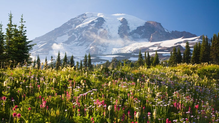
Washington: The Wonderland Trail
Length: 93 miles
The outdoors are where I feel the most like myself. So, when a heart condition sidelined me from adventure in 2016, I was devastated. The following year I got a pacemaker and was able to rediscover running, my greatest joy. On runs, I’d think of a line from a Mary Oliver poem: “Tell me, what is it you plan to do with your one wild and precious life?” Well, I decided I’d hike the Wonderland Trail .
I wanted to do something difficult, and at 93 miles, the Wonderland Trail is pretty demanding. I also liked that it was said to be well-marked, well-maintained, and to have plenty of water sources. (I need about six liters of water on a normal day to keep my blood pressure up.) Also: It’s just so darn gorgeous.
When I finally set off, I had so much gratitude for what my body and heart were able to do. I thought about that instead of my pack’s weight or the steep grades. At one point, in Spray Park, I sobbed for half an hour, overcome with the natural beauty and my ability to be within it. Then, on day four of my five-day itinerary, lightning struck. Literally. I was knocked unconscious, and when I woke the trees were on fire. [Ed. note: Hear Ingram’s full story on Season 3, Episode 1 of our podcast, Out Alive. ] I ran. I pushed the SOS button on my SPOT device, then I hit my knees praying for help. Twenty-five minutes later, a torrential downpour moved in. It extinguished the fire, and I was able to complete the last 10 miles of trail the next day.
On the way out, about 2 miles from the trailhead, I saw a girl starting her Wonderland hike. She had an enormous pack and was crying. I told her, “You are embarking on a life-changing journey. You’ve answered the call, and you can do it.” How beautiful is that, to come full circle?
Stephanie Ingram grew up in Colorado, Utah, New Mexico, and Oregon and now lives with her husband and five children outside Indianapolis, IN. Her dad got her into hiking. “He’s done a ton of big trips, and he taught me that backpacking is my ticket to staying outside as long as possible,” she says.

West Virginia: North-South Loop, Cranberry Wilderness
Length: 18 miles
I grew up in a town called Shadyside, staring across the Ohio River into West Virginia . Ohio seemed pretty benign compared to the adventure potential to the south. I finally started exploring “West By God” in earnest during college and never stopped. I loved the Dolly Sods Wilderness Area, Spruce Knob, and North Fork Mountain. Each of those areas take you to weather-beaten terrain that feels like northern Maine or even Alaska, with stunted pines, bogs, and open meadows and mountaintops. But it’s the Cranberry Wilderness that’s lodged itself in my brain as the state’s finest.
At 47,815 acres, it’s the biggest wilderness area in the state. Also, it’s far less trafficked than my other favorites, and the trails, even on this 18-mile loop, are practically game trails in spots. (Bring your GPS.) The Cranberry is another world, like a rainforest with a dense understory. My last trip here, I spent three nights. I could have moved faster, but it’s rugged, and really, this kind of out-there feeling isn’t something to rush through.
Glen Crippen lives in Athens, OH with his wife, two young children, and two dogs. His favorite trail snack is Vienna sausages. [Ed. note: we’ve literally never met anyone who likes these.] His most embarrassing trail moment? “Another hiker, an older gentleman, curious about what he heard in the trees, hiked toward the movement to find, uh, me heeding nature’s call.”

Wisconsin: Ice Age Trail Through Devil’s Lake State Park
Length: 14.5 miles
If there’s one trail that both epitomizes Wisconsin and smashes stereotypes about it, it’s the Ice Age National Scenic Trail through Devil’s Lake State Park. I’ve visited every one of Wisconsin’s 72 counties and hiked trails in most of them, and the Devil’s Lake segment of the IAT is unparalleled for both scenery and challenge—it’s difficult, but still doable for fit beginners.
This place offers a peek at the best landscapes Wisconsin has to offer: open prairie filled with wildflowers in the summer; stands of hardwoods ablaze in reds, oranges, and yellows in fall; and quartzite cliffs rising 500 feet above the lake.
Start this two-day, 14.5-mile trek at the southern trailhead at Roznos Meadow to give yourself a place to spend the night at the park’s campgrounds on the northern end. Launching at the southern trailhead also gives you an early look at the park’s craggy East Bluff, which looms large over the meadow and is home to two of the area’s most notable rock formations: Devil’s Doorway and Balanced Rock, giant quartzite boulders arranged like, well, a doorway and a spinning top, respectively.
The trail then loops around the lake and up the West Bluff on the other side, offering more views before descending to a handful of developed campgrounds for an overnight ($20 per night).
The 10.9-mile IAT segment officially ends a couple miles east of there, but it’s worth continuing another 3.6 miles to Parfrey’s Glen, the state’s first natural area—a designation that protects the best representations of the state’s native landscapes, geological formations, and archeological sites.
You’ll likely share the trail with others, both in Parfrey’s Glen and Devil’s Lake—it’s not the place to go for solitude. But for views that represent the essence of Wisconsin, far from farmland-and-cow stereotypes, and a hike that will get your heart pumping, Devil’s Lake is hard to beat.
Chelsey Lewis is from Milwaukee, WI and credits her parents for turning her on to hiking. “We didn’t have a lot of money when I was growing up,” she says. “So our vacations were hiking and camping. I’m so thankful for that. I’d take backwoods over Disney World any day.”

Wyoming: Paintbrush Divide Loop
Length: 20.1 miles
The Paintbrush Divide Loop is a rite of passage in the Tetons and is easily Wyoming’s best (big) dayhike. It’s probably one of the state’s best backpacking trips, too. Most folks navigate this loop counterclockwise—climbing 4,000 feet up Paintbrush Canyon, over Paintbrush Divide, and down Cascade Canyon. I, however, go the opposite direction as a crowd-beating measure.
Late one summer, I set out on dawn patrol from the String Lake trailhead. Meandering around an alpenglow-lit lake was a magical way to start the day. I flew through Cascade Canyon and, after a refreshing splash in Lake Solitude, I settled into a flow state, wandering in an eternal moment. On a prominent rock, I stopped and snapped a photo of myself amid jagged peaks that captured the pinnacle of my hiking career.
Next, I labored up the 2,000-foot climb to Paintbrush Divide—a 10,700-foot pass with unfettered views of the Tetons above and Jackson Hole below. From there, a stupidly steep descent led me into aptly-named Paintbrush Canyon, where I hiked past columbine and Indian paintbrush and even saw a moose and a grizzly. At 11 hours and 20-plus miles into the journey, I finished right where I began and soaked up the Grand Teton view with a reflective swim in the lake.
Steven Reinhold is a Backpacker ambassador and lives in Asheville, NC. He’s also a guide, consultant, and Director of Adventure at Black Folks Camp Too .
From January/February 2022
Popular on Backpacker

Join Outside+ to get access to exclusive content, 1,000s of training plans, and more.
- Clean Eating
- Vegetarian Times
- Yoga Journal
- Fly Fishing Film Tour
- National Park Trips
- Warren Miller
- Fastest Known Time
- Trail Runner
- Women's Running
- Bicycle Retailer & Industry News
- FinisherPix
- Outside Events Cycling Series
- Outside Shop
© 2024 Outside Interactive, Inc
- Sleep Systems
- Trekking Poles
- Camp Kitchen
- Accessories
- e-Gift Cards
- Backpacking 101
- Expert Articles
- Returns & Exchanges
- Search by Map
- Browse List

Best Backpacking Trips in the Southeastern U.S.
Ancient mountain ranges. Cool coastal marshes. Secluded swamps. Intriguing islands. This is just a sample of the biomes you can trek in the southeastern U.S. Whether you're looking for the views from rocky mountaintops or some peace in a boggy lowland forest, you're sure to find something to suit your fancy here. Browse our list of the best backpacking hikes in this region below and start planning your next adventure!
Featured Photo: Rabun Bald ( photo by Cody Wellons )
Skyway Loop Trail
This 18-mile loop is perhaps the most-beloved backpacking trail in Alabama. Located in the dense Talladega National Forest, it is rated as moderate. It's also known by several other names: Skyway, Chinnabee, Pinhoti Loop or, even shorter, Pin-Chin-Sky Loop. (That should help when it comes to researching more!)
If you're looking for a leisurely hike, heading clockwise is easier. Many people like starting from the Adam's Gap trailhead. Whichever way you choose, you can look forward to several waterfalls (including Devil's Den and Cheaha Falls), scenic overlooks, towering old-growth forests, and Lake Chinnabee.
There are lots of creek crossings. Some of these may be tricky after heavy rains. Other than that, the trail is mostly easy to follow. Plenty of established campsites are available throughout.
Black Creek Trail
For some southern seclusion, head out on Mississippi's longest trail. The Black Creek Trail comes in at 40 miles and is rated as moderate. It's a point-to-point, so you'll need to arrange a shuttle.
The path cuts through DeSoto National Forest through rolling hills, flat flood plain, and piney groves. Lots of little creeks flow into the bigger one, so water shouldn't be too hard to find. With all of the streams and ponds, over 100 bridges and boardwalks dot the route to make your hike a bit more pleasant. Keep a lookout for beavers, blue herons, wood ducks, and even some wild hogs. (Be sure to read our Wildlife Safety Tips article if you haven't already.)
You should always have a reliable backup map, GPS, etc when hiking. The white blazes on this trail can sometimes be hard to find, so it's especially important here. Dispersed camping and campfires are allowed, so you can find the perfect spot under the stars.
Myakka Hiking Trail
The Florida Trail is arguably the most popular backpacking route in the state of Florida. Many of its sections fall in close behind as top hiking destinations in the Sunshine state. But, the Myakka Hiking Trail also comes in near the top of the list for its surprising diversity of terrain.
Located in the southwestern part of the state in Myakka River State Park, you'll find 34 miles worth of trails. All of the trails are rated easy due to their levelness. You can expect lots of exposure in the expansive central Florida grasslands. But, you will find some relief in the mossy oak woods. Saw palmetto and palm trees are a novelty if you're not from the region. The lush ferns add to the subtropical paradise. Fall is a great time to visit for wildflowers. The route also offers marshlands, scrubby flatwoods, and remnants from an old ranch. Alligators, burrowing owls, and many other rare species of birds call this area home.
There are six established campsites. Some of these can be very wet depending on the time of year. The blackwater stream is capable of flooding large sections of the trail during the wet season, so check ahead. With four loops in the area, you can extend your hike or make this a base camp-type trip.
Palmetto Trail-Swamp Fox Passage
Part of the 500-mile long Palmetto Trail of South Carolina, Swamp Fox Passage is one of its most popular section hikes. It is much more manageable at 47 miles, which are rated as moderate. This makes it a great option for a long weekend. Its point-to-point route takes you through a variety of terrain, including peaceful savannas, towering pine forests, and secluded swamps. In other words, everything you would expect from a hike in a southern state! If you're into history, you might find it interesting that these swamps served as hideouts for Francis Marion during the Revolutionary War. There is also plenty of wildlife to be seen along the way, especially if you're into bird watching.
Although there is plenty of water, as evidenced by the many boardwalks on the trail, most of it is brackish. Seriously consider some water caches. Camping is only allowed at designated sites.
Roan Highlands
Looking for the magnificent views the Great Smoky Mountains offer? But don't like the hustle and bustle of its national park near Gatlinburg and Cherokee? Head to Roan Mountain State Park instead! It's located much farther north. In fact, you can view the tallest peaks in both North Carolina and Virginia from the summit of the balds.
The area features a series of 5 summits along the Tennessee-North Carolina state border. This is actually the longest stretch of balds in the Appalachian Mountains, so you know the views are going to be awesome! You'll also find quiet spruce-fir forests. Be sure to plan your trip in June for the best of the wildflowers.
There are several ways to go about hiking the Roan Highlands. One option is a 19-mile loop from Carver's Gap to Hump Mountain. This makes for a 2-3 day trip, rated difficult. You'll find several shelters along the way since it follows the Appalachian Trail for much of the route.
Panthertown Valley
With so many options in the area, we'll let you decide what route to take! Panthertown Valley Backcountry Area boasts 25+miles of trails. This makes it a great place to get away in North Carolina's Blue Ridge Mountains for a quick overnight or the whole weekend.
Known by locals as “the Yosemite of the East”, it offers some stunning and unique scenery. Granite domes are the main feature, hence its nickname. You'll find tons of other beauty too in the form of sweeping valleys, deep gorges, mountain bogs, babbling brooks, and lively waterfalls. It is also home to rare plant species and the Panthertown-Bonas Defeat bear sanctuary.
Dispersed camping is allowed and no permits are required, so no need to plan for months in advance. One thing to keep in mind is that the trails are not marked, so take a good map and be comfortable with your ability to follow them!
Davenport Gap to Max Patch

This route is arguably one of the most popular hikes on the Tennessee side of the Smokies. At 14 miles, you can easily make this an overnight trip. But, don't let that fool you. It's straight up the whole way!
It also follows the AT, so the trail is hard to lose. You get your first great views atop Snowbird Mountain. (You can get some nice views through the trees on the way up too if you go in the off-season.) Other than that, enjoy the shady walk through the forest and fern-covered undergrowth. The breathtaking 360° views atop Max Patch make the work worthwhile.
For more details on this trip, check out our full write-up .
Bartram Trail-Georgia Section
The Bartram Trail is another popular long-distance hike in the Southeast. It meanders through Georgia and North Carolina for 115 miles. If you don't have time for all that, try starting with the 35-mile Georgia section.
It offers all of the scenic beauty you would expect of the southern Appalachians, including waterfalls, knobs, sweeping lookouts, and secluded forests. Speaking of which, this trail is known for being one of the most secluded long-distance trails in the whole country. Some other highlights include a hike to the top of Rabun Bald, Georgia's second-highest point, and a walk along the Chattooga River. Be sure to take advantage of two short side trips to Pinnacle Knob and Dick's Creek Falls.
Get more logistics on this trail in our full article .
If you're looking for more hike ideas, read our " Best Backpacking Trips in the Eastern U.S. " roundup post. Also, the following Hike of the Week articles cover other segments of the Appalachian Trail.
Hike of the Week: Art Loeb Trail Hike of the Week: Triple Crown Loop Hike of the Week: Pine Mountain Trail
For even more amazing backpacking trips visit The Trailhead, our interactive hike map . It contains a curated list of dozens of hikes, each with a detailed write-up like this one.

Finally, check out our comprehensive list of backpacking articles that cover just about everything there is to know about backpacking. If you're just starting out, our Backpacking 101 section covers all the basics. If you already have a few trips under your belt, you can find more advanced topics covered in our Expert Articles .
Leave a comment
Please note, comments must be approved before they are published.
Who is Paria Outdoor Products?
Looking for backpacking trip ideas?
Browse Articles by Topic

We stand behind our gear and offer a lifetime warranty on all of our products.

Free standard shipping on all US orders. Shipping fees apply on international orders.

Browse our interactive map with dozens of amazing hikes through the U.S. and beyond.
Central America and the Caribbean Chevron
United States Chevron
The Best Place to Camp in Every State
By Emily Pennington

One of the best things about exploring all the best camping spots around the United States is witnessing just how astonishingly diverse its natural landscapes are. In a single road trip, you could find yourself cruising through the arid high desert in central California , then sleeping under the stars in a patch of old-growth rainforest in northern Washington .
Not only is exploring the country’s vast expanse of public lands good for your mental health , camping on them is the best way to beat the crowds to your morning hike and catch an unhurried sunset vista when the day is done. So, as the weather warms up and outdoorsy plans begin to take shape, we’ve put together a list of our favorite place to camp in every single state, including Puerto Rico .
To make sure that our list was affordable and accessible, we’re skipping options found on Hipcamp (a platform like Airbnb that lists outdoor stays and camping experiences on privately owned land) and sticking with the basics–every spot on this list sits within the national or state parks system. Lace up your boots, air out your tent and read on for our A-to-Z guide to the best camping spots in America.
This article has been updated with new information since its original publish date.

Best camping in Alabama: Cheaha State Park
Most travelers don’t go to Alabama for the mountain views, but this 77-site campground flips the script. Meaning “high place” in Creek, Cheaha State Park is set at a breezy 2,407 feet above sea level and provides an amenity-rich woodland haven (we’re talking bathhouses, fire rings, and electrical hookups), catering to hikers, bikers, and climbers .

Best camping in Alaska: Wonder Lake, Denali National Park
Arguably the spot with the most tantalizing view of Denali, Wonder Lake is a wilderness seeker’s dream. Accessible by shuttle bus, this tents-only primitive campground sits lakeside in the vast Alaskan tundra, amidst crimson dwarf birch shrubs.

Best camping in Arizona: Desert View Campground, Grand Canyon National Park
Escape the tourist throngs of Grand Canyon Village and enjoy a quieter, simpler camping experience at Desert View. Located a stone’s throw from the craggy maw of the Grand Canyon , these first-come, first-served sites are a shady, private place to unwind, in the midst of a juniper grove.

Best camping in Arkansas: Petit Jean State Park
RVers , tenters, and Yurt-lovers will revel in the multitude of camping options and creature comforts at Petit Jean State Park. Explore the sandstone boulders of Bear Cave and hike to 95-foot Cedar Falls, before an afternoon kickback in the swimming pool (you read that right).

Stacey Lastoe

Madison Flager

Matt Kirouac

Nora Zelevansky

Best camping in California: Upper Pines Campground, Yosemite National Park
Set smack in the middle of that famous Yosemite Valley granite, the year-round Upper Pines Campground is a fantastic place to beat the park’s notorious traffic, because it’s a stone’s throw from notable sights like Cook’s Meadow , Mirror Lake , and the scenic, 12-mile bike path .

Best camping in Colorado: Moraine Park Campground, Rocky Mountain National Park
Tucked into an elk-filled valley near attractions like Bear Lake and Glacier Gorge, this high-altitude getaway is ideal for view-seekers and avid hikers. Come for the year-round availability, stay for the jaw-dropping Rocky Mountain sunsets.

Connecticut
Best camping in Connecticut: Rocky Neck State Park
It’s true—swimming in the Long Island Sound, fishing for saltwater bass, and hiking among marshland waterfowl can all be found less than an hour drive from New Haven . After a day spent lounging on white sand beaches, stargaze right from your tent, while serenaded by the pops and crackles of the campfire.

Best camping in Delaware: Cape Henlopen State Park
Sink your toes into the sand at this 7,000-acre oceanfront campsite. Beloved by fishers and stand-up paddleboarders alike, the newly renovated campground offers amenities galore (like laundry and a camp store) while providing easy access to the park’s beaches, historic Fort Miles Museum, and tidal salt marshes.

Best camping in Florida: Bahia Honda State Park
Sip your morning coffee with a view of the electric blue waters of the Florida Keys . Bahia Honda’s white sand beaches, frilly palm trees, epic snorkeling, and impeccable night skies feel more like the Caribbean than the U.S.

Best camping in Georgia: West Rim Campground, Cloudland Canyon State Park
It’s hard to believe that cascading waterfalls, thousand-foot-deep canyons, and rugged sandstone cliffs can all be found in one place, least of all Georgia. But, impressively, Cloudland Canyon makes it happen. Overnight guests can choose between backpacking , car camping, or splurging on a cottage that’s spitting distance from the best views.

Best camping in Hawaii: Polihale State Park
Pitching your tent on the soft sand of Polihale State Park is about as close to heaven as you can get–if you can brave the dirt road to get there, that is. Here, the intrepid traveler (with a 4-wheel-drive vehicle) is rewarded with shaded oceanfront picnic tables, impressive sunsets, and epic views of the towering sea cliffs of the Nāpali Coast.

Best camping in Idaho: Glacier View Campground, Sawtooth National Forest
With striking views of 10,229-foot Mount Heyburn, shaded sites tucked among fragrant lodgepole pines, and easy access to one of the most stunning lakes in the state, it’s no wonder that Glacier View is one of the most sought-after campgrounds in Idaho. Hikers will appreciate the dozens of miles of nearby trails, while water lovers can float or paddle in nearby Redfish Lake.

Best camping in Illinois: Pharaoh Campground, Garden of the Gods Recreation Area
From its knobby, lichen-encrusted spires to its behemoth rust-colored rocks, Garden of the Gods is a park that lives up to its name. Solitude seekers will love the panoramic sunset views and the park’s shady, crowd-free campground of 12 first-come, first-served sites.

Best camping in Indiana: Dunewood Campground, Indiana Dunes National Park
The high, sandy hills of Indiana Dunes might seem more at home in the Sahara than along the southern edge of Lake Michigan, but the uniqueness of this geological wonder is what’s kept travelers coming back for over 100 years. Ready to stretch your legs? Explore the park’s amazing biodiversity along the 4.7-mile Cowles Bog Trail .

Best camping in Iowa: Backbone State Park
It’s not all flat farmland in Iowa . Since 1920, Backbone State Park has been a celebrated recreation area, boasting one of the state’s best geological wonders: the Devil’s Backbone, a steep ridge of river-carved bedrock. Hikers can explore amongst twisted cedars and cliffs of dolomite limestone, and rock climbers will love the park’s plentiful steep routes.

Best camping in Kansas: Historic Lake Scott State Park
The western edge of Kansas contains a multitude of natural wonders, like forested canyons, sparkling lakes, and rocky bluffs that dominate the famously flat expanse of the rest of the state. Historic Lake Scott State Park centers around a 100-acre spring-fed lake surrounded by old growth ash, elm, and cottonwood trees, perfect for the camper looking to fish, stand-up paddleboard, boat, or hike the 3-mile Lake Scott West Loop .

Best camping in Kentucky: Middle Fork Campground, Natural Bridge State Park
Kentucky’s Red River Gorge is an area revered by climbers for its flaky, Corbin sandstone, but travelers also come for the magnificent views and gargantuan stone arch. Hike or take the SkyLift to nab that perfect photo, then doze off to the burbling of the campground’s creek.

Best camping in Louisiana: Chicot State Park
Cyclists, backpackers, anglers, and water lovers of all stripes flock to Chicot State Park for its eerily scenic, swampy bottomland hardwood forest. Choose between 198 “improved” campsites, which offer water and electrical hookups, or get back to roots at one of the area’s six first-come, first-served backcountry campsites.

Best camping in Maine: Blackwoods Campground, Acadia National Park
Snuggled into a lush forest of spruce and hemlock, Blackwoods Campground provides a centrally located shady solace for adventure seekers in Acadia . Climb Cadillac Mountain for a spectacular sunrise show, dip your feet into the water at Sand Beach, and marvel at the craggy coastal headland of Otter Point.

Best camping in Maryland: Assateague State Park
Feel the brisk, salty spray of the Atlantic Ocean just steps from your campsite on this coastal barrier island. Pass the days sunbathing, or kayaking in secluded, marshy coves, beside the wild horses who wander the sand.

Massachusetts
Best camping in Massachusetts: Boston Harbor Islands National Recreation Area
After a quick ferry ride from Boston, campers can revel in the wildflowers, tidepools, and sandy shores of the Boston Harbor Islands. They’re a history lesson by day, too: Explore Civil War-era Fort Warren, before retreating to a hidden beach campsite on Lovells Island.

Best camping in Michigan: Twelvemile Beach Campground, Pictured Rocks National Lakeshore
Few campgrounds at Pictured Rocks come with a lake view, which makes Twelvemile Beach all the more desirable. Pitch a tent among stands of white birch and gaze out at the deep blue vastness of Lake Superior. And don’t miss kayaking around the park’s namesake rock formations—rentals and tours are available in nearby Munising.

Best camping in Minnesota: Woodenfrog Campground, Kabetogama State Forest
As one of the only water-based parks in the system, finding a launchpad for Voyageurs National Park can challenge the most seasoned road tripper. Our tip: Rent a boat from a local operator, and set off for the Ellsworth Rock Gardens and the tiny, deserted islands of Lake Kabetogma. Or, simply splash around in the lake’s warm waters at Woodenfrog’s own swimming beach.

Mississippi
Best camping in Mississippi: Tishomingo State Park
Rich with Native American history, Tishomingo State Park takes its name from a leader of the Chickasaw Nation. Its location in the foothills of the Appalachians makes this woodland park and campground perfect for peaceful hiking excursions and family float trips down Bear Creek.

Best camping in Missouri: Johnson’s Shut-Ins State Park
Beat the Missouri heat by splashing around in the boulder-strewn waterfalls and swimming holes of Johnson’s Shut-Ins. This well-appointed campground is a stone’s throw from the Black River, and locals love the walk-in campsites for their ample space and privacy.

Best Camping in Montana: Many Glacier Campground, Glacier National Park
Though it’s tricky to nab a coveted reservation at this storied national park campground , those who do will be rewarded with sweeping panoramas of the Northern Rockies and easy access to mirror-clear Swiftcurrent Lake. After a hearty camp breakfast, get your heartrate up on a trek to Iceberg Lake or the Grinnell Glacier Viewpoint.

Best camping in Nebraska: Smith Falls State Park
The misty cascade of 63-foot Smith Falls isn’t the only thing that makes this park great. Water-loving Nebraska campers can tube, canoe, and kayak the Niobrara, a National Scenic River.

Best camping in Nevada: Valley of Fire State Park
40,000 acres of flame-red Aztec sandstone and 2,000-year-old petroglyphs are what make Valley of Fire , near the metropolis of Las Vegas , truly remarkable. Here, two campgrounds boasting a total of 72 units offer travelers creature comforts like shade areas, showers, RV hookups (water and power), and a dump station. Don’t miss the 1-mile hike to the aptly-named Rainbow Vista.

New Hampshire
Best camping in New Hampshire: Lafayette Place Campground, Franconia Notch State Park
Easily one of the best spots for leaf-peeping in October, Franconia Notch is also a brilliant summer destination for hikers looking to hop onto a stretch of the Appalachian Trail and traverse the Franconia Ridge. Set right on the banks of the Pemigewasset River, this forested campground is as close as you can get to those scenic White Mountain trails as well.

Best camping in New Jersey: Worthington State Forest
Worthington State Forest is a breath of fresh air for Garden State residents—and just an hour drive from Newark. Hike to the top of Mount Tammany and gaze out at the verdant, rolling hills of northern New Jersey , before curling up in your sleeping bag on the banks of the Delaware River.

Best Camping in New Mexico: Three Rivers Campground, Lincoln National Forest
With White Sands’ backcountry camping area closed for the moment, it can be tricky to find a scenic alternative that’s within easy driving distance to the park. Luckily, remote Three Rivers Campground really delivers the goods. Not only can you stargaze while beating the heat here (the sites sit at a lofty 5,000 feet), visitors can also take a .5-mile trail to marvel at one of the largest petroglyph sites in the Southwest.

Best camping in New York: Letchworth State Park
Colloquially called the “Grand Canyon of the East,” Letchworth State Park is revered for its striking river gorge, with cliffs as high at 600 feet. 66 miles of hiking trails through noble fir and white spruce await avid hikers, while rafters and kayakers can try their hand at descending the Genesee River. The campground even offers a bridle path for equestrians.

North Carolina
Best camping in North Carolina: Mount Pisgah Campground
Spanning 469 miles from the Great Smoky Mountains to Shenandoah, the Blue Ridge Parkway is one of the most scenic roads in the country. Situated on its southern end near Asheville is Mount Pisgah, a breezy high-altitude respite from the summer heat. Don't miss the three-mile trek to its summit, followed up by a burger and local brew at the Pisgah Inn.

North Dakota
Best camping in North Dakota: Cottonwood Campground, Theodore Roosevelt National Park
Often touted as the landscape that made Roosevelt into the “conservationist president,” North Dakota’s colorful badlands, cheerful prairie dog towns, and herds of bison combine to make the national park a wonder to behold. Set on the banks of the Little Missouri River, Cottonwood Campground offers excellent wildlife viewing, plus fire rings and picnic tables for nights around the campfire.

Best camping in Ohio: Old Man’s Cave Campground, Hocking Hills State Park
From its deep, rough-cut gorges to its eerie hemlock groves, Hocking Hills is the perfect place for shady walks (and maybe even a little forest bathing , if that's your thing). Old Man’s Cave, named after a hermit who lived in its caverns in the late 1700s, is the most popular site in the park drawing explorers of all ages with its impressive rock formations and waterfalls.

Best camping in Oklahoma: Old Circle Campground, Robber’s Cave State Park
Once used as a hideout for legendary outlaw Jesse James, Robber’s Cave State Park is now a sanctuary for outdoor lovers of all types. Hikers, bikers, equestrians, climbers, anglers, and paddlers alike will love the easy reservoir access, miles of trails, and rugged cliffs of the San Bois Mountains.

Best camping in Oregon: Eagle Creek Campground
Situated in the center of the action of the Columbia River Gorge National Scenic Area , Eagle Creek Campground offers a glimpse into our nation’s history as the very first developed campground in the forest system. From camp, travelers can try to spot an osprey fishing or stroll along the basalt rock formations of the Eagle Creek Trail. Best of all, the famous Multnomah Falls is a short drive west.

Pennsylvania
Best camping in Pennsylvania: Ricketts Glen State Park Campground
Ricketts Glen Campground sits atop a forested peninsula that juts into the pristine waters of Lake Jean. But lakeside hangs are far from the top activity in the park. Meander through beech and hemlock stands, while taking in the area’s 22 waterfalls, finishing at the most striking: the 94-foot Ganoga Falls.

Puerto Rico
Best camping in Puerto Rico: Parque Nacional Balneario Seven Seas Campground
Park your tent just steps from the sea, at one of Puerto Rico’s beloved, crescent-shaped beaches. Soak up the Caribbean sunshine and snorkel right off the sand, then grab a rental car and switch gears for a short drive into the El Yunque rainforest.

Rhode Island
Best camping in Rhode Island: Charlestown Breachway
To overnight at Charlestown Breachway, campers will need their own “self-contained rig” (that's a motorhome in layman's terms). It’s a steep price of admission, but it allows RV owners, renters , and avid van-lifers a front row seat to some of the best saltwater fishing in the country. All sites are within walking distance to a sandy beach, providing breathtaking views of Block Island Sound.

South Carolina
Best camping in South Carolina: Devil's Fork State Park
Don’t let the name fool you—Devil’s Fork is home to some of the most heavenly, mountain spring-fed waters in the state. Set on the tranquil edge of Lake Jocassee, this largely undeveloped park is full of opportunities for freshwater scuba divers , trout lovers, and paddlers hunting for obscure waterfalls.

South Dakota
Best camping in South Dakota: Elk Mountain Campground, Wind Cave National Park
Though the park is famous for its enormous caverns full of boxwork and cave popcorn rock formations, Wind Cave is also extremely biodiverse. After settling in under a grove of ponderosa pines, search for bison herds on a scenic drive, or take in the rolling, golden hills on the Lookout Point Trail.

Best camping in Tennessee: Elkmont Campground, Great Smoky Mountains National Park
Set in the middle of the busiest national park in the country, the beautifully forested sites of Elkmont Campground are a fantastic place to set up base camp. 200 tent and RV sites with fire rings and picnic tables make post-hike feasts a cinch, and nearby, you’ll find trailheads for the mellow Little River Trail and Elkmont Nature Trail, both of which are great for trying to spot wild turkeys and deer.

Best camping in Texas: Chisos Basin Campground, Big Bend National Park
Perched atop an uncharacteristically green island in the sky, the Chisos Basin does not feel like Texas . Mountain lions and black bears roam free among the jagged, rust-colored cliffs, and the arid Chihuahuan Desert sprawls out thousands of feet below. If you're looking to hike, the campground’s 69 sites are the perfect jumping off point for the park’s best trails.

Best camping in Utah: The Needles Campground, Canyonlands National Park
Next time you’re in Moab, skip the hustle and bustle of Arches and head to the remote Needles Campground in Canyonlands, where Mars-like sandstone rock formations soar above sites lined with fire rings and picnic tables. During the day, explore the rust-red rocks and otherworldly terrain on the Chesler Park Viewpoint trail.

Best camping in Vermont: Smugglers’ Notch State Park
We’ve got two words for you: fall foliage. Vermont’s got it in spades, and at Smugglers’ Notch , near Stowe, car campers can soak it all in at 20 tent sites and 14 lean-to sites. Summit Mt. Mansfield or traipse along the moderate Sterling Pond Trail, then return to amenities like showers, toilets, and an RV dump station.

Best camping in Virginia: Big Meadows Campground, Shenandoah National Park
Perfect for catching a glimpse of tangerine-hued autumn leaves, Shenandoah is home to over 500 miles of trails, over a hundred of which are along the transcontinental Appalachian Trail. Big Meadows offers many homey comforts (like hot showers) while remaining close to waterfalls, wildlife viewing, and the park’s famous Skyline Drive.

Best camping in Washington: Hoh Campground, Olympic National Park
Sleep among moss-blanketed spruce, hemlock, and Douglas fir in one of the only temperate rainforests in the country. The first-come, first-served Hoh Campground allows travelers to spend the night right in the middle of the dense greenery. During the day, stroll along the 0.8-mile Hall of Mosses loop, and keep an eye out for bright yellow banana slugs.

West Virginia
Best camping in West Virginia: Grandview Sandbar Campground, New River Gorge National Park
Of the free, primitive campgrounds offered at New River Gorge National Park, we like Grandview Sandbar best for its easy river access, shady picnic tables, and designated fire rings. In summertime, beat the heat by hopping into the cool water or busy yourself with a stroll at nearby Grandview Overlook before grabbing a burger and a pint at Smokey’s on the Gorge .

Best camping in Wisconsin: Quartzite Campground, Devil’s Lake State Park
As the most popular park in the state, Devil’s Lake has a lot of hype to live up to. Luckily, it delivers. Scramble up rocky outcroppings for a stellar view of the water, hike the East Bluff Trail, or rent a standup paddleboard and traverse the lake. The area hosts three large developed campgrounds, and Quartzite offers the best lake access.

Best camping in Wyoming: Signal Mountain Campground, Grand Teton National Park
Tucked against the shoreline of immense Jackson Lake, Signal Mountain Campground serves up some seriously breathtaking views of Mt. Moran and the northern Tetons. This is a fabulous place to pitch a tent if you’re with kids or new to camping, as it lies in a developed park enclave with laundry, showers, a restaurant, and a marina nearby. When the weather’s sunny, rent a kayak and paddle to Donoho Pt. or lace up your boots for the nearby hike to Trapper Lake.

By signing up you agree to our User Agreement (including the class action waiver and arbitration provisions ), our Privacy Policy & Cookie Statement and to receive marketing and account-related emails from Traveller. You can unsubscribe at any time. This site is protected by reCAPTCHA and the Google Privacy Policy and Terms of Service apply.

49 of the best hiking trails in the US
Posted: September 28, 2023 | Last updated: March 13, 2024

- Hiking is a great way to stay active and enjoy the beautiful natural landscapes across the US.
- Experienced hikers should visit Sky Rock Hike, Mount Rose Trail, Mount Si, or Bar Trail.
- For a more leisurely stroll, Swamp Rabbit Trail and Forest Park are great for beginners.

For 360-degree views of the Blue Ridge Mountains, check out Spy Rock Hike.
You'll have to hike up the rocky outlook, but you'll be rewarded with an unobstructed view of the serene landscape.
This 3.1-mile hike is a popular one, so head there during the week for smaller crowds.

Blodgett Canyon in western Montana is sure to have some vibrant colors.
For a truly magical experience, plan for an overnight in Blodgett Canyon, located in the Bitterroot Mountains.
If you're more interested in a day trip, you can take the Blodgett Canyon Overlook Trail , which is under 2 miles and offers an amazing view of the gorgeous canyon.

In Vermont, head to the Healdville Trail which ascends Okemo State Forest.
On this 3-mile hike , you'll travel along a lovely, relaxing stream, venture through hardwood glades, and eventually climb the final mile through a forest of evergreens. If that weren't enough, you'll be rewarded with breathtaking vistas throughout.
At the end of the trail, there is a watchtower you can climb for 360-degree views of the surrounding mountain ranges.

See Tahoe like a local on the Mount Rose Trail.
What makes this hike particularly special is that you not only get to take in the splendor of Lake Tahoe , but also you'll get views of Reno and the surrounding Sierra Nevadas.
The summit is the highest peak on the north side of the lake, and it is listed as one of Tahoe Weekly's top 20 fall adventures .
You'll work for these views, with nearly 11 miles of trail and an elevation gain of 2,400 feet.

Go underground at Mammoth Cave National Park.
Just outside of Bowling Green , Kentucky, you'll find the longest known underground cave system in the world. There are plenty of underground adventures to be had, and above ground, you'll find plenty of hiking.
The area offers a plethora of trails , but the Sal Hollow Trail is one of the best in the park.

Michigan's Porcupine Mountains State Park Escarpment Trail is Instagram-famous.
Although the trail is less than 5 miles, don't let that fool you — elevation changes make this a challenging, yet rewarding hike. You'll find multiple lookouts along the way, and you'll wander through pine and oak trees, which are red in the fall.
Don't forget to stop and take a picture of the Lake of the Clouds to post after your hike.

Follow the Ice Age National Scenic Trail in Wisconsin to view the site of the last Ice Age.
Meander through untouched wilderness, rolling farmlands, and public parks on this trail.
The hike is 1,200 miles long, but for a more comfortable day trip , check out the section near Elkhart Lake called LaBudde Creek, which is full of natural history.

Embark on a naturalist-guided hike at Ridges Sanctuary in Wisconsin.
Want to learn more about the flora and fauna you're passing? While you can enjoy non-guided hikes, you'll get a lot out of walking with a naturalist in Wisconsin's oldest nonprofit nature preserve .
The spot is a designated State Natural Area, an Audubon Important Bird Area, and a National Natural Landmark, according to the Wisconsin Department of Natural Resources .
The conifer forest meets the beach, along with a variety of plants, birds, and even endangered species.

The Vista and Devil's Oven via Orange Trail Loop is a Connecticut gem.
Located in Devil's Hopyard State Park in East Haddam, this 2.2-mile hike allows you to take in the surrounding scenery.
Along the trail, you'll discover a lake, a cave, and a stunning waterfall .

Black Rock Mountain, Georgia's highest state park, has two trails.
Black Rock Mountain is Georgia's highest state park at an altitude of 3,640 feet.
For a short, moderate hike, plan on doing the 2.2-mile Tennessee Rock Trail . If you'd rather go for an all-day challenge, the James E. Edmonds Backcountry Trail clocks in at 7.2 miles.

For some serious Pacific Northwest vibes, explore Seattle's Mount Si.
Just 30 miles east of the city, you can challenge yourself on this 8-mile out-and-back trail. Approximately 100,000 people hike it each year, making it an incredibly popular Pacific Northwest hike .

Enjoy hiking on the trail that's home to Georgia's tallest waterfall.
Hope Oldham, one of REI's outdoor school senior instructors in Atlanta, told Insider that Amicalola Falls Trail is one of her favorite day hikes in the area. The water cascades down from 729 feet, and those views have made it one of the state's most popular parks.
Oldham warned that the hike is strenuous and has many stairs, but if you're up for the challenge it's worth it.
"It's Georgia's tallest waterfall, and the power you feel by standing at the base is truly humbling," she told Insider.

Don't miss the Overlook Mountain Trail in the Catskills for amazing views of the Hudson Valley.
Close to Woodstock, New York, this is the southernmost peak of the Catskill Escarpment .
" Hiking Overlook Mountain was breathtakingly beautiful. The hike is easy and the path is well-marked. Close to the top, you will find some interesting ruins of an old hotel, and at the top of the mountain, there is a fire tower," blogger Anisa Alhilali of Two Traveling Texans told Insider.

You don't even have to leave the city to experience the wonders of St. Louis' Forest Park.
Right in St. Louis City, you'll find a beloved natural space with 45,000 trees and other flora.
The park is actually bigger than New York City's Central Park , and it's home to many outdoor attractions, including walking and biking paths.

The Monon Trail in Indiana makes for an amazing, all-ages hike.
Because it's paved and mostly flat, anyone can enjoy this scenic path in Hamilton County , Indiana.
Along the 20-plus mile route, you'll encounter family-friendly breweries and local spots to eat or enjoy a coffee.

Experience the same view that inspired the words to "America the Beautiful" in Colorado.
For a bit of a challenge, hike the Barr Trail to the summit of Pikes Peak. Because it's labeled a difficult hike — one which includes 7,500 feet of elevation gain and over 12 miles to the peak — it's recommended to split the hike into two days.
Overnight hikers can spend a night at Barr Camp .
At the top of the hike, you'll look out over the same mountain range views that inspired Katharine Lee Bates to write the words to "America the Beautiful," according to the Songwriters Hall of Fame .

Meeman-Shelby Forest State Park near Memphis, Tennessee, has more than 20 miles of trails winding through it.
With over 12,000 acres, you'll never get bored in this park.
For a moderate loop hike that's under 4 miles, the Woodland Trail is ideal. If you'd prefer something longer, the 7.4-mile Chickasaw Bluff Trail will allow you to take in the scenery for even longer.
If biking or horseback riding is more what you're looking for, you can also find it in the state park .

Hike around the Lubbock Lake Landmark, a 336-acre archaeological and natural history preserve in West Texas.
Lubbock Lake Landmark is an important archaeological site . Here you'll discover the Yellowhorse Draw Trail, which is particularly beautiful when the trees start to change in the fall.
If you're looking for a more informative adventure, the site also allows visitors to watch active archeological digs.

Just 30 miles outside of Washington DC, you'll find a weekend escape in Prince William Forest Park.
You don't have to go far out of the city to enjoy a weekend of outdoor fun. The South Valley Trail runs right by the Quantico Creek, offering visitors picturesque waterfalls, tree-lined paths, and scenic bridges to explore.
Pack up your bags and tent and plan to stay at one of the many campsites along the way, or opt for a historic cabin if you'd prefer.

Take in the beauty of North Carolina's Beech Mountains with the Emerald Outback Trail System.
Here, you'll encounter 7 miles of treks that are designed to accommodate all experience levels. Whether you're wanting a leisurely afternoon stroll or something more intense, you'll find it there.
Trails are marked with green for beginner routes, blue for intermediate routes, and black for advanced trails. All the hikes offer the chance to trek through lush forests and take in some gorgeous views at the lookout points.

Turkey Mountain Trail rests on the west bank of the Arkansas River.
This 300-acre wilderness area is shrouded in trees, but you can still enjoy the large ponds and river along the route. After an ample ascent, you'll find scenic views from the summit, which rises 300 feet above the Arkansas River.
The Yellow Trail is a 3.7-mile hike that includes many overhangs to stop and take in the stunning views.

For a short and vigorous hike, check out the Waterrock Knob Trail in North Carolina.
You'll gain over 6,000 feet in elevation during the 1.2-mile round-trip hike , but the summit will make it all worth it. The top of the hike provides sweeping panoramic views.
For an added challenge, with an even greater reward, strap a chair to you back so that you can sit, relax, and watch the sunrise or sunset from the peak.

Dubbed "The Niagara of Pennsylvania," Bushkill Falls is a beautiful hike.
You'll find a few trails within the park which vary in difficulty. Hikers of all levels will love the Red Trail to Bridal Veils Falls.
The 1.4-mile loop features a waterfall and plenty of lively flora.
Because it's nestled in the woods of the Poconos , there are plenty of things to do near the trail as well.

City slickers can escape to Lehigh Valley for the hike in Hawk Mountain Sanctuary.
Lehigh Valley, Pennsylvania, is tucked into the rolling mountains of the countryside, and it's a great way to get away from the hustle and bustle of city life.
The Hawk Mountain Sanctuary offers 8 miles of easy-to-moderate trails. Throughout the hikes, visitors can enjoy views of vistas and soaring raptors (birds of prey).

Enjoy views of Mount Hood while trekking the Pittock Mansion Hike.
Seth Buchwalter , an outdoor enthusiast who lives in Portland, Oregon, recommended this 5-mile round-trip hike that begins just outside of the city.
It's a moderate trail, and you can expect an elevation gain of 950 feet.
"It starts relatively flat, winding, down and around a beautiful creek, passing an old stone house, before kicking in the vertical gain a bit," he told Insider. "Nearing the top, you'll experience a few switchbacks that are intense, but still manageable for the novice hiker."

Hike some of the famed Colorado Trail in Durango.
In Colorado's southwestern corner, you can hike Junction Creek to Gudy's Rest . There are over 300 miles of trails in the area, but this is an excellent option for beginners.
In total, it's 8 miles long, although there's a perfect stopping point at a wooden footbridge 5 miles in if you'd prefer something shorter.
The hike offers outstanding views of the San Juan Mountains .

The Lincoln Woods Trail in New Hampshire is a great hike for those who want to explore the forest.
Although this moderate hike can be completed in a day, there are also two campsites along the path for those who want to make a weekend out of it.
"The good thing about it — or bad, depending on what you are looking for — is that the trail is flat and protected, so the conditions will be the same throughout your hike. Even though it is 9.8 miles long, the fact that it is pretty flat makes it easy for a family to do if they are willing to spend the whole day," Trevor Peschek, a hiking enthusiast who works for Wanderu , told Insider.
He also said that you'll encounter two beautiful waterfalls, Franconia Falls and Thirteen Falls, along the path.

Crystal Lake Trail in Mono County, California, combines views and brews.
This 3-mile, dog-friendly hike gains 750 feet in elevation, and the reward is views of Lake George, Crystal Crag, and Crystal Lake.
Mono County is also home to other trails if you're looking to spend more time there, but Crystal Lake Trail offers something extra special: local breweries like Black Doubt Brewing Co. , Mammoth Brewing Co. , and Shelter Distilling are located close to the path for a post-hike refreshment.

Experience some of the Appalachian Trail at Hay Rock Overlook Trail in Virginia.
The Appalachian Trail stretches for nearly 2,200 miles from Maine to Georgia, but this section in Virginia is a great spot to take in the scenic views of Roanoke Valley.
The Hay Rock Overlook Trail hike is moderately difficult at around 8.5 miles, so it makes for the perfect challenging day hike with breathtaking surroundings.

If you're exploring the wine country of Finger Lakes, New York, don't miss Watkins Glen State Park.
The natural beauty of this region is truly spellbinding, and you can enjoy 19 cascading waterfalls along the trail. The park offers an easy to moderate hike with lots of stairs on most of the paths.
Watkins Glen State Park was also selected from more than 6,000 state parks across the nation as a nominee in the USA Today Readers' Choice Poll for best state park in the United States in 2015 and came in third place overall.

Immerse yourself for a few days on the Laurel Highlands hiking trail.
If you're looking for a multi-day, beginner-friendly hike, then this one in southwestern Pennsylvania is a perfect choice.
The 70-mile trail offers overnight areas every 8 to 10 miles, so you can move at a comfortable pace and recharge.
The whole trail features towering trees, but some prime viewing spots include Beam Rocks, Spruce Run, and Laurel Summit.

Hike the tree-lined river banks on the Swamp Rabbit Trail in Greenville, South Carolina.
This 22-mile mixed-use trail runs right through downtown Greenville, so you get the best of both worlds: nature at its finest and a charming southern city.
One of the stars of the trail is an iconic beech tree with exposed roots and a canopy that towers 100 feet in the air. The trail also leads to Falls Park on the Reedy , an urban park with a suspension bridge where you can get unobstructed views of the Reedy River waterfalls.

Climb to the top of Mount Beacon in Hudson Valley, NY.
There are numerous lookout points as you climb Mount Beacon , so there are options on how long the hike goes. If the 200 stairs and steep switchbacks don't tire you out too much, once you've passed a clifftop you can venture even further to a rebuilt fire tower.
Once you reach the top, you'll be rewarded with a panoramic view stretching from the Hudson Highlands to the Catskill Mountains.

Get the adrenaline pumping on the Precipice Trail at Acadia National Park in Maine.
Any trail with "precipice" in its name is sure to get the blood pumping. Tava Hoag , a former editor at TravelPirates , told Insider it's not for anyone who's afraid of heights. In fact, she conquered her own fear while hiking it.
"It is a very steep out and back trail where you have to use iron rungs and small ledges to get to the top of Champlain Mountain," she told Insider.
Expect to take about three hours on the 1.4-mile, strenuous hike .

Hike up to Conundrum Hot Springs and relax in the naturally warm waters.
Nothing is better than hiking along the stunning Elk Mountains and ending your journey with a dip in a hot spring.
"The views are stunning along the whole hike, but especially from the 102-degree pool," Paul Ronto, Content Director at RunRepeat and avid outdoorsmen, told Insider.
He also advised that permits are required, so make sure to read how to get one before making the trek.

The Coal Mines Trail brings you through some charming Washington towns.
The Pacific Northwest is a particularly beautiful spot to hike during the fall months.
"I love hiking in the Pacific Northwest because of all the fall colors. My favorite hike to see the fall leaves in the Coal Mines Trail in Snoqualmie," Alex Tran, an outdoor enthusiast and yoga instructor , told Insider.
Near the trail is the Bavarian town of Leavenworth where there is an annual Oktoberfest , and it will also take you to the historic town of Roslyn .

Experience all the beauty of nature with the backdrop of NYC's skyline on the Silver Mine Lake Trail.
The Silver Mine Lake Trail is just a quick train or cab ride away from New York City , offering the chance to escape the city without too much hassle.
Nestled in Harriman State Park (which has over 200 miles of trails), this one takes you to the top of Black Mountain. Expect scenic vistas with the skyscrapers of Manhattan in the background along the way.

The Savage Alpine Trail in Denali National Park is an unexpected fall adventure.
Jennifer Melroy, an author for Nation Park Obsessed , told Insider that this Alaskan hike is one of her favorites — especially when the trees are changing.
"I love hiking this trail in the fall for two reasons," she said. "The first is the fall colors in the tundra. The aspen trees have this amazing shade of gold which contrasts with the reds and pinks of the willow trees. Also, the blueberries are ripe and found all along the trail."
It's a strenuous 8.2-mile round-trip hike through the national park with 1,400 feet of elevation gain.

Get a killer workout on the Inner Basin Trail near Flagstaff, Arizona.
Tucked in the Coconino National Forest , the Inner Basin Trail has clear markers and measures 3.9 miles round trip.
"This is a moderate trail with a noticeable elevation gain that will leave even the most experienced hiker a little winded," Shawna Newman of Active Weekender, an adventure blog, told Insider. "The terrain itself is not challenging and the surrounding beauty makes it the perfect trail for snapping some photos."

Journey on the diverse Flint Hills Trail in Kansas.
From picturesque prairies to fresh farmland, the Flint Hills Trail offers a wide array of landscapes. It's also the longest and most diverse trail in Kansas, according to The Wichita Eagle .
Although the flat landscape makes it a pretty easy hike, you can still challenge yourself by hiking all 117 miles of it — which usually takes about eight or nine days to complete.

Explore the Stanford Trail in Ohio's Cuyahoga Valley National Park.
The Stanford Trail is just one of the many available hiking spots in Cuyahoga Valley National Park . If you're wanting an extra challenge, the hike meets up with the Brandywine Gorge Trail which offers you the option to extend your adventure.
If getting outside is a priority, but you're concerned about mobility or have young ones in tow, the park also offers the option of riding along the Cuyahoga Valley Scenic Railroad .

Witness the fall monarch butterfly migration on the Eastern Lake Trail in South Walton, Florida.
Every year, a monarch butterfly migration at the beginning of fall draws hikers seeking a unique outdoor experience.
There are over 27 miles of trails in this area, and the relatively challenging 11-mile orange loop on the Eastern Lake Trail makes for a great workout.
And after the hike, you can relax on the shores of the nearby Miramar beach .

Check out the boardwalk at Big Bog State Recreation Area in Minnesota.
A boardwalk allows visitors to take in all the views of the 500-square mile peat bog .
Wander through the stunted tamarack and spruce forest on the mile-long trail, and at the end, you'll be treated to a viewing platform, benches, and a binocular viewer.
Since the trail is made of a raised boardwalk, it is accessible for strollers, wheelchairs, and less-experienced hikers.

Hike California's hidden gem, the Mount Eddy Trail in Shasta-Trinity National Forest.
This 10-mile round-trip hike has over 2,000 feet of elevation gain.
Located in Siskiyou County, the northernmost region of California , the hike is one of the area's less-traveled trails, and it offers breathtaking views of Mount Shasta.
After you hike, you can explore all the other outdoor activities that Shasta-Trinity National Forest has to offer.

Take in the scenic views on Texas' East Trail in Lost Maples State Natural Area.
You'll find this 3-mile trail in the Lost Maples State Natural Area in Vanderpool, Texas. Marvel at the beauty of the area complete with bigtooth maples, bald cypress, and sycamore trees which reflect against sparkling waters.
The park is specifically known for its stunning colors in the fall months.

Hike New Mexico's highest peak on the Bull of the Woods trail.
You won't find better views in New Mexico than atop Wheeler Peak in the Bull of the Woods Wilderness.
At 14.5 miles , you can either make this an intense day trip or break up your hike with a night camping in the wilderness.

Stroll along the river on the Chocolate Gulch Trail in Sun Valley, Idaho.
Right in the Sawtooth Mountains, this 5-mile hike typically takes about half a day to complete. The trail begins on the banks of a river, and you'll eventually climb a peak to view the waters below.
The trail is a great place to view wildlife, and it's also dog-friendly.

Bird-lovers will want to check out Waggoner's Gap Hawk Watch in Landisburg, Pennsylvania.
This one is ideal for people who want an easier trail that still gives them a chance to marvel at nature. Not only are the views outstanding, but also this is one of the largest concentrations of raptors in the US, with nearly 20,000 passing through each year.
The bird migration combined with the full foliage makes it clear why the trail was named one of the top 10 hikes in Cumberland County by The Sentinel.

Take in the astounding views on the Whitaker Point Trail in Arkansas.
You'll find this 2.9-mile trail in the Upper Buffalo Wilderness Area of the Ozarks.
The trail leads to Whitaker Point , also called Hawksbill Crag, which juts out about 100 feet above the forest floor. It's a highly photographed spot in Arkansas, and for a good reason — you'll be able to peer out over the valley surrounding the Buffalo National River.
This story was originally published on October 10, 2018, and most recently updated on September 28, 2023.
- 10 things that could potentially kill you on your next camping trip and how to protect yourself
- 10 breathtaking places to hike around the world
- 26 hiking trails around the world that should be on your bucket list
- 19 of the most beautiful campsites around the world
More for You
Don’t pack these 9 TSA-prohibited items in your checked baggage
I'm a Swede who used to work with Americans. These are the main differences I saw in our working cultures.
The Best Beach in Every State
Lions have reached out to Michigan Panthers kicker after epic game-winning FG
6 Cars That Seem Expensive but Rarely Need Repairs
25 legendary musicians you might not know were LGBTQ+
You Shouldn’t Be Able to Pay With Cash OR a Card at a National Park. They Should Be Free.
Russian role in attack on American officials?
How Northrop Grumman's B-21 Raider Changes The Landscape Of Air Power
Lost cities hidden for thousands of years discovered under forest
At 101 years old, I’m the ‘world’s oldest practicing doctor’: My No. 1 rule for keeping your brain sharp
LA Times updates controversial column after claims of blatant sexism by LSU's Kim Mulkey
I’ve Worked on Cruise Ships for 10 Years—These Are 18 Mistakes Every Traveler Should Avoid
Cherokee Nation wants federal law fix on Black tribal citizens
12 Japanese Cars That Aren’t Worth the Cost
The best lake towns in America to live in year-round, based on data
17 Mythical Places That Actually Exist
The Most Iconic Wedding Gowns In History
Common Blood Pressure Drug Increases Lifespan, Slows Aging in Animals
WWE Planning Meeting To Discuss Change For WrestleMania 40 Title Match
- Travel recommendations
- The taste of travel
- Tips & tricks
- Travel experiences

Holiday planning made simple: The best vacation spots in the US

There’s so much to see and do in the US. Whether you enjoy outdoor adventures, consider yourself more of a culture buff or are passionate about history. This article includes the best vacation spots in the US from north to south and east to west, as well as everywhere in between.
The best summer vacation spots in the US
Summer’s here , the weather’s heating up, and you want to take a much-needed break in the sun. We’ve rounded up the best places in the US to spend your summer days and nights.
Niagara Falls, NY: Best vacation spot in the US for solo travelers

Niagara Falls is the 8th wonder of the world. It sits on the border of both the United States and Canada. Cross over the Rainbow Bridge by car to reach Niagara Falls, Canada, in less than 20 minutes.
This is a great destination for solo travelers who like to gamble because of its three casinos and its all-you-can-eat buffets. Families can take a Falls boat tour and visit the Aquarium of Niagara or the Castellani Art Museum at Niagara University.
Dallas, TX: Best vacation spots in the US for art enthusiasts

Dallas is one of the best vacation spots in the US for people passionate about art and culture. In particular, art lovers will enjoy spending time at the Dallas Museum of Art in the Art District. If you’re into theater or music, come to enjoy a concert at the Moody Performance Hall .
In addition to its burgeoning art district, it has numerous museums. History buffs can discover historical sites like the JFK Memorial, the Sixth Floor Museum , the Texas Theater , and the Conspiracy Museum.
Dallas is also home to the NFL Dallas Cowboys and the Dallas Mavericks of the NBA. You can drive to a game in your rental car .
Mackinac Island, MI: Best vacation spots in the US to break from modern stress

Mackinac Island, MI, is in Michigan’s Upper Peninsula. It is packed with charm and history. From the island, you can enjoy breathtaking views of Lake Huron. There is plenty to do and see on the island during the day and night.
You can explore Mackinac’s sights with a carriage ride around the island, which does not allow motorized vehicles. If you have a sweet tooth, don’t leave without trying the famous local fudge. Fancy a round of golf? There are two golf courses to choose from on the island.
Note: You must take a plane or ferry to reach the island.
Lake Tahoe, CA: Best spot in the US for a lake vacation

Enjoy the splendor of nature with a summer vacation to beautiful Lake Tahoe. It is home to several state parks, biking, and hiking trails. The lake borders the states of California and Nevada, and there are several casinos in the area, making this among the best vacation spots in the US for those who enjoy gambling.
Visiting here, you’ll be a short drive from Carson City and Reno, NV, which is also known as the Biggest Little City in the World. Spend some time exploring these local cities – you’ll be less than an hour from Reno and Carson City , NV.
If you plan to drive around Lake Tahoe in the winter, be sure to have a 4WD or snow chains on your tires. My husband and I attempted to drive from Reno, NV to Lake Tahoe on Christmas Day. Because of a chain requirement, we had to turn around just miles before getting there. We were so disappointed.
Boston, MA: Best vacation spots in the US for sports lovers

Explore the historical city of Boston on your next vacation. This city is rich in history and has numerous sights and museums, including the Museum of Fine Arts. Located on Massachusetts Bay, it is among the best vacation spots in the US to enjoy seafood, especially lobster. Boston is a great vacation spot in the US for sports lovers too and is home to a professional baseball, basketball, and hockey team.

The best romantic vacations for couples
Celebrate your love or rekindle your relationship at one of these popular destinations in the US.
Napa Valley, CA: Best vacation spots in the US for wine lovers

Napa is an ideal place for wine lovers and foodies looking for a romantic getaway. It is easily one of the best vacation spots in the US for wine lovers; however, this region is home to some of the top spas in the US. You can get couple’s spa treatments like mud or mineral baths, take a hot spring dip, or learn floating meditation.
Consider visiting for one of the annual local events, such as the Napa Lighted Art Festival in January or Bottlerock Napa Valley , a three-day music festival in May .
Oahu, HI: Best exotic vacation spots in the US

Explore the island of Oahu on a luxurious and exotic US vacation. You’ll indulge in delicious foods and can enjoy memorable experiences like taking an oceanfront horseback ride or swimming with the dolphins. Attend a luau and delve into Hawaiian culture.
The island also has many oceanfront bars for a sunset cocktail. It is among the best vacation spots in the US for couples on their honeymoon or looking to get some alone time.
Kirkham Hot Springs, ID: Best romantic vacation spot for outdoor enthusiasts

Are you looking for somewhere different to spend a romantic vacation? Kirkham is a great choice for couples who like to spend time outdoors enjoying nature. Come to bathe in the warmth of the hot springs. Go hiking or horseback riding on local trails. Other outdoor excursions include kayaking and whitewater rafting.
Gatlinburg, TN: Best romantic vacation spot in the smoky mountains

Cozy up with your sweetie in one of Gatlinburg ‘s honeymoon cottages in front of the fireplace. Be sure to take your camera with you as there are many places to get pictures of the Smoky Mountains. Take a helicopter or chairlift ride to enjoy close-up views of the mountains.
Sedona, AZ: The Best romantic vacation spot in the US for hiking

Be romantic while enjoying the beautiful rock formations and the forests in Sedona. Get up early in the morning to watch the sunrise over Red Rock Country while sipping wine from a local vineyard. You can also go hiking, take an off-road adventure in a Jeep, or explore arts and culture with a visit to one of the many local art galleries. Sedona is a beautiful place to make memories.
The best beach vacations in the US
There’s a whole range of different beach vacations to choose from in the US, from those with a party atmosphere to quiet bays where you can enjoy your favorite book.
Miami, FL: The best beach vacation spot in the US for nightlife

Miami has an array of different beaches to visit. There is a beach for everyone, from families to solo travelers. Here are a few beach recommendations. South Beach is ideal if you’re looking for nightlife, as there are several waterfront bars where you can listen to live music and dance. Visit North Shore Beach if you want more peace and quiet, as well as smaller crowds.
Key Biscayne Beach is perfect for those traveling with children. Family-friendly activities here include bicycling, flying kites, swimming, and making sand castles. Other activities you can enjoy on a Miami beach include surfing, boating, sailing, and fishing.
Muskegon, MI: The best beach vacation spot for pets

If you’re looking for a hidden gem, you’ve found it. This is also a great beach vacation spot if you travel with a pet. Pere Marquette Beach is on Lake Michigan, about an hour from Grand Rapids and two hours from Traverse City. It has over two miles of beach with a designated area for dogs.
The beach has a bar, volleyball court, and a walking path to the lighthouse. Drive 15 minutes to nearby Grand Haven City Beach for a different experience.
On the way to Pere Marquette Beach in Muskegon, I like to shop in the Lakeside neighborhood. They have a couple of art galleries and an old-fashioned candy store where you can buy salt water taffy and yummy fudge.
Martha’s Vineyard, MA: The best beach vacation spot in the US for surfing

Martha’s Vineyard has many different public and private beaches. Some are great for sunbathing, while others are popular with surfers.
You’ll find great fishing at Lobsterville Beach. East Beach and Aquinnah Beach are great places to enjoy a spectacular sunset. Squibnocket Beach is most popular with surfers.
After spending a day at the beach, you can shop at its quaint boutiques or visit the local museum to learn about the island’s history.
Hilton Head, SC: The best beach vacation spot in the US to spot sea turtles

Hilton Head has lovely beaches along the Atlantic Coast. It is a great place for a family vacation, as several beachfront resorts exist. Hilton Head Island has beautiful weather almost year-round. The family can enjoy bike riding on the boardwalk, kayaking or spotting sea turtles on the beach. Along with beach adventures, Hilton Head offers amazing golf for both the novice and the pro.
Ship Island, MS: The best beach vacation spot in the US for shelling

You can only get to Ship Island by boat. It will take you about an hour to get to the island from Gulfport, MS. Watch for dolphins on the ride. Some of the best beach activities here include swimming and shelling. There’s also a historic fort on the island with numerous exhibits.

The best family vacation spots in the US
Can’t quite stretch the budget to Disneyland? Check out these alternatives to avoid the crowds and save a little money.
Hersheypark in Hershey, PA: The best vacation spot in the US for chocolate lovers

Hersheypark is a chocolate lover’s dream. It is located close to the city of Harrisburg. This is an ideal place for a family with children of different ages. There is something for everyone to enjoy, including a zoo, chocolate factory, and amusement park. Hersheypark has rides for all ages, including rollercoasters for thrill seekers.
Dollywood Theme Park, Pigeon Forge, TN: The best vacation spots in the US for country music lovers

Are you a fan of Dolly Parton and country music? If so, Dollywood Theme Park is the place for you. It has the modern thrills of an amusement park with old-world charm. Dollywood is in the Smoky Mountains and is close to Pigeon Forge resorts , which are great for family vacations. You’ll also be just minutes from a designer store outlet where you can enjoy lots of retail therapy.
Knott’s Berry Farm, Buena Park, CA: The best vacation spots in the US for large families

Knott’s Berry Farm has something for the whole family. It is a popular amusement park just minutes from Anaheim, CA. Walking around the park, you’ll likely meet Snoopy, Charlie Brown, or one of the characters created by Charles Schultz.
Wisconsin Dells, WI: The best vacation spots in the US for families year-round

You won’t hear the kids complain of boredom when in Wisconsin Dells. This city has so much to do and see for adults and children. Wisconsin Dells is a great place to visit year-round. You can ski or go tubing during the winter and enjoy water fun in the summer. There’s also an amusement park and a wildlife park in the town. For the adults, there are many breweries, wineries, and distilleries to explore.
Sandusky, OH: The best vacation spot in the US with an amusement park

Sandusky is home to Cedar Point , an amusement and waterpark, one of the best vacation spots in the US for families. It is the 2nd oldest amusement park in the US. The park boasts of having the first strata coaster over 400 feet tall. It sits on Lake Erie and has its own beach where parents can relax while the kids are being entertained in the park.
Tips for planning the perfect vacation
Start planning your perfect vacation by choosing a location along with travel dates. Remember, you can often save money by booking your flight during the off-season for your selected destination.
Now that you’ve decided where to go, make a list of things you want to do and see while you’re there. Packing wisely can prevent you from overfilling your suitcase and having to pay extra airline baggage fees if you’re flying.
Finally, you’ll want to find the ideal place to stay. Start by deciding what kind of accommodation you’d prefer. For example, do you want to stay in a resort , a small boutique hotel, or a spacious rental home big enough for the whole family? Be sure to choose a place that’s right for the kind of vacation you want to have – and whoever you plan to be enjoying it with.
How does KAYAK know what to put in this guide?
This guide is a combination of my passion for travel, personal experiences, tips from the KAYAK team and plenty of research! I’m an avid traveler who likes to see the world, especially the best vacation spots in the US, and I’m always looking for ways to save money without sacrificing comfort or enjoyment when traveling.
About the author

Explore more articles

- How we work
- Hotel owners
- Advertise with us
- Airline fees
- Low fare tips
- Badges & Certificates
- Terms & Conditions
California consumers have the right to opt out of the sale * of their personal information. For more information on how we securely process personal information, please see our Privacy Policy .
Do not sell my info ON
* The definition of "sale" under the California Consumer Privacy Act is applicable only to California consumers.
- CBSSports.com
- Fanatics Sportsbook
- CBS Sports Home
- NCAA Tournament
- W. Tournament
- Champions League
- Motor Sports
- High School
- Horse Racing
Men's Brackets
Women's Brackets
Fantasy Baseball
Fantasy football, football pick'em, college pick'em, fantasy basketball, fantasy hockey, franchise games, 24/7 sports news network.
- CBS Sports Golazo Network
- March Madness Live
- PGA Tour on CBS
- UEFA Champions League
- UEFA Europa League
- Italian Serie A
- Watch CBS Sports Network
- TV Shows & Listings
The Early Edge
A Daily SportsLine Betting Podcast
With the First Pick
NFL Draft is coming up!
- Podcasts Home
- Eye On College Basketball
- The First Cut Golf
- NFL Pick Six
- Cover 3 College Football
- Fantasy Football Today
- Morning Kombat
- My Teams Organize / See All Teams Help Account Settings Log Out
The best hiking backpacks for your next trail adventure
From versatile daypacks to spacious multi-day backpacks, these are the best hiking backpacks you can get in 2024..
With warming weather and wildflowers blooming, spring is one of our favorite times of year for hiking . So we've already started shopping for the best hiking gear to use on the tried-and-true trails we love, as well as new routes we've never seen before.
Whether you're lining up your weekend day hikes for the season or planning a multi-day backpacking adventure through the Appalachian Trail, a sturdy, comfortable backpack is key. The best hiking backpacks are lightweight yet strong enough to store everything you need for your hike, including plenty of easy-access pockets and external loops so you can grab your water bottle , protein bars and other essentials without having to dig through the main compartment.
Keep reading to find our favorite hiking backpacks for every kind of outdoor adventure.
Best hiking backpack overall: REI Co-op Trail 40 Pack
With an internal, spring-loaded frame and padding along the back and shoulder straps, the REI Co-op Trail 40 pack is built to keep you comfortable, even when it's loaded to capacity. The frame and foam padding contour to your back while adding load support so the weight isn't all hanging from your shoulders.
While framed backpacks tend to be bulkier, this hiking backpack manages to keep its total weight under three pounds. So you can get that extra support and that 40-liter storage capacity without the extra weight. That's why it tops our list of hiking backpacks. It's small and light enough to use on a day hike, yet supportive and comfortable enough to take on a 2-3 day trip.
Get the versatile, supportive hiking backpack from REI for $149.
Top features of the REI Co-op Trail 40 pack
- The 40-liter capacity is small enough for day hikes yet roomy enough for an overnight trip.
- The durable ripstop nylon fabric is abrasion-resistant and repels water to keep your things protected.
- With zipper pockets on each hip strap, accessory straps and side water bottle pockets, you can keep things organized and accessible during your hike.
- An internal frame provides load support.
Best backpack for day hikes: Fjallraven S/F expandable hip pack
For all the weekend warriors out there, this Fjallraven S/F expandable hip pack is the perfect storage option. On short hikes, strap it around your hips for easy access to water, snacks and all your other essentials.
On longer day hikes, unroll the top to expand this hip pack into an 11.5-liter backpack, complete with shoulder straps. That's enough room to pack a lunch or any extra gear you need on your adventure. When expanded, you'll also find an internal sleeve for a water bladder (not included) so you can hydrate without stopping.
The expandable design is great for all kinds of day hikes, allowing you to be as unencumbered as possible while still being able to carry everything you need. Get the lightweight, expandable daypack at REI for $120.
Top features of the Fjallraven S/F expandable hip pack:
- The hip pack design gives you easy access to all your things during your hike.
- This pack expands into an 11.5-liter backpack with straps for day hikes that require extra gear.
- With internal sleeves, external pockets and a bungee cord strap, it's easy to keep your essentials organized.
Best hiking backpack for overnight trips: Earth Pak 55L waterproof backpack
Completely waterproof and boasting a convenient roll-top design, the Earth Pak 55L backpack is your new best friend for those 1-3 day hikes. There's room for everything you need and plenty of external loops and pockets for stashing things you need easy access to.
Hikers will appreciate the roll-top closure that makes accessing the main compartment a breeze and gives you the option to roll this down to a smaller size if you haven't filled it.
It's an especially great pick if your outdoor adventures tend to combine fishing, kayaking or other water sports into your hikes.
Get the durable, waterproof 55-liter hiking backpack on Amazon for $66 (reduced from $84).
Top features of the Earth Pak 55L waterproof backpack:
- There's no rain cover needed thanks to the 100% waterproof construction.
- Designed to float, the backpack can be tied to a kayak or fishing boat to give your back a rest.
- External loops and pockets provide easy access to the essentials you'll need on the go.
- This backpack comes with a waterproof phone carrying case.
Best backpack for thru-hikers: Deuter Aircontact Core 65 + 10 Pack
If you're heading far off the beaten path on a 5-day or longer hike, you need a backpack with plenty of storage capacity and plenty of support so you can log miles without wearing out your back. That's where the Deuter Aircontact Core 65 + 10 Pack comes in.
The internal frame and load adjustment straps help take the weight off of your shoulders and allow you to fine-tune the fit for the most comfortable possible weight distribution. The chest straps can also be adjusted to sit higher or lower as well as wider or shorter to get the right fit for you.
In terms of storage, the main compartment normally holds 65 liters but you can expand the collar to add an extra 10 liters of storage room when needed. Or keep it tucked away when you don't for a smaller pack.
There are straps, pockets and sleeves galore on this spacious backpack built for thru-hikers, so you'll be able to squeeze in all the odds and ends you need. That includes compression straps to hold a sleeping bag, mat or tent and a separate bottom compartment roomy enough for a sleeping bag (but also great for stashing extra shoes or dirty gear separately from the rest of your things.
The expandable design is great for accommodating both short weekend hikes and longer thru-hikes, so if your schedule is packed with multi-day hikes of different lengths, this is the one pack to carry you through them all.
Get the rugged and spacious backpacking backpack at REI for $250.
Top features of the Deuter Aircontact Core 65 + 10 Pack:
- Get up to 75 liters of storage capacity in one backpack.
- The expandable design is ideal for both short and long multi-day hikes.
- Plenty of pockets, sleeves and straps to organize all of your hiking gear and keep it accessible.
- The fully adjustable shoulder, hip and chest straps allow you to fine-tune the fit and load distribution for a custom and comfortable fit.
Best hiking backpack under $50: Reebow Gear 3-Day Assault Pack
The Reebow Gear 3-Day Assault Pack is a military-style tactical backpack that happens to be a great design for hikers. The durable, water-resistant fabric features 40 liters of storage divided between two spacious main compartments and two smaller outer zipper pockets.
You'll find row after row of Molle-style loops for attaching all the accessories you could possibly need. Adjustable snap-buckle compression straps allow you to minimize shifting as you hike so you can navigate rough terrain without worrying about your pack throwing you off balance.
Overall, it's a great pack for day hikes that can also serve as an overnight hiking backpack when you need it. Even at its regular price of $50, this rugged and roomy backpack is a steal. But right now, you have a chance to get it for even less: Amazon has dropped the price to just $36.
Top features of the Reebow Gear 3-Day Assault Pack:
- Its 40-liter storage capacity is plenty for 1-3 day hikes.
- Keep your things organized across two main compartments and two zippered pockets.
- Rows of loops on the outside give you plenty of space to attach more accessories without using up space in the main compartments.
- Use the adjustable compression straps to compress the backpack or to carry a sleeping bag.
More top-rated hiking backpacks:
- A versatile, packable overnight backpack under $30: Venture Pal 40L backpack, $27
- The ultralight hiker's dream backpack: Hyperlite Mountain Gear Southwest 55 Pack, $379
- Easy-access daypack with 13 liters of storage: Mountainsmith Day Lumbar Pack, $100
- A hydration pack and daypack in one: Everfun hiking backpack with 2L water bladder, $35 (reduced from $45)
- Get a thru-hiking backpack with an internal frame under $150: Teton 75L Explorer, $110
- Fit everything you need in one water-repellent backpack: Osprey Aether Plus 85 Pack, $440
Our Latest Essentials Stories
Get Caitlin Clark's NCAA scoring leader T-shirt
Meredith gordon • 2 min read.
Best deals on golf gear to shop this spring
Meredith gordon • 6 min read.
The best Callaway golf deals for spring
Meredith gordon • 5 min read.
Amazon's must-see Optimum Nutrition protein powder deal
Rachael green • 2 min read.
The best sunglasses for any sport in 2024
Rachael green • 6 min read.
Preorder the 2024 Samsung Frame TV and get a free 4K TV
Rachael green • 3 min read, share video.

Best backpacks for hiking in 2024

The best gut powders and capsules to reduce bloating

Best deals from the Nike Spring Sale: Air Jordans, more

Apple Watch SE is under $200 at Walmart and Amazon
COMMENTS
Distance: 221 miles. Difficulty: 4. The John Muir Trail's 211 miles from Yosemite Valley to the highest summit in the Lower 48, 14,505-foot Mount Whitney in Sequoia National Park, has often been described as "America's Most Beautiful Trail"—and hyperbolic as it sounds, it's hard to argue against that lofty claim.
Rocky Mountains. Pawnee And Buchanan Pass Loop: The premier backpacking trip in the Indian Peaks Wilderness. Devils Thumb + Kings Lake Loop: The best single night backpacking trip in the Indian Peaks Wilderness. Fancy Pass, Missouri Lakes Loop: Hike this popular loop in the Holy Cross Wilderness. Four Pass Loop: Colorado's most coveted ...
4. Mount Sterling Loop Trail (Via Low Gap)—Great Smoky Mountains National Park, Tennessee Length: 28.5 miles Elevation Change: 8,110 feet Days: 4-5 Trailheads: Low Gap Trailhead, Big Creek Trailhead Situated in the country's most visited national park, the Mount Sterling Loop Trail offers an intermediate-level backpacking trip to the peak of one of the tallest points in the park.
While the park will be open earlier than that, it will be the best bet for a backpacker to skip any snow on the higher elevation trails. August on the trail happens to be one of the busiest months, so it might be tough to get a permit. 5. Little River Trail - Great Smoky Mountain National Park.
4. Hike the Little River Trail to Backcountry Campsite #30, Great Smoky Mountains National Park. Photo by Adam Welch. Distance: 12.34 miles. Elevation: 412 feet. Type: Out-and-back. This 12+ mile trail is located in Great Smoky Mountains National Park and follows a reclaimed railway bed along the Little River.
Photo: Shutterstock. Why you should go: get all the glory of hiking the Appalachian Trail without having to walk the full 2,180 miles. Location: 100-Mile Wilderness, Maine Distance: 93 miles (weirdly not 100) Elevation gain: 15,000 feet Type: point-to-point Recommended number of nights: 7 to 10 The Appalachian Trail is hiked by hundreds of thru-hikers every year.
Backpacking through the Gallatin Mountains, even for just a week, is sure to make the list of 15 best national park backpacking trips. With multiple scenic mountain passes, lakeside camping, wide open meadows, abundant wildlife, and some of Yellowstone's prominent peaks, a trek through the Gallatin Mountains is difficult to beat.
Hiking the Appalachian Trail: A Beginner's Guide. Yes, You Can Stay in a Ski Town for Under $150 a Night. At 165 miles, the Tahoe Rim Trail is a gorgeous long-distance route around the ridgeline ...
10 Best Backpacking Trips in U.S. Parks. This year the National Park Service (NPS) celebrates its 100th birthday. Over the past century, the agency has protected and managed a system that has ...
The Lost Coast Trail, California. The Lost Coast Trail in Northern California is one of the best backpacking trips in the US. Backpacking this route takes you along the rugged coastline of the King Range National Conservation Area, providing some incredible views. The trail spans 24 miles, so prepare for a two or three-day hike.
The United States is enormous. It is the third-largest country in the world by square kilometers. The country has excellent regions that offer landscapes, mountain ranges, beaches, and beautiful cities. It's no wonder it provides some of the best backpacking trips in the world. Finding backpacking trips in the USA can be difficult.
The Catskill Mountains offer some of New York state's best beginner backpacking trips. Hunter Mountain, the second tallest of the Catskills High Peaks, is a great place to start. This 4.6-mile one-way outing winds up 2,238 feet, with a forested trail and sneak peeks of the bucolic Catskills region along the way.
2. Shining Rock Wilderness, North Carolina. Mileage: 22 miles roundtrip | Length: 4 days | Elevation Gain/Loss: 2,300 feet with backpacking packs (plus 1,700 ft with a day pack) The Shining Rock Wilderness in the Blue Ridge Mountains of North Carolina is one of the most spectacular East Coast backpacking destinations.
Hit this one in late June through August for the warmest conditions. 7. Under the Rim Trail, Bryce Canyon National Park, Utah. Most people see Bryce from the top of the canyon, but the Under the ...
Profile Lake in New Hampshire is one of America's 10 Best Backpacking Trips. The Pemi Loop is 50.7 km of intense hiking - more than 2,743 m in elevation gain - with eight 1,219 m-plus peaks encircling the western half of New Hampshire's Pemigewasset Wilderness.Featuring rugged terrain and spectacular vistas, this trip is best done in two or three days.
Best backpacking trails in the US. Are you a US backpacker enthusiast? You are in luck. There is an abundance of possibilities to choose from popular trails like the Appalachian Trail and Pacific Crest Trail, to lesser-known gems like Colorado Plateau Loop or High Sierra Loop.. The Appalachian Trail is a renowned 2200 mile hiking route in the US, traversing from Georgia to Maine and featuring ...
Difficulty: difficult. Hit this 32.4-mile out-and-back in the Maze District for an ambitious, insiders-only trek through hidden grottos and redrock pinnacles on a, well, maze of faint trails. Start from the Golden Stairs trailhead (4WD only), and hike along the Standing Rock jeep road to Mother and Child Pinnacles.
8. Teton Crest Trail - Grand Teton National Park, Wyoming. 9. Haleakala Crater Crossing - Haleakala National Park, Hawaii. 10. Coastal Trail - Redwood National & State Parks, California. 11. Cascade Pass to Stehekin - North Cascades National Park, Washington. Wildlife Safety While Backpacking in the National Parks.
In the winter, Resurrection Pass is a popular ski area, and in summer provides ample hiking, biking, and horseback riding opportunities. From a forest floor layered with heshkegh ka'a (devil's club) and protected by a thick canopy of spruce and ancient cottonwood, the trail ascends to an upper valley of rolling tundra.
The Florida Trail is arguably the most popular backpacking route in the state of Florida. Many of its sections fall in close behind as top hiking destinations in the Sunshine state. But, the Myakka Hiking Trail also comes in near the top of the list for its surprising diversity of terrain. Located in the southwestern part of the state in Myakka ...
Best camping in Alaska: Wonder Lake, Denali National Park. Arguably the spot with the most tantalizing view of Denali, Wonder Lake is a wilderness seeker's dream. Accessible by shuttle bus, this ...
1 / 50. 49 of the best hiking trails in the US ©Westend61/Getty Images. Hiking is a great way to stay active and enjoy the beautiful natural landscapes across the US. Experienced hikers should ...
Mackinac Island, MI: Best vacation spots in the US to break from modern stress. Mackinac Island, MI, is in Michigan's Upper Peninsula. It is packed with charm and history. From the island, you can enjoy breathtaking views of Lake Huron. There is plenty to do and see on the island during the day and night.
Get a thru-hiking backpack with an internal frame under $150: Teton 75L Explorer, $110. Fit everything you need in one water-repellent backpack: Osprey Aether Plus 85 Pack, $440. From versatile ...